

Seattle/Washington Itinerary
 Aug 5th, 2023, 10:45 AM
#1
Original Poster
Join Date: Jan 2003
Posts: 226
Likes: 0
Received 0 Likes
on
0 Posts
Seattle/Washington Itinerary
Hi all!
We are late to planning the specifics of our Washington state vacation but would love your input. We are a family of three, traveling this month, and looking for a mix of mountain, sea, and urban/cultural activities.
Here is what we have so far:
SUNDAY - Arrive. Mariner's game in afternoon. Stay at the Sheraton Grand Hotel
MONDAY - Pike's Place food tour, Space Needle, Chilhully Gardens, museums?
TUESDAY - Depart for Anacortes. Stay at the Anacortes Ship Harbor Inn. Whale watching trip during day, Sunset/Bioluminescent Kayaking in evening.
WEDNESDAY - Drive to Snoqualmie Falls, continue to Packwood. Stay at Crest Trail Lodge.
THURSDAY - Mt Ranier by 8am (which entrance, which hikes?). Drive back towards Seattle, hotel TBD
FRIDAY - more of Seattle, maybe ferry to Bainbridge Island
SATURDAY - Underground Seattle Tour in the AM, Seahawks/Cowboys Exhibition Game in evening
SUNDAY - depart for home
Another thing that has been on/off the itinerary is going to Diablo Lake, pushing arrival in Packwood by a day. Having a hard time figuring out if the drive is worth it.
Would love to hear your thoughts on what you wouldn't miss, great places to eat (we like ethnic food, spice, seafood), things a young teenager would enjoy or mistakes we have made in planning. Thanks so much!
 Aug 5th, 2023, 12:54 PM
#2
Join Date: Dec 2005
Posts: 1,319
Likes: 0
Received 0 Likes
on
0 Posts
We really enjoyed Argosy’s Locks Cruise, https://www.argosycruises.com/argosy...locks-cruise-2.
Aug 5th, 2023, 03:42 PM
#3
Some general comments.
First, there's no "s" in the Pike Place market. Pike Place is a street.
Second, ordinarily I'd recommend visiting the Paradise visitor center at Mount Rainier, using the wildly scenic Stevens Canyon Road in order to get there from Packwood. https://goo.gl/maps/igKe7v65RbYoHPfPA
Unfortunately, ongoing construction on the Stevens Canyon Road means it's closed to through traffic on weekdays, only open on weekends (Friday night to Sunday night.) So to get from Packwood to Paradise means doing a long zigzag to the Longmire entrance to the national park - like this: https://goo.gl/maps/mWRJkCLxCaUh4FtGA . Note that Google's time estimates on both these routes are rather laughable, given the likelihood of fairly long queues at the national park entrances.
The alternate is to visit the Sunrise visitor center on the northeast side of the mountain, via Cayuse and Chinook Passes (SR 410.) Map - https://goo.gl/maps/UXd8EBYmkde6PS9P8 . Again, I wouldn't trust Google's time estimates.
The views of the mountain are (IMO) better from Sunrise than from Paradise; the advantage Paradise has is access to more trails and especially to the Reflection Lakes (along the part of the Stevens Canyon Road you can reach from the west side, rather than the east.)
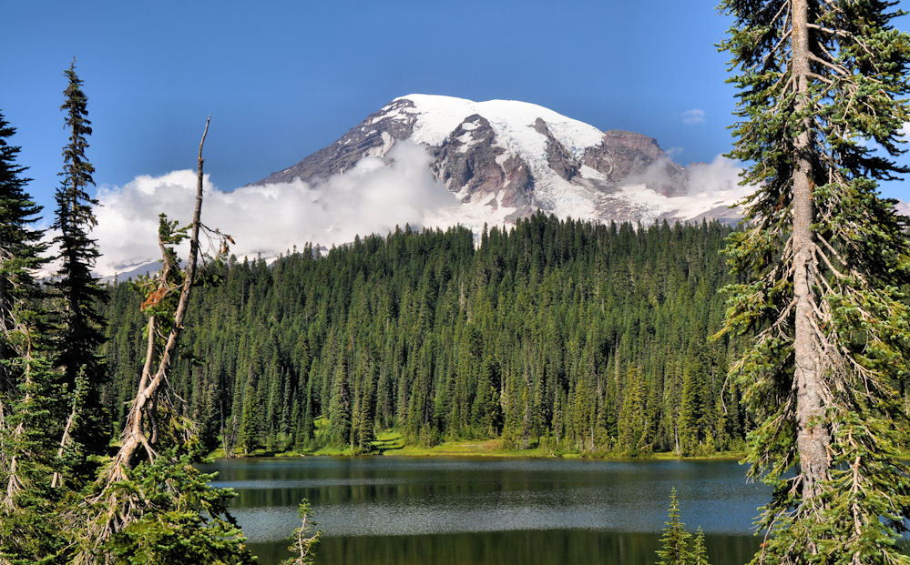
Either visitor center will give you great views, assuming the mountain is "out," and not socked in by clouds, or, God forbid, smoke from wildfires. But if you want to be on the ground by 8, you're going to have to be on the road at OMG o'clock.
I hesitate to recommend missing a national park, but I feel compelled to raise a couple of alternatives, just in the interests of full disclosure. First, while it's not in the national park, the view of Mount Rainier from the top of the gondola at the Crystal Mountain ski resort, not far from Sunrise, is nothing short of amazing. You're basically at eye level with Mount Rainier, viewing it across the White River canyon. There's a cafe at the top, lots of trails that radiate away from the gondola, and it probably won't be as trafficky and crowded as you'll find at the national park visitor centers. Map - https://goo.gl/maps/xDXL7fzYtQ7pRYrM6
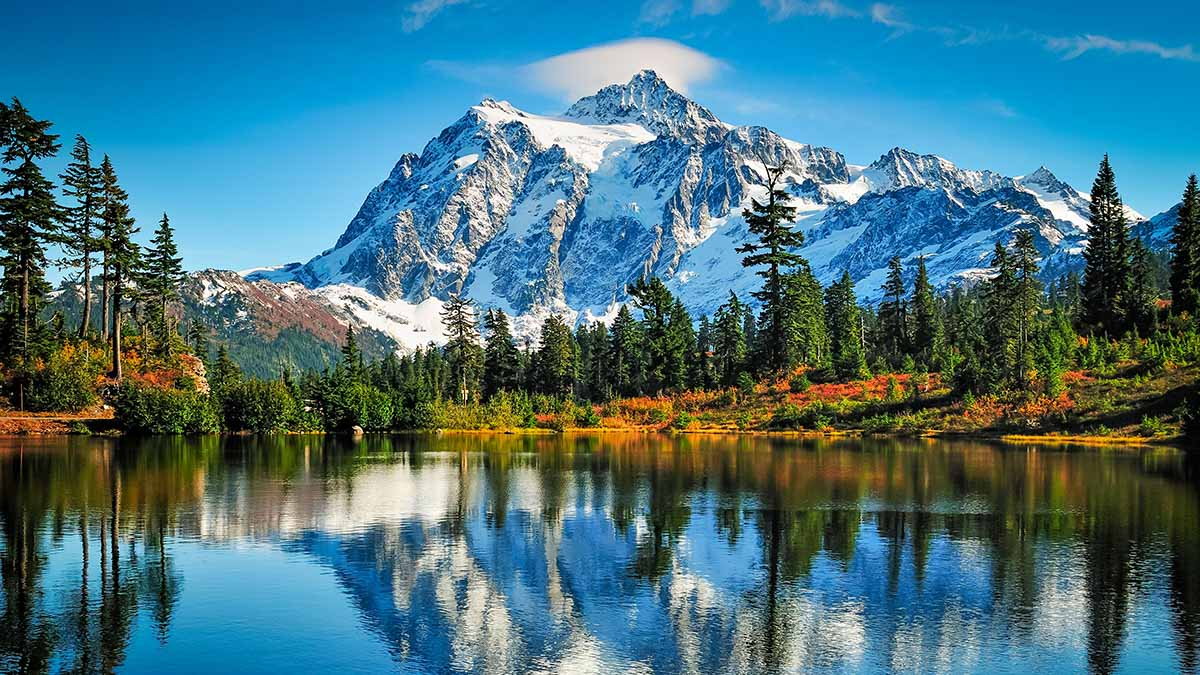
The second alternative is a lot more extreme, and it goes back to your plans to visit Anacortes and your thinking about Diablo Lake. This alternative is to drive up the Mount Baker Highway to its terminus at a place called Artist Point, with its neighboring Picture Lake. This route doesn't get you into North Cascades National Park (which is mainly a hike-in park with basically no visitor facilities) but the views from Artist Point and Picture Lake - wow, just wow. Again, there are trails and views without parallel. Map - https://goo.gl/maps/rWFwzD56Js52wuxR9
Now I'm not saying that this is a substitute for Mount Rainier, but if you decided to skip Mt. Rainier, or to make it a day trip from Seattle instead of an overnight out of Packwood, I'm betting you wouldn't be disappointed in the least.
First, there's no "s" in the Pike Place market. Pike Place is a street.
Second, ordinarily I'd recommend visiting the Paradise visitor center at Mount Rainier, using the wildly scenic Stevens Canyon Road in order to get there from Packwood. https://goo.gl/maps/igKe7v65RbYoHPfPA
Unfortunately, ongoing construction on the Stevens Canyon Road means it's closed to through traffic on weekdays, only open on weekends (Friday night to Sunday night.) So to get from Packwood to Paradise means doing a long zigzag to the Longmire entrance to the national park - like this: https://goo.gl/maps/mWRJkCLxCaUh4FtGA . Note that Google's time estimates on both these routes are rather laughable, given the likelihood of fairly long queues at the national park entrances.
The alternate is to visit the Sunrise visitor center on the northeast side of the mountain, via Cayuse and Chinook Passes (SR 410.) Map - https://goo.gl/maps/UXd8EBYmkde6PS9P8 . Again, I wouldn't trust Google's time estimates.
The views of the mountain are (IMO) better from Sunrise than from Paradise; the advantage Paradise has is access to more trails and especially to the Reflection Lakes (along the part of the Stevens Canyon Road you can reach from the west side, rather than the east.)
Either visitor center will give you great views, assuming the mountain is "out," and not socked in by clouds, or, God forbid, smoke from wildfires. But if you want to be on the ground by 8, you're going to have to be on the road at OMG o'clock.
I hesitate to recommend missing a national park, but I feel compelled to raise a couple of alternatives, just in the interests of full disclosure. First, while it's not in the national park, the view of Mount Rainier from the top of the gondola at the Crystal Mountain ski resort, not far from Sunrise, is nothing short of amazing. You're basically at eye level with Mount Rainier, viewing it across the White River canyon. There's a cafe at the top, lots of trails that radiate away from the gondola, and it probably won't be as trafficky and crowded as you'll find at the national park visitor centers. Map - https://goo.gl/maps/xDXL7fzYtQ7pRYrM6
The second alternative is a lot more extreme, and it goes back to your plans to visit Anacortes and your thinking about Diablo Lake. This alternative is to drive up the Mount Baker Highway to its terminus at a place called Artist Point, with its neighboring Picture Lake. This route doesn't get you into North Cascades National Park (which is mainly a hike-in park with basically no visitor facilities) but the views from Artist Point and Picture Lake - wow, just wow. Again, there are trails and views without parallel. Map - https://goo.gl/maps/rWFwzD56Js52wuxR9
Now I'm not saying that this is a substitute for Mount Rainier, but if you decided to skip Mt. Rainier, or to make it a day trip from Seattle instead of an overnight out of Packwood, I'm betting you wouldn't be disappointed in the least.
Aug 7th, 2023, 03:31 PM
#6
Original Poster
Join Date: Jan 2003
Posts: 226
Likes: 0
Received 0 Likes
on
0 Posts
Aug 7th, 2023, 03:34 PM
#7
Original Poster
Join Date: Jan 2003
Posts: 226
Likes: 0
Received 0 Likes
on
0 Posts
Gardyloo
i can�t thank you enough for your thoughtful and detailed response. It�s exactly what I love about these forums. I really appreciate you sharing your expertise.
Can you tell me what a day trip from Seattle to Mt Ranier May look like? What time should we leave and where should we go?
i can�t thank you enough for your thoughtful and detailed response. It�s exactly what I love about these forums. I really appreciate you sharing your expertise.
Can you tell me what a day trip from Seattle to Mt Ranier May look like? What time should we leave and where should we go?
Aug 7th, 2023, 03:51 PM
#9
Original Poster
Join Date: Jan 2003
Posts: 226
Likes: 0
Received 0 Likes
on
0 Posts
Aug 9th, 2023, 06:59 AM
#10
Logistically I'd go on a weekday in order to avoid crowding at the park entrances and at Paradise, and I'd get as early a start as possible. The timing on the Google map tends to be very optimistic, especially on weekends. I'd also, frankly, pay attention to the weather forecast and I'd consult the NPS webcams for the national park - Webcams - Mount Rainier National Park (U.S. National Park Service) (nps.gov) - before heading out. If things are socked in on the mountain (which is always a possibility - it creates its own weather) I might think twice about going at all, since the 2 1/2+ hours' drive is not especially scenic for much of the distance. We are fortunate to live in an area very rich in scenic destinations, from sea level all the way to stratovolcano summits, so having a "plan B" is never a bad thing.
Last edited by Gardyloo; Aug 9th, 2023 at 07:03 AM.

Thread
Original Poster
Forum
Replies
Last Post
jujuba
Canada
8
Mar 3rd, 2010 06:03 PM


