


Trip Report: Outback Adventure


 Sep 13th, 2025 | 08:11 AM
#22
Original Poster

Joined: Apr 2004
Posts: 1,147
Likes: 0
I looked at that bitumen strip in the middle of the road & remembered when we thought it was marvellous to have the same on our formerly unsealed black soil road. My second thought, looking at the red gravel was to wonder how many windscreens were broken on that road every year.
Sep 13th, 2025 | 02:53 PM
#23
Joined: Oct 2007
Posts: 16,547
Likes: 4
Originally Posted by RalphR;[url=tel:17678848
17678848[/url]]That's one thing I was quite worried about. Took care to slow down and pull over with oncoming traffic, especially the road trains. Sounds like you live in a rural area. May I ask where?
Sep 14th, 2025 | 08:58 PM
#24

Joined: Jun 2008
Posts: 4,864
Likes: 0
speaking of road trains-my grandaughter who was born in Broome and lived in the Kimberleys used to make that sort of road train with her blocks-she had never seen any other "train". And she always looked in the toilet bowl to see if there were any frogs before using . A diiferent life
love your adventures
love your adventures


 Sep 16th, 2025 | 11:20 AM
#27
Original Poster
Joined: Apr 2004
Posts: 1,147
Likes: 0
speaking of road trains-my grandaughter who was born in Broome and lived in the Kimberleys used to make that sort of road train with her blocks-she had never seen any other "train". And she always looked in the toilet bowl to see if there were any frogs before using . A diiferent life
Sep 16th, 2025 | 12:51 PM
#28
Original Poster
Joined: Apr 2004
Posts: 1,147
Likes: 0
Part 5. Mt Isa, Qld to Tobermorey Station, NT
Still somewhat jet-lagged, we were up early in Mt. Isa. It was a bright, chilly morning, a perfect time to drive up to the Mt. Isa Lookout to take in an excellent 360-degree view over the city. Dominating the industrial view to the west were two enormous smokestacks, one for a copper smelter, the other, towering 850 ft (260 m) high, serving a lead smelter. Silver and zinc are also extracted from ores mined nearby.
After a superb modern breakfast at Bambino Express, we hit the road. At this point we had planned to head due south to take the Birdville Track to Marree and the Flinders Ranges in South Australia. But since the Track was closed due to flooding, we began a 2000 km (1200 mi) detour to Marree by driving SW to join the Urandangi Road, Plenty Highway and Binns Track to Alice Springs in the Northern Territory. This 1000 km (600 mi) stretch was mostly unpaved and was probably the most remote section of our journey.
About 20 minutes out of Mt. Isa, we realized were low on diesel – a serious oversight since the next fuel was about 280 km (175 mi) away and had we continued, we could have ended up stranded on a road where we saw just two road trains and one car in about three hours. Fortunately, we were still close enough to Mt. Isa to turn back and fill up.
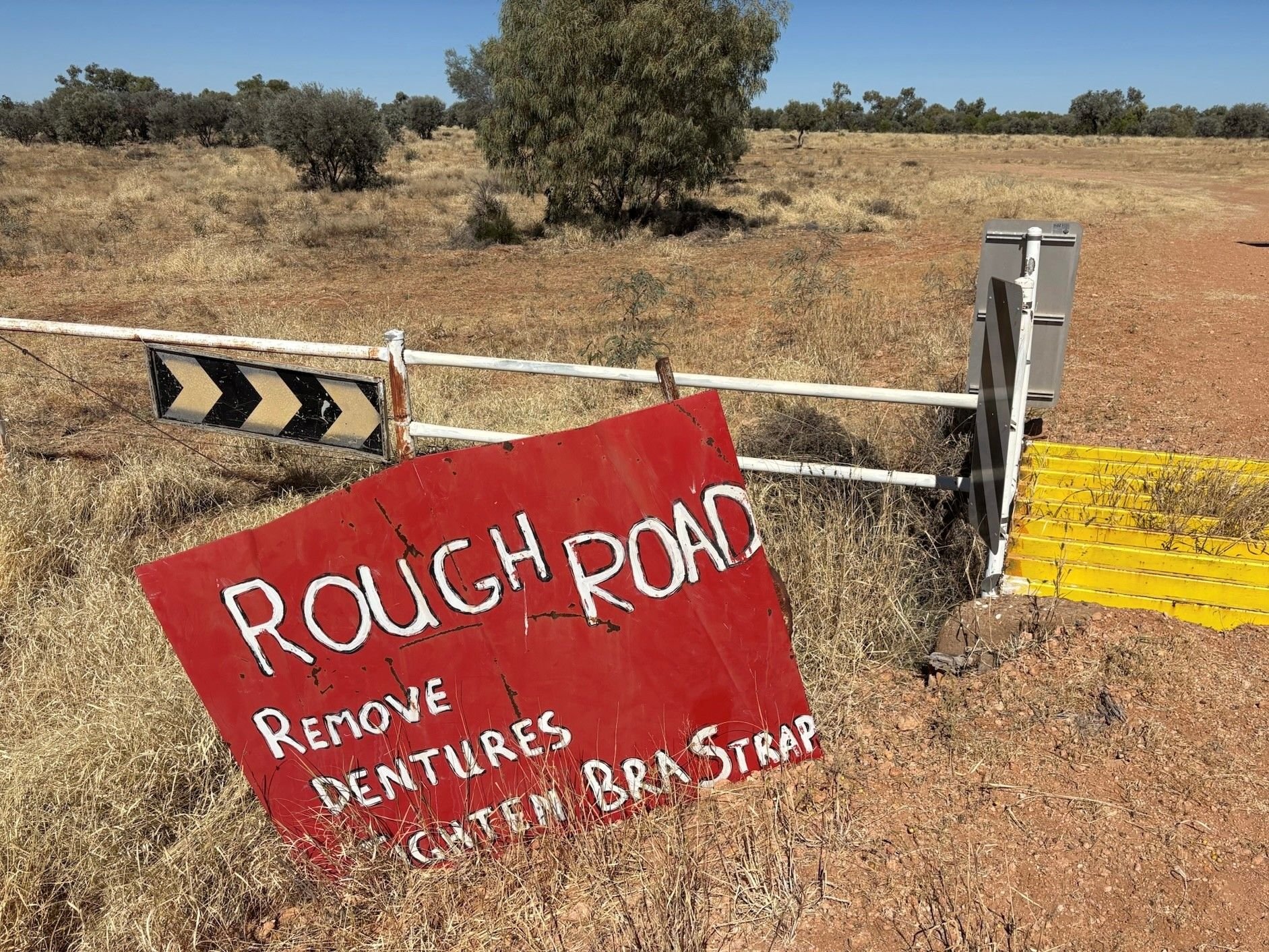
Leaving Mt. Isa, on the Boulia-Mt. Isa “Highway”, civilization abruptly ends as the road winds through the rugged hills to the south. By the time we turned onto the Urandangi Road, the terrain was dead flat with wide expanses of red ground, parched grass and isolated shrubs. This was cattle country although I don’t remember seeing many cattle. Perhaps they all were on the two oncoming road trains that buried us in their dust as they thundered by us early on. We really should have deflated our tires a little (as recommended by the rental company) to reduce the chance of getting a flat on the unsealed road, but keeping our speed down to about 75 km/hr (~45 mph) probably helped.
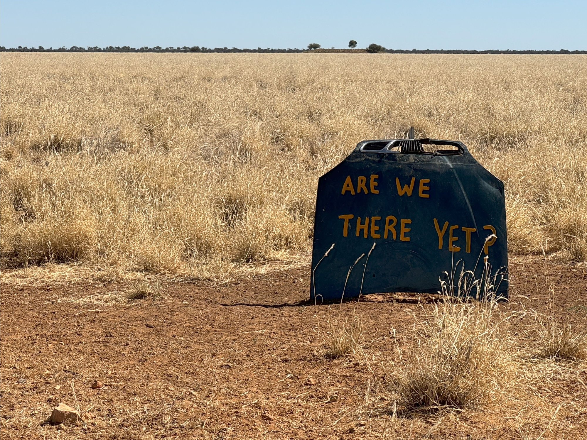
Keeping us amused along the way, often hung near the occasional cattle grid crossing, were crude signs made from detached car hoods (bonnets) with comical expressions like “ARE WE THERE YET???” painted on them. Less entertaining were the occasional shells of abandoned vehicles off the side of the road – “Is this what happens when you run out of gas out here?”, we wondered.
Ultimately, we reached the small town of Urandangi only about 20 kms from the Northern Territory (NT) border. There was hardly a soul was in sight. I learned that Urandangi was nearly wiped off the map by flooding of the nearby Georgina River in 2023. Some buildings survived, but not the Dangi Pub, which was ruined and has since been torn down. We could have used a few beers by this stage!
After crossing the Georgina River, it was a short drive to our destination, the Tobermory Station, a HUGE cattle property the size of Rhode Island just over the NT border. As a side-business, it runs the only camping area with fuel and amenities for hundreds of kilometers. Not surprisingly, the diesel was very expensive: AUD 2.80/liter or ~USD 7/gallon.
We found a nice spot to set up under a grove of gum trees in the middle of the complex between the restrooms, cooking area, a small store and an outdoor bar. With tents up, we made a beeline to the bar, shade provided by a large, horizontal windmill fan. There we struck up conversation with a couple living in Broome, in the north of Western Australia (WA), who were headed across the continent on holiday. He is a general practitioner and she, an occupational therapist, both working with indigenous communities in WA. It was very interesting hearing about the special challenges they face in their work, for example, efforts to improve indigenous life expectancies, which lag some 10 years behind that of European Australians.
With a beautiful sunset slowly unfolding, the four of us took a stroll around the levee surrounding the complex to protect it from flood. We cooked dinner on the truck and then were kindly invited by a couple “next door” to us in the campground for a sit-down around their campfire and an engaging chat over, for us, more beer and some wine. He was an Australian who had served in the Vietnam War, reminding me of Australia’s involvement in the conflict.
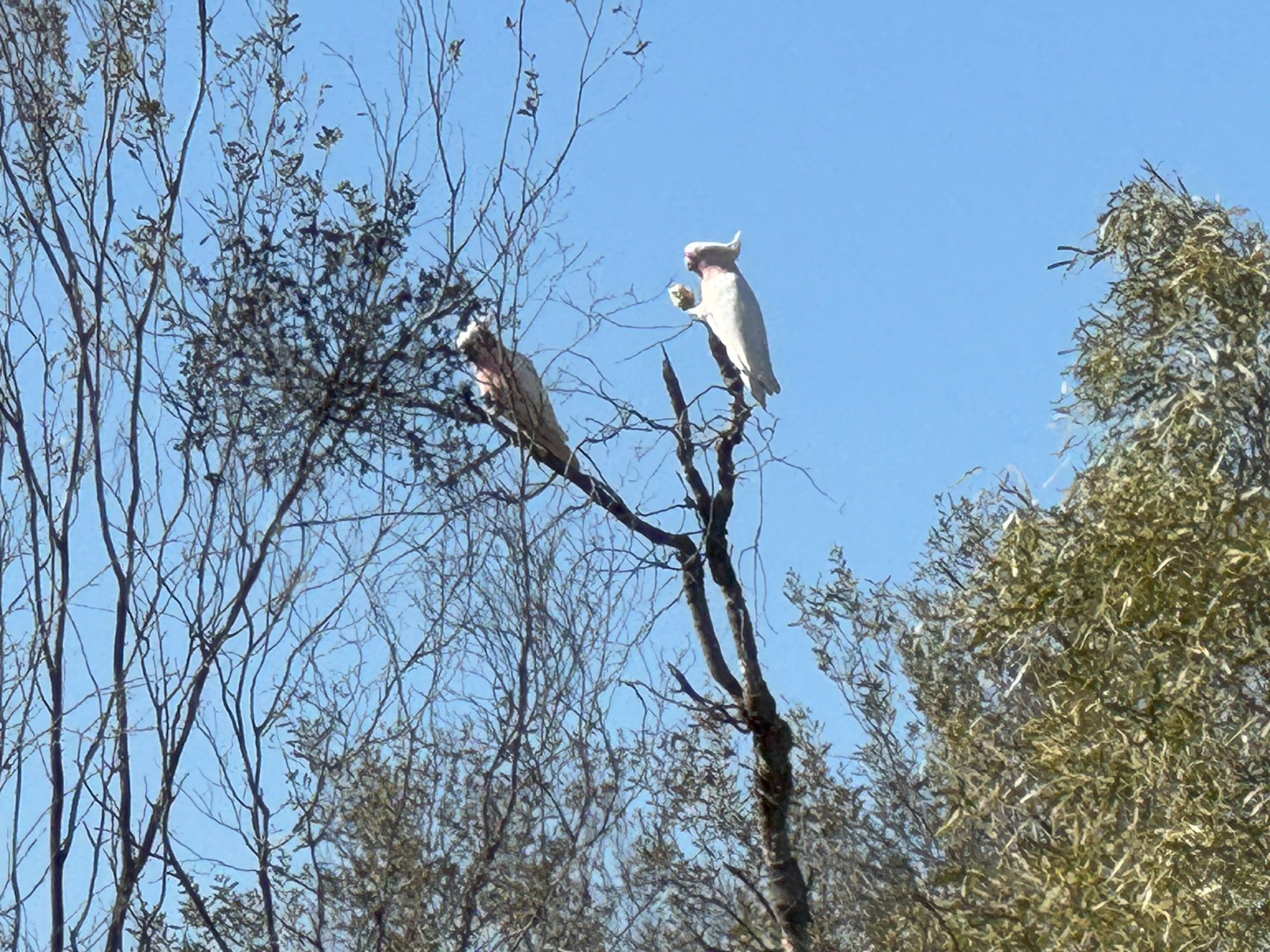
The desert night was cold, so I was grateful that Dave had asked for extra sleeping bags when we picked up the vehicle in Cairns the week before. A large flock of galahs (grey and pink parrots) settled in the trees above us squawking halfway through the night. They took flight shortly after we arose, flying as a near murmuration around the camp at sunrise – a spectacular sight.

Mt Isa from the Mt Isa Lookout. Copper and lead smelter stacks left and right.

Road train in downtown Mt. Isa. He couldn't avoid running the red light!

Arid, yet pretty country leaving Mt Isa
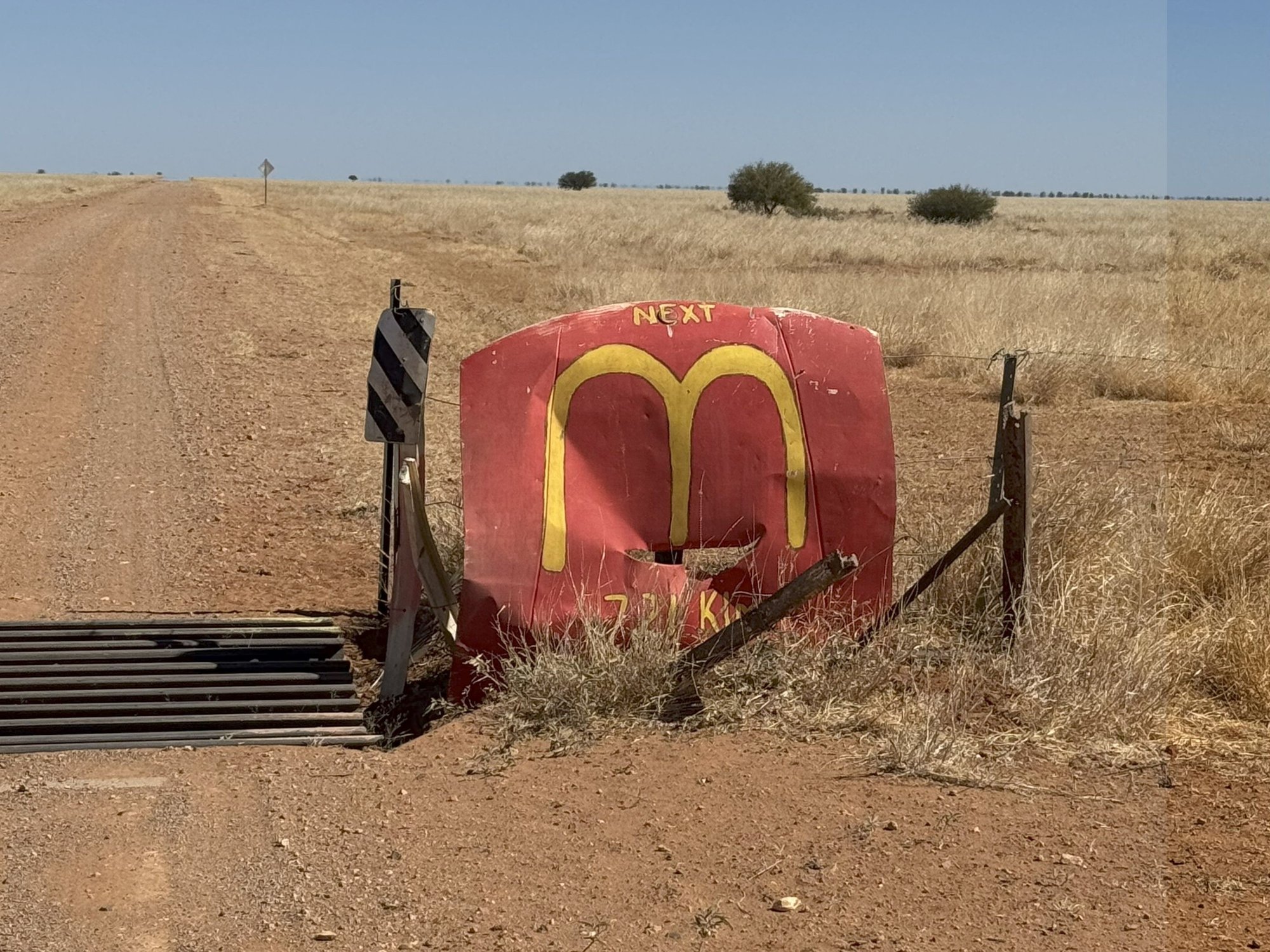
LOL on the Urandangi Road! Only 721 kms to "Macca's"???
No kidding!

Alas, there the pub was torn down after the flood in 2023.

Abandoned house in Urandangi. So sad.

Tobermorey Station bar area
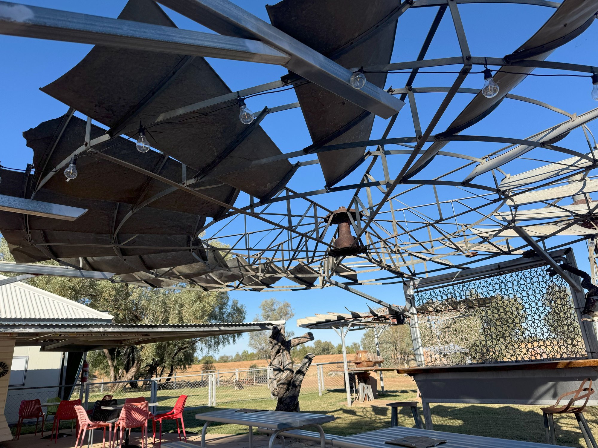
A windmill fan for shade...

Dave, beer in hand, camping under the gum trees at Tobermorey Station
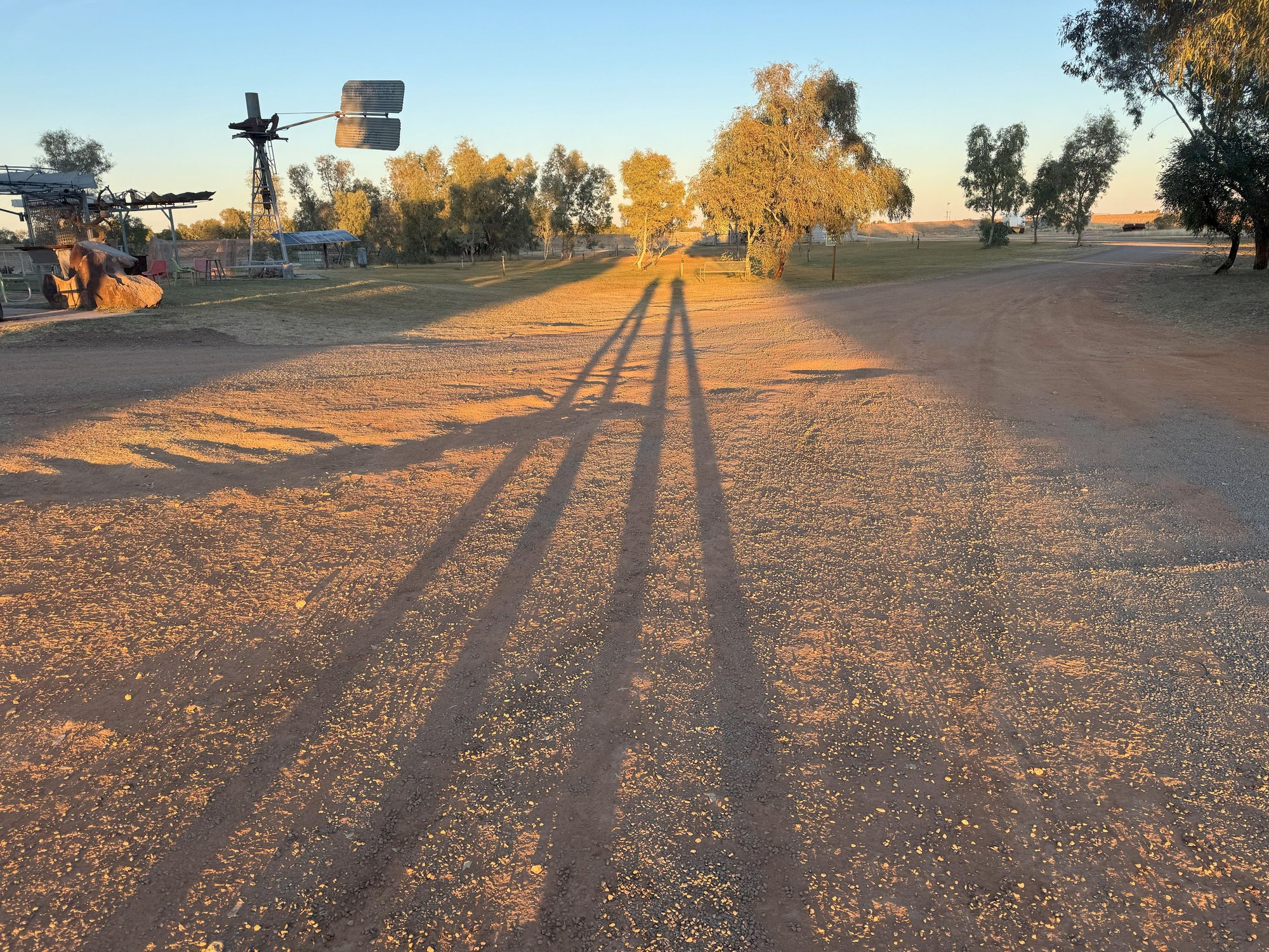
Morning shadows

Flock of screeching galahs at sunrise. Buggers kept us up half the night with all the noise.

Galahs close-up, for reference.
After a superb modern breakfast at Bambino Express, we hit the road. At this point we had planned to head due south to take the Birdville Track to Marree and the Flinders Ranges in South Australia. But since the Track was closed due to flooding, we began a 2000 km (1200 mi) detour to Marree by driving SW to join the Urandangi Road, Plenty Highway and Binns Track to Alice Springs in the Northern Territory. This 1000 km (600 mi) stretch was mostly unpaved and was probably the most remote section of our journey.
About 20 minutes out of Mt. Isa, we realized were low on diesel – a serious oversight since the next fuel was about 280 km (175 mi) away and had we continued, we could have ended up stranded on a road where we saw just two road trains and one car in about three hours. Fortunately, we were still close enough to Mt. Isa to turn back and fill up.
Leaving Mt. Isa, on the Boulia-Mt. Isa “Highway”, civilization abruptly ends as the road winds through the rugged hills to the south. By the time we turned onto the Urandangi Road, the terrain was dead flat with wide expanses of red ground, parched grass and isolated shrubs. This was cattle country although I don’t remember seeing many cattle. Perhaps they all were on the two oncoming road trains that buried us in their dust as they thundered by us early on. We really should have deflated our tires a little (as recommended by the rental company) to reduce the chance of getting a flat on the unsealed road, but keeping our speed down to about 75 km/hr (~45 mph) probably helped.
Keeping us amused along the way, often hung near the occasional cattle grid crossing, were crude signs made from detached car hoods (bonnets) with comical expressions like “ARE WE THERE YET???” painted on them. Less entertaining were the occasional shells of abandoned vehicles off the side of the road – “Is this what happens when you run out of gas out here?”, we wondered.
Ultimately, we reached the small town of Urandangi only about 20 kms from the Northern Territory (NT) border. There was hardly a soul was in sight. I learned that Urandangi was nearly wiped off the map by flooding of the nearby Georgina River in 2023. Some buildings survived, but not the Dangi Pub, which was ruined and has since been torn down. We could have used a few beers by this stage!
After crossing the Georgina River, it was a short drive to our destination, the Tobermory Station, a HUGE cattle property the size of Rhode Island just over the NT border. As a side-business, it runs the only camping area with fuel and amenities for hundreds of kilometers. Not surprisingly, the diesel was very expensive: AUD 2.80/liter or ~USD 7/gallon.
We found a nice spot to set up under a grove of gum trees in the middle of the complex between the restrooms, cooking area, a small store and an outdoor bar. With tents up, we made a beeline to the bar, shade provided by a large, horizontal windmill fan. There we struck up conversation with a couple living in Broome, in the north of Western Australia (WA), who were headed across the continent on holiday. He is a general practitioner and she, an occupational therapist, both working with indigenous communities in WA. It was very interesting hearing about the special challenges they face in their work, for example, efforts to improve indigenous life expectancies, which lag some 10 years behind that of European Australians.
With a beautiful sunset slowly unfolding, the four of us took a stroll around the levee surrounding the complex to protect it from flood. We cooked dinner on the truck and then were kindly invited by a couple “next door” to us in the campground for a sit-down around their campfire and an engaging chat over, for us, more beer and some wine. He was an Australian who had served in the Vietnam War, reminding me of Australia’s involvement in the conflict.
The desert night was cold, so I was grateful that Dave had asked for extra sleeping bags when we picked up the vehicle in Cairns the week before. A large flock of galahs (grey and pink parrots) settled in the trees above us squawking halfway through the night. They took flight shortly after we arose, flying as a near murmuration around the camp at sunrise – a spectacular sight.
Mt Isa from the Mt Isa Lookout. Copper and lead smelter stacks left and right.
Road train in downtown Mt. Isa. He couldn't avoid running the red light!
Arid, yet pretty country leaving Mt Isa
LOL on the Urandangi Road! Only 721 kms to "Macca's"???
No kidding!
Alas, there the pub was torn down after the flood in 2023.
Abandoned house in Urandangi. So sad.
Tobermorey Station bar area
A windmill fan for shade...
Dave, beer in hand, camping under the gum trees at Tobermorey Station
Morning shadows
Flock of screeching galahs at sunrise. Buggers kept us up half the night with all the noise.
Galahs close-up, for reference.
Last edited by RalphR; Sep 16th, 2025 at 12:56 PM.
 Sep 18th, 2025 | 02:23 AM
#30
Joined: Oct 2007
Posts: 16,547
Likes: 4
Ralph, if you get to Lightning Ridge, Goodooga or Moree - don't miss their Artesian Aquatic centres.
Like Tripplanner, I�m seeing parts of Australia through your eyes that I�ll probably not see with mine & I�m enjoying your trip report enormously- thanks again.
Like Tripplanner, I�m seeing parts of Australia through your eyes that I�ll probably not see with mine & I�m enjoying your trip report enormously- thanks again.
Sep 18th, 2025 | 02:31 AM
#31
Joined: Oct 2007
Posts: 16,547
Likes: 4
Here�s the Great Artesian Basin - you might come across some other baths & bores in your travels.
https://en.m.wikipedia.org/wiki/File...sian_Basin.png
https://en.m.wikipedia.org/wiki/File...sian_Basin.png
Sep 19th, 2025 | 02:25 PM
#33
Joined: Oct 2007
Posts: 16,547
Likes: 4
[QUOTE=derek33;17679925]
Derek: Artesian means it�s an underground aquifer.
The only places you can swim in it are where a bite has been sunk into it and the water brought to the surface or through a naturally occurring spring
��-
From Wikipedia
Artesian" refers to water from a confined aquifer (an underground layer of rock or sediment) that is under pressure and flows to the surface without pumping, forming artesian wells or artesian springs. The term is most famously associated with Australia's Great Artesian Basin, one of the world's largest underground freshwater reserves, which is vital for drinking water and supporting industries in the region.
What is an artesian system?
Artesian water in Australia
Related terms
The only places you can swim in it are where a bite has been sunk into it and the water brought to the surface or through a naturally occurring spring
��-
From Wikipedia
Artesian" refers to water from a confined aquifer (an underground layer of rock or sediment) that is under pressure and flows to the surface without pumping, forming artesian wells or artesian springs. The term is most famously associated with Australia's Great Artesian Basin, one of the world's largest underground freshwater reserves, which is vital for drinking water and supporting industries in the region.
What is an artesian system?
- Confined Aquifer:
The water is trapped in a layer of permeable rock or sediment, surrounded by impermeable layers.
- Pressure:
The water within this confined aquifer is under pressure, often due to the weight of water from higher elevations.
- Natural Flow:
When a well is drilled into this confined aquifer, the pressure forces the water up the wellbore without the need for pumps.
Artesian water in Australia
- The Great Artesian Basin (GAB):
This massive basin is Australia's largest groundwater resource, covering a significant portion of New South Wales, Queensland, South Australia, and the Northern Territory.
- Resource for communities:
The GAB provides drinking water for many regional towns and is crucial for the agriculture, mining, and tourism industries in inland Australia.
- Cultural Significance:
Water from the GAB has been vital for First Nations communities for millennia and remains an important source for cultural and spiritual practices.
- Ecological Value:
The natural artesian springs in the GAB are home to many rare and significant species.
Related terms
- Artesian Well:
A well that taps into an artesian aquifer, allowing water to rise naturally to the surface.
- Artesian Spring:
Occurs when artesian water naturally escapes to the surface through cracks in the overlying rock layer.
Last edited by Bokhara2; Sep 19th, 2025 at 02:27 PM.
Sep 22nd, 2025 | 11:20 AM
#34
Original Poster
Joined: Apr 2004
Posts: 1,147
Likes: 0
Part 6: Tobermorey to Jervois Station and Alice Springs
From Tobermorey Station we turned onto the Plenty Highway toward our next destination, Jervois Station, another cattle property 265 km (165 mi) to the west. Either Google Maps was in error, or I had screwed up using Google Maps, as we had expected it to be a 7+ hour drive averaging just 40 kph (25 mph) on what we assumed would be a rough slow-going road. But although the road was unsealed nearly the whole way, it was in good shape, and we found ourselves at the property by lunchtime with an afternoon to kill. The landscape was much the same as it had been most of the previous day – mostly flat, red soil, sparse mulga scrub and occasional eucalyptus trees, especially near (dry) watercourses. We stopped for a good look at a couple of enormous (~15 ft high) red termite mounds close to the road, as well as to enjoy the sight of a flock of beautiful pink cockatoos (aka Major Mitchell’s cockatoos) that flew across the road in front of us to perch in a nearby tree.
The amenities at Jervois were bare bone – a small shop, a crude restroom block a fair walk away from the camping area, and, most importantly, a diesel pump. The camping area was adjacent to a dry riverbed, lined with eucalypts as usual.Up to this point the infamous Outback flies had not been much of a bother, but at the Jervois Station they were out in force as we set up our camp and ate lunch. We had contemplated a walk along the pretty, shaded creek bed, but feeling a little tired from the previous night’s sleep interrupted by screeching galahs, and not wanting to be shooing flies away flies the whole time, we retired to our tents for an afternoon nap. By evening a few other groups had set up camp. Unfortunately, with no common bar area and with campers spaced well apart in the field, there was little chance of socialization as there had been at Tobermorey.
Leaving Jervois the next morning, back on the Plenty Highway, we were surprised to see bitumen being laid either side of a newly constructed bridge, then additional patches of bitumen and finally, uninterrupted bitumen with road signs indicating the date of completion of each section. We learned that the Plenty Highway will eventually be paved all the way east to the Queensland border, thereby completing a more direct paved route to Alice Springs and the Red Center from the East Coast.
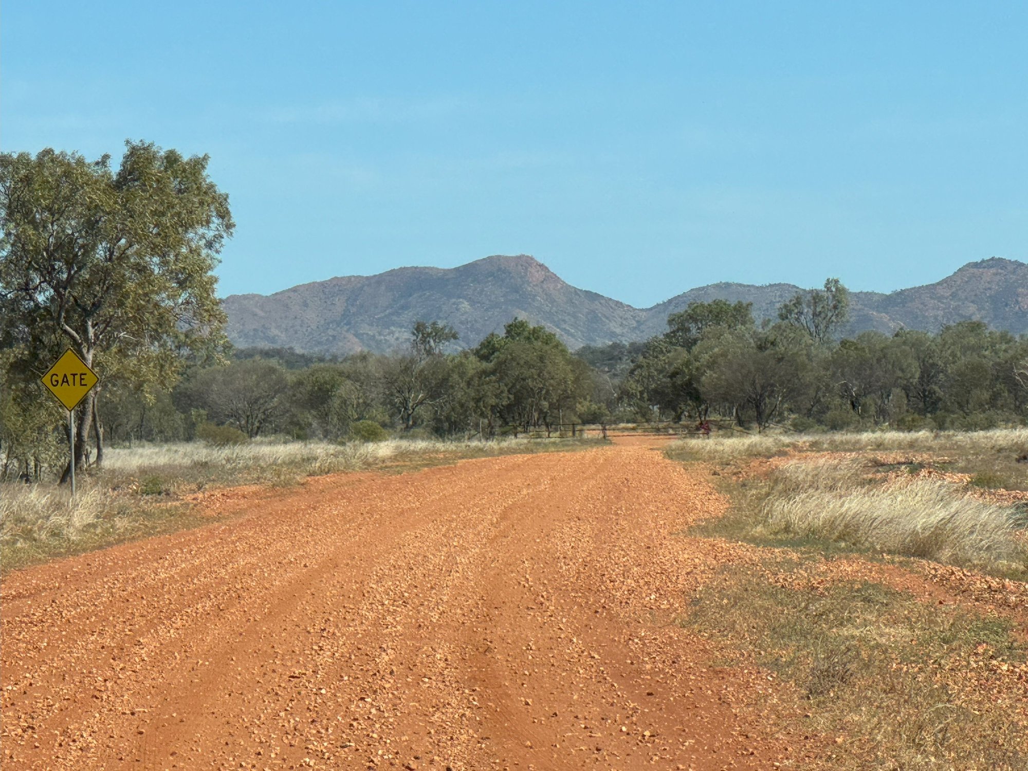
Although the Plenty Hwy continued west to join the Stuart Hwy (the only north-south paved road in central Australia) just north of Alice Springs, to get our money’s worth from our 4WD, we turned off on the now continuously sealed road to take the rough, unpaved Binns Track, a historic backroad to Alice that winds through the scenic MacDonnell Ranges east of the city. Much of the property along the way is Aboriginal land with a permit needed to leave the road reserve. There were gates on the road between adjacent properties that needed to be opened to pass.
Approaching Alice, we stopped for a hike at Trephina Gorge, one of several gorges sliced into the East MacDonnell ranges. As sunset was approaching, we didn’t get as far as I would have hoped, but nonetheless, we were there long enough to appreciate the quiet rugged beauty of the place. We stopped on the way out to see what is claimed to be the largest ghost gum tree in Australia, just as the day’s last light was upon it.
A magnificent full moon rose behind us just as we arrived in Alice, where we settled into the Alice Springs Hotel for two nights. We were rather disappointed with the limited dining options nearby but were reasonably satisfied sharing a pizza for dinner at the Epilogue Lounge & Rooftop Bar on Todd Street.

Ralph (left), giant termite mound (right)
Pink cockatoos (aka Major Mitchell cockatoos). Wished I'd brought:1) my binoculars and 2) my SLR camera with zoom lens!

Outback cattle station - a stereotypical Outback scene

Camping at Jervois Station. The flies were driving us nuts at this point!
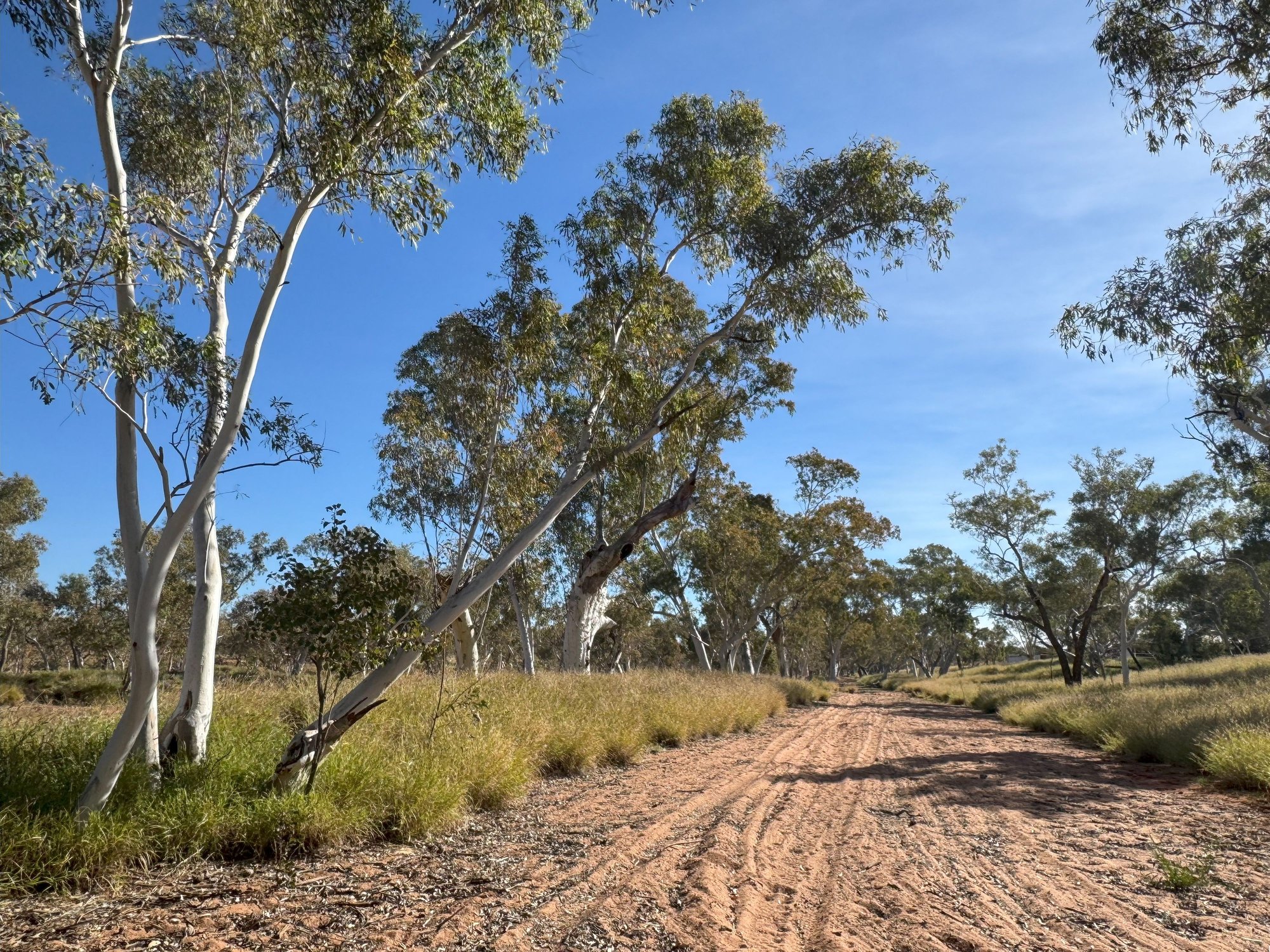
Riverbed near our camping spot, Jervois

Sunrise with Venus. Jervois Station

Starting the Binns Track

Get the gate, mate!
Approaching the East MacDonnells

Trephina Gorge, East MacDonnell Ranges

Trephina Gorge
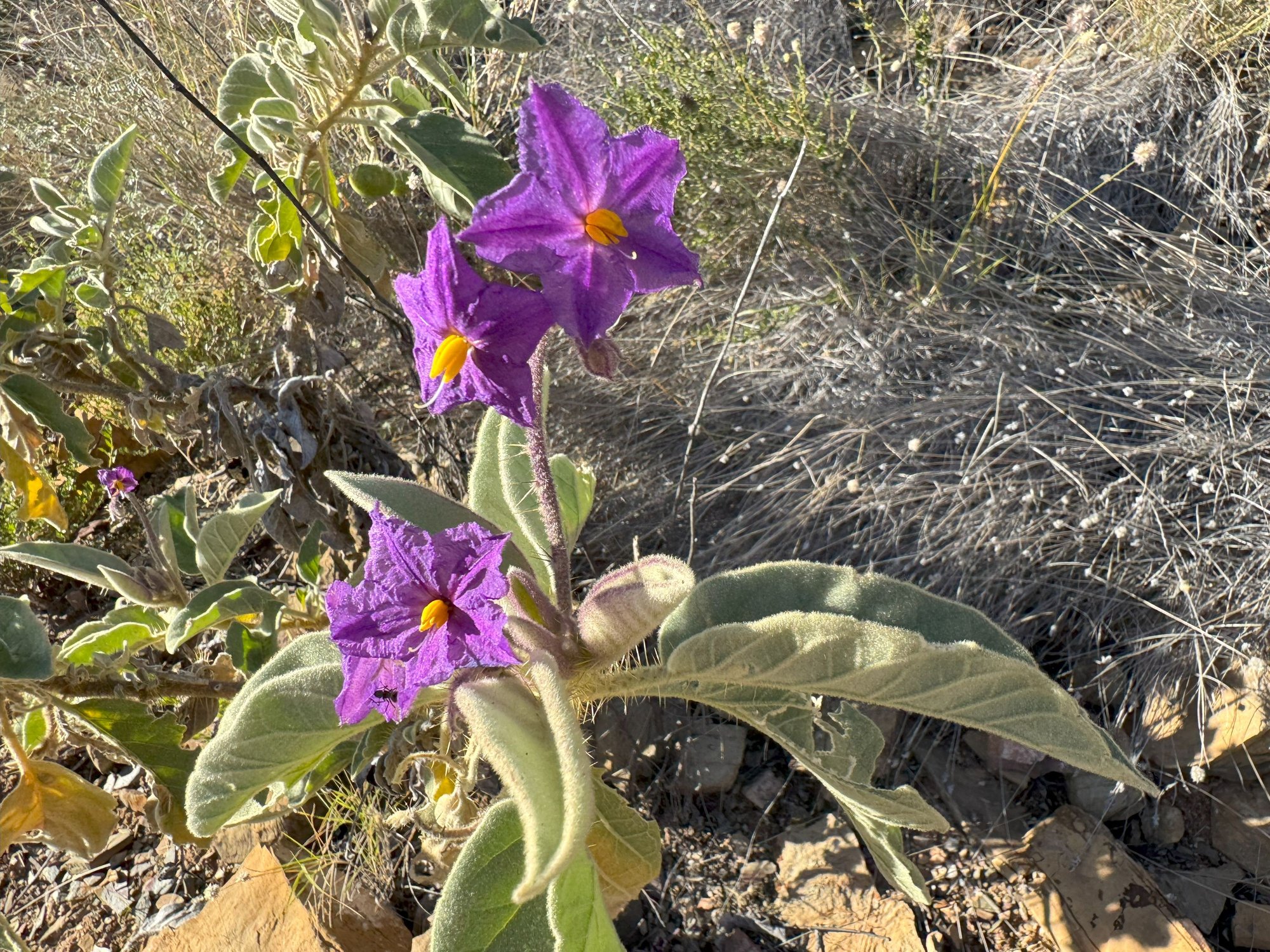
Wildflowers, Trephina Gorge

Largest ghost gum in Australia, according to the sign
The amenities at Jervois were bare bone – a small shop, a crude restroom block a fair walk away from the camping area, and, most importantly, a diesel pump. The camping area was adjacent to a dry riverbed, lined with eucalypts as usual.Up to this point the infamous Outback flies had not been much of a bother, but at the Jervois Station they were out in force as we set up our camp and ate lunch. We had contemplated a walk along the pretty, shaded creek bed, but feeling a little tired from the previous night’s sleep interrupted by screeching galahs, and not wanting to be shooing flies away flies the whole time, we retired to our tents for an afternoon nap. By evening a few other groups had set up camp. Unfortunately, with no common bar area and with campers spaced well apart in the field, there was little chance of socialization as there had been at Tobermorey.
Leaving Jervois the next morning, back on the Plenty Highway, we were surprised to see bitumen being laid either side of a newly constructed bridge, then additional patches of bitumen and finally, uninterrupted bitumen with road signs indicating the date of completion of each section. We learned that the Plenty Highway will eventually be paved all the way east to the Queensland border, thereby completing a more direct paved route to Alice Springs and the Red Center from the East Coast.
Although the Plenty Hwy continued west to join the Stuart Hwy (the only north-south paved road in central Australia) just north of Alice Springs, to get our money’s worth from our 4WD, we turned off on the now continuously sealed road to take the rough, unpaved Binns Track, a historic backroad to Alice that winds through the scenic MacDonnell Ranges east of the city. Much of the property along the way is Aboriginal land with a permit needed to leave the road reserve. There were gates on the road between adjacent properties that needed to be opened to pass.
Approaching Alice, we stopped for a hike at Trephina Gorge, one of several gorges sliced into the East MacDonnell ranges. As sunset was approaching, we didn’t get as far as I would have hoped, but nonetheless, we were there long enough to appreciate the quiet rugged beauty of the place. We stopped on the way out to see what is claimed to be the largest ghost gum tree in Australia, just as the day’s last light was upon it.
A magnificent full moon rose behind us just as we arrived in Alice, where we settled into the Alice Springs Hotel for two nights. We were rather disappointed with the limited dining options nearby but were reasonably satisfied sharing a pizza for dinner at the Epilogue Lounge & Rooftop Bar on Todd Street.
Ralph (left), giant termite mound (right)
Pink cockatoos (aka Major Mitchell cockatoos). Wished I'd brought:1) my binoculars and 2) my SLR camera with zoom lens!
Outback cattle station - a stereotypical Outback scene
Camping at Jervois Station. The flies were driving us nuts at this point!
Riverbed near our camping spot, Jervois
Sunrise with Venus. Jervois Station
Starting the Binns Track
Get the gate, mate!
Approaching the East MacDonnells
Trephina Gorge, East MacDonnell Ranges
Trephina Gorge
Wildflowers, Trephina Gorge
Largest ghost gum in Australia, according to the sign
Last edited by RalphR; Sep 22nd, 2025 at 11:24 AM. Reason: Formatting
Sep 27th, 2025 | 03:24 AM
#38
Joined: Oct 2008
Posts: 4,622
Likes: 0
I did a sort of similar journey some years ago. Fueled by bananas and chocolate rather than diesel, as I was riding a bicycle.
Australian Road Trip
Australian Road Trip
Sep 30th, 2025 | 03:09 AM
#40
Joined: Oct 2007
Posts: 16,547
Likes: 4
I did a sort of similar journey some years ago. Fueled by bananas and chocolate rather than diesel, as I was riding a bicycle.
Australian Road Trip
Australian Road Trip

