
This time-capsule island will sink beneath the waves.
I
t takes a lot to get lost somewhere as small as Tangier Island, but that’s exactly the predicament I found myself in one humid September afternoon. Wandering the dusty backroads and brackish creeks of the island’s western half, I was looking for a beach to take some cinematic coastal shots during my short stay.
Thankfully, my aimless floundering was noticed by James, a resident driving a golf cart and conspicuous in a faded pink polo shirt. In exchange for holding onto a rubber bowl of fresh pears he’d just picked from a tree in a friend’s garden, James kindly offered to drop me at the empty public beach on the island’s quiet southeast corner (which shows how lost I was).
This sort of generosity wasn’t uncommon during my short time on Tangier Island. In the street, I was often greeted with a smile and a hello, but there was something my mind couldn’t compute. A circle I couldn’t square. Why were these people so happy when their island was sinking?
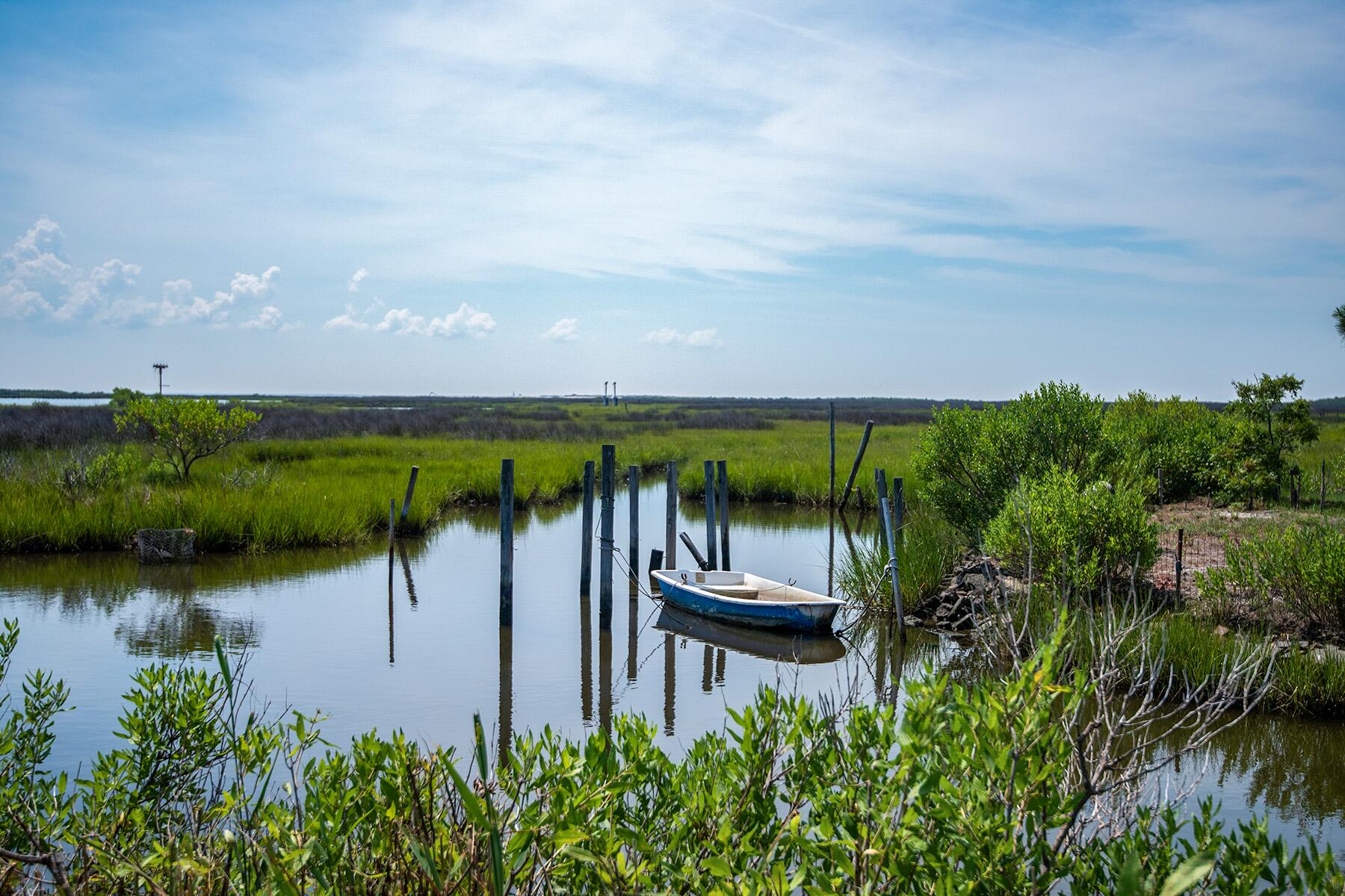
Isolated and adrift in the middle of Virginia’s vast Chesapeake Bay, Tangier Island is a marshy 1.2-square-mile island resembling a broken heart from above with a population of around 400 people. Spread over 700 acres, the island sits 12 miles from Virginia’s eastern shore and is reachable by boat and a small airstrip. And while 12 miles doesn’t sound too far, I felt an intense seclusion following my one-hour boat ride from Onancock Harbor. Nothing is visible on the horizon from Tangier. My journey was lonely, with the static scene only pierced by cormorants occasionally swooping to the water’s surface and back up again.


Recommended Fodor’s Video
Aside from the silhouetted outline of a pale blue water tower and a narrow church spire, approaching the island’s low, lumpy skyline reveals just how little it rises above the water’s surface.
While the island has been populated since the 17th century (originally by British colonists), Tangier’s landmass has been reduced by 67% since 1850. The entire island could be underwater within 50-100 years, thanks to the slow marching drum of climate change, which would mean a devastating displacement for its residents, who feel a powerful sense of identity that stretches back centuries.
Could it also make them–arguably–the continental U.S.’s first climate change refugees?
Life on the Island
Arriving on Tangier Island is often said to be like stepping back in time, though that is a little overblown. Life here is uncomplicated, and the residents like to keep it that way (there hasn’t been a full-time police officer there for almost four years).
Jumping off the sleek lobster boat that carried me from Onancock and into a busy harbor scene loaded with colorful crabbing cages, the first thing I noticed was the lack of cars. People get around by walking, cycling, or driving electric golf carts. It’s quite a refreshing scene, but it also hints at how minuscule the place is.
The fishing boats and crabbing cages I passed also represent virtually the only industries on the island. Alongside the tourists who visit looking for a window into the unique lifestyle here, the only sustainable industries on Tangier Island are fishing, crabbing, and oystering (crabbing in summer and oystering in winter, typically).
The Main Ridge Road is where most of the action is found. Home to Lorraine’s Seafood, the Four Brothers Crab House, Jim’s Gift Shop, and marking the beginning and end point of the island’s regular cart tours, it’s where most of the tourists here congregate. A quietly religious society, bars and pubs are conspicuous in their absence as alcohol isn’t sold, and you won’t find beer in any grocery store here either.
Passing the graveyard of the handsome wooden Swain Memorial United Methodist Church, it was impossible to ignore the repetition of surnames on the headstones. I spotted Eskridge, Thomas, Crockett, and Charnock several times, indicating a deep generational attachment to the island.
That unsevered link to the past has led to a distinct accent that harkens back to when a Cornishman, John Crockett, and his eight sons and their families became the first white settlers here in 1686. Sounding like a cross between a rural southern twang and a rolling English West Country yodel, conversing with locals can be both confounding and fascinating, especially when they use archaic terms like “yorn” for yours and “sot” for sat.
Some inflections flit between Dickensian and piratical before returning to something more comprehensible. Thankfully, at the Tangier History Museum, many of the local idioms and phrases are explained on a handy panel.
But as well as giving an overview of the island, the museum doesn’t sugarcoat what’s happening to its landmass.
The Sinking Island
The first corridor of the museum acknowledges Tangier’s loss of land with an exhibition called “The Shrinking Island,” where several panels discuss what’s happened over the last 170 years. The large map flanking the other side of the corridor has to be regularly repainted to keep it accurate, especially after each passing storm (to which the island is highly vulnerable to).
So, is there a way to prevent the steady loss of land?
Despite the evidence, the residents of Tangier Island are largely skeptical of the suggestion that climate change is the reason for the shrinking landmass and prefer to point to storm-driven erosion as the primary factor. But being battered by storms and undeniable rising sea levels aren’t mutually exclusive.
And regardless of who the culprit is, the simple fact is that the island needs help–which would come at a significant cost.
Published in 2021, the Frontiers in Climate peer-reviewed study estimated that it would cost “roughly 250–350 million USD to fully protect and restore the Town of Tangier and Tangier Island.” Factored into this, among other things, would be a protective stone wall along all the island’s most vulnerable sides and retrofits of the town’s plumbing and electrical systems.
After seeing harrowing images of flooded streets in the aftermath of a storm at the museum, I wanted to hear from a local about that experience. At Jim’s Gift Store, shopkeeper Faith Charnock explained one especially bad storm to me.
“This one particular hurricane about three years ago, what happened was scary,” she explained. “The tide came up and was on my front porch. When it was supposed to go down, it didn’t go fully down, and when it came up again, it went up twice as much. It was very scary, very close.”
“The water got in golf carts, got in houses. It was super high.”
Living with that kind of existential threat seemed unconscionable to me, but this is the only home these people have ever known.
If the worst happens in a few decades, the Frontiers in Climates study estimates the cost of relocating the town (with its extensive infrastructure) to be between 100 and 200 million dollars.
The question is whether the federal government or some miracle investor thinks the island, its people, and their unique way of life are worth saving.
