


The Vacaying Vikings return to Scandinavia! May, 2026

 May 31st, 2026 | 09:22 PM
#22
Original Poster

Joined: Oct 2005
Posts: 960
Likes: 28
Thank you Adelaidean, Cherthor and esm.
.
tripplanner001 I'd say Norway is similar, if not slightly more expensive, than Denmark.
KarenWoo Norway, without doubt. Norway has some very attractive cities (and villlages) as you will see later in this TR, but the experience is really around the mountains, fjords and natural landscapes. If I had to pick my favourite Scandinavian city, that would have to be Stockholm.
May 31st, 2026 | 09:38 PM
#23

Joined: Apr 2010
Posts: 1,863
Likes: 0
Yes, Norway is undoubtedly my favorite of the Scandinavian countries, especially the western coast with its fjords and little towns, some barely hamlets.
ANUJ, we were in Stavanger in August 2022, but it had been raining heavily the past few days, with more rain forecast. So we decided against Pulpit Rock, much to my chagrin. Though I was rather apprehensive about the whole excursion as I have vertigo and am terrified of heights. But I still regret not being able to do the trek, highly unlikely I will go back, and I am only getting older!
However, I did get to do something similar in Cambodia this January. Kulen Mountain, with a steep cliff like Pulpit Rock, only you just walk a short distance on mostly even surface, easy peasy. But the photos look just as dramatic! 😉
Last edited by geetika; May 31st, 2026 at 09:40 PM.
May 31st, 2026 | 09:53 PM
#24
Original Poster
Joined: Oct 2005
Posts: 960
Likes: 28
Day 6 : Bergen, On the northbound Havila voyage
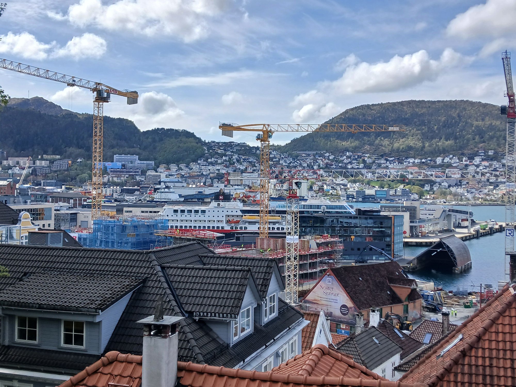
We woke up late today, exhausted after a marathon of a previous day. We stepped out for a short walk towards Nordnes (the tip of the west side of the Bergen harbour) and one last stroll by the harbour itself, before heading to the ferry terminal.
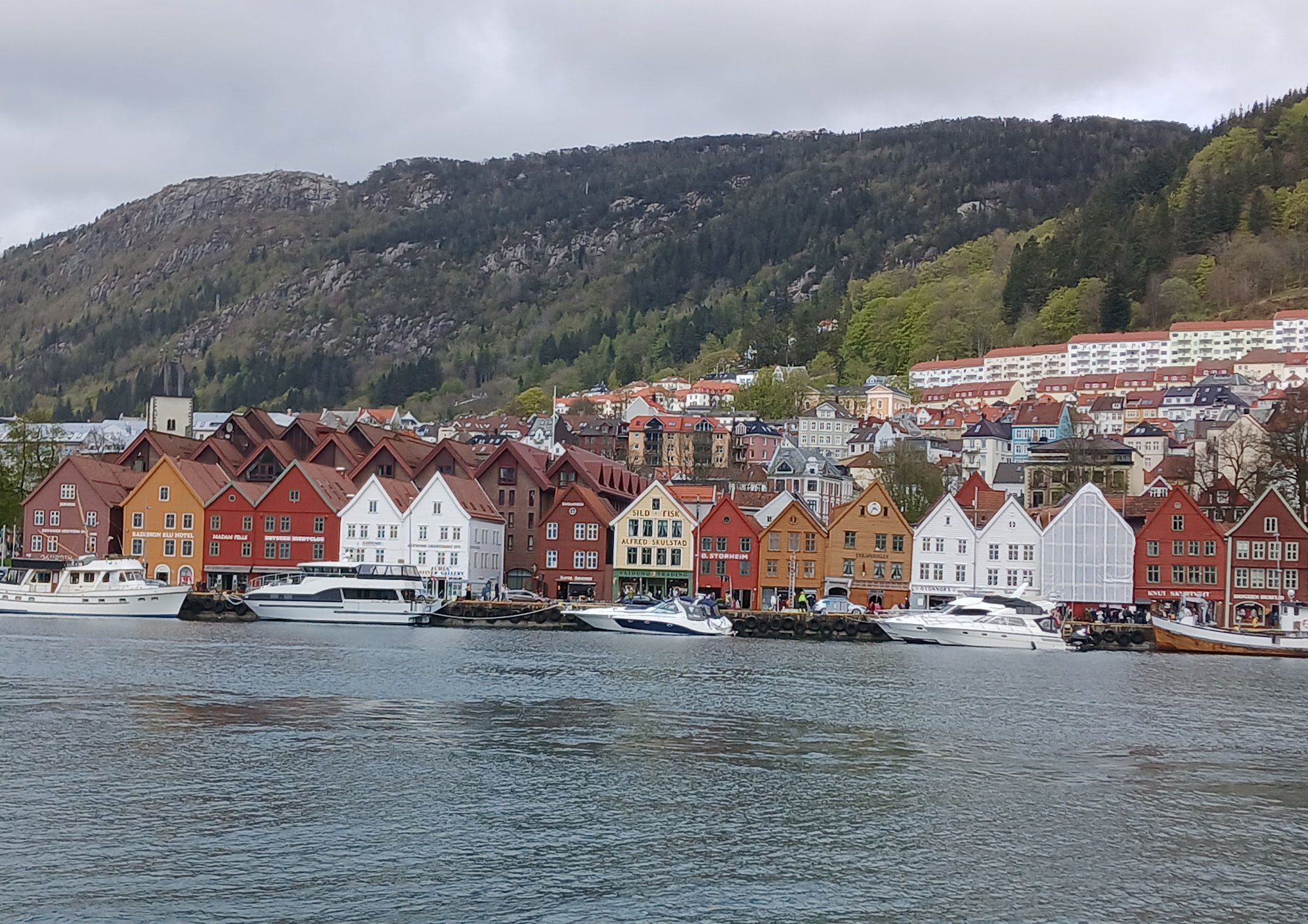
Bryggen, viewed from across the harbour
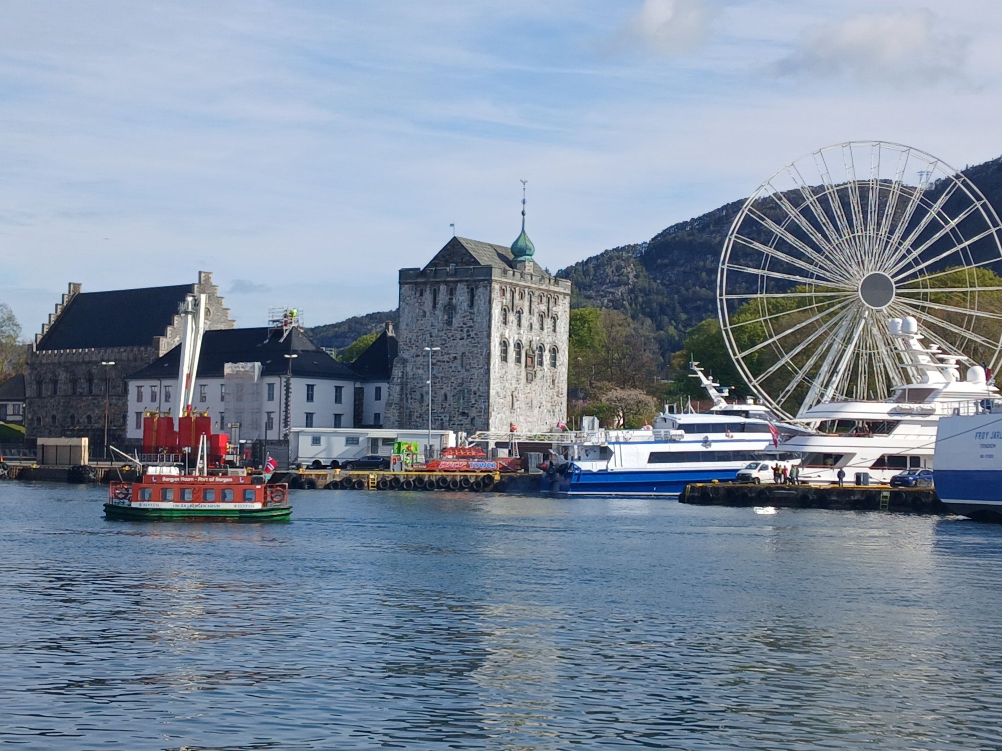
Bergen fortress, viewed from across the harbour. The ferris wheel was new, possibly ahead of the forthcoming Constitution Day celebrations

By the harbour
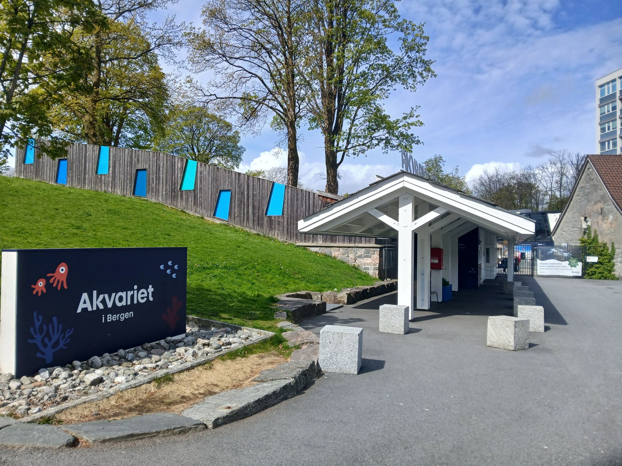
Passing the acquarium, on the way to the park
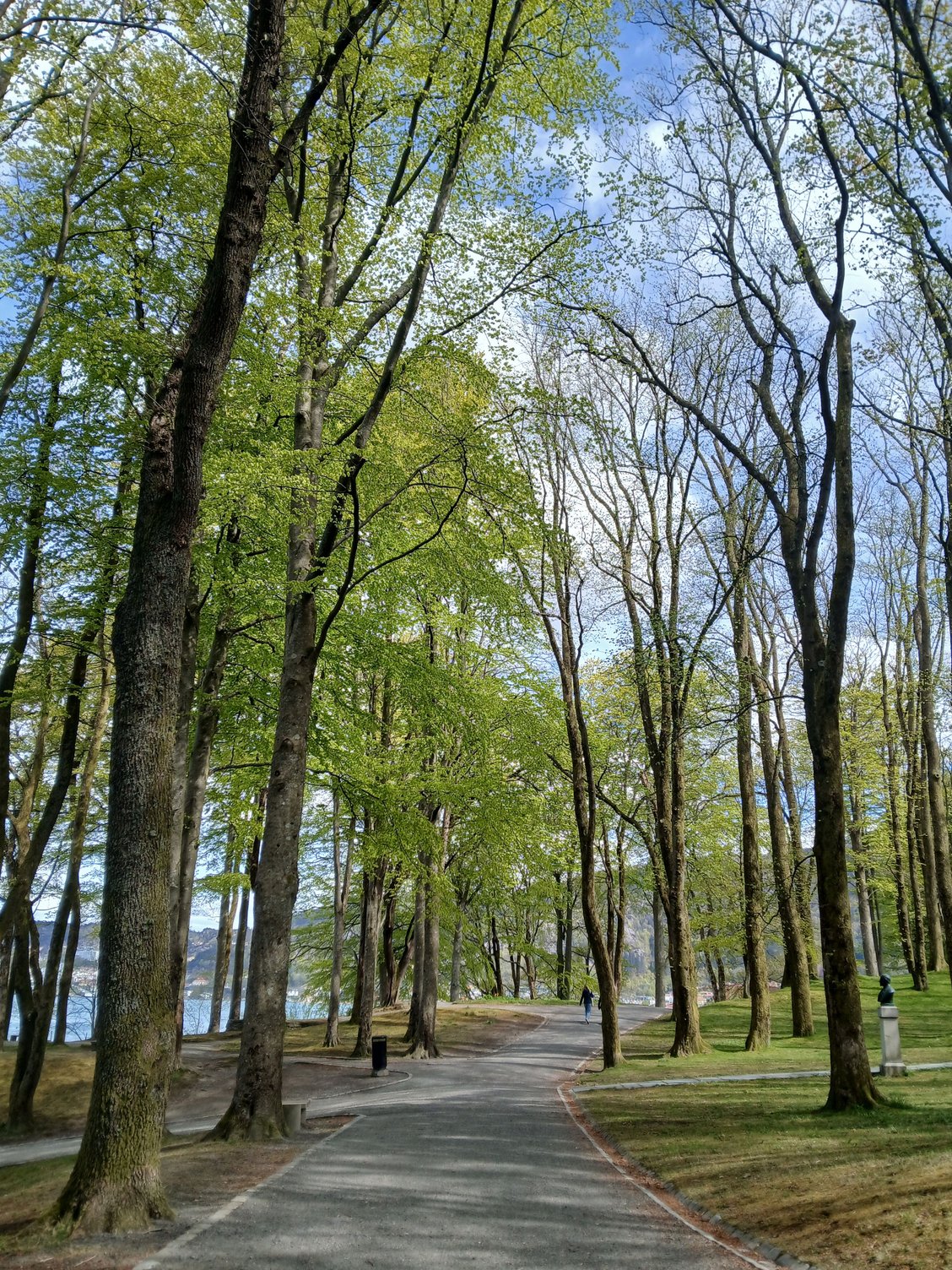
At the park

At the viewpoint, at northern edge of the park
I don’t like cruises, but I'm only willing to make an exception for Norway. In truth, Havila (operating since 2021) and Hurtigruten (the long-established incumbent) are not cruises, but working ferries. Infact, Havila resents the usage of the term “cruise”, they call themselves “the world’s most beautiful coastal voyage”. They transport cargo, mail and essential supplies along Norway’s west coast, providing a vital lifeline to remote communities – and also carry passengers. No onboard entertainment, no buffets - this is simply purposeful transport, offering a unique perspective of Norway’s coastline from the water — and that is exactly what we wanted. More commentary on environmental aspects of Havila to follow, later in my trip report.
Both operators run the same route, alternating days of the week, calling at 34 ports between Bergen in the south and Kirkenes in the north (right by the Russian border). Twenty years ago, we travelled only the Bergen–Bod� stretch with Hurtigruten — you can choose anything from port-to-port sailings to shorter segments. This time, we opted to try Havila and selected their “short voyage” from Bergen to Troms�, much farther north from Bodo.
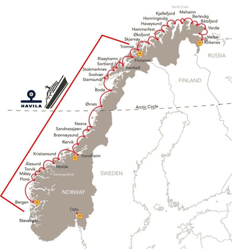
The traditional Norwegian Coastal Route map. The stretch maked with a red bracket represents our journey.
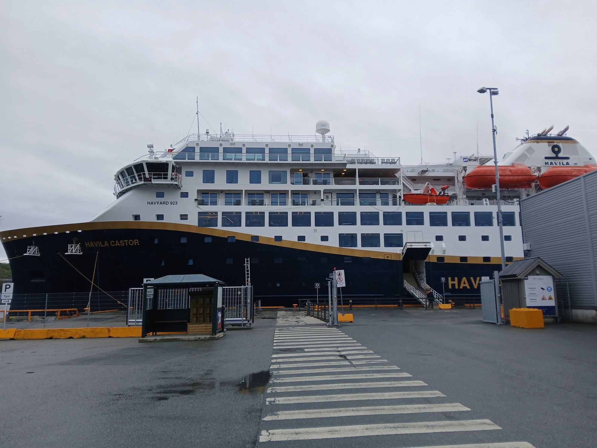
We were very impressed with our ship, the Havila Castor.
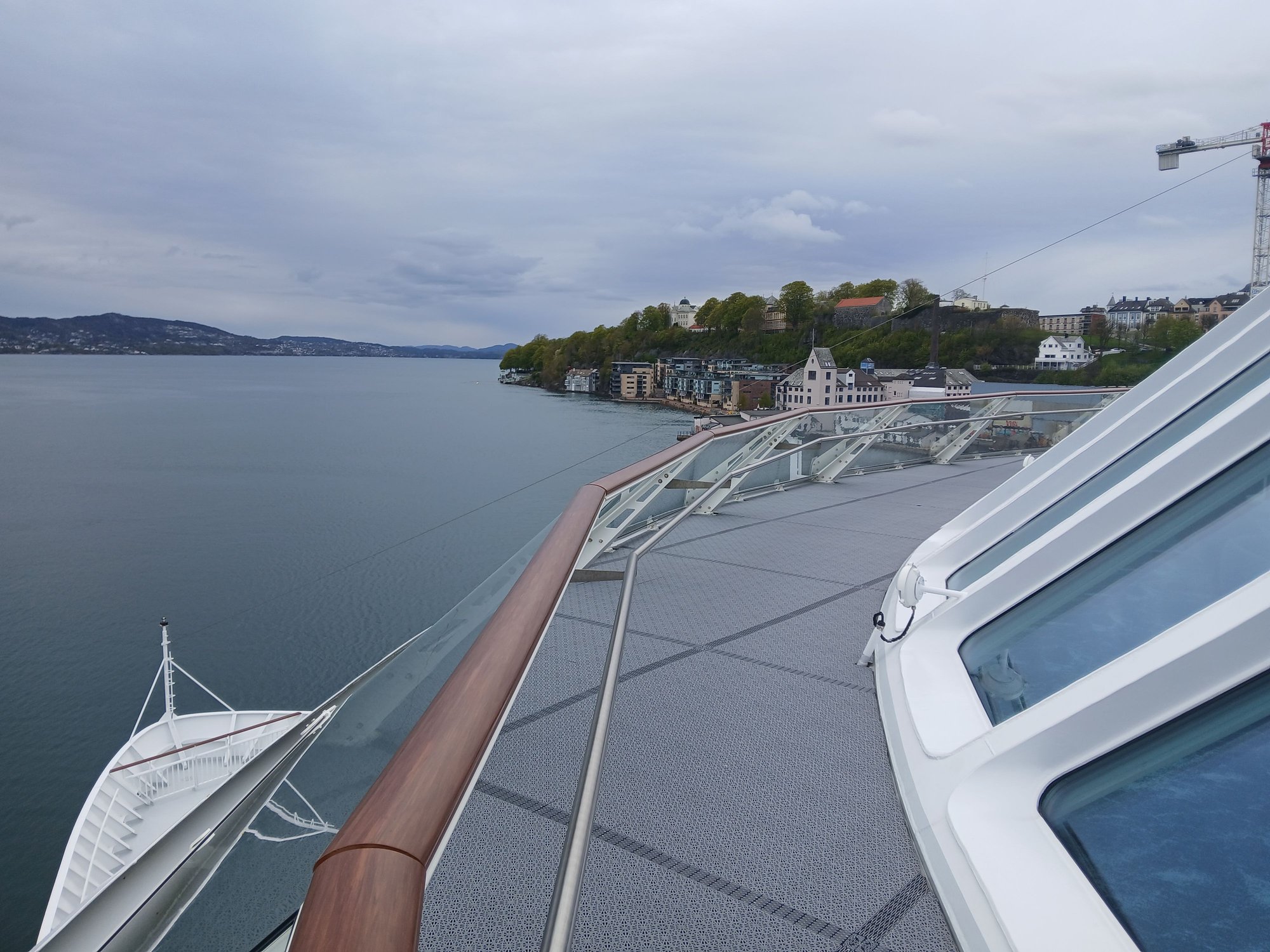
View of the port, from Nordnes
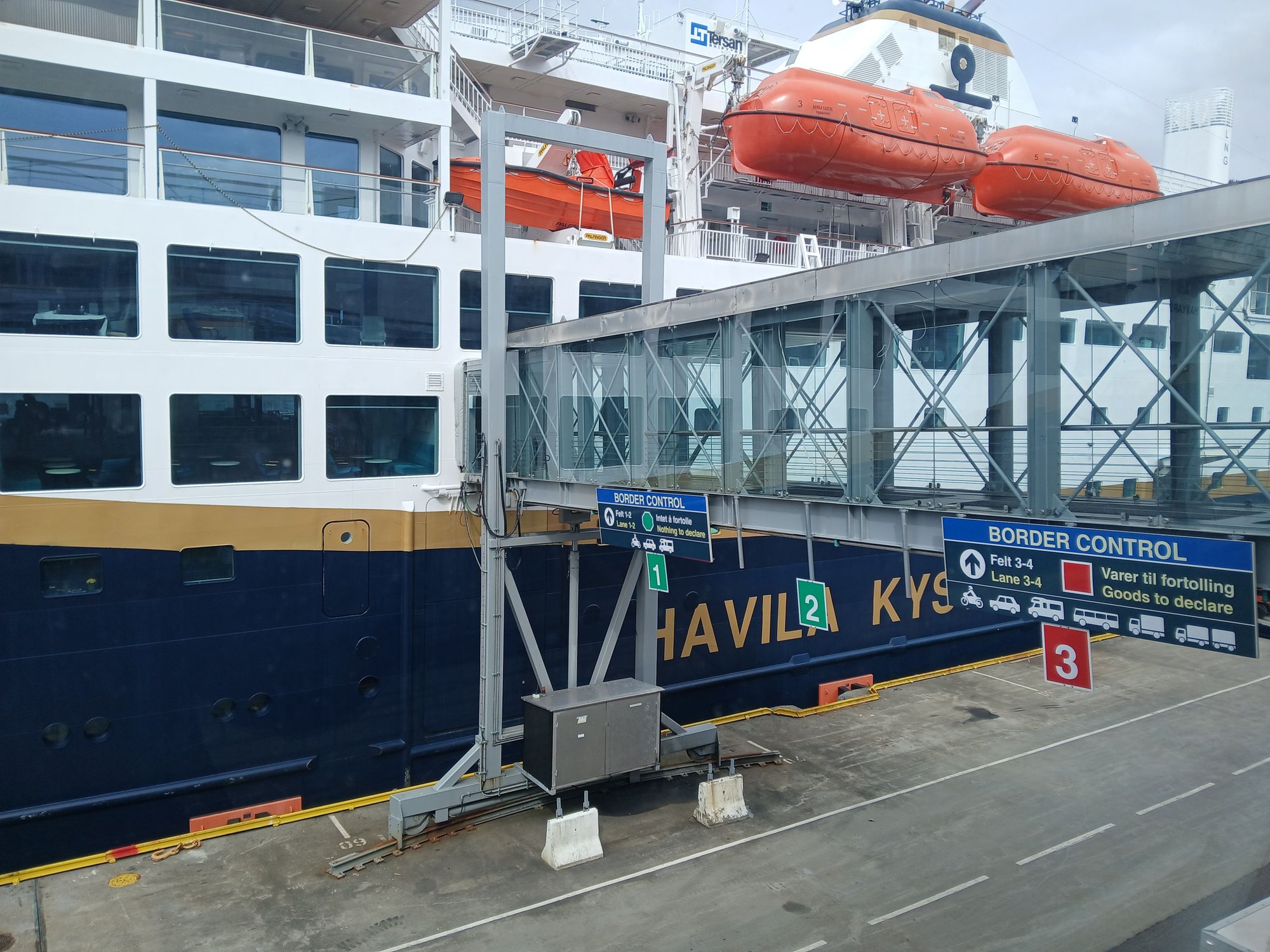
Boarding our ship, the Havila Castor

We spent most of our time on the top deck lounge and bar
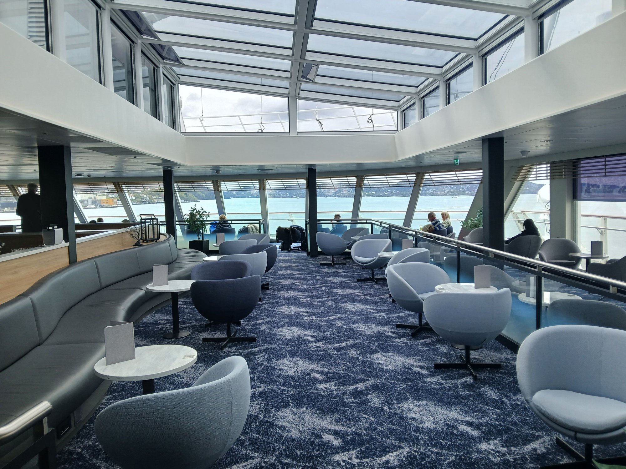
.. as it had large panoramic windows with a wrap around deck outside

The cafe
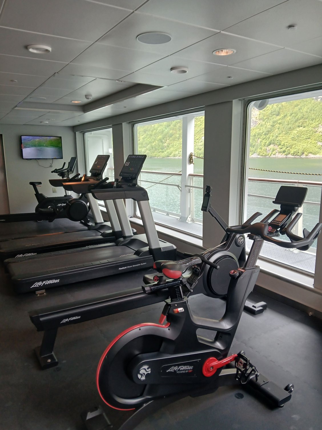
The gym
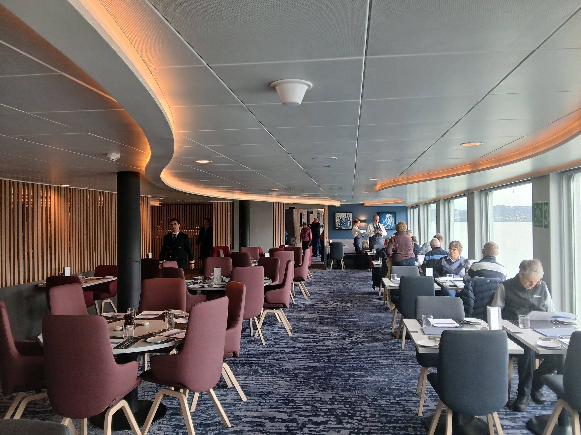
The restaurant, which is where we ate almost all our meals
The dining concept on Havila is a-la-carte with small plates (you are free to re-order more), to avoid food wastage. Here is our first dinner on board, a three course menu which perhaps looked better than it tasted - but we were relieved to be well-catered over the next 4 days as vegetarians.

Charred cauliflower
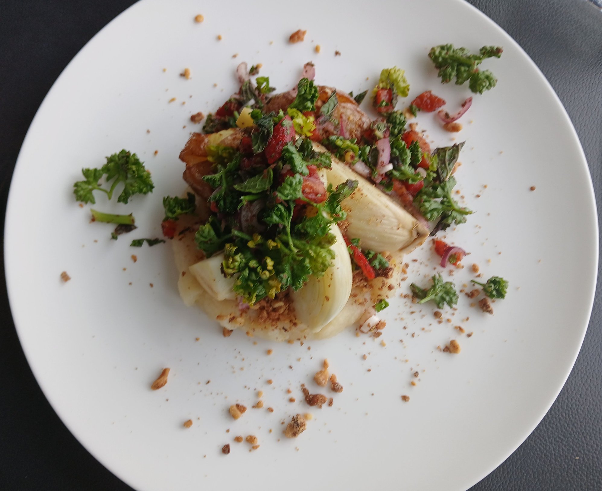
Roasted fennel, celeriac puree
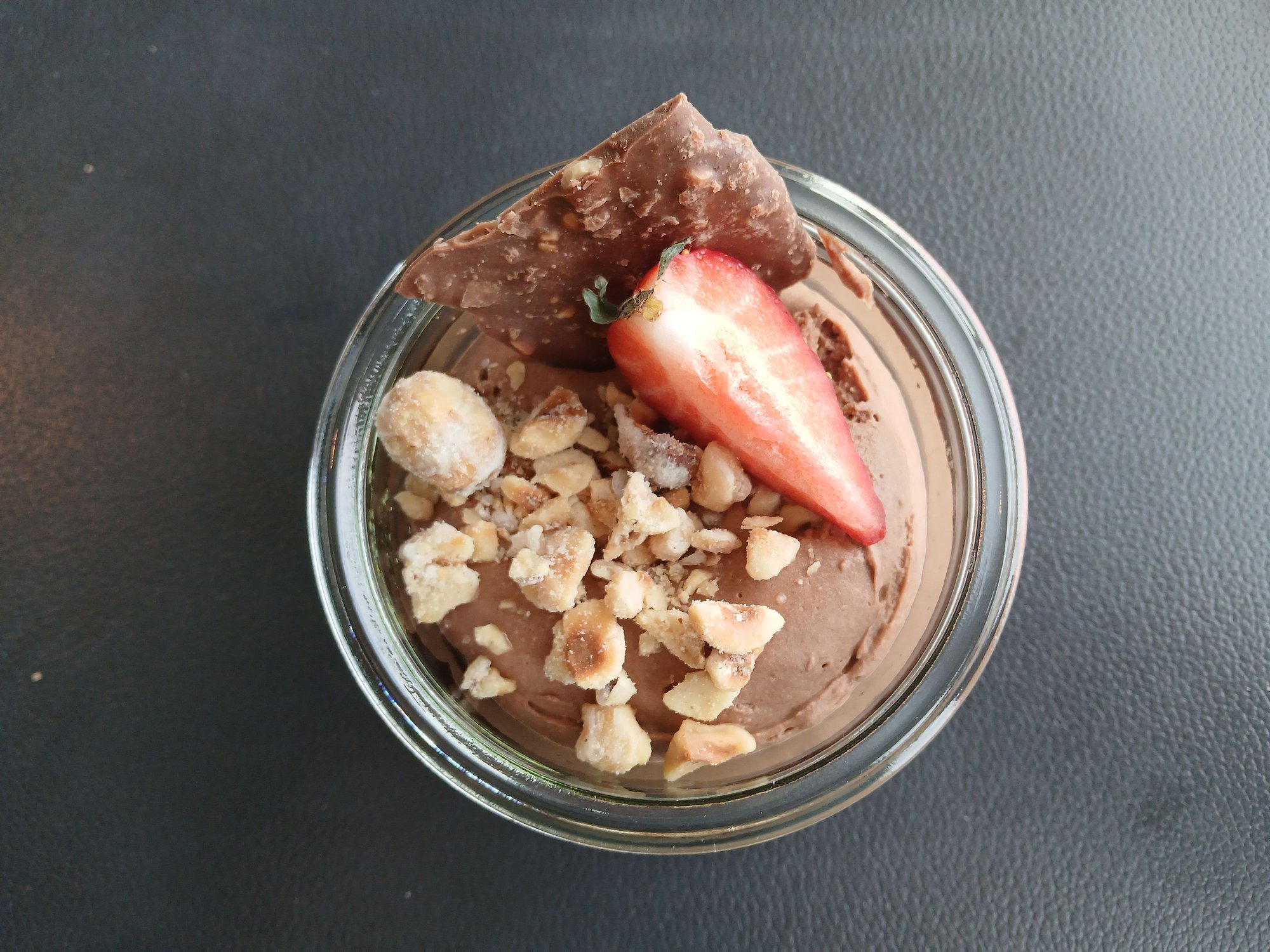
Chocolate mousse
Finally around 8.30pm, we set sail from Bergen. Bon Voyage, or as the Norwegians would say God reise!
Leaving the ship terminal

The terminal
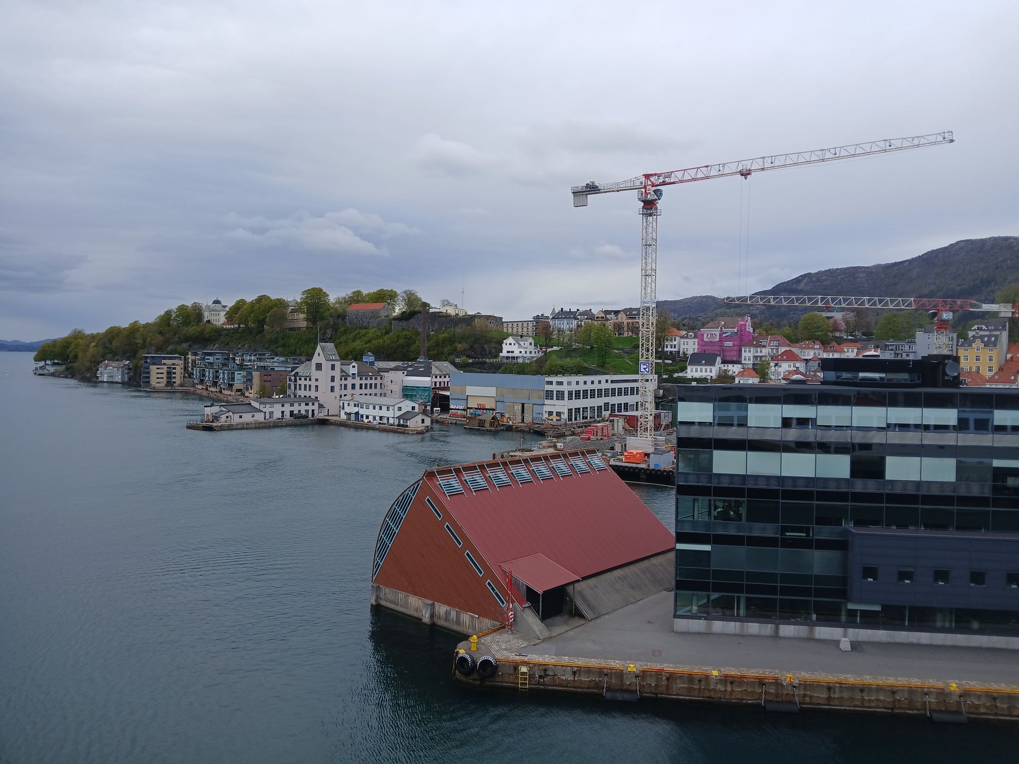
The city

And we're away ...

Farewell Bergen !
Bryggen, viewed from across the harbour
Bergen fortress, viewed from across the harbour. The ferris wheel was new, possibly ahead of the forthcoming Constitution Day celebrations
By the harbour
Passing the acquarium, on the way to the park
At the park
At the viewpoint, at northern edge of the park
I don’t like cruises, but I'm only willing to make an exception for Norway. In truth, Havila (operating since 2021) and Hurtigruten (the long-established incumbent) are not cruises, but working ferries. Infact, Havila resents the usage of the term “cruise”, they call themselves “the world’s most beautiful coastal voyage”. They transport cargo, mail and essential supplies along Norway’s west coast, providing a vital lifeline to remote communities – and also carry passengers. No onboard entertainment, no buffets - this is simply purposeful transport, offering a unique perspective of Norway’s coastline from the water — and that is exactly what we wanted. More commentary on environmental aspects of Havila to follow, later in my trip report.
Both operators run the same route, alternating days of the week, calling at 34 ports between Bergen in the south and Kirkenes in the north (right by the Russian border). Twenty years ago, we travelled only the Bergen–Bod� stretch with Hurtigruten — you can choose anything from port-to-port sailings to shorter segments. This time, we opted to try Havila and selected their “short voyage” from Bergen to Troms�, much farther north from Bodo.
The traditional Norwegian Coastal Route map. The stretch maked with a red bracket represents our journey.
We were very impressed with our ship, the Havila Castor.
View of the port, from Nordnes
Boarding our ship, the Havila Castor
We spent most of our time on the top deck lounge and bar
.. as it had large panoramic windows with a wrap around deck outside
The cafe
The gym
The restaurant, which is where we ate almost all our meals
The dining concept on Havila is a-la-carte with small plates (you are free to re-order more), to avoid food wastage. Here is our first dinner on board, a three course menu which perhaps looked better than it tasted - but we were relieved to be well-catered over the next 4 days as vegetarians.
Charred cauliflower
Roasted fennel, celeriac puree
Chocolate mousse
Finally around 8.30pm, we set sail from Bergen. Bon Voyage, or as the Norwegians would say God reise!
Leaving the ship terminal
The terminal
The city
And we're away ...
Farewell Bergen !
Last edited by ANUJ; May 31st, 2026 at 10:52 PM.
May 31st, 2026 | 09:58 PM
#25
Original Poster
Joined: Oct 2005
Posts: 960
Likes: 28
geetika If it was raining when you visited Stavanger, you made the right call to skip Pulpit Rock. I just looked up Kulen Mountain - what an uncanny resemblance ! Never say never - Norway may find its way into your future plans !
May 31st, 2026 | 10:45 PM
#26
Original Poster
Joined: Oct 2005
Posts: 960
Likes: 28
Day 7 : �lesund and Geirangerfjord, On the northbound Havila voyage
Following a night of sound sleep (and adjusting to the ship motion), we headed for breakfast. Our very first port of call was Torvik.

Morning on the high seas
Calling at Torvik, a short cargo halt
After a (short) halt at �lesund, the ship sails through the Geirangerfjord, returning to �lesund for a much longer stop later in the evening (allowing time to explore the town, more to follow). We enjoyed the bird's eye view over the �lesund rooftops, from the ship's deck.
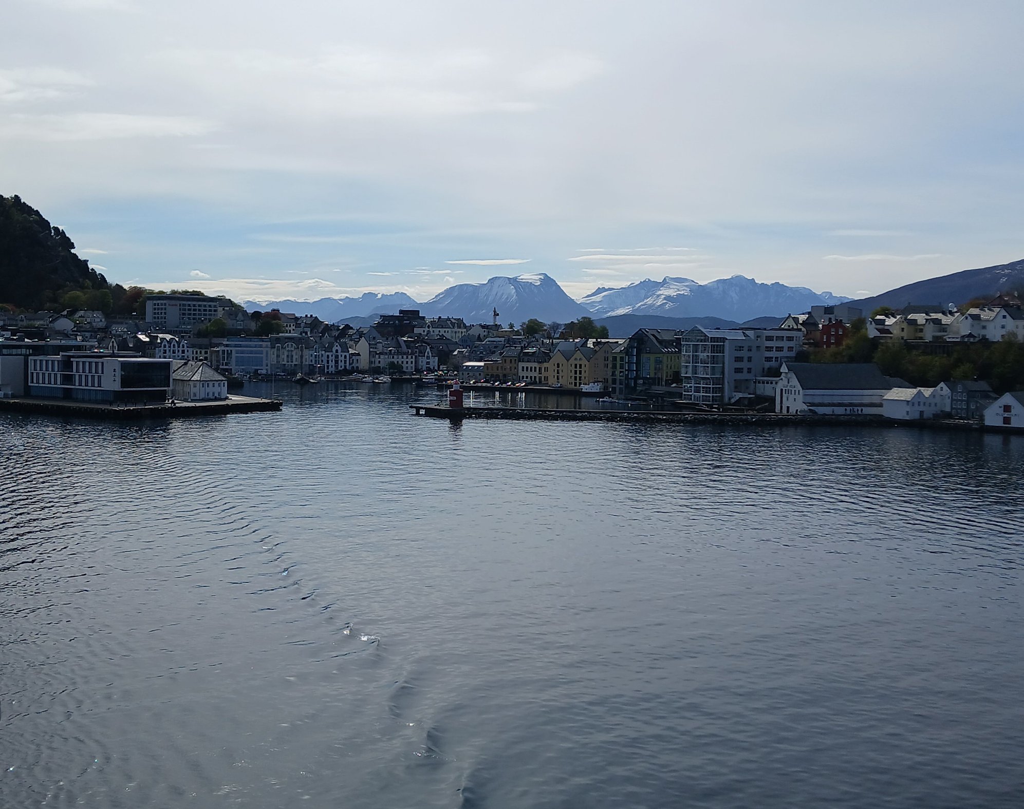
Arriving at Alesund

Views from the deck

Views from the deck
Leaving Alesund, for Geiranger
Havila takes its environmental commitment very seriously, operating four of the most eco-friendly ships in the world. The ships use a flexible hybrid system running on LNG, which switches to large battery packs (charged by hydropower) for zero-emission sailing in protected areas. This is why Havila's fleet is permitted to sail into the pristine fjords, like Geiranger - which is otherwise restricted to smaller boats only. By 2030, the fleet is expected to run entirely on hydrogen. There is no engine noise and no smoke — just stillness and silence.
The ship left �lesund to turn into the Stirfjord (the “grand fjord”). The scenery was magical, whether viewed from one of the lounges or out on deck.

The scenery unfolding before us

From the lounge
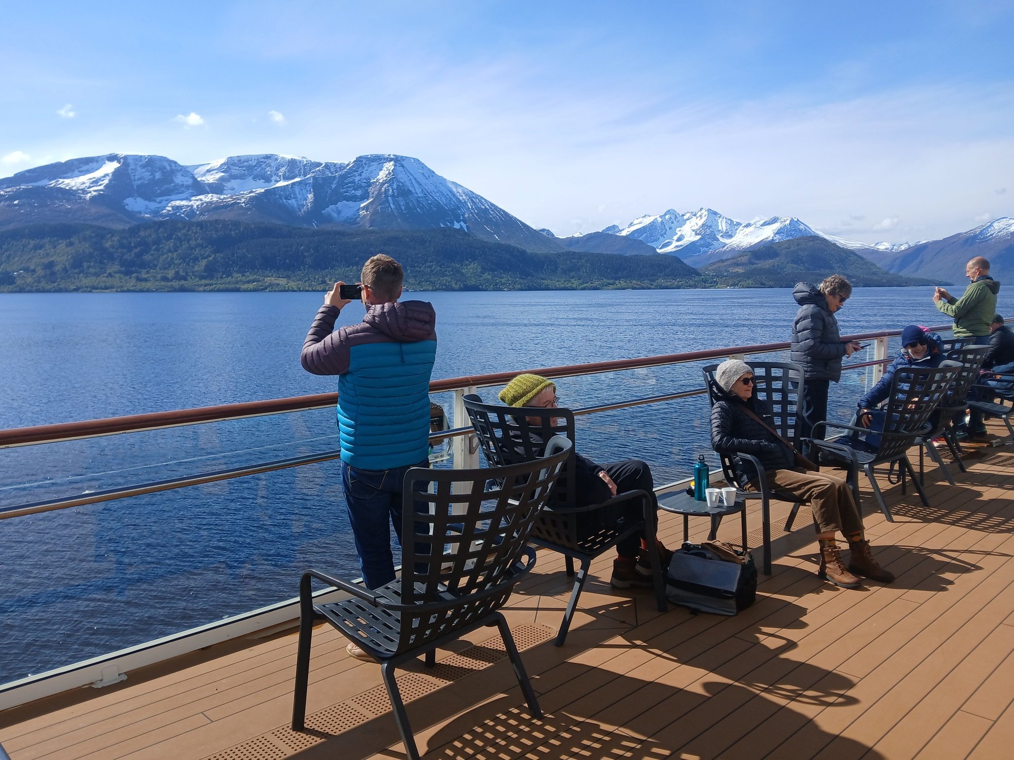
From the outdoor deck
We passed the mouth of Hj�rundfjord, flanked by the steep Sunnm�re Alps (with the historic Hotel Oye located at its very end). Havila and Hurtigruten sail here in autumn (instead of Geiranger).
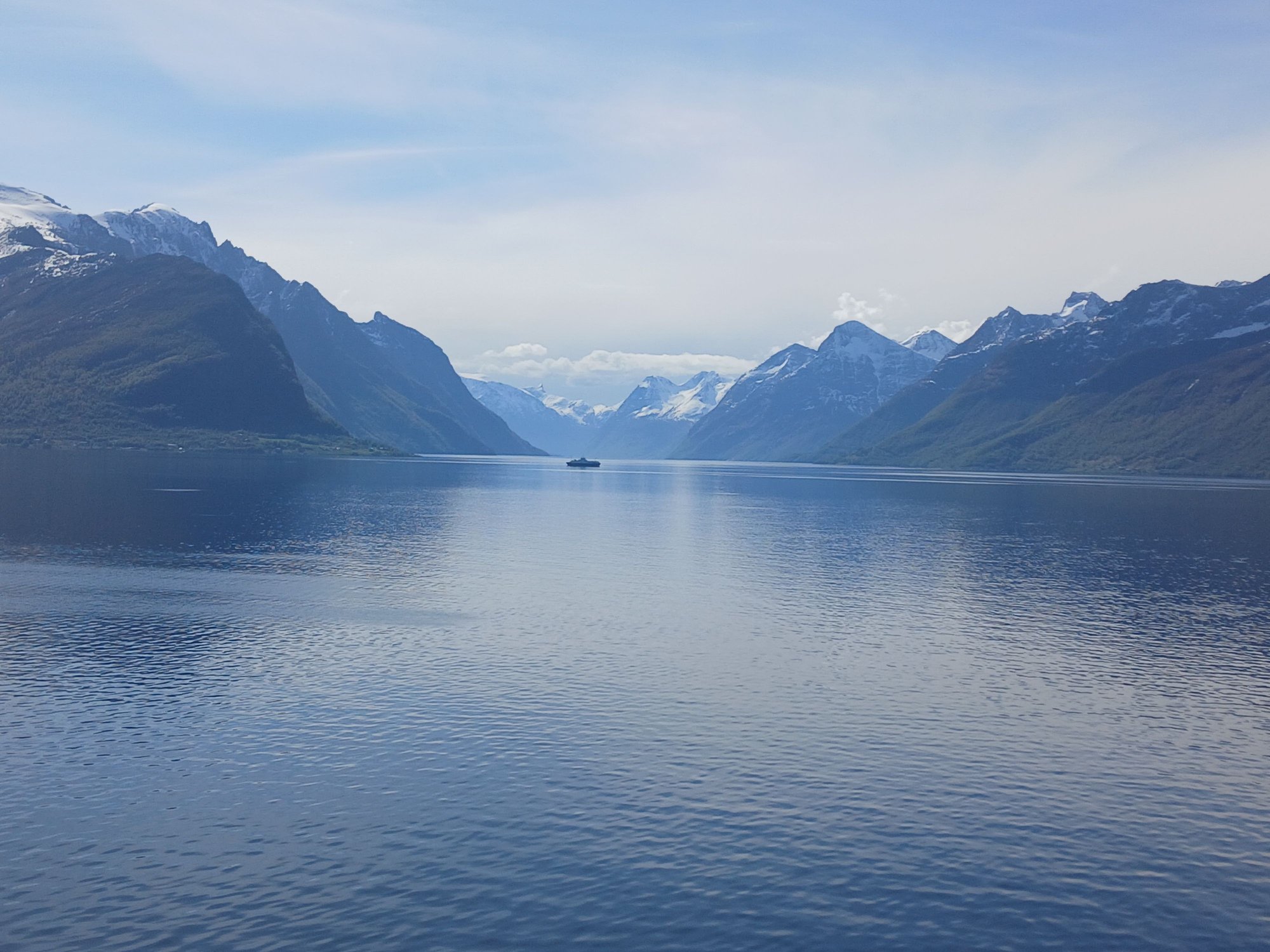
The mouth of the remote, and undervisited Hj�rundfjord
At the village of Standa, the fjord branches off into Sunnylvsfjord, with the village of Hellesylt at its end.
The fjord gets narrower
.. with the vilage of Hellesylt in the far distance
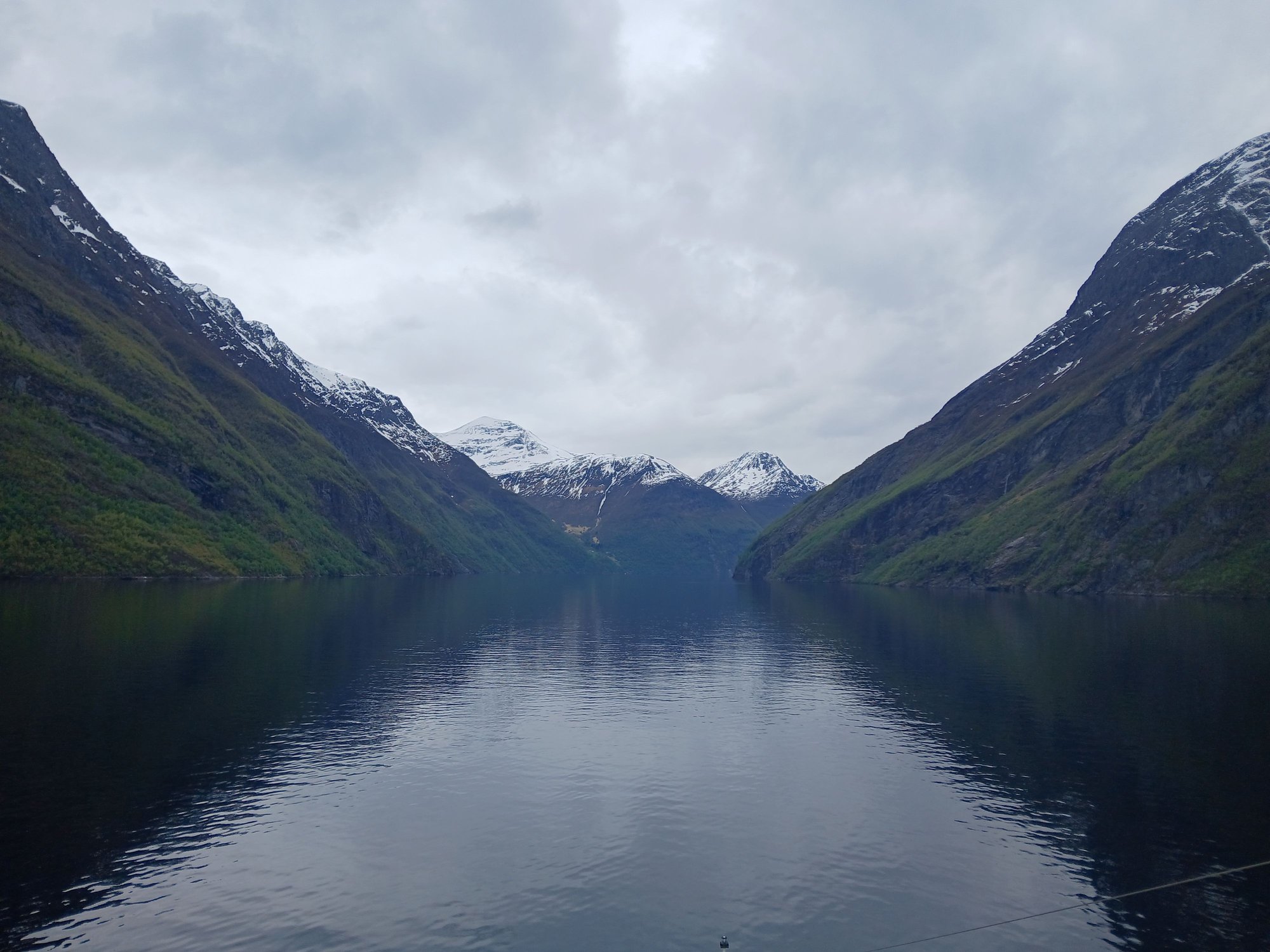
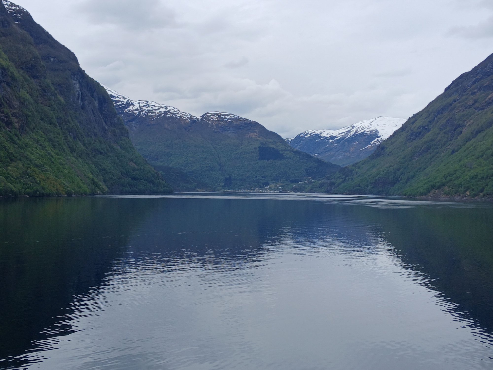
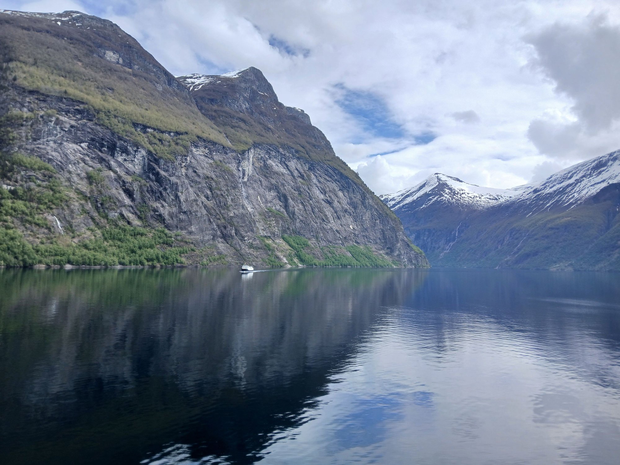
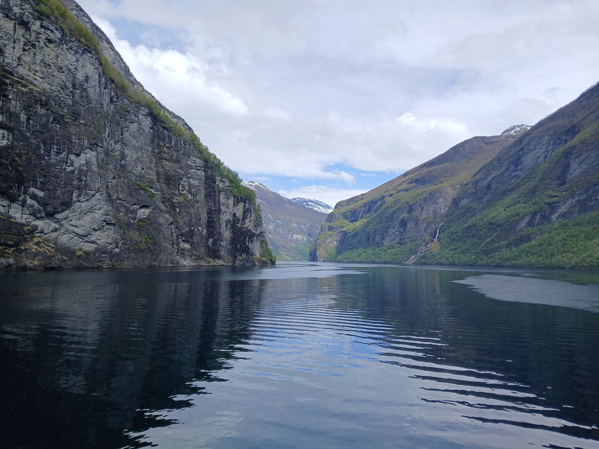
The 15km final stretch is Geirangerfjord, in the lap of majestic mountains, cascading waterfalls, and pristine nature. It’s a grand spectacle.
Turning into the Geirnagerfjord
Deeper into the fjord

The Suitor (Friaren) falls

The Seven Sisters (De syv s�strene) falls

The imposing cliffs

Entering the final stretch

View of the �rnevegen (The Eagle Road), a steep mountain road featuring 11 hairpin bends leading up the mountainside towards Eidsdal
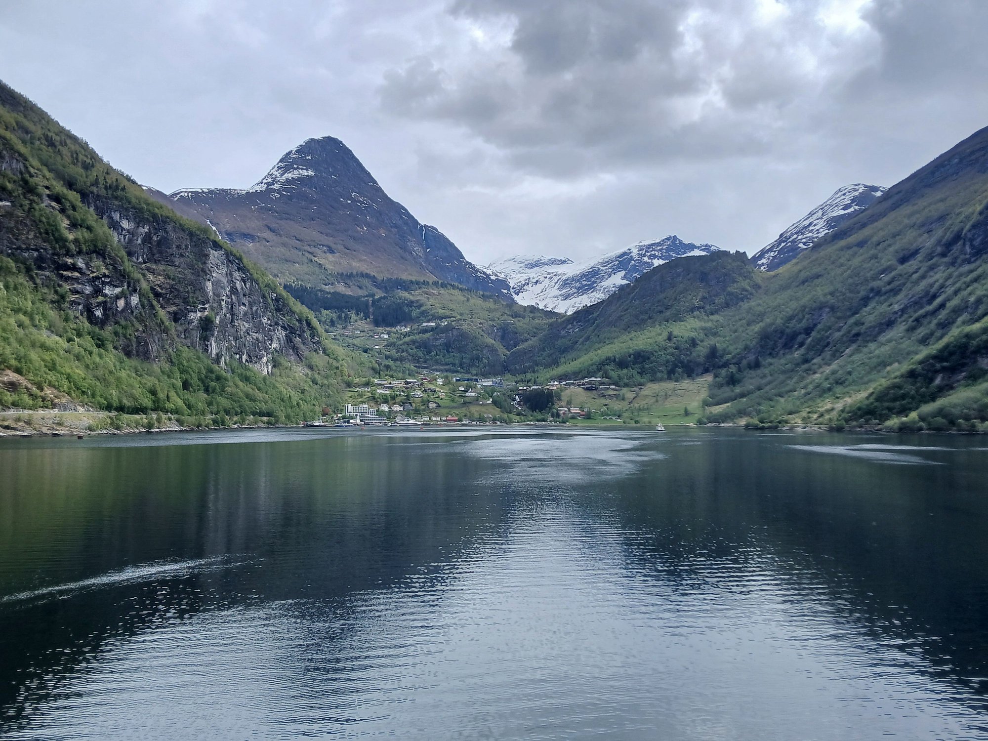
Approaching the village of Geiranger at the end of the fjord

A closer look at the village of Geiranger
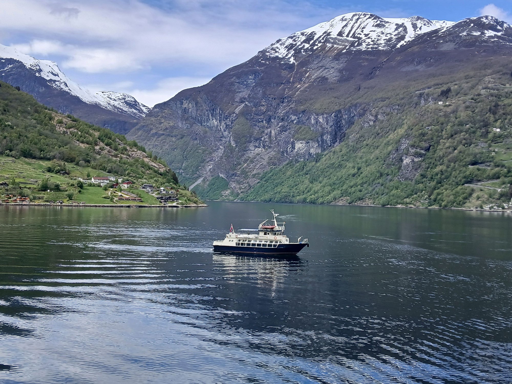
A tender boat arrives to take passengers on some excursions
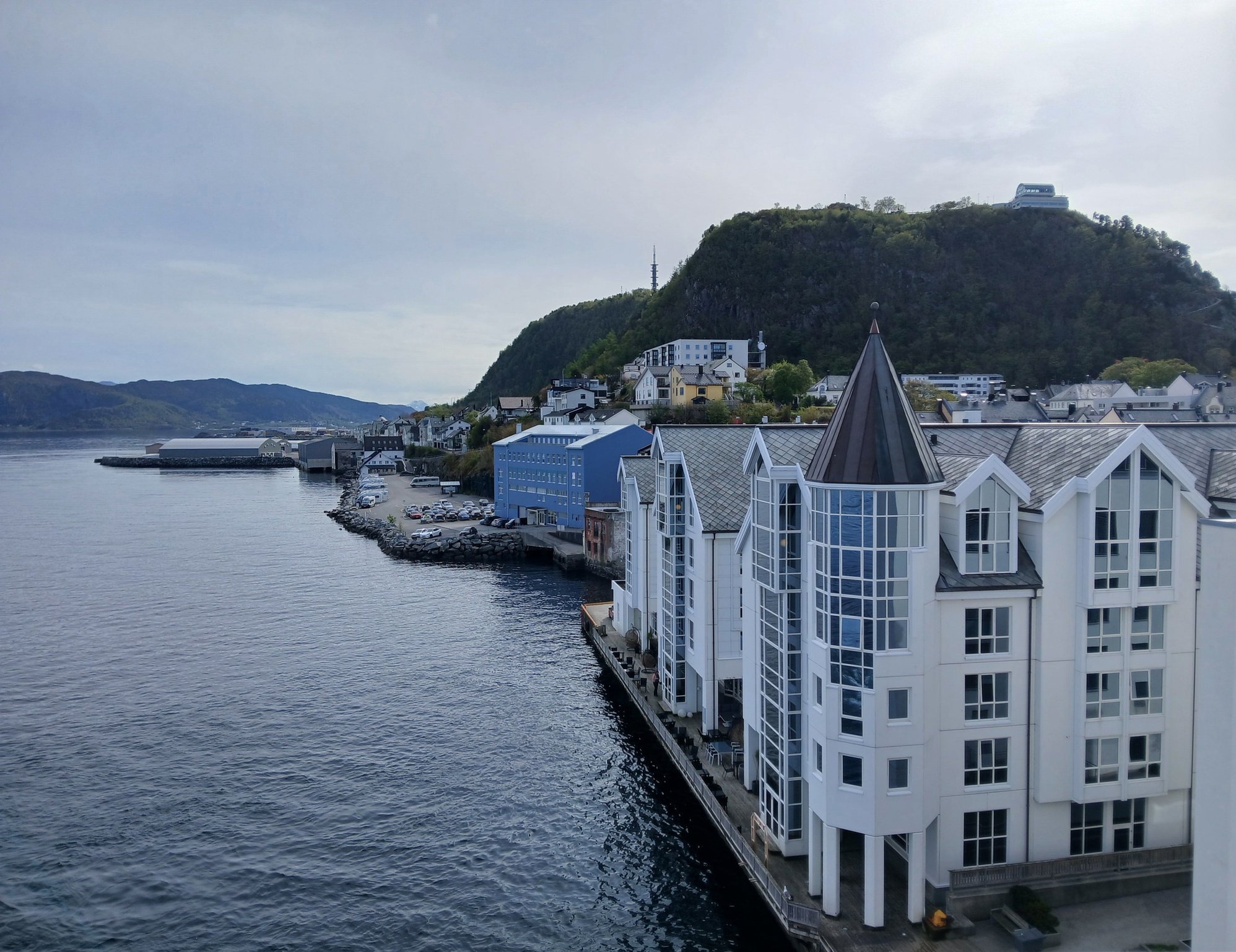
After transferring passengers to a tender boat for excursions, the ship returns to �lesund. This time we had an hour to disembark and revisit the compact centre of one of our favourite cities (from our 2006 trip) in Norway. �lesund has a distinctively colorful art nouveau streetscape, rebuilt from scratch after it was ravaged by a fire in 1904.

Walking down the east side of the canal

East side of the canal, with the floating docks
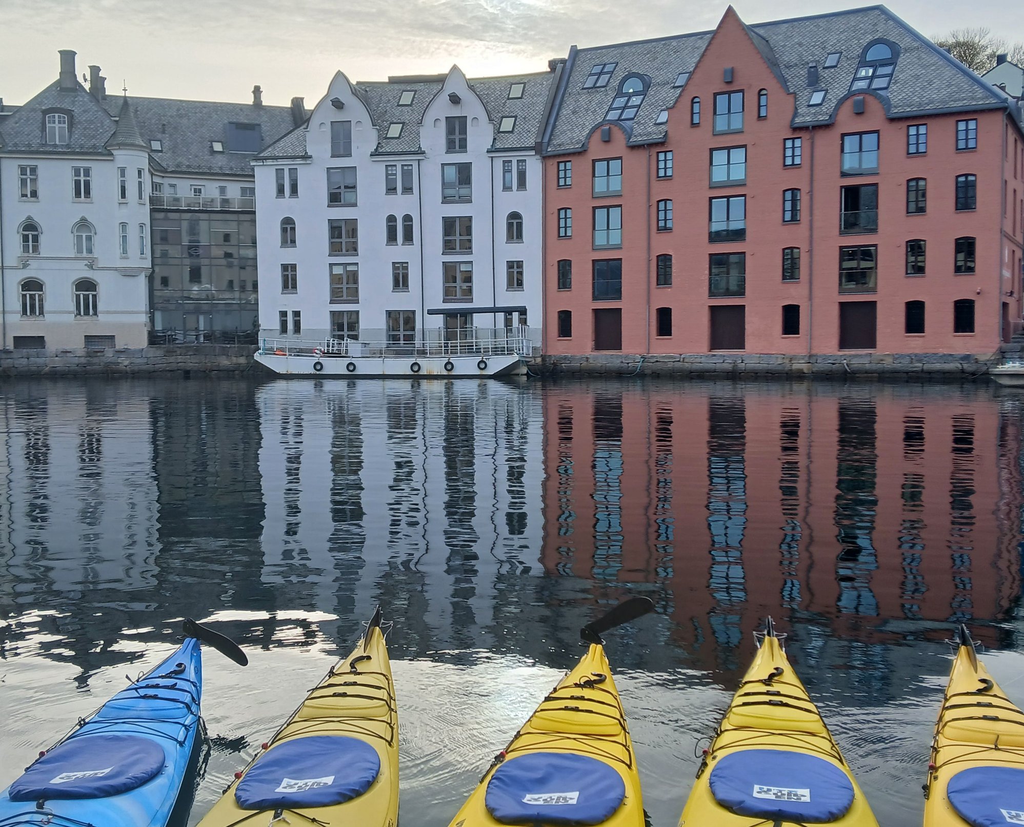
East side of the canal, with the kayaks
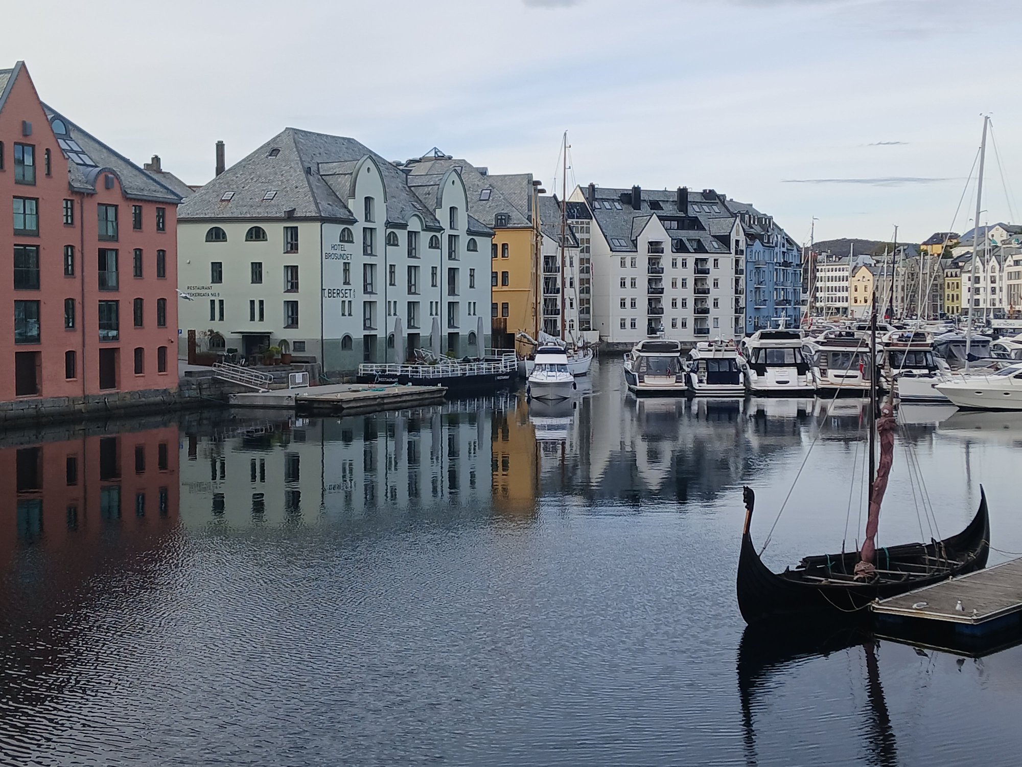
Views from the Helbroa bridge, across the canal

Art nouveau architecture along the west side of the canal

Art nouveau architecture along the west side of the canal
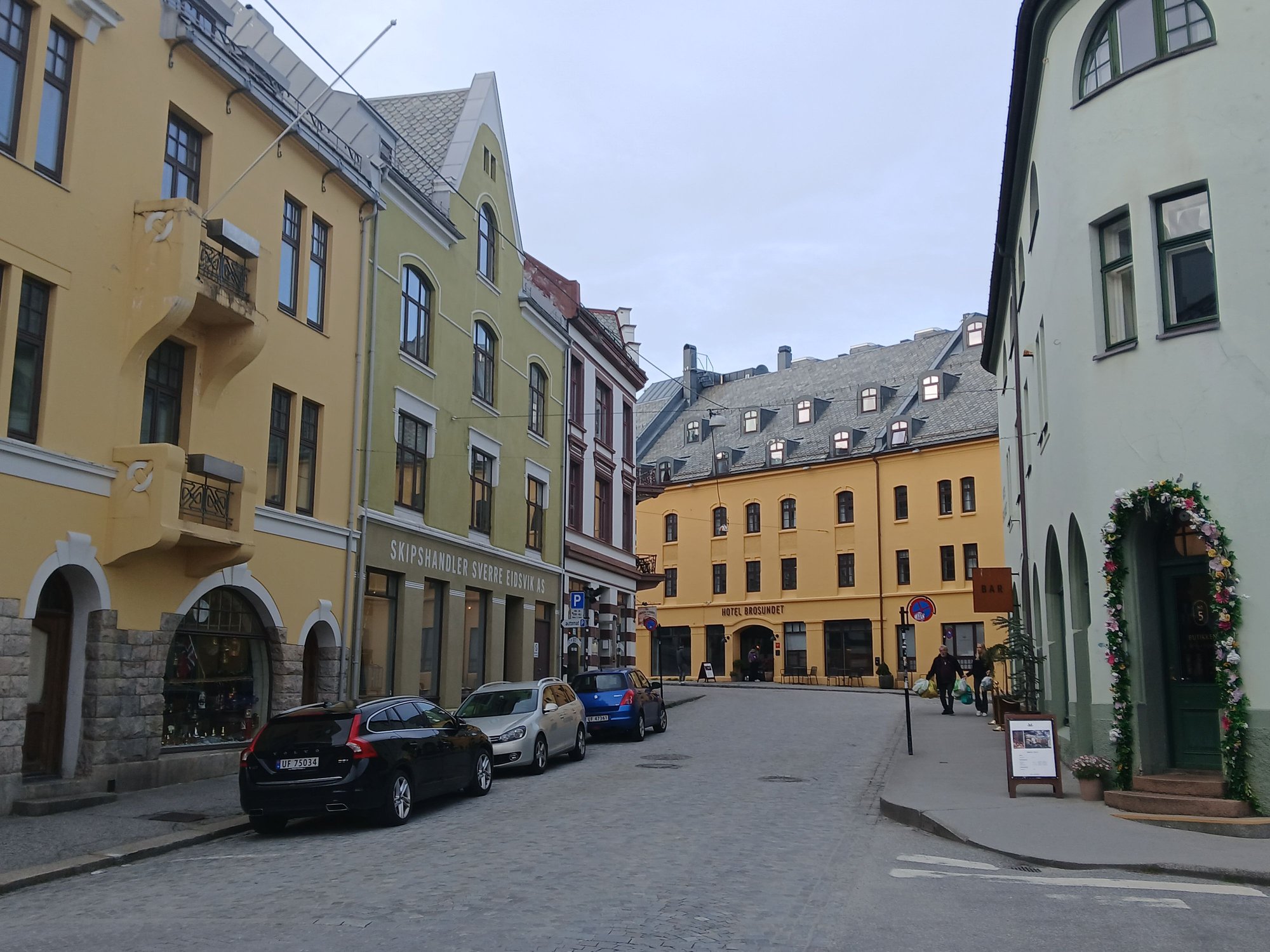
Along the Apotekergata street to the historic Hotel Brosundet (it's the yellow building you see in previous pictures)
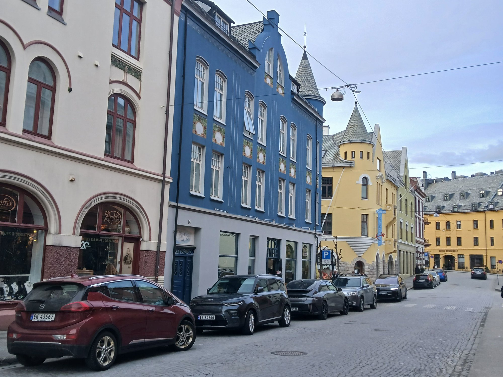
More beautiful buildings

View of Alesund, with the mountains in the back, taken from the port
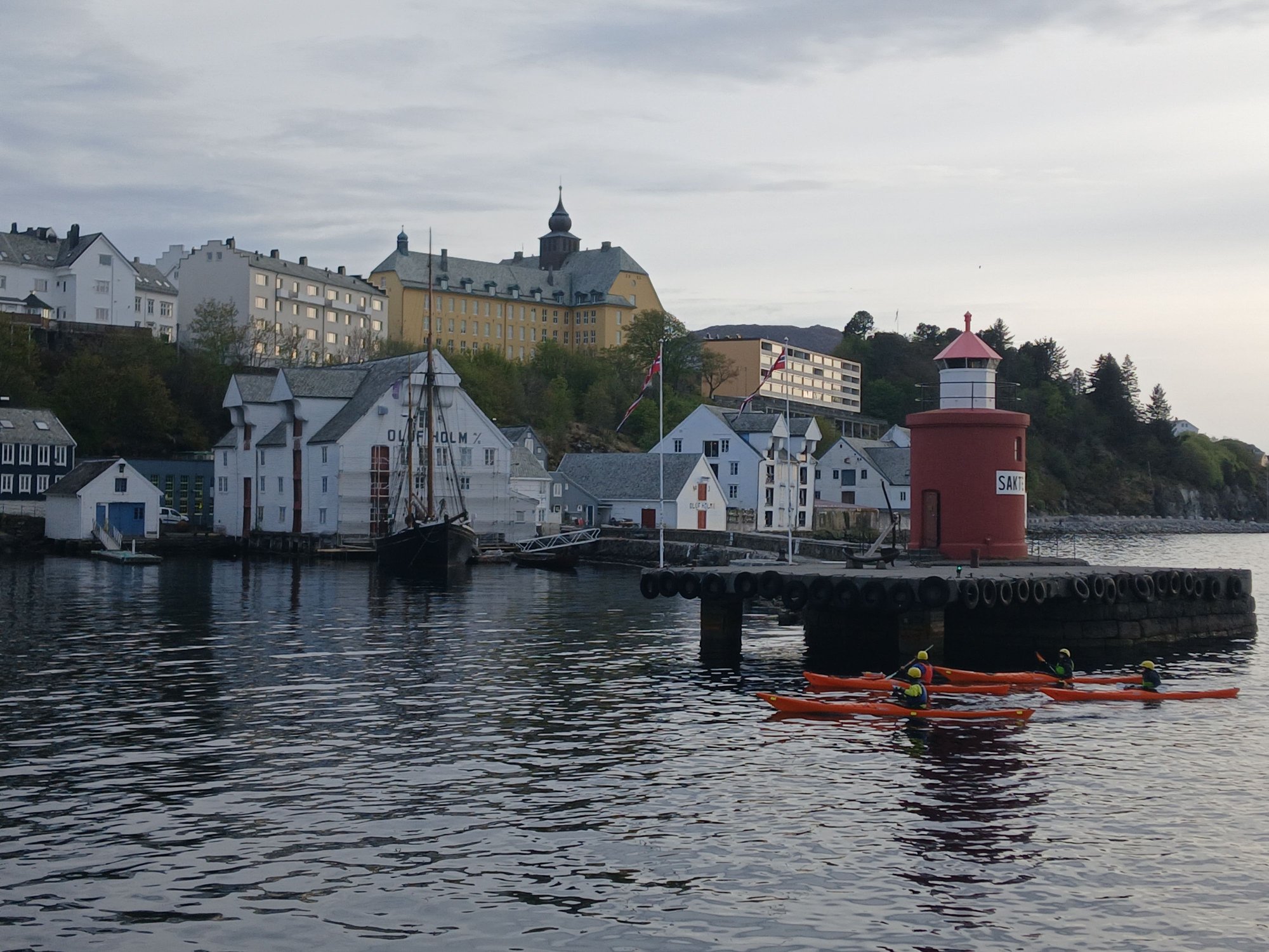
View of lighthouse, from the port
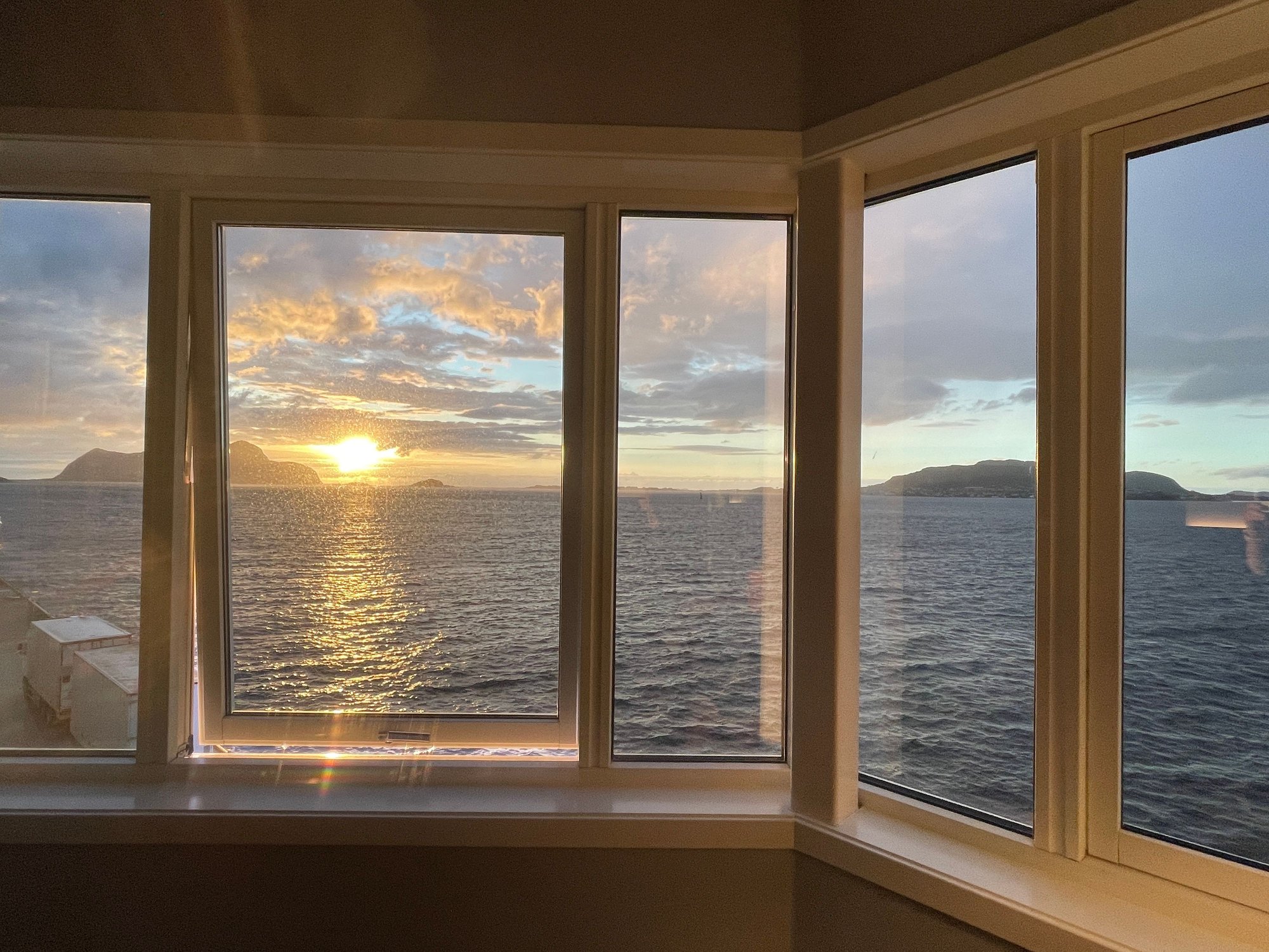
With a music quiz on board keeping us entertained tonight, we stayed up well past our usual bedtime to enjoy a 10pm Norwegian sunset, before calling on Molde - our final port for the night.

Farewell Alesund

A 10pm sunset
Calling at Molde, to pickup passengers from the excursions
Morning on the high seas
Calling at Torvik, a short cargo halt
After a (short) halt at �lesund, the ship sails through the Geirangerfjord, returning to �lesund for a much longer stop later in the evening (allowing time to explore the town, more to follow). We enjoyed the bird's eye view over the �lesund rooftops, from the ship's deck.
Arriving at Alesund
Views from the deck
Views from the deck
Leaving Alesund, for Geiranger
Havila takes its environmental commitment very seriously, operating four of the most eco-friendly ships in the world. The ships use a flexible hybrid system running on LNG, which switches to large battery packs (charged by hydropower) for zero-emission sailing in protected areas. This is why Havila's fleet is permitted to sail into the pristine fjords, like Geiranger - which is otherwise restricted to smaller boats only. By 2030, the fleet is expected to run entirely on hydrogen. There is no engine noise and no smoke — just stillness and silence.
The ship left �lesund to turn into the Stirfjord (the “grand fjord”). The scenery was magical, whether viewed from one of the lounges or out on deck.
The scenery unfolding before us
From the lounge
From the outdoor deck
We passed the mouth of Hj�rundfjord, flanked by the steep Sunnm�re Alps (with the historic Hotel Oye located at its very end). Havila and Hurtigruten sail here in autumn (instead of Geiranger).
The mouth of the remote, and undervisited Hj�rundfjord
At the village of Standa, the fjord branches off into Sunnylvsfjord, with the village of Hellesylt at its end.
The fjord gets narrower
.. with the vilage of Hellesylt in the far distance
The 15km final stretch is Geirangerfjord, in the lap of majestic mountains, cascading waterfalls, and pristine nature. It’s a grand spectacle.
Turning into the Geirnagerfjord
Deeper into the fjord
The Suitor (Friaren) falls
The Seven Sisters (De syv s�strene) falls
The imposing cliffs
Entering the final stretch
View of the �rnevegen (The Eagle Road), a steep mountain road featuring 11 hairpin bends leading up the mountainside towards Eidsdal
Approaching the village of Geiranger at the end of the fjord
A closer look at the village of Geiranger
A tender boat arrives to take passengers on some excursions
After transferring passengers to a tender boat for excursions, the ship returns to �lesund. This time we had an hour to disembark and revisit the compact centre of one of our favourite cities (from our 2006 trip) in Norway. �lesund has a distinctively colorful art nouveau streetscape, rebuilt from scratch after it was ravaged by a fire in 1904.
Walking down the east side of the canal
East side of the canal, with the floating docks
East side of the canal, with the kayaks
Views from the Helbroa bridge, across the canal
Art nouveau architecture along the west side of the canal
Art nouveau architecture along the west side of the canal
Along the Apotekergata street to the historic Hotel Brosundet (it's the yellow building you see in previous pictures)
More beautiful buildings
View of Alesund, with the mountains in the back, taken from the port
View of lighthouse, from the port
With a music quiz on board keeping us entertained tonight, we stayed up well past our usual bedtime to enjoy a 10pm Norwegian sunset, before calling on Molde - our final port for the night.
Farewell Alesund
A 10pm sunset
Calling at Molde, to pickup passengers from the excursions
Last edited by ANUJ; May 31st, 2026 at 10:51 PM.
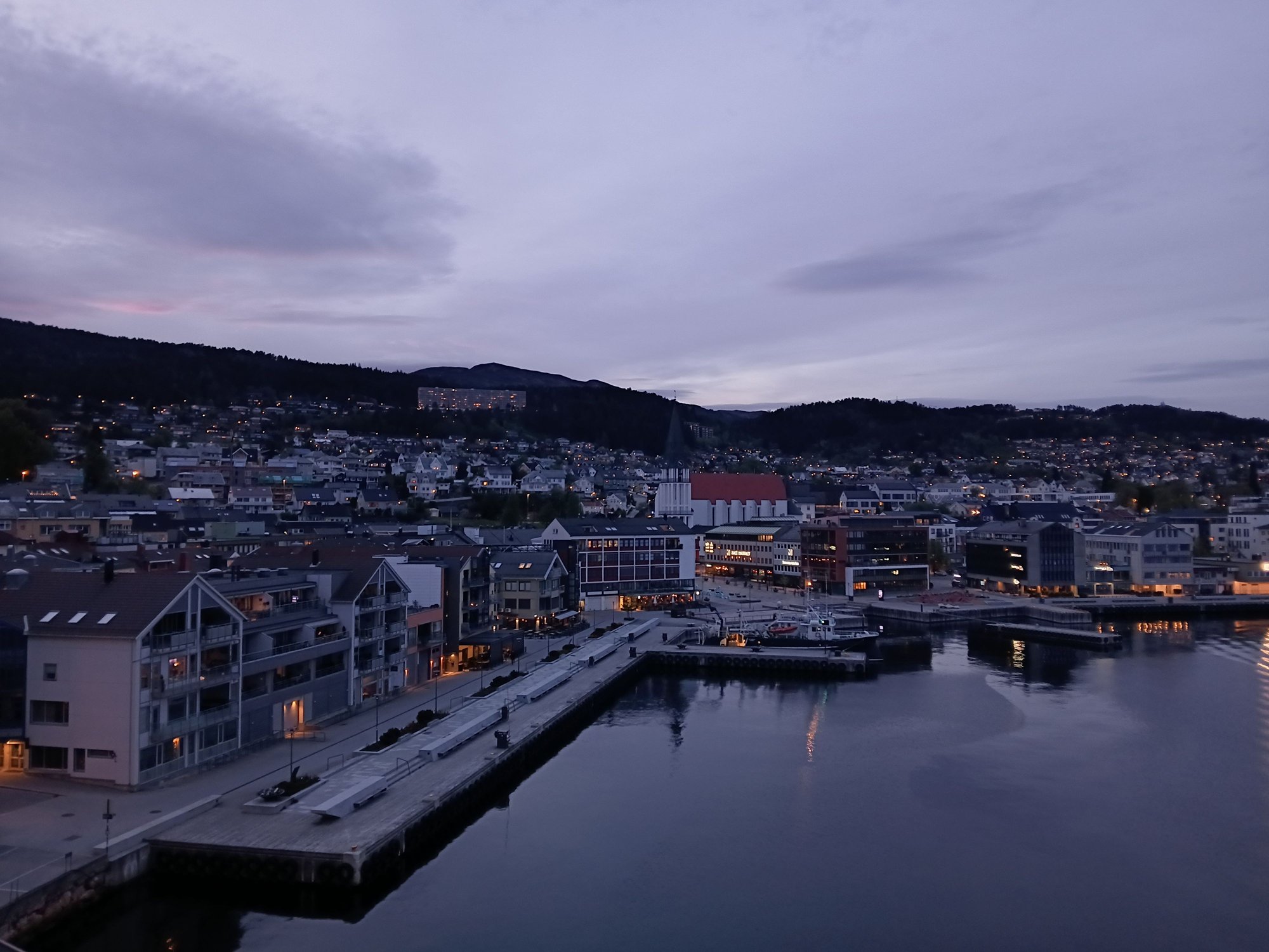
Yesterday | 12:47 PM
#27


Joined: Dec 2013
Posts: 424
Likes: 41
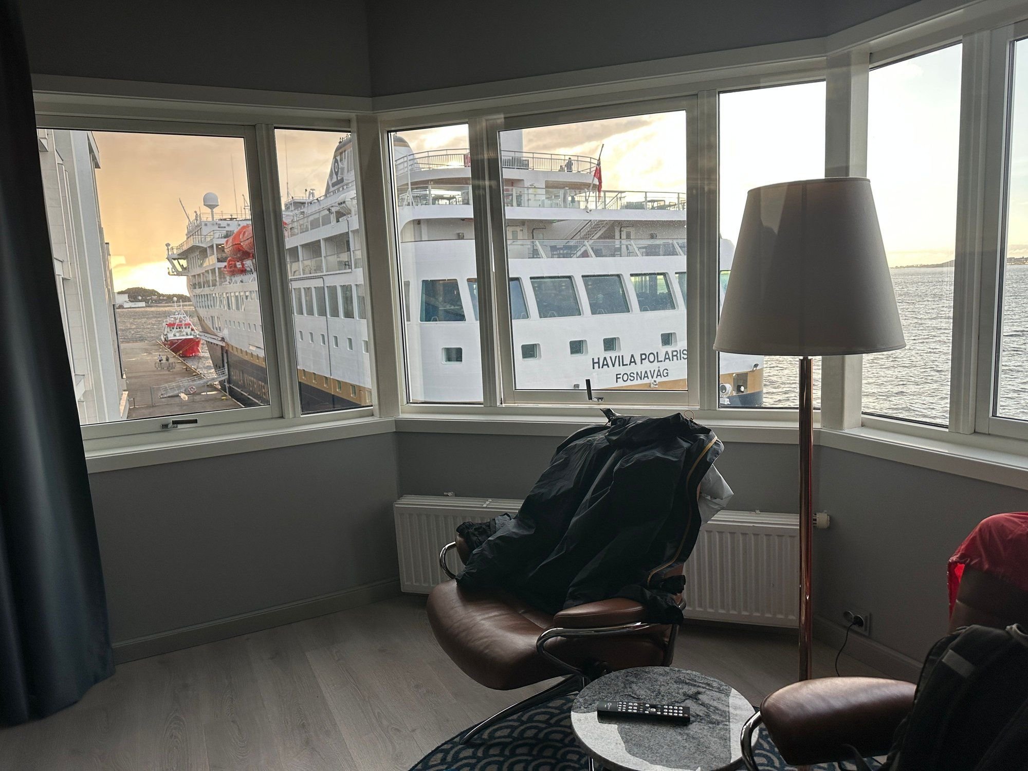
Hahaha! Where you docked at Alseund was where we stayed at the sea view hotel. We were very happy at check in with the sea view room until we came back later and found the Havila cruise ship docking right by our window.
Luckily it was a short docking, so no harm done and we had a glorious sunset view from the hotel room after the ship left.
Luckily it was a short docking, so no harm done and we had a glorious sunset view from the hotel room after the ship left.
 Yesterday | 09:37 PM
#29
Original Poster
Joined: Oct 2005
Posts: 960
Likes: 28
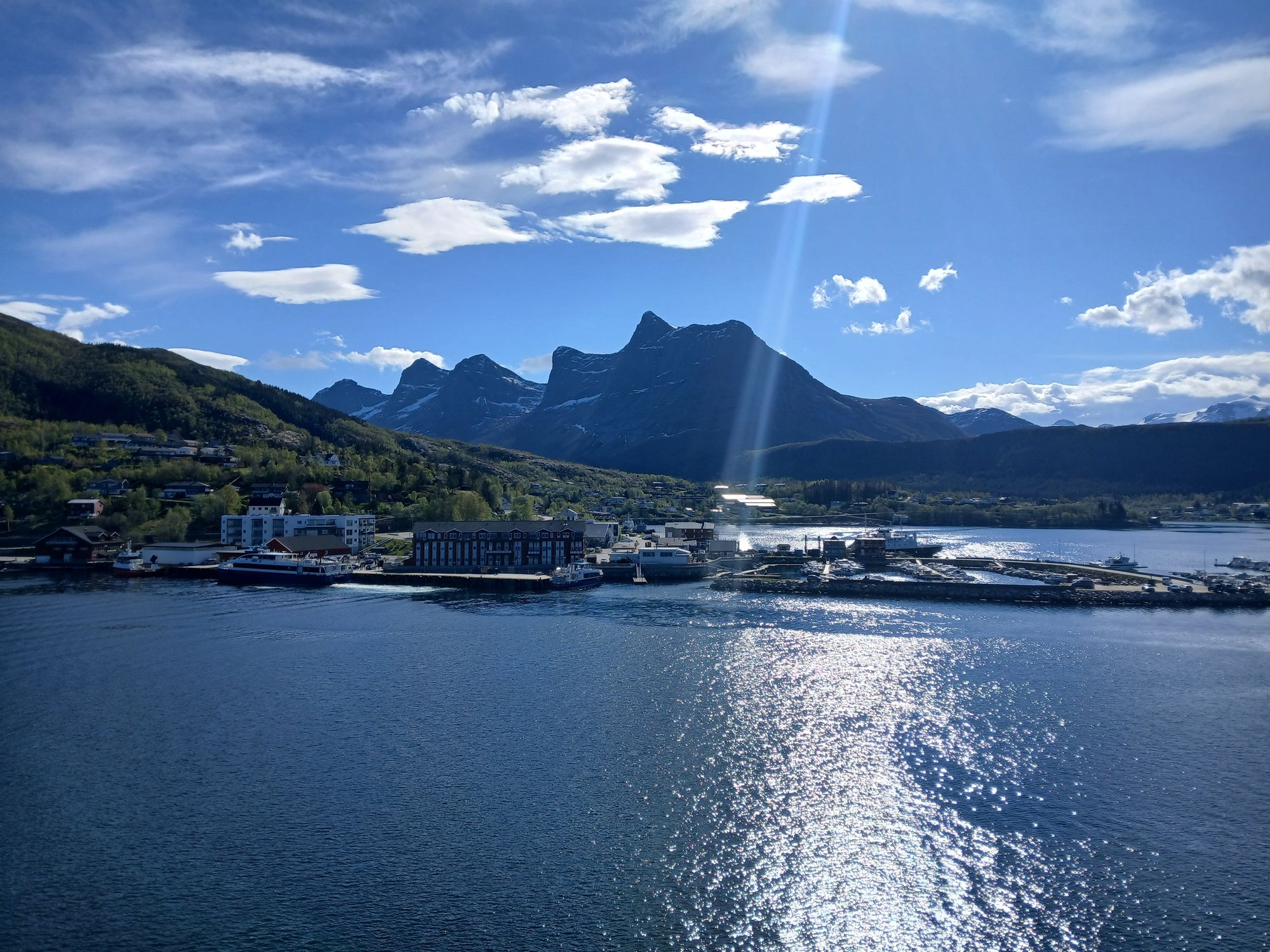
Day 8 : Trondheim, On the northbound Havila voyage
After breakfast, we planned to visit Trondheim this morning where the ship docks for 3 hours. With light showers expected, we planned a tightly focused walking route including few points of interest - primarily the old bridge and Nidaros Cathedral. Nidaros is actually the historic medieval name of Trondheim, which was the first capital of Norway.

Crossing the Hurtigruten on its southbound journey, this morning

Passing the Munkholen Island, which has historically served as a Viking execution site, a Benedictine monastery, and a prison! It is now a summer recreational destination
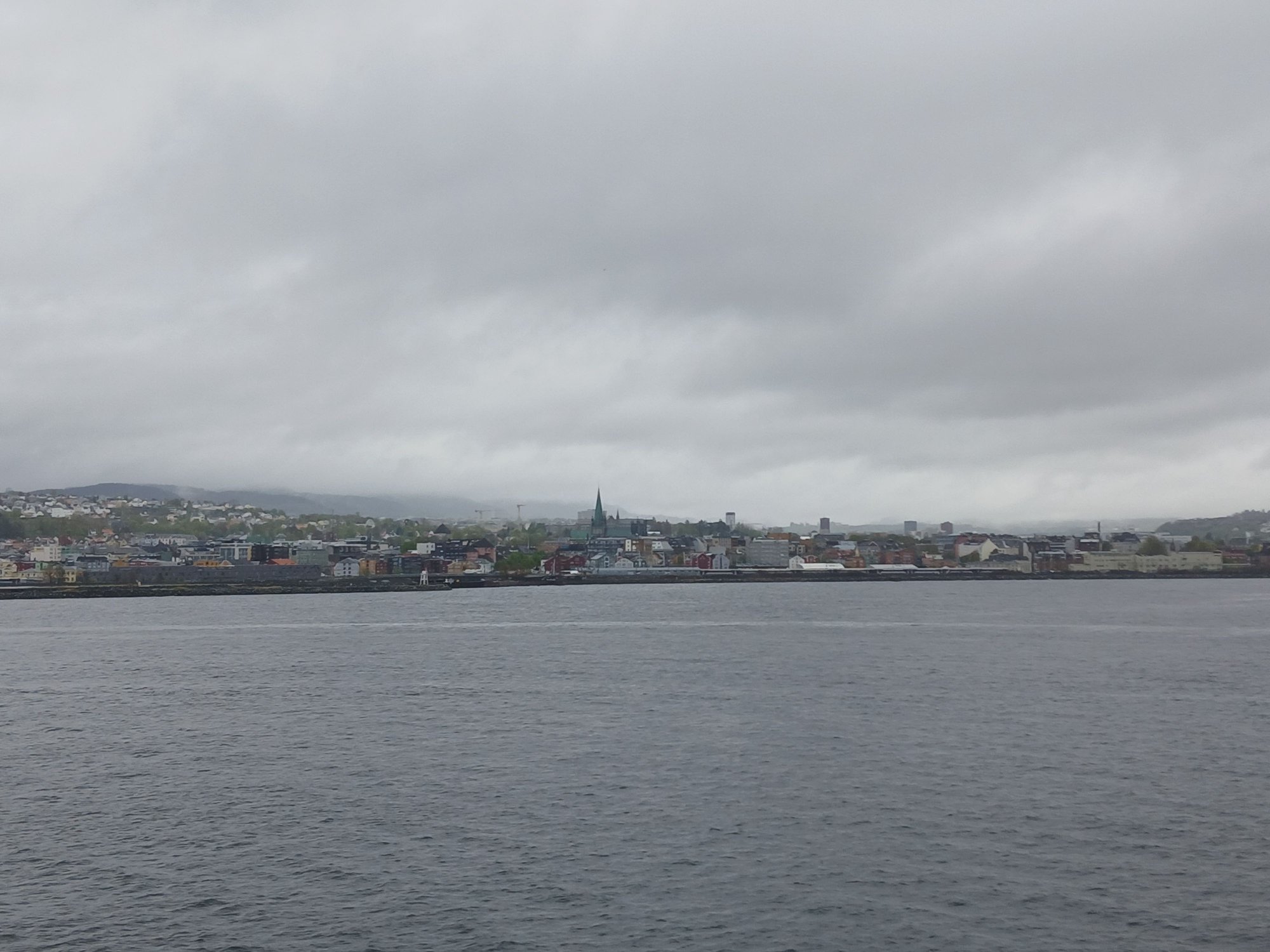
Approaching Trondheim
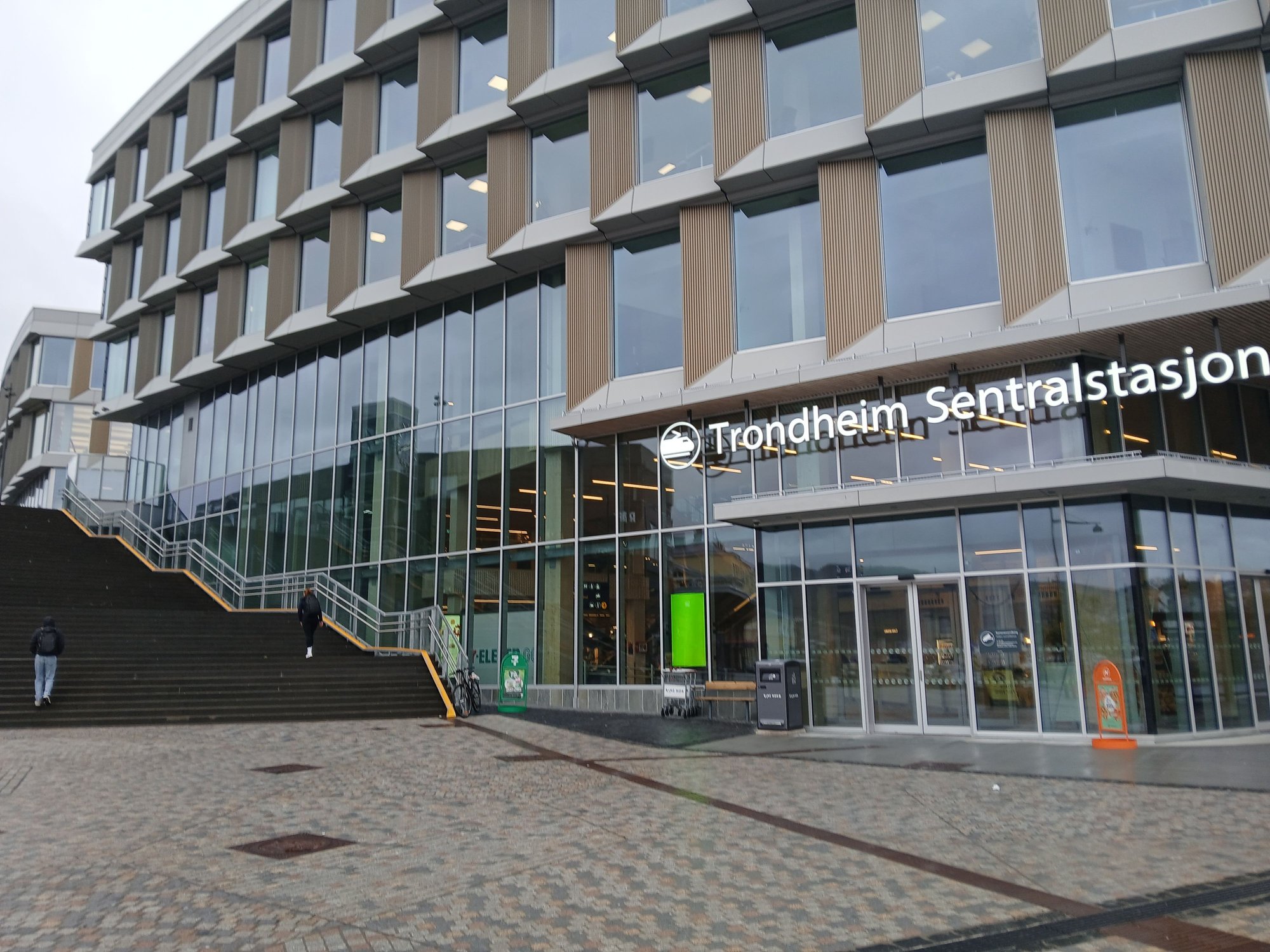
Unlike �lesund, where the ship docks near the centre, the Trondheim terminal is a 20 minute walk away from the action. We crossed the pedestrian bridge near the station.
Crossing over the bridge to the station
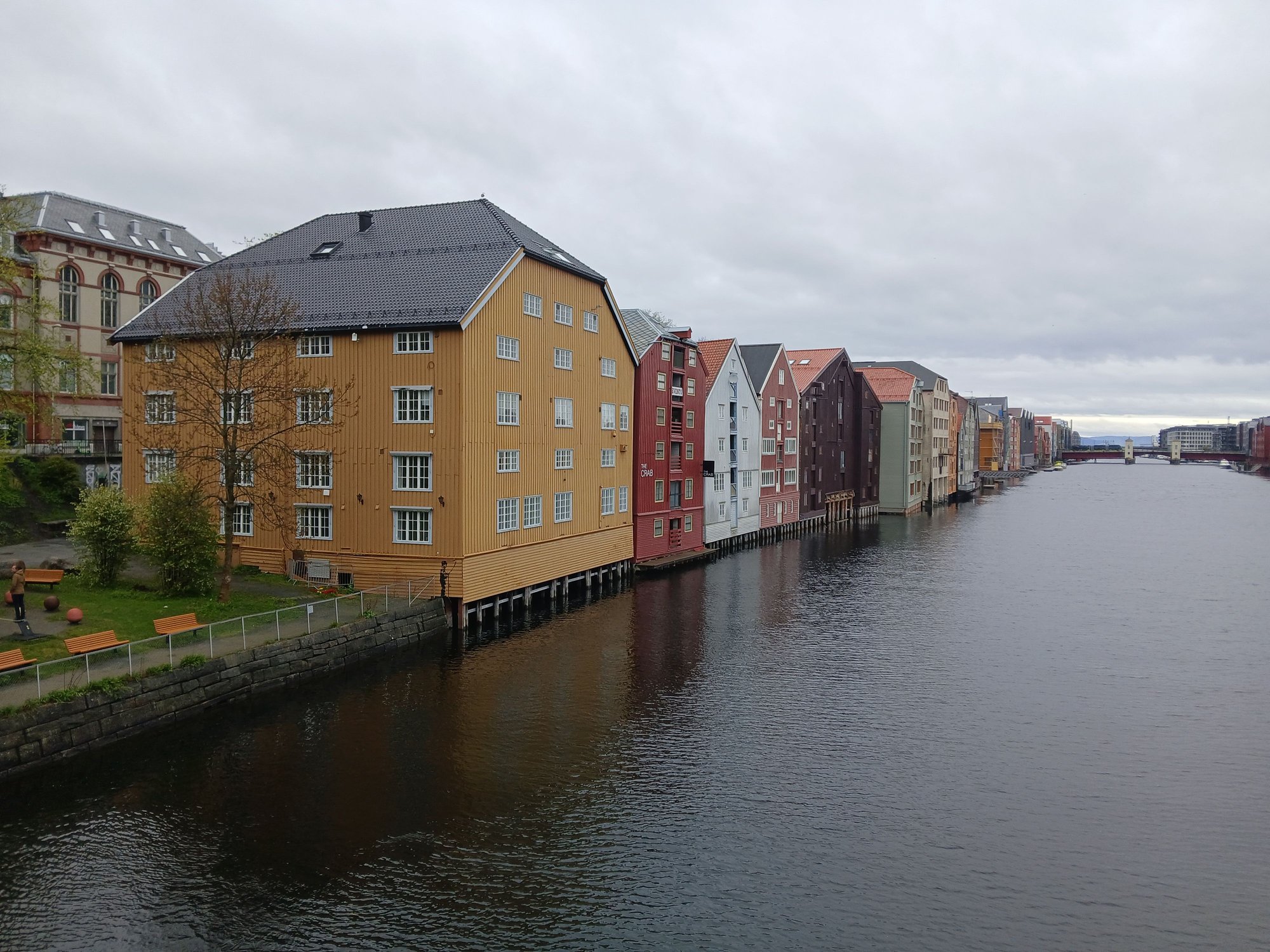
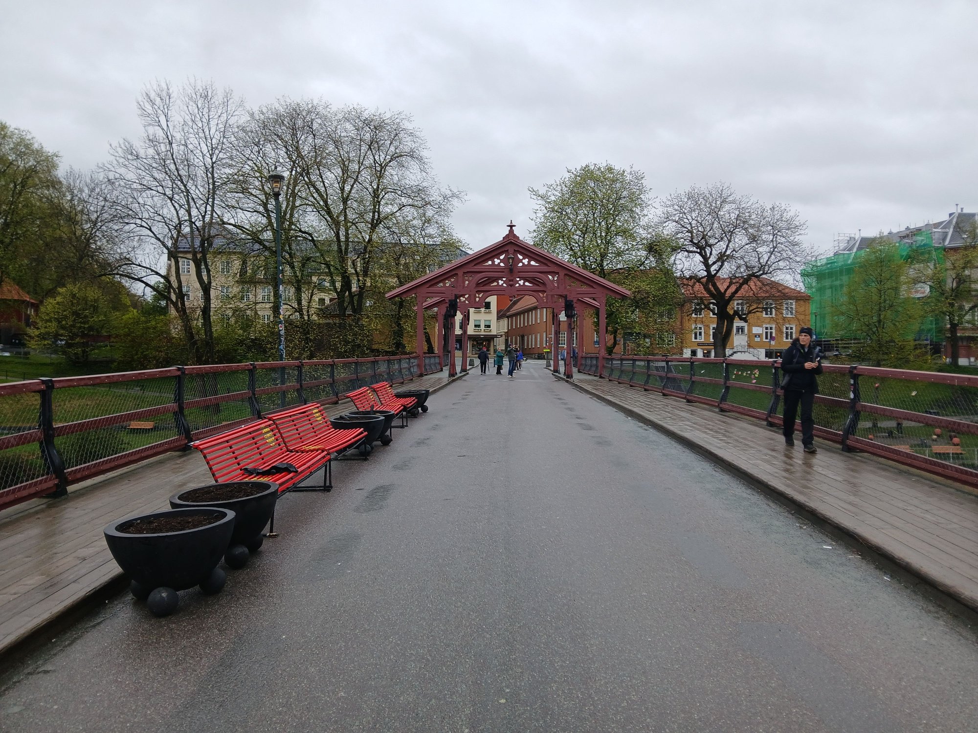
Passing the canal, we strayed into the Old warehouse district and Gamle Byro (�Old Bridge�).

Wandering through the old warehousing district
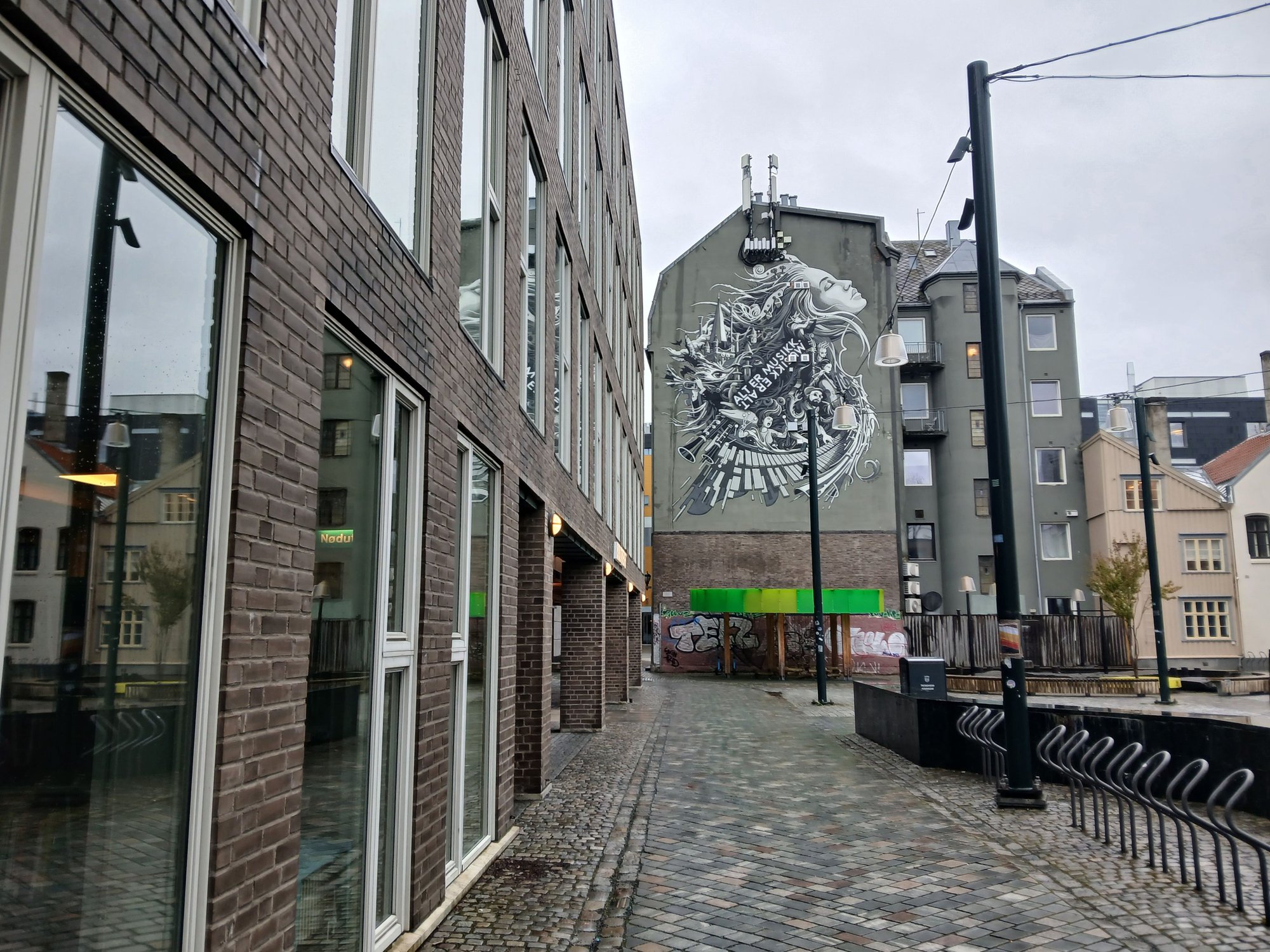
with some street art

Reaching the Old Bridge
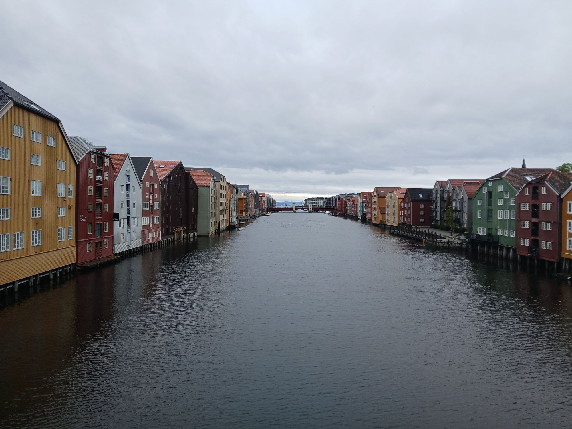
With the inconic view of the colorful warehouses ("bryggene")
Lining the left bank of the Nidelven river

And the right bank
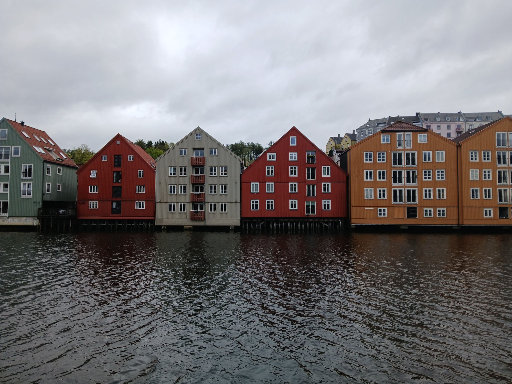
Frontal view of warehouses, many converted to homes, shops or cafes
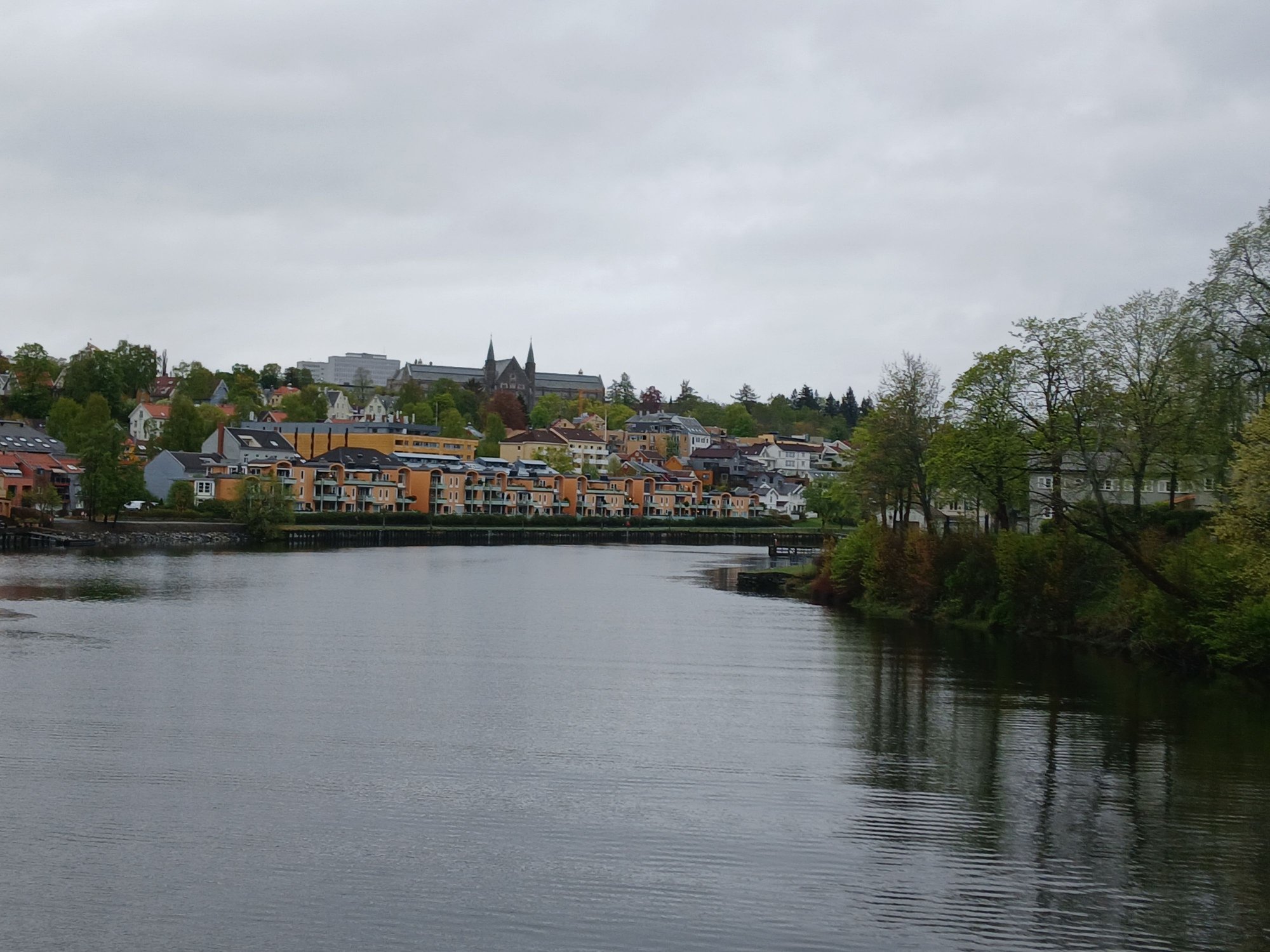
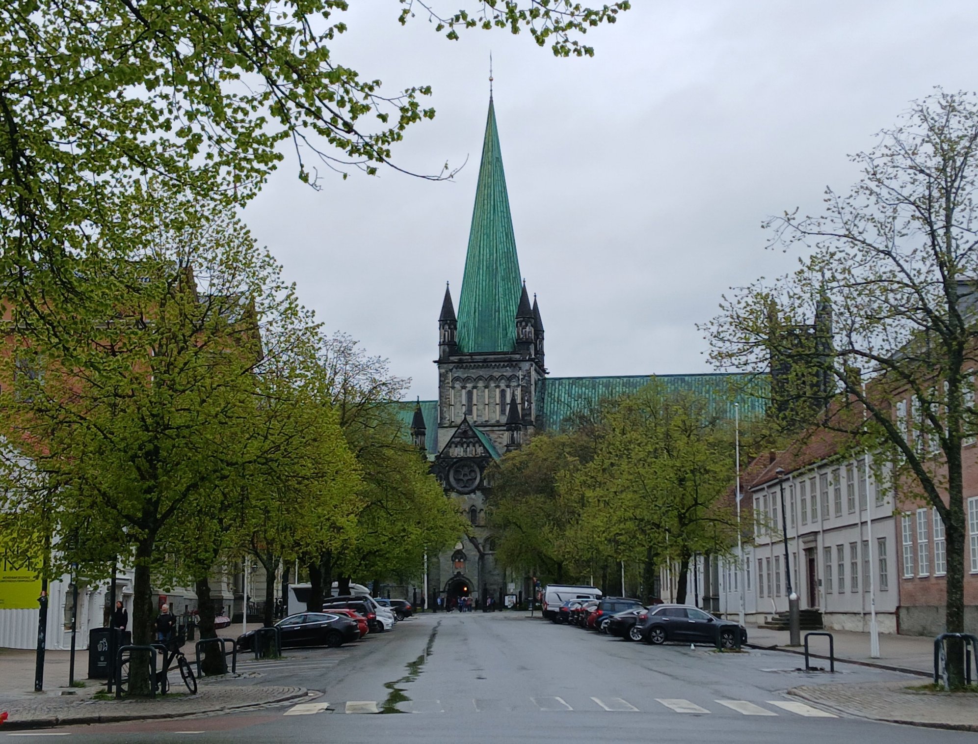
View facing the other side of the bridge, Nidaros Cathedral rising along the skyline
Leaving the bridge, for the cathedral
We walked down the Marinen Park to reach the Nidaros Cathedral, which was closed for tourist visits due to a scheduled service. The Nidaros Cathedral is the northernmost medieval cathedral in the world, built between the 11th and 12th century. It is also houses the tomb of St. Olav, the Viking king who brought Christianity to the country.
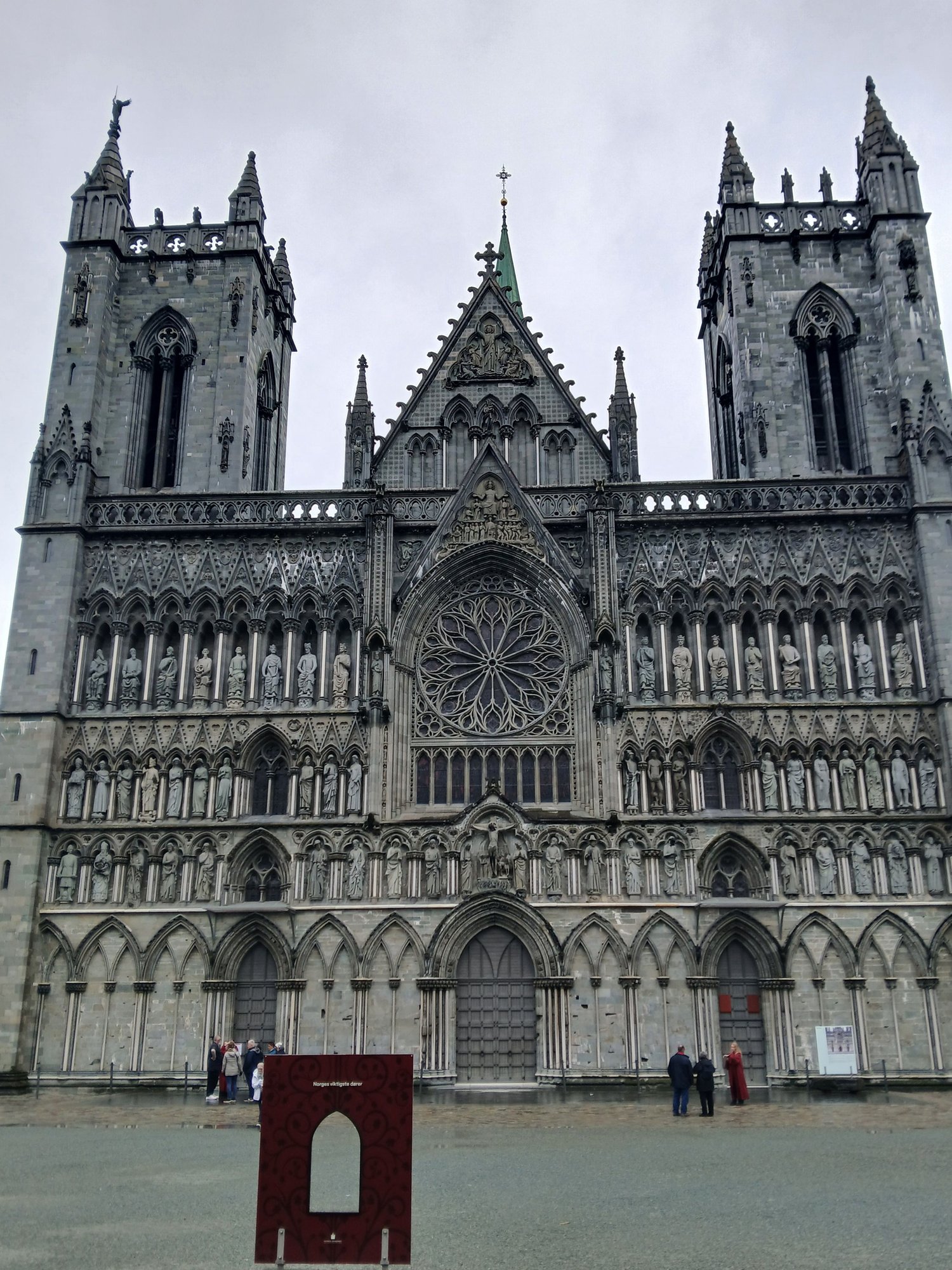
The ornate facade, Gothic and Romanesque architectural styles
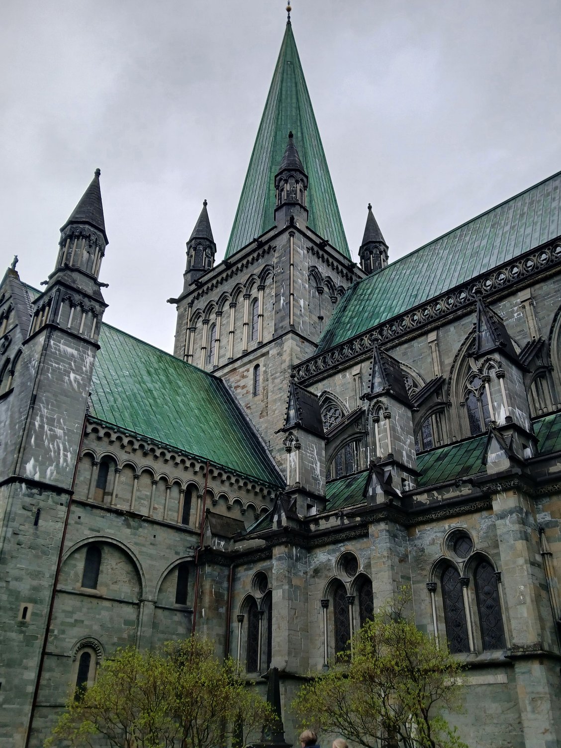
Side view
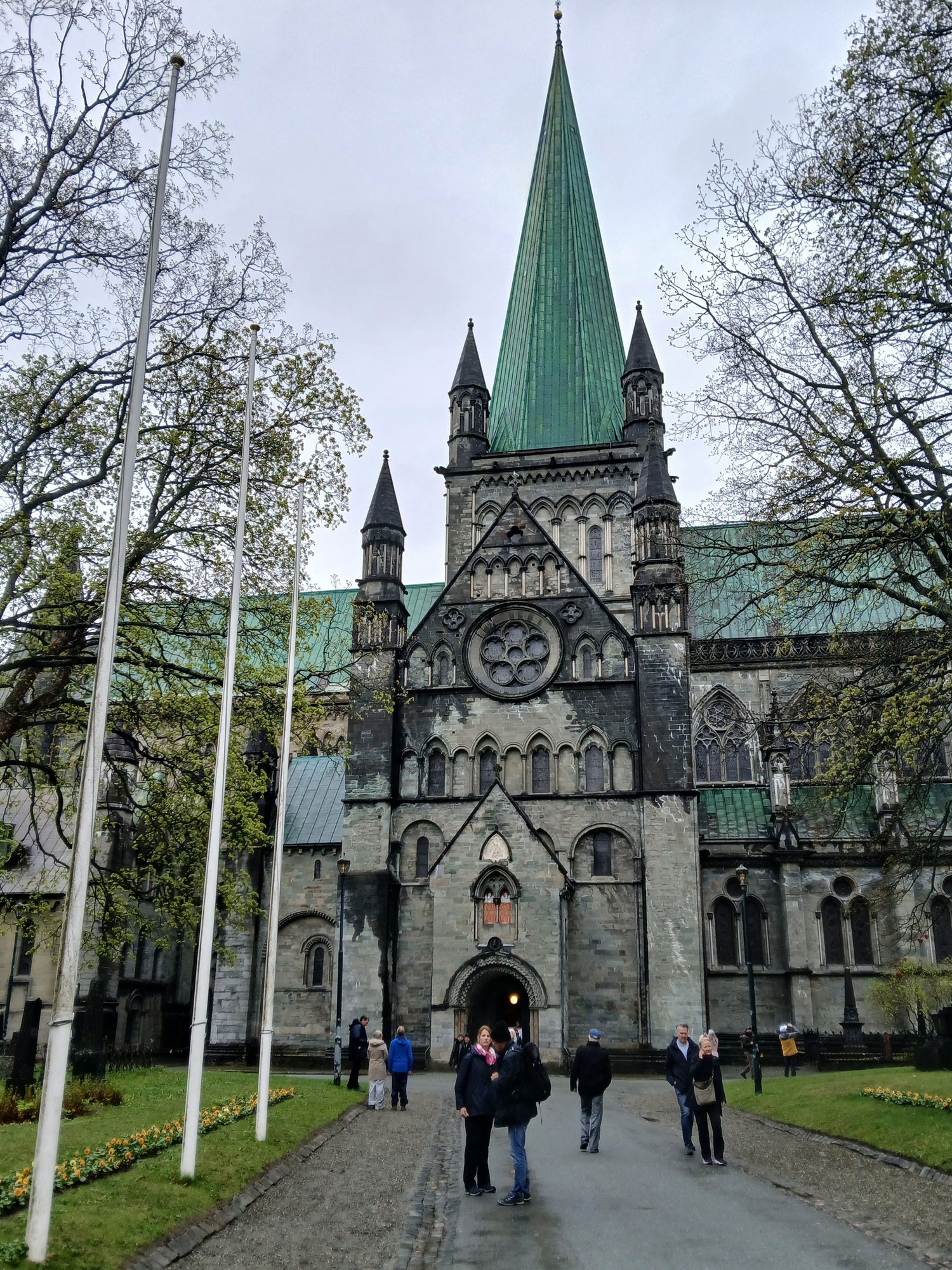
Locals making their way to the service
Distant view from Munkegata, heading to the city square
Walking down from the Radhus to the main square (Torvet), we passed the Stiftsg�rden - the Norwegian King�s official residence in Trondheim. It is made entirely of wood and is one of the largest wooden buildings in Europe.

The Radhus (City Hall)
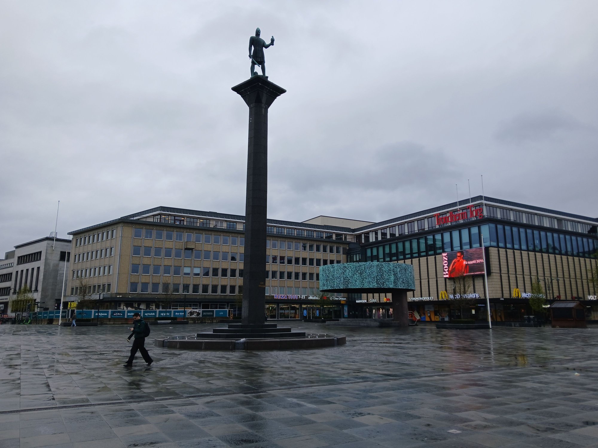
The main city square (Torvet)
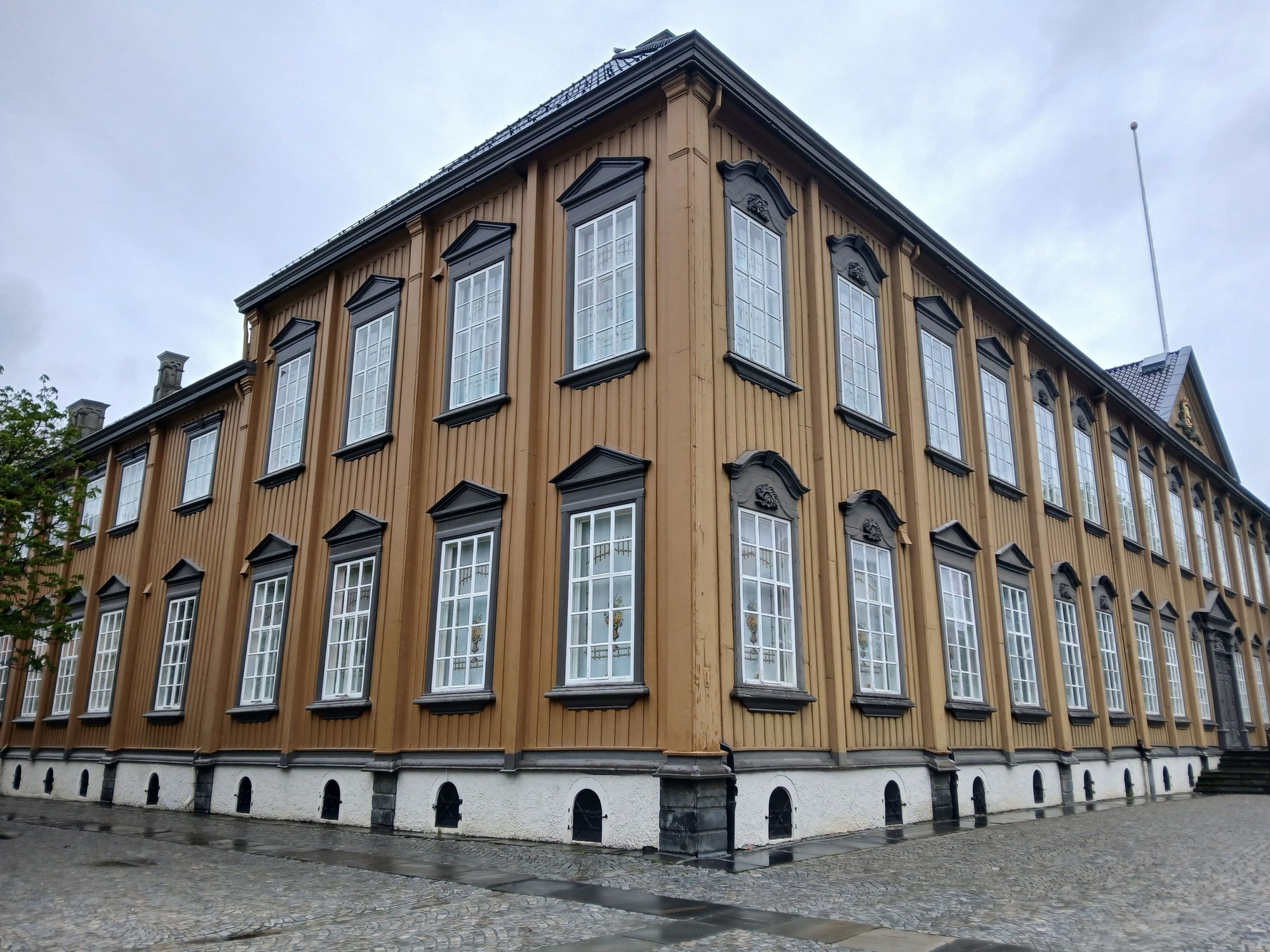
Stiftsg�rden
On our way back to the ship, we passed the Rockheim Museum (dedicated to local pop and rock music) with floating saunas right across it.

On our way back

The floating saunas
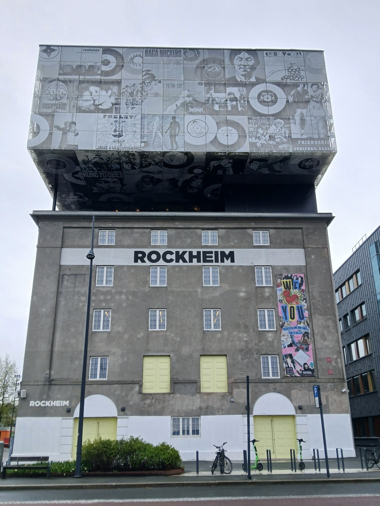
The Rockheim Museum
Back on board
Back on board in time for lunch, we eased into the longest non stop sailing stretch of the Havila, exiting the Trondheim fjord and along the Trondelag.
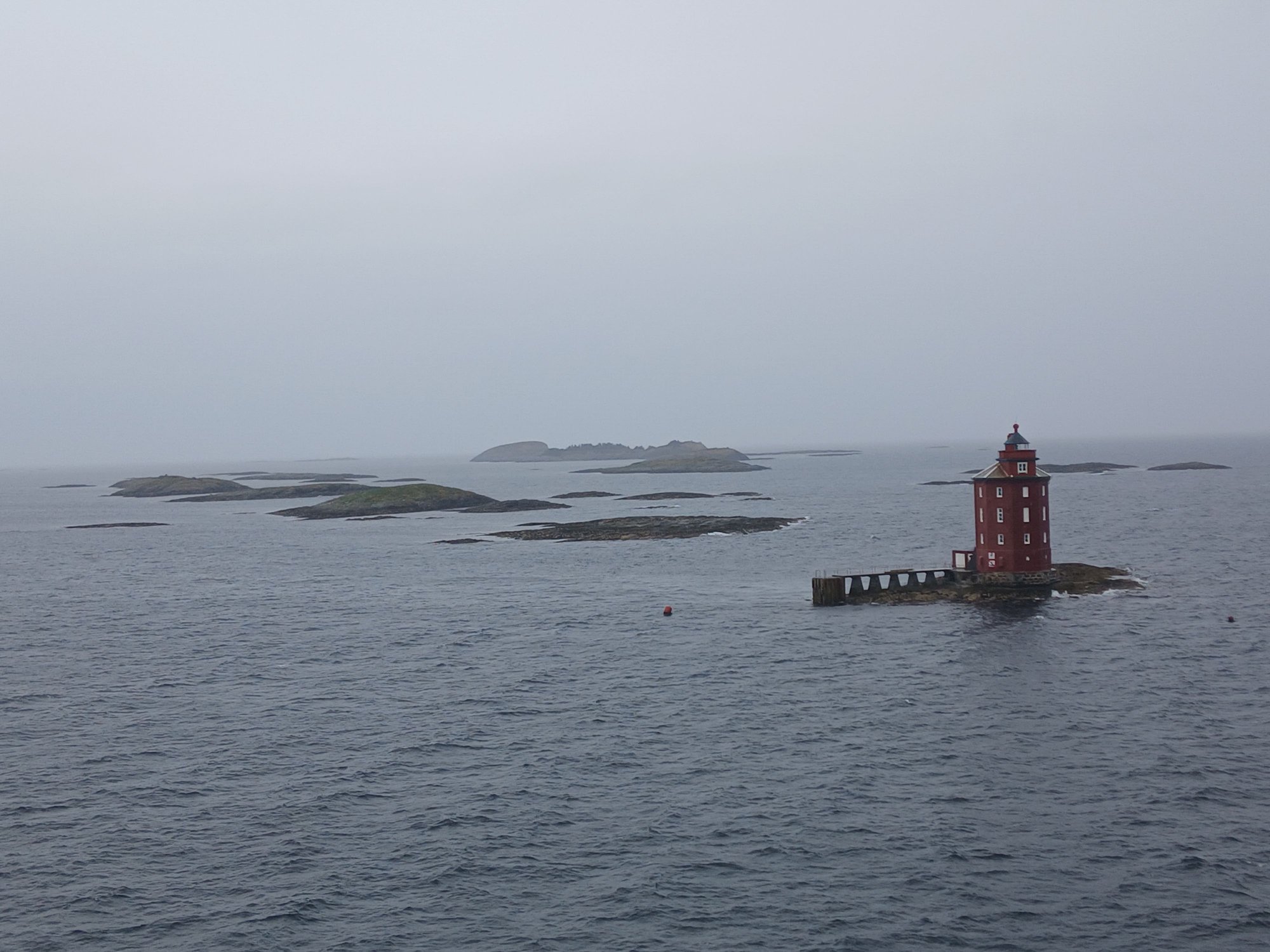
Kjeungskj�r Lighthouse
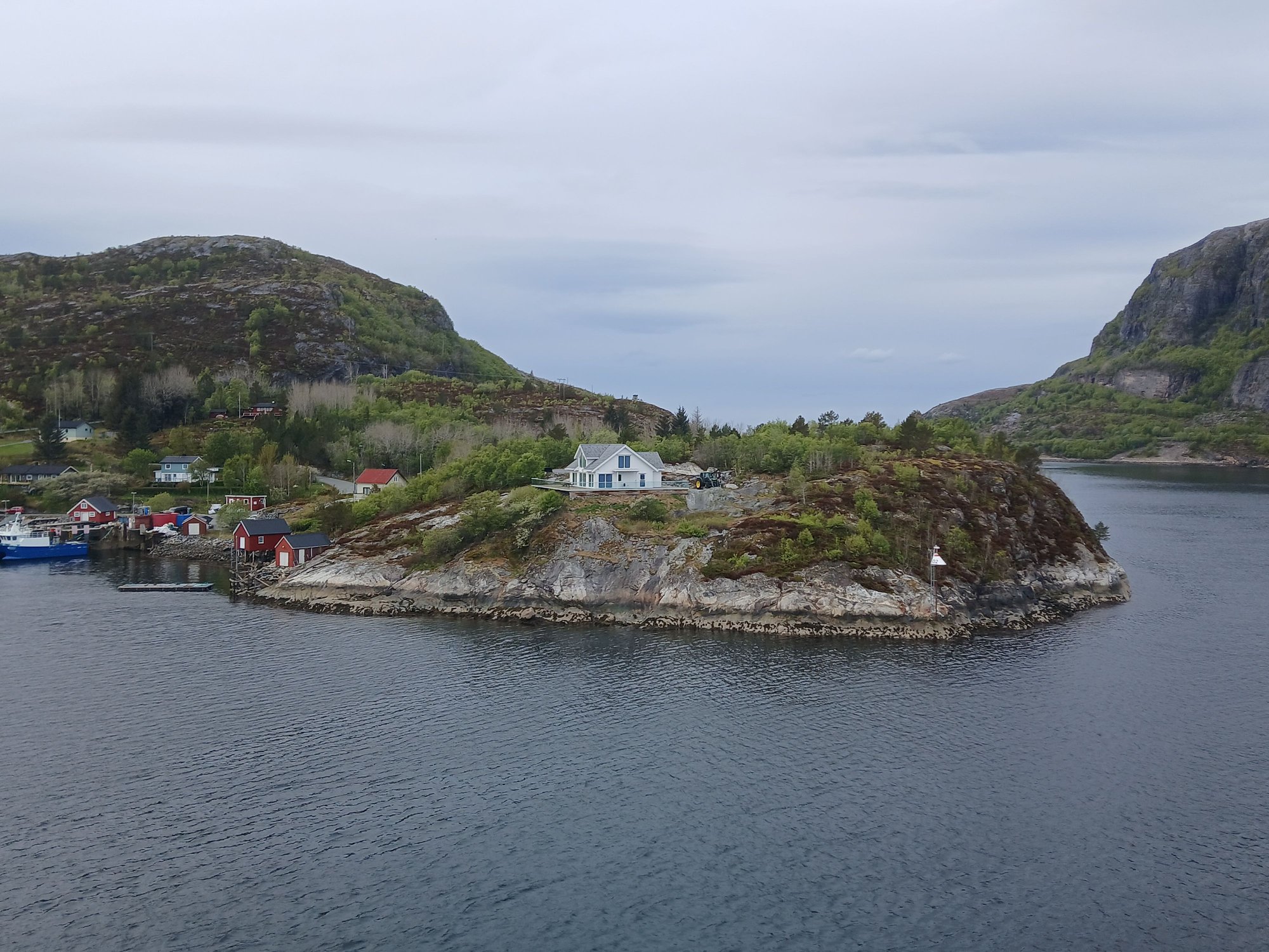
With the weather improving, the captain took a minor detour through the narrow straight of Stoksund, making one final stop at Rorvik for the night.

Entering the narrow strait of Stoksund
Navigating the narrow strait of Stoksund
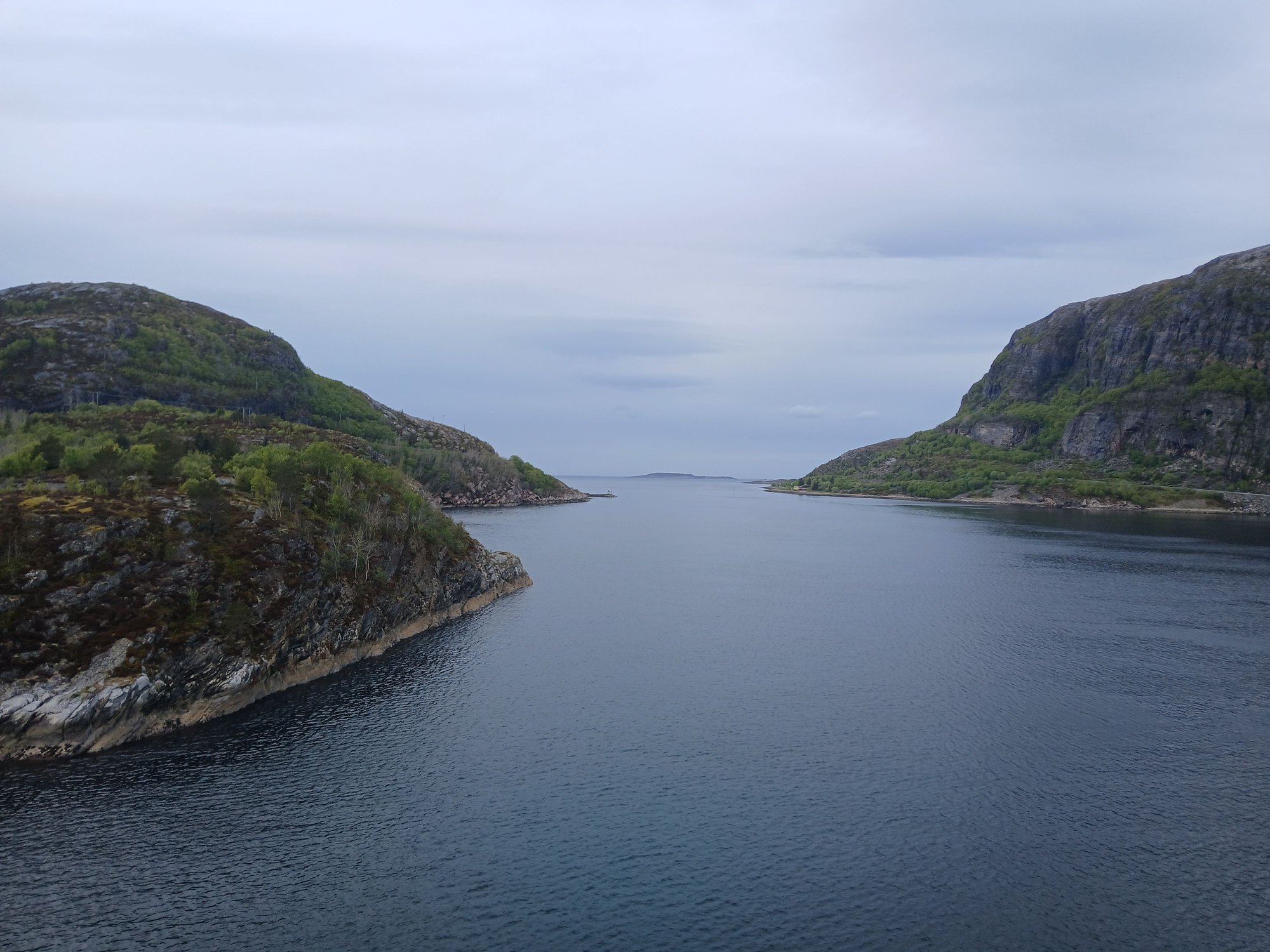
Navigating the narrow strait of Stoksund
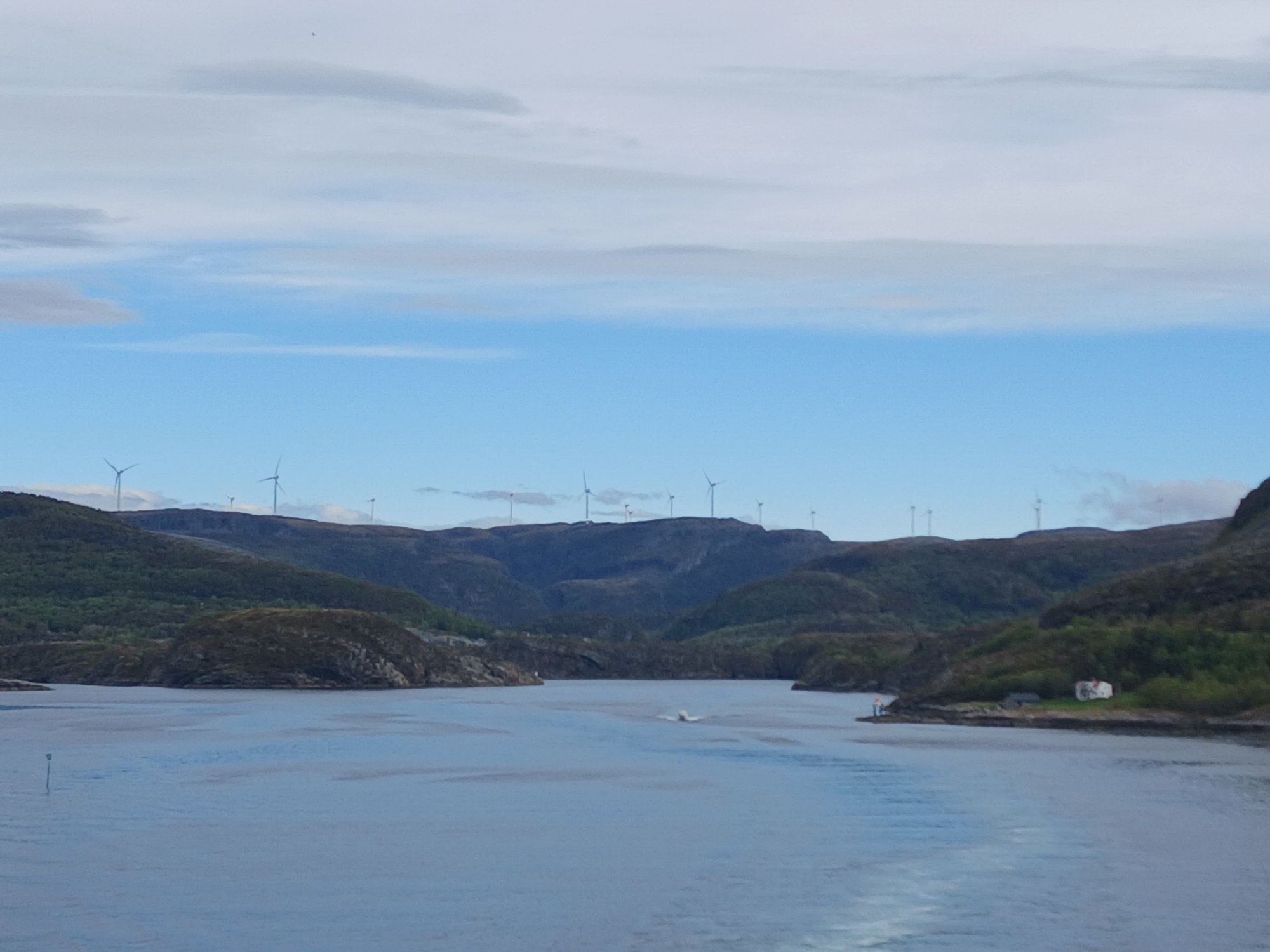
The noticeably flatter landscapes of the Trondelag as we sail north
Crossing the Hurtigruten on its southbound journey, this morning
Passing the Munkholen Island, which has historically served as a Viking execution site, a Benedictine monastery, and a prison! It is now a summer recreational destination
Approaching Trondheim
Unlike �lesund, where the ship docks near the centre, the Trondheim terminal is a 20 minute walk away from the action. We crossed the pedestrian bridge near the station.
Crossing over the bridge to the station
Passing the canal, we strayed into the Old warehouse district and Gamle Byro (�Old Bridge�).
Wandering through the old warehousing district
with some street art
Reaching the Old Bridge
With the inconic view of the colorful warehouses ("bryggene")
Lining the left bank of the Nidelven river
And the right bank
Frontal view of warehouses, many converted to homes, shops or cafes
View facing the other side of the bridge, Nidaros Cathedral rising along the skyline
Leaving the bridge, for the cathedral
We walked down the Marinen Park to reach the Nidaros Cathedral, which was closed for tourist visits due to a scheduled service. The Nidaros Cathedral is the northernmost medieval cathedral in the world, built between the 11th and 12th century. It is also houses the tomb of St. Olav, the Viking king who brought Christianity to the country.
The ornate facade, Gothic and Romanesque architectural styles
Side view
Locals making their way to the service
Distant view from Munkegata, heading to the city square
Walking down from the Radhus to the main square (Torvet), we passed the Stiftsg�rden - the Norwegian King�s official residence in Trondheim. It is made entirely of wood and is one of the largest wooden buildings in Europe.
The Radhus (City Hall)
The main city square (Torvet)
Stiftsg�rden
On our way back to the ship, we passed the Rockheim Museum (dedicated to local pop and rock music) with floating saunas right across it.
On our way back
The floating saunas
The Rockheim Museum
Back on board
Back on board in time for lunch, we eased into the longest non stop sailing stretch of the Havila, exiting the Trondheim fjord and along the Trondelag.
Kjeungskj�r Lighthouse
With the weather improving, the captain took a minor detour through the narrow straight of Stoksund, making one final stop at Rorvik for the night.
Entering the narrow strait of Stoksund
Navigating the narrow strait of Stoksund
Navigating the narrow strait of Stoksund
The noticeably flatter landscapes of the Trondelag as we sail north
Today | 03:09 AM
#31
Original Poster
Joined: Oct 2005
Posts: 960
Likes: 28
My driving routes are usually screenshots from google maps, with all the intermediate stops. Some maps are just saved as images and cropped, edited or overlaid with text to provide more context.
Today | 05:53 AM
#32
Original Poster
Joined: Oct 2005
Posts: 960
Likes: 28
Day 9 : Bod� and Svolvaer, On the northbound Havila voyage
We had an early breakfast, in eager anticipation of our Arctic Circle crossing expected between 7.30-8.00 am. The crossing is marked by a globe monument on the Vikingen island, between the towns of Nesna and Ornes.
Fun fact : The Arctic Circle is constantly moving as the earth wobbles on its axis. The circle is currently about 1 km north of the globe on Vikingen Island here, but will return to this very spot in 33,000 years!

The morning rays of the sun streaming through the clouds

Passing the Vikingen Island
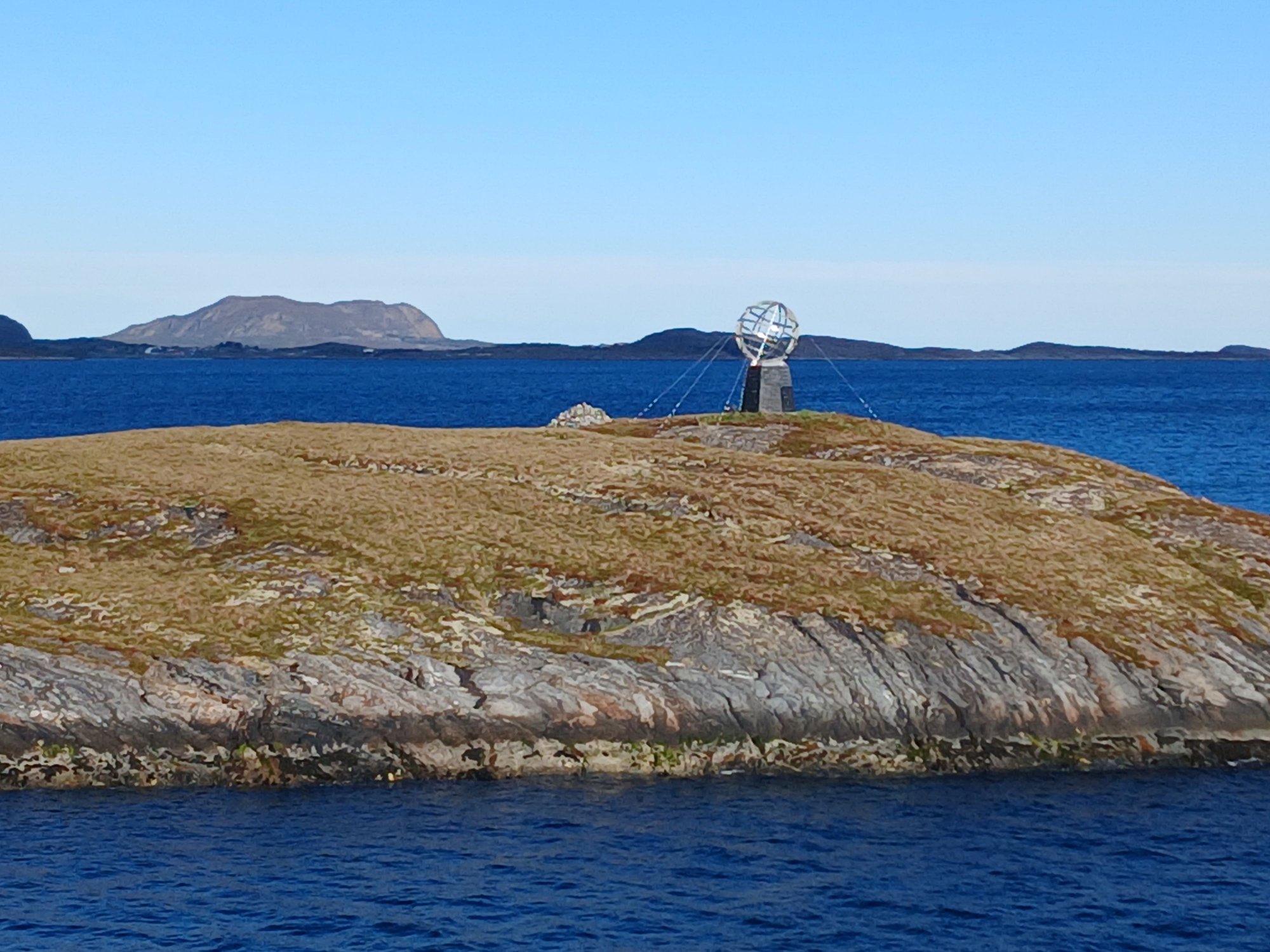
A closer look at the globe

And we are now officially in the Arctic !
Approaching Ornes

Docking at Ornes
Out on deck, the Arctic crossing was celebrated with a traditional baptism ceremony, followed by a special toast. It was a lot of fun.

We were joined by Njord, the Norse God of the Sea and Wind !
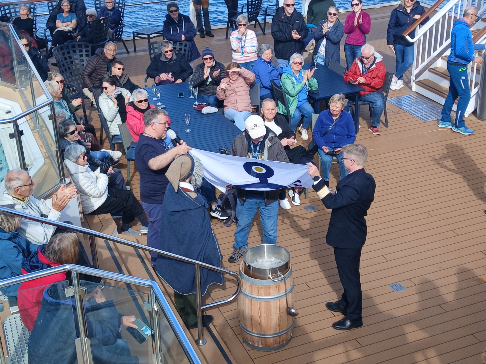
The previous night, we were asked to drop chits in a bowl with our best guess of the exact time we would cross the Arctic Circle. The winner of this contest was announced - who predicted it accurately down to the last second - 7:43am and the rest I cant remember
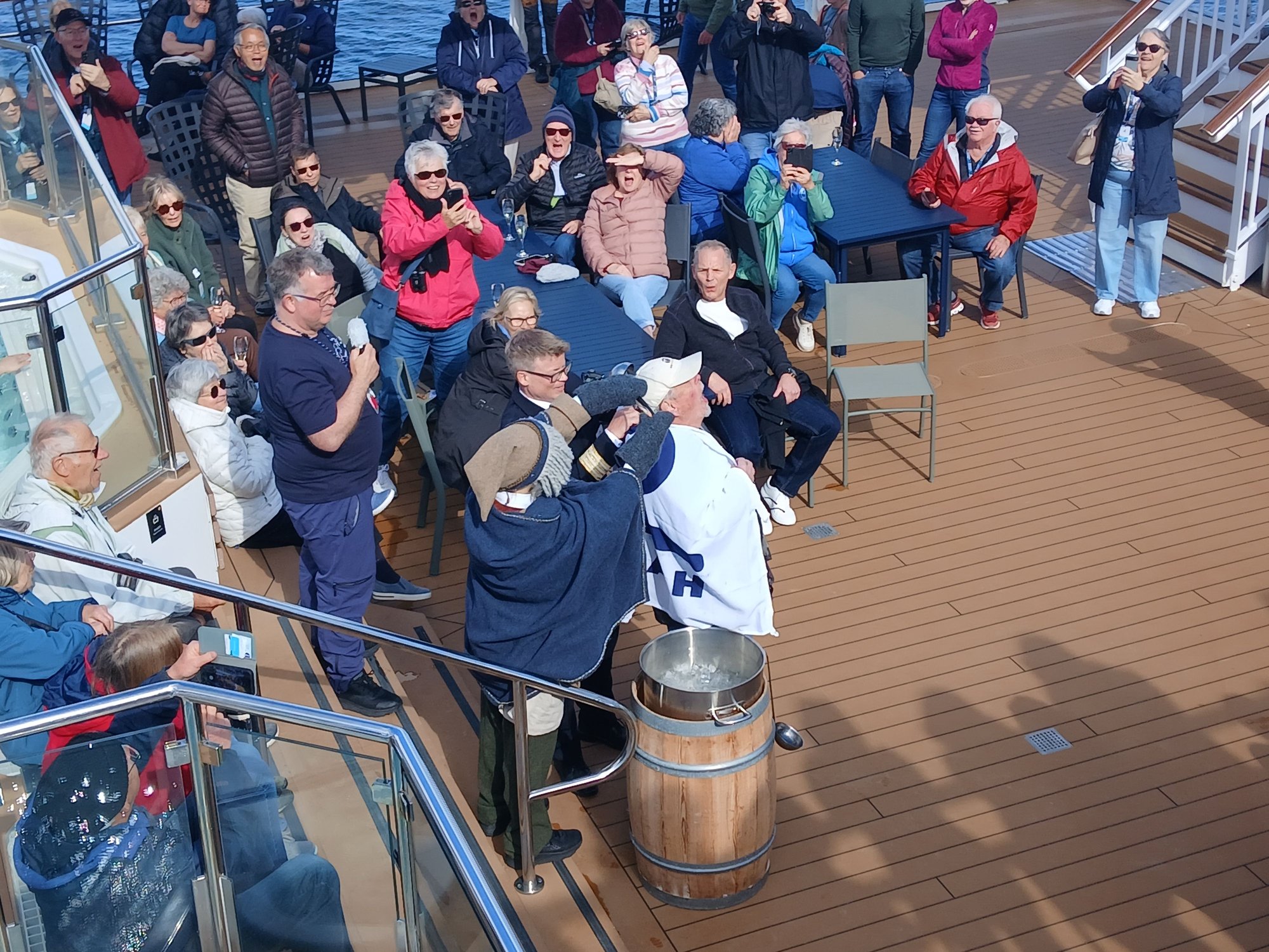
The traditional baptism by ice !
Our first major stop today was Bod�. In 2006, this is where we ended our journey on the Hurtigruten. With a tight onward ferry connection to Moskenes (Lofoten), we had largely overlooked the city. This time around, with a three hours� stop, we had sufficient time to explore Bod� on foot.

Arriving at Bodo
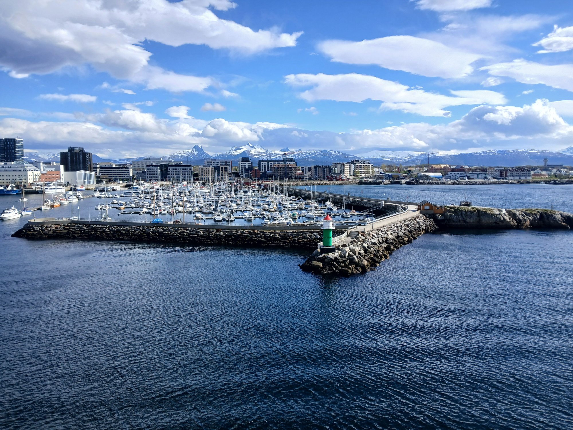
View of the pier and lighthouse at Bodo
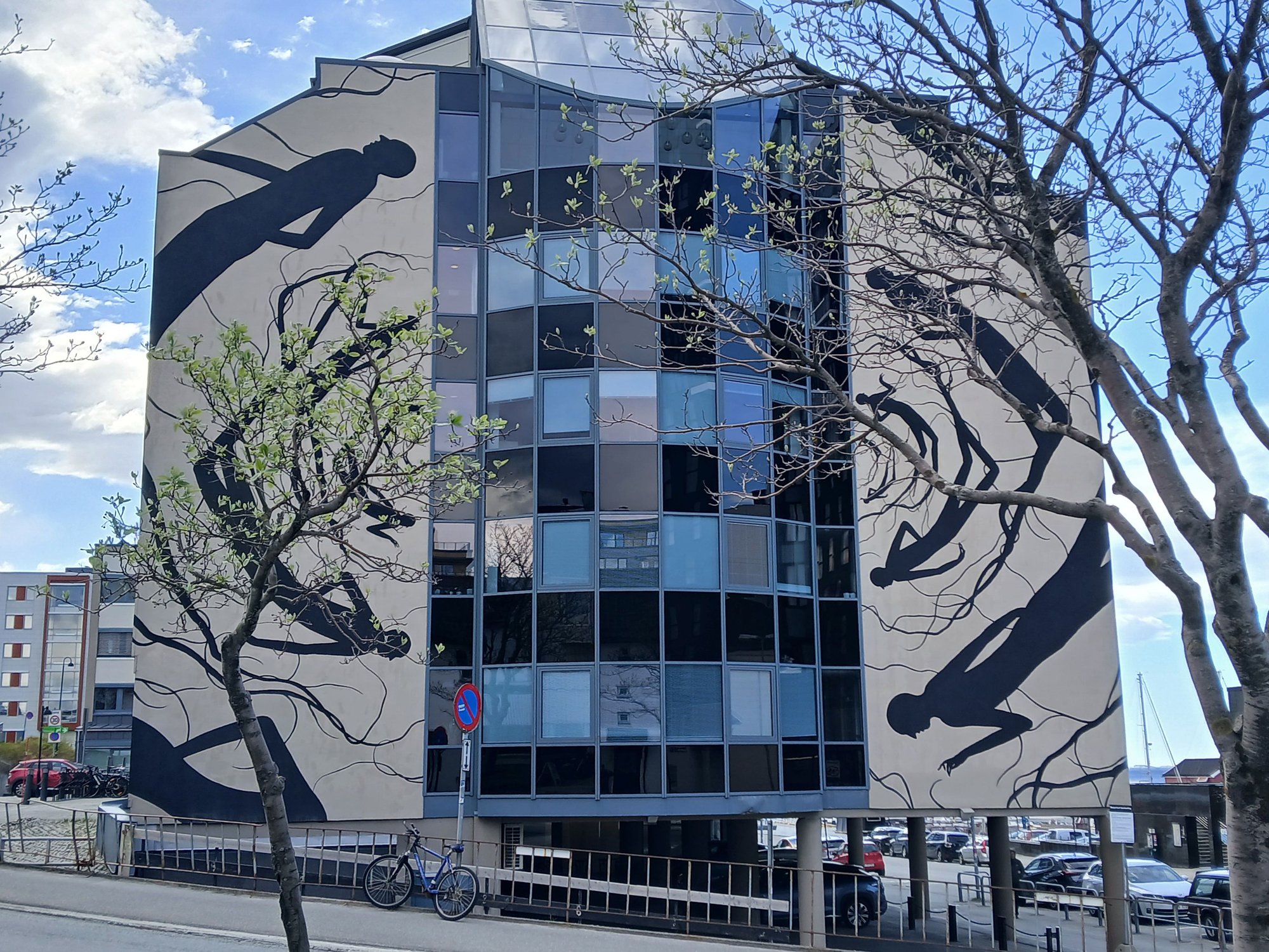
The city was completely destroyed during WW2, and rebuilt in a modernist style that prioritized functionality over charm. We followed the street art trail, a legacy of a 2016 art festival where several graffiti artists were invited to color the city with their work.

"Insomnia" at Dronningens gate 15 (Italian artist Millo)

"Butterfly" at Havnegata (Norwegian artist Martin Whatso)

"After School" at Kongens gate 18 (Russian artist Rustam Qbic)
"Maelstrom" at Moloveien 20 (Spanish artist David de la Mano)

Untitled at Sj�gata 18 (British artist Phlegm)
We passed the Bod� radhus and cathedral towards the jetty, and returned to the ship via the waterfront.
By the jetty
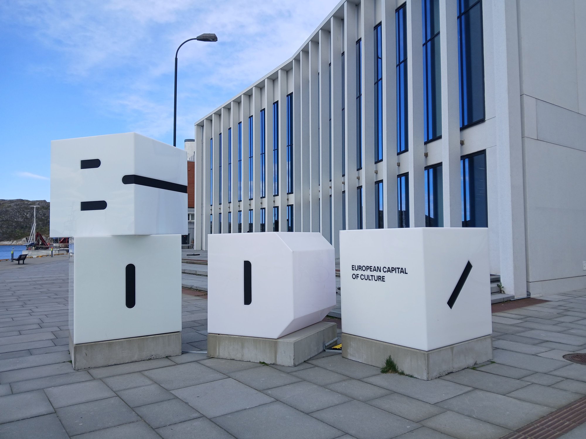
Bod� was one of the European Capitals of Culture in 2024, the first city located north of the Arctic Circle to be awarded this designation
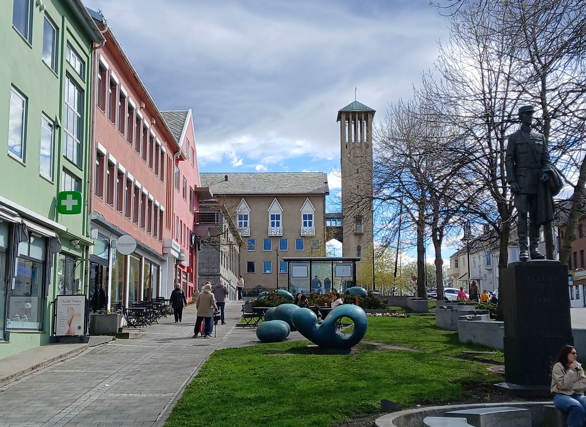
Along the main street, view of the distinctive radhus in the back

Along the waterfront, past the floating saunas
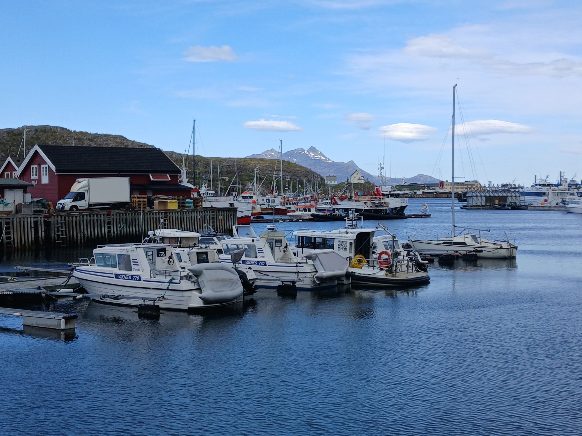
Later this evening, we reached the Lofoten with a brief halt at Stamsund.
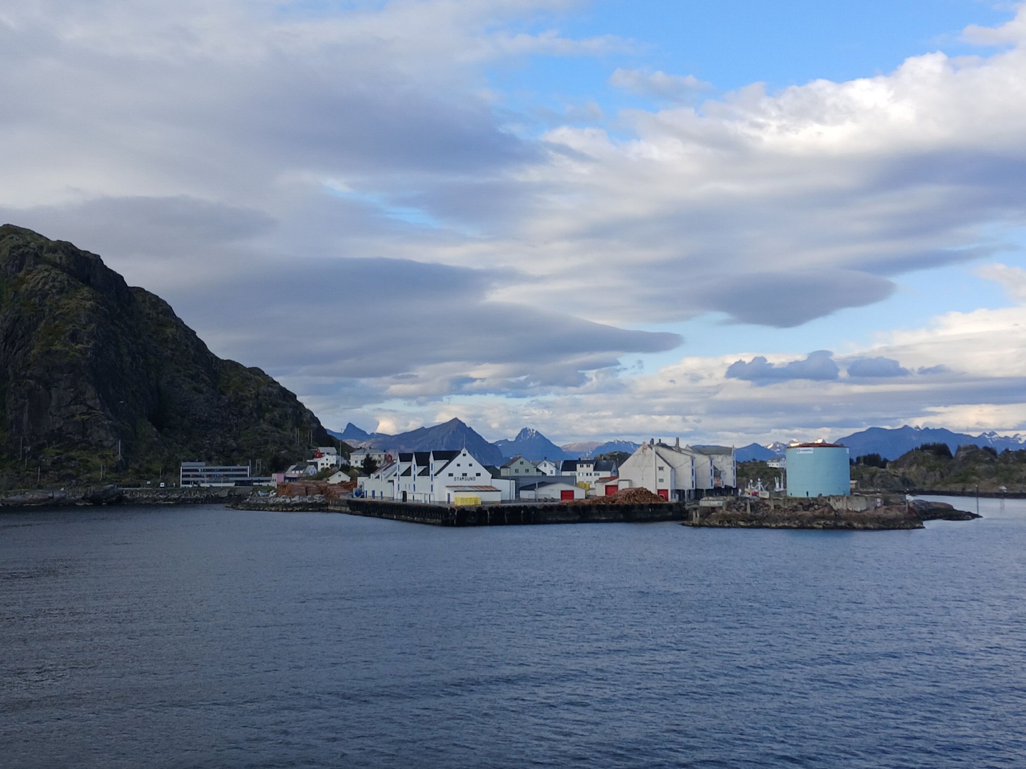
Arriving in Stamsund

The early views of the jagged peaks of the Lofoten rising out of the sea (the "Lofoten Wall")
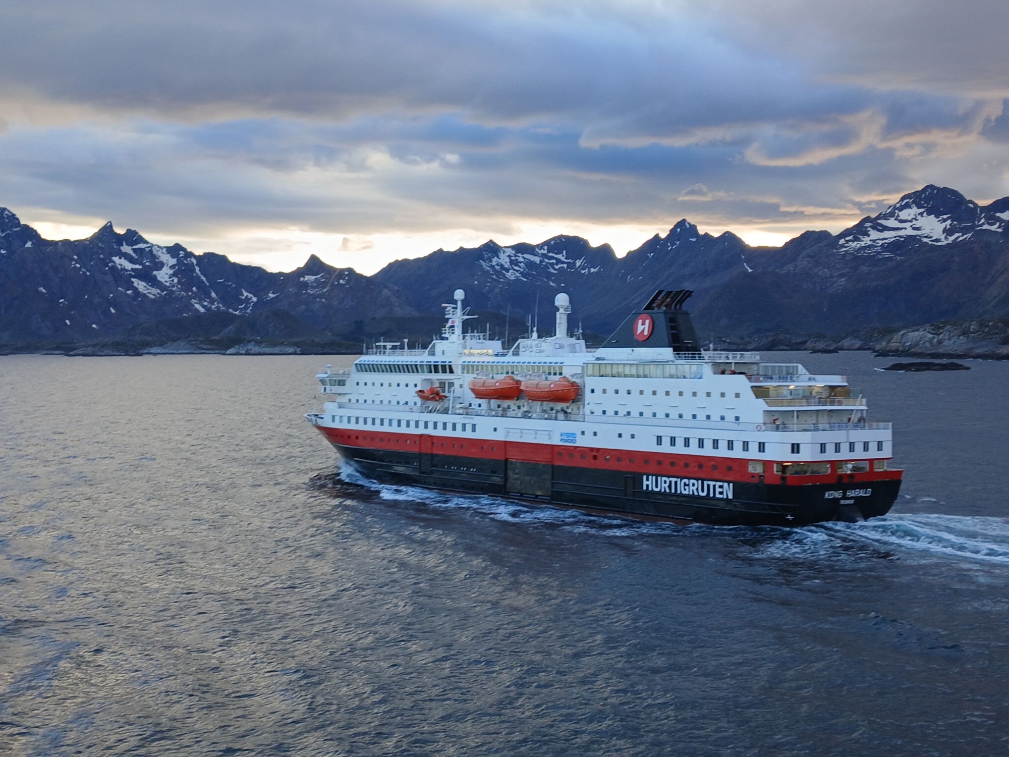
Passing another Hutigruten ship on its southbound journey, as we approached Svolvaer
Our next major stop was Svolvaer, the commercial and cultural capital of the Lofoten Islands, and a major hub for exploring the archipelago. We had spent a night here in 2006. With an hour's halt post-dinner, we decided to step out and take a short stroll anyway. We walked along the waterfront, towards the Svinoya bridge, eventually returning to the main square (Torget).
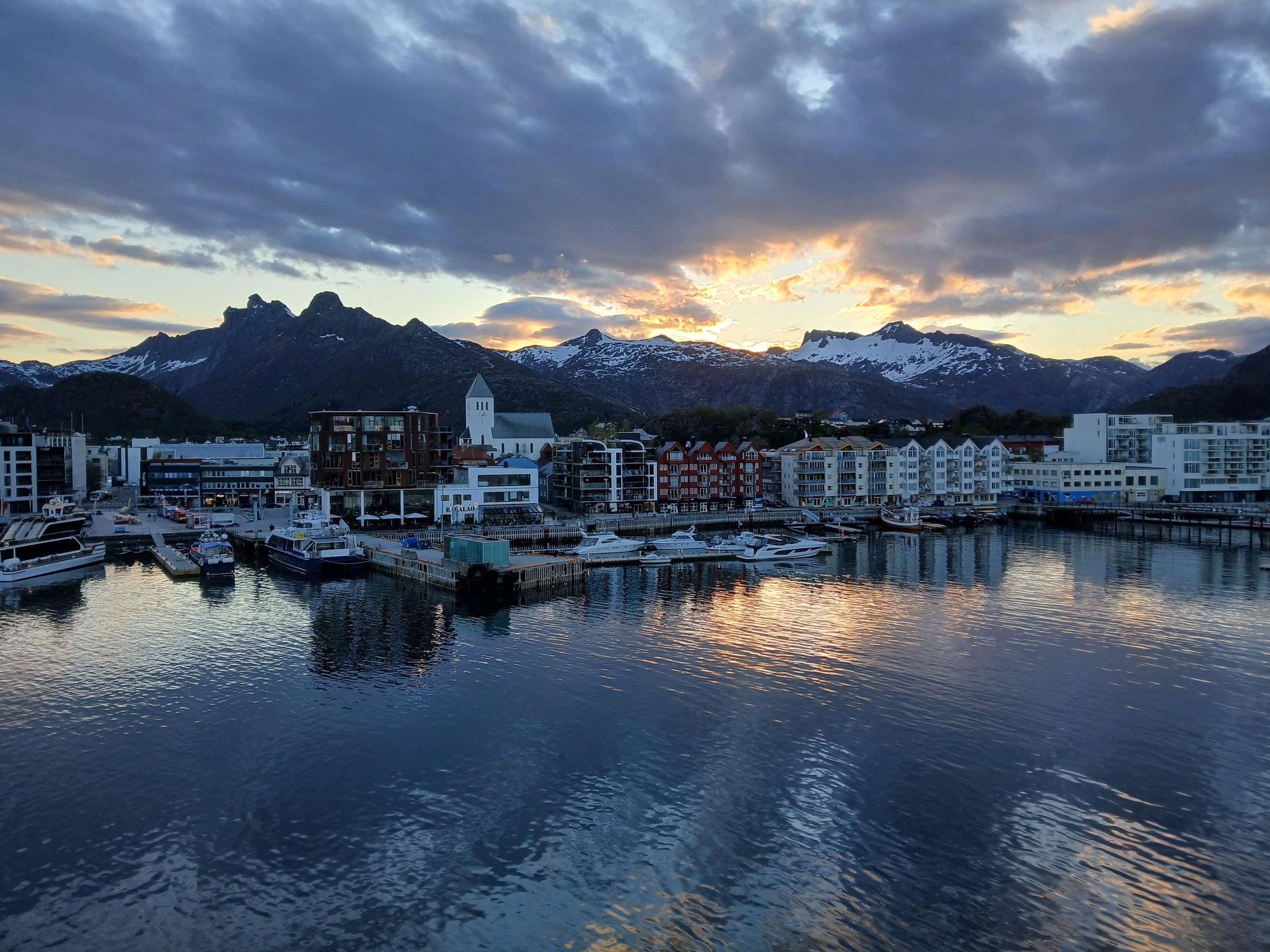
Arriving at Svolvaer

View of the fish drying racks as we prepare to dock
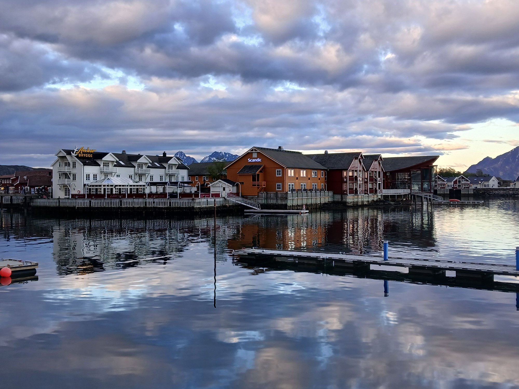
Passing Lamholmen, the little islet with rorbus of Anker Brygge and Scandic hotel

Looking back at the waterfront

A cluster of rorbus (fishing cabins)

Svolvaer is famous for Svolv�rgeita, a jagged twin-peaked mountain famous among rock climbers. If you zoom into this photo, and follow the line of blue poles/bollards you can see it amidst the mountains - looks like two fingers or a goat's horns

The main square
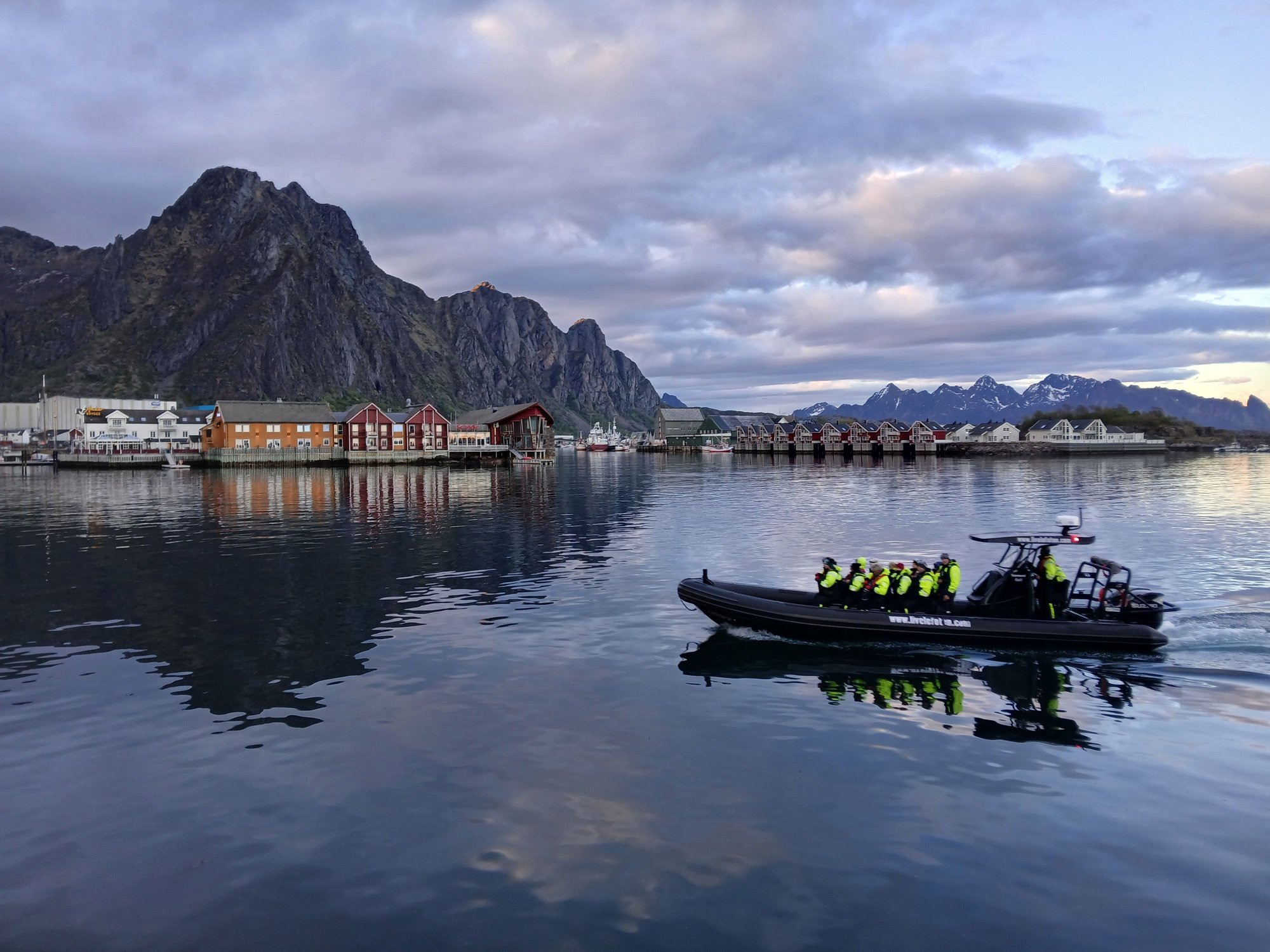
The RIB excursion returns, with fellow travelers rejoining our ship
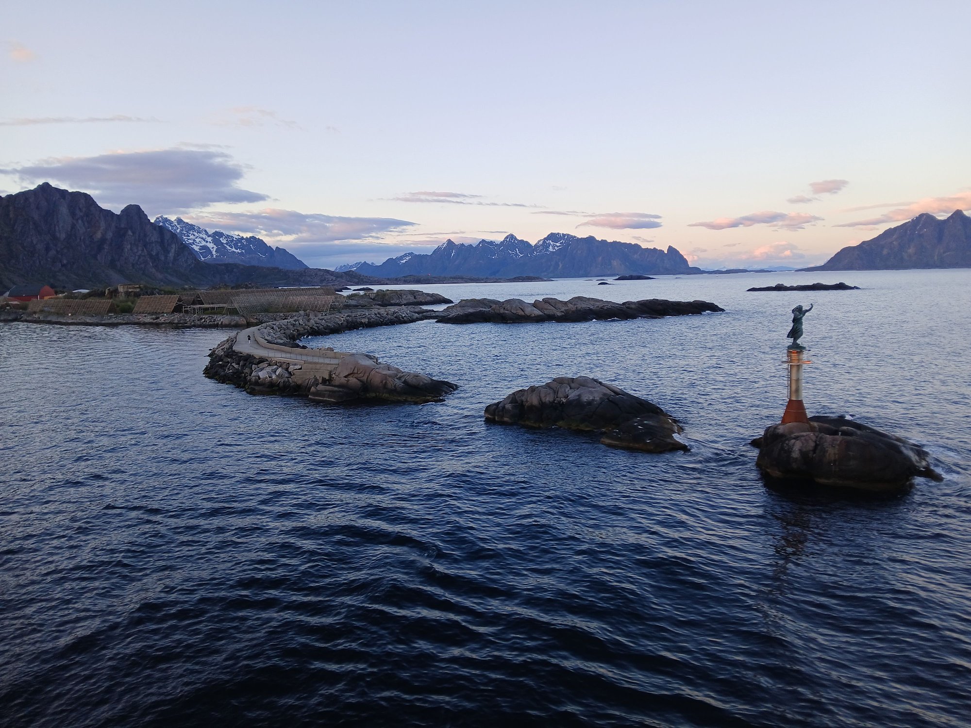
Farewell Svolvaer (view of the Fisherman's Wife monument as we depart)
At night, the ship sailed through the narrow Raftsundet strait while exiting the Lofoten, with a surprise detour through the beautiful Trollfjord. This is a dramatic, 2-kilometer-long fjord famous for its narrow 100-meter entrance and imposing cliffs. It is accessible only by a tough hike or by water - permissible only if conditions are favourable (no strong winds, no avalanche risks). It was a real test of skill for our captain to navigate in, turn at its end and exit.
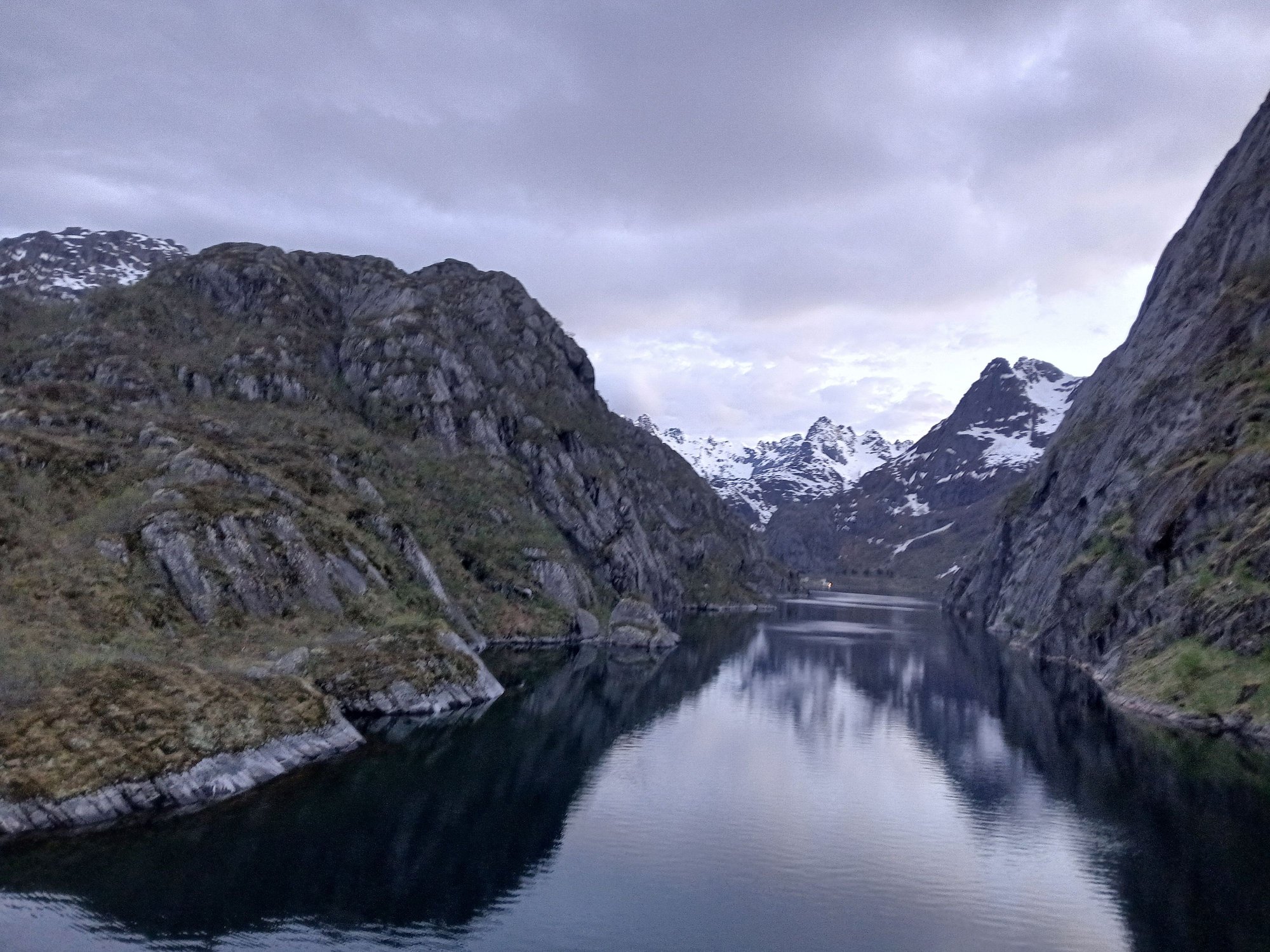
Approaching the Trollfjord, around 11.45pm

Towards the end of the fjord

The ship takes a turn

And heads out

The fjord near its narrowest point, almost touching the cliffs
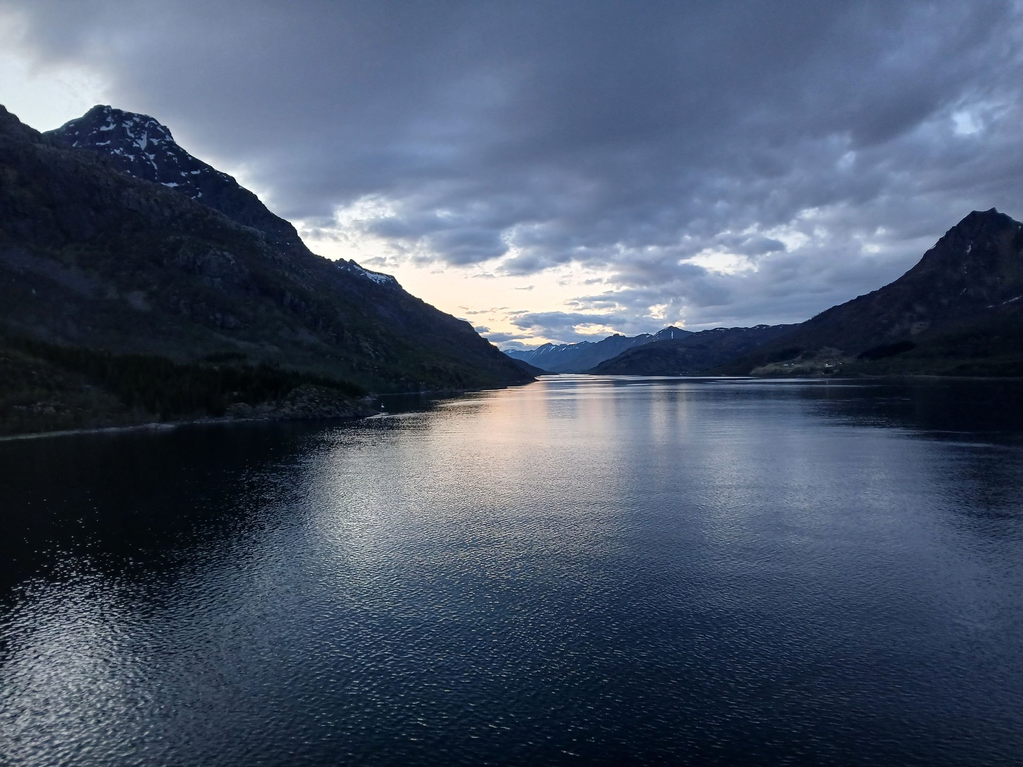
Midnight in the Arctic
Fun fact : The Arctic Circle is constantly moving as the earth wobbles on its axis. The circle is currently about 1 km north of the globe on Vikingen Island here, but will return to this very spot in 33,000 years!
The morning rays of the sun streaming through the clouds
Passing the Vikingen Island
A closer look at the globe
And we are now officially in the Arctic !
Approaching Ornes
Docking at Ornes
Out on deck, the Arctic crossing was celebrated with a traditional baptism ceremony, followed by a special toast. It was a lot of fun.
We were joined by Njord, the Norse God of the Sea and Wind !
The previous night, we were asked to drop chits in a bowl with our best guess of the exact time we would cross the Arctic Circle. The winner of this contest was announced - who predicted it accurately down to the last second - 7:43am and the rest I cant remember
The traditional baptism by ice !
Our first major stop today was Bod�. In 2006, this is where we ended our journey on the Hurtigruten. With a tight onward ferry connection to Moskenes (Lofoten), we had largely overlooked the city. This time around, with a three hours� stop, we had sufficient time to explore Bod� on foot.
Arriving at Bodo
View of the pier and lighthouse at Bodo
The city was completely destroyed during WW2, and rebuilt in a modernist style that prioritized functionality over charm. We followed the street art trail, a legacy of a 2016 art festival where several graffiti artists were invited to color the city with their work.
"Insomnia" at Dronningens gate 15 (Italian artist Millo)
"Butterfly" at Havnegata (Norwegian artist Martin Whatso)
"After School" at Kongens gate 18 (Russian artist Rustam Qbic)
"Maelstrom" at Moloveien 20 (Spanish artist David de la Mano)
Untitled at Sj�gata 18 (British artist Phlegm)
We passed the Bod� radhus and cathedral towards the jetty, and returned to the ship via the waterfront.
By the jetty
Bod� was one of the European Capitals of Culture in 2024, the first city located north of the Arctic Circle to be awarded this designation
Along the main street, view of the distinctive radhus in the back
Along the waterfront, past the floating saunas
Later this evening, we reached the Lofoten with a brief halt at Stamsund.
Arriving in Stamsund
The early views of the jagged peaks of the Lofoten rising out of the sea (the "Lofoten Wall")
Passing another Hutigruten ship on its southbound journey, as we approached Svolvaer
Our next major stop was Svolvaer, the commercial and cultural capital of the Lofoten Islands, and a major hub for exploring the archipelago. We had spent a night here in 2006. With an hour's halt post-dinner, we decided to step out and take a short stroll anyway. We walked along the waterfront, towards the Svinoya bridge, eventually returning to the main square (Torget).
Arriving at Svolvaer
View of the fish drying racks as we prepare to dock
Passing Lamholmen, the little islet with rorbus of Anker Brygge and Scandic hotel
Looking back at the waterfront
A cluster of rorbus (fishing cabins)
Svolvaer is famous for Svolv�rgeita, a jagged twin-peaked mountain famous among rock climbers. If you zoom into this photo, and follow the line of blue poles/bollards you can see it amidst the mountains - looks like two fingers or a goat's horns
The main square
The RIB excursion returns, with fellow travelers rejoining our ship
Farewell Svolvaer (view of the Fisherman's Wife monument as we depart)
At night, the ship sailed through the narrow Raftsundet strait while exiting the Lofoten, with a surprise detour through the beautiful Trollfjord. This is a dramatic, 2-kilometer-long fjord famous for its narrow 100-meter entrance and imposing cliffs. It is accessible only by a tough hike or by water - permissible only if conditions are favourable (no strong winds, no avalanche risks). It was a real test of skill for our captain to navigate in, turn at its end and exit.
Approaching the Trollfjord, around 11.45pm
Towards the end of the fjord
The ship takes a turn
And heads out
The fjord near its narrowest point, almost touching the cliffs
Midnight in the Arctic

Thread
Original Poster
Forum
Replies
Last Post
sophiehammond6368
Europe
7
Jan 26th, 2025 10:24 AM


