


2023 : A Highland Odyssey

 Jun 14th, 2023 | 10:42 PM
#62
Original Poster

Joined: Oct 2005
Posts: 931
Likes: 28
Day 18 : Tarbert (Lewis & Harris)
This was our 3rd day based out of Tarbert, and we had planned to cover the entire south of Harris.
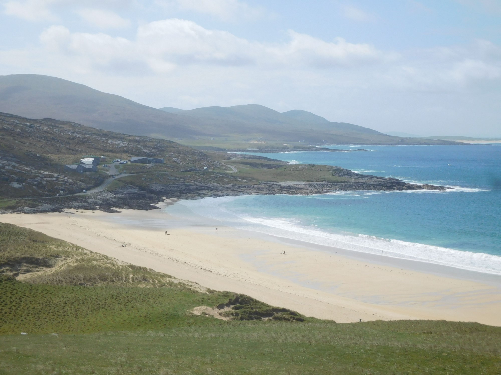
We set off on the A859, branching off on the road to Logaintir, leading to Luskentyre. The road to Luskentyre is beautiful, and as the beach slowly began to emerge, we know we were in for a treat.
The road to Luskentyre
Approaching Luskentyre
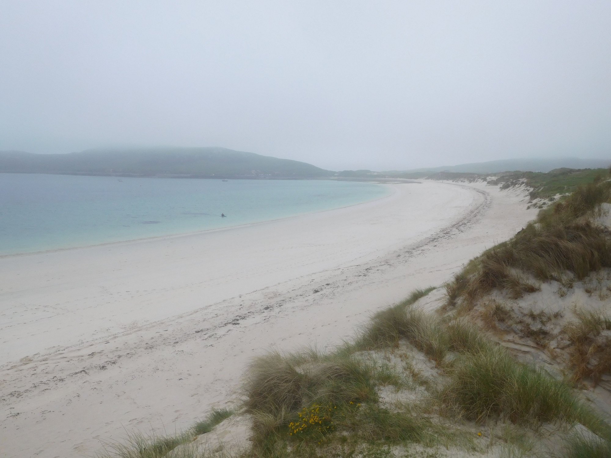
The vast expanse emerges
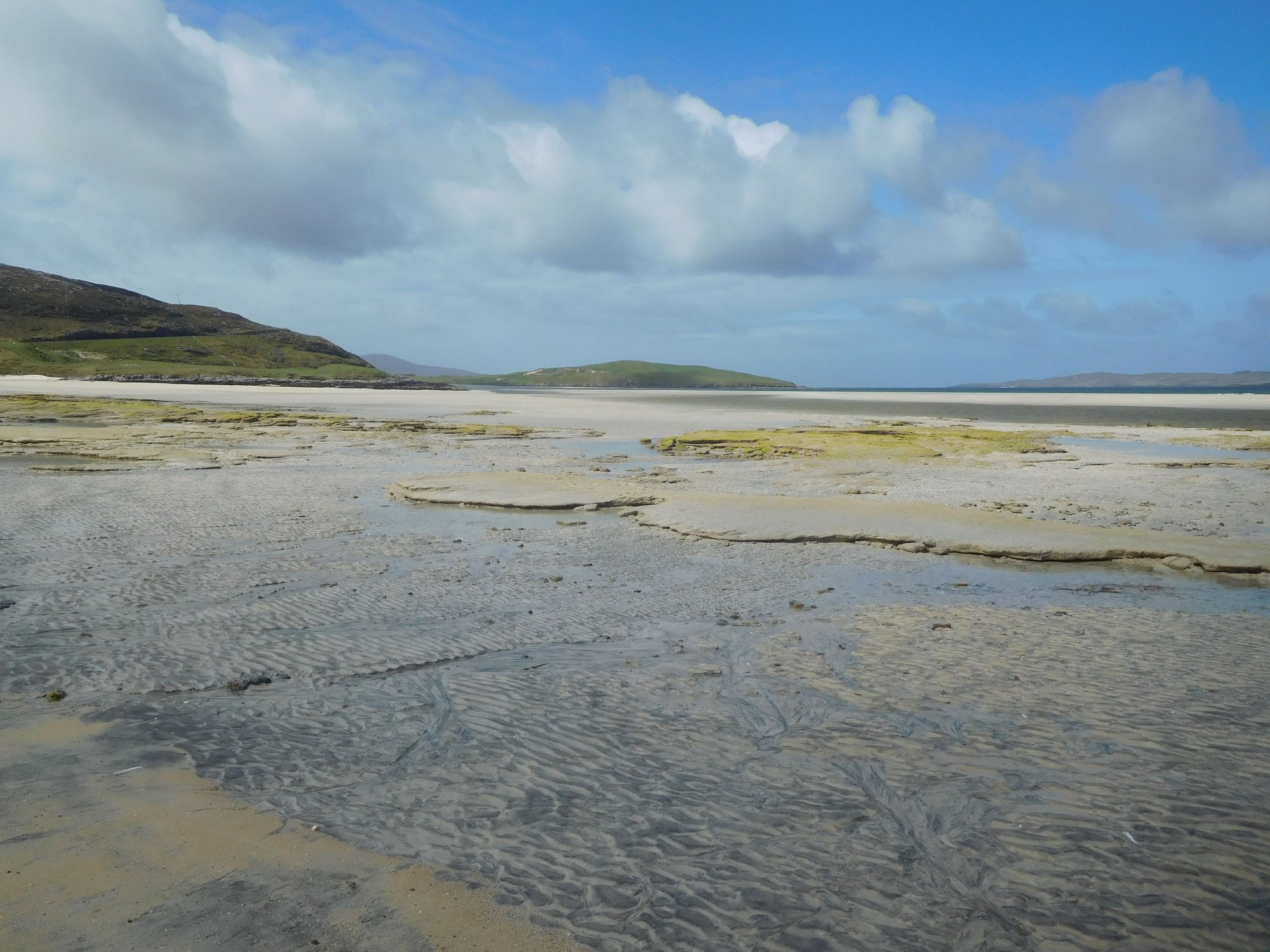
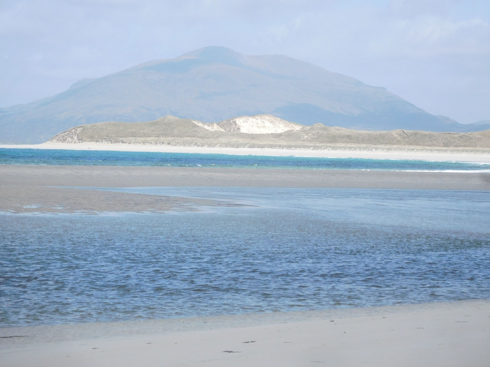
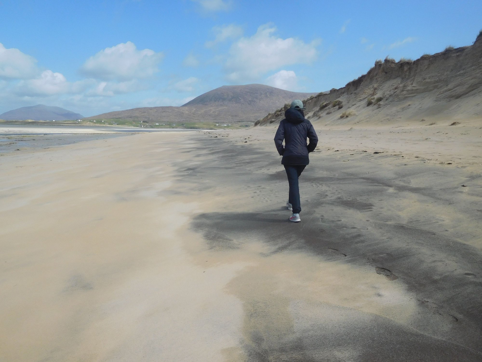
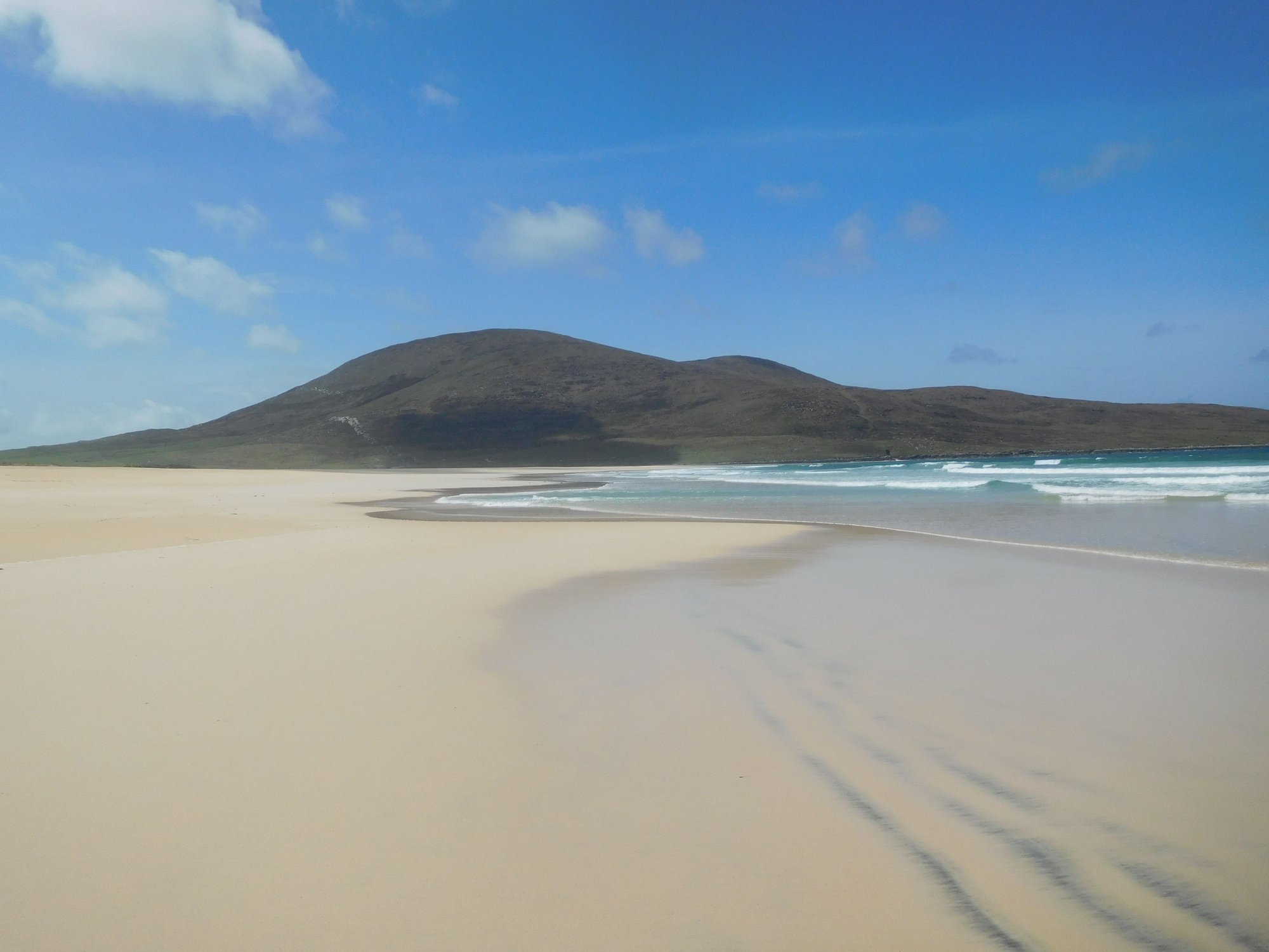
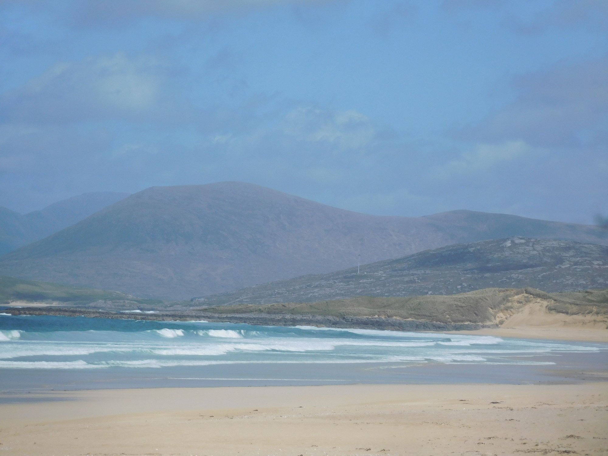
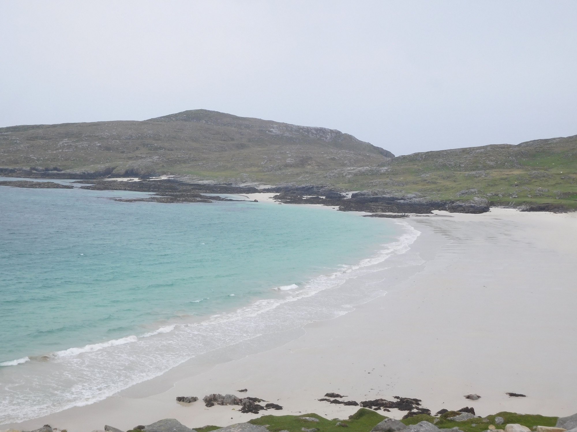
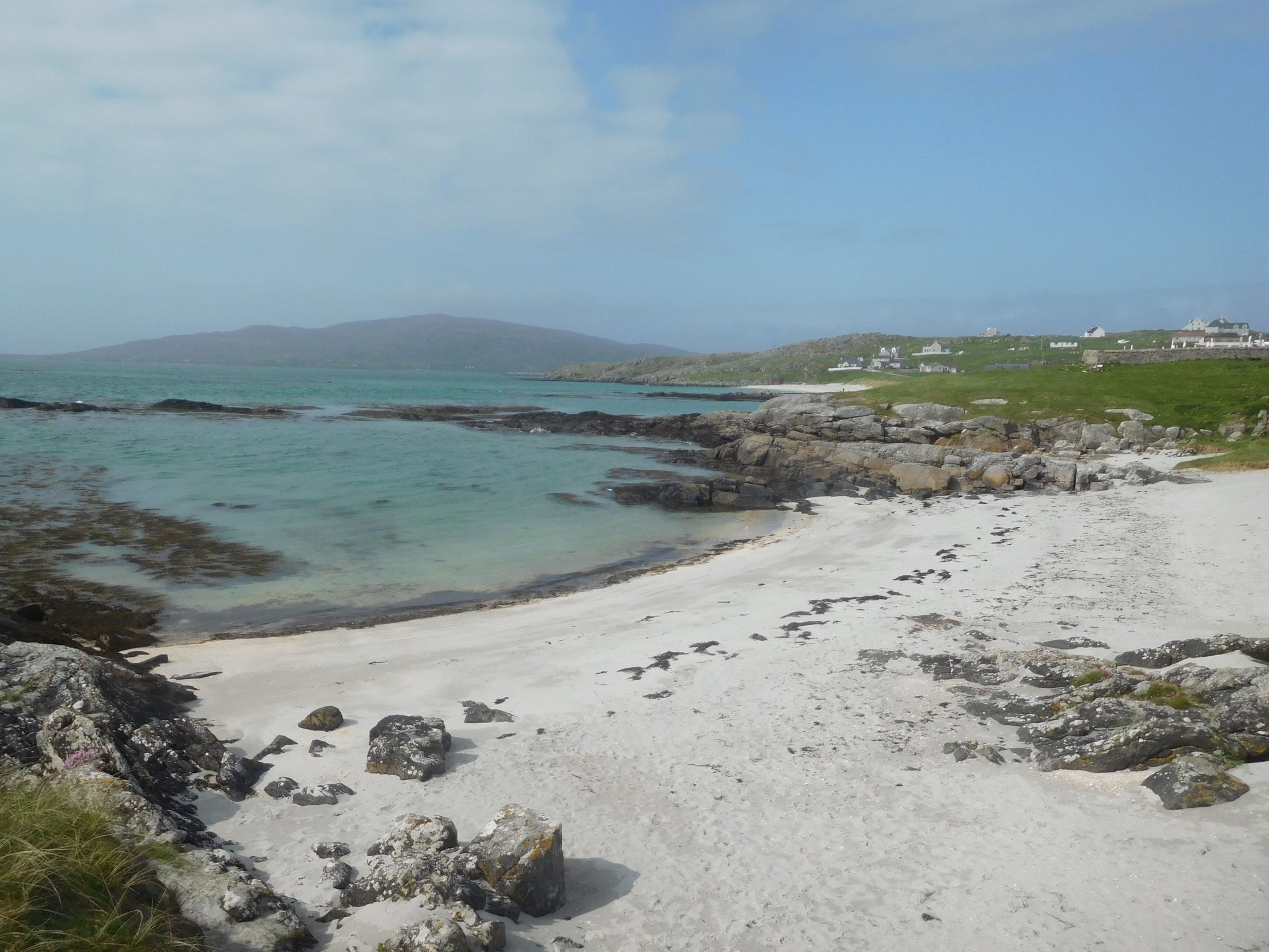
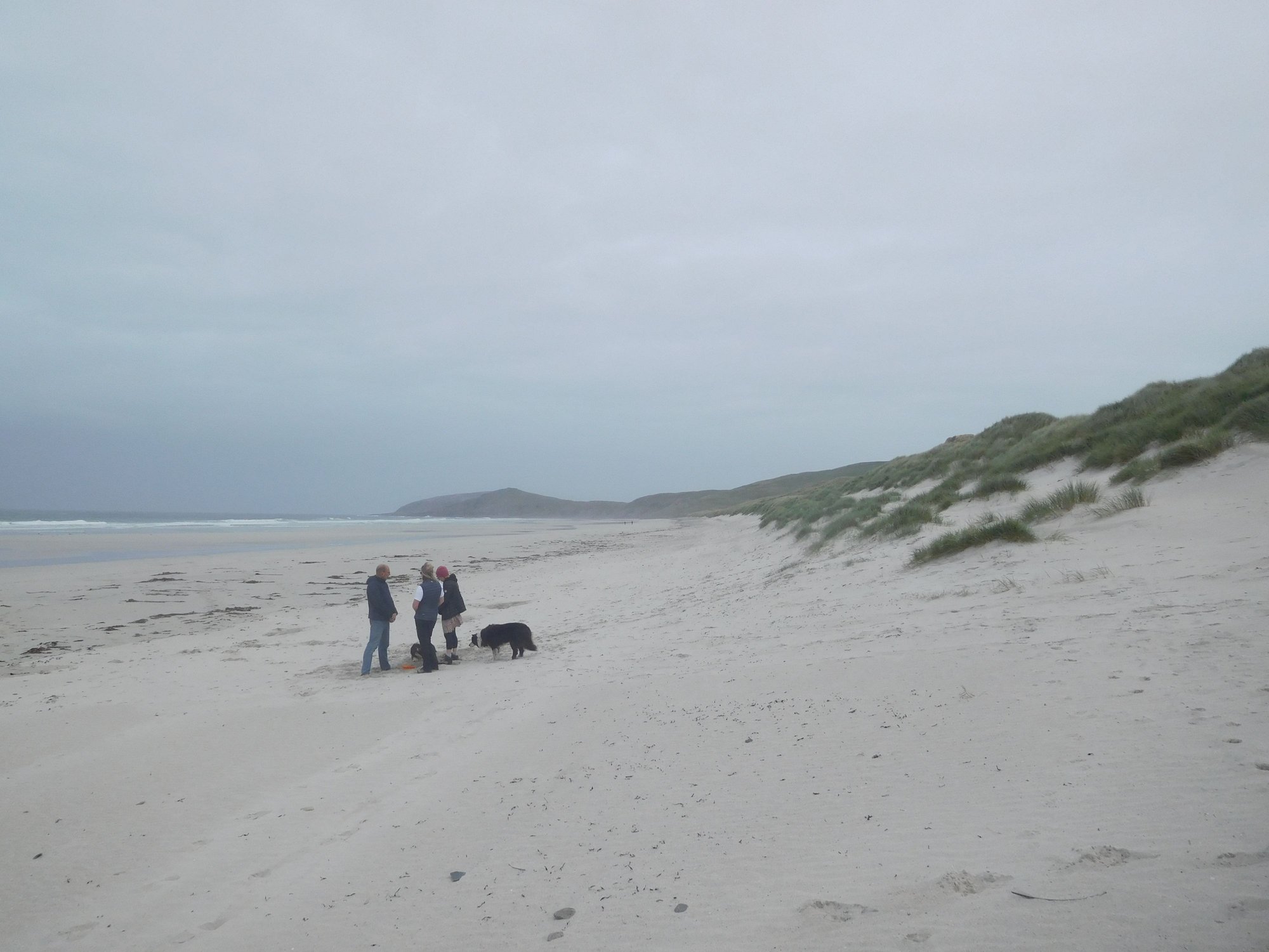
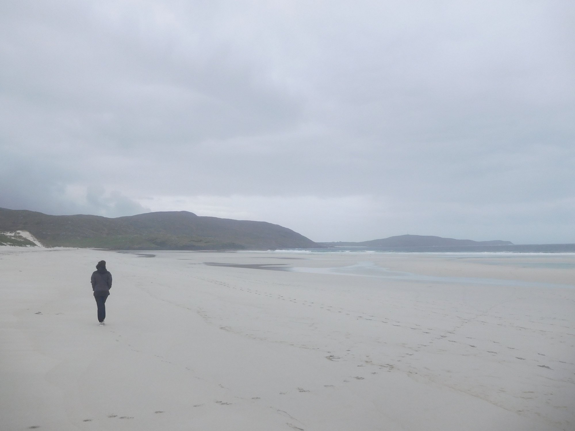
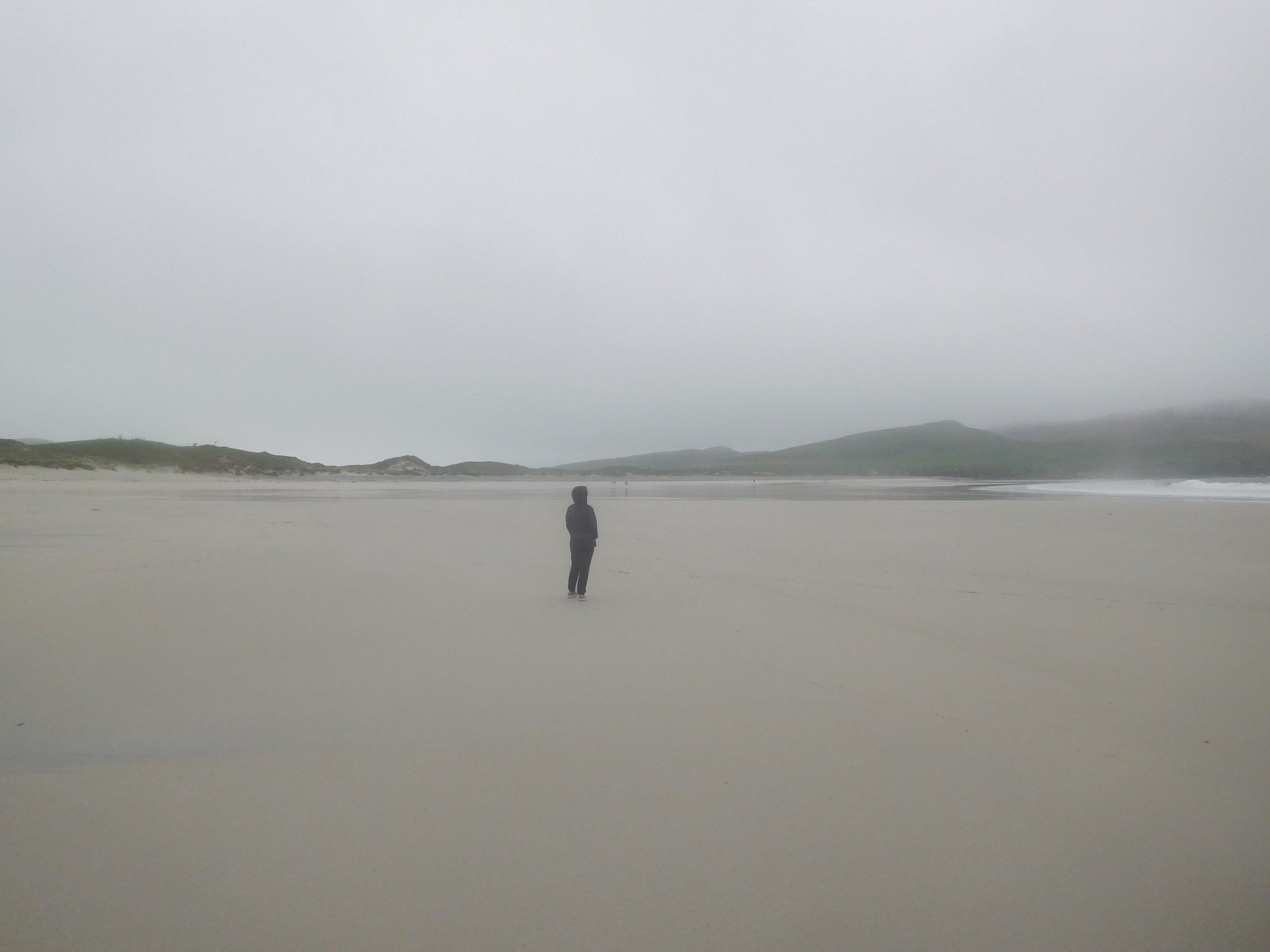
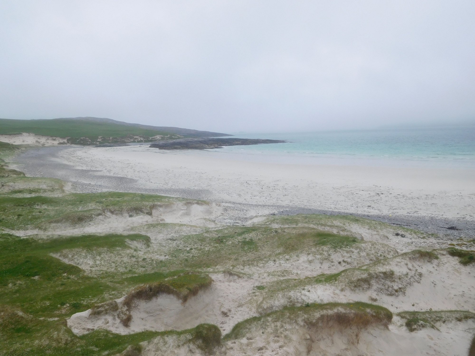
After taking the last spot in the small car park, we made our way through the grassy dunes to the beach. What lay before us was a 2 mile stretch of the most pristine sands and clearest glittering blue waters. Luskentyre is regularly voted among the top 3 beaches in the UK. Honestly, I think its one of the most beautiful beaches we’ve seen anywhere on Earth. We walked down the whole length of the beach, and found it impossible to leave.
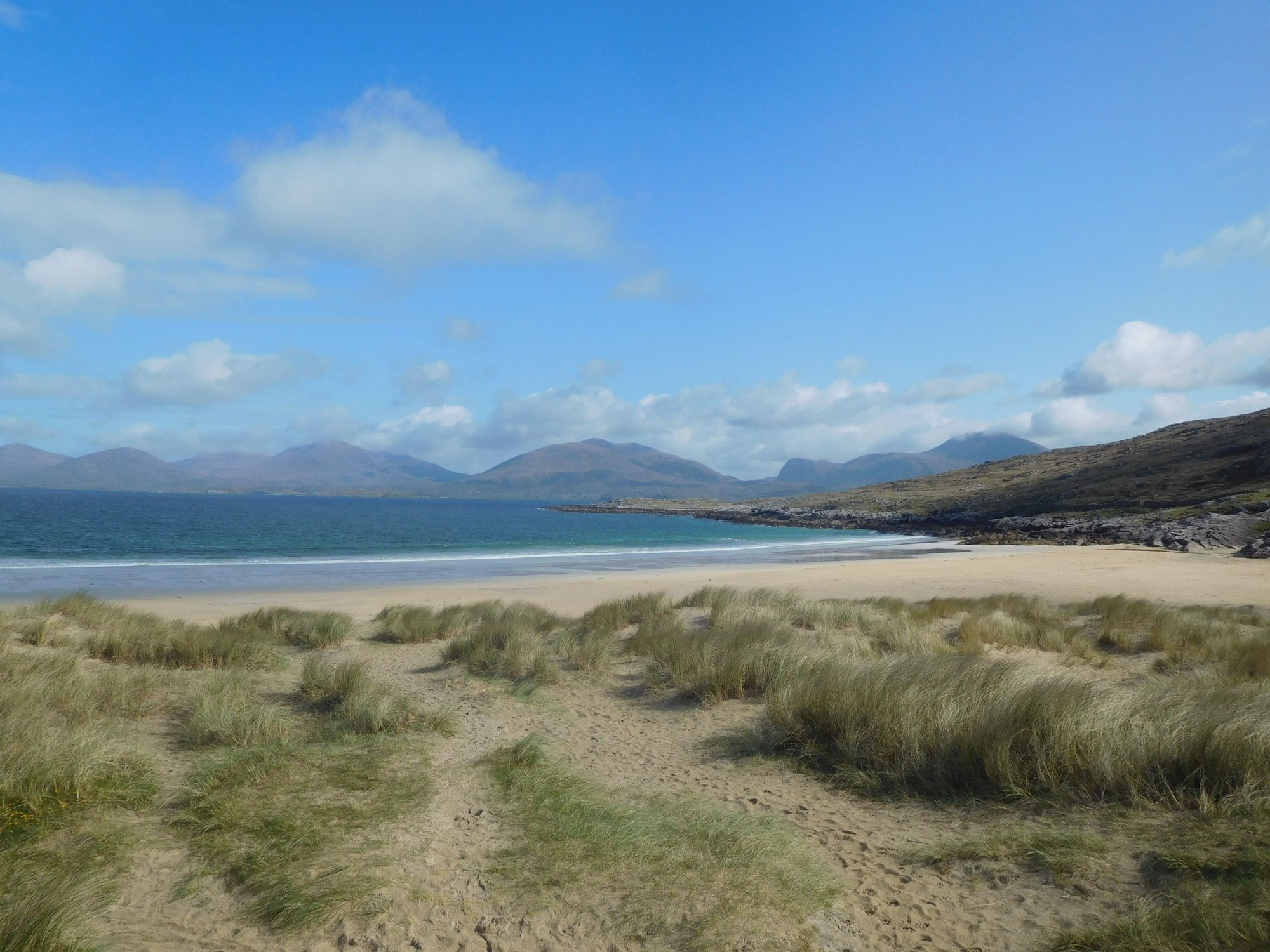
Through the dunes
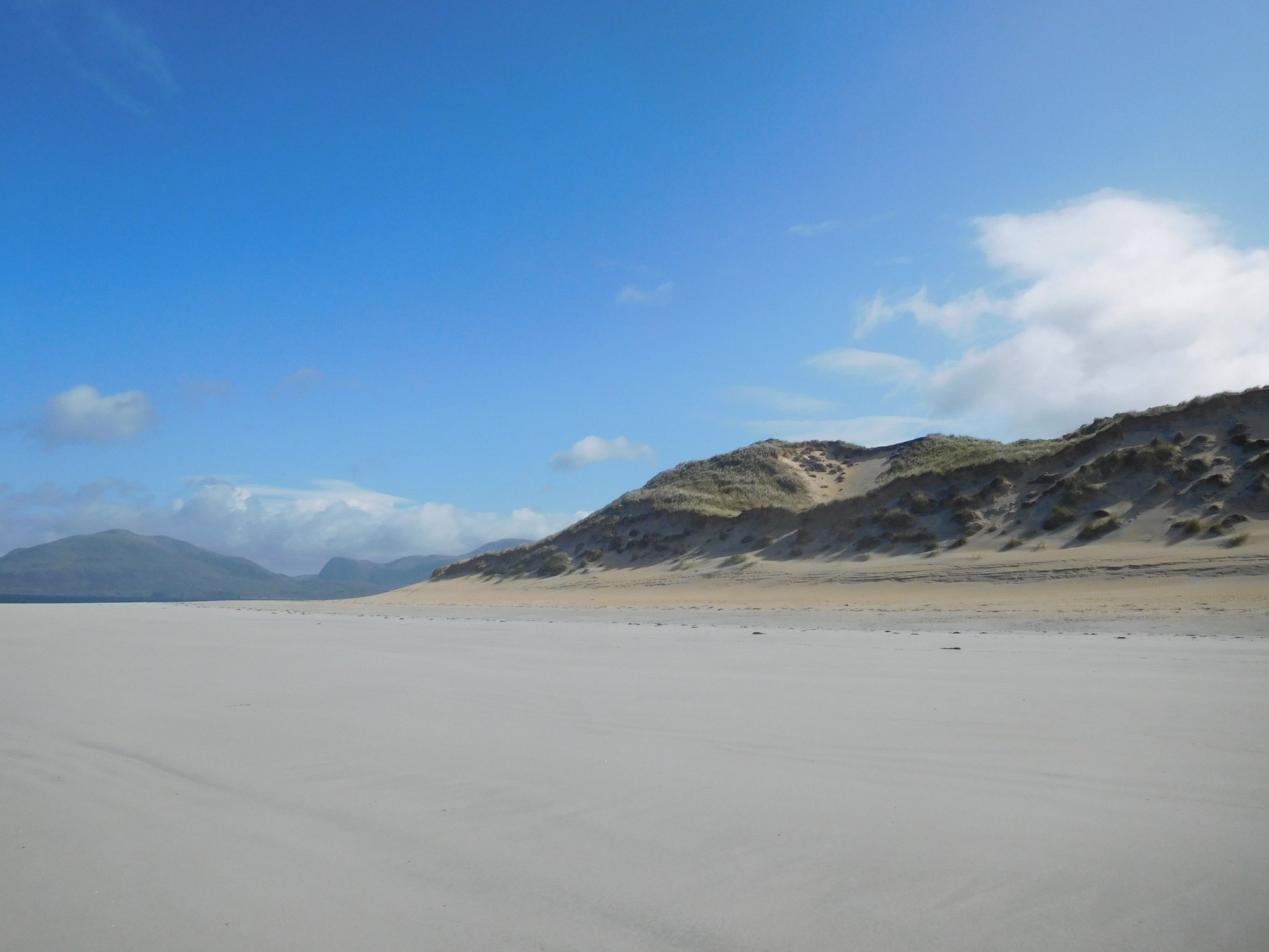
and onto the beach
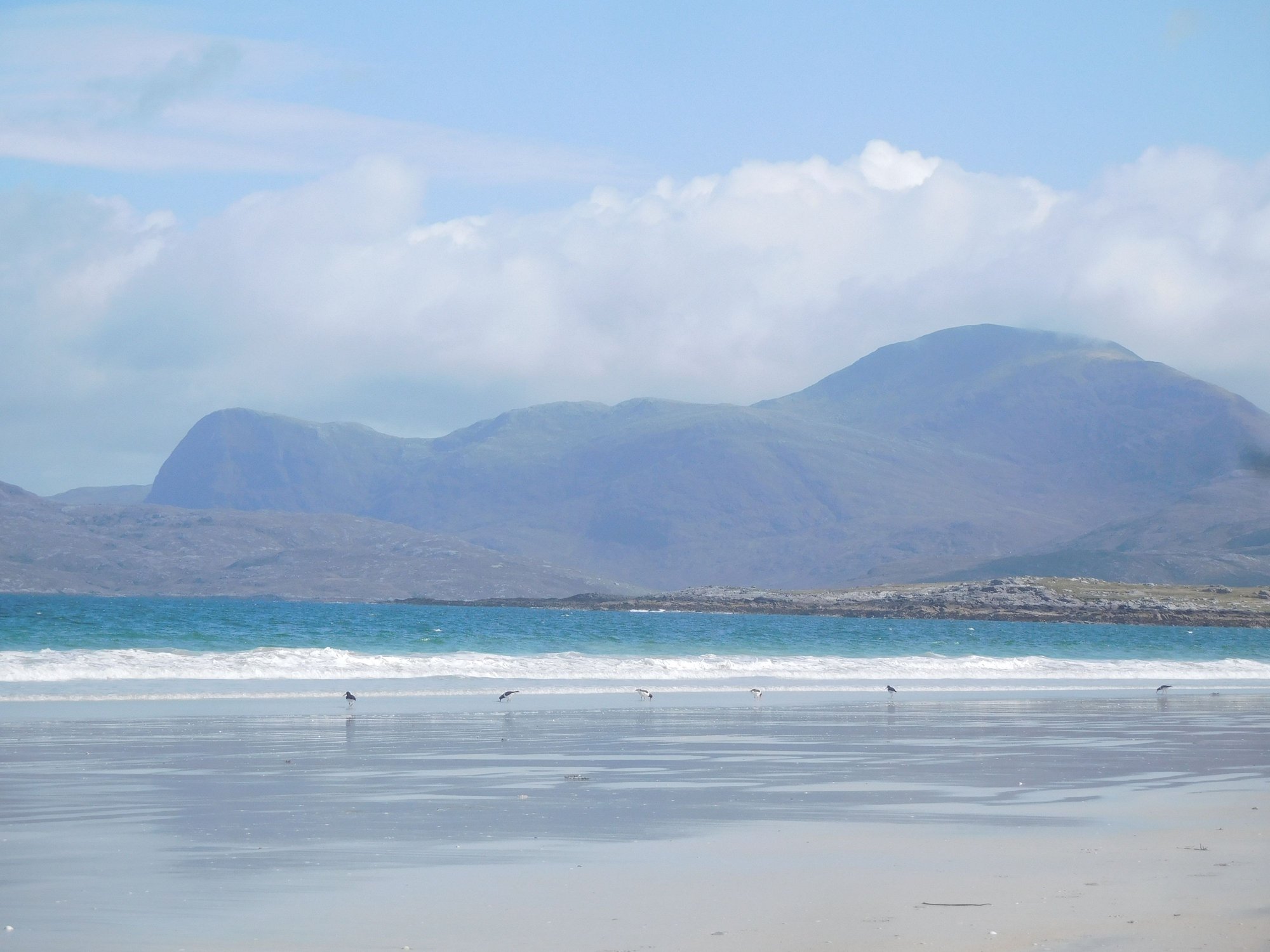
Oystercatchers along the water
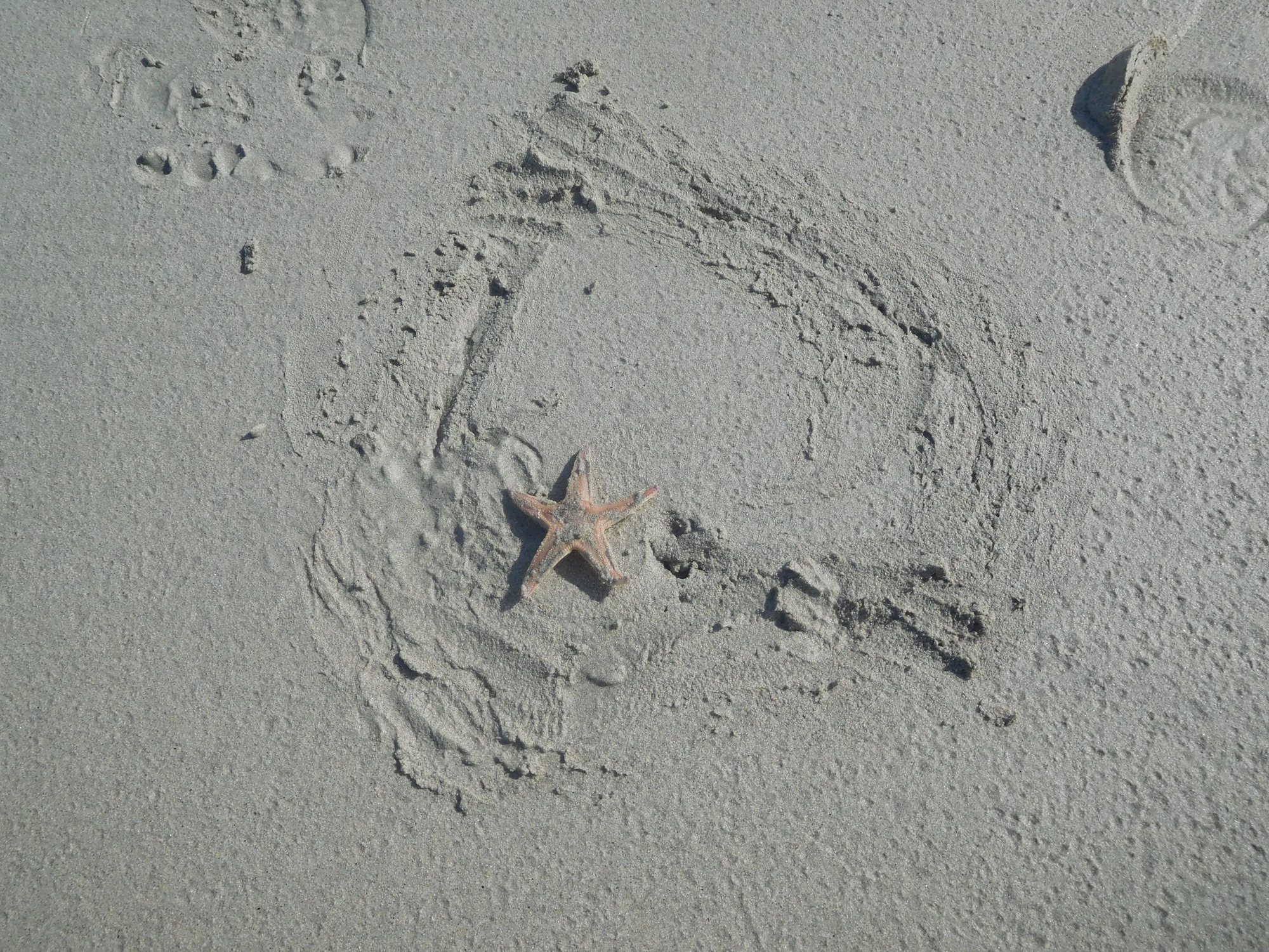
Starfish in the sand
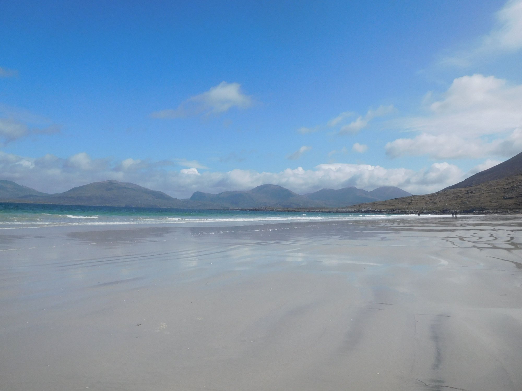
Walking along the beach
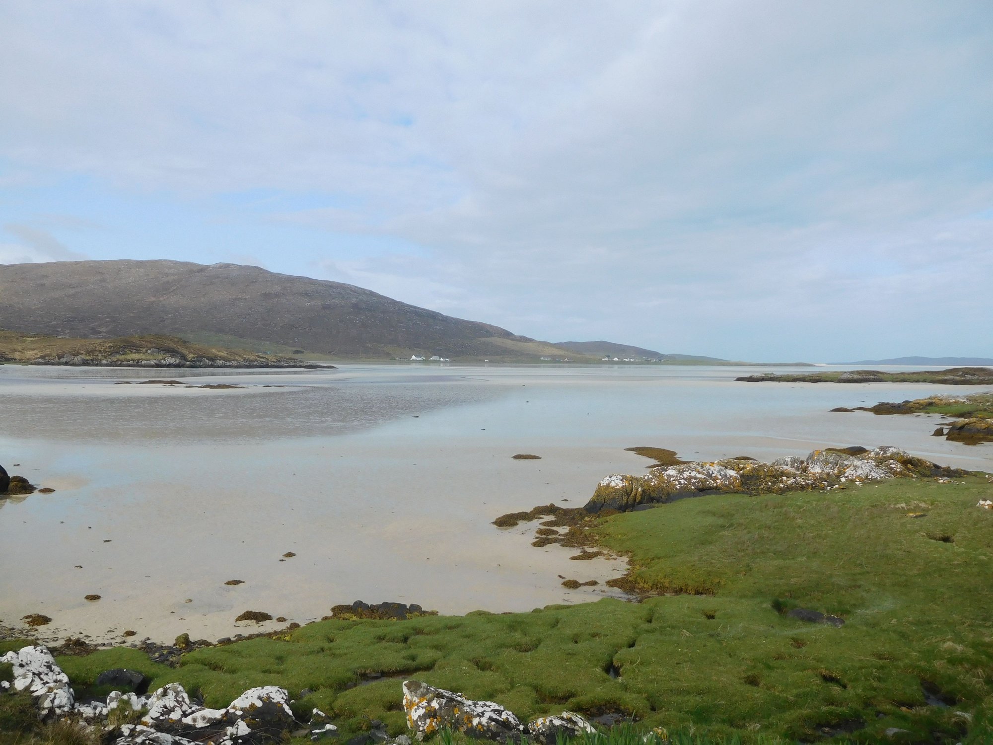
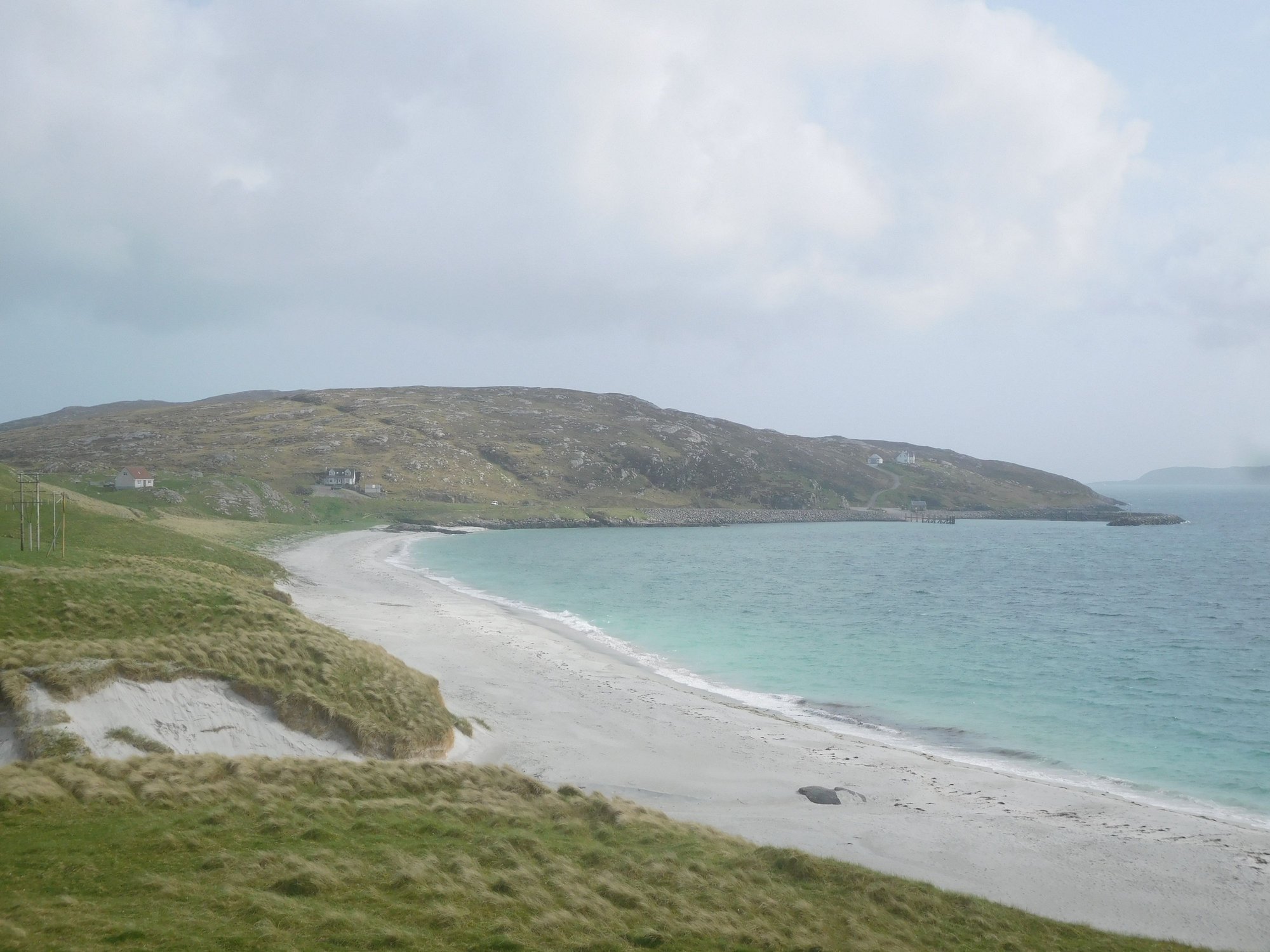
We rejoined the A859 and stopped at Seilebost beach next.
Seilebost
The varied colors of the sea
Leaving Seilebost
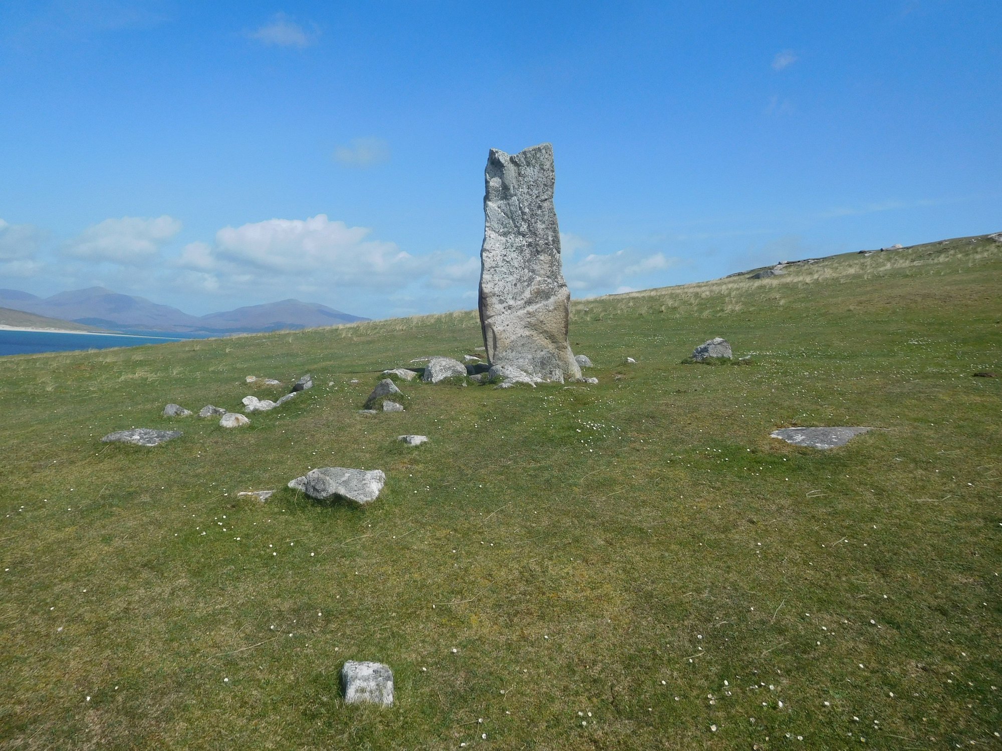
This was followed by Nisabost beach, where a short climb up the grassy hill to the MacLeod stone opened up some panoramic views.
The MacLeod standing stone

Views of Harris from top of the hill
View of Nisabost beach from hill
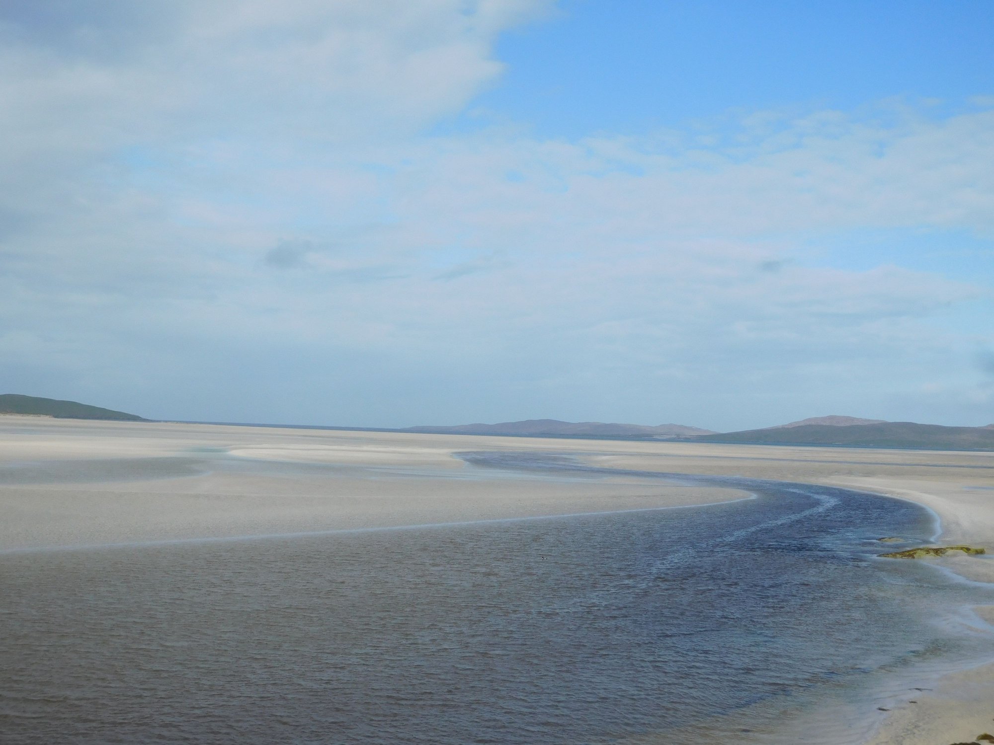
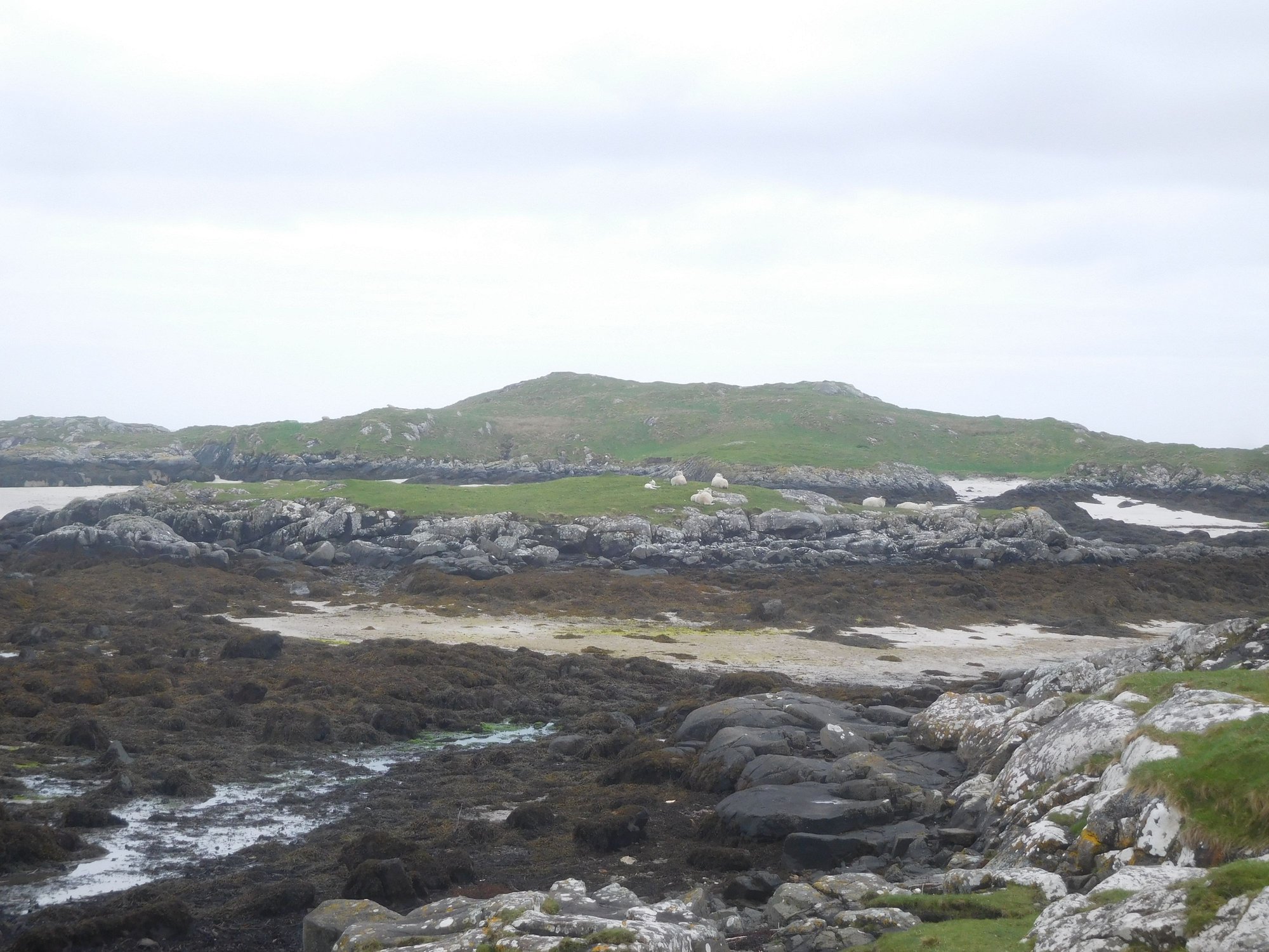
Our final beach was Scarista, another vast and expansive stunner of a beach. All these unusual beach names are reminders of the Viking history of these islands.
Scarista
Scarista
Making our way back to the car park from Scarista
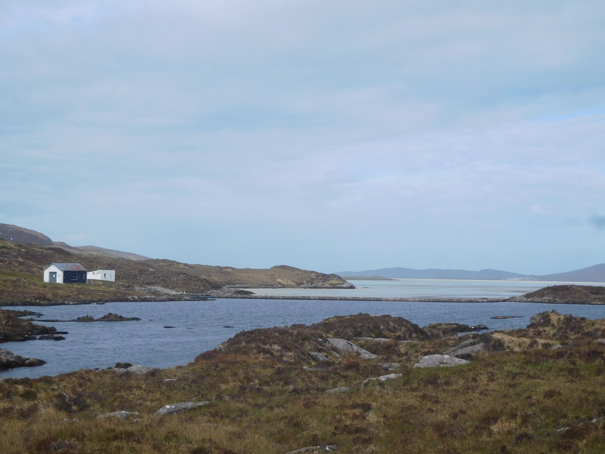
I recall reading an article in the National Geographic that Lewis and Harris is "home to an unfathomable number of shades of blue" - the full palette was on display for us today. We drove by Northton to pickup some home-baked goodies at Croft36, an unattended gourmet food store with an honesty box.
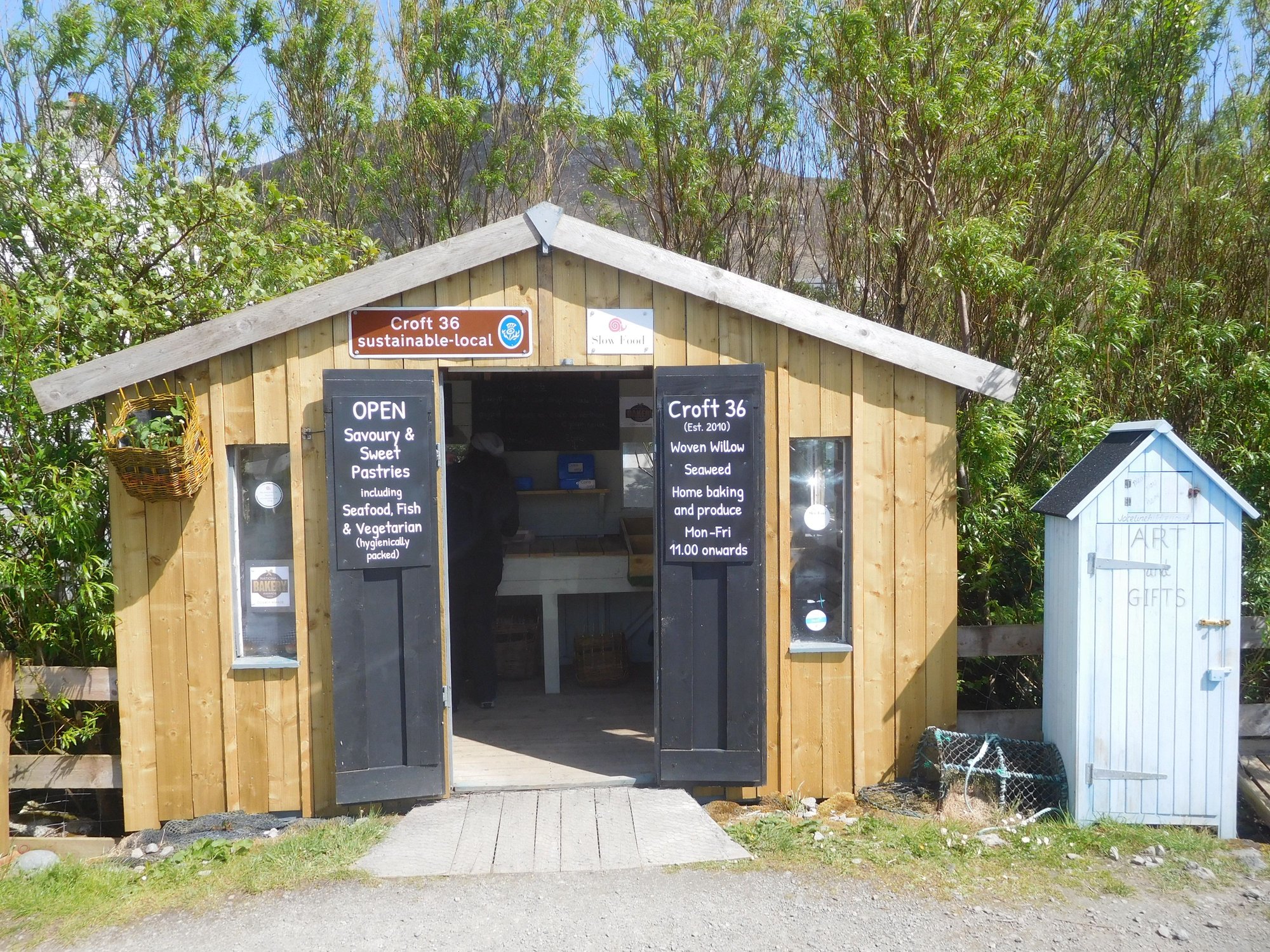
Croft36
After a short stop at Leverburgh to buy some groceries at the local community store, we headed to Rodel to visit the 16th century St Clements church.
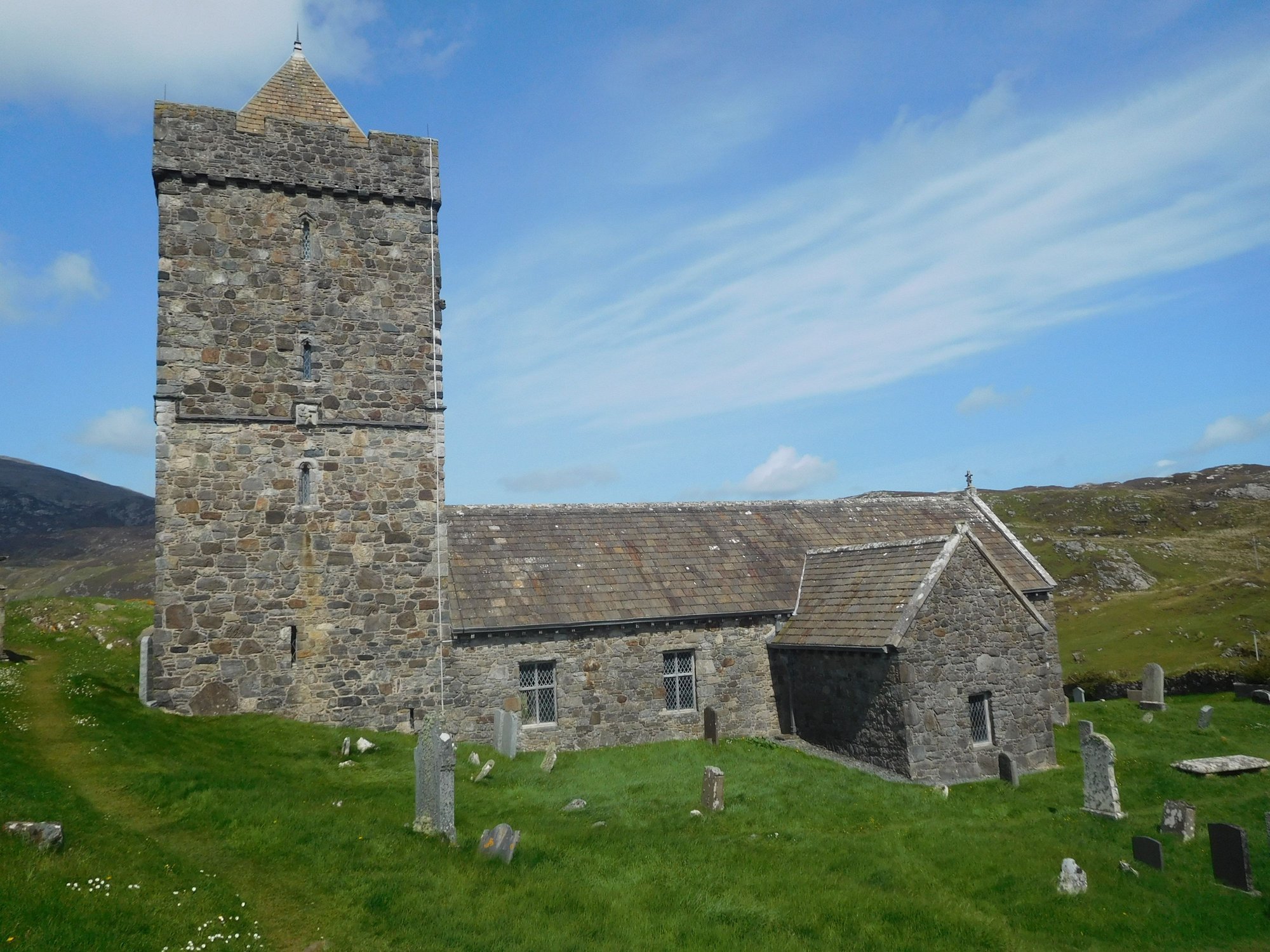
Outside
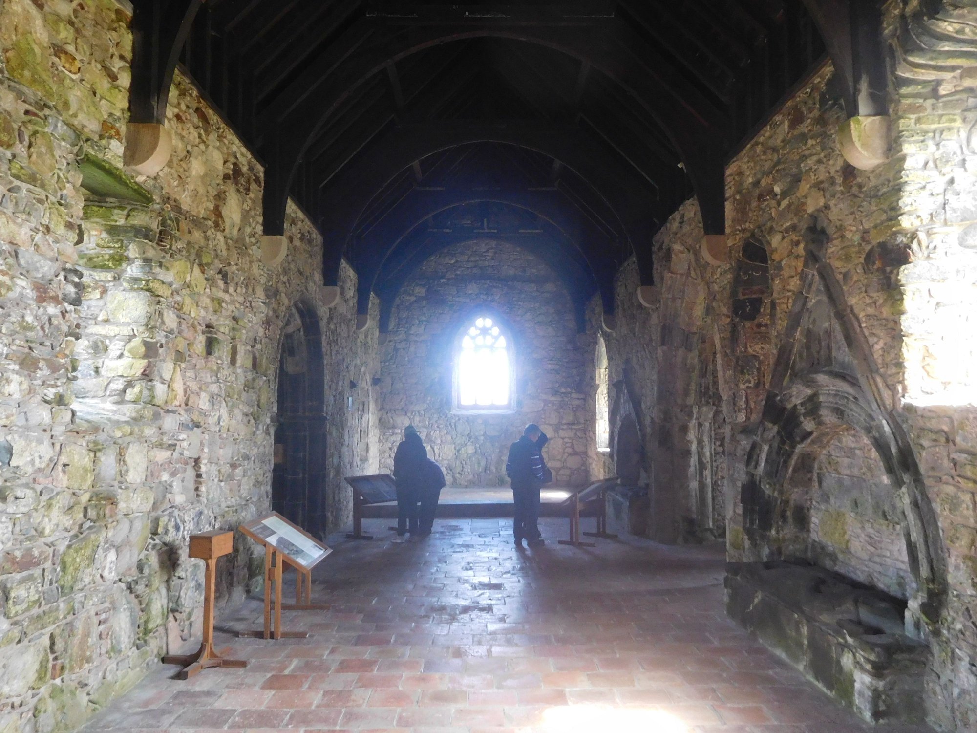
Inside
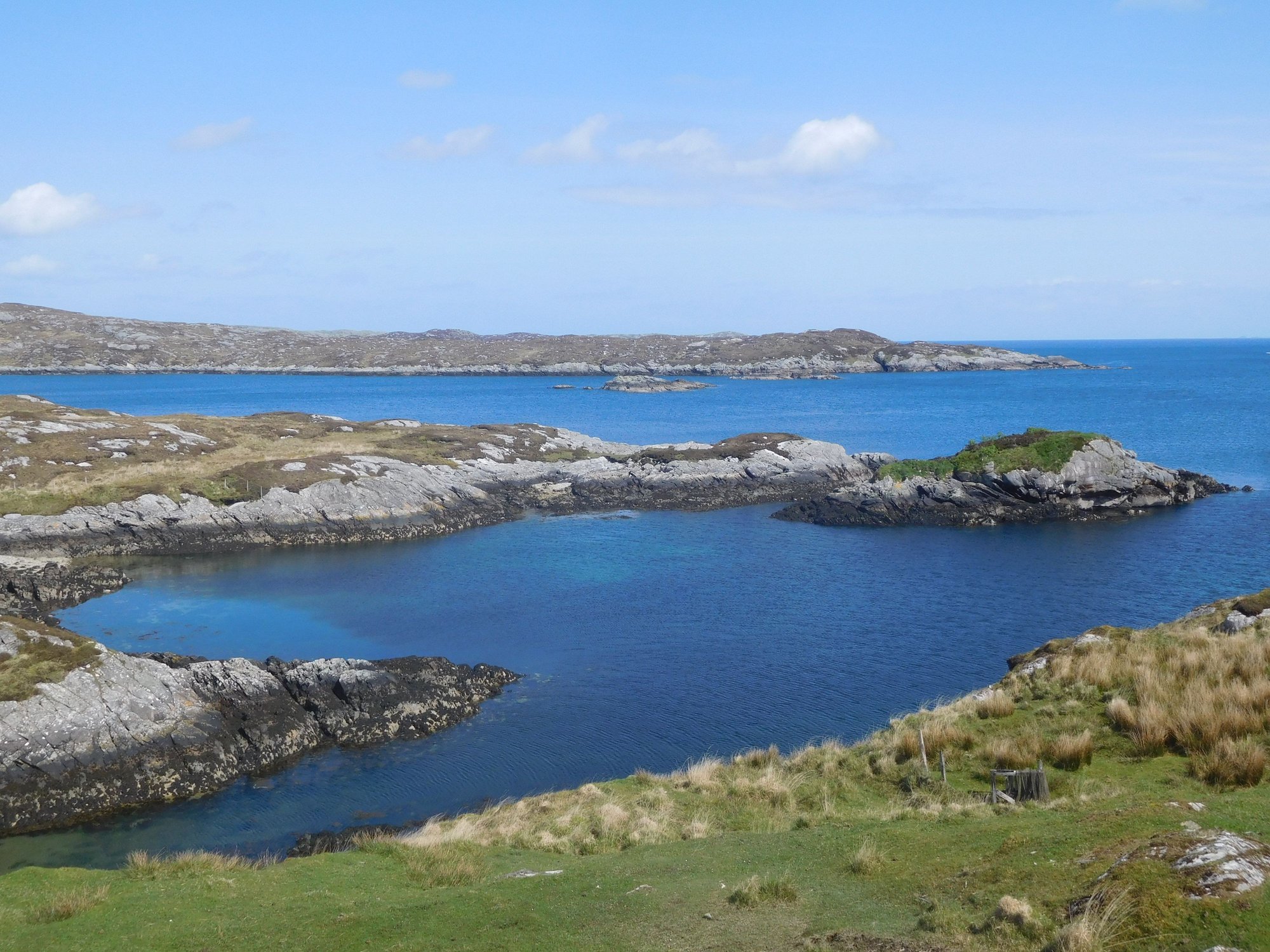
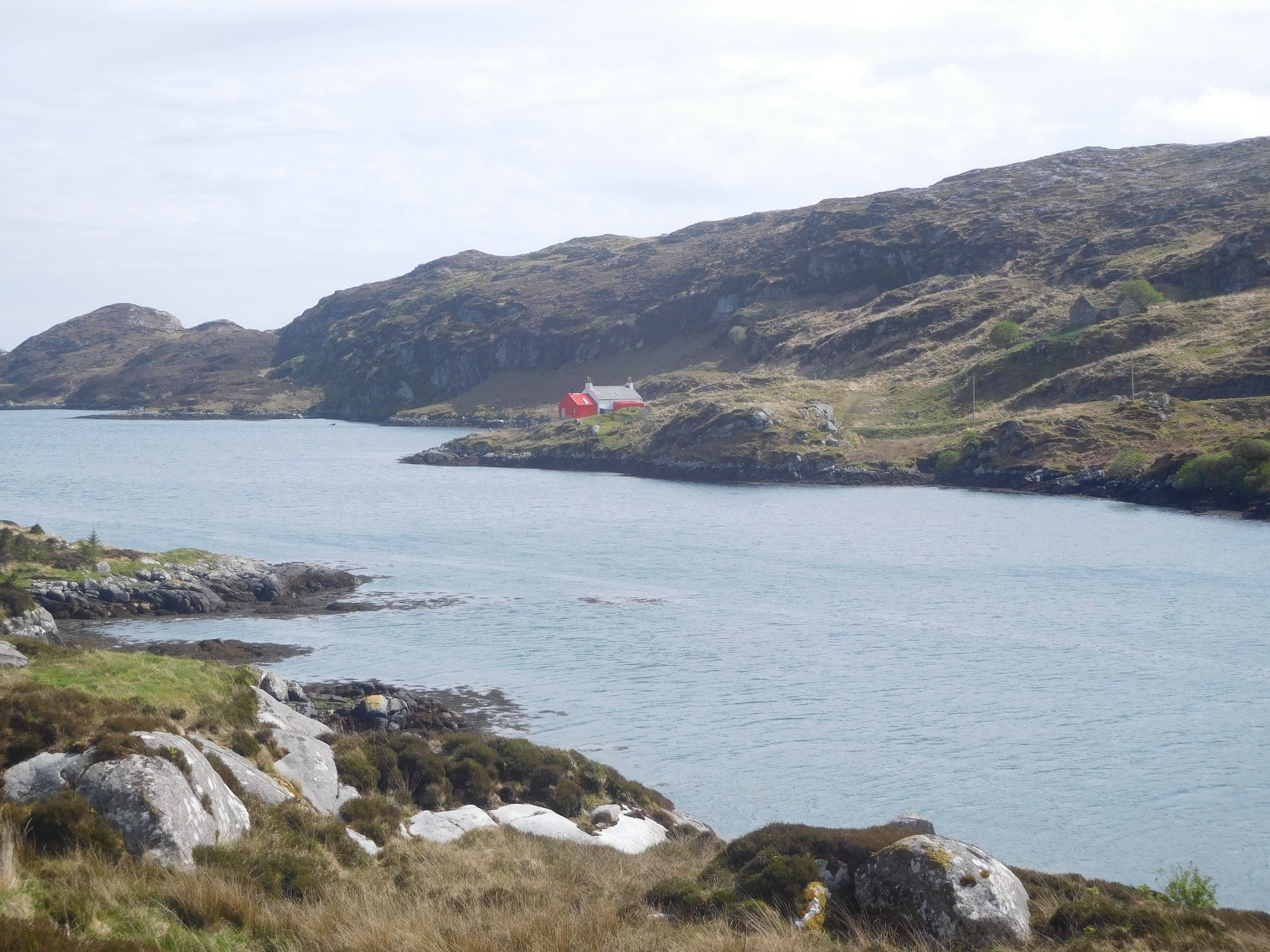
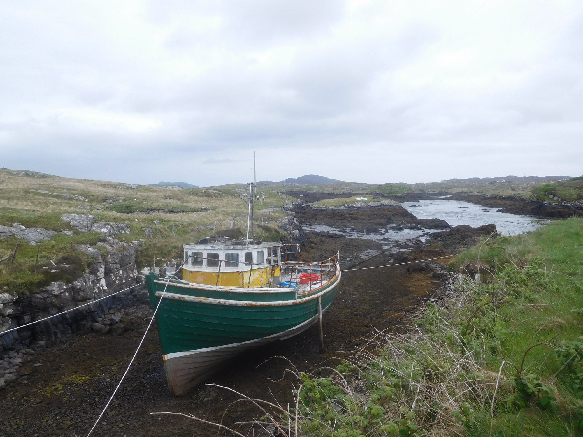
We then drove the Golden Road (so called because of the exorbitant cost of building this road in such difficult terrain) along the east coast. We passed several tiny villages with unusual Norse names Finsbay, Ardslave, Quidiinsh, Grosebay – all reminders of the Viking history of these islands. The landscape was distinctively unique, often described as "moonscape". I don't recall seeing a single car (or human!) along the drive.
Some interesting pit-stops on the route were Skoon Gallery at Geocrab (for some delicious choco brownie and coffee) and the Clo Mor Harris Tweed Centre in Drinisshadder (with interesting exhibits and information about the history of the wool fabric on the island).
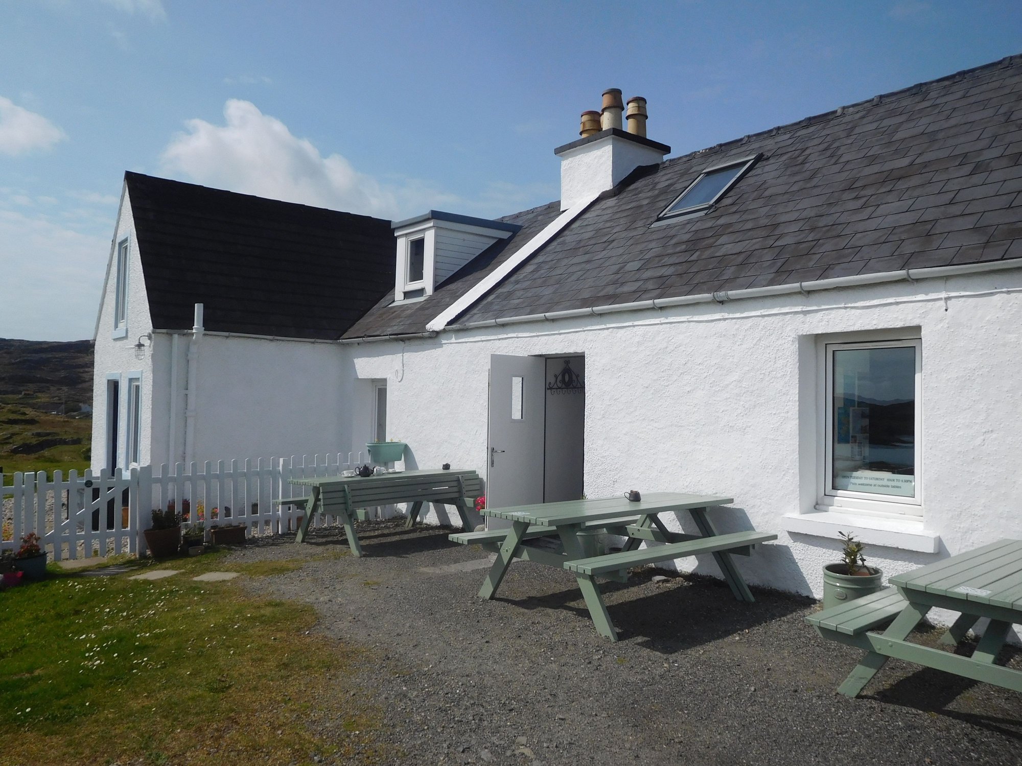
At Skoon Art Gallery and Cafe
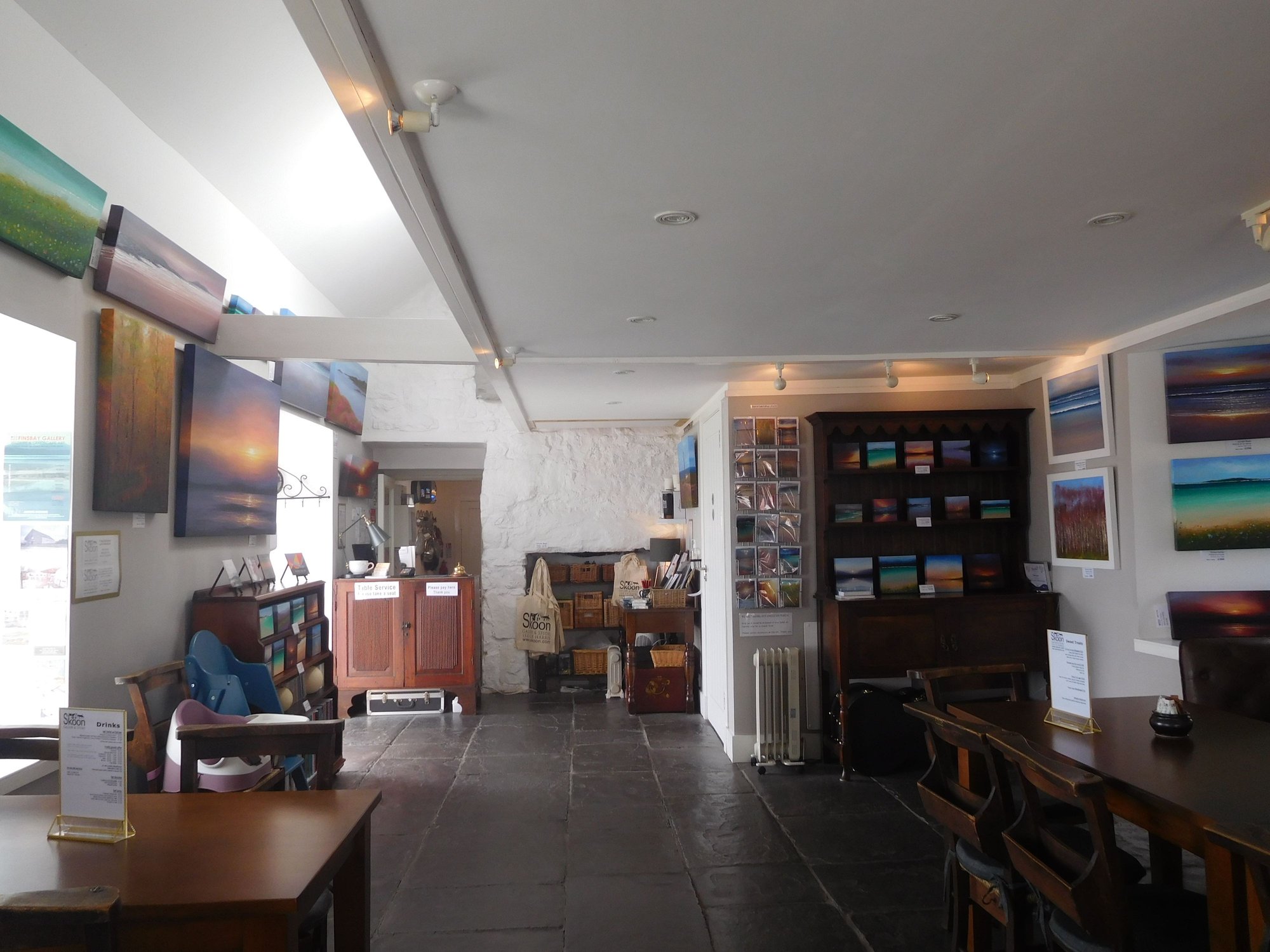
Inside the cafe
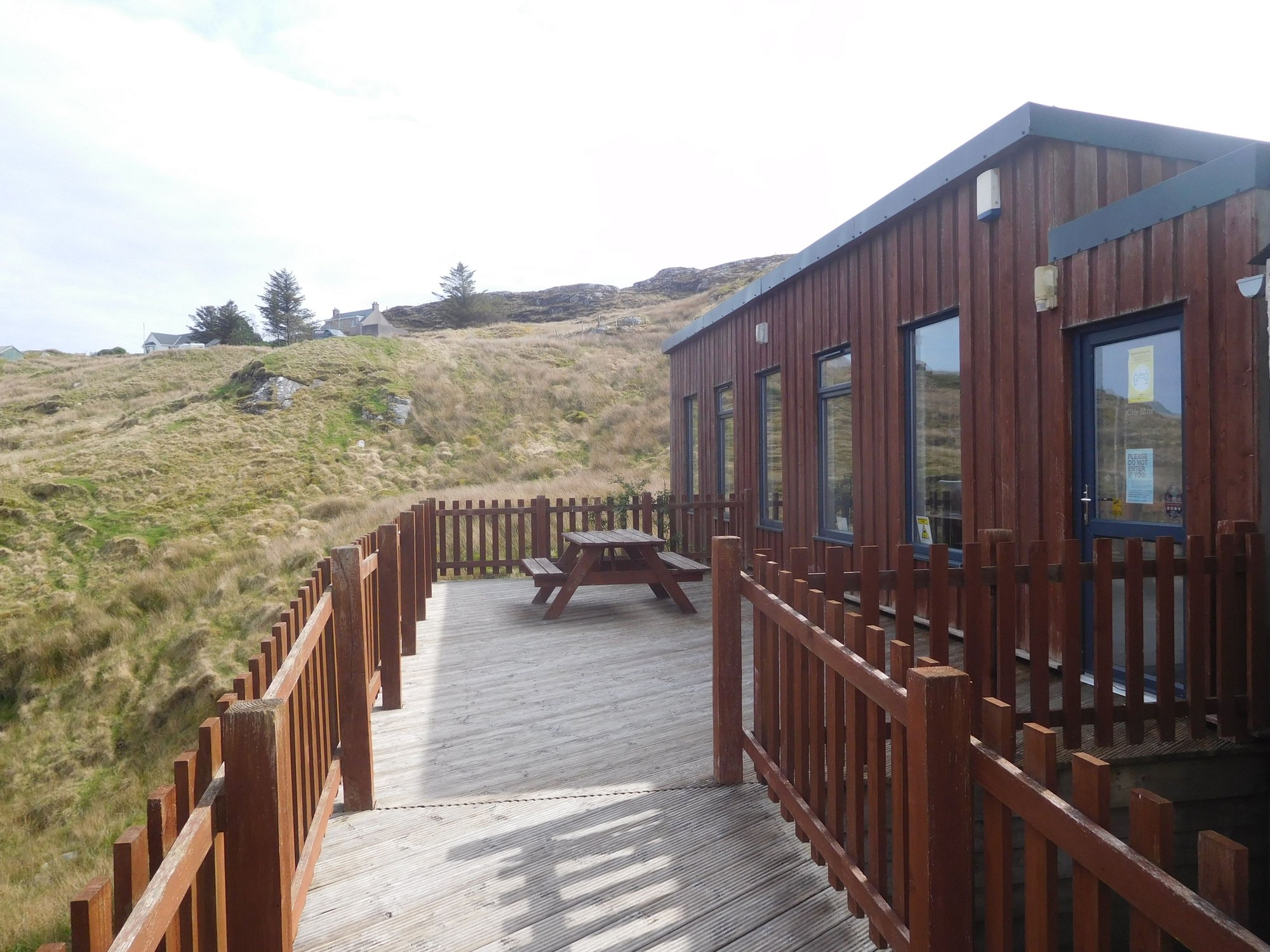
At Clo Mor Harris Tweed Centre
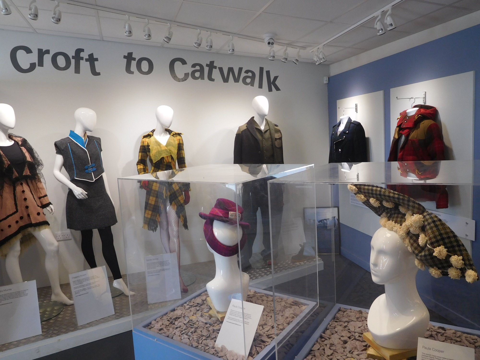
Inside the centre
We were back in Tarbert by evening, with another terrific day of exploring under our belts.
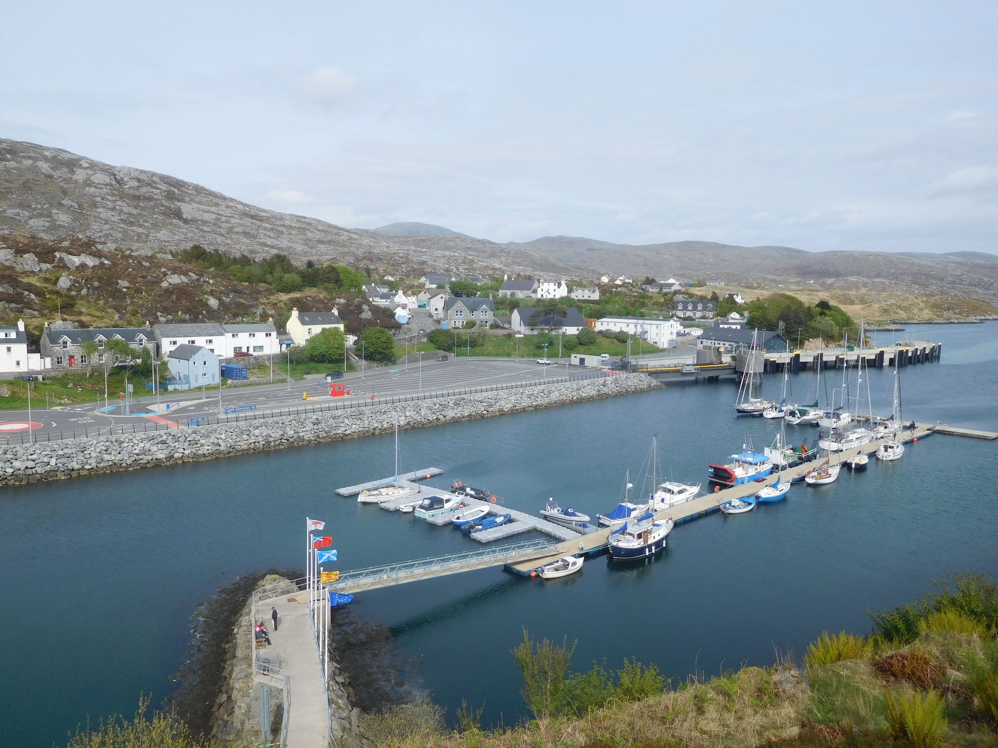
The drive back to Tarbert, past the pier
This was our 3rd day based out of Tarbert, and we had planned to cover the entire south of Harris.
We set off on the A859, branching off on the road to Logaintir, leading to Luskentyre. The road to Luskentyre is beautiful, and as the beach slowly began to emerge, we know we were in for a treat.
The road to Luskentyre
Approaching Luskentyre
The vast expanse emerges
After taking the last spot in the small car park, we made our way through the grassy dunes to the beach. What lay before us was a 2 mile stretch of the most pristine sands and clearest glittering blue waters. Luskentyre is regularly voted among the top 3 beaches in the UK. Honestly, I think its one of the most beautiful beaches we’ve seen anywhere on Earth. We walked down the whole length of the beach, and found it impossible to leave.
Through the dunes
and onto the beach
Oystercatchers along the water
Starfish in the sand
Walking along the beach
We rejoined the A859 and stopped at Seilebost beach next.
Seilebost
The varied colors of the sea
Leaving Seilebost
This was followed by Nisabost beach, where a short climb up the grassy hill to the MacLeod stone opened up some panoramic views.
The MacLeod standing stone
Views of Harris from top of the hill
View of Nisabost beach from hill
Our final beach was Scarista, another vast and expansive stunner of a beach. All these unusual beach names are reminders of the Viking history of these islands.
Scarista
Scarista
Making our way back to the car park from Scarista
I recall reading an article in the National Geographic that Lewis and Harris is "home to an unfathomable number of shades of blue" - the full palette was on display for us today. We drove by Northton to pickup some home-baked goodies at Croft36, an unattended gourmet food store with an honesty box.
Croft36
After a short stop at Leverburgh to buy some groceries at the local community store, we headed to Rodel to visit the 16th century St Clements church.
Outside
Inside
We then drove the Golden Road (so called because of the exorbitant cost of building this road in such difficult terrain) along the east coast. We passed several tiny villages with unusual Norse names Finsbay, Ardslave, Quidiinsh, Grosebay – all reminders of the Viking history of these islands. The landscape was distinctively unique, often described as "moonscape". I don't recall seeing a single car (or human!) along the drive.
Some interesting pit-stops on the route were Skoon Gallery at Geocrab (for some delicious choco brownie and coffee) and the Clo Mor Harris Tweed Centre in Drinisshadder (with interesting exhibits and information about the history of the wool fabric on the island).
At Skoon Art Gallery and Cafe
Inside the cafe
At Clo Mor Harris Tweed Centre
Inside the centre
We were back in Tarbert by evening, with another terrific day of exploring under our belts.
The drive back to Tarbert, past the pier
Last edited by IBkatherine; Jun 15th, 2023 at 07:10 AM.
Jun 15th, 2023 | 01:28 PM
#64

Joined: Mar 2003
Posts: 6,222
Likes: 0
I have been enjoying your report and photos. We are currently waiting for our flight home to Boston.
We are laying over in Chicago. Didn�t have the best itinerary because we used miles. Left Edinburgh this morning.
we had a fabulous trip to Scotland! You traveled to some amazing places�
We are laying over in Chicago. Didn�t have the best itinerary because we used miles. Left Edinburgh this morning.
we had a fabulous trip to Scotland! You traveled to some amazing places�
 Jun 15th, 2023 | 08:29 PM
#66
Joined: Mar 2003
Posts: 6,222
Likes: 0
We just returned home from Scotland. Skye is gorgeous! Scenery is stunning and so unique, and a great place for hiking. Another beautiful area in Scotland is Glen Coe, a hiker�s and walker�s paradise.
Jun 16th, 2023 | 04:54 AM
#67
Original Poster
Joined: Oct 2005
Posts: 931
Likes: 28
Thank you stokebailey, KarenWoo and tripplanner001 for your comments and encouragement.
Karen - hope you enjoyed your trip. Tripplanner - I agree Skye and Glen Coe offer stunning scenery and unforgettable hiking opportunities (The Quiraing and Lost Valley being our absolute highlights from 2017). Skye has gotten so much busier - in 2017, I remember being one of maybe 6-8 cars at places like Old Man of Storr and Quiraing vs the large formal parking lots packed with maybe ~100 cars this time (and this was May!).
Karen - hope you enjoyed your trip. Tripplanner - I agree Skye and Glen Coe offer stunning scenery and unforgettable hiking opportunities (The Quiraing and Lost Valley being our absolute highlights from 2017). Skye has gotten so much busier - in 2017, I remember being one of maybe 6-8 cars at places like Old Man of Storr and Quiraing vs the large formal parking lots packed with maybe ~100 cars this time (and this was May!).
Jun 16th, 2023 | 05:45 AM
#68
Original Poster
Joined: Oct 2005
Posts: 931
Likes: 28
DAY 19 : Tarbert (Lewis & Harris)
As we sat at our breakfast table this morning, the weather had worsened and it was gloomy and wet. We waited for it to clear a bit, and left later than I'd hoped to, that morning. This was our final day on Harris and our intent was to cover western Harris and the island of Scalpay (connected to Harris by a bridge).
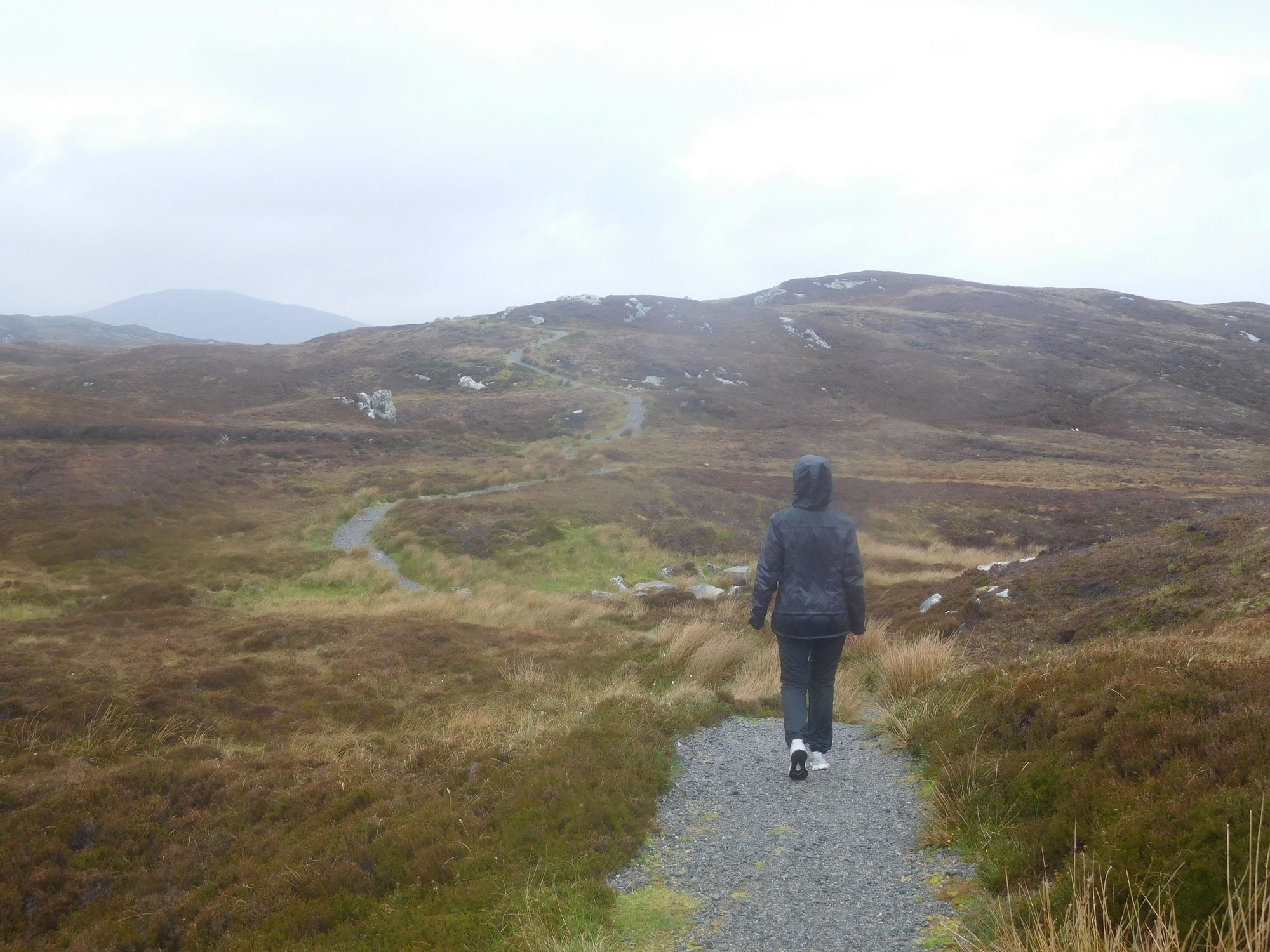
We filled some petrol at the Ardhsaig fuel station and then headed to Meavaig for the eagle observatory.
The road to Maavaig
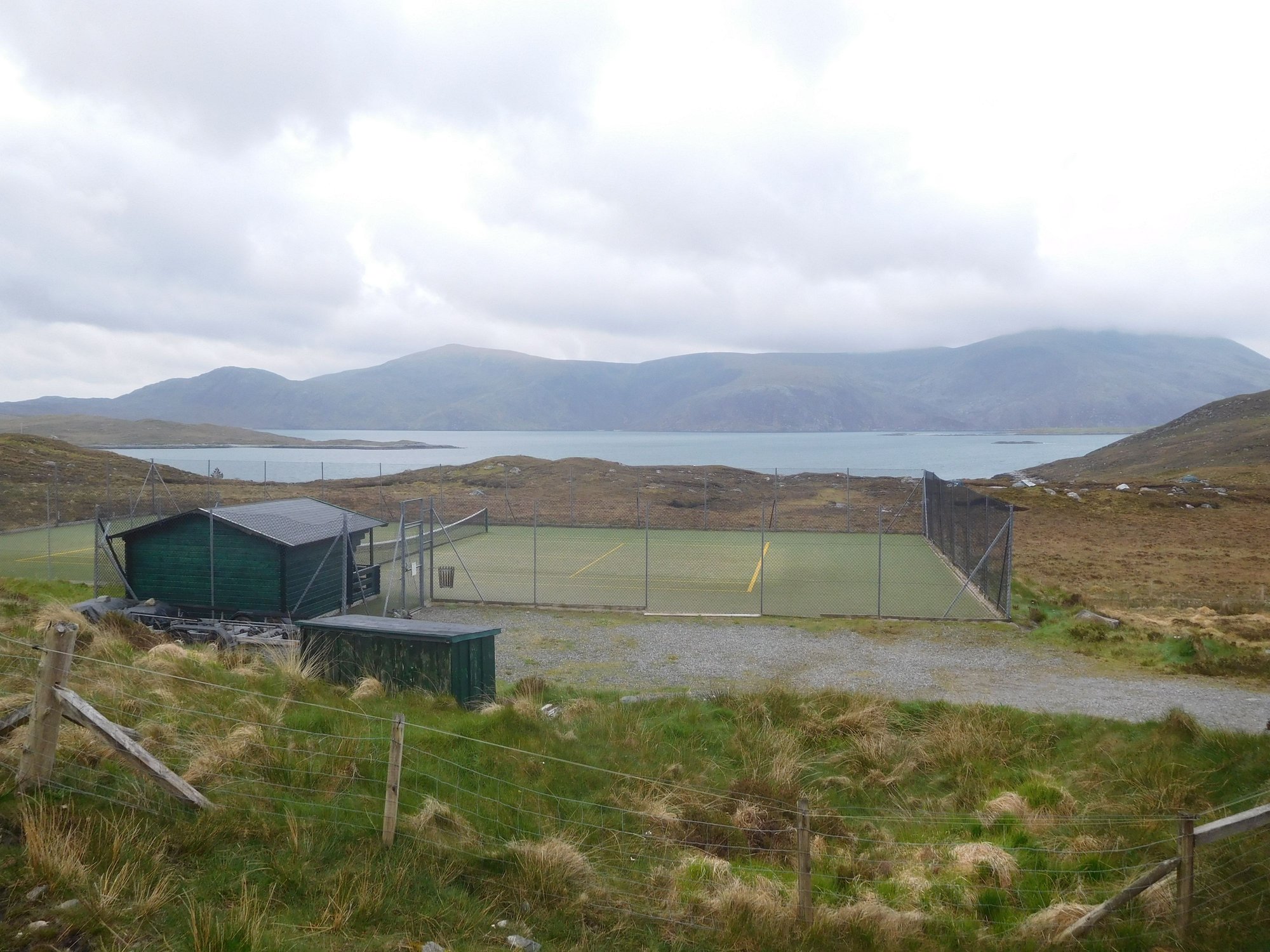
Bunabhainneadar Tennis Court, fancy a game anyone?
It’s a 2km walk from the car park through an absolutely beautiful glen to the hide. A group of two serious birdwatchers were already there, and we were happy to follow their lead. We found a pair of binoculars there for use by visitors and began looking. Over the course of about 75 minutes, we spotted three eagles - it’s a majestic sight watching them circling the skies in search for food.
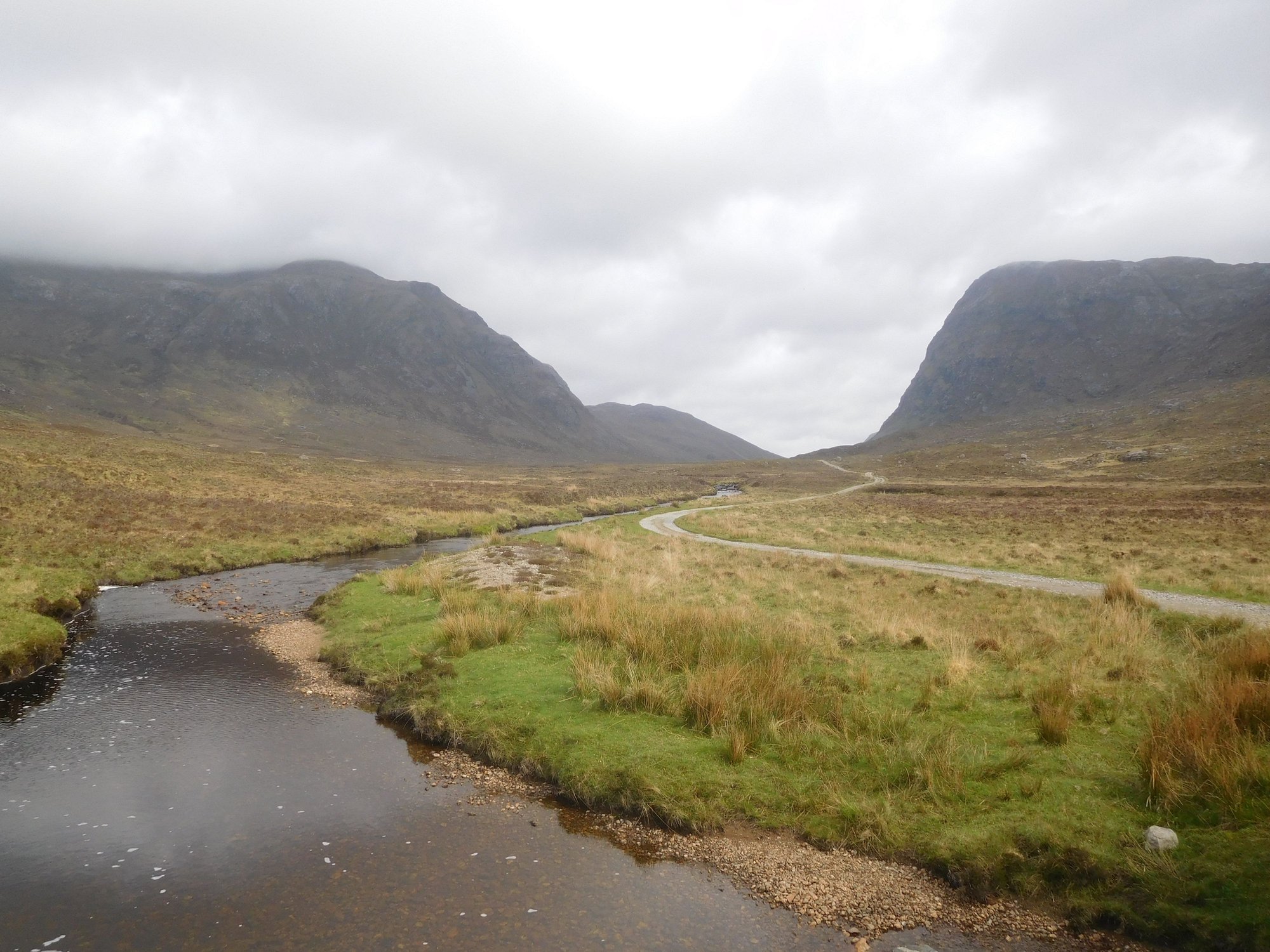
The glen
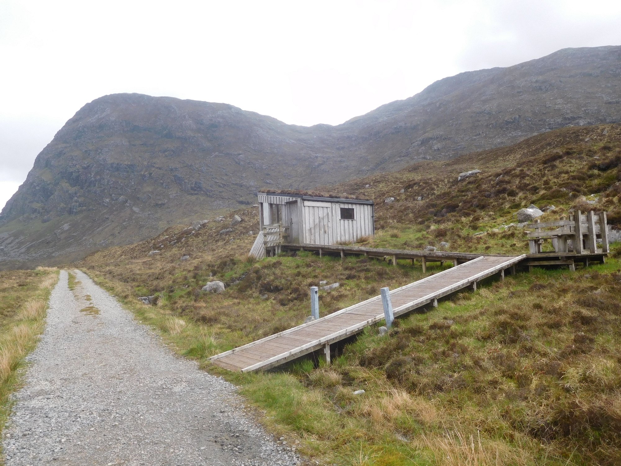
Approaching the hide
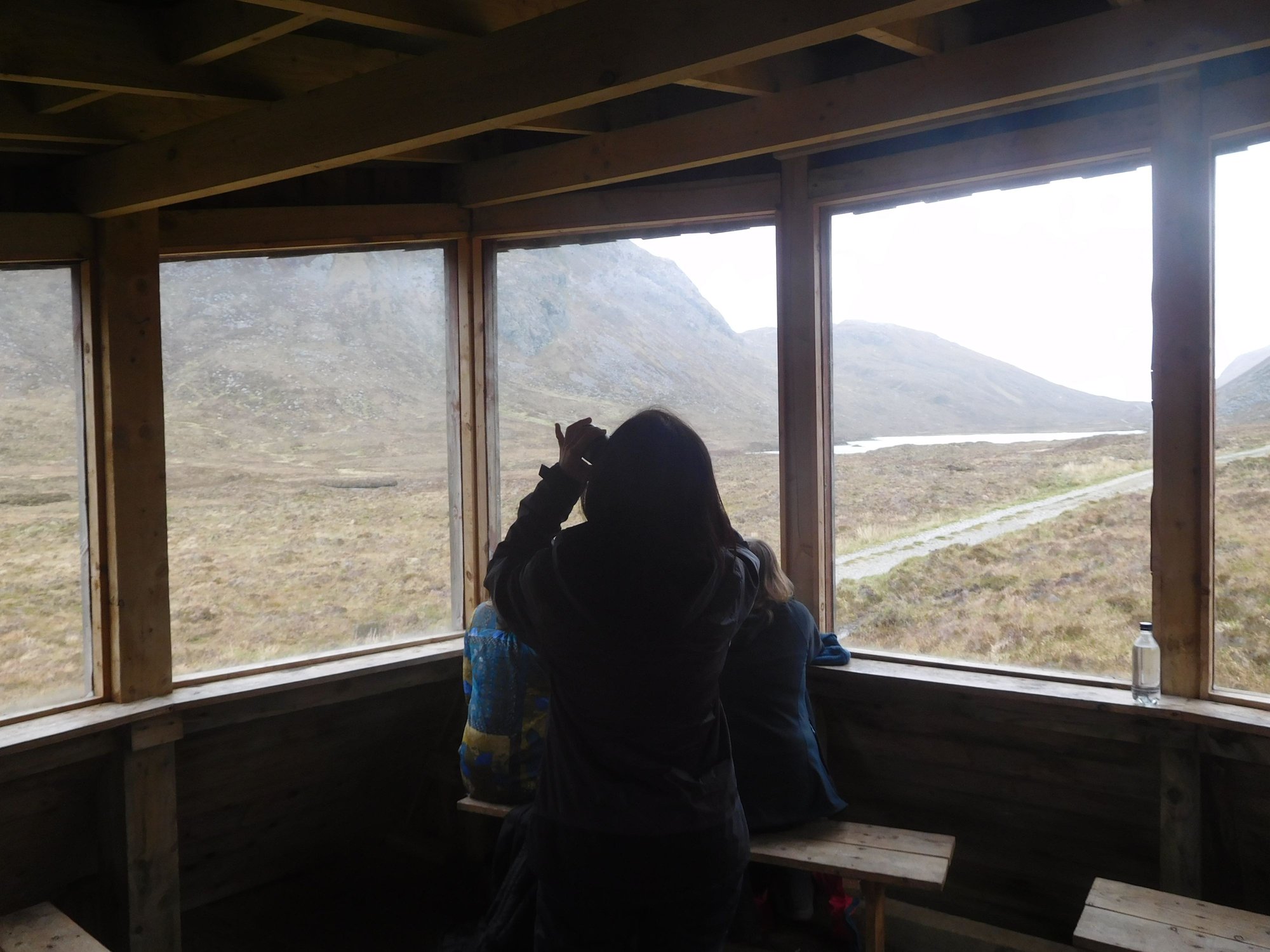
Inside the hide
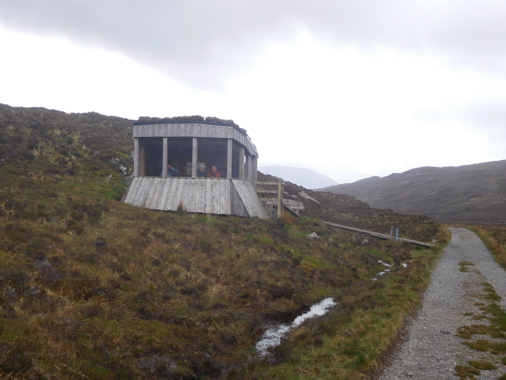
Leaving for the car park
After that we headed further west along the B887, with the road literally passing by the front door of the privately owned Amhuinnsuidhe Castle.

The castle
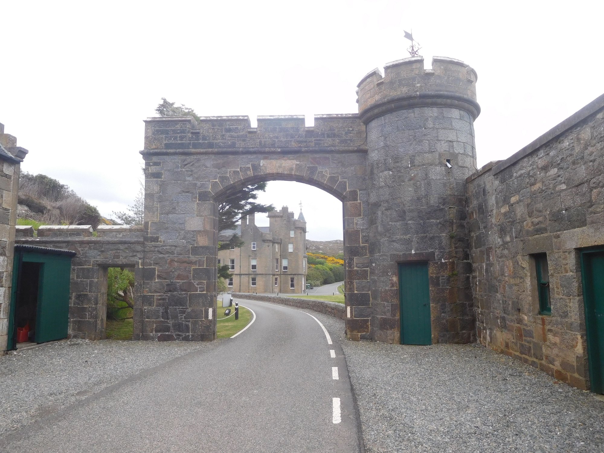
.. and the road passed through the grounds !
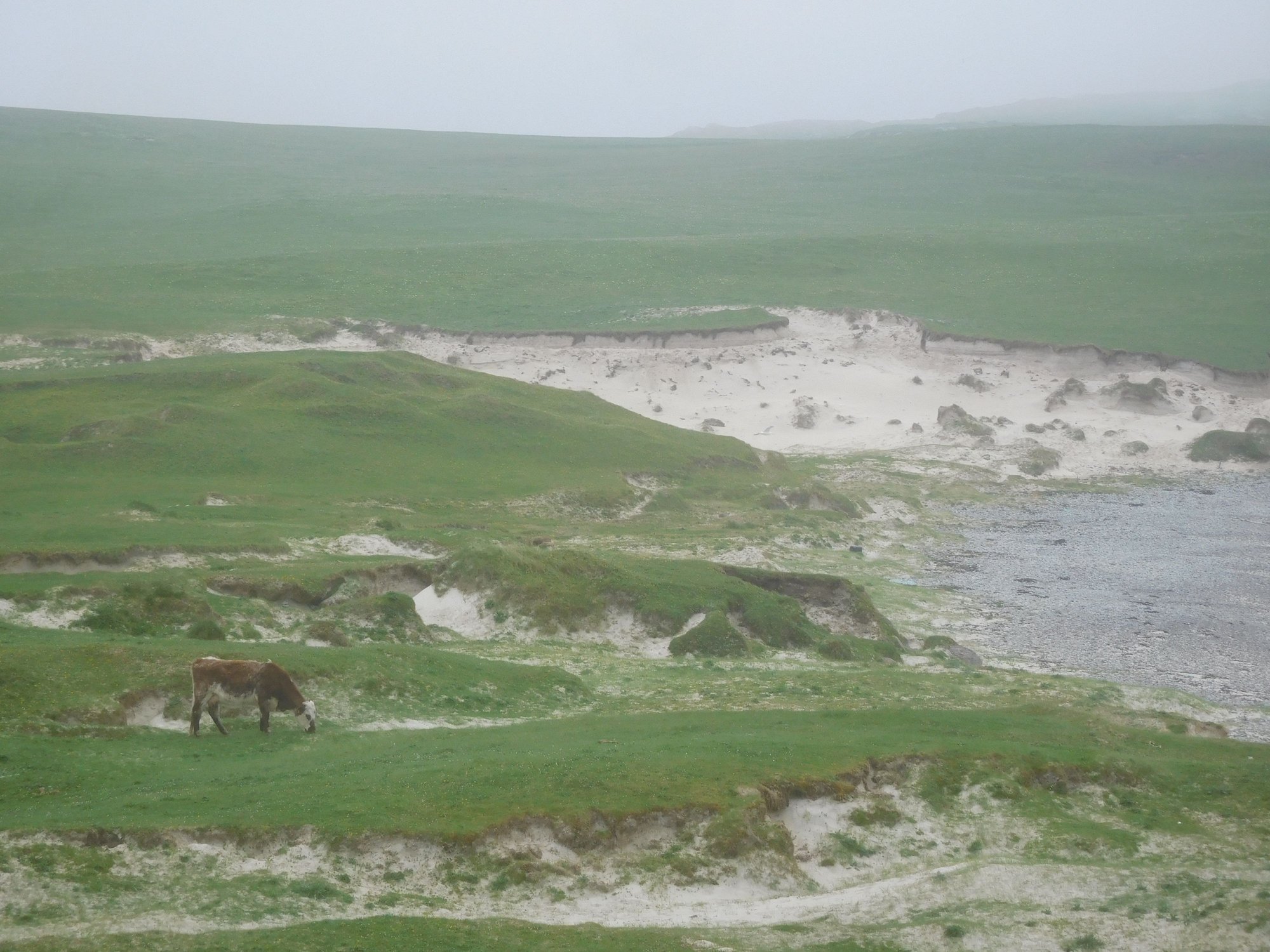
Our final stop was Hushinish, with a beautifully remote sandy beach. As we returned, some cows had come onto the road, and we had to wait for them to let us pass !
Aproaching Hushinish
At the beach
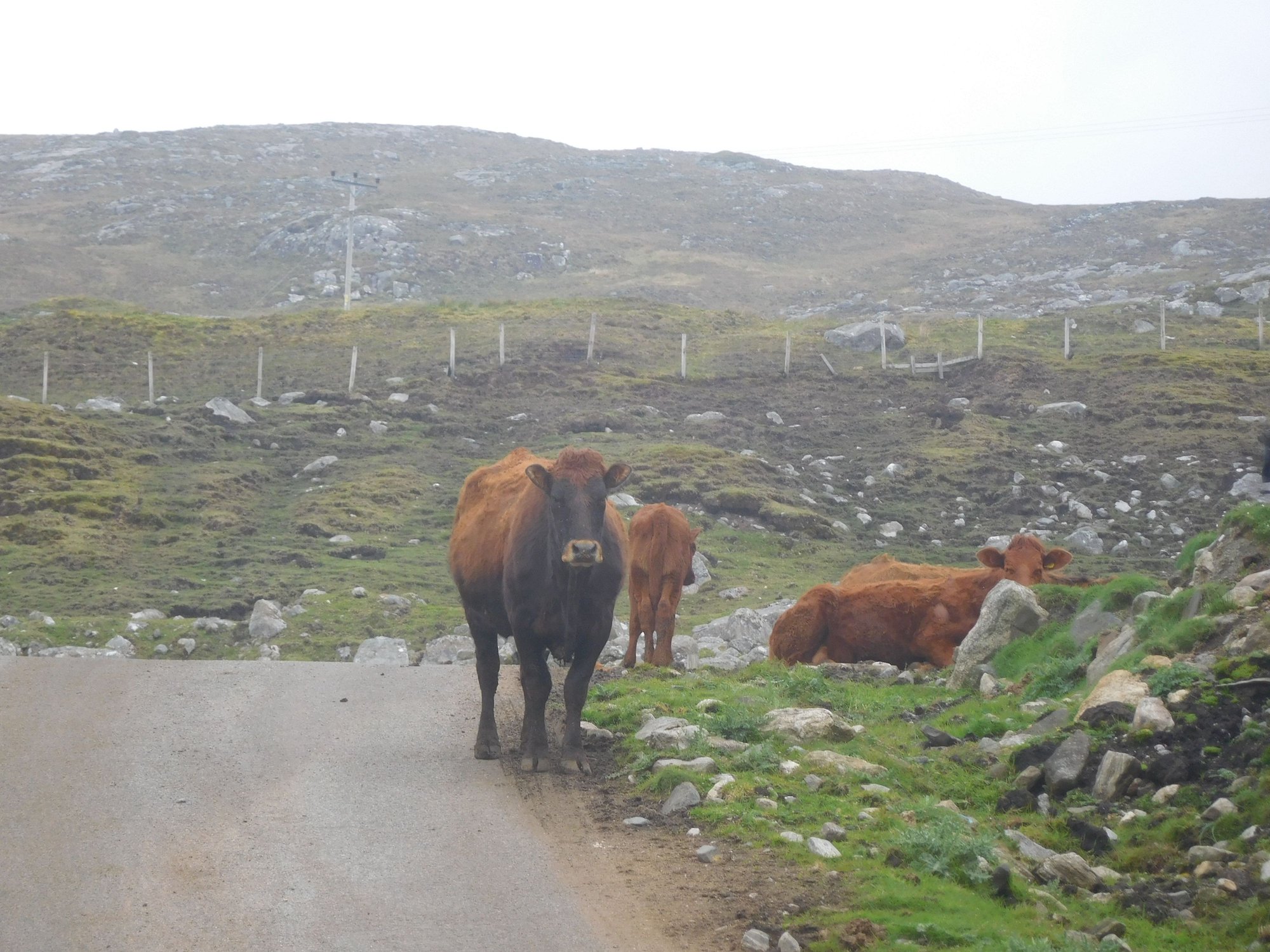
The cattle blockade !
We returned to Tarbert, enjoying some wonderful Harris scenery again.
.
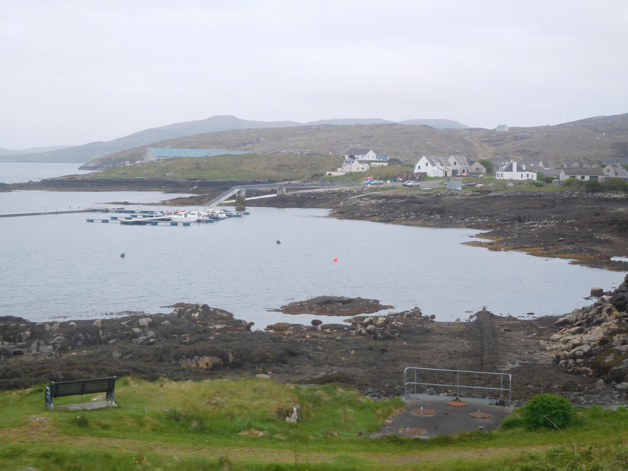
Later that afternoon, we took the road heading east from Tarbert to Scalpay.
Past the bridge ...
.. and onwards to Scalpay
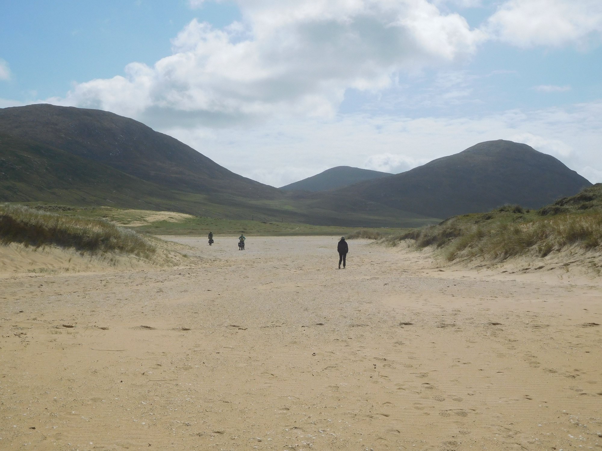
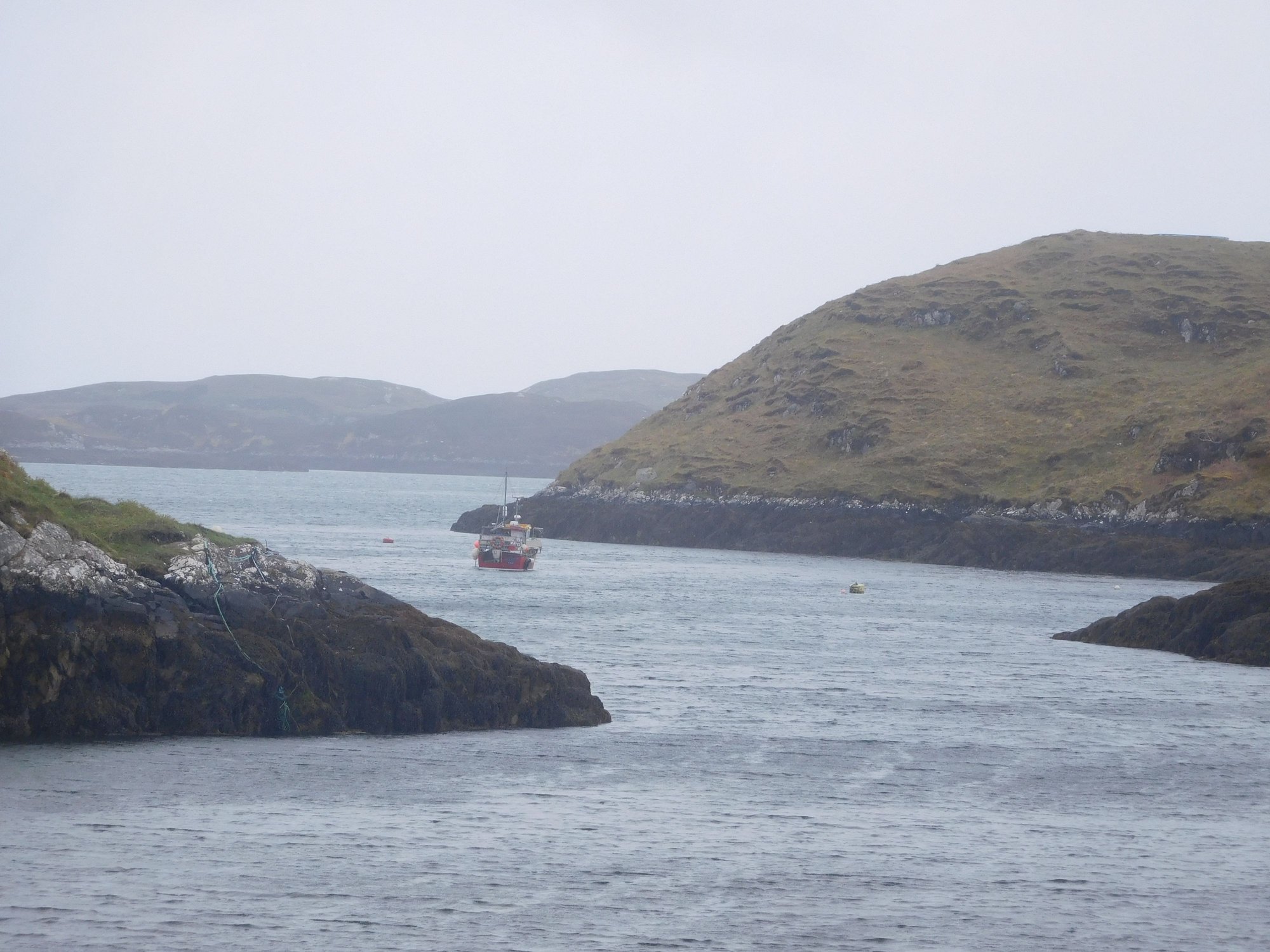
We parked at a point where there was no more road to drive on (!) at Kennavay (marked the Outend Car Park on maps). From here we began our 2km walk to the lands' end where the Eilean Glas Lighthouse sits. It had begun to rain quite heavily again, so we didn’t linger for long and headed back to our car and returned to Tarbert.
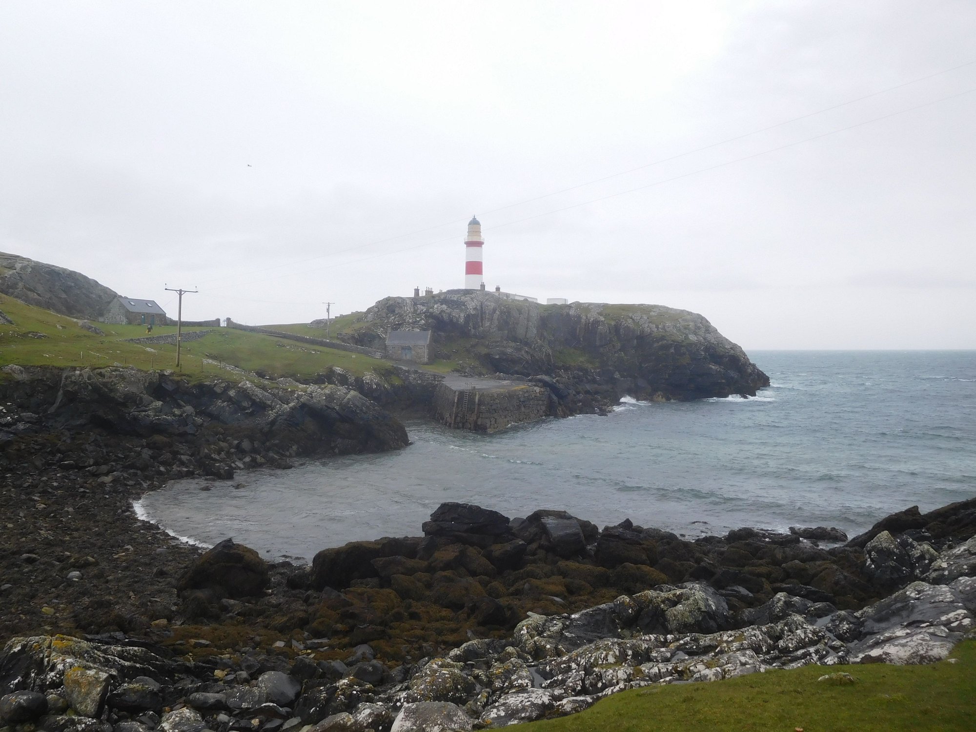
The lighthouse finally appears after a long walk
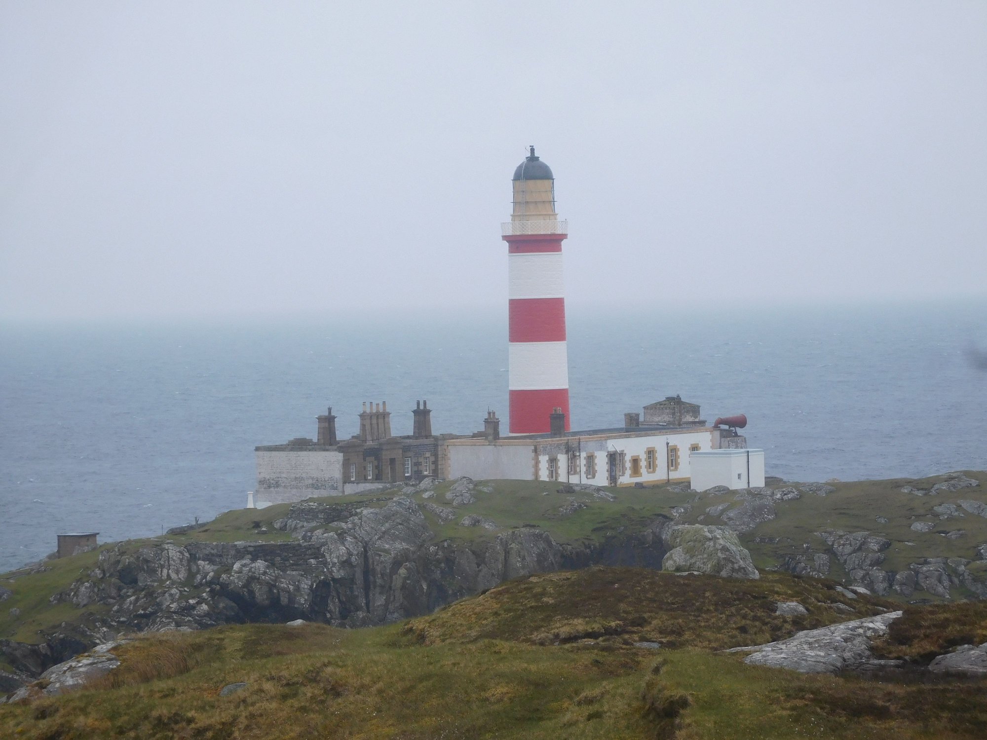
Closer view
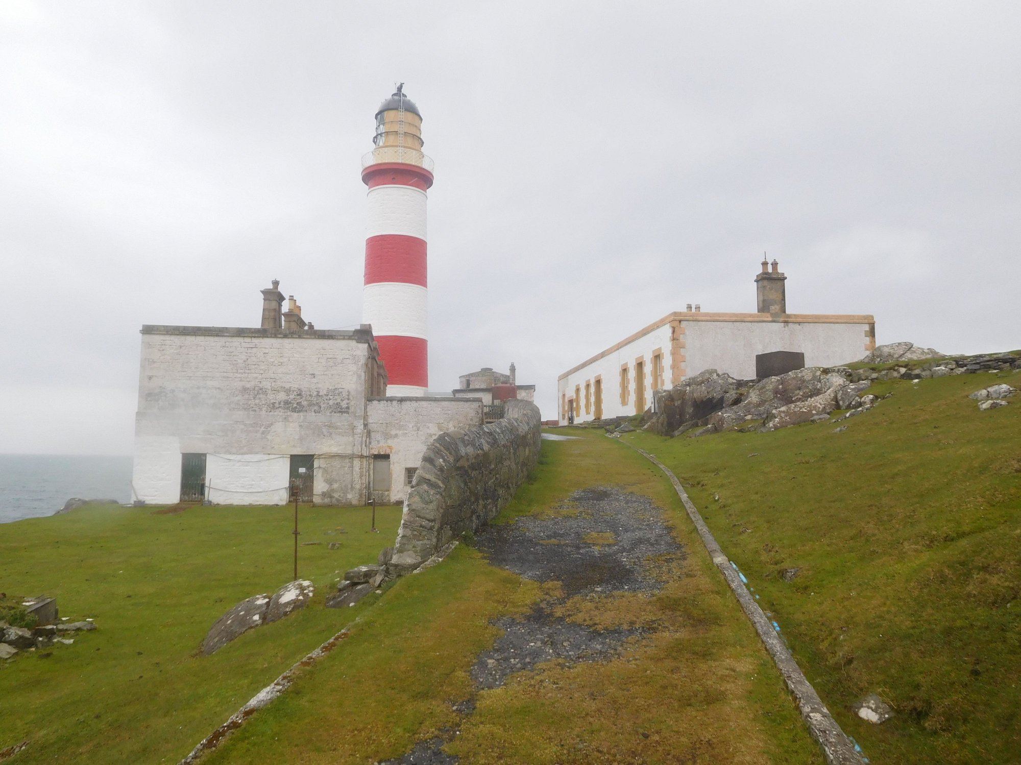
At the lighthouse, there's a cafe on site now
Returning to the car park
Our four days in Lewis and Harris had been incredibly rewarding. We had an early start next morning, and slept after an early meal at Island Bites, the very popular local food truck.
We filled some petrol at the Ardhsaig fuel station and then headed to Meavaig for the eagle observatory.
The road to Maavaig
Bunabhainneadar Tennis Court, fancy a game anyone?
It’s a 2km walk from the car park through an absolutely beautiful glen to the hide. A group of two serious birdwatchers were already there, and we were happy to follow their lead. We found a pair of binoculars there for use by visitors and began looking. Over the course of about 75 minutes, we spotted three eagles - it’s a majestic sight watching them circling the skies in search for food.
The glen
Approaching the hide
Inside the hide
Leaving for the car park
After that we headed further west along the B887, with the road literally passing by the front door of the privately owned Amhuinnsuidhe Castle.
The castle
.. and the road passed through the grounds !
Our final stop was Hushinish, with a beautifully remote sandy beach. As we returned, some cows had come onto the road, and we had to wait for them to let us pass !
Aproaching Hushinish
At the beach
The cattle blockade !
We returned to Tarbert, enjoying some wonderful Harris scenery again.
.
Later that afternoon, we took the road heading east from Tarbert to Scalpay.
Past the bridge ...
.. and onwards to Scalpay
We parked at a point where there was no more road to drive on (!) at Kennavay (marked the Outend Car Park on maps). From here we began our 2km walk to the lands' end where the Eilean Glas Lighthouse sits. It had begun to rain quite heavily again, so we didn’t linger for long and headed back to our car and returned to Tarbert.
The lighthouse finally appears after a long walk
Closer view
At the lighthouse, there's a cafe on site now
Returning to the car park
Our four days in Lewis and Harris had been incredibly rewarding. We had an early start next morning, and slept after an early meal at Island Bites, the very popular local food truck.
Jun 16th, 2023 | 06:54 AM
#69
Joined: Mar 2003
Posts: 6,222
Likes: 0
Regarding the crowds on Skye, it wasn't as bad as we were expecting. Even though all the accommodations in Portree had "No Vacancy" signs, the roads were not as busy as we thought they would be. Many places we didn't see any cars at all. The car parks were busy, but we always found a parking spot. So I think June is still a good time to visit. July and August would be more crowded. I plan to write a trip report in mid-July when I return from visiting our grandchildren in Texas. We hop on another plane this Monday! Yikes!
ANUJ, I love your trip to Scotland. You certainly visited some more remote and out of the way places. I love your photos of the beaches, the cows, the lone boat, and the lighthouse!
ANUJ, I love your trip to Scotland. You certainly visited some more remote and out of the way places. I love your photos of the beaches, the cows, the lone boat, and the lighthouse!
Jun 16th, 2023 | 08:57 PM
#71
Original Poster
Joined: Oct 2005
Posts: 931
Likes: 28
DAY 20 : Eriskay, South Uist
Our host in Tarbert had congratulated us for not having to experience typical “Island Weather” during our stay. Our lucky streak ended today, with near-continuous rain as we traversed most of Uist.
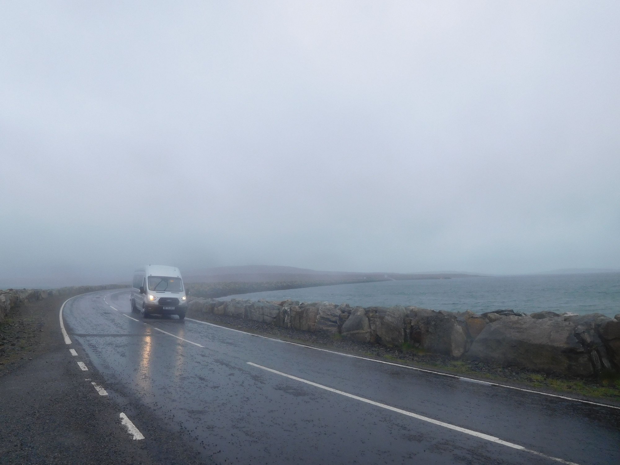
We set off from Tarbert to Leverburgh, to catch our ferry (about an hour's crossing) to Berneray (the northern tip of Uist). Uist is the "middle group" of islands in the Outer Hebrides, connected by causeways. Our plan today was to drive the entire length (100+ kms) from North Uist to South Uist along the A865, eventually spending a night in beautiful Eriskay.
Seal Viewing point near Berneray harbour
On the causeway to North Uist
We stopped briefly at the beach at Traigh Iar beach, fascinated by its neon green machair.
Traigh Iar
It was a beautiful drive through Uist - with vast and completely desolate moorland, interspersed with several lochs along the way.
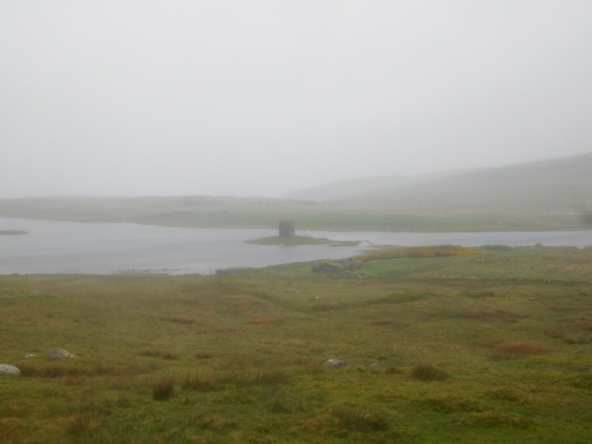
Scolpaig Tower, sitting on a loch in North Uist
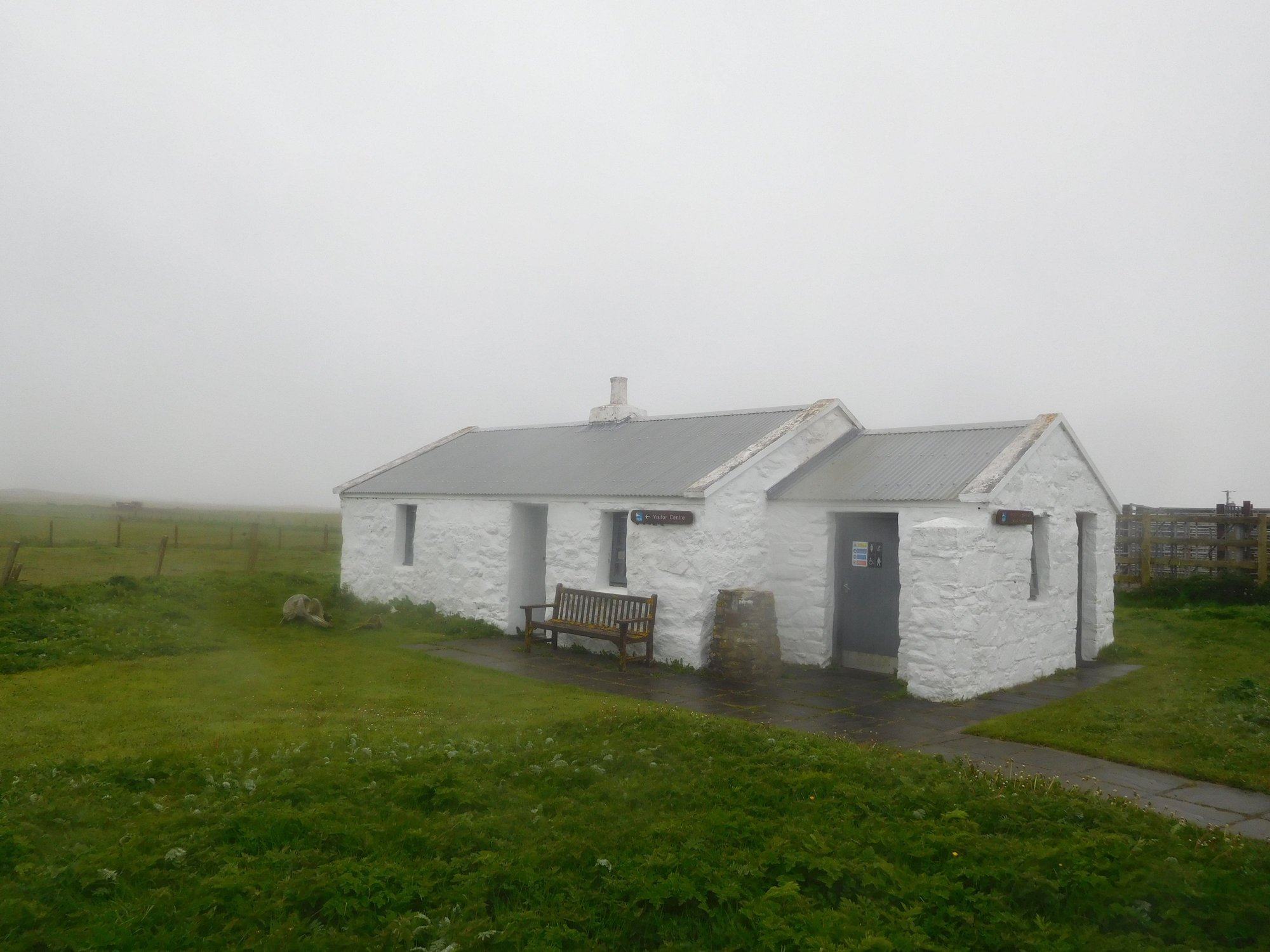
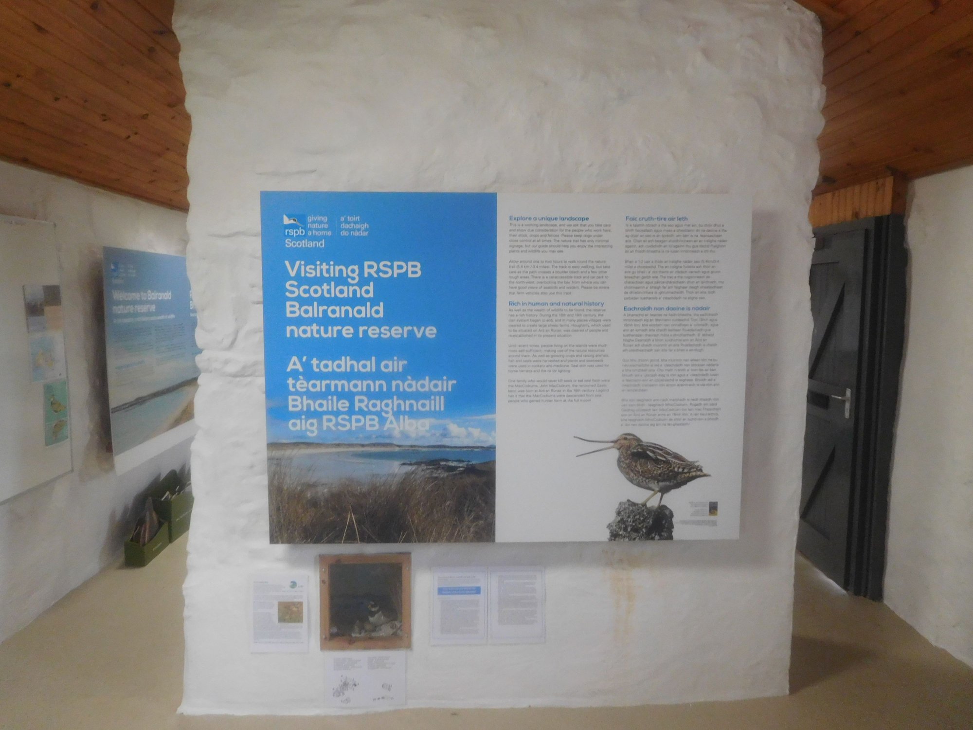
We stopped at the Balranald Nature Reserve, with lots of information boards about rare migratory birds that come here (including the elusive corncrake from Africa) and walking routes. However, it was rainy and foggy with zero chances of any sightings, so we had to move on.
At the RSPB Centre, Balranald
Inside
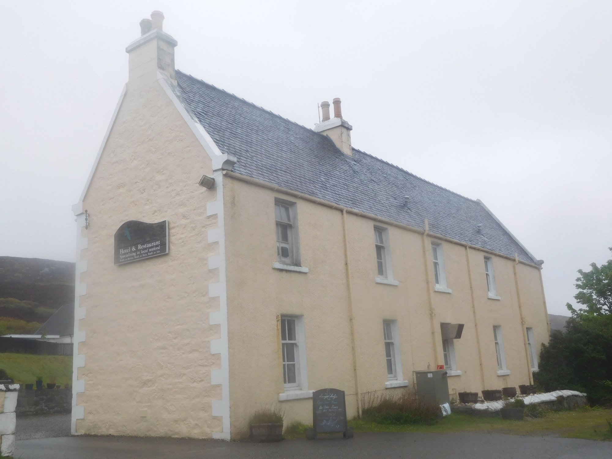
We made a short detour via Langass Lodge, a former shooting lodge and now a hotel, located in a pretty spot by Loch Eport, and sighted some deer.
The lodge
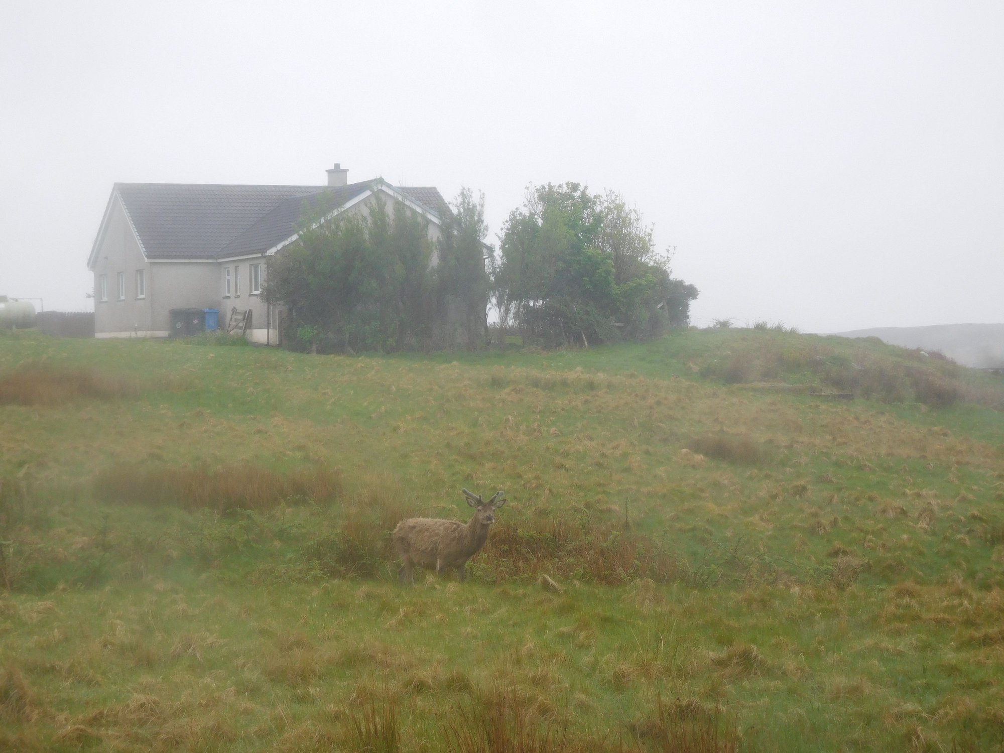
Deer
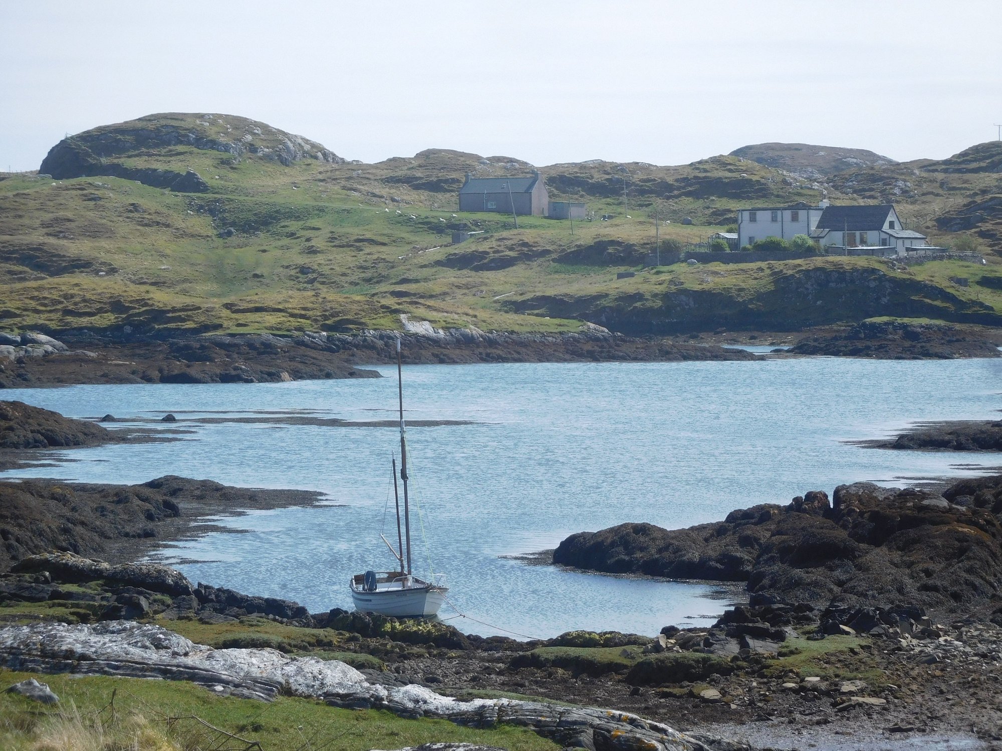
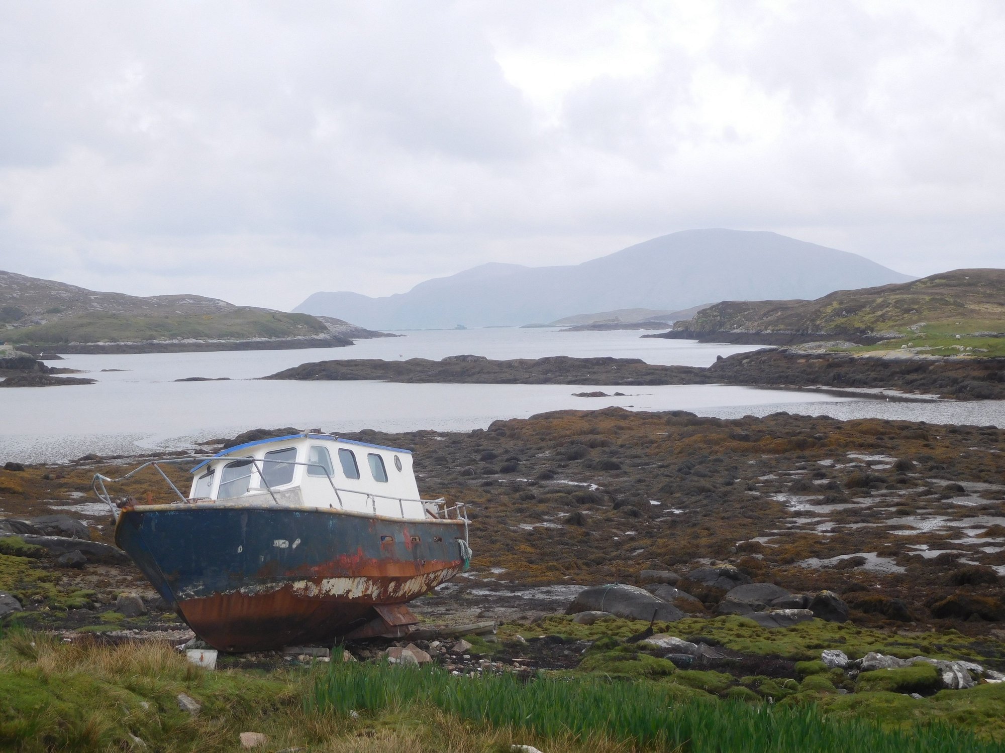
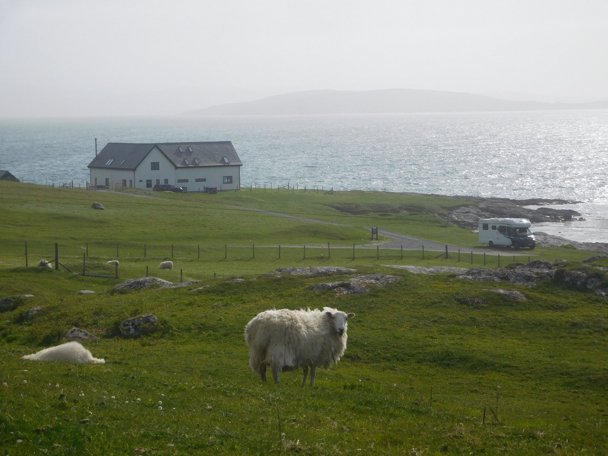
We passed Benbecula and headed down South Uist. We made another detour to Loch Skipport, an area where Shetland ponies are known to graze. At the end of a boggy path leading down to the loch, we stumbled upon a group of animal watchers animatedly observing something through their bincoulars and other high tech equipment, my eyes only saw a boat. I overheard that an orca was spotted some days ago in the estuary appearing in the second photo below.
On the way
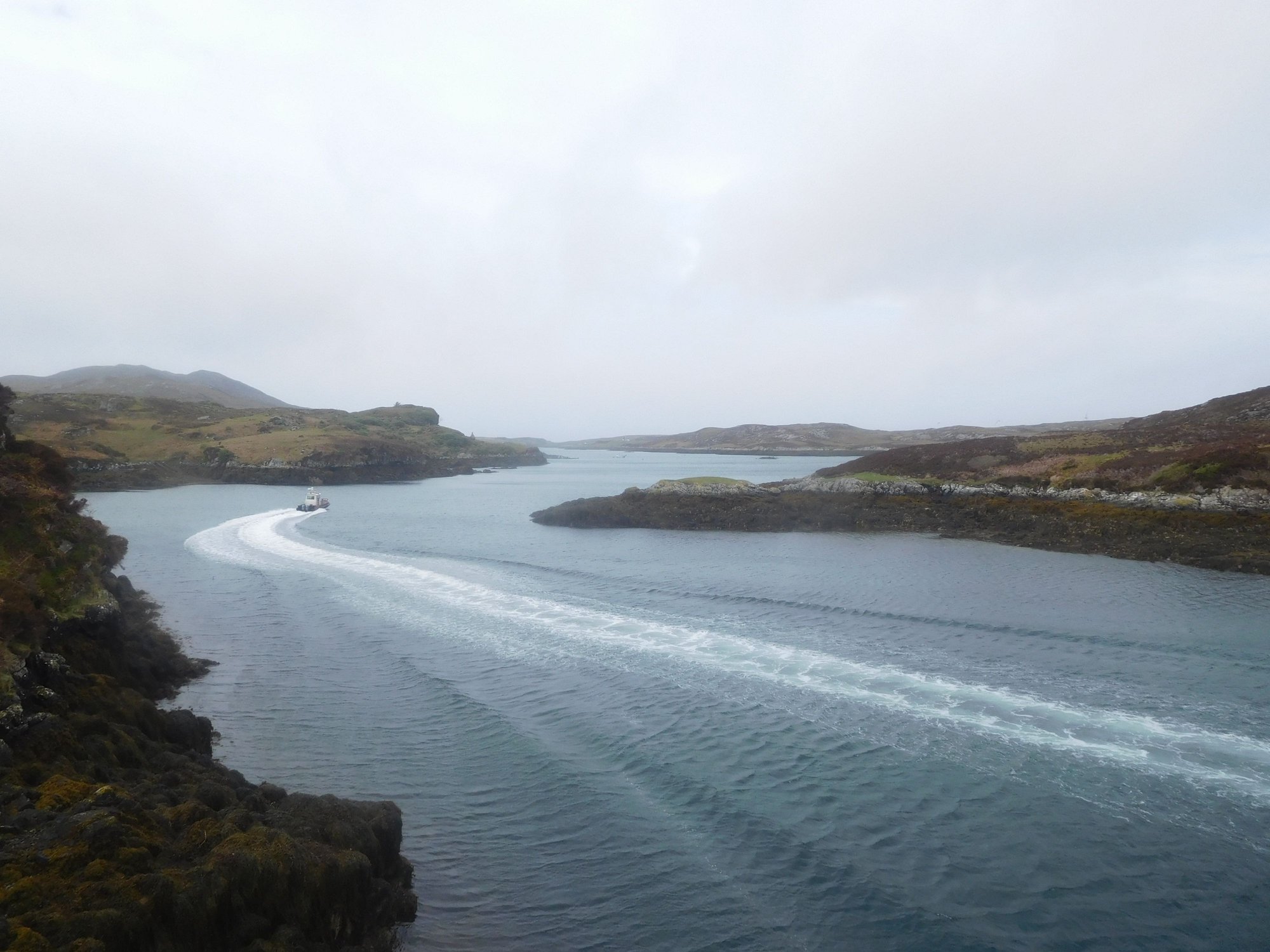
At Loch Skipport
As we were returning, we encountered Shetland ponies walking in the middle of the road. I asked my wife to pull down her window and attempt a close-up photo as we passed. As we got near, a curious (possibly hungry) pony unexpectedly shoved his head into the car, and my wife recoiled in shock. I flapped my side mirrors open and close to nudge him away and finally edged past. I expected my wife to give me a earful about this close encounter of the animal kind, instead she exclaimed “What a stinky mouth!” My wife has unreasonable expectations of oral hygiene, even from wild animals.
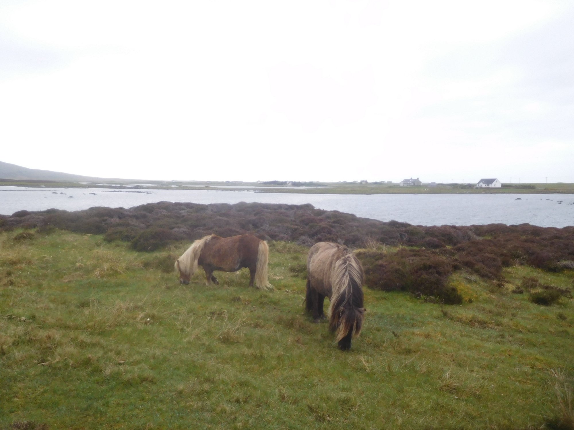
Shetland ponies
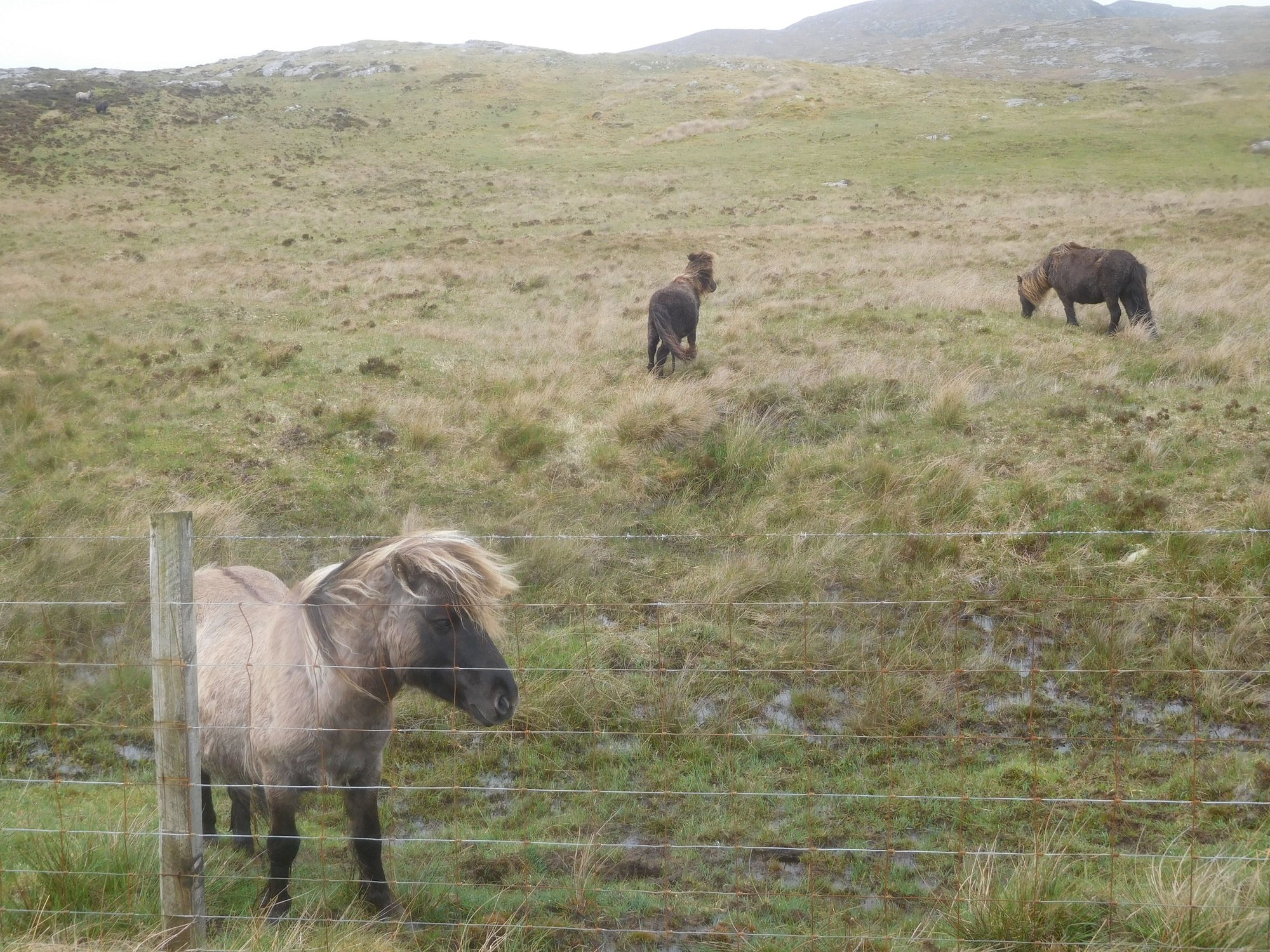
More ponies
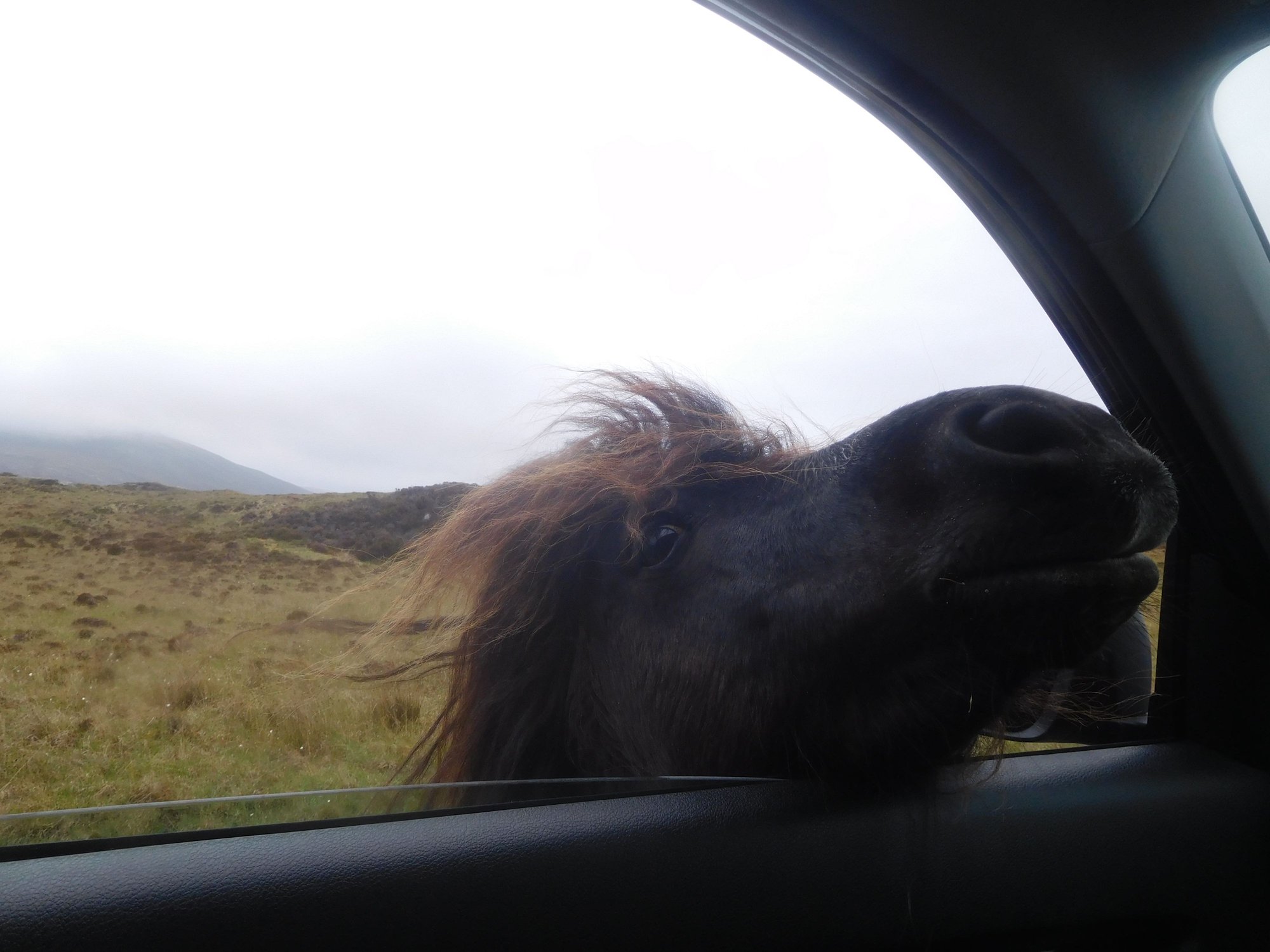
.. and this one shoves his head in!
We stopped for fuel and groceries near the Co Op at Daliburgh. We continued driving past the Polochar Inn till we got to the long causeway to Eriskay, and made our way to our B&B.
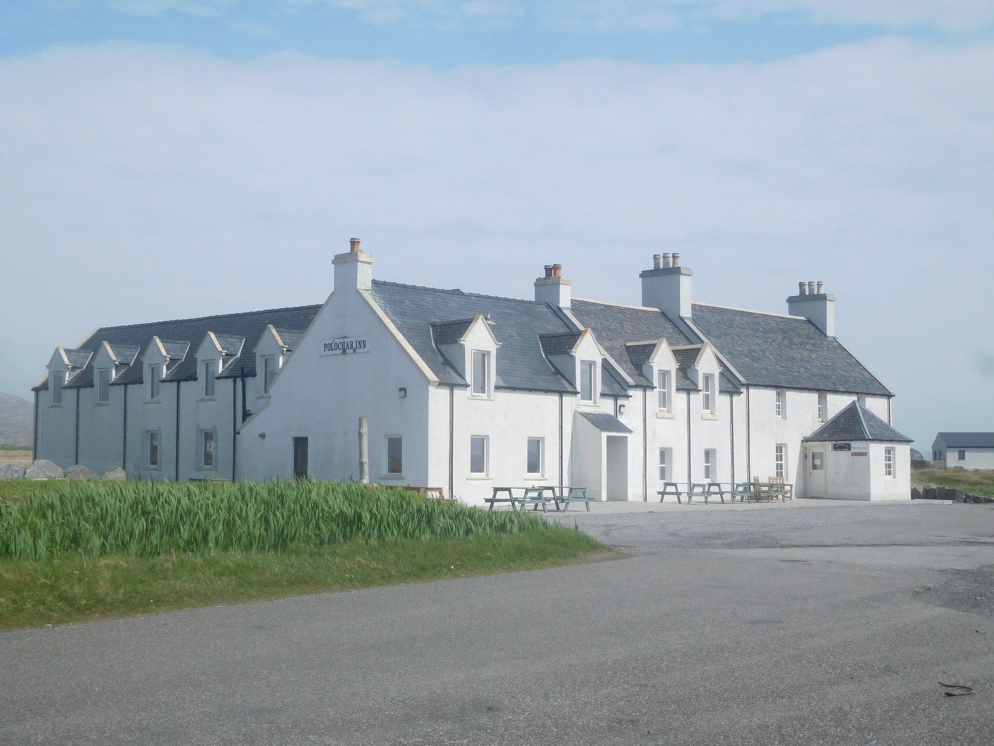
The Polochar Inn
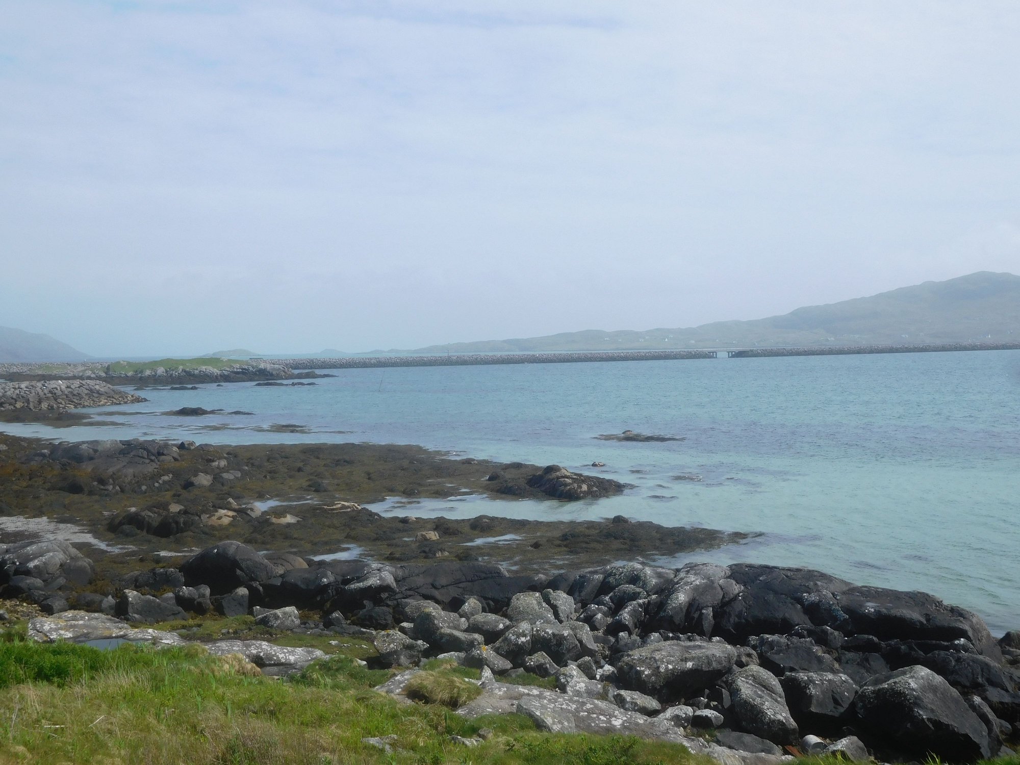
The Ersikay causeway, appears as a thin black line across the water
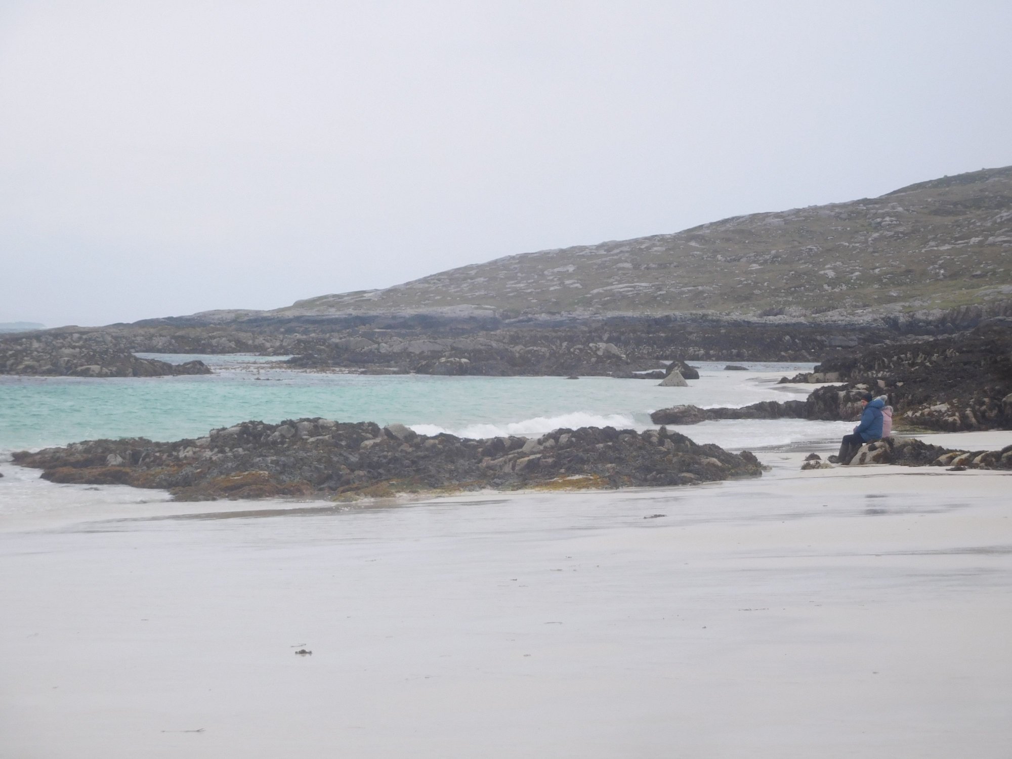
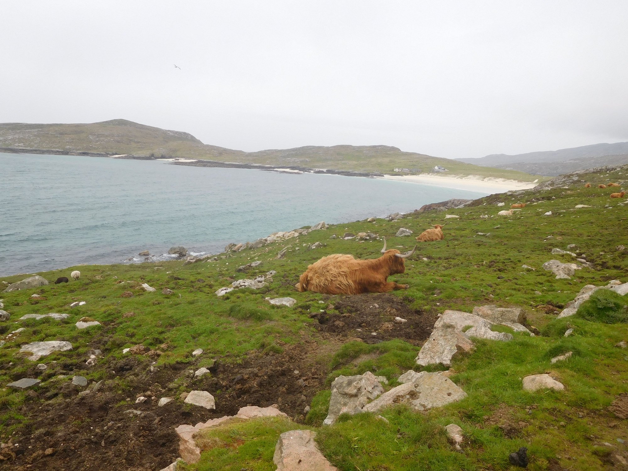
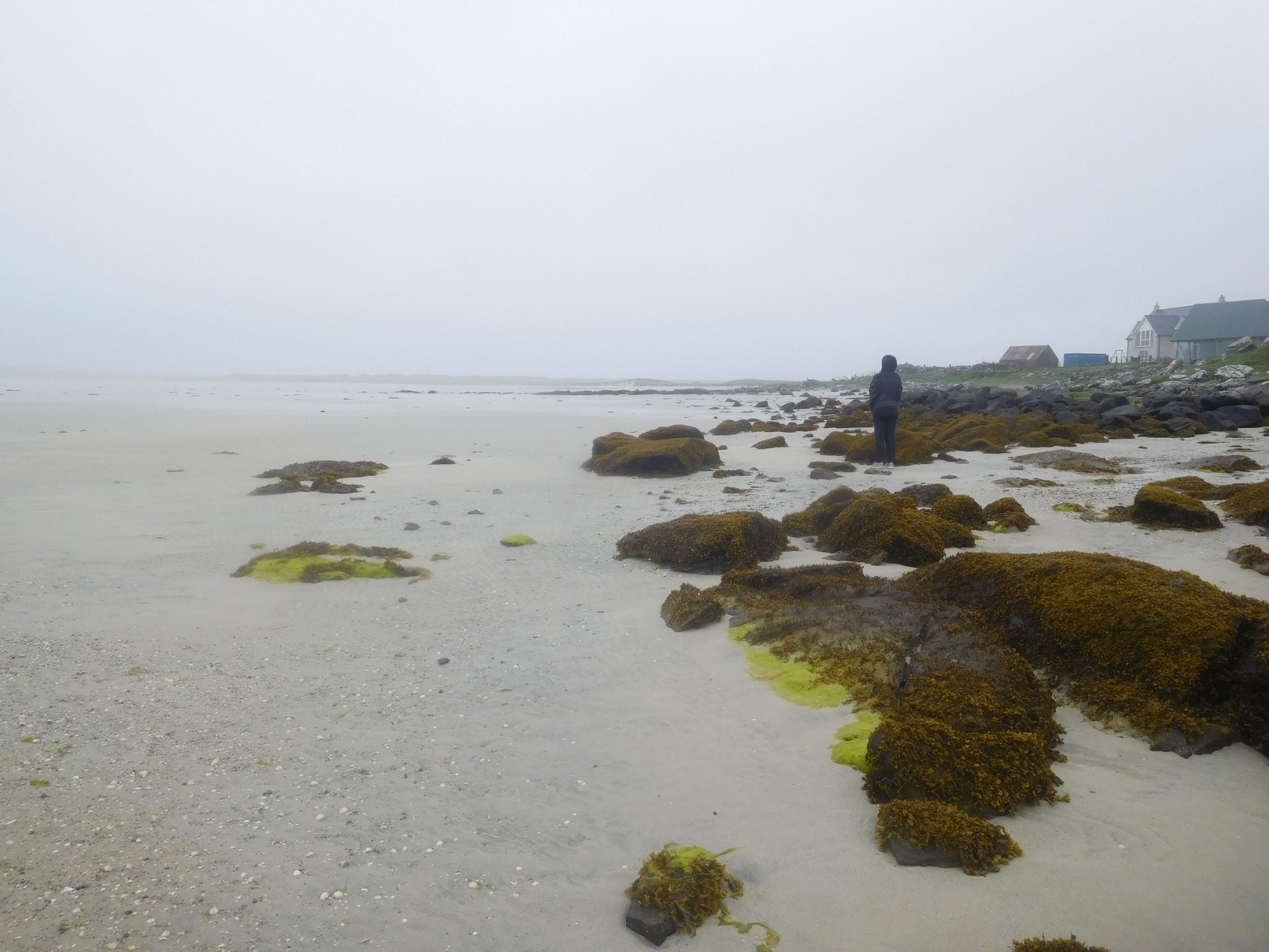
The skies had cleared completely, and we relaxed at the the beautiful (completely private!) beach, just across the road from our B&B.
View of beach
View of beach
Faint silhouette of Lingay island
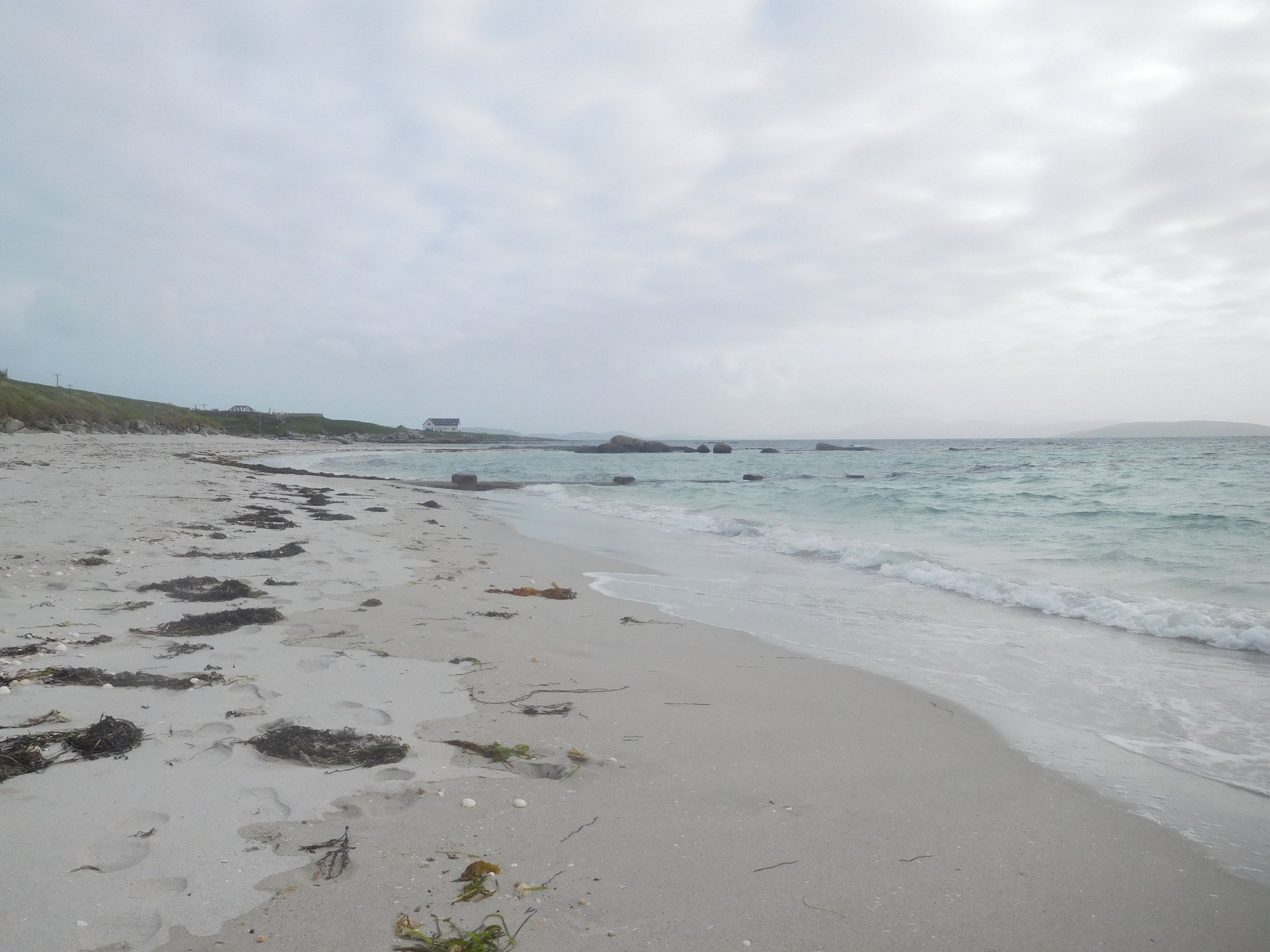
At the beach, not a soul in sight
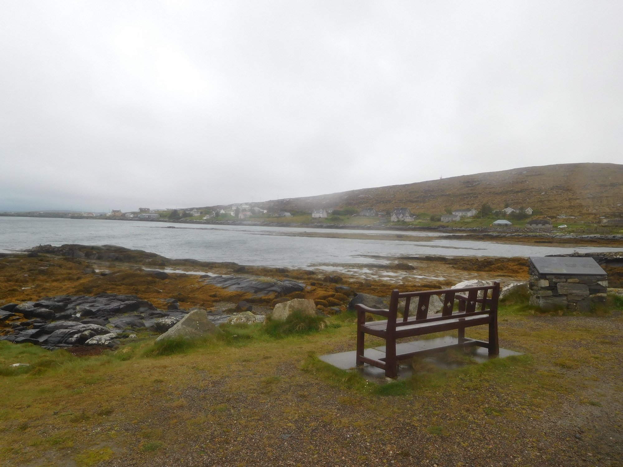
Eriskay is a beautiful, tiny village with few houses (population of ~150), a community store, a pub and a football ground acknowledged by FIFA as one of the most remarkable places to play football in the world!
Walking around the village
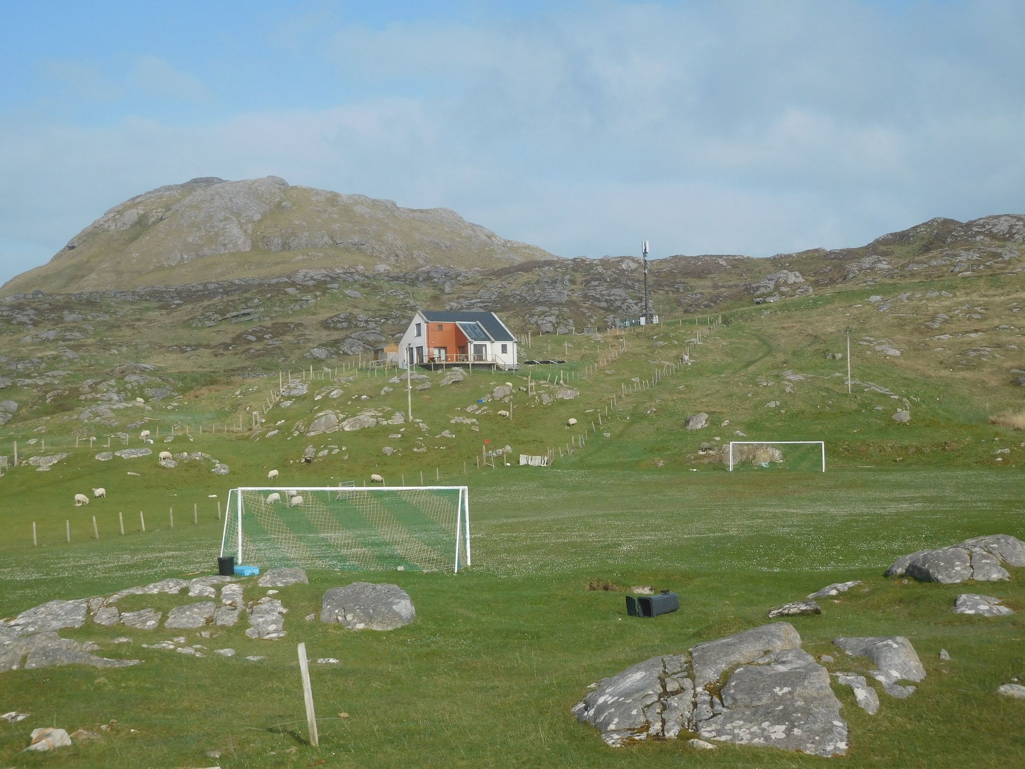
Eriskay football pitch
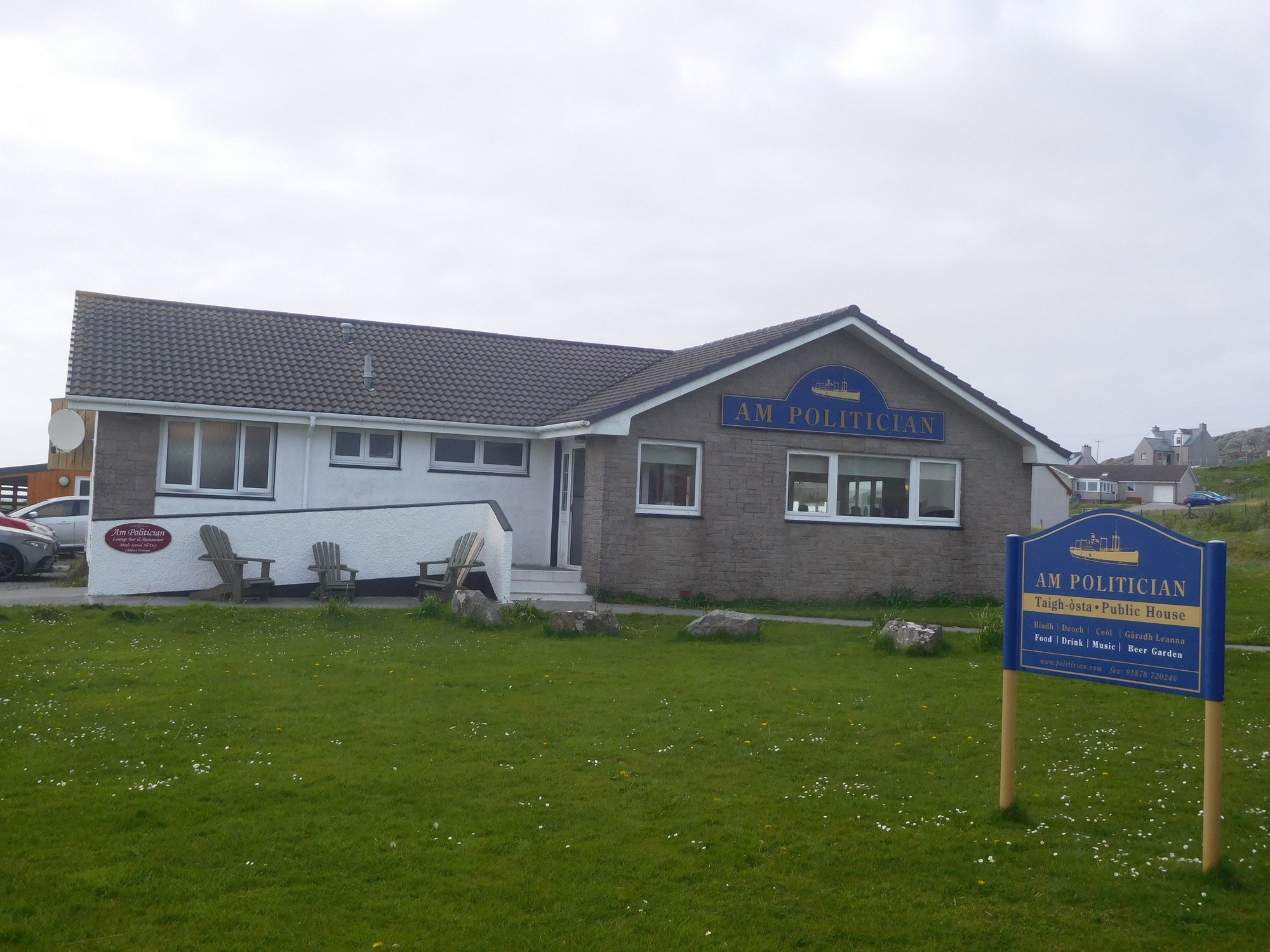
The local pub
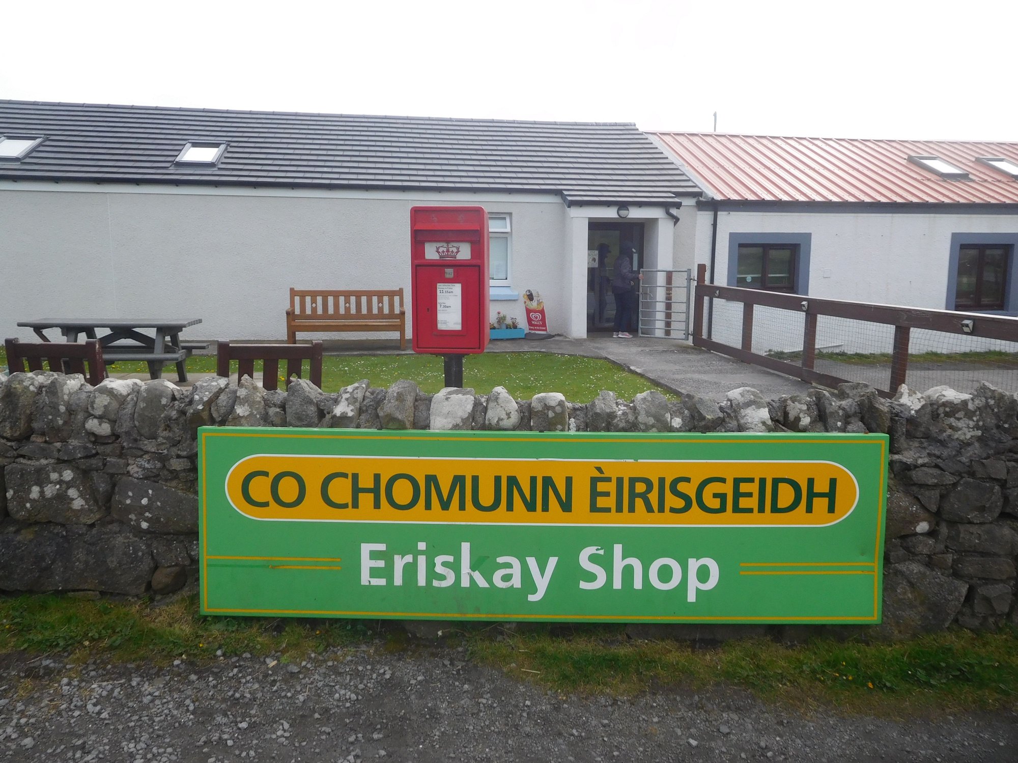
The local store

Views from St Michael's church
Coming next : Our final 2 days in the Outer Hebrides in beautiful Barra …
We set off from Tarbert to Leverburgh, to catch our ferry (about an hour's crossing) to Berneray (the northern tip of Uist). Uist is the "middle group" of islands in the Outer Hebrides, connected by causeways. Our plan today was to drive the entire length (100+ kms) from North Uist to South Uist along the A865, eventually spending a night in beautiful Eriskay.
Seal Viewing point near Berneray harbour
On the causeway to North Uist
We stopped briefly at the beach at Traigh Iar beach, fascinated by its neon green machair.
Traigh Iar
It was a beautiful drive through Uist - with vast and completely desolate moorland, interspersed with several lochs along the way.
Scolpaig Tower, sitting on a loch in North Uist
We stopped at the Balranald Nature Reserve, with lots of information boards about rare migratory birds that come here (including the elusive corncrake from Africa) and walking routes. However, it was rainy and foggy with zero chances of any sightings, so we had to move on.
At the RSPB Centre, Balranald
Inside
We made a short detour via Langass Lodge, a former shooting lodge and now a hotel, located in a pretty spot by Loch Eport, and sighted some deer.
The lodge
Deer
We passed Benbecula and headed down South Uist. We made another detour to Loch Skipport, an area where Shetland ponies are known to graze. At the end of a boggy path leading down to the loch, we stumbled upon a group of animal watchers animatedly observing something through their bincoulars and other high tech equipment, my eyes only saw a boat. I overheard that an orca was spotted some days ago in the estuary appearing in the second photo below.
On the way
At Loch Skipport
As we were returning, we encountered Shetland ponies walking in the middle of the road. I asked my wife to pull down her window and attempt a close-up photo as we passed. As we got near, a curious (possibly hungry) pony unexpectedly shoved his head into the car, and my wife recoiled in shock. I flapped my side mirrors open and close to nudge him away and finally edged past. I expected my wife to give me a earful about this close encounter of the animal kind, instead she exclaimed “What a stinky mouth!” My wife has unreasonable expectations of oral hygiene, even from wild animals.
Shetland ponies
More ponies
.. and this one shoves his head in!
We stopped for fuel and groceries near the Co Op at Daliburgh. We continued driving past the Polochar Inn till we got to the long causeway to Eriskay, and made our way to our B&B.
The Polochar Inn
The Ersikay causeway, appears as a thin black line across the water
The skies had cleared completely, and we relaxed at the the beautiful (completely private!) beach, just across the road from our B&B.
View of beach
View of beach
Faint silhouette of Lingay island
At the beach, not a soul in sight
Eriskay is a beautiful, tiny village with few houses (population of ~150), a community store, a pub and a football ground acknowledged by FIFA as one of the most remarkable places to play football in the world!
Walking around the village
Eriskay football pitch
The local pub
The local store
Views from St Michael's church
Coming next : Our final 2 days in the Outer Hebrides in beautiful Barra …
Last edited by ANUJ; Jun 16th, 2023 at 09:08 PM.
Jun 17th, 2023 | 03:23 AM
#73
Joined: Mar 2003
Posts: 6,222
Likes: 0
To echo Adelaidean's words, so desolate and dramatic! Looks like you are at the ends of the earth. I assume these islands don't get a lot of tourists.
The beaches look like Caribbean beaches, much like Claigan Coral Beach on Skye.
The beaches look like Caribbean beaches, much like Claigan Coral Beach on Skye.
Jun 17th, 2023 | 07:56 PM
#74
Original Poster
Joined: Oct 2005
Posts: 931
Likes: 28
Thanks everyone for your comments.
The islands (particularly the Outer Hebrides) seem to attract the niche travelers (more cyclists and walkers than motorists), and have (so far) escaped the onslaught of mainstream tourism. The sustained and institutional marketing efforts around the NC500 has certainly driven tourism numbers up in the highlands.
The islands (particularly the Outer Hebrides) seem to attract the niche travelers (more cyclists and walkers than motorists), and have (so far) escaped the onslaught of mainstream tourism. The sustained and institutional marketing efforts around the NC500 has certainly driven tourism numbers up in the highlands.
Jun 17th, 2023 | 08:34 PM
#75
Original Poster
Joined: Oct 2005
Posts: 931
Likes: 28
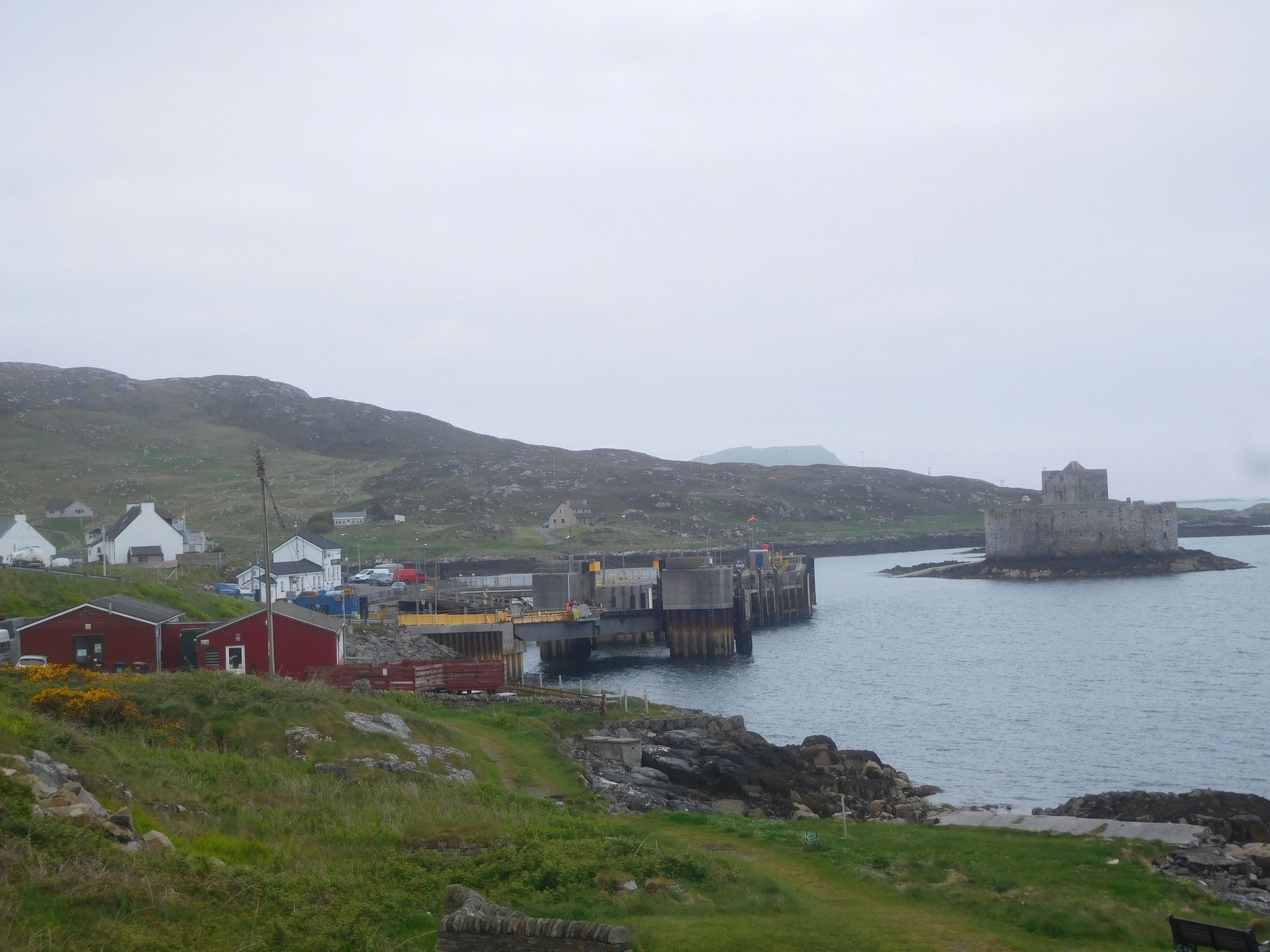
DAY 21 : Castlebay, Barra
After breakfast, we headed to Eriskay harbour to catch our morning ferry to Ardmhor in Barra. This was the shortest sailing of ~45 minutes.
Barra is home to one of the most unique airports in the world at Eoligarry, where flights use the beach as a runway. The local airline LoganAir flies twice a day to and from Glasgow. Today, the first flight was scheduled to land around 12.30pm. I was told it’s quite a spectacle, so we planned to hang around and watch. We drove to Eoligarry at the northern tip of Barra and parked by the airport, where there are 2 terrific beaches on either side. Traigh Mhor (which is used for the airstrip) and wasn’t accessible as an aircraft landing was imminent (the orange wind sock being up is a sign the beach is off-limits). The other beach is Traigh Eais, which we decided to visit while waiting for the flight. It’s beautiful stretch of sand, hidden behind a grassy hill and some dunes.
The only other family on the Traigh Eais beach
.. and us
We returned by 12.15pm to find a number of people had gathered already to watch the event. It was a fascinating experience !
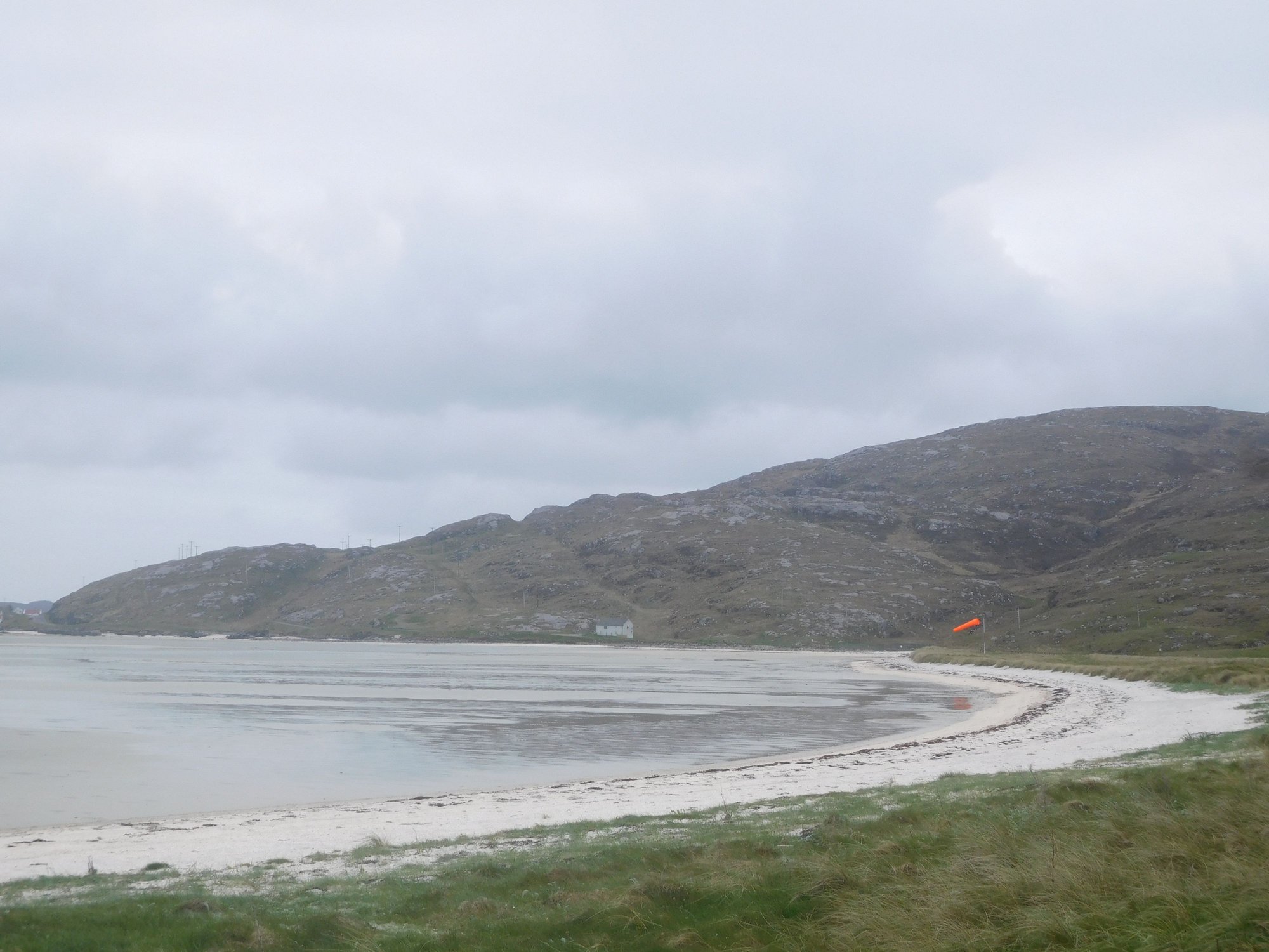
The beautiful Traigh Mor beach with orange windsock up
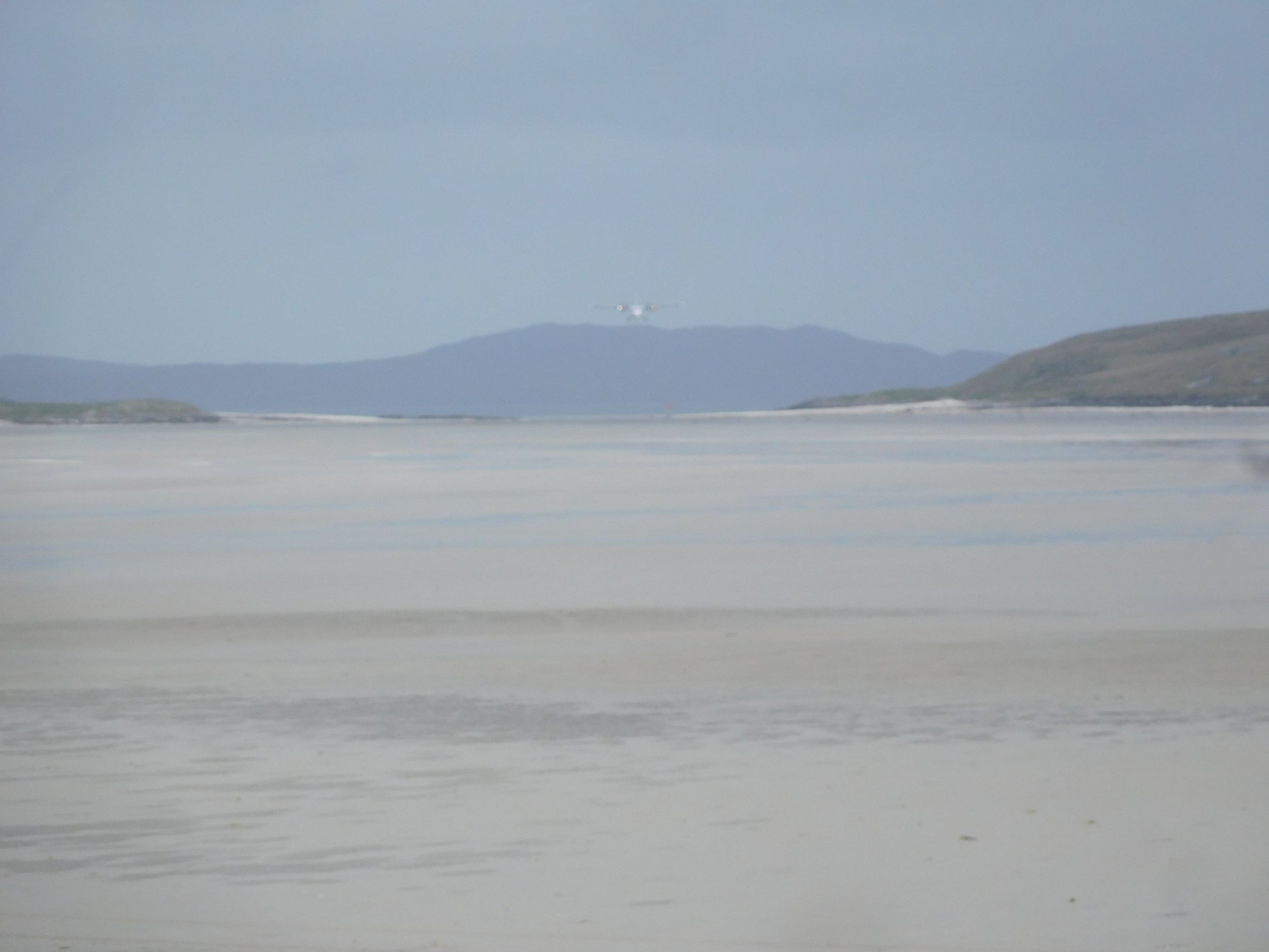
Lights in the sky ....
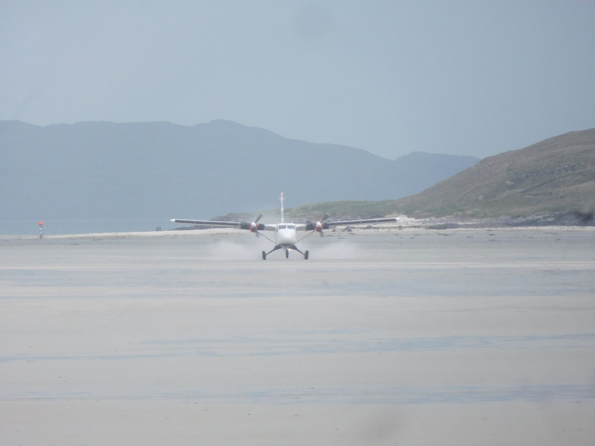
Touchdown !
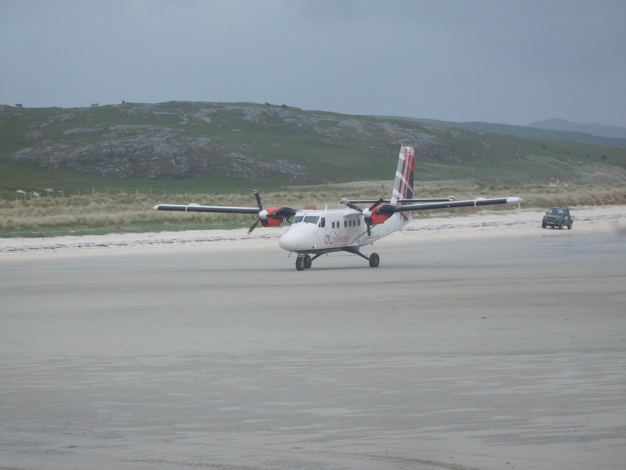
Taxiing in
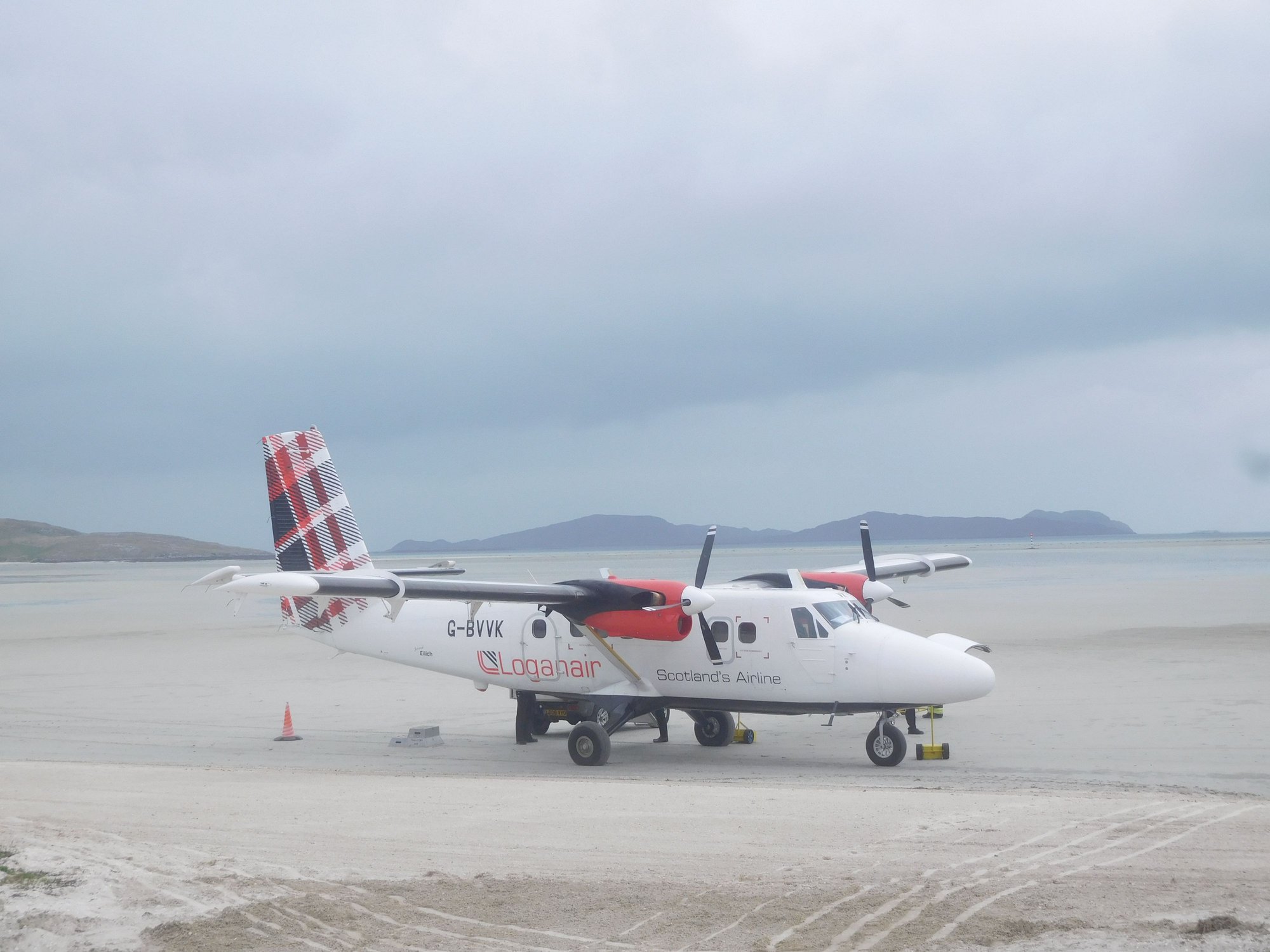
Getting parked
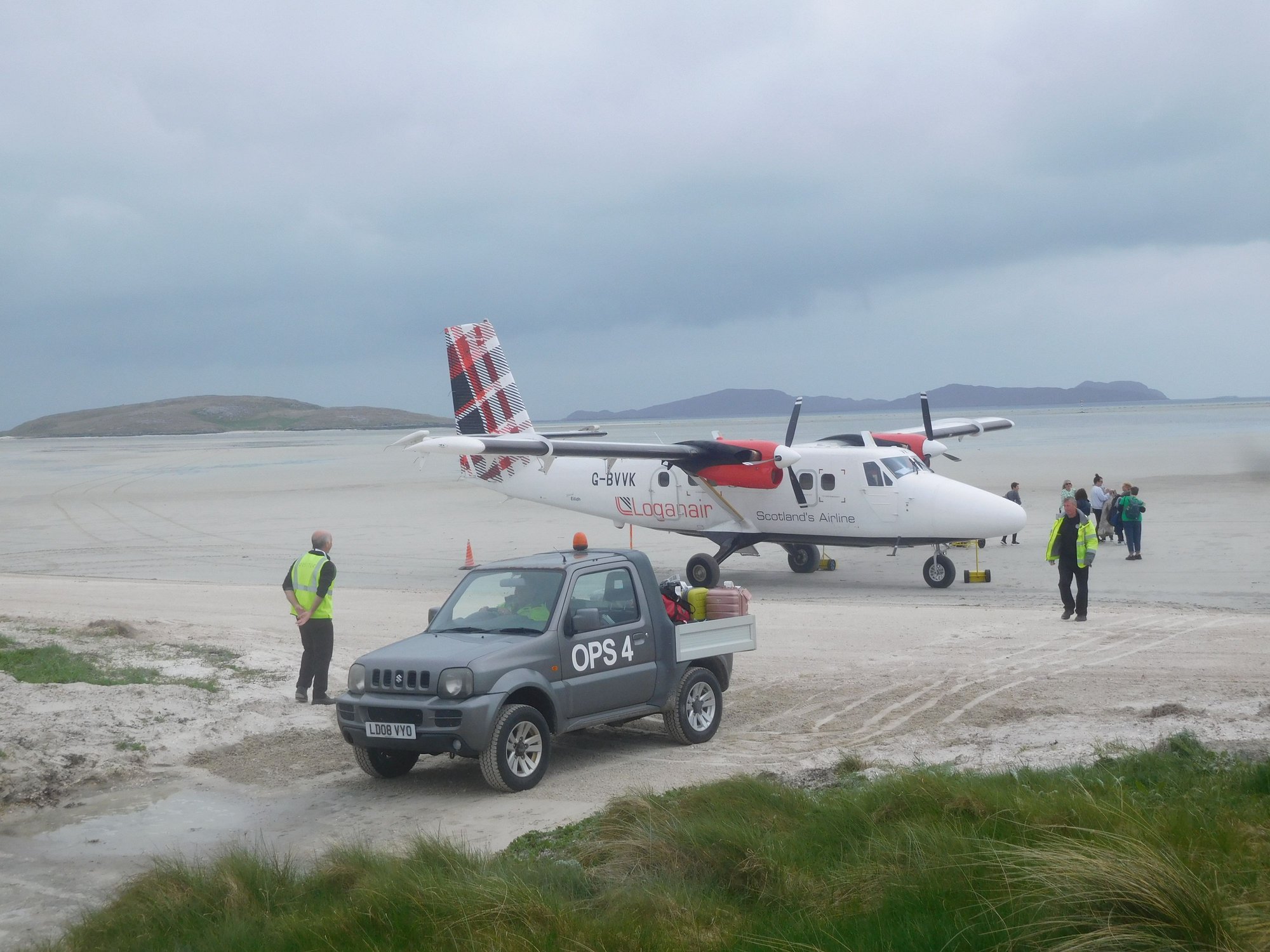
Bags being unloaded and passengers disembark
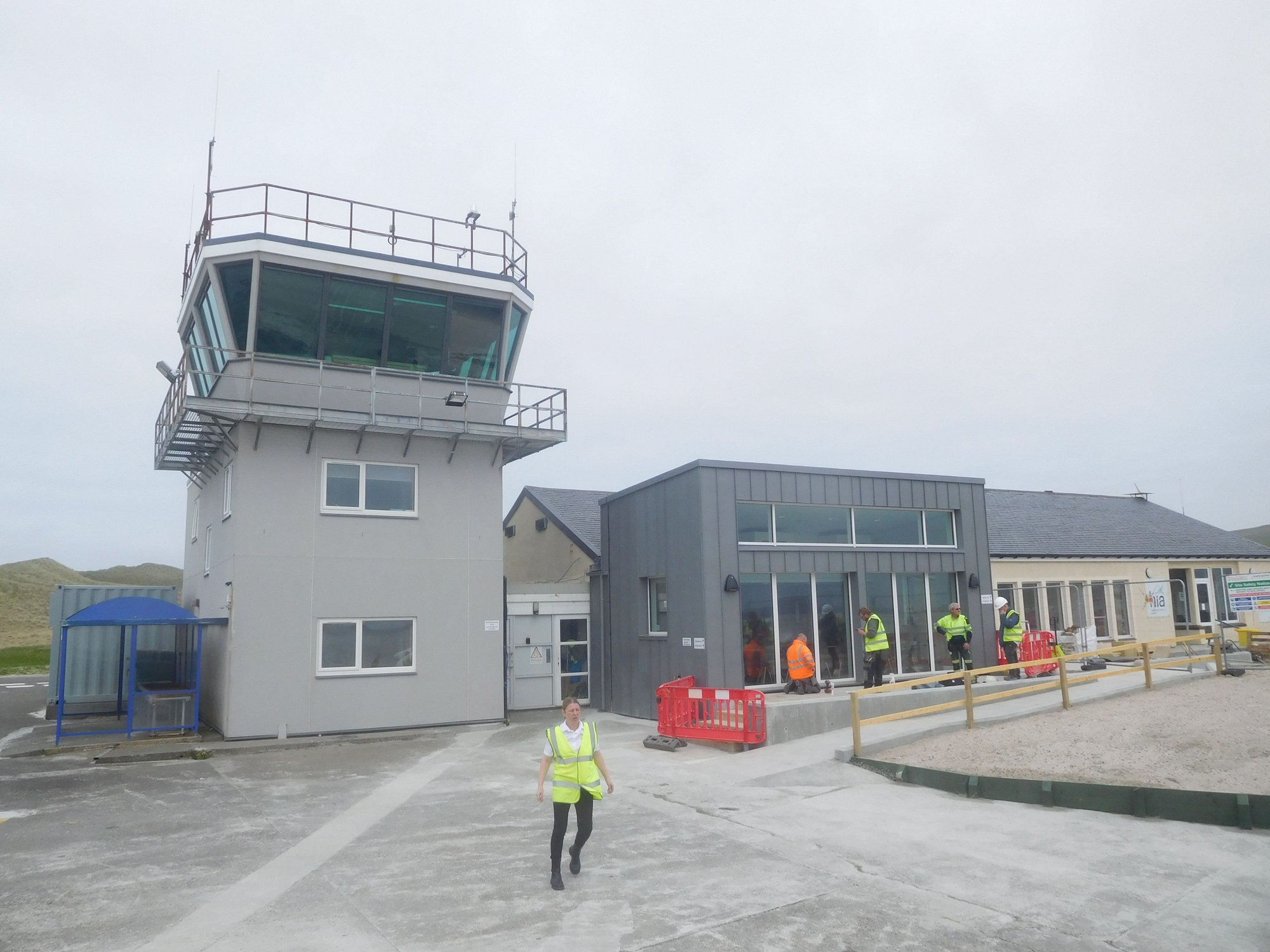
The tiny airport ! The blue hut by the tower is for baggage claim!
We then drove down the eastern rim of the A88 towards Castlebay, enjoying the unique Barra scenery.
Along the way
Along the way
First glimpse of Castlebay
We checked into our B&B, and rushed to the nearby Calmac office. As I had mentioned earlier in this trip report, Calmac had cancelled our direct Castlebay-Oban (7.00am-11.40am) ferry the day after, with a revised routing : Ardmhor (Barra)-Eriskay (4.45am-5.25am) and Lochboisdale-Oban (6.10am-11.45am). The friendly counter staff apologized that work at the Castlebay pier had led to a week of cancellations and finally handed me my revised tickets (which Calmac hadn’t bothered to send me, due to an ongoing system upgrade)! I asked if there was any way to get onto the Castlebay-Oban ferry a day earlier or get to Eriskay the previous evening (so I could get a good nights sleep and leave at a more earthly hour). Regrettably, this meant cutting a day out of Barra. I was told the system showed no available spaces for cars given the resulting exodus, but I was welcome to show up and try getting on. At this point, I gave up and resigned to my fate.
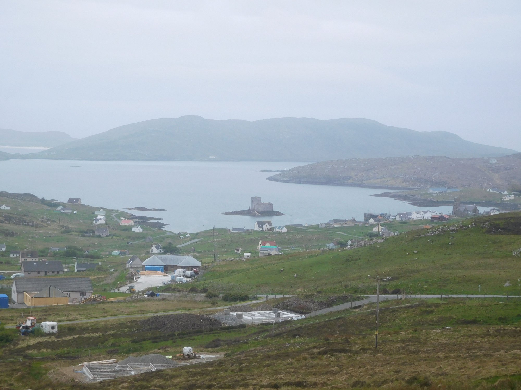
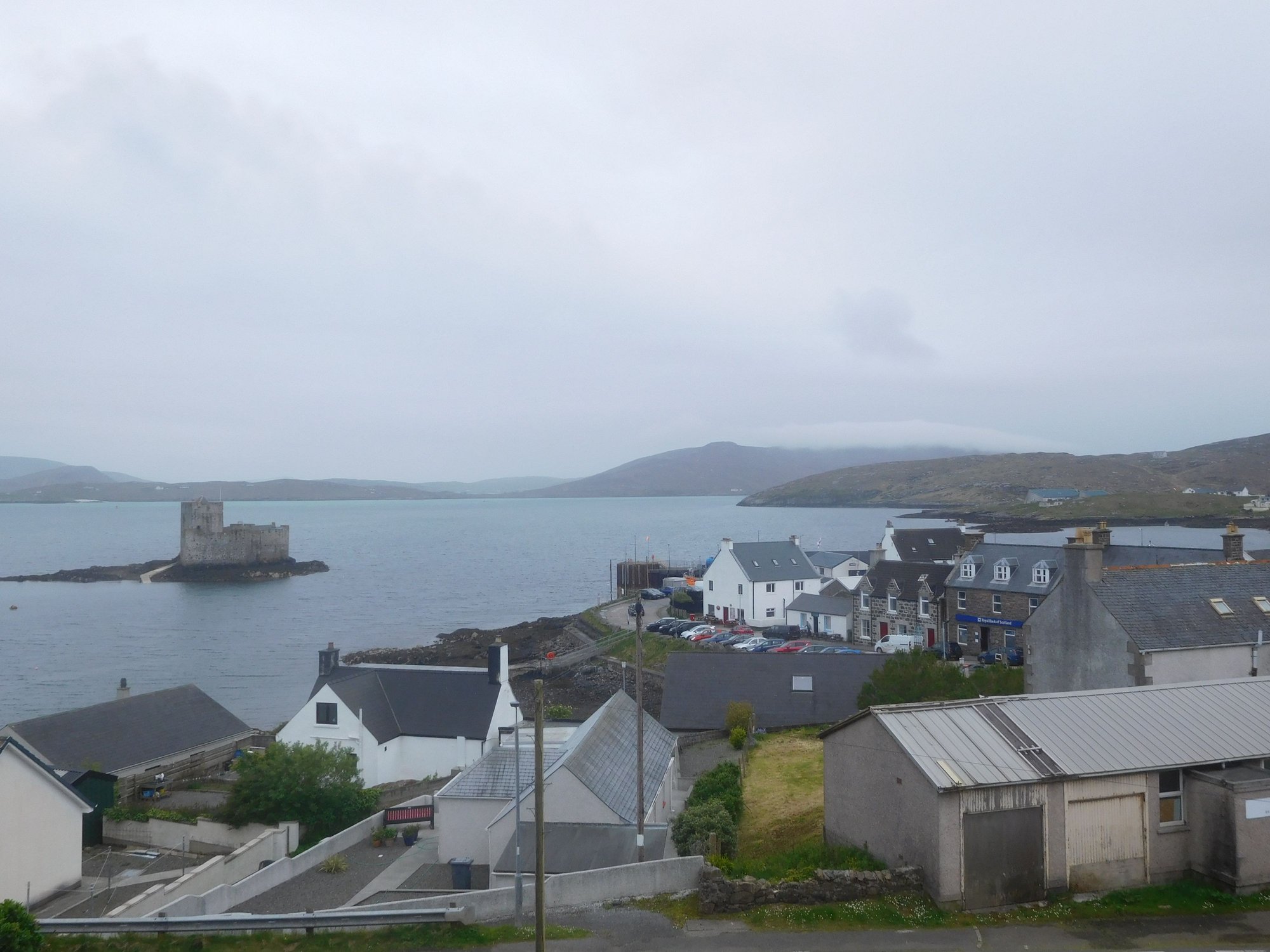
We enjoyed strolling around tiny Castlebay (population ~300) that evening. I had hoped to climb up to the statue of the Virgin and Child on Heaval, the highest hill on Barra, but there was a thick cloud cover with likely zero visibility so we gave it a pass.
Castlebay marina
Castlebay ferry terminal
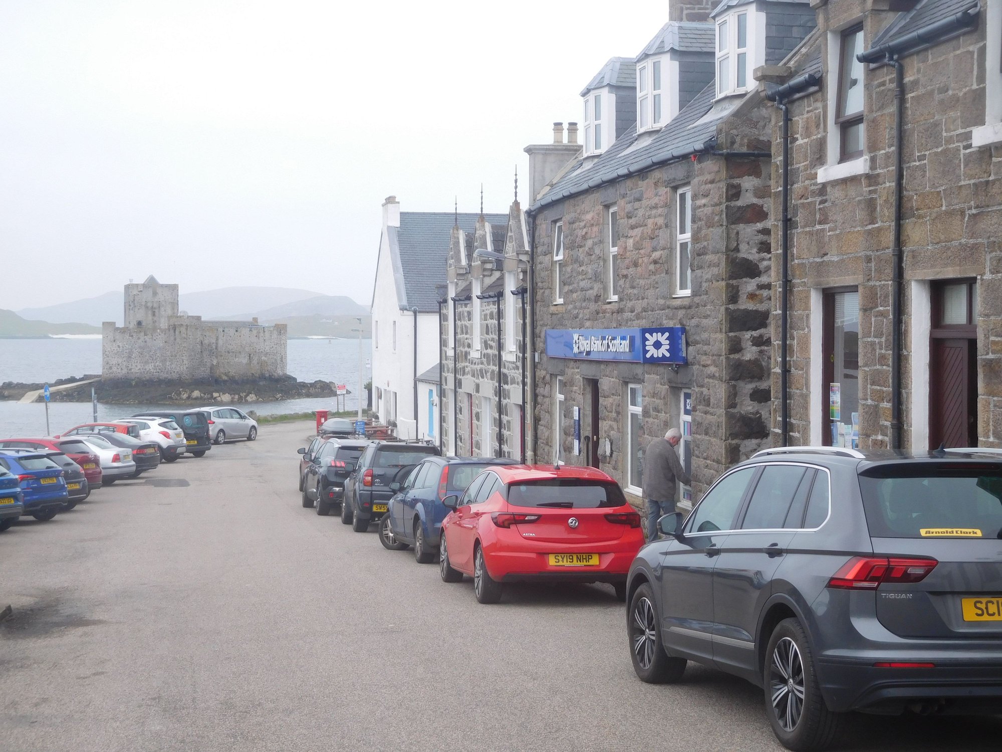
The main street (Pier Road)
View over Barra rooftops from the church (Our Lady, Star of the Sea)
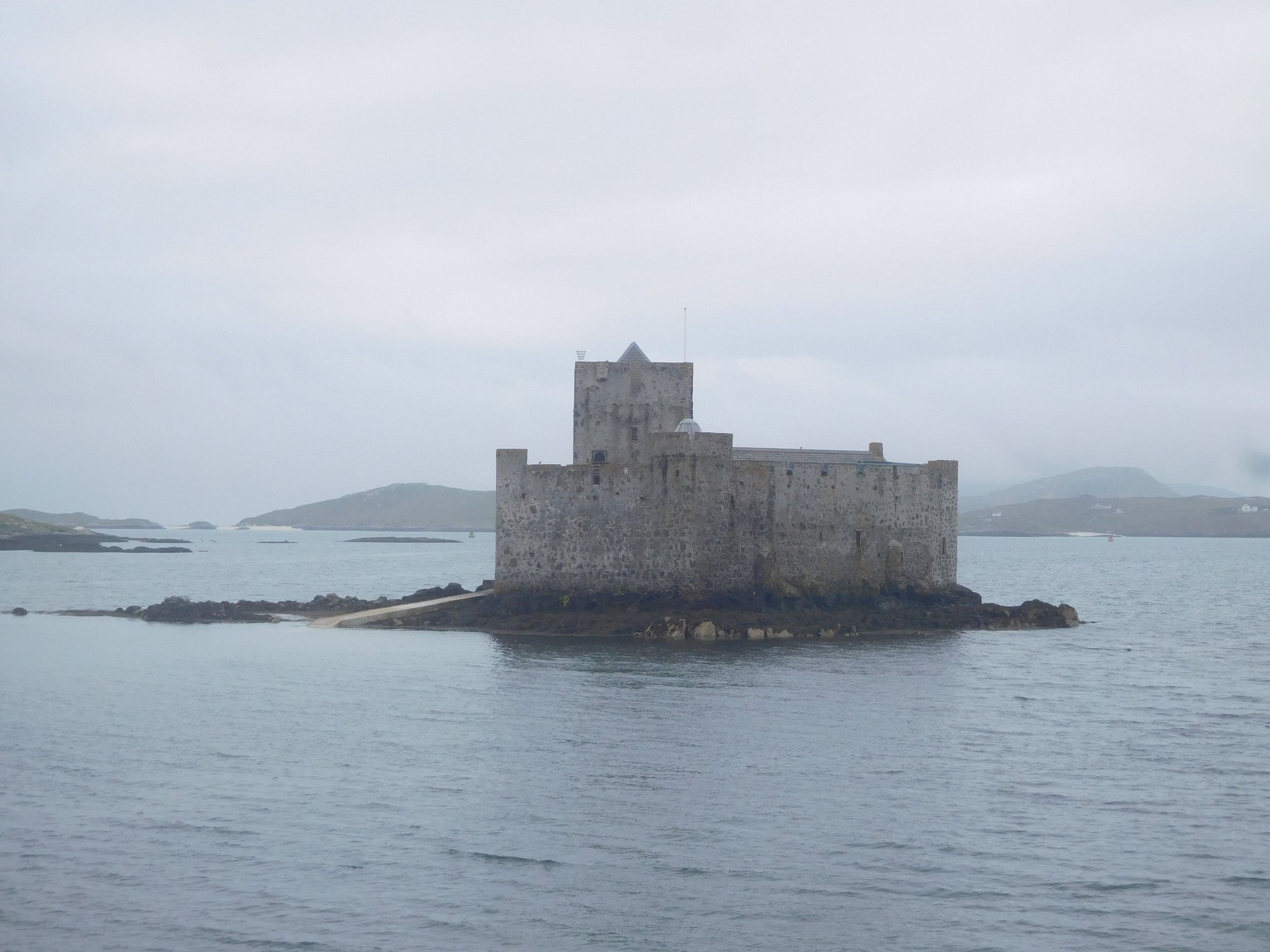
Kisimul Castle (15th century), currently not accessible due to ongoing conservation work
Barra is home to one of the most unique airports in the world at Eoligarry, where flights use the beach as a runway. The local airline LoganAir flies twice a day to and from Glasgow. Today, the first flight was scheduled to land around 12.30pm. I was told it’s quite a spectacle, so we planned to hang around and watch. We drove to Eoligarry at the northern tip of Barra and parked by the airport, where there are 2 terrific beaches on either side. Traigh Mhor (which is used for the airstrip) and wasn’t accessible as an aircraft landing was imminent (the orange wind sock being up is a sign the beach is off-limits). The other beach is Traigh Eais, which we decided to visit while waiting for the flight. It’s beautiful stretch of sand, hidden behind a grassy hill and some dunes.
The only other family on the Traigh Eais beach
.. and us
We returned by 12.15pm to find a number of people had gathered already to watch the event. It was a fascinating experience !
The beautiful Traigh Mor beach with orange windsock up
Lights in the sky ....
Touchdown !
Taxiing in
Getting parked
Bags being unloaded and passengers disembark
The tiny airport ! The blue hut by the tower is for baggage claim!
We then drove down the eastern rim of the A88 towards Castlebay, enjoying the unique Barra scenery.
Along the way
Along the way
First glimpse of Castlebay
We checked into our B&B, and rushed to the nearby Calmac office. As I had mentioned earlier in this trip report, Calmac had cancelled our direct Castlebay-Oban (7.00am-11.40am) ferry the day after, with a revised routing : Ardmhor (Barra)-Eriskay (4.45am-5.25am) and Lochboisdale-Oban (6.10am-11.45am). The friendly counter staff apologized that work at the Castlebay pier had led to a week of cancellations and finally handed me my revised tickets (which Calmac hadn’t bothered to send me, due to an ongoing system upgrade)! I asked if there was any way to get onto the Castlebay-Oban ferry a day earlier or get to Eriskay the previous evening (so I could get a good nights sleep and leave at a more earthly hour). Regrettably, this meant cutting a day out of Barra. I was told the system showed no available spaces for cars given the resulting exodus, but I was welcome to show up and try getting on. At this point, I gave up and resigned to my fate.
We enjoyed strolling around tiny Castlebay (population ~300) that evening. I had hoped to climb up to the statue of the Virgin and Child on Heaval, the highest hill on Barra, but there was a thick cloud cover with likely zero visibility so we gave it a pass.
Castlebay marina
Castlebay ferry terminal
The main street (Pier Road)
View over Barra rooftops from the church (Our Lady, Star of the Sea)
Kisimul Castle (15th century), currently not accessible due to ongoing conservation work
Last edited by ANUJ; Jun 17th, 2023 at 08:43 PM.
Jun 18th, 2023 | 08:38 PM
#76
Original Poster
Joined: Oct 2005
Posts: 931
Likes: 28
DAY 22 : Castlebay, Barra
This was our last day in Barra. Our plan was to visit Vatersay, the southernmost inhabited island (population : 90!) in the Hebrides, connected by a causeway to the Isle of Barra.
Across the causeway to Vatersay
As we drove down the only road past Caolas, we reached a triangular junction by the church. We headed towards Uidh to discover some wonderfully desolate beaches, with only cows and sheep for company.
Beach 1
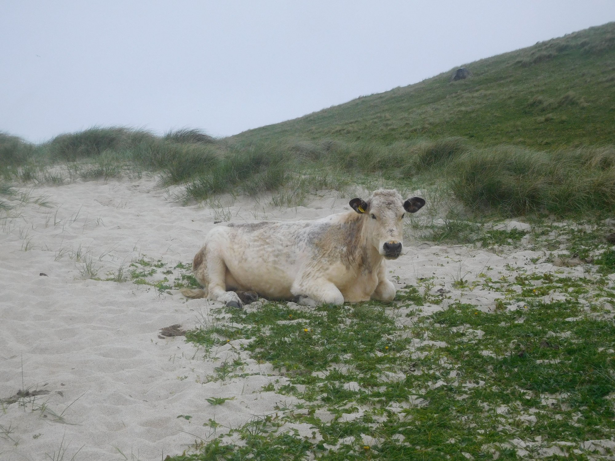
Cow enjoying Beach 1
Beach 2
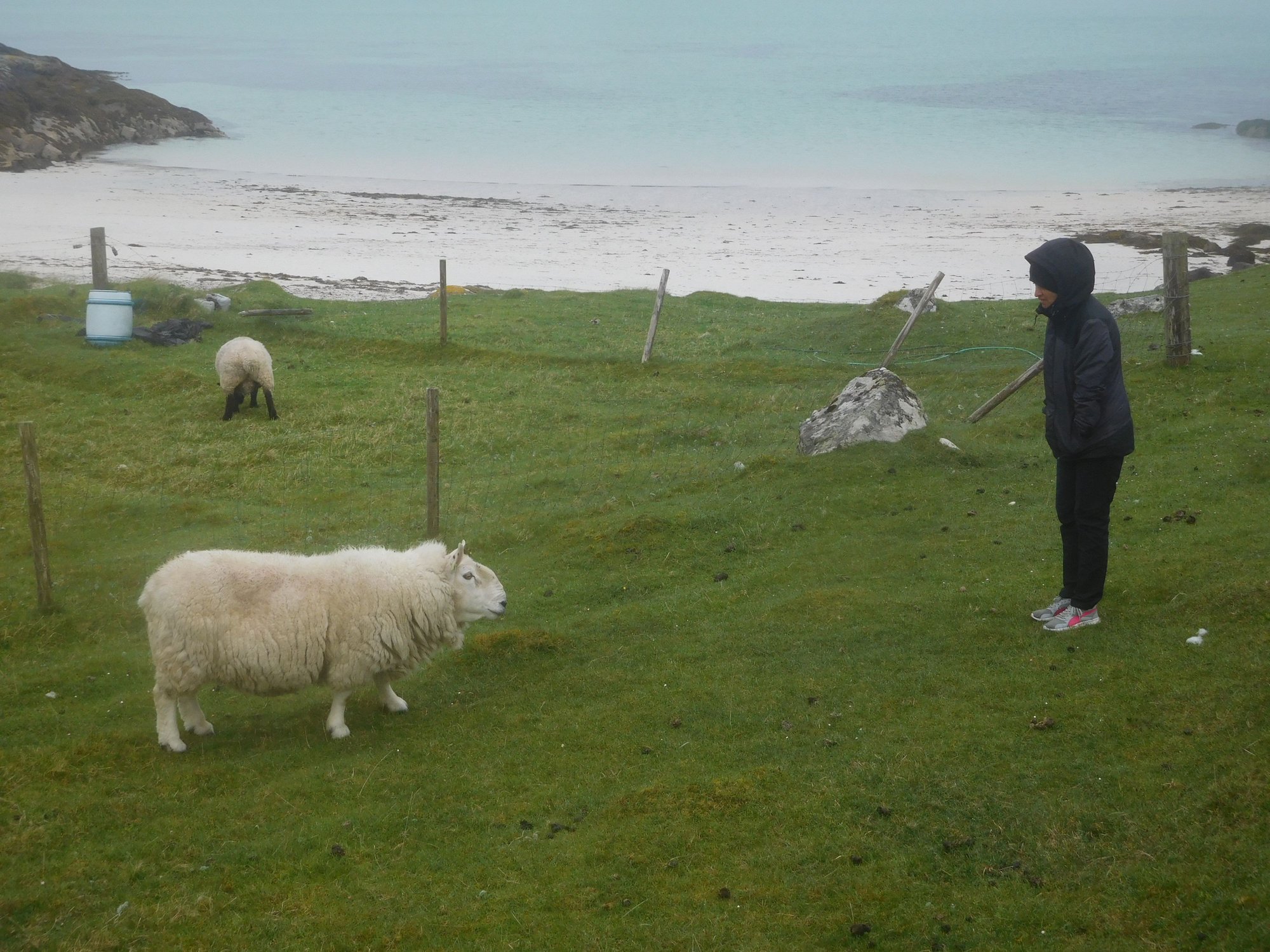
Beach 3
Leaving Uidh
We then headed further south and parked at the Vatersay Hall Cafe / Community Centre, which also marks the official start point of the Hebridean way – a cycling or walking route (for the supremely adventurous!) that goes all the way from Vatersay (Barra) to Stornoway (Lewis)
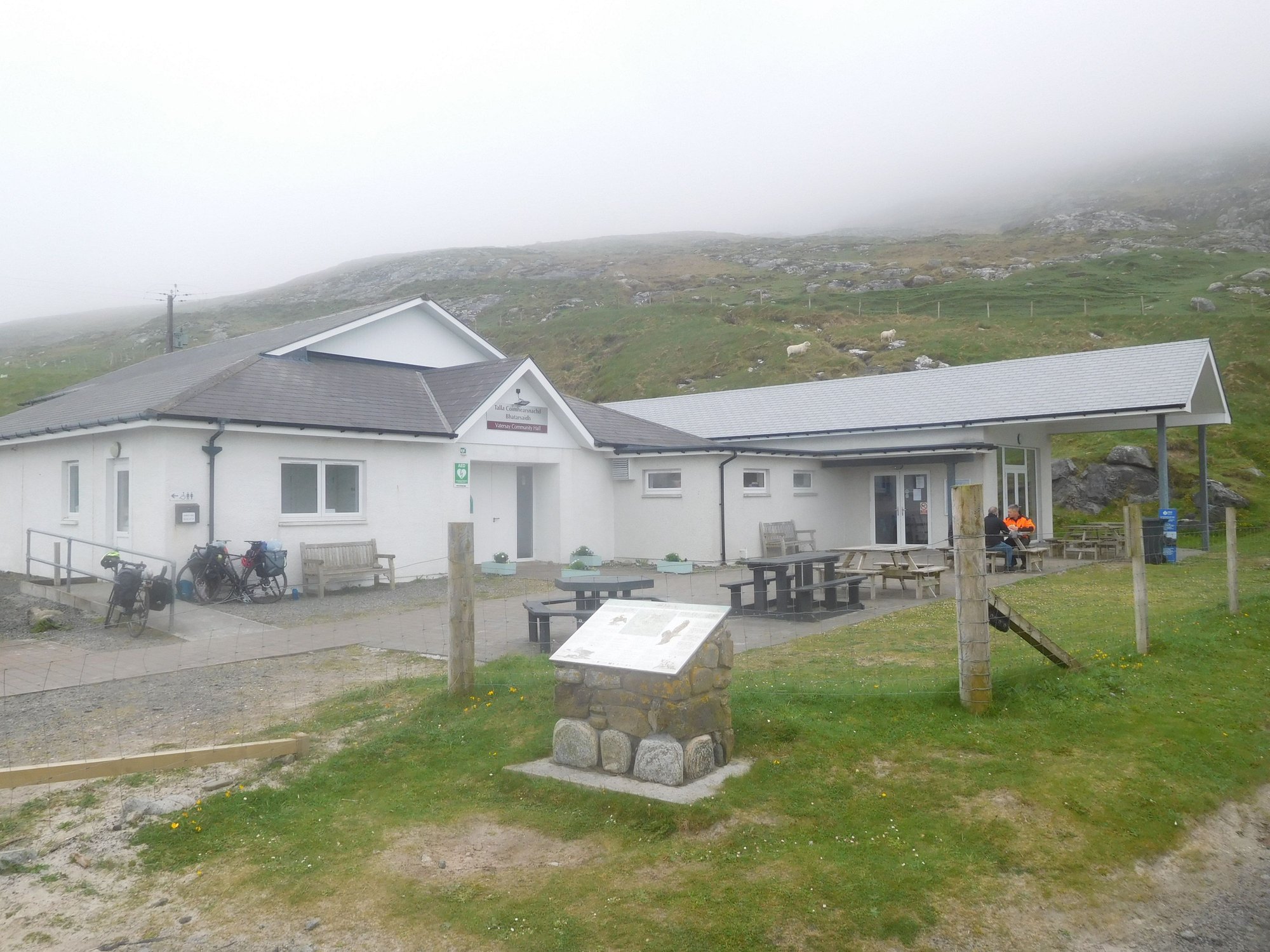
At the centre
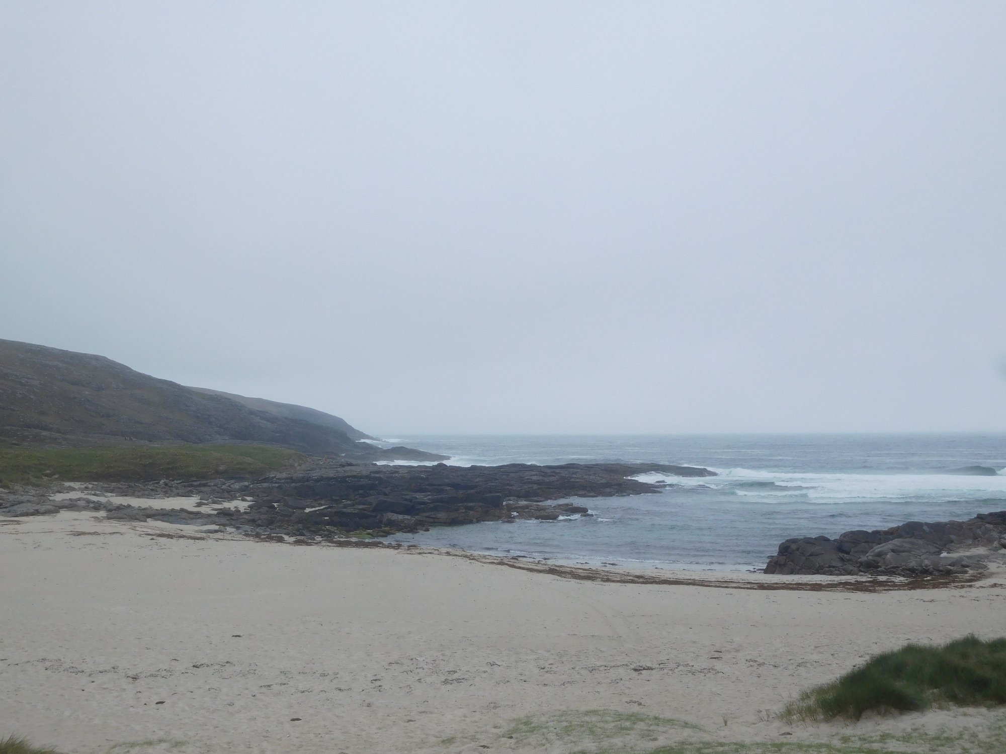
There were two beaches on either side. We passed the first beach Traigh a Braigh on the way itself – to find only one other human kayaking in the sea.
View of Traigh a Braigh

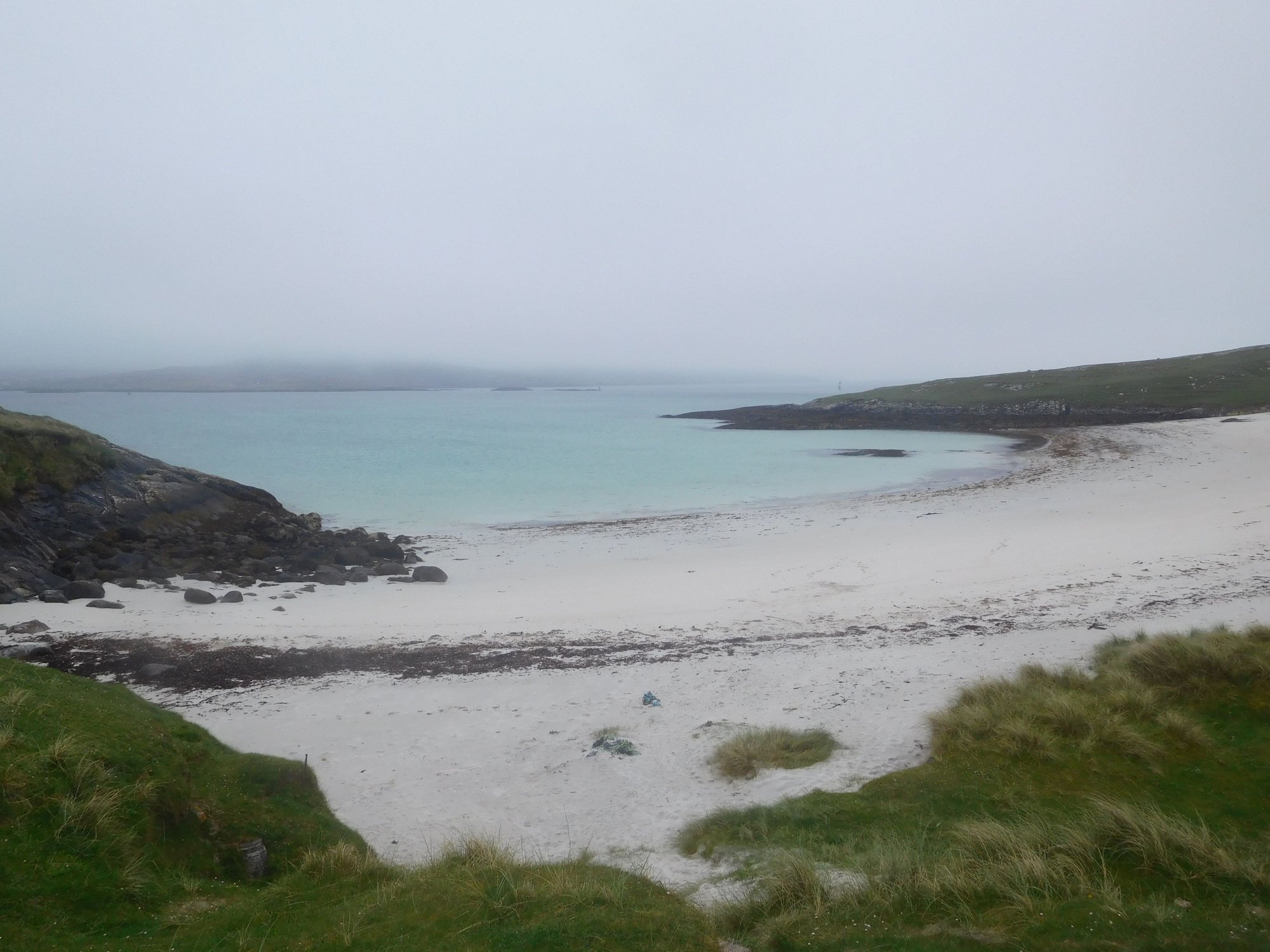
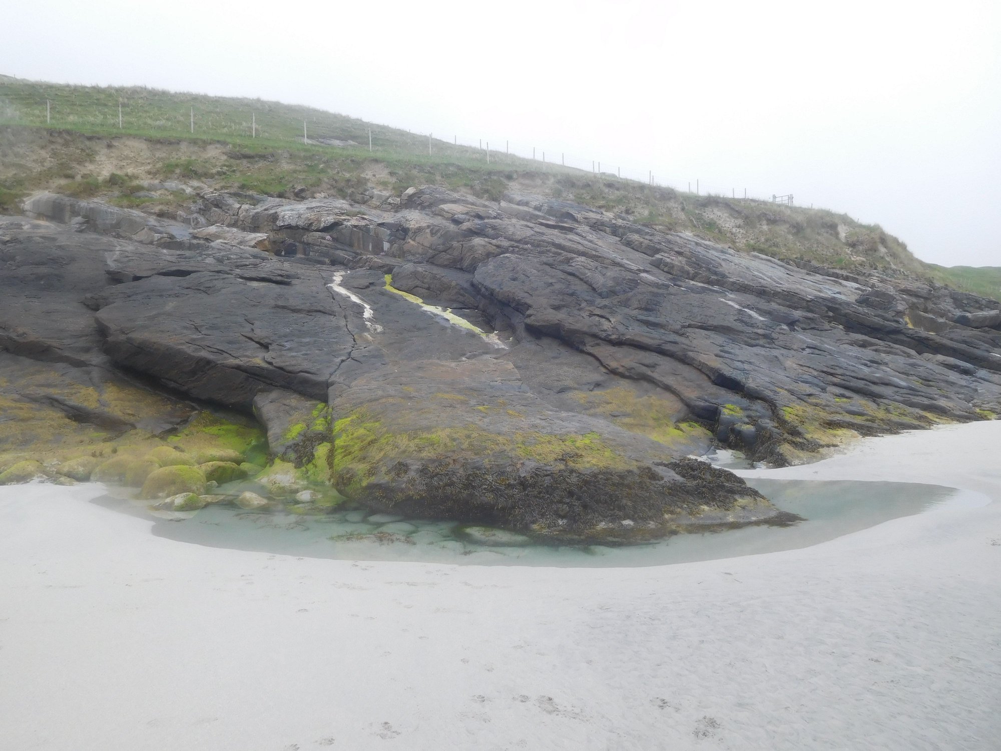
We took the trail behind the Vatersay Hall Cafe leading over the hill to the other secluded beach Traigh Shiar. This is a real stunner and we spent a lot of time there. As we scrambled over some rocks to get to a hidden cove and sea cave, it was heart-breaking to see a beluga whale had washed ashore a week ago.

View of Traigh Shiar
At the beach
Along the beach
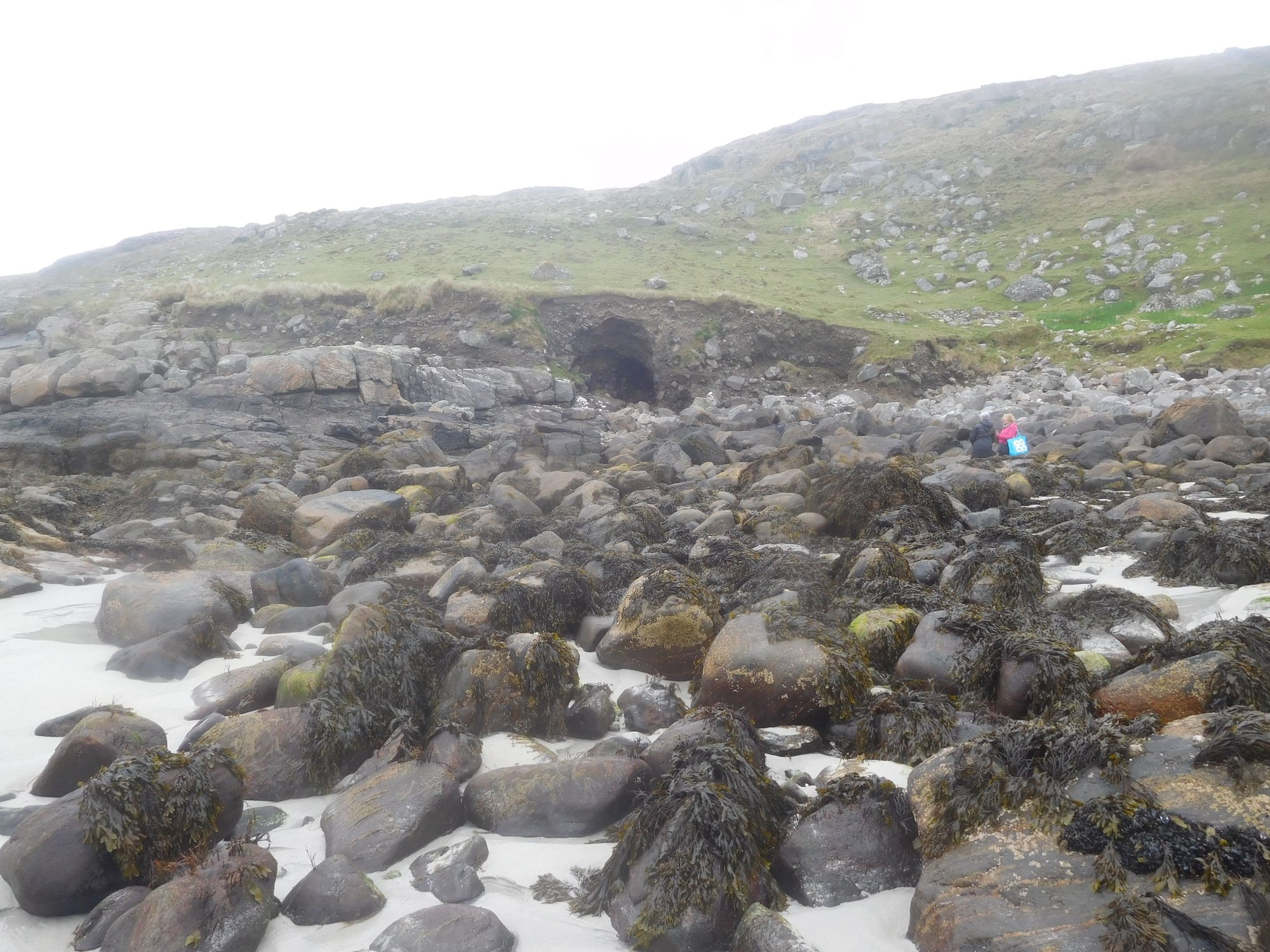
The sea cave in the cove
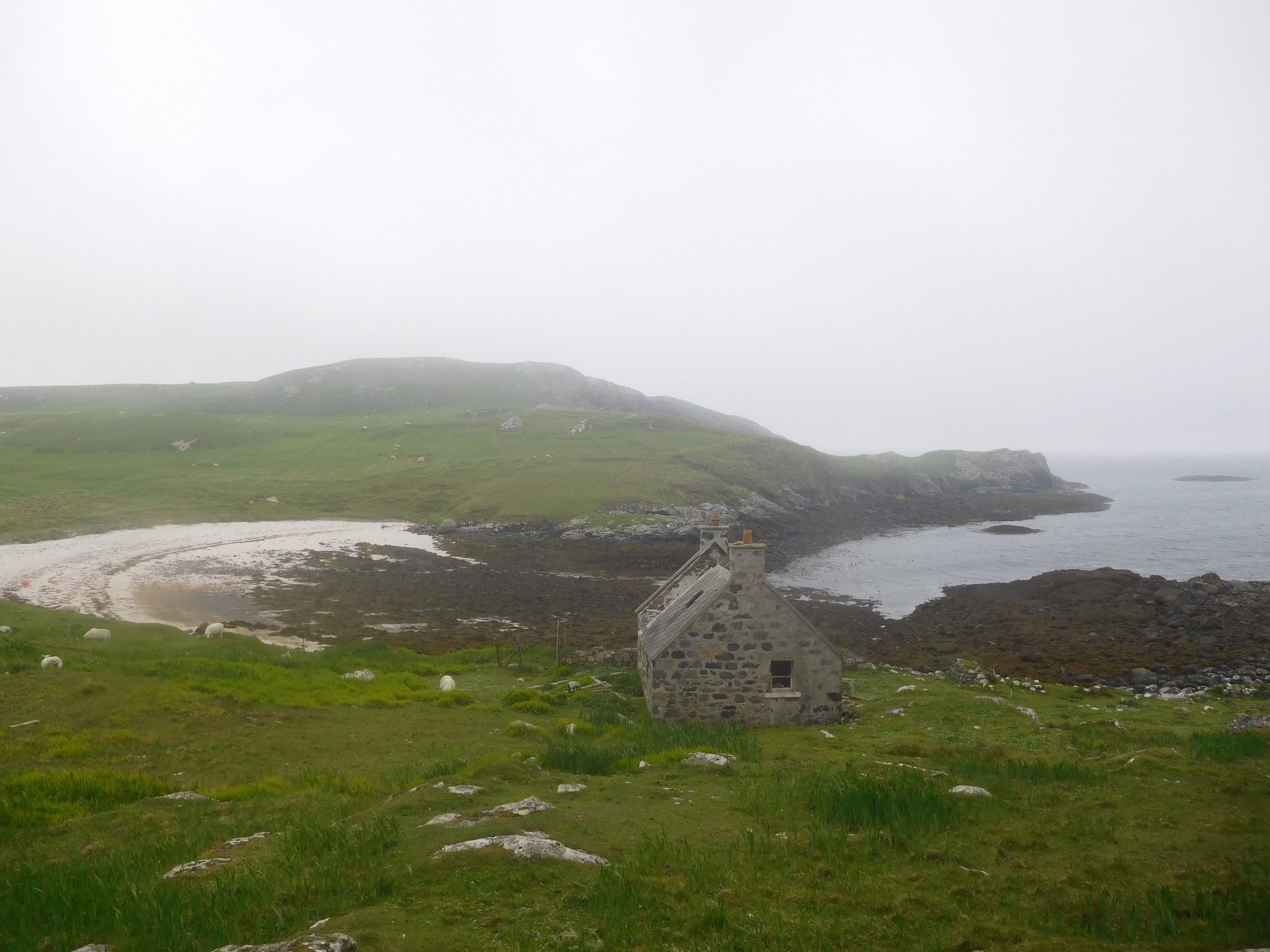
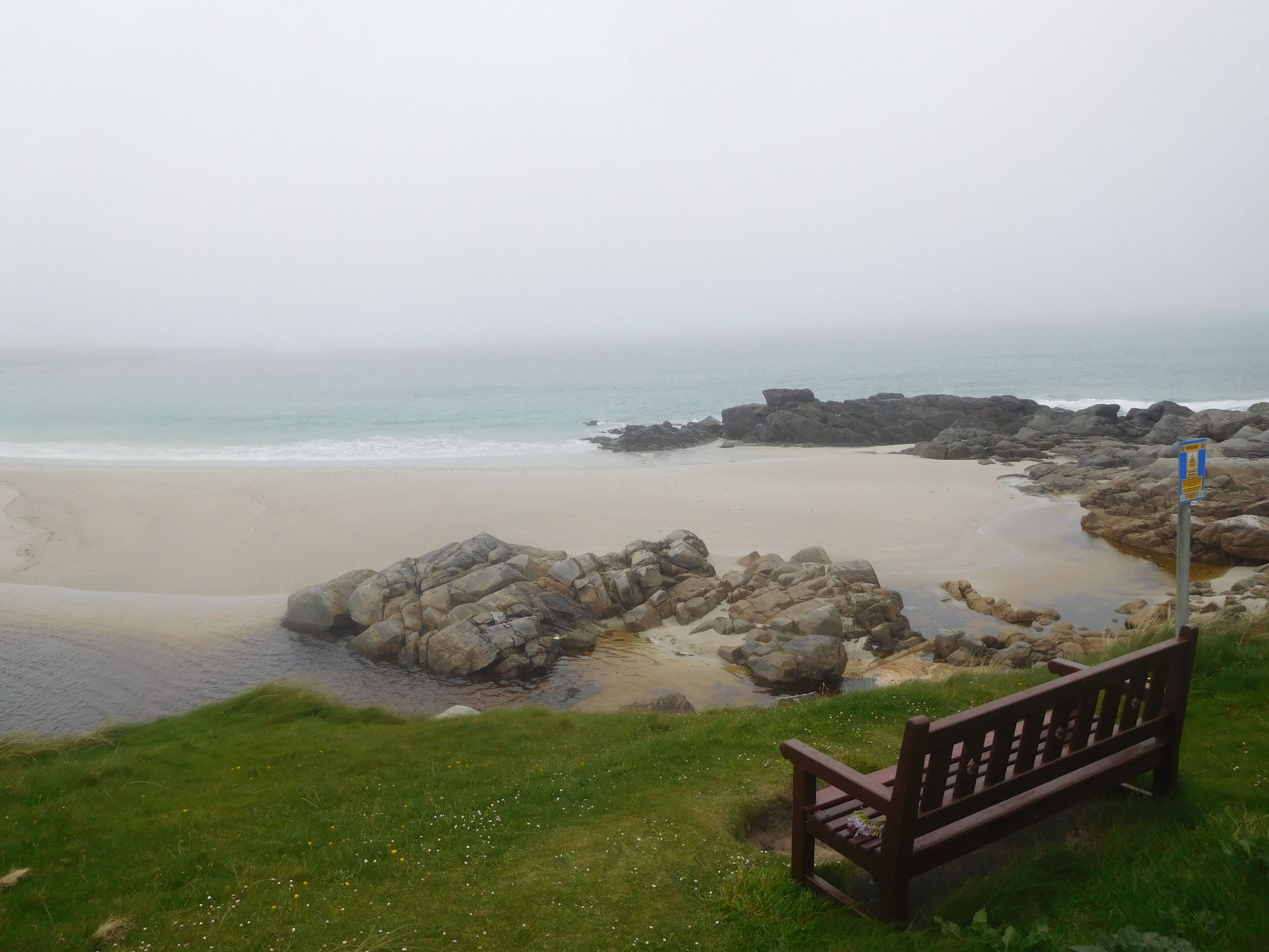
Our final stop was the southernmost tip of the island, where we walked past an abandoned village and through several farm gates to reach the remotest beach ever Bagh A Deas.
At the Bagh A Deas beach
Cows grazing by the beach
Returning to our parking spot
We then returned to Castlebay and drove a short stretch of the western rim of the A888 to Allasdale, enjoying more coastal scenery.
Driving back to Barra
Beach near Allasdale, with a quicksand signboard
We headed back and slept really early, as we had to drive to Ardmhor at the northern end of Barra to catch the 4.45am ferry the next day. Our host suggested we drive the western road at that hour, and thoughtfully packed us take-way boxes that lasted us breakfast and lunch the next day !
Barra had been another unique Hebridean experience, parts of it (especially Vatersay) felt like we were so far removed from any trace of human civilization, with just the sound of birds chirping and the Atlantic ocean lashing on the island shores. The Outer Hebrides had exceeded all our expectations, and offered a complete change of scenery from the NC500 and Orkney we experienced earlier.
Across the causeway to Vatersay
As we drove down the only road past Caolas, we reached a triangular junction by the church. We headed towards Uidh to discover some wonderfully desolate beaches, with only cows and sheep for company.
Beach 1
Cow enjoying Beach 1
Beach 2
Beach 3
Leaving Uidh
We then headed further south and parked at the Vatersay Hall Cafe / Community Centre, which also marks the official start point of the Hebridean way – a cycling or walking route (for the supremely adventurous!) that goes all the way from Vatersay (Barra) to Stornoway (Lewis)
At the centre
There were two beaches on either side. We passed the first beach Traigh a Braigh on the way itself – to find only one other human kayaking in the sea.
View of Traigh a Braigh
We took the trail behind the Vatersay Hall Cafe leading over the hill to the other secluded beach Traigh Shiar. This is a real stunner and we spent a lot of time there. As we scrambled over some rocks to get to a hidden cove and sea cave, it was heart-breaking to see a beluga whale had washed ashore a week ago.
View of Traigh Shiar
At the beach
Along the beach
The sea cave in the cove
Our final stop was the southernmost tip of the island, where we walked past an abandoned village and through several farm gates to reach the remotest beach ever Bagh A Deas.
At the Bagh A Deas beach
Cows grazing by the beach
Returning to our parking spot
We then returned to Castlebay and drove a short stretch of the western rim of the A888 to Allasdale, enjoying more coastal scenery.
Driving back to Barra
Beach near Allasdale, with a quicksand signboard
We headed back and slept really early, as we had to drive to Ardmhor at the northern end of Barra to catch the 4.45am ferry the next day. Our host suggested we drive the western road at that hour, and thoughtfully packed us take-way boxes that lasted us breakfast and lunch the next day !
Barra had been another unique Hebridean experience, parts of it (especially Vatersay) felt like we were so far removed from any trace of human civilization, with just the sound of birds chirping and the Atlantic ocean lashing on the island shores. The Outer Hebrides had exceeded all our expectations, and offered a complete change of scenery from the NC500 and Orkney we experienced earlier.
Last edited by ANUJ; Jun 18th, 2023 at 08:48 PM.
Jun 19th, 2023 | 04:53 AM
#78

Joined: Apr 2010
Posts: 1,858
Likes: 0
Anuj, what a fabulous TR and drool worthy pictures! We�ve been to Edinburgh, Glasgow, etc three times, but never to the Highlands. Hope to see some bit in the next few years, with Rabbies though as I don�t believe DH will want to drive. Or rather, he�ll be okay with it, but I�be having kittens all the while. Hence am greatly enjoying your travels, thanks 😊
Jun 19th, 2023 | 06:52 AM
#79
Original Poster
Joined: Oct 2005
Posts: 931
Likes: 28
Karen, this was 24 nights in total in Scotland. So we're getting to the end of this report!
geetika, thank you. I'm aware Rabbies get very favourable reviews (and we crossed paths twice). However, self-driving is the only way to do these regions justice.
geetika, thank you. I'm aware Rabbies get very favourable reviews (and we crossed paths twice). However, self-driving is the only way to do these regions justice.
Jun 19th, 2023 | 09:14 PM
#80
Original Poster
Joined: Oct 2005
Posts: 931
Likes: 28
DAY 23 : Balmaha (Loch Lomond/Trossachs)
We had an adventurous start to the morning
- leaving Castlebay at 4am in pitch darkness along 9 miles of single-track road, heading to Ardmhor. Thankfully, there was no fog, and my powerful headlamps provided good visibility which boosted my confidence. I drove very slowly and carefully, and was the first car to reach and wait in queue for boarding the ferry to Eriskay.
- racing another 13 miles to Lochboisdale after landing in Eriskay, to catch the 6.10am sailing to Oban. We had been assured that the Calmac staff at Lochboisdale had full information about impacted passengers, and would not leave without us. It all worked out in the end, but it�s an experience I�ll never forget!
On the ferry to Oban (a very long ~5 hour sailing), my wife and I slept like babies waking up only to enjoy the views of Ardnamurchan and Mull as we sailed through the narrow sound to Oban. We were back in Oban after 6 years, and stopped briefly at the Tesco superstore for provisions and filling petrol.
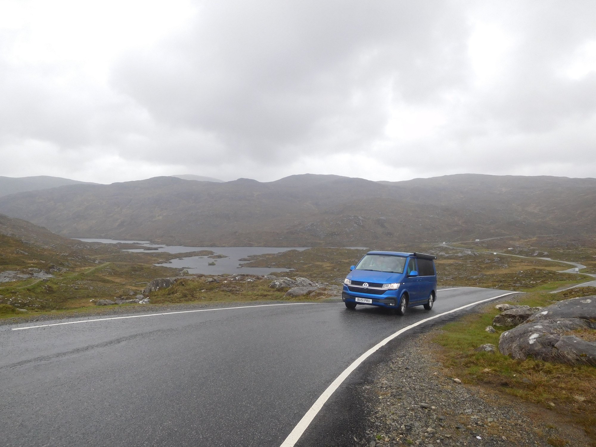
We took the A85 to Tyndrum passing through the stunning Glen Orchy, eventually going down the A82 along Loch Lomond. Loch Lomond is beautiful, but I was surprised to see the amount of development that has taken place along the western shore and the heavy traffic, since our last visit. This has impacted the experience � for example, I could barely recognise the charming village of Luss which we had enjoyed back in 2017 (it was so crowded without any visible parking spots and gave it a miss). We made several others stops though.
Ardlui
Tarbet
Firkin Point
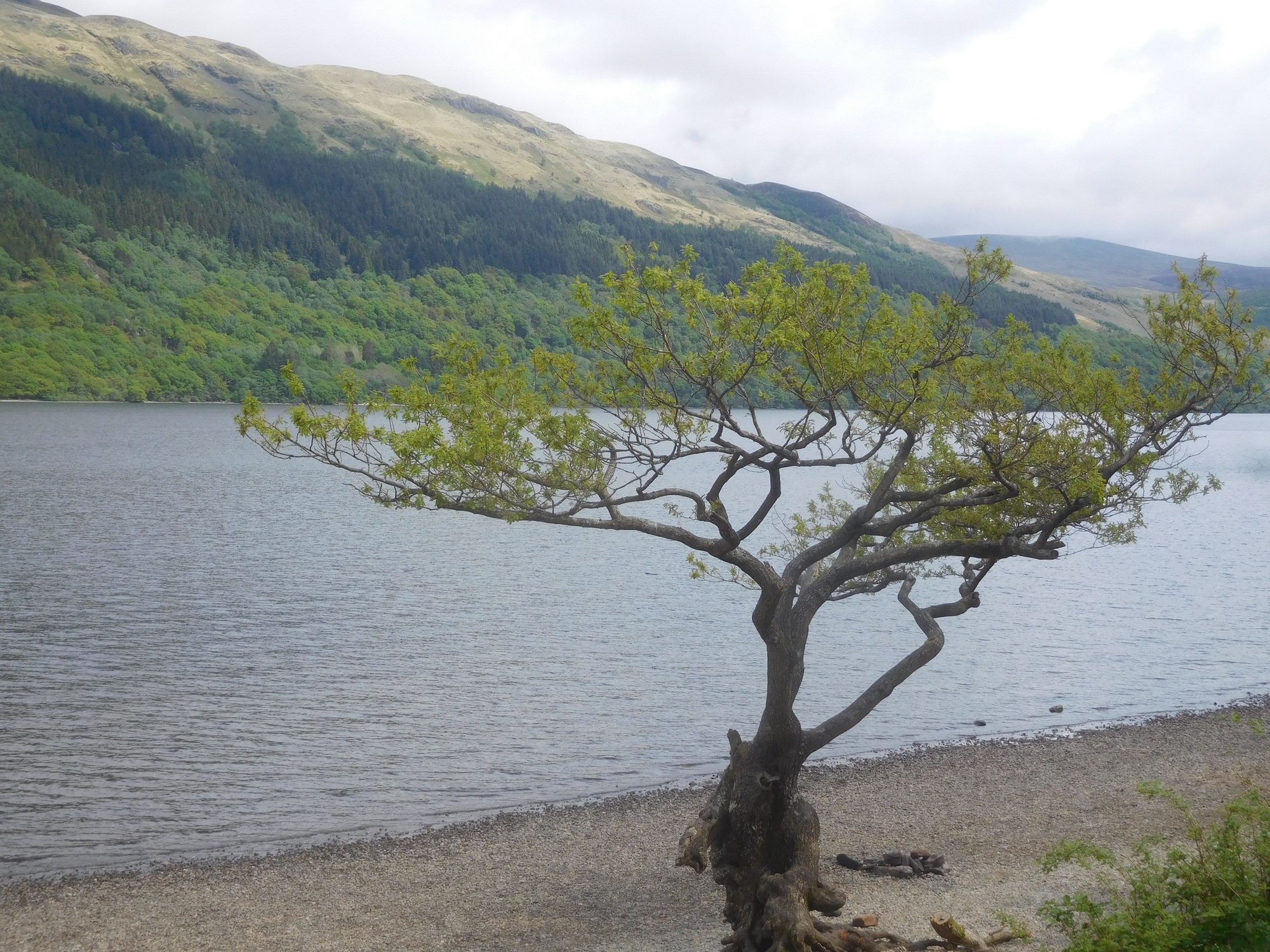
Firkin Point
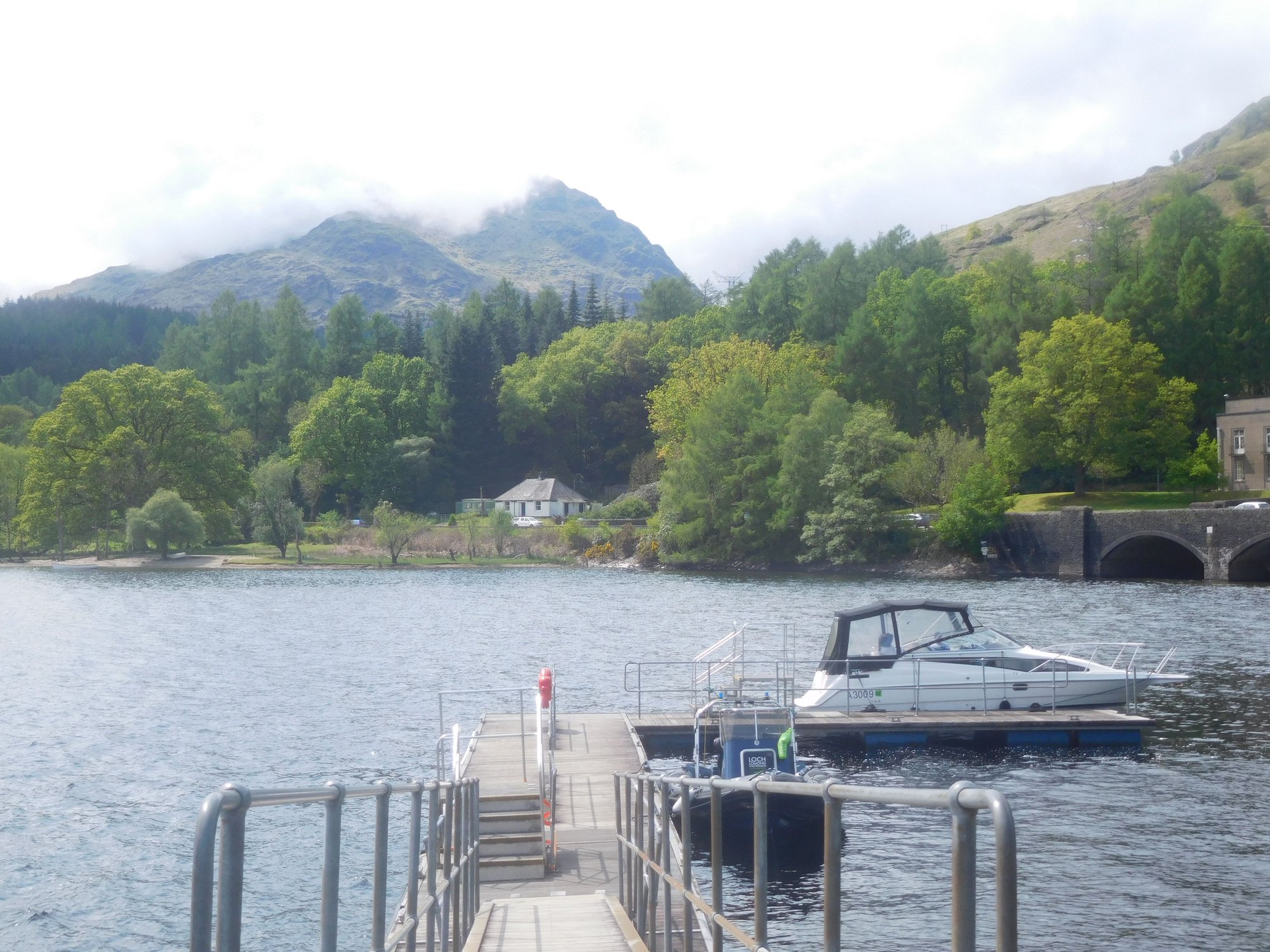
After passing Balloch at the southern tip of the loch, we took the A811 past Drymen and branched off to Balmaha. This eastern shore is stunningly beautiful and very serene. As we checked into our B&B, our host echoed our sentiments calling the western shore �just a motorway� (a tad harsh!), while the eastern shore and Trossachs were �the real deal�.
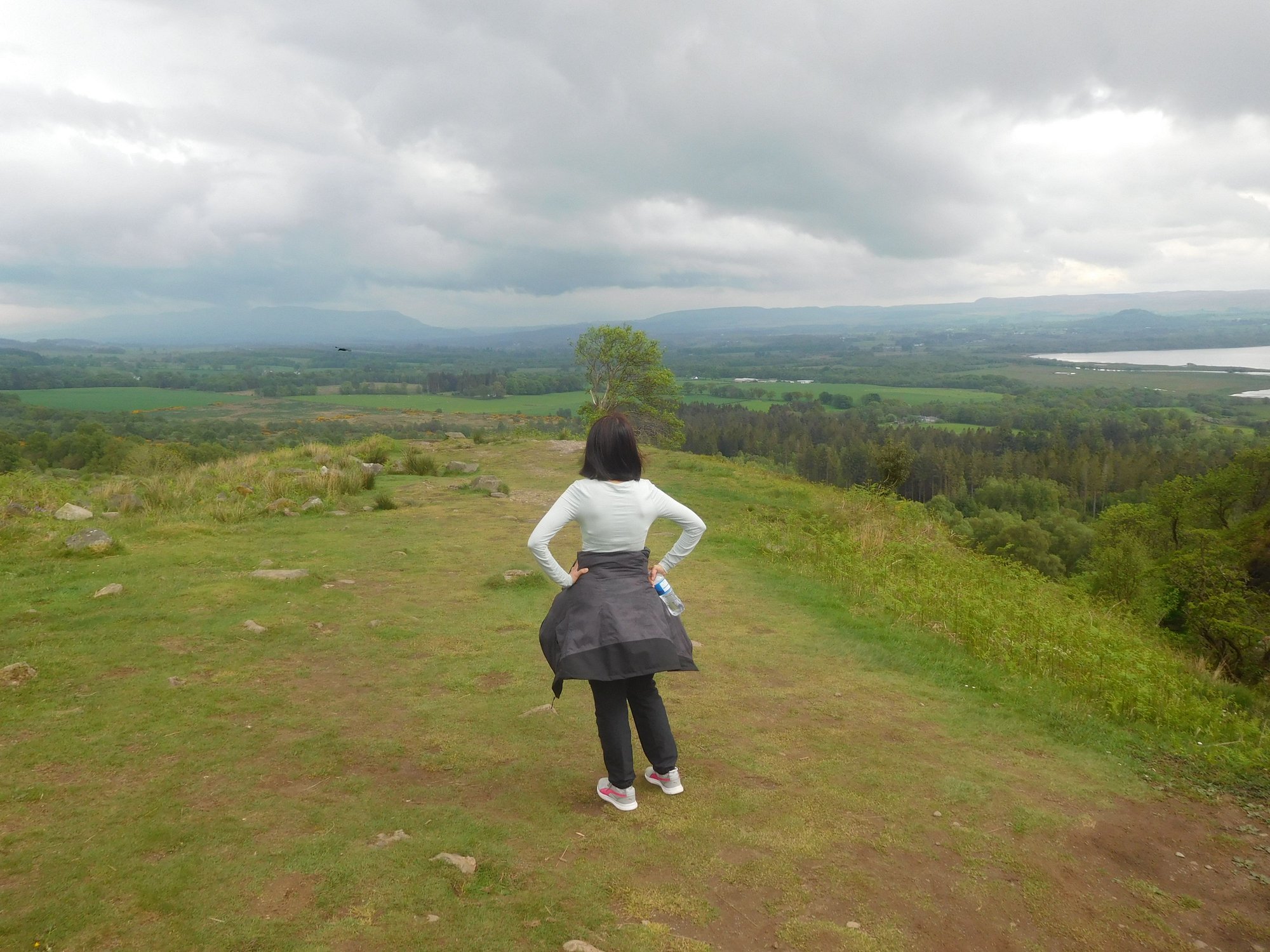
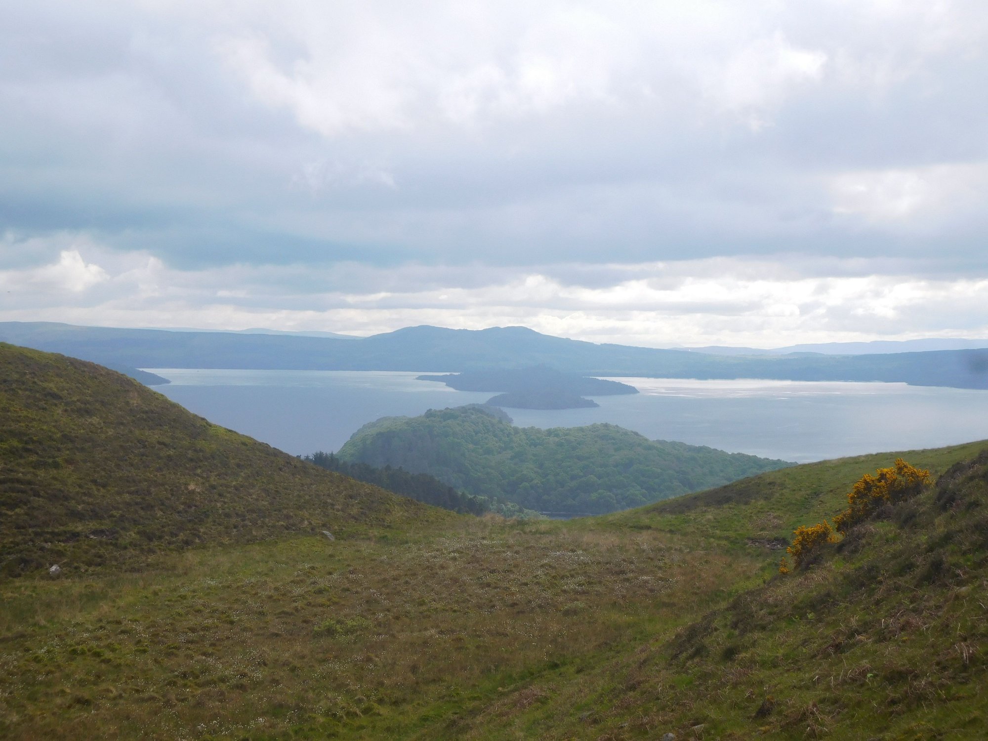
After some rest, we set off to hike the Conic Hill. This was the primary reason we chose to base in Balmaha and enjoy the iconic (and much photographed) view over Loch Lomond. The trail begins the large car park near our B&B. It's a beautiful but steep hike, and treacherous in parts - I didn't enjoy the (newly fitted?) stony steps and the boggy sections.
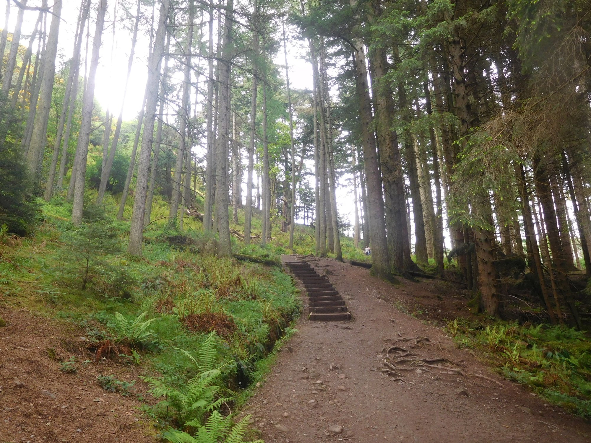
Through the woods, and past the gate
Catching our breath, about half-way up
Early views emerge
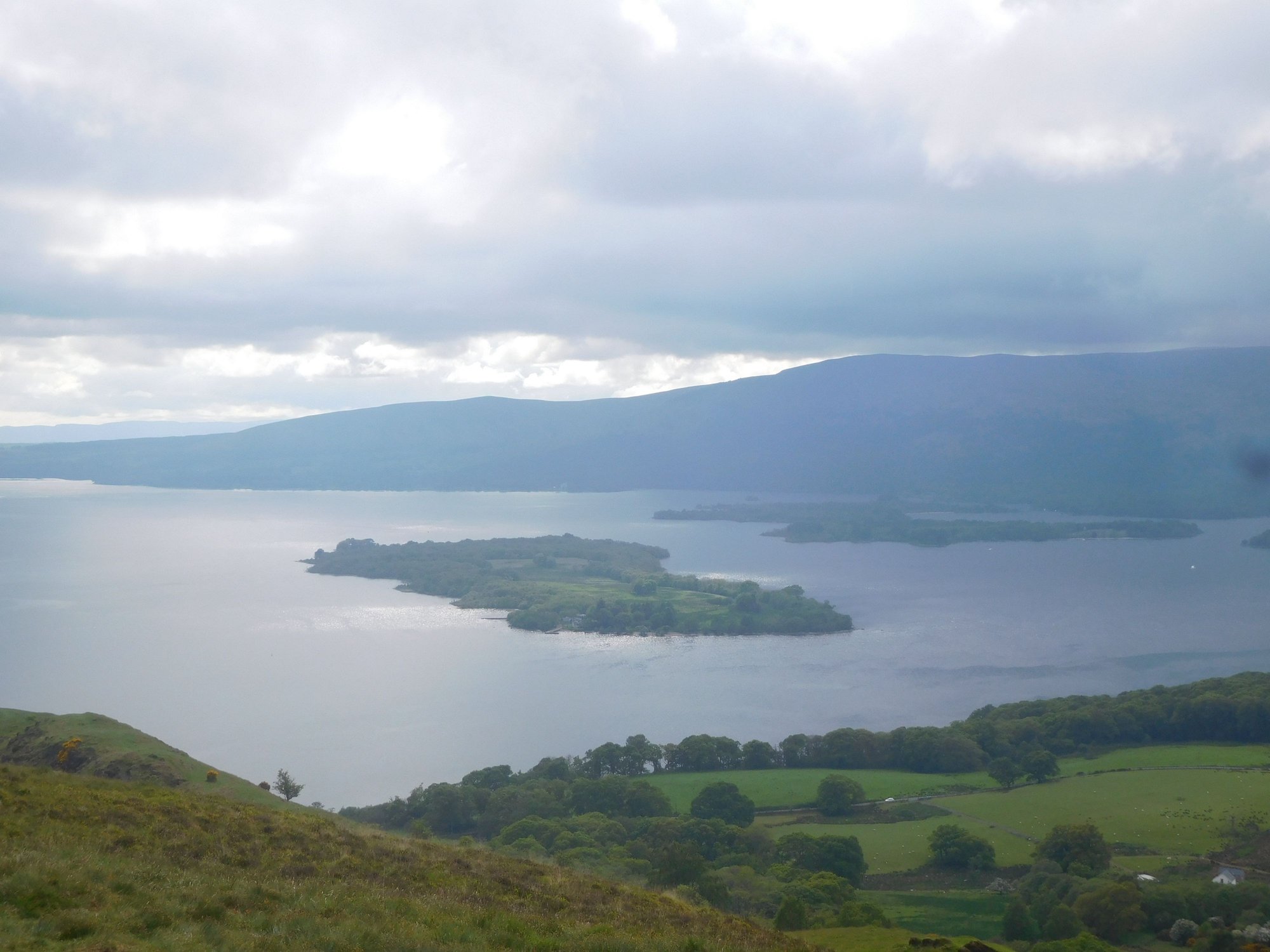
Early views emege
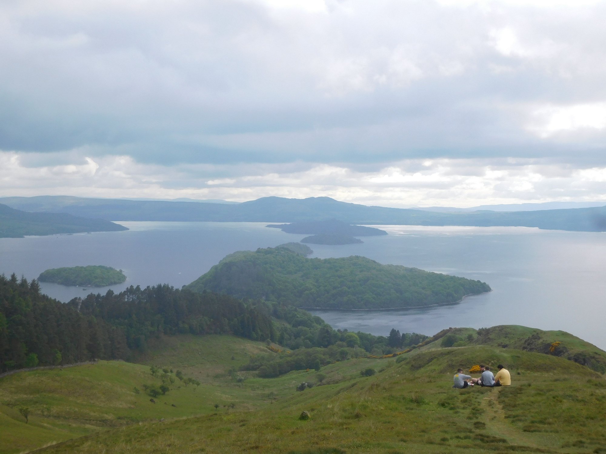
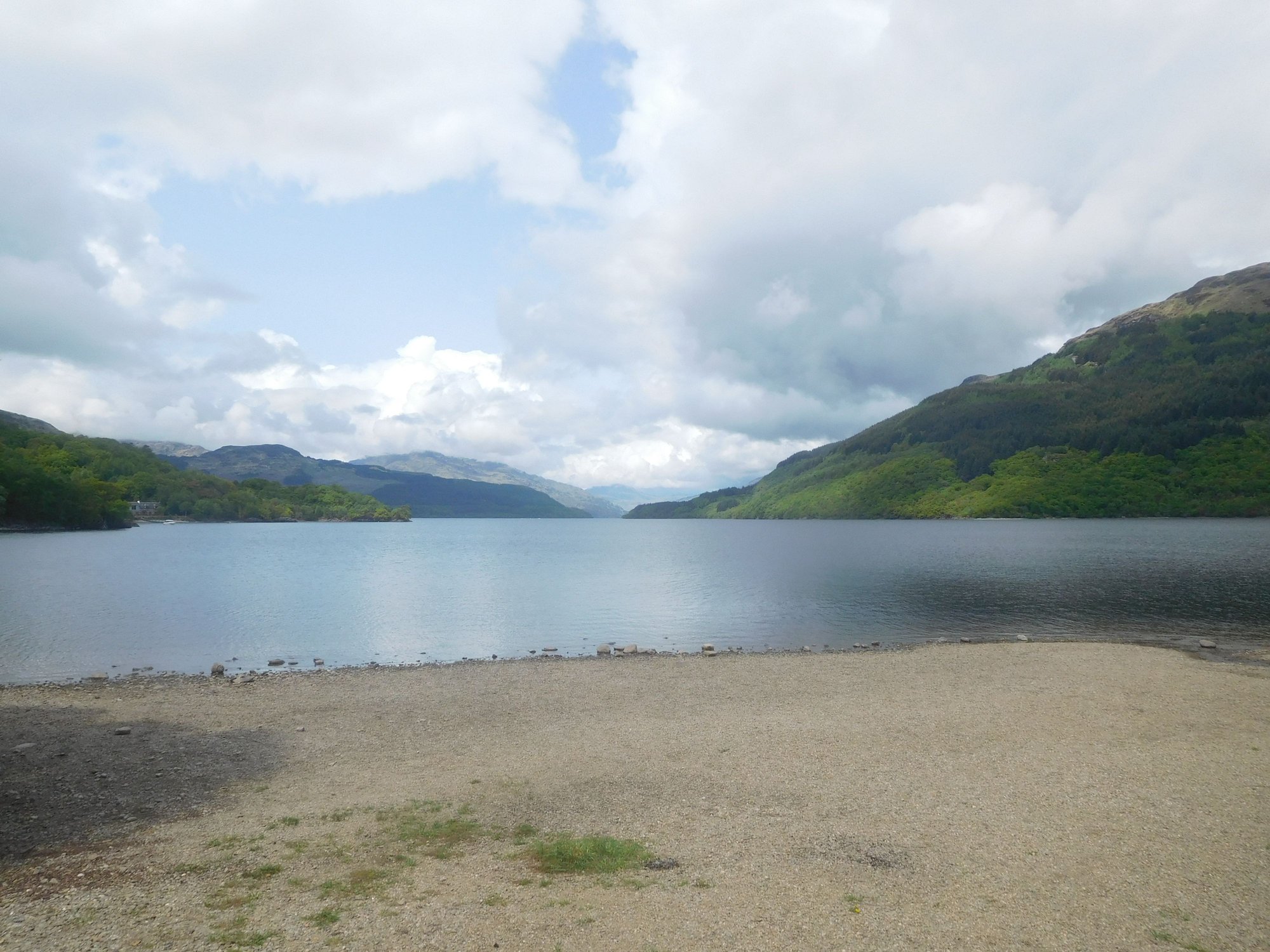
Iconic view over Loch Lomond
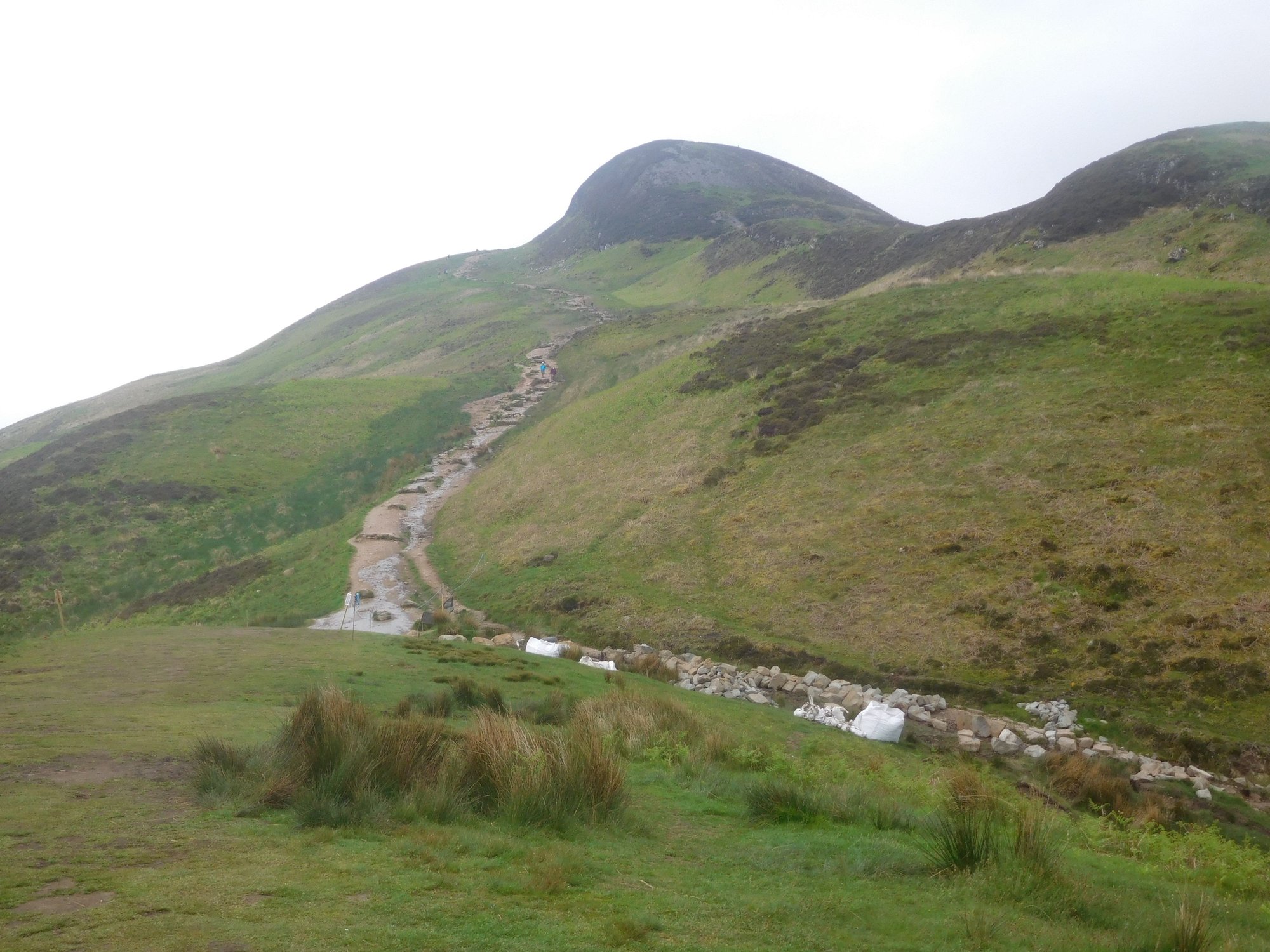
The Conic hill summit, we didn't bother going all the way
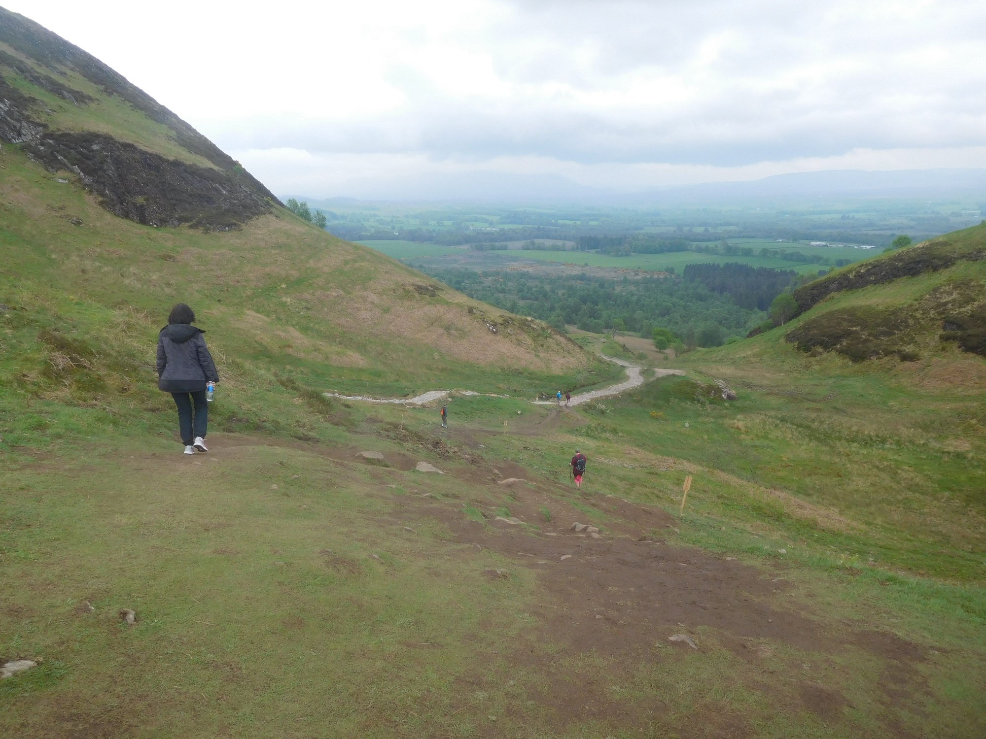
Heading back down
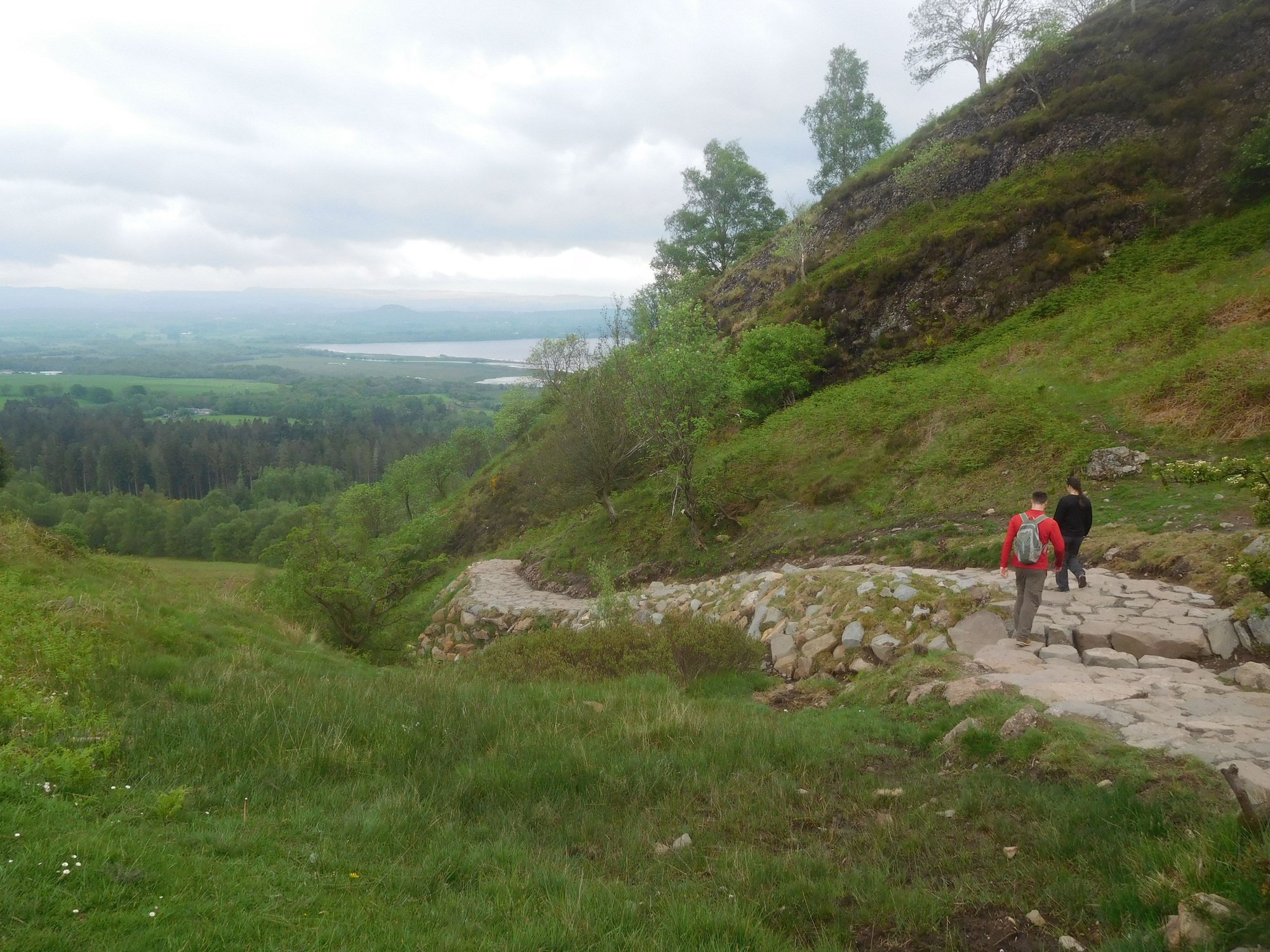
Carefully down the stony steps
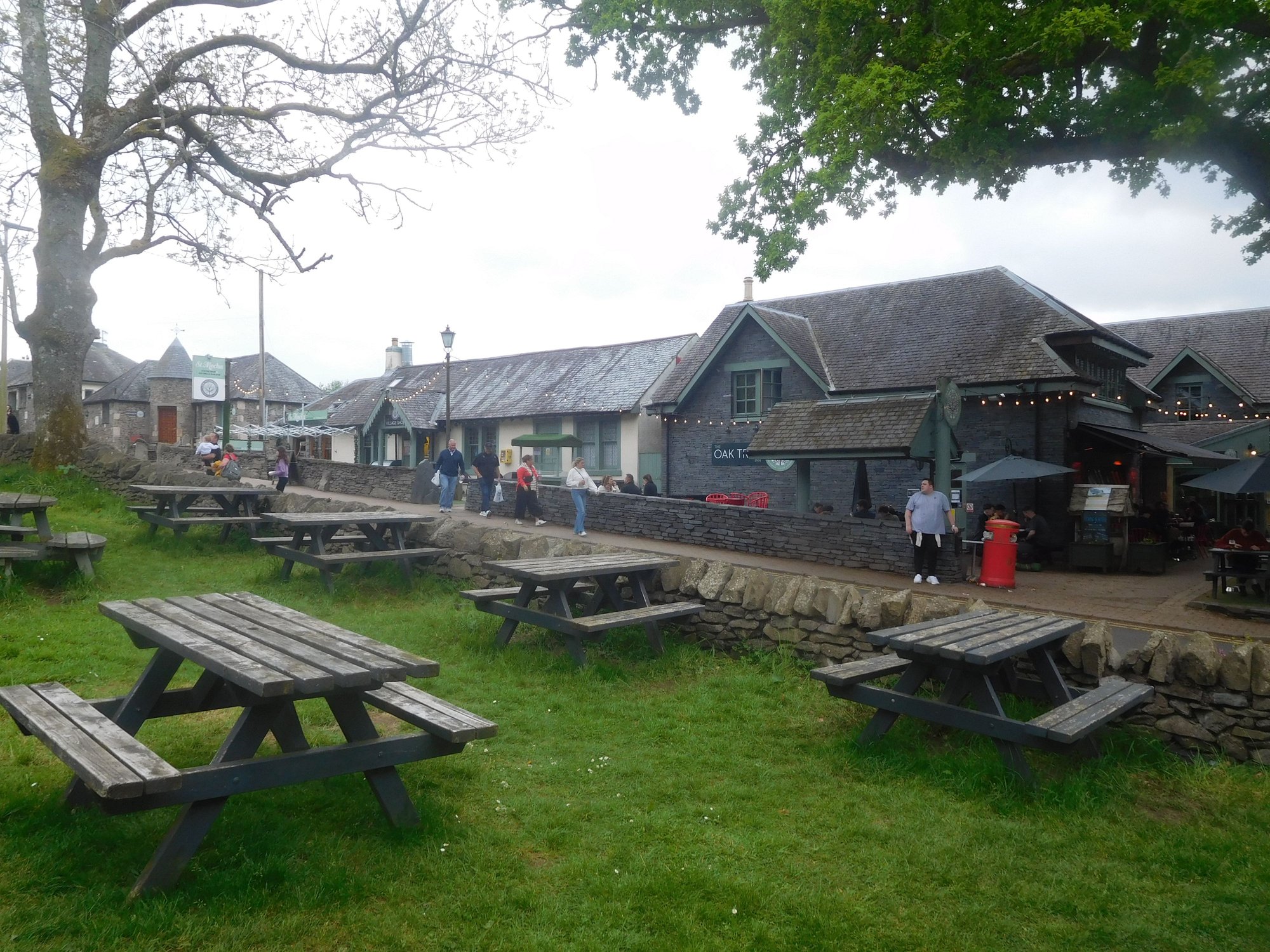
Back at base, near the Oak Tree Inn
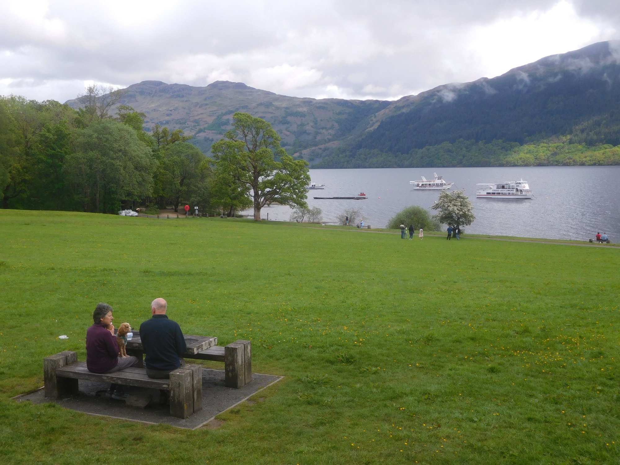
Back down from the hill, we strolled around Balmaha, a very pretty village itself. This was intended to be a �buffer� day to hedge against any ferry related disruptions given Calmac�s unreliability. While the rerouting had caused much stress and inconvenience, we were thankful it didn�t derail our itinerary altogether.
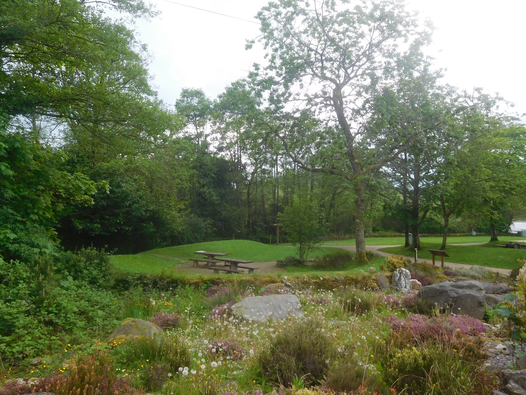
Park / Tom Weir's rest
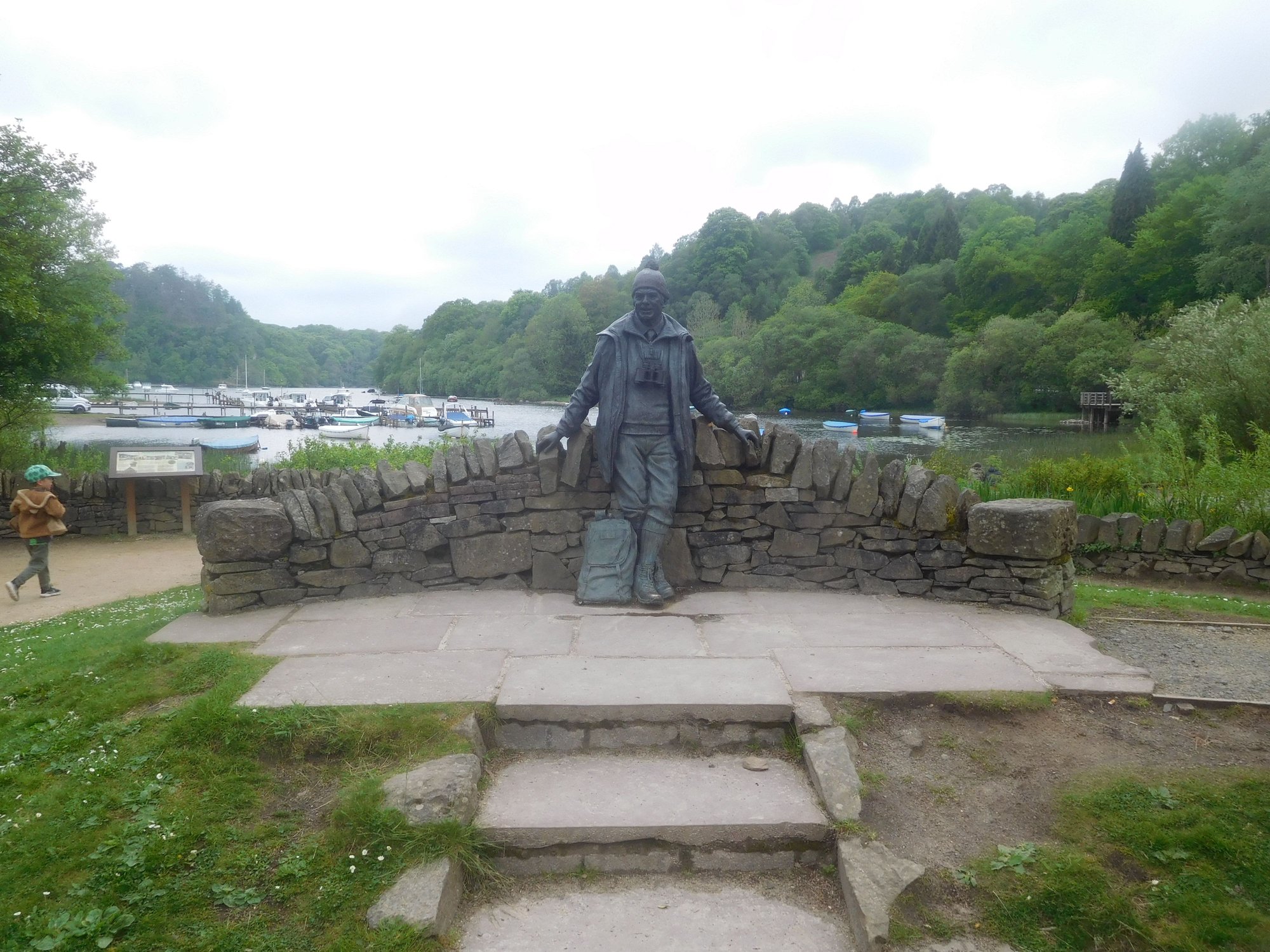
Tom Weir's statue. A mountaineer, author and broadcaster, widely credited with promoting adventure tourism.
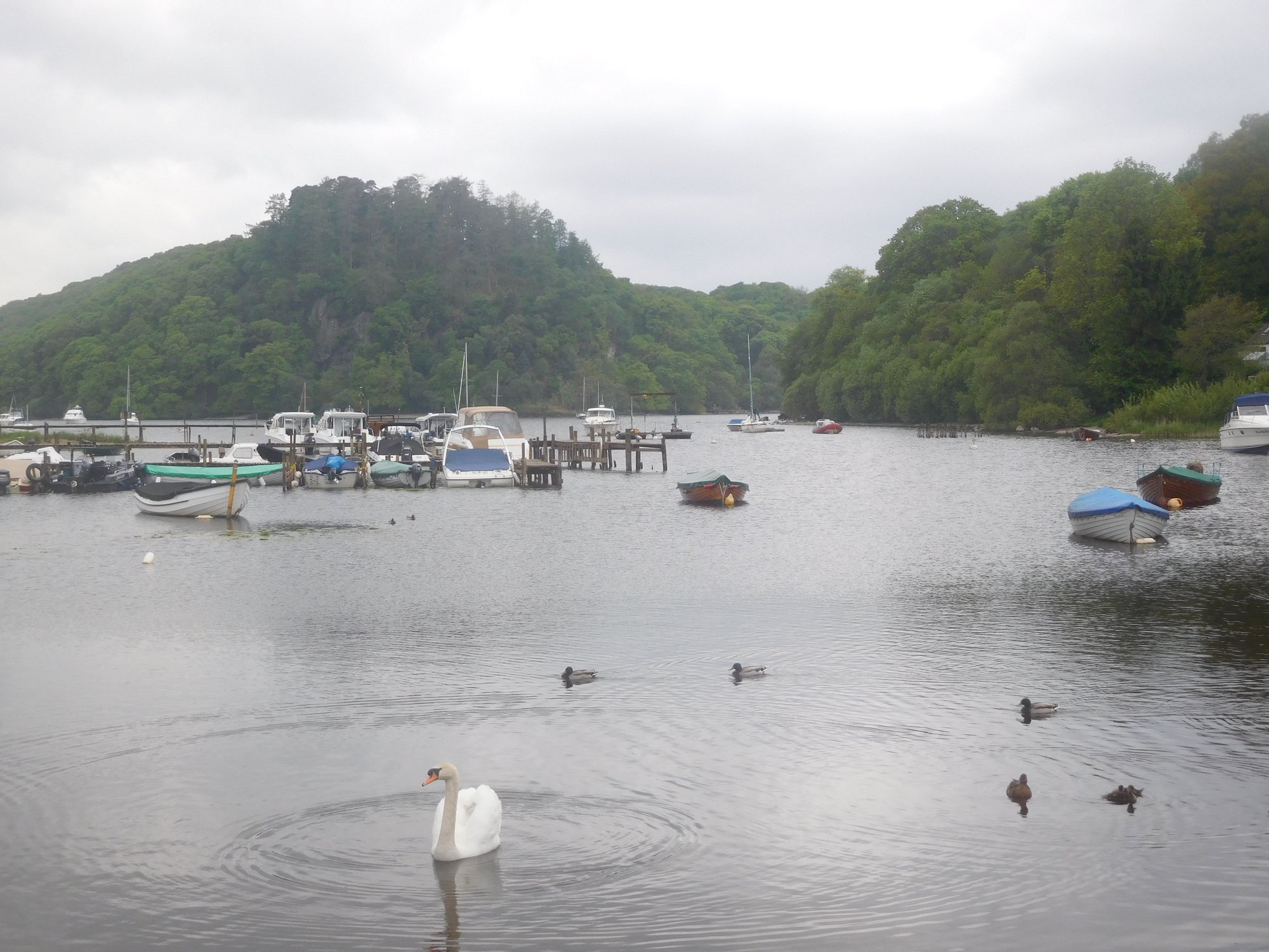
By the shore
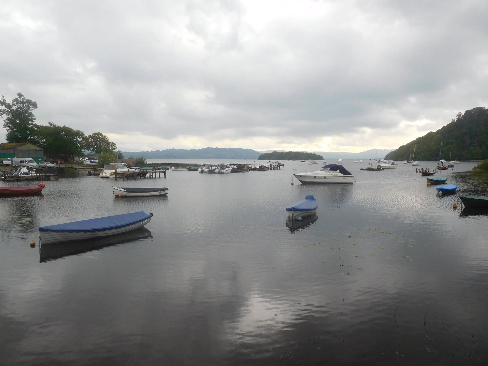
By the ferry point to Inchcailloch island
- leaving Castlebay at 4am in pitch darkness along 9 miles of single-track road, heading to Ardmhor. Thankfully, there was no fog, and my powerful headlamps provided good visibility which boosted my confidence. I drove very slowly and carefully, and was the first car to reach and wait in queue for boarding the ferry to Eriskay.
- racing another 13 miles to Lochboisdale after landing in Eriskay, to catch the 6.10am sailing to Oban. We had been assured that the Calmac staff at Lochboisdale had full information about impacted passengers, and would not leave without us. It all worked out in the end, but it�s an experience I�ll never forget!
On the ferry to Oban (a very long ~5 hour sailing), my wife and I slept like babies waking up only to enjoy the views of Ardnamurchan and Mull as we sailed through the narrow sound to Oban. We were back in Oban after 6 years, and stopped briefly at the Tesco superstore for provisions and filling petrol.
We took the A85 to Tyndrum passing through the stunning Glen Orchy, eventually going down the A82 along Loch Lomond. Loch Lomond is beautiful, but I was surprised to see the amount of development that has taken place along the western shore and the heavy traffic, since our last visit. This has impacted the experience � for example, I could barely recognise the charming village of Luss which we had enjoyed back in 2017 (it was so crowded without any visible parking spots and gave it a miss). We made several others stops though.
Ardlui
Tarbet
Firkin Point
Firkin Point
After passing Balloch at the southern tip of the loch, we took the A811 past Drymen and branched off to Balmaha. This eastern shore is stunningly beautiful and very serene. As we checked into our B&B, our host echoed our sentiments calling the western shore �just a motorway� (a tad harsh!), while the eastern shore and Trossachs were �the real deal�.
After some rest, we set off to hike the Conic Hill. This was the primary reason we chose to base in Balmaha and enjoy the iconic (and much photographed) view over Loch Lomond. The trail begins the large car park near our B&B. It's a beautiful but steep hike, and treacherous in parts - I didn't enjoy the (newly fitted?) stony steps and the boggy sections.
Through the woods, and past the gate
Catching our breath, about half-way up
Early views emerge
Early views emege
Iconic view over Loch Lomond
The Conic hill summit, we didn't bother going all the way
Heading back down
Carefully down the stony steps
Back at base, near the Oak Tree Inn
Back down from the hill, we strolled around Balmaha, a very pretty village itself. This was intended to be a �buffer� day to hedge against any ferry related disruptions given Calmac�s unreliability. While the rerouting had caused much stress and inconvenience, we were thankful it didn�t derail our itinerary altogether.
Park / Tom Weir's rest
Tom Weir's statue. A mountaineer, author and broadcaster, widely credited with promoting adventure tourism.
By the shore
By the ferry point to Inchcailloch island

