43 Best Sights in USA

Background Illustration for Sights

We've compiled the best of the best in USA - browse our top choices for the top things to see or do during your stay.

Marin Headlands

Fodor's Choice

The stunning headlands stretch from the Golden Gate Bridge to Muir Beach, drawing photographers who perch on the southern heights for spectacular shots of the city and bridge. Equally remarkable are the views north along the coast and out to the ocean, where the Farallon Islands are visible on clear days. Hawk Hill (accessed from Conzelman Road) has a trail with panoramic views and is a great place to watch the fall raptor migration; it's also home to the mission blue butterfly.

The headlands' strategic position at the mouth of San Francisco Bay made them a logical site for military installations from 1890 through the Cold War. Today you can explore the crumbling concrete batteries, where naval guns once protected the area. Main attractions are centered on Forts Barry and Cronkhite, which are separated by Rodeo Lagoon and Rodeo Beach, a dark stretch of sand that attracts sandcastle builders and dog owners.

Haleakala National Park – Summit District

Fodor's Choice
The 'Ohe'o Gulch Falls, or Seven Sacred Pools, is the small set of pools and cascades found on 'Ohe'o Gulch Stream at Haleakala National Park, at Kipahulu
© Peter Guttman/PeterGuttman.com

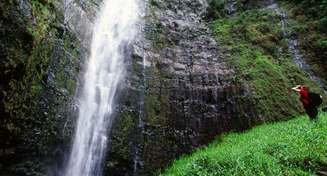
This is one of the few places on Earth can you drive (or bike) from sea level to 10,023 feet in only 38 miles. What's more, in that ascent to summit of the Haleakala volcano, you'll journey from the lush, tropical island landscape to the stark, moonlike basin of the volcano's enormous, otherworldly crater.

Several trails take in these varied landscapes, including the Keoneeheehee (Sliding Sands) Trail, a hike with out-and-back segments to overlooks and down into the crater; if you're truly fit and ambitious, you can even follow it all the way across the crater floor. Hikers and those camping at the tent-only Hosmer Grove Campground (reservations required) should check in at the Park Headquarters Visitor Center, near the Summit District entrance. This is also a good place to learn about the volcano's history and pick up trail maps at the gift shop. You'll also find the Haleakala Visitor Center at the crater's summit.

If you plan to head to the summit before 7 am, you must make sunrise reservations, which you can do up to 60 days before your visit. (Make these and campground reservations at  recreation.gov). Although a few last-minute sunrise-viewing tickets are released online two days out, they can be difficult to secure. Alternatively, consider visiting for sunset. Reservations aren't required and, on most days, the views are as stunning as those during sunrise.

Regardless of when you head up Haleakala, check ahead for the latest weather conditions. Extreme gusty winds, heavy rain, and even snow in winter are not uncommon. Because of the high altitude, the mountaintop temperature is often as much as 30°F cooler than that at sea level, so bring a jacket. In addition, the air is thin at 10,000 feet, so don't be surprised if you feel breathless while walking around the summit. Take it easy, and drink lots of water. Anyone scuba diving within the last 24 hours should not make the trip up Haleakala.

Note that entrance tickets are valid for three days. It's a good idea to hold onto your receipt in case you want to visit the Summit District on more than one day, or you also plan to visit the park's Kipahulu District in East Maui as part of a drive along the Hana Highway.

Puuhonua O Honaunau National Historical Park

Fodor's Choice
Pu'ukohola Heiau National Historic Site on Hawaii's Big Island.
(c) Cecoffman | Dreamstime.com

This breathtaking, 420-acre National Historical Park has the best preserved puuhonua (place of refuge) in the state, and an aura of ancient sacredness and serenity still imbues the place. Providing a safe haven for noncombatants, kapu (taboo) breakers, defeated warriors, and others, the puuhonua offered protection and redemption for anyone who could reach its boundaries, by land or sea. The oceanfront, 960-foot stone wall built more than 400 years ago still stands and is one of the park's most prominent features. A number of ceremonial temples, including the restored Hale o Keawe Heiau (circa 1700), have served as royal burial chambers. Bring a picnic to the oceanfront park, where there are tables and bathrooms. The 2¼-mile, 1871 Trail takes you past incredible lava features and historic sites. This treasure of a park is a must-see for every visitor to the Big Island.

Recommended Fodor's Video

Valley Forge National Historical Park

Fodor's Choice
George Washington Headquarters of the American Revolutionary War Continental Army encampment in Isaac Potts field stone house scenic site at Valley Forge National Historical Park near Philadelphia in Pennsylvania.
(c) Olivierl | Dreamstime.com

The 3,500-acre park is the location of the 1777–78 winter encampment of General George Washington and the Continental Army, where winter tested and proved the army's perseverance. Begin at the excellent Valley Forge Visitor Center for touring information and to explore displays of historical objects and immersive modern exhibits about the encampment and the men and women of all kinds who spent the winter here. The center also has an area with regional visitor information, an orientation film, and the Encampment Store. Take a nine-stop, 10-mile driving tour (free cell phone guide) or buy the audio guide ($8.95); or take a narrated trolley tour (limited times other than summer; reserve ahead) for $22. Call ahead if you want to hire a private tour guide. Stops include reconstructed log huts of the Muhlenberg Brigade and the National Memorial Arch, which pay tribute to the soldiers, and Washington's headquarters.

\n

In 1777 the army had just lost the nearby battles of Brandywine, White Horse, and Germantown, but Washington and his troops were actually encouraged (although exhausted), because they had fought the British well. While the British occupied Philadelphia, Washington's soldiers endured horrid conditions—blizzards, inadequate food and clothing, and disease. Although no battle was fought at Valley Forge, 2,000 soldiers (of about 12,000) died here. The troops did win the war of will, regaining strength under the leadership of Prussian drillmaster Friedrich von Steuben. In June 1778 Washington led his troops away from Valley Forge in search of the British.

\n

The park contains more than 35 miles of jogging and bicycling paths (bike rentals available in summer; call ahead) and hiking trails, and you can picnic in designated areas. A leisurely visit takes about half a day.

Canaveral National Seashore

Fodor's Choice

Miles of grassy, windswept dunes and a virtually empty beach await you at this remarkable 57,000-acre park on a barrier island with 24 miles of undeveloped coastline spanning from New Smyrna to Titusville. The unspoiled area of hilly sand dunes, grassy marshes, and seashell-sprinkled beaches is a large part of NASA's buffer zone and is home to more than 1,000 species of plants and 300 species of birds and other animals.

Surf and lagoon fishing are available, and a hiking trail leads to the top of a Native American shell mound, Turtle Mound. A visitor center is on Route A1A at Apollo Beach. The parks can get busy on weekends or when rocket launches are scheduled during park operating hours, as the park provides a spectacular viewing area for launches from Kennedy Space Center.

7611 S. Atlantic Ave., New Smyrna Beach, FL, 32169, USA
386-428–3384
Sight Details
$20 cars; $10 pedestrians, bicycles; valid for 7 days

Something incorrect in this review?

Cape Cod National Seashore

Fodor's Choice

The region's most expansive national treasure, Cape Cod National Seashore was established in 1961 by President John F. Kennedy, for whom Cape Cod was home and haven. The lands and waters of the Seashore comprise 44,000 acres of the Cape, extending from Chatham to Provincetown. The protected area includes 40 miles of pristine sandy beach; rolling dunes; swamps, marshes, and wetlands; and pitch-pine and scrub-oak forest. Self-guided nature trails, as well as biking and horse trails, wind through these landscapes. Hiking trails from Salt Pond Visitor Center lead to Nauset Marsh, Salt Pond, and the Buttonbush Trail, a quarter-mile nature path designed for people with low or no vision. A hike or bike ride to Coast Guard Beach leads to a turnout looking out over marsh and sea. A section of the cliff here was washed away in 1990, revealing the remains of a prehistoric dwelling. The National Seashore has two visitor centers, one in Eastham and one in Provincetown.

Salt Pond Visitor Center, open year-round at the southern end of the Seashore, reveals sweeping views of the Salt Pond and Nauset Marsh. Activities offered (typically from May to October) include ranger-led walks, canoe and kayak tours, demonstrations, and lectures, as well as evening beach walks, campfire talks, and other programs. The centerpiece of the visitor center lobby is a large map showing Cape Cod's location in the Gulf of Maine, displaying the Cape's glacial history and the powerful natural forces that continue to shape it. The visitor center's museum explores the cultural themes represented on Cape Cod, including the Wampanoag, "The First People of the Light," plus European settlement, fishing, life-saving, lighthouses, communication technology and tourism. An air-conditioned auditorium shows films on geology, sea rescues, whaling, Henry David Thoreau, and Guglielmo Marconi.

Cedar Breaks National Monument

Fodor's Choice

Cedar Breaks is a 3-mile-long natural amphitheater that plunges a half-mile into the Markagunt Plateau, offering spectacular scenery and fewer crowds than at the area's better known national parks. Mostly short alpine hiking trails trace the rim, meandering past wildflowers in summer. You can get a nice view of these distinctive red rock formations that bear a strong resemblance to those of Bryce Canyon at the handful of overlooks along Highway 148—which means hikers, skiers, and snowshoers can usually find solitude along the trails.

Winter is one of the best times to visit, when snow drapes the red-orange formations. A much-needed new visitor center with a park store, exhibits, a new restroom facility, and sheltered outdoor space for public programming  is scheduled to open by the Sunset Trailhead parking area by spring 2024. From here, you can hike the 1-mile round-trip Sunset Trail, which is paved and wheelchair accessible, or embark on the most memorable of the park's hikes, the 5-mile round-trip South Rim Trail. This latter trek is moderately challenging, but if time is short, just hike the first mile to the Spectra Point viewpoint for an eye-popping panorama. Across Highway 148, the easy 0.6-mile round-trip Nature Trail connects with Point Supreme Campground, which has 25 tent and RV sites. In winter, call ahead for conditions (the road is sometimes closed due to heavy snowfall), and keep in mind that visitor facilities are closed from around October through late May, and sometimes longer if there's a lot of snow.

Hwy. 148, Brian Head, UT, 84719, USA
435-986–7120
Sight Details
$10 per person (free under the age of 16)
Visitor center closed mid-Oct.–late May

Something incorrect in this review?

Chiricahua National Monument

Fodor's Choice

Vast fields of desert grass are suddenly transformed into a landscape of forest, mountains, and striking rock formations as you enter the 12,000-acre Chiricahua National Monument. The Chiricahua Apache—who lived in the mountains for centuries and, led by Cochise and Geronimo, tried for 25 years to prevent white pioneers from settling here—dubbed it "the Land of the Standing-Up Rocks." Enormous outcroppings of volcanic rock have been worn by erosion and fractured by uplift into strange pinnacles and spires. Because of the particular balance of sunshine and rain in the area, April and May see brown, yellow, and red leaves coexisting with new green foliage. Summer in Chiricahua National Monument is exceptionally wet: from July through September there are thunderstorms nearly every afternoon. Few other areas in the United States have such varied plant, bird, and animal life. Deer, coatimundi, peccaries, and lizards live among the aspen, ponderosa pine, Douglas fir, oak, and cypress trees—to name just a few.

Chiricahua National Monument is an excellent area for bird-watchers, and hikers have more than 17 miles of scenic trails. Hiking-trail maps and advice are available at the visitor center. A popular and rewarding hike is the moderately easy Echo Canyon Loop Trail, a 3½-mile path that winds through cavelike grottos, brilliant rock formations, and a wooded canyon. Birds and other wildlife are abundant.

Congaree National Park

Fodor's Choice

South Carolina's only national park is unlike any other—the park is the floodplain of the Congaree River, meaning that throughout the year, the majority of this bottomland forest is a true swamp. The wettest, hardest-to-reach areas survived centuries of logging, leaving towering cypress trees—some of the oldest and largest trees east of the Mississippi River—in the heart of the 27,000-acre park. Access varies by your ambition and tolerance for mud. A 2.6-mile loop via elevated boardwalk is handicap accessible and meanders through perennial swamp, higher pine uplands, and past Weston Lake. Longer trails total 25 miles, allowing for loops and overnight treks into the park, but bring extra socks and boots suitable for wading, especially on the fantastic but especially soggy Oakridge Trail. A potentially drier method of exploring the interior is by kayak or canoe. Local outfitters, including River Runner Outdoor Center and Carolina Outdoor Adventures, run three-hour kayak tours from the Cedar Creek Canoe Access. Or, coordinate a shuttle and canoe rental and paddle Cedar Creek one way, putting in at Bannister Bridge Canoe Access.

Bring binoculars and sharp ears—Congaree hosts a cacophony of birds and wildlife, including otters, wild boar, deer, and woodpeckers. The park also has two primitive campgrounds. Book in advance, especially during the two-week synchronized firefly season in May and June.

Apart from packaged snacks at the visitor center, there are no concessions in the park, and nearby restaurants are limited.

For more information see Chapter 11: Congaree National Park.

Cumberland Island National Seashore

Fodor's Choice

Encompassing the vast majority of Cumberland Island, this 36,347-acre preserve has pristine forests and marshes marbled with wooded nature trails, 18 miles of undeveloped beaches, and opportunities for fishing, bird-watching, and viewing the ruins of Thomas Carnegie's great estate, Dungeness. You can also join history and nature walks led by Park Service rangers. Bear in mind that summers are hot and humid and that you must bring everything you need, including your own food, drinks, sunscreen, and insect repellent. The only public access to the island is via the Cumberland Queen II ferry.

Dry Tortugas National Park

Fodor's Choice

This park, 70 miles off the shores of Key West, consists of seven small islands. Most people spend their time on Garden Key, touring the 19th-century Fort Jefferson, the largest brick building in the Western Hemisphere, then heading out to snorkel on the protected reef. The brick fort acts like a gigantic, almost 16-acre reef. Around its moat walls, coral grows and schools of snapper, grouper, and wrasse hang out.

Serious snorkelers and divers head out farther offshore to epic formations, including Palmata Patch, one of the few surviving concentrations of elkhorn coral in the Keys. Day-trippers congregate on the sandy beach to relax in the sun and enjoy picnics. Overnight tent campers have use of restroom facilities and achieve a total getaway from noise, lights, and civilization in general.

The park has signposted a self-guided tour that takes about 45 minutes. You should budget more time if you're into photography because the scenic shots are hard to pass up. Ranger-guided tours are also available at certain times. Check in at the visitor center for a schedule.

Expert Talks

Fodor's Choice

Informal lectures take place on the Zion Human History Museum patio twice a day (10:30 am and 2:30 pm) and daily at 4 pm at Zion Lodge and may cover anything from wildlife and geology to the stories of early settlers. Talks usually last from 20 to 30 minutes, though some run longer.

Fort Clatsop–Lewis and Clark National Historical Park

Fodor's Choice

See where the 30-member Lewis and Clark Expedition endured a rain-soaked winter in 1805–06, hunting, gathering food, making salt, and trading with the local Clatsops, Chinooks, and Tillamooks. This memorial is part of the 3,200-acre Lewis and Clark National Historical Park and is a faithful replica of the log fort depicted in Clark's journal. The fort lies within a forested wonderland, with an exhibit hall, gift shop, film, and trails. Park rangers dress in period garb during the summer and perform such early-19th-century tasks as making fire with flint and steel. Hikers enjoy the easy 1-mile Netul Landing Trail and the more rigorous but still fairly flat 6½-mile Fort to Sea Trail.

Full Moon Hikes

Fodor's Choice

Once a month from March through November, the park offers ranger-led full-moon hikes along the Dune Life Nature Trail. These nocturnal adventures are fun for the whole family and show the landscape in a fascinating, luminous perspective. Tickets are required and can be purchased online for $8. They are available exactly two months ahead and sell out almost immediately. 

Grand Staircase–Escalante National Monument

Fodor's Choice

This breathtaking, immense, and often difficult-to-access wilderness became a national monument in 1996. And although its federal status continues to generate controversy that has led to reductions and subsequent restorations of its boundaries, this nearly 1.9-million-acre tract of red rock canyons, stepped escarpments (the Grand Staircase), sheer rock ridges, and sweeping mesas continues to beguile hikers, canyoneers, and other outdoors enthusiasts. Unlike parks and monuments operated by the National Park Service, Grand Staircase–Escalante is administered by the Bureau of Land Management (BLM), and visiting its key attractions requires a bit more research and effort than, for example, Bryce or Capitol Reef, which are relatively more compact and accessible.

The best way to plan your adventures within the park is by stopping by one of the four visitor centers in the area, the best of these being the stunning Escalante Interagency Visitor Center in downtown Escalante. The smaller BLM Visitor Center in Cannonville is also helpful, or if you're entering the monument from the south, check out the BLM Visitor Centers in Kanab and Big Water. Given that many of the monument's top attractions are in remote areas with limited signage and access via unpaved (and sometimes very rough) roads, many visitors hire one of the area's many experienced outfitters and guides—this is an especially smart strategy if it's your first time in the area. Some of the monument's top attractions are big draws—including Calf Creek Recreation Area and the several hikes and vistas along Hole-in-the-Rock Road accessed from Escalante, the Burr Trail up near Boulder, and the Paria Movie Set and Paria Canyon–Vermilion Cliffs Wilderness east of Kanab.

Great Falls Park

Fodor's Choice

Facing the C&O Canal National Historical Park across the Potomac River on the Virginia side, this is where the steep, jagged falls of the Potomac roar into the narrow Mather Gorge, the rocky narrows that make the Potomac churn. No matter the time of year, the views of the falls and river are spectacular, and more than 150 species of birds make their home in and around the 800-acre park. Great Falls Park is a favorite for outings; here you can follow trails past the old Patowmack Canal and among the boulders and forests lining the edge of the falls. There are three overlooks in the park, two of which are accessible to people with disabilities. Camping and alcoholic beverages are not allowed, but you can fish (a Virginia or Maryland license is required), climb rocks (climbers must register first at the visitor center or lower parking lot), or—if you're an experienced boater with your own equipment—go white-water kayaking (below the falls only).

As is true all along this stretch of the river, the currents are deadly. Despite frequent signs and warnings, there are those who occasionally dare the water and drown.

Staff members conduct special tours and walks year-round.

Kaloko–Honokohau National Historical Park

Fodor's Choice

The trails at this sheltered 1,160-acre coastal park near Honokohau Harbor, just north of Kailua-Kona, are popular with walkers and hikers, and the park is a good place to observe Hawaiian archaeological history and intact ruins. These include a heiau (temple), house platforms, ancient fishponds, and numerous petroglyphs along a boardwalk. The park's wetlands provide refuge to waterbirds such as the endemic Hawaiian stilt and coot. Two beaches here are good for swimming, sunbathing, and sea turtle spotting: Aiopio, a few yards north of the harbor, is small and calm, with protected swimming areas (good for kids); Honokohau Beach, also north of the harbor, is a ¾-mile stretch with ruins of ancient fishponds. Of the park's three entrances, the middle one leads to a visitor center with helpful rangers and lots of information. Local docents with backgrounds in geology or other subjects give nature walks. To go directly to the beaches, take the harbor road north of the Gentry retail center, park in the gravel lot, and follow the signs.

Kasha-Katuwe Tent Rocks National Monument

Fodor's Choice

Volcanic tent-shaped hoodoos and narrow slot canyons are the hallmarks of this enchanted landscape accessed from Interstate 25 between Albuquerque and Santa Fe. The national monument was established in 2001 and is managed in cooperation with Cochiti Pueblo, whose residents have called the area Kasha-Katuwe for centuries. The sandstone rock formations here are a visual marvel, resembling stacked tents in a stark, water- and wind-eroded box canyon. Tent Rocks offers superb hiking year-round, although it can get hot in summer, when you should bring extra water. The drive to this magical landscape offers its own delights, as the road from Interstate 25 heads west toward Cochiti Dam and through the cottonwood groves around the pueblo. It's a good hike for kids. Just 2 miles round-trip, hiking Tent Rock takes only about 1½ leisurely hours, but it's the kind of place where you'll want to hang out for a while. Take a camera, but leave your pets at home—no dogs are allowed. There are no facilities here, just a small parking area with a posted trail map and a self-pay admission box; you can get gas and pick up picnic supplies and bottled water (along with some locally made Pueblo items) at Pueblo de Cochiti Convenience Store, a few miles up the road. Note that as of fall 2023, the national monument remained closed to visitors following the COVID-19 pandemic, but plans are under way to reopen the property through a day-use reservation system (to discourage over-crowding); check the website for the latest updates.

Monument Valley Navajo Tribal Park

Fodor's Choice

The Navajo have farmed and herded sheep in Monument Valley for generations; the landscape remains one of the most striking in the Navajo Nation. At its center is the 30,000-acre Monument Valley Navajo Tribal Park, where wind and rain have shaped massive red-sandstone monoliths into the formations that define the horizon. Rising hundreds of feet above the desert floor, they stand largely undisturbed—no power lines, no fences—giving the scene a timeless feel.The setting may look familiar from classic Westerns, including many John Wayne films, but it holds its own well beyond the screen. A 17-mile self-guided drive over a rough dirt road loops past landmarks like the Mittens and Totem Pole. It’s the only road through the park, so navigation is straightforward, but conditions can be challenging depending on the weather.  Be sure to walk (15 minutes round-trip) from North Window around the end of Cly Butte for the views.

Monument Valley Rd., Monument Valley, UT, 84536, USA
435-727–5870-visitor center
Sight Details
$15 per person
Closed Thanksgiving, Christmas, and New Year's Day

Something incorrect in this review?

Muir Woods National Monument

Fodor's Choice

One of the last old-growth stands of redwood (Sequoia sempervirens) giants, Muir Woods is nature's cathedral: awe-inspiring and not to be missed. The nearly 560 acres of Muir Woods National Monument contain some of the most majestic redwoods in the world—some more than 250 feet tall.

Part of the Golden Gate National Recreation Area, Muir Woods is a pedestrian's park. The popular 2-mile main trail begins at the park headquarters and provides easy access to streams, ferns, azaleas, and redwood groves. Weekends can prove to be very busy, so consider taking a more challenging route, such as the Ben Johnson Trail–Dipsea Trail route, which climbs west from the forest floor to soothing views of the ocean and the Golden Gate Bridge.

Picnicking and camping aren't allowed, and neither are pets. Crowds can be large, especially from May through October, so come early in the morning or late in the afternoon. The Muir Woods Visitor Center has books and exhibits about redwood trees and the woods' history as well as the latest info on trail conditions. The Muir Woods Trading Company serves hot food, pastries, and coffee, and the gift shop offers plenty of souvenirs.

Muir Woods has no cell service or Wi-Fi, so plan directions and communication ahead of time.

For parking reservations (required) and shuttle information, visit  gomuirwoods.com. To drive directly from San Francisco, take U.S. 101 North across the Golden Gate Bridge to Exit 445B for Mill Valley/Stinson Beach, then follow signs for Highway 1 North and Muir Woods.

Oregon Dunes National Recreation Area

Fodor's Choice

The largest expanse of coastal sand dunes in North America extends for 40 miles from Florence to Coos Bay. This favorite destination for ATV riding encompasses some 31,500 acres and draws more than 1.5 million visitors annually. Within the recreation area, 515-acre Honeyman Memorial State Park is a base camp for dune-buggy enthusiasts, mountain bikers, hikers, boaters, horseback riders, and dogsledders (the sandy hills are an excellent training ground). There's a campground, too. The dunes are a vast playground for children, particularly the slopes surrounding cool Cleawox Lake. If you have time for just a quick scamper in the sand, stop by the Oregon Dunes Overlook off U.S. 101, 11 miles south of Florence across from Crown Zellerback Campground; or hike the short and easy path to some towering dunes at John Dellenback Dunes Trailhead, which is 11 miles south of Reedsport, just south of Eel Creek Campground.

Pearl Harbor National Memorial

Fodor's Choice

Pearl Harbor is still a working military base as well as Oahu’s most visited attraction, consisting of five distinct destinations. Managed by the National Park Service, the Pearl Harbor Visitor Center and USS Arizona Memorial make up the national memorial, where exhibits tell the story not only of the devastating Japanese attack on Pearl Harbor on December 7, 1941, but also of the wartime internment of Japanese Americans, World War II battles in the Aleutian Islands, and the occupation of Japan after the war. The history continues at three privately operated sights: the Pacific Fleet Submarine Museum (whose centerpiece is the USS Bowfin), the Battleship Missouri Memorial, and the Pearl Harbor Aviation Museum.

A valid government-issued photo ID is required to enter the base. You can walk to the visitor center or the submarine museum from the parking lot, but access to the USS Arizona requires a ferry ride (and ticket reservations via  www.recreation.gov), and access to other sites, including the USS Missouri and the aviation museum, requires a shuttle bus trip. Advance reservations are required to access USS Arizona Memorial. There are no same-day tickets except rare standby spots.

No bags of any kind except clear stadium ones—not even small purses—are allowed at any of the sights, though cameras, cell phones, and wallets can be hand-carried. A bag check is available. Children under four can visit the submarine museum, but for safety reasons, they are not allowed on the USS Bowfin itself.

1 Arizona Memorial Pl., Pearl Harbor, HI, USA
808-422–3399-timed ticket reservations
Sight Details
Visitor center and USS Arizona Memorial free (aside from $1 ticket reservation fee); fees for other sites; parking $7

Something incorrect in this review?

Point Reyes National Seashore

Fodor's Choice

One of the Bay Area's most spectacular treasures and the only national seashore on the West Coast, the 71,000-acre Point Reyes National Seashore encompasses hiking trails, secluded beaches, and rugged grasslands, as well as Point Reyes itself, a triangular peninsula that juts into the Pacific. The Point Reyes Lighthouse occupies the peninsula's tip and is a scenic 21-mile drive from Bear Valley Visitor Center.

When Sir Francis Drake sailed along the California coast in 1579, he allegedly missed the Golden Gate Strait and San Francisco Bay, but he did land at what he described as a convenient harbor. In 2012 the federal government recognized Drake's Bay, which flanks the point on the east, as that harbor, designating the spot a National Historic Landmark.

The infamous San Andreas Fault runs along the park's eastern edge; take the Earthquake Trail from the visitor center to see the impact near the epicenter of the 1906 earthquake that devastated San Francisco. A half-mile path from the visitor center leads to Kule Loklo, a reconstructed Miwok village of the region's first known inhabitants.

You can experience the diversity of Point Reyes's ecosystems on the scenic Coast Trail through eucalyptus groves and pine forests and along seaside cliffs to beautiful and tiny Bass Lake.

The 4.7-mile-long (one-way) Tomales Point Trail follows the spine of the park's northernmost finger of land through the Tule Elk Preserve, providing spectacular ocean views from high bluffs. The excellent Point Reyes Safari ( pointreyessafaris.com) tour takes guests to the preserve to see the majestic Tule elk, along with other local wildlife.

USS Arizona Memorial

Fodor's Choice

Lined up tight in a row of seven battleships off Ford Island, the USS Arizona took a direct hit on December 7, 1941, exploded, and rests still on the shallow bottom where she settled. You must reserve tickets ( www.recreation.gov) ahead of time to ensure access to the memorial; same-day tickets are no longer offered. As spaces are limited and tend to fill up, reserve as far ahead as possible; you can do so up to two months in advance. When your tour starts, you watch a short documentary film, then board the ferry to the memorial.

The swooping, stark-white structure, which straddles the wreck of the USS Arizona, was designed by Honolulu architect Alfred Preis to represent both the depths of the low-spirited, early days of the war and the uplift of victory. A somber, contemplative mood descends upon visitors during the ferry ride; this is a place where 1,177 people died. Gaze at the names of the dead carved into the wall of white marble. Look at oil on the water's surface, still slowly escaping from the sunken ship. Scatter flowers (but no lei—the string is bad for the fish). Salute the flag. Remember Pearl Harbor.

Pearl Harbor, HI, 96818, USA
808-422–3399
Sight Details
Free (advance reservation fee for timed-entry tickets $1); audio tours and other features cost extra

Something incorrect in this review?

Bathhouse Row

Fronted by a wide sidewalk and a row of magnolia trees, Bathhouse Row consists of eight architecturally unique structures that date from 1892 to 1923 and showcase the importance of hydrotherapy prior to the advent of modern medicine. Once doctors stopped prescribing the "water cure," most of the bathhouses sat vacant until the park—in an effort to preserve and utilize the stately structures—began leasing them to the private sector. Today, all but one is occupied. Two operate as actual bathhouses (Quapaw and Buckstaff), and the others house a brewery and restaurant (Superior), a hotel and restaurant (Hale), a visitor center and museum ( Fordyce), a cultural center featuring artwork from the park's Artist-in-Residence Program (Ozark), and a gift shop (Lamar).

Bighorn Canyon National Recreation Area

To learn about this 120,000-acre national park wilderness that was established in 1966 following the creation of Yellowtail Dam, visit the South District's Cal Taggart Visitor Center in Lovell, Wyoming, where you can view geological and historical exhibits on the area, as well as a film about the canyon. Two shorter movies, one on the Pryor Mountain wild horses and the other about Medicine Wheel National Historic Landmark (east of Lovell), are shown on request, and there's a small gift and bookshop. The park's South District is reached by heading north on Route 37 east of Lovell and encompasses Horseshoe Bend Marina, Devil Canyon Overlook, 12 hiking trails (in both Wyoming and southern Montana), four historic ranches that you can tour on your own, and three campgrounds. The park's North District is 120 miles north, in Fort Smith, Montana. Note that part of the park near Lovell is adjacent to Yellowtail Wildlife Management Area at the southern end of Bighorn Lake. More than 155 species of birds—including white pelicans, pheasants, bald eagles, and great blue herons—inhabit the 19,202-acre refuge, as do numerous other animal species, including red fox, mule deer, and cottontail rabbits.

20 U.S. 14A, Lovell, WY, 82431, USA
307-548–5406
Sight Details
Free

Something incorrect in this review?

Cascade-Siskiyou National Monument

One of the West's most underrated national park units, this 114,000-acre swath of wilderness preserves a diverse landscape of towering volcanic mountains, arid high desert, and fertile river valley. Follow Highway 66 east from Ashland to access some of the monument's best hikes, which include a 3-mile round-trip jaunt up to Hobart Bluff, a 4-mile round-trip climb to the observation tower atop Soda Mountain, and a 2.8-mile round-trip trek to Pilot Rock, an ancient volcanic plug. A long section of the Pacific Crest Trail also passes through the monument, including an easy section around Hyatt Lake, a pristine reservoir that's popular for kayaking, trout fishing, and camping. Not far from the lake, Green Springs Inn & Cabins offers rustic but beautifully situated accommodations; adjacent to it is a BLM contact station where rangers can supply maps and advice on what to see in this rugged section of southern Oregon. 

De Soto National Memorial

Hernando de Soto, one of the first Spanish explorers to land in North America, came ashore with his men and 200 horses near what is now Bradenton in 1539. This federal park commemorates De Soto's expedition and the Native Americans he and his crew encountered.

During the height of tourist season, from mid-December to late April, park staff and volunteers dress in period costumes at Camp Uzita, demonstrate the use of 16th-century weapons, and show how European explorers prepared and preserved food for their overland journeys. The season ends with a reenactment of the explorer's landing. The site also offers a film and short nature trail through the mangroves.

8300 De Soto Memorial Hwy., Bradenton, FL, 34209, USA
941-792–0458
Sight Details
Free (donations accepted)

Something incorrect in this review?

Duck Harbor

This half of Isle au Haut is part of Acadia National Park and has more than 18 miles of trails winding through quiet spruce woods, along beaches and seaside cliffs, and over the spin of the central mountain's ridge. The park's small campground, with several lean-tos, is open from mid-May to mid-October and fills up quickly. Reservations (as far in advance as possible) are essential. 

Elkhorn Ranch

This remote unit of the park is composed of the 218 acres of ranchland where Theodore Roosevelt ran cattle on the open range. Today there are no buildings, but foundation blocks outline the original structures.

Visitors who have two to three days in the park or are diehard “Rooseveltians” should make this trek, and then only when it hasn’t been raining because most of the route is on unpaved roads; check with visitor center staff about road conditions.

This area truly encapsulates the spirit of why this is called Roosevelt National Park.

Theodore Roosevelt National Park, ND, 58645, USA
701-623–4466-South Unit
Sight Details
Free

Something incorrect in this review?