2 Best Sights in Big Island, Hawaii

Background Illustration for Sights

Nicknamed "The Big Island," Hawaii Island is a microcosm of Hawaii the state. From long white-sand beaches and crystal-clear bays to rain forests, waterfalls, valleys, exotic flowers, and birds, all things quintessentially Hawaii are well represented here.

An assortment of happy surprises also distinguishes the Big Island from the rest of Hawaii—an active volcano (Kilauea) oozing red lava and creating new earth every day, the clearest place in the world to view stars in the night sky (Maunakea), and some seriously good coffee from the famous Kona district, and also from neighboring Kau.

Home to eight of the world’s 13 sub-climate zones, this is the land of fire (thanks to active Kilauea volcano) and ice (compliments of not-so-active Maunakea, topped with snow and expensive telescopes). At just under a million years old, Hawaii is the youngest of the main Hawaiian Islands. Three of its five volcanoes are considered active: Mauna Loa, Hualalai, and Kilauea. The Southeast Rift Zone of Kilauea has been spewing lava regularly since January 3, 1983; another eruption began at Kilauea's summit caldera in March 2008, the first since 1982. Back in 1984, Mauna Loa's eruptions crept almost to Hilo, and it could fire up again any minute—or not for years. Hualalai last erupted in 1801, and geologists say it will definitely do so again within 100 years. Maunakea is currently considered dormant but may very well erupt again. Kohala, which last erupted some 120,000 years ago, is inactive, but on volatile Hawaii Island, you can never be sure.

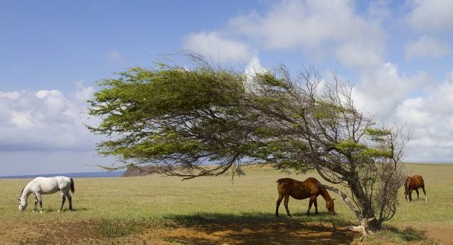
Ka Lae

Horses at South Point graving around a wind blown tree.
Marty Wakat / Shutterstock

According to ancient Hawaiian lore, the first Polynesians came ashore at South Point, known in Hawaiian as "Ka Lae." The southernmost point of land in the United States, the South Point Complex is a National Historic Landmark known for the oldest Hawaiian settlement in the Islands, uncovered by archaeologists in 1956. Old canoe-mooring holes, still visible, were carved through the rocks, possibly by settlers from Tahiti as early as AD 750. Today, visitors come here for the views and access to Green Sand Beach. To get to the beach, drive 12 miles down the turnoff road, past rows of giant electricity-producing windmills powered by the nearly constant winds sweeping across this coastal plain. Bear left when the road forks, and park in the lot at the end. Walk past the boat hoists toward the little lighthouse. South Point is just past the lighthouse at the southernmost cliff. You may see brave locals jumping off the cliffs and then climbing up rusty old ladders, but swimming here is not recommended. Don't leave anything of value in your car. The area is isolated and without services. Green Sand Beach is a 40-minute hike down the coast.

South Point Rd. off Mamalahoa Hwy., HI, 96772, USA
Sight Details
Free

Something incorrect in this review?

Thurston Lava Tube (Nahuku)

One of the park's star attractions, Thurston Lava Tube (named "Nahuku" in Hawaiian) spans 600 feet underground. The massive cavelike tube, discovered in 1913, was formed by hot molten lava traveling through the channel. To reach the entrance of the tube, visitors descend a series of stairs surrounded by Hawaiian rain forest and the sounds of native birds. The Kilauea eruption of 2018 resulted in an almost two-year closure of the tube. During the closure, the drainage system was improved to reduce standing water on the cave’s floor, and electrical lines and lighting were replaced. Visitors should not touch the walls or delicate tree root systems that grow down through the ceiling. Parking is limited near the tube. If the lot is full, you can park at the Kilauea Iki Overlook parking lot, ½ mile away.