25 Best Sights in Grand Canyon National Park, Arizona

Bright Angel Point

Fodor's choice

Bright Angel Point is one of the most awe-inspiring overlooks on either rim. To get to it, follow the trail that starts on the grounds of the Grand Canyon Lodge and runs along the crest of a point of rocks that juts into the canyon for several hundred yards. The walk is only ½ mile round-trip, but it's an exciting trek accented by sheer drops on each side of the trail. In a few spots where the route is extremely narrow, metal railings ensure visitors' safety. The temptation to clamber out on precarious perches to have your picture taken should be resisted at all costs.
Grand Canyon Skywalk

Fodor's choice

This cantilevered glass terrace is suspended nearly 4,000 feet above the Colorado River and extends 70 feet from the edge of the Grand Canyon. Approximately 10 feet wide, the bridge's deck, made of tempered glass several inches thick, has 5-foot glass railings on each side creating an unobstructed open-air platform. Admission to the skywalk is an add-on to the basic Grand Canyon West admission. Visitors must store personal items, including cameras, cell phones, and video cameras, in lockers before entering. A professional photographer takes photographs of visitors, which can be purchased from the gift shop.

Buy Tickets Now

Hopi Point

Fodor's choice

From this elevation of 7,071 feet, you can see a large section of the Colorado River; although it appears as a thin line, the river is nearly 350 feet wide. The overlook extends farther into the canyon than any other point on Hermit Road. The incredible unobstructed views make this a popular place to watch the sunset.

Across the canyon to the north is Shiva Temple. In 1937 Harold Anthony of the American Museum of Natural History led an expedition to the rock formation in the belief that it supported life that had been cut off from the rest of the canyon. Imagine the expedition members' surprise when they found an empty Kodak film box on top of the temple—it had been left behind by Emery Kolb, who felt slighted for not having been invited to join Anthony's tour.

Directly below Hopi Point lies Dana Butte, named for a prominent 19th-century geologist. In 1919 an entrepreneur proposed connecting Hopi Point, Dana Butte, and the Tower of Set across the river with an aerial tramway, a technically feasible plan that fortunately has not been realized.

Recommended Fodor's Video

Mather Point

Fodor's choice

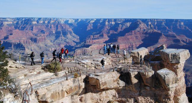
You'll likely get your first glimpse of the canyon from this viewpoint, one of the most impressive and accessible (next to the main visitor center plaza) on the South Rim. Named for the National Park Service's first director, Stephen Mather, this spot yields extraordinary views of the Grand Canyon, including deep into the inner gorge and numerous buttes: Wotans Throne, Brahma Temple, and Zoroaster Temple, among others.

Point Sublime

Fodor's choice

You can camp within feet of the canyon's edge at this awe-inspiring site. Sunrises and sunsets are spectacular. The winding road, through gorgeous high country, is only 17 miles, but it will take you at least two hours one-way. The road is intended only for vehicles with high road clearance (pickups and four-wheel-drive vehicles). It is also necessary to be properly equipped for wilderness road travel. Check with a park ranger or at the information desk at Grand Canyon Lodge before taking this journey. You may camp here only with a permit from the Backcountry Information Center.

Yavapai Point

Fodor's choice

Dominated by the Yavapai Geology Museum and Observation Station, this point displays panoramic views of the mighty gorge through a wall of windows. Exhibits at the museum include videos of the canyon floor and the Colorado River, a scaled diorama of the canyon with national park boundaries, fossils, and rock fragments used to re-create the complex layers of the canyon walls, and a display on the natural forces used to carve the chasm. Dig even deeper into Grand Canyon geology with free daily ranger programs. This point is also a good location to watch the sunset.

Desert View Watchtower

From the top of the 70-foot stone-and-mortar watchtower with its 360-degree views, even the muted hues of the distant Painted Desert to the east and the Vermilion Cliffs rising from a high plateau near the Utah border are visible. In the chasm below, angling to the north toward Marble Canyon, an imposing stretch of the Colorado River reveals itself. Up several flights of stairs, the watchtower houses a glass-enclosed observatory with telescopes.

Eagle Point

The heart of Grand Canyon West, this scenic overlook is where you'll find the Skywalk, the Sky View Restaurant, a café, replicas of Native American structures, and a shop where you can purchase authentic Native American crafts. Hualapai musicians and dancers perform Friday, Saturday, and Sunday from 10 am to 3 pm at the outdoor amphitheater here.

Grandview Point

Grandview Point
Phlens | Dreamstime.com

At an elevation of 7,399 feet, the view from here is one of the finest in the canyon. To the northeast is a group of dominant buttes, including Krishna Shrine, Vishnu Temple, Rama Shrine, and Sheba Temple. A short stretch of the Colorado River is also visible. Directly below the point, and accessible by the steep and rugged Grandview Trail, is Horseshoe Mesa, where you can see remnants of Last Chance Copper Mine.

Guano Point

Named for the nitrogen-rich bat droppings (guano) that were mined from a cave across the canyon, Guano Point boasts the most spectacular landscapes at the West Rim. You'll have to make a short hike from the shuttle drop-off to get to the no-longer-functioning aerial tramway at the point, but once there, you'll be rewarded with nearly 360-degree views of the canyon and the river below. Guano Point Cafe serves BBQ and curried vegetables.

Hermits Rest

This westernmost viewpoint and Hermit Trail, which descends from it, were named for "hermit" Louis Boucher, a 19th-century French-Canadian prospector who had a number of mining claims and a roughly built home down in the canyon. The trail served as the original mule ride down to Hermit Camp beginning in 1914. Views from here include Hermit Rapids and the towering cliffs of the Supai and Redwall formations. You can buy curios and snacks in the stone building at Hermits Rest.

Lipan Point

Here, at the canyon's widest point, you can get an astonishing visual profile of the gorge's geologic history, with a view of every eroded layer of the canyon and one of the longest visible stretches of Colorado River. The spacious panorama stretches to the Vermilion Cliffs on the northeastern horizon and features a multitude of imaginatively named spires, buttes, and temples—intriguing rock formations named after their resemblance to ancient pyramids. You can also see Unkar Delta, where a creek joins the Colorado to form powerful rapids and a broad beach. Ancestral Pueblo farmers worked the Unkar Delta for hundreds of years, growing corn, beans, and melons.

Lookout Studio

Built in 1914 to compete with the Kolbs' photographic studio, the building was designed by architect Mary Jane Colter. The combination lookout point, museum, and gift shop has a collection of fossils and geologic samples from around the world. An upstairs loft provides another excellent overlook into the gorge below.

Maricopa Point

This site merits a stop not only for the arresting scenery, which includes the Colorado River below, but also for its view of a defunct mine operation. On your left, as you face the canyon, are the Orphan Mine, a mine shaft, and cable lines leading up to the rim. The mine, which started operations in 1893, was worked first for copper and then for uranium until the venture came to a halt in 1969. Little remains of the mine infrastructure today, but some displays along the Rim Trail discuss its history. The Battleship, the red butte directly ahead of you in the canyon, was named during the Spanish-American War, when warships were in the news.

Mohave Point

Some of the canyon's most magnificent stone spires and buttes visible from this lesser-known overlook include the Tower of Set; the Tower of Ra; and Isis, Osiris, and Horus temples. From here you can view the 5,401-foot Cheops Pyramid, a grayish rock formation behind Dana Butte, plus some of the strongest rapids on the Colorado River.

Moran Point

This point was named for American landscape artist Thomas Moran, who was especially fond of the play of light and shadows from this location. He first visited the canyon with John Wesley Powell in 1873. "Thomas Moran's name, more than any other, with the possible exception of Major Powell's, is to be associated with the Grand Canyon," wrote noted canyon photographer Ellsworth Kolb. It's fitting that Moran Point is a favorite spot of photographers and painters.

Navajo Point

A possible site of the first Spanish view into the canyon in 1540, this overlook is also at the highest natural elevation (7,461 feet) on the South Rim.

Pima Point

Enjoy a bird's-eye view of Tonto Platform and Tonto Trail, which winds its way through the canyon for more than 70 miles. Also to the west, two dark, cone-shaped mountains—Mount Trumbull and Mount Logan—are visible on the North Rim on clear days. They rise in stark contrast to the surrounding flat-top mesas and buttes.

Point Imperial

At 8,803 feet, Point Imperial has the highest vista point at either rim. It offers magnificent views of both the canyon and the distant country: the Vermilion Cliffs to the north, the 10,000-foot Navajo Mountain to the northeast in Utah, the Painted Desert to the east, and the Little Colorado River canyon to the southeast. Other prominent points of interest include views of Mt. Hayden, Saddle Mountain, and Marble Canyon.

Point Imperial Rd., Arizona, 86052, USA

Roosevelt Point

Named after the president who gave the Grand Canyon its national monument status in 1908 (it was upgraded to national park status in 1919), Roosevelt Point is the best place to see the confluence of the Little Colorado River and the Grand Canyon. The cliffs above the Colorado River south of the junction are known as the Palisades of the Desert. A short woodland loop trail leads to this eastern viewpoint.

Cape Royal Rd., Arizona, 86052, USA

The Abyss

At an elevation of 6,720 feet, the Abyss is one of the most awesome stops on Hermit Road, revealing a sheer drop of 3,000 feet to the Tonto Platform, a wide terrace of Tapeats sandstone about two-thirds of the way down the canyon. From the Abyss you'll also see several isolated sandstone columns, the largest of which is called The Monument.

Trailview Overlook

Look down on a dramatic view of the Bright Angel and Plateau Point trails as they zigzag down the canyon. In the deep gorge to the north flows Bright Angel Creek, one of the region's few permanent tributary streams of the Colorado River. Toward the south is an unobstructed view of the distant San Francisco Peaks, as well as Bill Williams Mountain and Red Butte.

Vista Encantada

This point on the Walhalla Plateau offers views of the upper drainage of Nankoweap Creek, a rock pinnacle known as Brady Peak, and the Painted Desert to the east. This is an enchanting place for a picnic lunch.

Cape Royal Rd., Arizona, 86052, USA

Walhalla Overlook

One of the lowest elevations on the North Rim, this overlook has views of the Unkar Delta, a fertile region used by Ancestral Pueblo as farmland. These ancient people also gathered food and hunted game on the North Rim. A flat path leads to the remains of the Walhalla Glades Pueblo, which was inhabited from 1050 to 1150 AD.

Cape Royal Rd., Arizona, 86052, USA

Yaki Point

Take the Kaibab Rim shuttle here (no private vehicles are allowed) for an exceptional view of Wotans Throne, a flat-top butte named by François Matthes, a U.S. Geological Survey scientist who developed the first topographical map of the Grand Canyon. The overlook juts out over the canyon, providing unobstructed views of inner-canyon rock formations, South Rim cliffs, and Clear Creek Canyon. It's one of the best places on the South Rim to watch the sunrise or sunset. About a mile south is the trailhead for the South Kaibab Trail.