


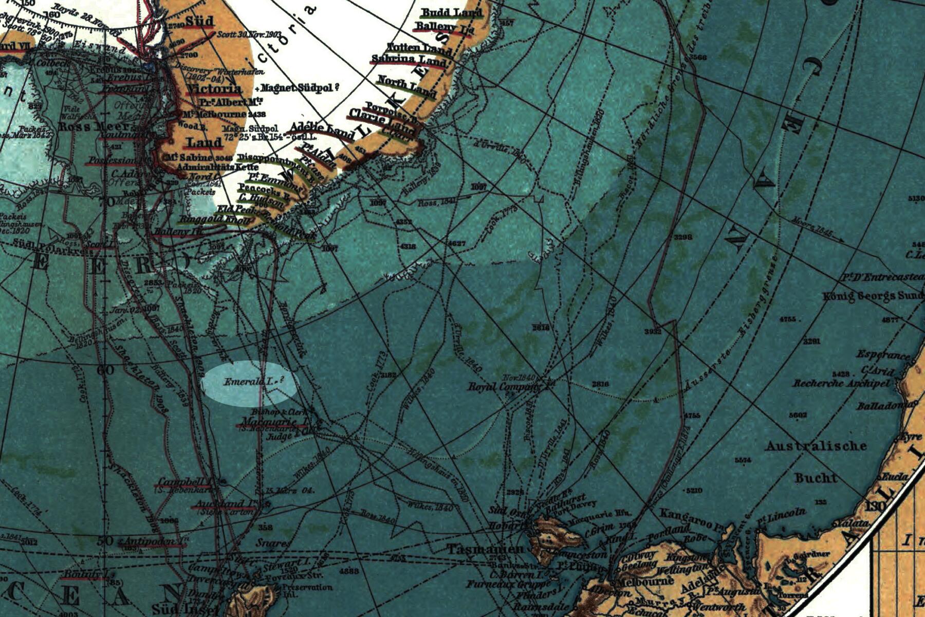

The Emerald Island might be a phantom.
Shrouded in fog, the Emerald Island shares similarities with its famous Gaelic counterpart, Ireland. This small and mountainous land crops up between New Zealand and Antarctica, almost precisely on the other side of the world from Ireland’s own craggy slopes and cliffs. And like the land of Eire, this island has a connection to fairy magic.
Except that this Emerald Island almost certainly doesn’t exist. It’s a phantom island.
Phantom or ghost islands are the ones that refuse to die off our maps. Some were simply fabricated, creative mapmakers’ poetic license to dress up an empty corner of an atlas or zealous explorers’ need to justify an expedition. What gets tricky is when sailors see an island, and then it’s gone for the next crew–especially when it’s spotted again years later.
Emerald Island hit the maps in 1821 when Captain William Elliot recorded a sighting south of Macquarie Island and named it for his British sealing ship, the Emerald. Sailors in 1840 returned and just found the open sea. Then fifty years later, Emerald was back. Yet it blinked out of sight just a few decades later, in 1909, when the crew of the ship Nimrod went searching for it. Despite its coy nature, Emerald Island remained on maps near Antarctica until 1987.
Recommended Fodor’s Video
Even with modern technology, reconciling maps with what our eyes detect isn’t so simple. Behind these ghost islands are centuries of adventurers under pressure, bizarre weather, and legends of sorceresses that lure sailors to their doom. What is certain is in the search to “discover” ghost islands, plenty of real people lost their lives. Yet scientists and expedition cruisers still search for phantoms.

The Fairy Sorceress and Dead Reckoning
Emerald Island joins the ranks of the disappearing “discovered” islands in polar regions created by the magic of Fata Morgana. In Britain’s Arthurian legends, the king’s sorceress half-sister Morgan was Arthur’s formidable enemy. Even after her downfall, “Fairy Morgan” is credited with enticing people around Europe to their deaths by rising from the water, showing them shimmering apparitions of new lands, and drowning them in their quests. The powerful enchantress even commanded floating ships, conjuring up the legendary Flying Dutchman that eventually chased Johnny Depp around the screen.
While less sinister, the science behind Morgan’s mirage still has plenty of sleight of hand. The more common atmospheric illusion happens when the ground is much warmer than the air, bouncing light and producing the low, watery effect on sticky hot summer days. The rarer Fata Morgana requires an inversion, with cold surface air below warmer layers. As light bends through this unusual atmosphere, it pulls objects to look higher, larger, and closer.
Coasts hundreds of miles away appear just ahead. Hills elevate to towering mountains. Horizons stretch into cliffs. Ships fly above false horizons. It’s no wonder sailors in the world’s cold seas, eager to make their mark on the map, saw islands popping up everywhere.
Another culprit for these phantoms has a morbid moniker: dead reckoning. Edward Brooke-Hitching, the author of The Phantom Atlas: The Greatest Lies, Myths, and Blunders on Maps, explains this elaborate guesswork. The earliest maps, the mappae mundi, were more like encyclopedic art of religious beliefs, legends, history, cities, and the natural world. With Ptolemy’s creation of longitude and latitude coordinates, maps became navigational tools for early exploration. But they still relied on “right about here.”
“Coordinates were misjudged and misrecorded. Fata Morgana and clouds were mistaken for coastlines. It wasn’t until John Harrison invented the marine chronometer in the eighteenth century that the accuracy of sightings became more acute,” says Brooke-Hitching.
Chasing Phantom Lands
Satellite imagery takes the guesswork out of spotting land masses. Even before our eyes in the sky, better global positioning techniques started un-discovering islands as early as the 17th century. Yet plenty of vexed scientists and cartographers found it hard to disprove land that made it to print. And there are still a few evasive mysteries regarding the ghosts on the map.
“It’s entirely possible that there are minor islands or other insignificant features currently marked on maps that might not actually exist,” says Brooke-Hitching. “If they lie outside of shipping lanes or routes of traffic, and have historically been of little interest so that no one has been motivated to check them, then they might well have been left alone to live in their peaceful nonexistence.”
Today, a sandy strip of land just like this is playing peek-a-boo with Google Maps in the South Pacific. Satellite views keep showing a disappearing and reappearing land mass between Australia and New Caledonia. Thought to have been Sandy Island, first recorded by Captain James Cook in 1776, it popped up again in records from 1895 and, a century later, on satellite views. But in 2012, an Australian scientific team definitively documented no land above or just under the water in this location. Everyone loves a comeback, and in May of 2022, Sandy Island popped back on the satellites.
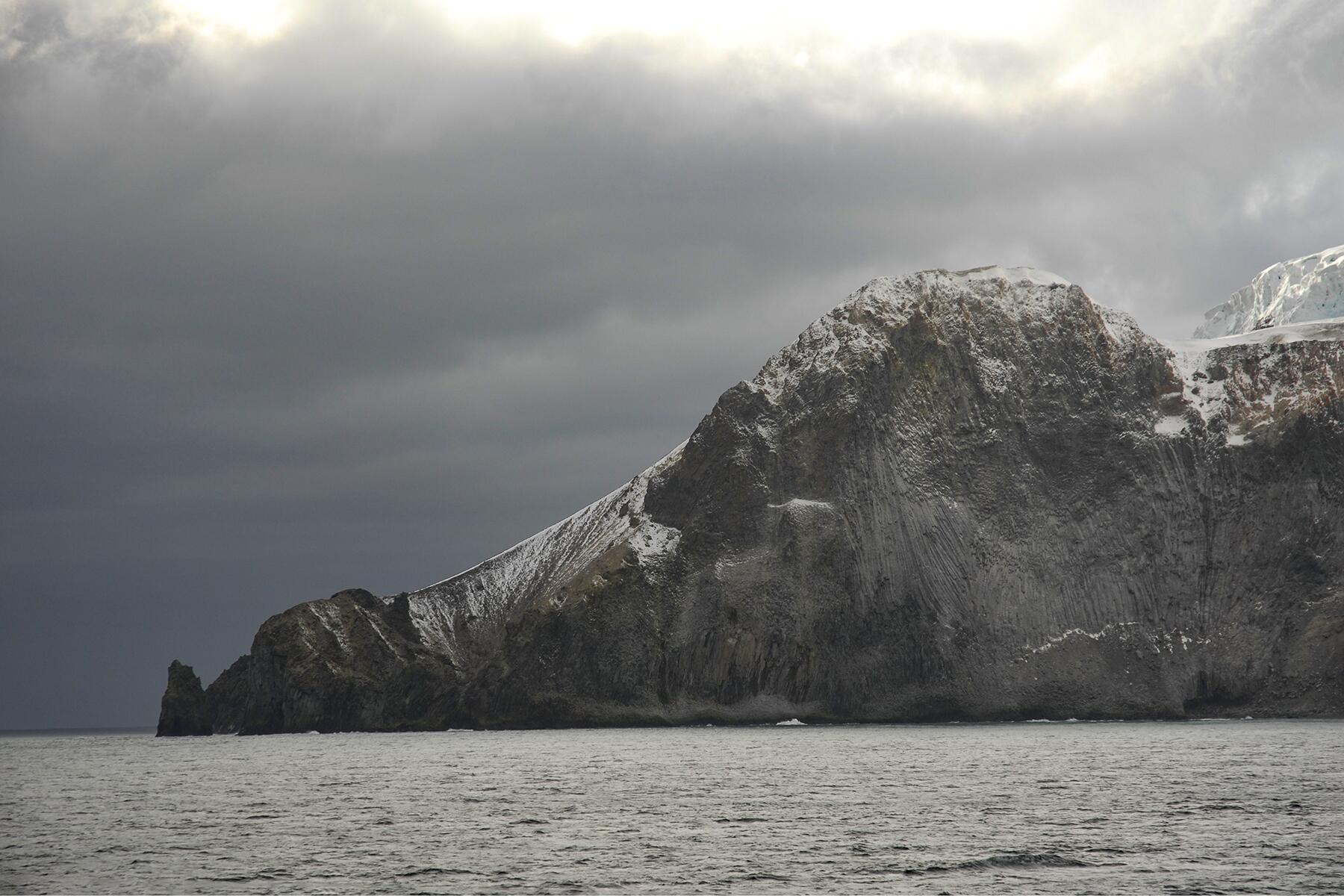
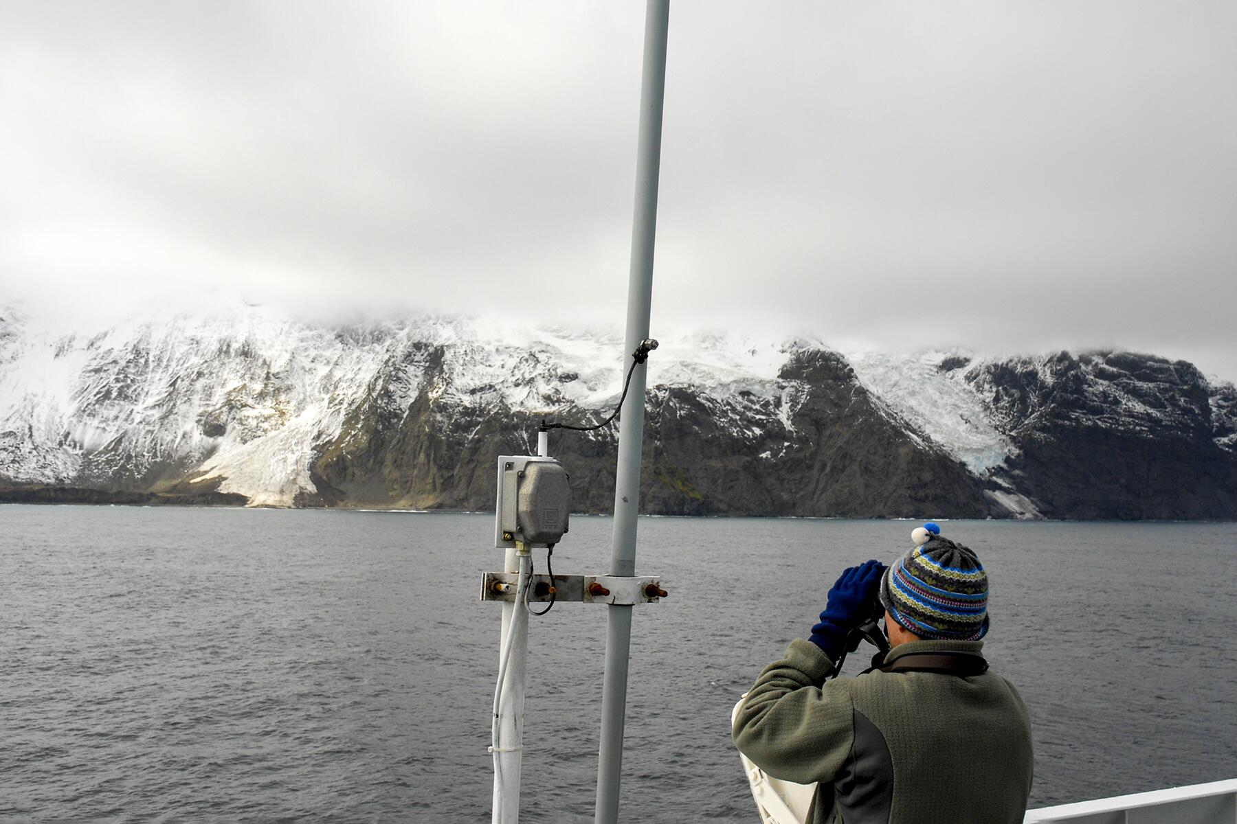
One ghost is here to stay. Antarctic cruisers with Oceanwide Expeditions can take a spin by the world’s reappearing island. The glacier-covered Bouvet Island revealed itself between South Africa and Antarctica in 1739, but inaccurate dead reckoning lost the island for future sailors until 1808. Norway’s modern nature preserve wasn’t done with its tricks. Thousands of miles from habitation, an abandoned lifeboat was found on Bouvet in 1964 with no trace of anyone on land. The ghost island spawned its own hauntings with this mystery, landing as the setting in several books and Alien vs. Predator.
Today, “the most isolated spot in the whole world” gets a few intrepid cruisers to see its penguins, seals, and weather station. But its allure endures. Even though Emerald Island and hundreds like it have disappeared from our maps, Bouvet gives the venturers hope that there are still points on the map left with surprises beyond error and tricky optical specters.