


The Journey is the Thing
 May 31st, 2021 | 08:53 AM
#1
Original Poster


Joined: Jan 2003
Posts: 21,148
Likes: 83
The Journey is the Thing
As with most avid travelers, the past year has been a real challenge for the traveling nQ8s.
The day we scored vaccination appointments, I started planning. The world wasn’t ready, but a few states in our own country seemed to be, so I booked two domestic trips, the first to begin Day 15 post vaccination (a seven night mini road trip within our home state of CO) and a 15 day trip for May covering bits of CO/WY/ID/UT.
Our hope was that we’d get ahead of the summer crowds which are no doubt descending upon the places we visited even as I type.
The itinerary for our 15 day trip:
Vernal, UT – two nights as a base for exploring Dinosaur National Monument
Rock Springs, WY – one night to break up our long meandering wander from Vernal, UT to Pinedale, WY via Flaming Gorge National Recreation Area
Pinedale, WY – three nights as a base for exploring the Wind River Range and environs
Jackson, WY – three nights as a base for exploring Teton National Park
Lava Hot Springs, ID – one night to break up our long meandering wander from Jackson, WY to Park City, UT
Park City, UT – three nights to explore whatever we came across
Palisade, CO – one night to break up the drive between Park City and home
And what a wander it was, 2,567 miles!
May 11 –
Living in Colorado means crazy weather; so it was no surprise that after a week of spring like temperatures, 4-6 inches of snow was expected the night before we left.
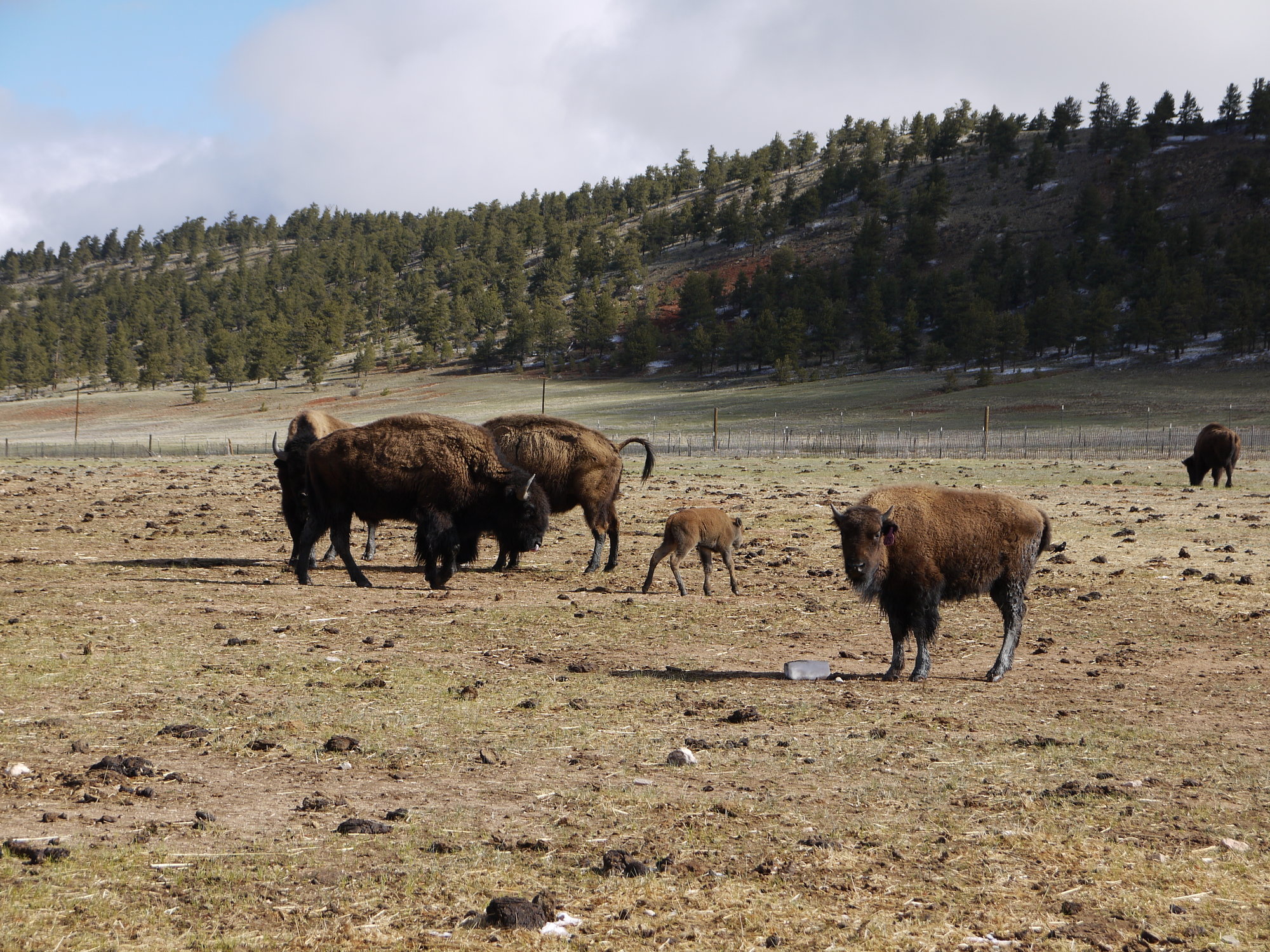
The snow was delivered as promised, but we left as planned and headed west on Highway 24, Pikes Peak invisible due to the low clouds. Just past Lake George we saw several elk, and then several bison (even a calf) as we turned on CO 9 towards Fairplay.
We motored through Alma, North’s America’s highest incorporated town, and worked our way over 11,542 foot high Hoosier Pass, where the temperature dropped to 25 F and it began to snow as we crossed the Continental Divide.
There was plenty of leftover snow up here. A red fox trotted across the highway right in front of us as we made our descent into Breckenridge, which was much quieter than when we drove through last September; the slopes were still open; town still a mess from ongoing construction.
We continued on CO 9 to Frisco, then I-70 east for three miles, then rejoined CO 9 through Silverthorne and towards Kremmling passing a herd of yaks.
It began to rain, and then snow, and then rain again. And then came the fog and poor visibility. At Kremmling we turned onto US 40 and eventually began the climb over Muddy Pass and Rabbit Ears Pass; where things got really hairy really fast.
Soon we were in the thick of a spring snowstorm; the snow wet and heavy, the wind howling and creating white-out conditions; we were unable to see the road in front of us. A couple of snow plows passed - headed in the opposite direction - while we broke trail through slicker-than-snot snow and ice.
The windshield wipers on our AWD vehicle took this opportunity to freeze; we couldn’t see well enough to pull off the road to break them free.
The west summit of Rabbit Ears Pass was a mess.
Suffice to say, things were very tense, but Bill’s skilled driving eventually got us safely down to Steamboat Springs.
After settling our nerves over lunch at our new favorite Steamboat Springs eatery (Cinco de Mayo), we continued our drive on 40 West.
The remainder of the afternoon was spent trying to outrun the nasty looking clouds to the east that threatened hail; fortunately, we were westbound headed towards a sliver of blue.
We passed through Hayden, Craig, and Maybell, where the road became long and straight, in the prairie now, albeit a prairie with relief. We passed through Elk Springs and Massadona, where Bill spent two weeks geologic mapping back in the day; and stopped at the Blue Mountain overlook where we admired "important orogeny s***" (the engineer’s words, not mine).
Soon we were passing through Dinosaur, CO, the town a car junk yard, not much to the place. Of course there was the ubiquitous cannabis shop, Bill commenting that one of those would have made geologic mapping much more fun, me surprised to see leaves on the trees.
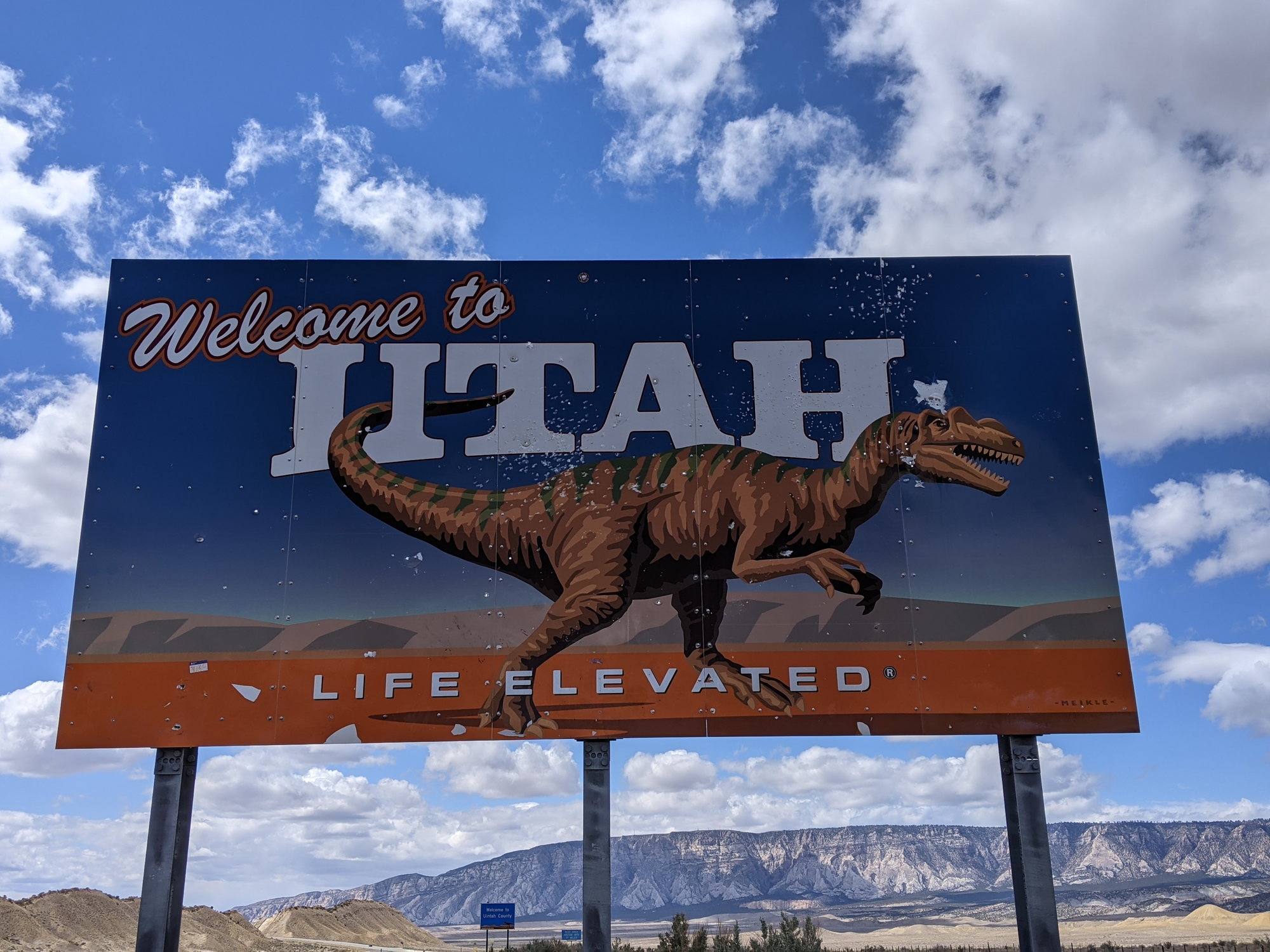
We crossed into Utah, welcomed to a very well irrigated Jensen with temperatures of 60 F. I’ve just learned that the green oasis of Jensen is home to a Chinese owned 22,000 acre alfalfa ranch, where hay is grown for export to China’s booming dairy industry.
We arrived in Vernal, UT some seven hours after leaving home, the driver in desperate need of a beer.
Our digs for the next two nights was Dinosaur Inn, a perfectly adequate upscale motel, doing its best to overcome its unfortunate highway location (Vernal reminded us of Moab, essentially a very long one street town, that one street the highway).
Our room was fairly quiet considering the location, clean and comfortable. And, the best part, it was walking distance to the Vernal Brewing Company, which has a mask free, enter at your own risk policy (UT lifted its mask mandate on April 10).
This this being Utah, one must order food to have alcohol, so it was a She’s a Peach wheat beer, She’s a Hot One Jalapeno wheat beer and beer cheese/sausage soup for the knackered driver, homemade root beer for me. And what a deal, $4 a pint.
To be continued...
The day we scored vaccination appointments, I started planning. The world wasn’t ready, but a few states in our own country seemed to be, so I booked two domestic trips, the first to begin Day 15 post vaccination (a seven night mini road trip within our home state of CO) and a 15 day trip for May covering bits of CO/WY/ID/UT.
Our hope was that we’d get ahead of the summer crowds which are no doubt descending upon the places we visited even as I type.
The itinerary for our 15 day trip:
Vernal, UT – two nights as a base for exploring Dinosaur National Monument
Rock Springs, WY – one night to break up our long meandering wander from Vernal, UT to Pinedale, WY via Flaming Gorge National Recreation Area
Pinedale, WY – three nights as a base for exploring the Wind River Range and environs
Jackson, WY – three nights as a base for exploring Teton National Park
Lava Hot Springs, ID – one night to break up our long meandering wander from Jackson, WY to Park City, UT
Park City, UT – three nights to explore whatever we came across
Palisade, CO – one night to break up the drive between Park City and home
And what a wander it was, 2,567 miles!
May 11 –
Living in Colorado means crazy weather; so it was no surprise that after a week of spring like temperatures, 4-6 inches of snow was expected the night before we left.
The snow was delivered as promised, but we left as planned and headed west on Highway 24, Pikes Peak invisible due to the low clouds. Just past Lake George we saw several elk, and then several bison (even a calf) as we turned on CO 9 towards Fairplay.
We motored through Alma, North’s America’s highest incorporated town, and worked our way over 11,542 foot high Hoosier Pass, where the temperature dropped to 25 F and it began to snow as we crossed the Continental Divide.
There was plenty of leftover snow up here. A red fox trotted across the highway right in front of us as we made our descent into Breckenridge, which was much quieter than when we drove through last September; the slopes were still open; town still a mess from ongoing construction.
We continued on CO 9 to Frisco, then I-70 east for three miles, then rejoined CO 9 through Silverthorne and towards Kremmling passing a herd of yaks.
It began to rain, and then snow, and then rain again. And then came the fog and poor visibility. At Kremmling we turned onto US 40 and eventually began the climb over Muddy Pass and Rabbit Ears Pass; where things got really hairy really fast.
Soon we were in the thick of a spring snowstorm; the snow wet and heavy, the wind howling and creating white-out conditions; we were unable to see the road in front of us. A couple of snow plows passed - headed in the opposite direction - while we broke trail through slicker-than-snot snow and ice.
The windshield wipers on our AWD vehicle took this opportunity to freeze; we couldn’t see well enough to pull off the road to break them free.
The west summit of Rabbit Ears Pass was a mess.
Suffice to say, things were very tense, but Bill’s skilled driving eventually got us safely down to Steamboat Springs.
After settling our nerves over lunch at our new favorite Steamboat Springs eatery (Cinco de Mayo), we continued our drive on 40 West.
The remainder of the afternoon was spent trying to outrun the nasty looking clouds to the east that threatened hail; fortunately, we were westbound headed towards a sliver of blue.
We passed through Hayden, Craig, and Maybell, where the road became long and straight, in the prairie now, albeit a prairie with relief. We passed through Elk Springs and Massadona, where Bill spent two weeks geologic mapping back in the day; and stopped at the Blue Mountain overlook where we admired "important orogeny s***" (the engineer’s words, not mine).
Soon we were passing through Dinosaur, CO, the town a car junk yard, not much to the place. Of course there was the ubiquitous cannabis shop, Bill commenting that one of those would have made geologic mapping much more fun, me surprised to see leaves on the trees.
We crossed into Utah, welcomed to a very well irrigated Jensen with temperatures of 60 F. I’ve just learned that the green oasis of Jensen is home to a Chinese owned 22,000 acre alfalfa ranch, where hay is grown for export to China’s booming dairy industry.
We arrived in Vernal, UT some seven hours after leaving home, the driver in desperate need of a beer.
Our digs for the next two nights was Dinosaur Inn, a perfectly adequate upscale motel, doing its best to overcome its unfortunate highway location (Vernal reminded us of Moab, essentially a very long one street town, that one street the highway).
Our room was fairly quiet considering the location, clean and comfortable. And, the best part, it was walking distance to the Vernal Brewing Company, which has a mask free, enter at your own risk policy (UT lifted its mask mandate on April 10).
This this being Utah, one must order food to have alcohol, so it was a She’s a Peach wheat beer, She’s a Hot One Jalapeno wheat beer and beer cheese/sausage soup for the knackered driver, homemade root beer for me. And what a deal, $4 a pint.
To be continued...
 May 31st, 2021 | 11:00 AM
#2

Joined: Jan 2020
Posts: 2,618
Likes: 0
Sounds like the stare of a fun trip. I am waiting to see if you did the things in the Vernal area that we did. We did the trip from Boulder through Steamboat Springs and on to Vernal on 40 and it was beautiful, but I am so glad we saw no snow that sounds like a nail biter.
May 31st, 2021 | 03:18 PM
#4
Original Poster
Joined: Jan 2003
Posts: 21,148
Likes: 83
May 12 –
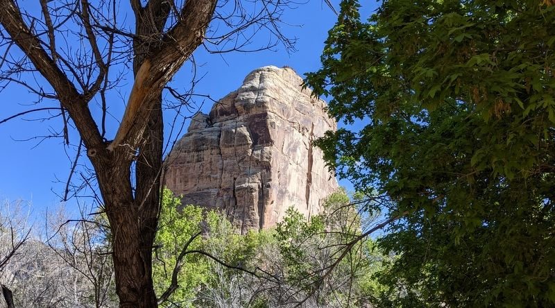
Dinosaur National Monument has been on my radar for a while, my Mom occasionally reminding me that we might enjoy a visit. We’re partial to the SW of our state and although I’m not sure why, I didn’t expect much in this far NW corner of CO.
After the usual not very good hotel breakfast, we left the hotel at 7:15 am (46 F) and backtracked some 36 miles to Dinosaur, CO. The Canyon Visitor’s Center was closed (only open on weekends at the time), so it’s a very good thing that we’d borrowed a park map from my SIL and her partner who’d visited in April. Also thanks to them, we had some very vague directions to a hiking trail they’d discovered and recommended.
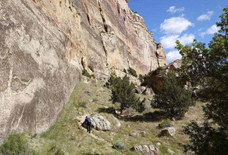
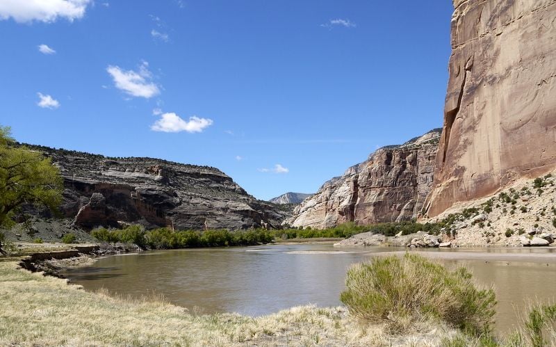
So with that in mind, we drove some 25 miles into the rugged, desolate park, crossing back into Utah about 21 miles in, and then another 12 miles down the steep, rocky Echo Park Road (closed to passenger cars, impassable in wet weather and a bit dicey today, a few fords to cross) in search of this wonderful mystery spot, not sure if we were in the right place, hoping we’d not get stuck, but taking notes for future reference just the same.
WOW. What a gorgeous, serene spot.
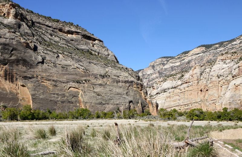
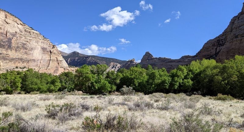
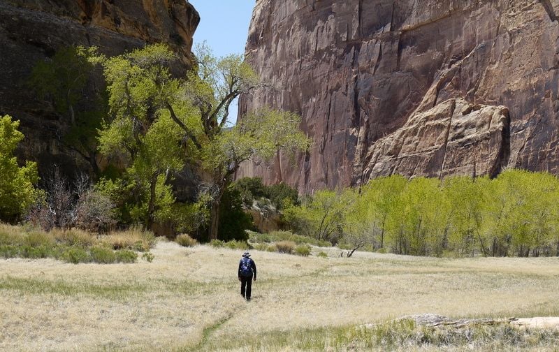
Not only did we find the near empty primitive camp ground at the bottom of the canyon, we found the trail (Mitten Park, begins between campsites 9-10), which turned out to be more than I bargained for.
We hiked in about a mile, then I chickened out…the trail led up a rocky slope to a terrace dangling over the Green River. The views were incredible throughout the hike. Bill made it up to the terrace, I waited down below.
https://www.nps.gov/dino/planyourvis...nparktrail.htm
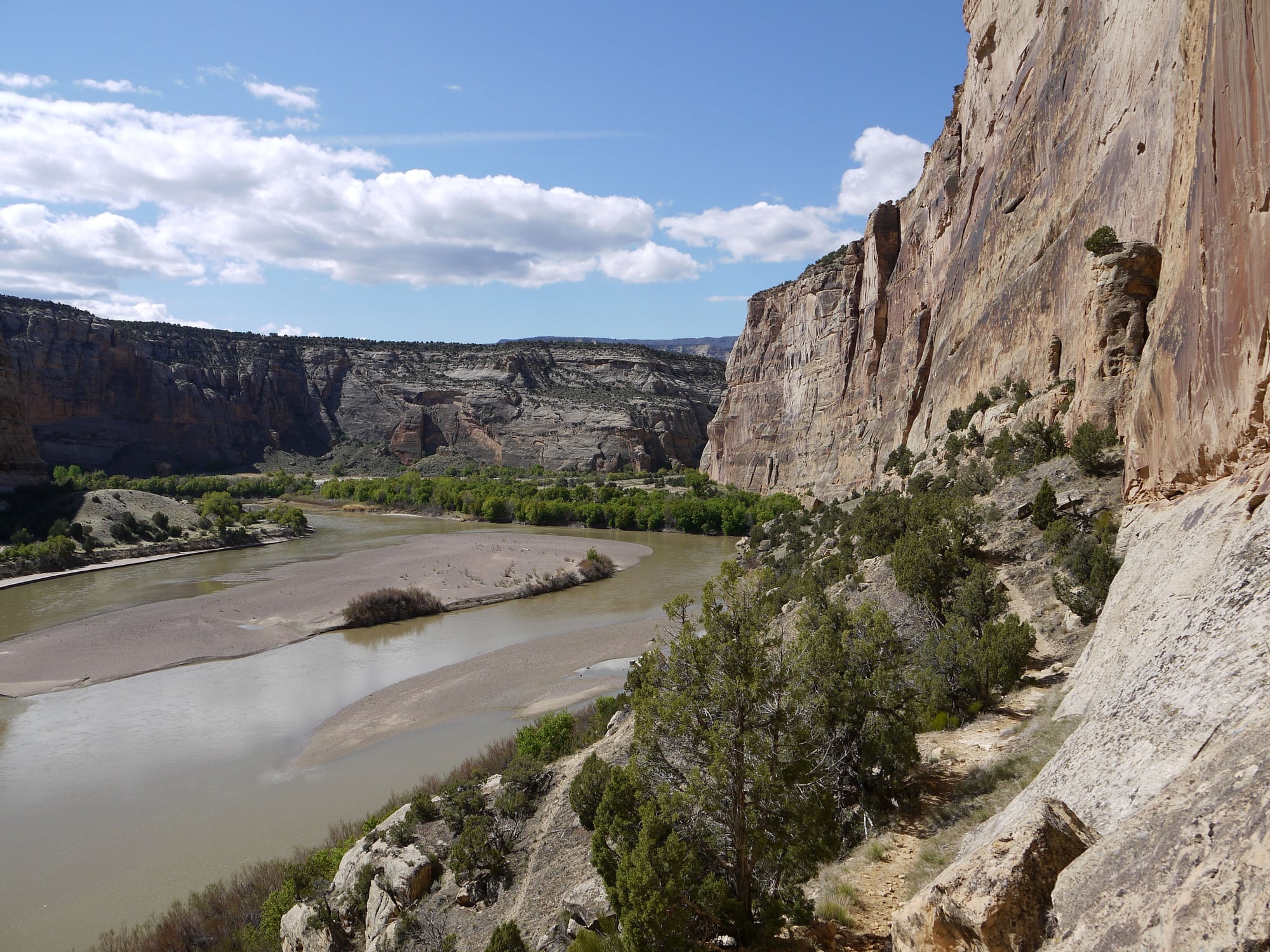
We then sought out the Confluence Trail, where the Green River and the Yampa River meet, later discovering that we’d found it early on, but didn’t realize it (an easy path that led down to the river’s edge). So we kept going, thinking the trail must lead to the very end of the canyon. Oh boy. It soon became a 12 inch wide primitive trail and rock scramble, perched atop a ledge clinging to the side of the canyon with a drop off to the river below. We could see a group of people in rafts waaaay below us, taking the easy way .
.
The trail became more and more difficult and there didn’t seem to be an end in sight, so we turned back (3.4 miles return, 2:10). We later discovered that we’d actually been hiking the Narrows of Lower Sand Canyon.
https://www.nps.gov/dino/planyourvis...nyon-route.htm
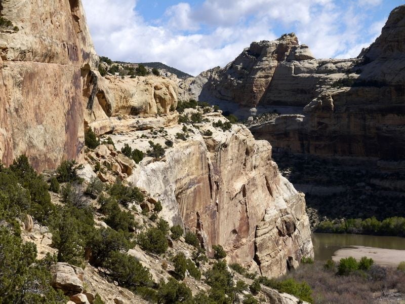
With only one full day in Dinosaur, we needed to get a move on, so we drove the 12 miles back up to the asphalt to take in the views from the Echo Park Overlook to see where we’d just been (awesome) and then to the end of the road at Harper’s Corner.
Back in CO, we took Highway 40, then turned onto 149 towards the Quarry Exhibition Hall, a sign advising us at the turn that advance reservations were needed. We drove on anyway, and good thing, as business was slow and we were given tickets for entry to the hall minutes after our arrival (still at limited capacity and requiring masks at the time of our visit). I’ve never been much interested in dinosaurs, but this place was fascinating:
https://www.nps.gov/dino/planyourvis...hibit-hall.htm
And just like that the day was shot. In retrospect, we should have allowed two full days for Dinosaur National Monument.
We returned to Vernal and made an encore visit to Vernal Brewing Company where we dined on the patio, enjoying a decent pizza with candied bacon, beer soup, a couple of Ms. Bee Hiven Blonde Ales for the beer drinker, and more root beer for me.
To be continued...
Dinosaur National Monument has been on my radar for a while, my Mom occasionally reminding me that we might enjoy a visit. We’re partial to the SW of our state and although I’m not sure why, I didn’t expect much in this far NW corner of CO.
After the usual not very good hotel breakfast, we left the hotel at 7:15 am (46 F) and backtracked some 36 miles to Dinosaur, CO. The Canyon Visitor’s Center was closed (only open on weekends at the time), so it’s a very good thing that we’d borrowed a park map from my SIL and her partner who’d visited in April. Also thanks to them, we had some very vague directions to a hiking trail they’d discovered and recommended.
So with that in mind, we drove some 25 miles into the rugged, desolate park, crossing back into Utah about 21 miles in, and then another 12 miles down the steep, rocky Echo Park Road (closed to passenger cars, impassable in wet weather and a bit dicey today, a few fords to cross) in search of this wonderful mystery spot, not sure if we were in the right place, hoping we’d not get stuck, but taking notes for future reference just the same.
WOW. What a gorgeous, serene spot.
Not only did we find the near empty primitive camp ground at the bottom of the canyon, we found the trail (Mitten Park, begins between campsites 9-10), which turned out to be more than I bargained for.
We hiked in about a mile, then I chickened out…the trail led up a rocky slope to a terrace dangling over the Green River. The views were incredible throughout the hike. Bill made it up to the terrace, I waited down below.
https://www.nps.gov/dino/planyourvis...nparktrail.htm
We then sought out the Confluence Trail, where the Green River and the Yampa River meet, later discovering that we’d found it early on, but didn’t realize it (an easy path that led down to the river’s edge). So we kept going, thinking the trail must lead to the very end of the canyon. Oh boy. It soon became a 12 inch wide primitive trail and rock scramble, perched atop a ledge clinging to the side of the canyon with a drop off to the river below. We could see a group of people in rafts waaaay below us, taking the easy way
.The trail became more and more difficult and there didn’t seem to be an end in sight, so we turned back (3.4 miles return, 2:10). We later discovered that we’d actually been hiking the Narrows of Lower Sand Canyon.
https://www.nps.gov/dino/planyourvis...nyon-route.htm
With only one full day in Dinosaur, we needed to get a move on, so we drove the 12 miles back up to the asphalt to take in the views from the Echo Park Overlook to see where we’d just been (awesome) and then to the end of the road at Harper’s Corner.
Back in CO, we took Highway 40, then turned onto 149 towards the Quarry Exhibition Hall, a sign advising us at the turn that advance reservations were needed. We drove on anyway, and good thing, as business was slow and we were given tickets for entry to the hall minutes after our arrival (still at limited capacity and requiring masks at the time of our visit). I’ve never been much interested in dinosaurs, but this place was fascinating:
https://www.nps.gov/dino/planyourvis...hibit-hall.htm
And just like that the day was shot. In retrospect, we should have allowed two full days for Dinosaur National Monument.
We returned to Vernal and made an encore visit to Vernal Brewing Company where we dined on the patio, enjoying a decent pizza with candied bacon, beer soup, a couple of Ms. Bee Hiven Blonde Ales for the beer drinker, and more root beer for me.
To be continued...
Last edited by Melnq8; May 31st, 2021 at 03:21 PM.
 Jun 1st, 2021 | 06:24 AM
#7
Joined: Jul 2004
Posts: 6,339
Likes: 8
You guys always have an adventure or two don't you? Great report and photos.
>"and towards Kremmling passing a herd of yaks."
You say that so nonchalantly, as if one always expects to see yaks while driving through Colorado.
I had heard there was talk of loosening the requirements to purchase alcohol in a Utah restaurant, but that might have been just talk. If Bill likes dark beers have him try Polygamy Porter next time, "Why Have Just One?". It's actually pretty good.
Looking forward to more adventures that are coming, I believe, based on the title.
Trending Topics
 Jun 1st, 2021 | 02:47 PM
#10
Original Poster
Joined: Jan 2003
Posts: 21,148
Likes: 83
May 13 �
After a second night of fighting with the fitted sheets that refused to stay fitted, we left our hotel around 8:15, sunny and 55 F. The plan for today was to take our time getting to Rock Springs, exploring Flaming Gorge National Recreation area along the way.
https://utah.com/flaming-gorge
As we headed north on 191 and passed sign after sign pointing out the Bishop Conglomerate, the Webber Formation, Manco Shale, the Dakota Formation, the Humbug Formation et al., I learned that the area around Vernal �is a big chunk of the geologic column� (Bill�s words) and evidently a geologist�s dream.
Our drive also took us past a huge open pit, so we stopped at the overlook and discovered it was a phosphate mine.
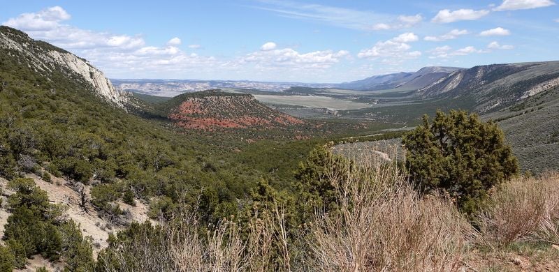
Some 25-30 miles north of Vernal we found ourselves in the Ashley National Forest in the Uinta Mountains, having climbed from an elevation of 5,328 feet to over 8,400. We stopped to walk the short Aspen Interpretative Trail which led to some beaver ponds and then forged on, both surprised to see so many long drops up here.
We joined UT 44 and worked our way north towards Manila, stopping at the Red Canyon Lodge for a map (visitor�s center closed until Memorial Day) and a stroll down to the lake. As we left, we followed a sign pointing to Red Canyon overlook, having no idea what lay ahead. WOW.
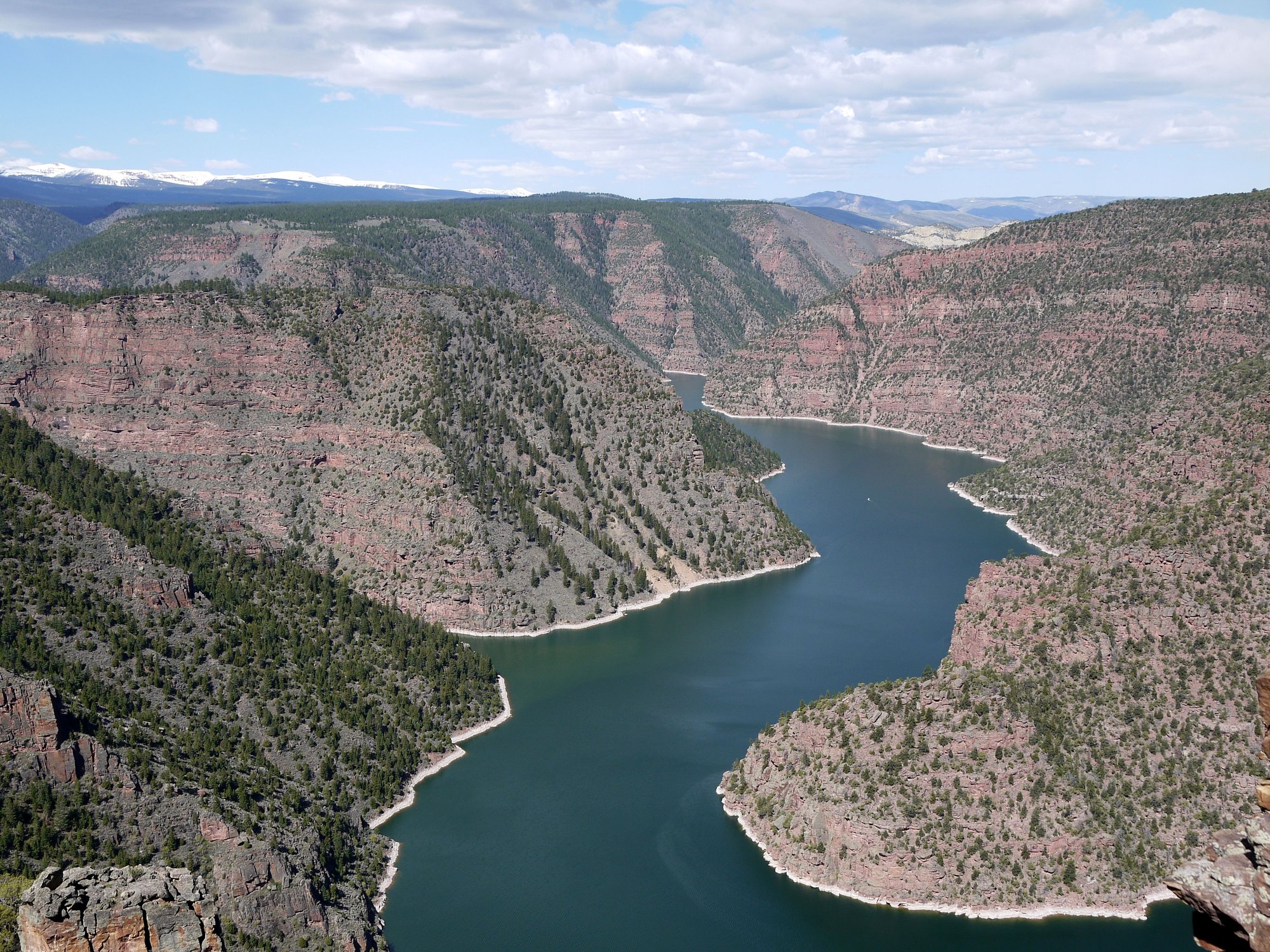
Red Canyon
Red Canyon
We had the overlook almost entirely to ourselves.
After ogling the incredible views, we continued our drive, deciding to explore the Sheep Creek Loop, which turned out to be another geologist�s orogenous zone. Bill pointed out the bent and twisted rock layers; the diversion not only scenic, but educational and unexpectedly interesting.
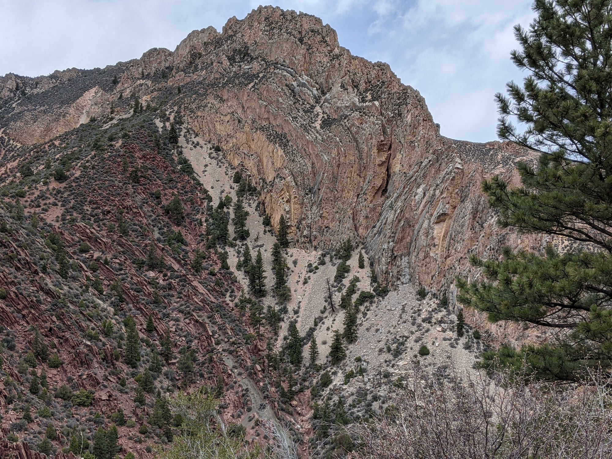
Sheep Creek Loop
Sheep Creek Loop
The scenery became less dramatic as we approached Manila just south of the Wyoming border. We�d foolishly thought we�d have lunch here, but not much on offer in this town of 211 so we parked and rummaged through the cooler instead.
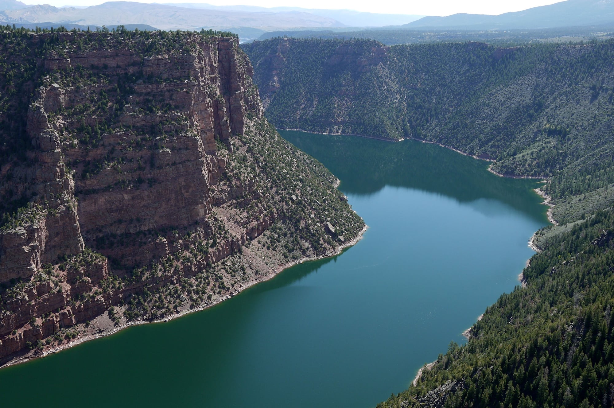
Our plan was to see at least some of both sides of the gorge, so we backtracked on UT 44 south towards 191, stopping to ogle the views at the Sheep Creek Bay Overlook.

Sheep Creek Bay
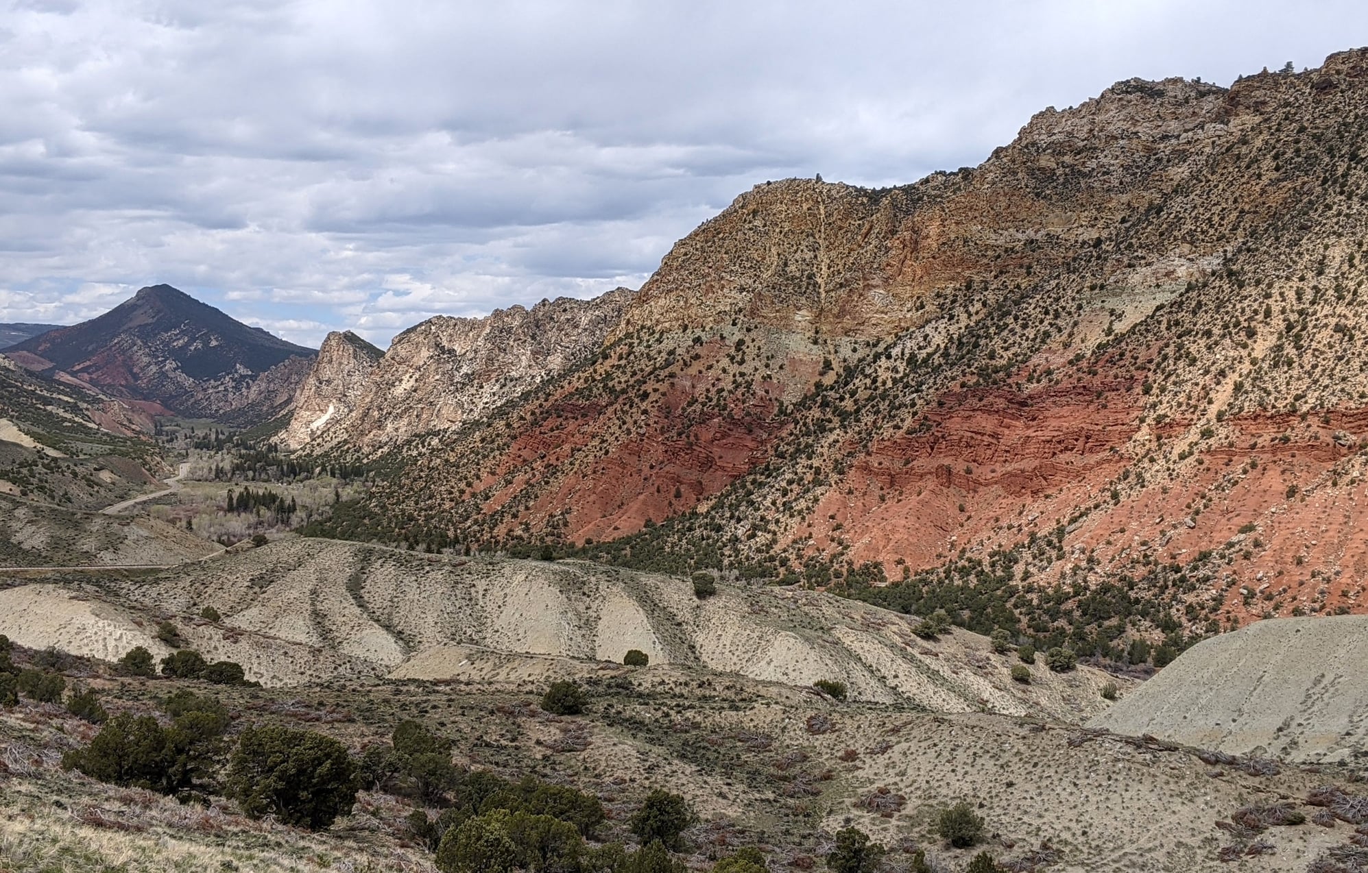
Sheep Creek Bay
At the junction of UT 44 and 191, we turned back north to the Flaming Gorge Dam (visitor center closed) and then to the dam viewpoint, which we had to ourselves.
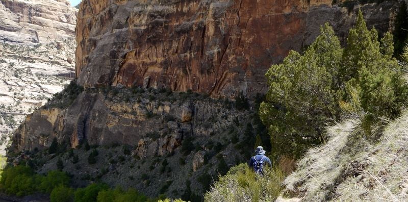
Needing exercise, we parked at the Little Hole Recreation complex and set out on the Little Hole Trail (parks pass or recreation pass required), which was supposed to be easy�and it was�once we made the steep descent down to the Green River and the even steeper ascent via the boat ramp trail. This very pretty National Scenic Trail follows the river and is surrounded by towering canyon walls. Pressed for time, we were only able to walk 2.75 miles return, which meant we had to pass the same five foot long snake that scared the bejesus out of me twice, making it unhappy and prepared to strike on the second pass (not sure what species, but relieved that nothing rattled!). It was a warm, sticky 73 F when we finished.
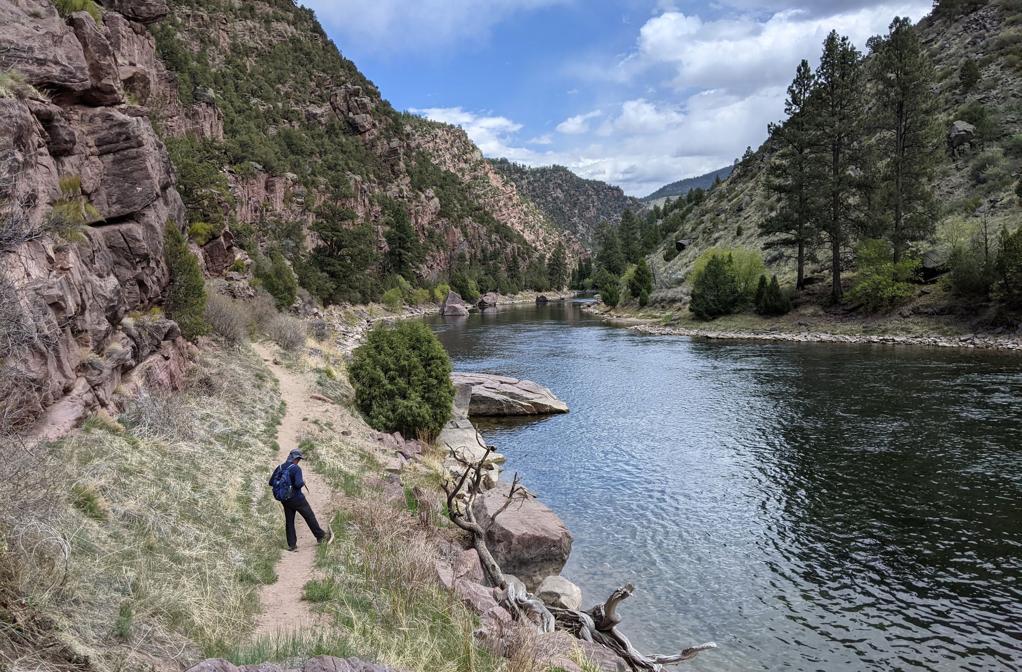
Little Hole Trail
Back on 191 north we eventually crossed into Wide Opening, aka Wyoming; there was no sign to indicate this, but the sudden increase in speed limit (55 to 70) and much smoother road tipped us off.
The drive to Rock Springs was hilly; the roads curvier than one might expect, lonely, and even pretty, in a desolate sort of way. Bill called it �the empty quarter of WY�; one can understand why this road is closed more than open in the winter; the snow markers are taller than most, the snow fences abundant. The windblown drifting snow must be a nightmare.
We eventually joined I-80 to Rock Springs and despite the GPS losing its mind, we located our hotel for the night; The Clarion, an old fashioned place that was probably rather grand in its day.
Our room was large and pretty quiet, not because the walls weren�t thin, but because we had no neighbors.
Dinner found us across the hotel�s parking lot at Super Torta Mina Taqueria, where we were presented with naked tacos served on paper plates with plastic cutlery by servers not wearing masks (Wyoming�s mask mandate was lifted on March 16). A sign at the condiment bar asked patrons to use the hand sanitizer, yet none that we saw did. It was an interesting introduction to WY�s COVID mixed messaging, and needless to say, not a culinary highlight.
To be continued...
After a second night of fighting with the fitted sheets that refused to stay fitted, we left our hotel around 8:15, sunny and 55 F. The plan for today was to take our time getting to Rock Springs, exploring Flaming Gorge National Recreation area along the way.
https://utah.com/flaming-gorge
As we headed north on 191 and passed sign after sign pointing out the Bishop Conglomerate, the Webber Formation, Manco Shale, the Dakota Formation, the Humbug Formation et al., I learned that the area around Vernal �is a big chunk of the geologic column� (Bill�s words) and evidently a geologist�s dream.
Our drive also took us past a huge open pit, so we stopped at the overlook and discovered it was a phosphate mine.
Some 25-30 miles north of Vernal we found ourselves in the Ashley National Forest in the Uinta Mountains, having climbed from an elevation of 5,328 feet to over 8,400. We stopped to walk the short Aspen Interpretative Trail which led to some beaver ponds and then forged on, both surprised to see so many long drops up here.
We joined UT 44 and worked our way north towards Manila, stopping at the Red Canyon Lodge for a map (visitor�s center closed until Memorial Day) and a stroll down to the lake. As we left, we followed a sign pointing to Red Canyon overlook, having no idea what lay ahead. WOW.
Red Canyon
Red Canyon
We had the overlook almost entirely to ourselves.
After ogling the incredible views, we continued our drive, deciding to explore the Sheep Creek Loop, which turned out to be another geologist�s orogenous zone. Bill pointed out the bent and twisted rock layers; the diversion not only scenic, but educational and unexpectedly interesting.
Sheep Creek Loop
Sheep Creek Loop
The scenery became less dramatic as we approached Manila just south of the Wyoming border. We�d foolishly thought we�d have lunch here, but not much on offer in this town of 211 so we parked and rummaged through the cooler instead.
Our plan was to see at least some of both sides of the gorge, so we backtracked on UT 44 south towards 191, stopping to ogle the views at the Sheep Creek Bay Overlook.
Sheep Creek Bay
Sheep Creek Bay
At the junction of UT 44 and 191, we turned back north to the Flaming Gorge Dam (visitor center closed) and then to the dam viewpoint, which we had to ourselves.
Needing exercise, we parked at the Little Hole Recreation complex and set out on the Little Hole Trail (parks pass or recreation pass required), which was supposed to be easy�and it was�once we made the steep descent down to the Green River and the even steeper ascent via the boat ramp trail. This very pretty National Scenic Trail follows the river and is surrounded by towering canyon walls. Pressed for time, we were only able to walk 2.75 miles return, which meant we had to pass the same five foot long snake that scared the bejesus out of me twice, making it unhappy and prepared to strike on the second pass (not sure what species, but relieved that nothing rattled!). It was a warm, sticky 73 F when we finished.
Little Hole Trail
Back on 191 north we eventually crossed into Wide Opening, aka Wyoming; there was no sign to indicate this, but the sudden increase in speed limit (55 to 70) and much smoother road tipped us off.
The drive to Rock Springs was hilly; the roads curvier than one might expect, lonely, and even pretty, in a desolate sort of way. Bill called it �the empty quarter of WY�; one can understand why this road is closed more than open in the winter; the snow markers are taller than most, the snow fences abundant. The windblown drifting snow must be a nightmare.
We eventually joined I-80 to Rock Springs and despite the GPS losing its mind, we located our hotel for the night; The Clarion, an old fashioned place that was probably rather grand in its day.
Our room was large and pretty quiet, not because the walls weren�t thin, but because we had no neighbors.
Dinner found us across the hotel�s parking lot at Super Torta Mina Taqueria, where we were presented with naked tacos served on paper plates with plastic cutlery by servers not wearing masks (Wyoming�s mask mandate was lifted on March 16). A sign at the condiment bar asked patrons to use the hand sanitizer, yet none that we saw did. It was an interesting introduction to WY�s COVID mixed messaging, and needless to say, not a culinary highlight.
To be continued...
Jun 2nd, 2021 | 09:11 AM
#14
Joined: Jan 2020
Posts: 2,618
Likes: 0
Sorry the mods have you on the naughty list.
We always look for rock art when we are in the west. There are some great lizard pictographs down the road past the VC. The area called McKee spring has some fantastic petroglyphs too.
Keeping my fingers crossed that your report will be posted soon.
We always look for rock art when we are in the west. There are some great lizard pictographs down the road past the VC. The area called McKee spring has some fantastic petroglyphs too.
Keeping my fingers crossed that your report will be posted soon.
Jun 2nd, 2021 | 02:34 PM
#15
Original Poster
Joined: Jan 2003
Posts: 21,148
Likes: 83
I assume you're talking about the Visitor's Center at the Quarry entrance?
The installment in moderation has since posted. Will try to get another out pretty quick.
The installment in moderation has since posted. Will try to get another out pretty quick.
Last edited by Melnq8; Jun 2nd, 2021 at 02:50 PM.
Jun 2nd, 2021 | 02:49 PM
#16
Original Poster
Joined: Jan 2003
Posts: 21,148
Likes: 83
May 14 –
I’m not much of a breakfast eater, but Bill is, and he said the Clarion’s breakfast was the best of our two week trip. They offered made to order omelets and pancakes as well as the standard continental fare.
We were only 1:40 from our next stop, Pinedale, WY, so in no hurry. After a leisurely start and a grocery run, we left Rock Springs, both surprised that it was so big - population 23,000 – I’m not sure why but I was expecting a much smaller town.
We drove east on I-80, then joined 191 north, not much to look at other than a straight road and a dry and dusty landscape. There wasn’t a tree in sight and signs advised us to keep our headlights on, which made seeing oncoming traffic easier out here on the plains.
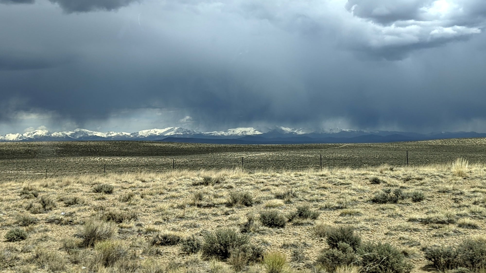
Distant snow-covered peaks came into view as we approached Eden. We’d lived in Wyoming for several years back in the 80’s and one thing hadn’t changed in our absence, the relentless wind. It eventually started to rain, and the temperature dropped like a rock, from 64 to 49 in a matter of minutes.
We saw smoke ahead as we approached the ramshackle town of Boulder, elevation 7,058 (later learning it was a controlled burn), trees suddenly reappearing, naked of leaves, but trees just the same.
Soon we were rolling into Pinedale, WY, population 2,050. The first thing we noticed was that the Wind River Brewery, which was on my must try list, was closed for repairs. Bummer.
A quick sandwich for lunch and a visit with a chatty woman at the Visitor’s Center later, we were checked into our room at the Best Western. Our assigned room wasn’t ready, so we were upgraded to a suite, which turned out to be huge, although the bathroom was comically small in comparison.
The chatty woman at the Visitor’s Center had mentioned that two moose were seen in the town park that morning, so naturally we hightailed it over there, finding it on the edge of town (Boyd-Skinner) and walking it from end to end. What a nice spot – homes backed right to the forest and creek. Sure enough, we saw one of the moose lounging by the creek, but in an effort to keep a respectful distance, and having left my zoom lens back in CO, my photo attempts were awful.
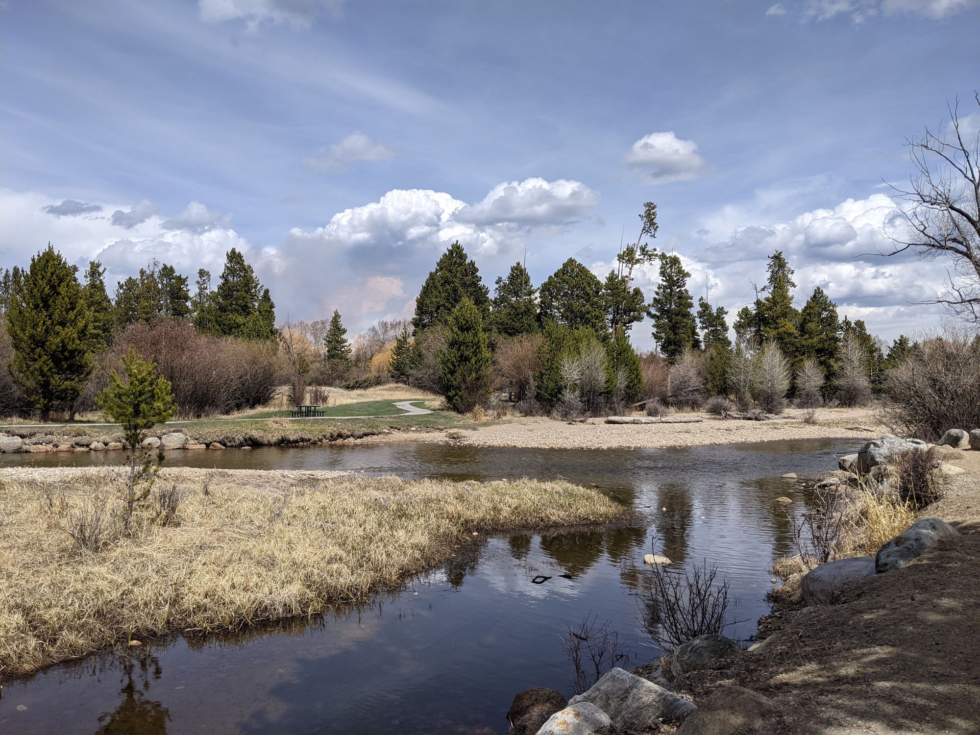
Boyd-Skinner Park
Boyd-Skinner Park
We then drove towards the Wind River Range to check out the hiking options, making it as far as the White Pine Ski Area before running into substantial snow on the road, an indication that we’d need to find lower elevation trails.
To be continued…
I’m not much of a breakfast eater, but Bill is, and he said the Clarion’s breakfast was the best of our two week trip. They offered made to order omelets and pancakes as well as the standard continental fare.
We were only 1:40 from our next stop, Pinedale, WY, so in no hurry. After a leisurely start and a grocery run, we left Rock Springs, both surprised that it was so big - population 23,000 – I’m not sure why but I was expecting a much smaller town.
We drove east on I-80, then joined 191 north, not much to look at other than a straight road and a dry and dusty landscape. There wasn’t a tree in sight and signs advised us to keep our headlights on, which made seeing oncoming traffic easier out here on the plains.
Distant snow-covered peaks came into view as we approached Eden. We’d lived in Wyoming for several years back in the 80’s and one thing hadn’t changed in our absence, the relentless wind. It eventually started to rain, and the temperature dropped like a rock, from 64 to 49 in a matter of minutes.
We saw smoke ahead as we approached the ramshackle town of Boulder, elevation 7,058 (later learning it was a controlled burn), trees suddenly reappearing, naked of leaves, but trees just the same.
Soon we were rolling into Pinedale, WY, population 2,050. The first thing we noticed was that the Wind River Brewery, which was on my must try list, was closed for repairs. Bummer.
A quick sandwich for lunch and a visit with a chatty woman at the Visitor’s Center later, we were checked into our room at the Best Western. Our assigned room wasn’t ready, so we were upgraded to a suite, which turned out to be huge, although the bathroom was comically small in comparison.
The chatty woman at the Visitor’s Center had mentioned that two moose were seen in the town park that morning, so naturally we hightailed it over there, finding it on the edge of town (Boyd-Skinner) and walking it from end to end. What a nice spot – homes backed right to the forest and creek. Sure enough, we saw one of the moose lounging by the creek, but in an effort to keep a respectful distance, and having left my zoom lens back in CO, my photo attempts were awful.
Boyd-Skinner Park
Boyd-Skinner Park
We then drove towards the Wind River Range to check out the hiking options, making it as far as the White Pine Ski Area before running into substantial snow on the road, an indication that we’d need to find lower elevation trails.
To be continued…
Jun 2nd, 2021 | 05:32 PM
#17
Joined: Jul 2004
Posts: 6,339
Likes: 8
You are a good TR writer!
Too bad Wind River Brewery was closed, it's been a happening joint the few times I've been there. There is fabulous hiking in the Winds but most of it requires a long (6-10 miles) approach before you get to the good stuff. And, as you noted, the season is short. It will be interesting to see what you guys came up with.
Too bad Wind River Brewery was closed, it's been a happening joint the few times I've been there. There is fabulous hiking in the Winds but most of it requires a long (6-10 miles) approach before you get to the good stuff. And, as you noted, the season is short. It will be interesting to see what you guys came up with.
Jun 3rd, 2021 | 05:27 AM
#20
Joined: Jan 2020
Posts: 2,618
Likes: 0
Melnq, we look for rock art wherever we go in the west. I have lots posted in my Flickr page and organized a bit in the albums
flickr.com/photos/emalloy2009
I have not posted a TR under my new user name but if you care for directions to any of the sites we have been to you can look for old TRs under emalloy
flickr.com/photos/emalloy2009
I have not posted a TR under my new user name but if you care for directions to any of the sites we have been to you can look for old TRs under emalloy
Last edited by oldemalloy; Jun 3rd, 2021 at 05:32 AM.

