


Salvaging Summer
 Oct 10th, 2020, 02:06 PM
#21
September 22 -
The hotel is nice, new and fresh; we have a quiet night. They’ve discontinued daily room cleaning due to COVID, but Housekeeping stops by to offer clean towels, soap, coffee supplies and to empty the trash.
They’ve also discontinued their usual breakfast and instead offer a grab bag or abbreviated hot breakfast; burritos or breakfast sandwich, muffins, yogurt, handed out by an employee. Certainly nothing to get excited about; I find myself wondering for the 100th time about all the extra trash going to landfill during the pandemic.
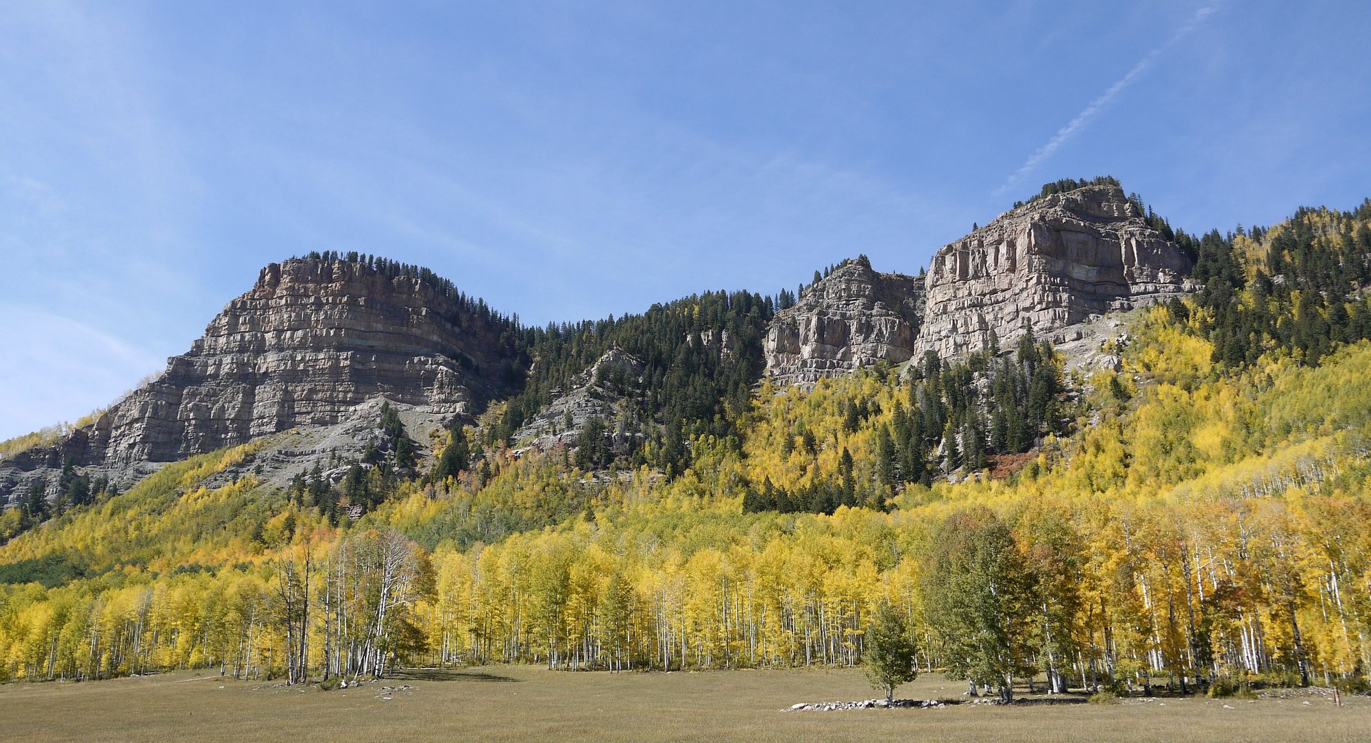
We head out, hoping to find the 5.2 mile multi-use Spring Creek Trail. We pass a line of firefighters walking up CR 36 - no idea to where – but we don’t find the trail.
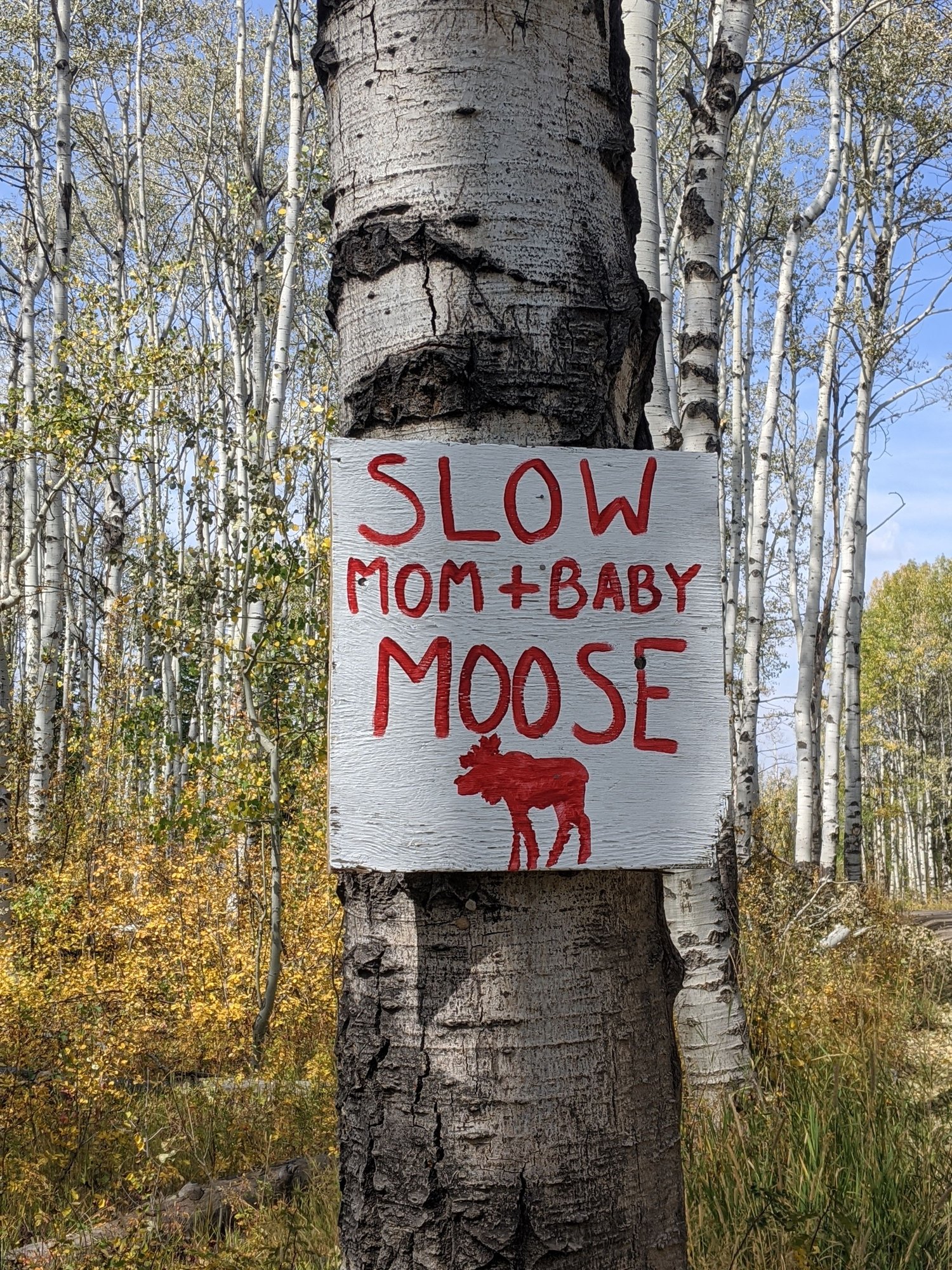
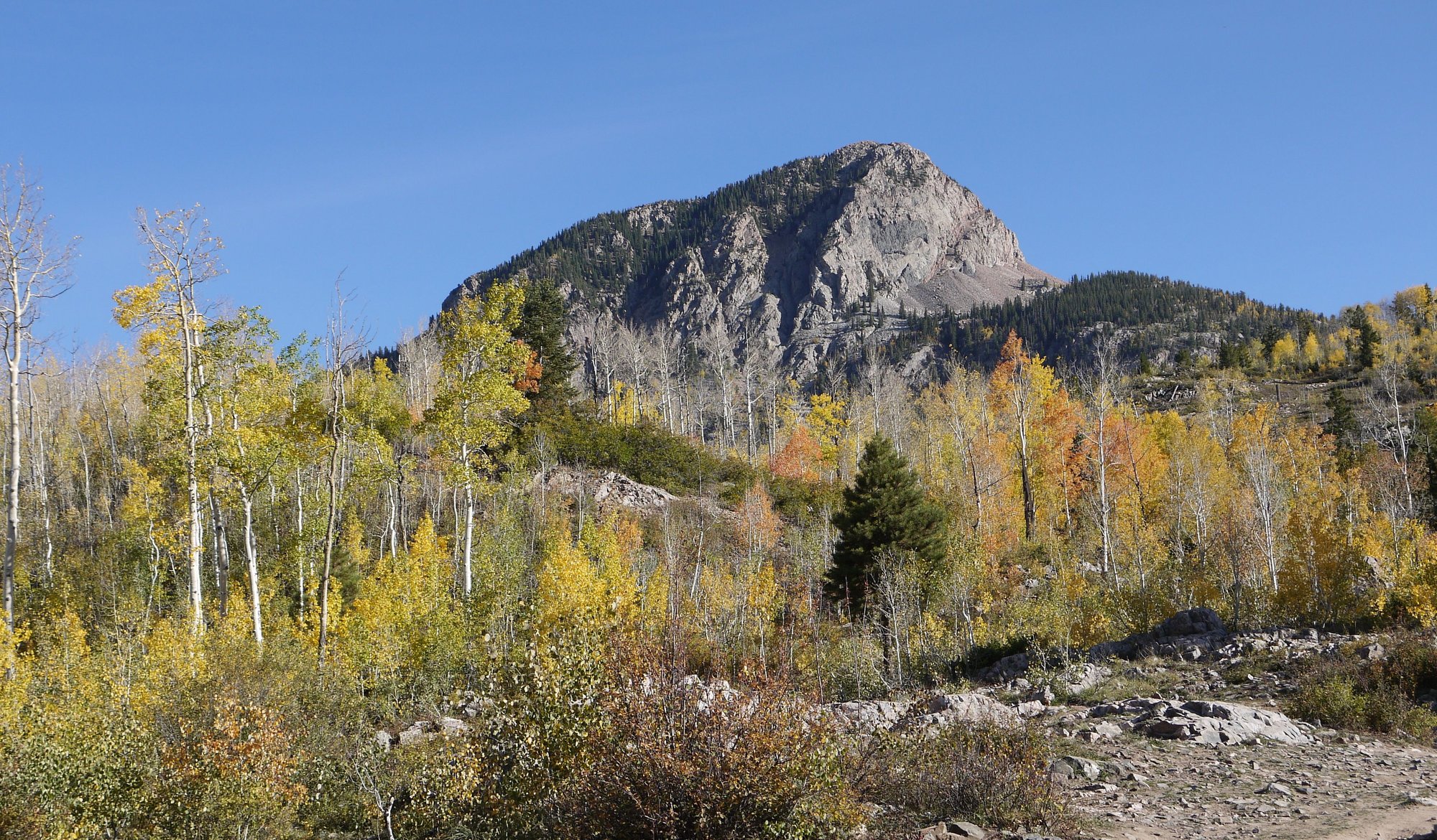
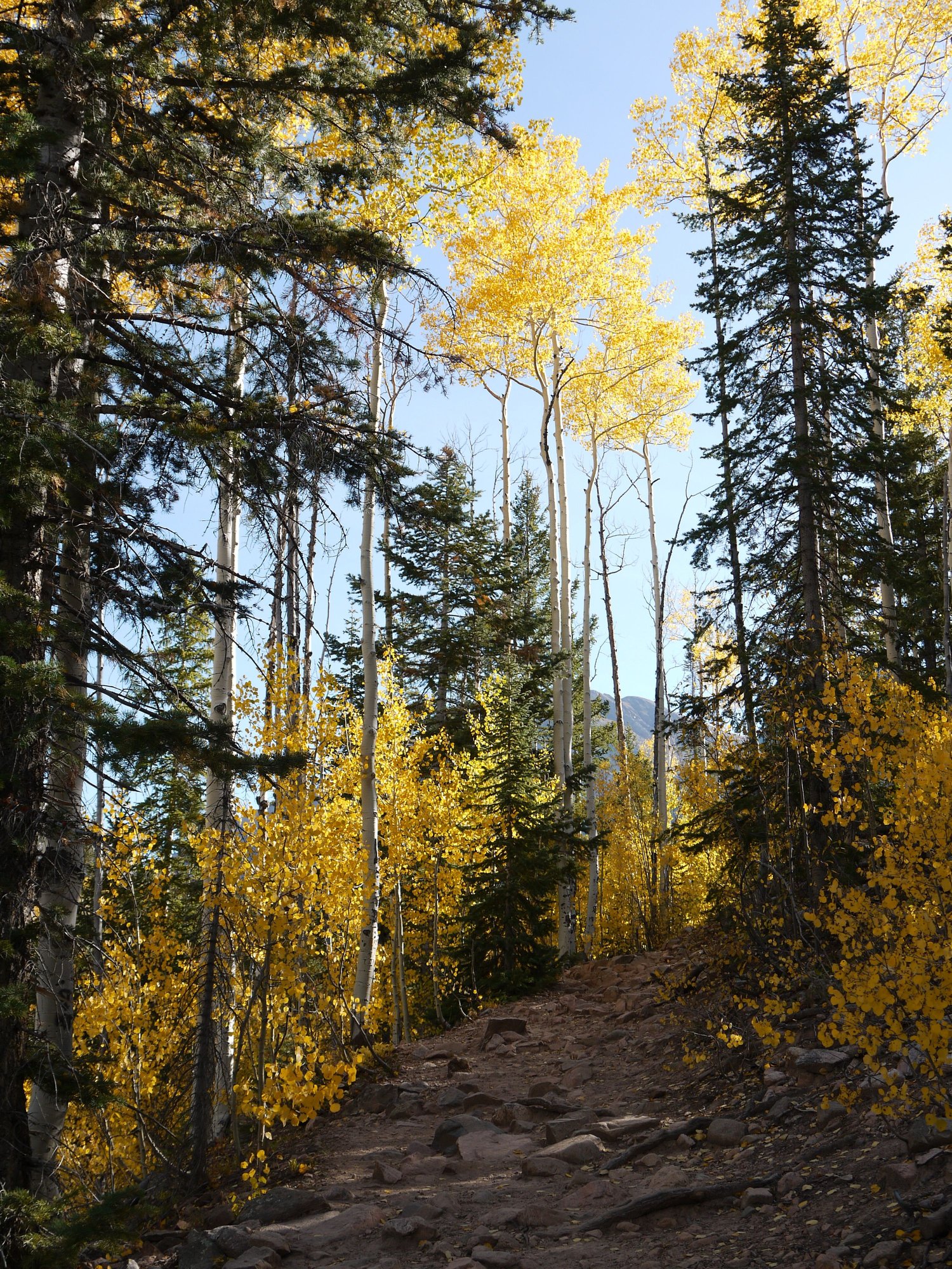
Instead we stumble upon the 5.5 mile Lower Bear Creek trail (off CR 36 before Strawberry Fields), and decide to hike it instead. A sign tells us that this area is on Stage 2 Fire restrictions, but open.
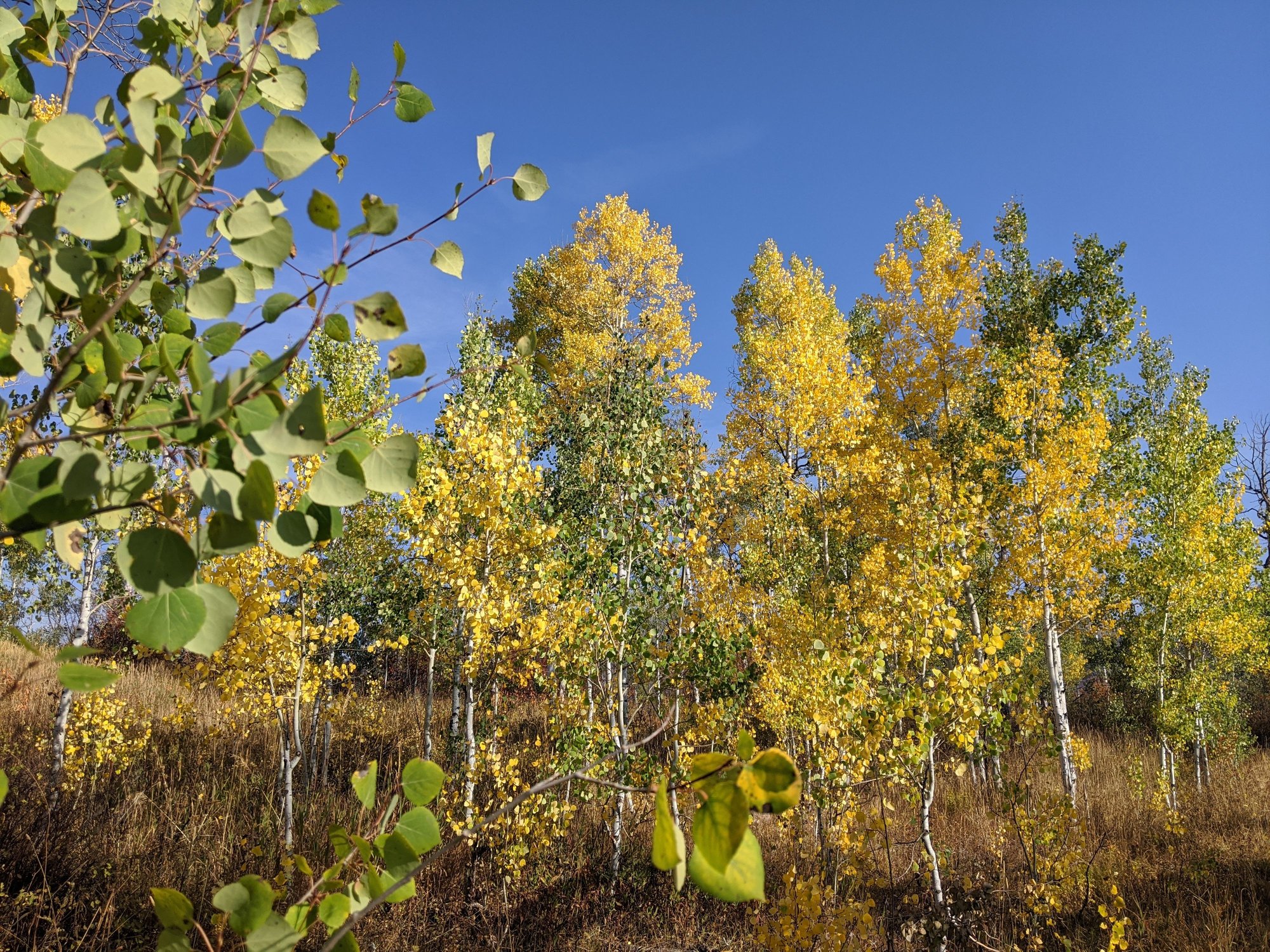
The air is smoky; we see a large smoke cloud behind us. This is my first hike since I broke my wrist, I’m a bit timid; I take it slowly. The trail is exposed, extremely dry and dusty, the day warm.
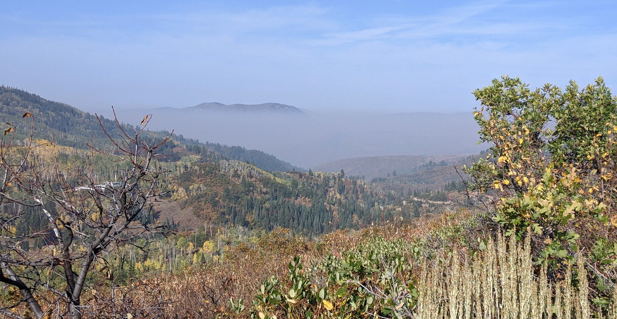
Smoke cloud in nearby Mount Zirkel Wilderness Area
Lower Bear Creek Trail
Helicopters fly overhead. Around the two mile mark we see smoke ahead of us. A passing hiker tells us that he reported the smoke on Friday and at that time there were only two plumes, suspected offshoots from the Middle Fork fire burning in nearby in Mount Zirkel wilderness area. But now there are eight. He tells us he thinks the helicopters are dropping off crews in Elk Park.
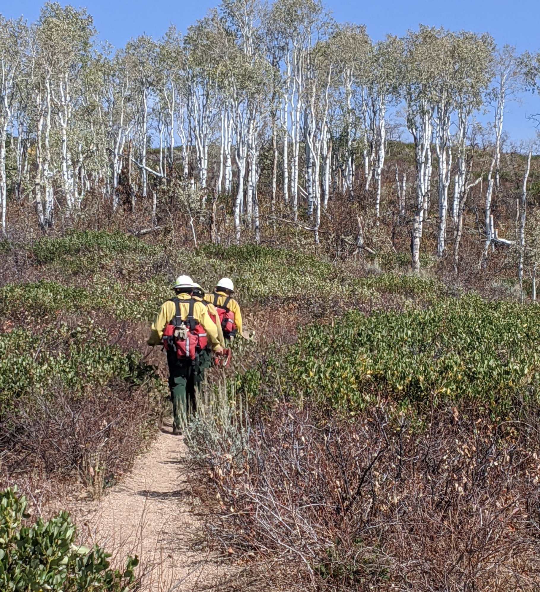
On the way out, we pass three firefighters hiking in – in full garb. It’s now hot. I feel for them, what a horrible job they have; the smoke is a long way off, so they have a long hike ahead. We see their vehicles in the parking lot when we finish – firefighters from Oregon. We Coloradoans thank you.
Firefighters on the Lower Bear Creek Trail
Sign on CR 36
Sign on CR 36
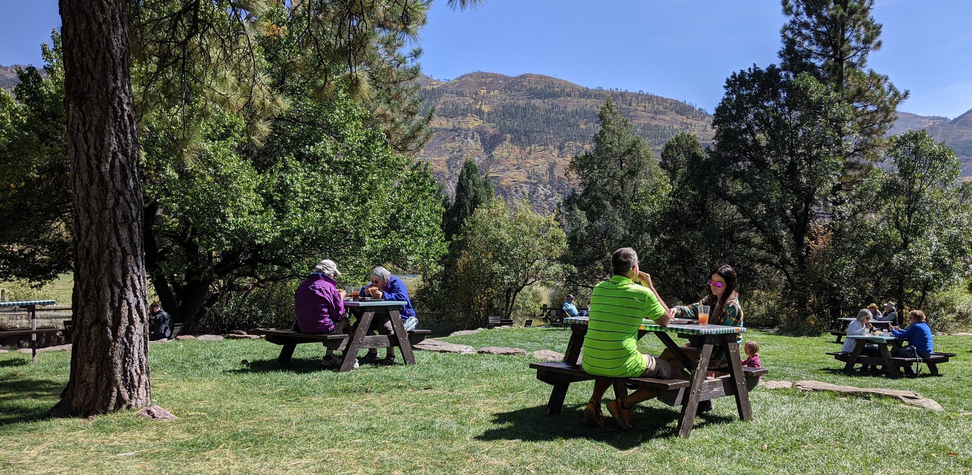
We next drive out to find the former location of Taco Cabo, to see if perhaps they have two outlets now. Nope, Cinco de Mayo has taken their place. They have a covered area outside with excellent spaced tables, so we decide to investigate. A brilliant idea. It’s Taco Tuesday – the chicken and Carnitas tacos so good that we go back for seconds. An employee tells me they’ve been there for a just a few months. Then it’s back to the room to shower and relax.
To be continued...
The hotel is nice, new and fresh; we have a quiet night. They’ve discontinued daily room cleaning due to COVID, but Housekeeping stops by to offer clean towels, soap, coffee supplies and to empty the trash.
They’ve also discontinued their usual breakfast and instead offer a grab bag or abbreviated hot breakfast; burritos or breakfast sandwich, muffins, yogurt, handed out by an employee. Certainly nothing to get excited about; I find myself wondering for the 100th time about all the extra trash going to landfill during the pandemic.
We head out, hoping to find the 5.2 mile multi-use Spring Creek Trail. We pass a line of firefighters walking up CR 36 - no idea to where – but we don’t find the trail.
Instead we stumble upon the 5.5 mile Lower Bear Creek trail (off CR 36 before Strawberry Fields), and decide to hike it instead. A sign tells us that this area is on Stage 2 Fire restrictions, but open.
The air is smoky; we see a large smoke cloud behind us. This is my first hike since I broke my wrist, I’m a bit timid; I take it slowly. The trail is exposed, extremely dry and dusty, the day warm.
Smoke cloud in nearby Mount Zirkel Wilderness Area
Lower Bear Creek Trail
Helicopters fly overhead. Around the two mile mark we see smoke ahead of us. A passing hiker tells us that he reported the smoke on Friday and at that time there were only two plumes, suspected offshoots from the Middle Fork fire burning in nearby in Mount Zirkel wilderness area. But now there are eight. He tells us he thinks the helicopters are dropping off crews in Elk Park.
On the way out, we pass three firefighters hiking in – in full garb. It’s now hot. I feel for them, what a horrible job they have; the smoke is a long way off, so they have a long hike ahead. We see their vehicles in the parking lot when we finish – firefighters from Oregon. We Coloradoans thank you.
Firefighters on the Lower Bear Creek Trail
Sign on CR 36
Sign on CR 36
We next drive out to find the former location of Taco Cabo, to see if perhaps they have two outlets now. Nope, Cinco de Mayo has taken their place. They have a covered area outside with excellent spaced tables, so we decide to investigate. A brilliant idea. It’s Taco Tuesday – the chicken and Carnitas tacos so good that we go back for seconds. An employee tells me they’ve been there for a just a few months. Then it’s back to the room to shower and relax.
To be continued...
 Oct 10th, 2020, 02:54 PM
#22
September 23 -
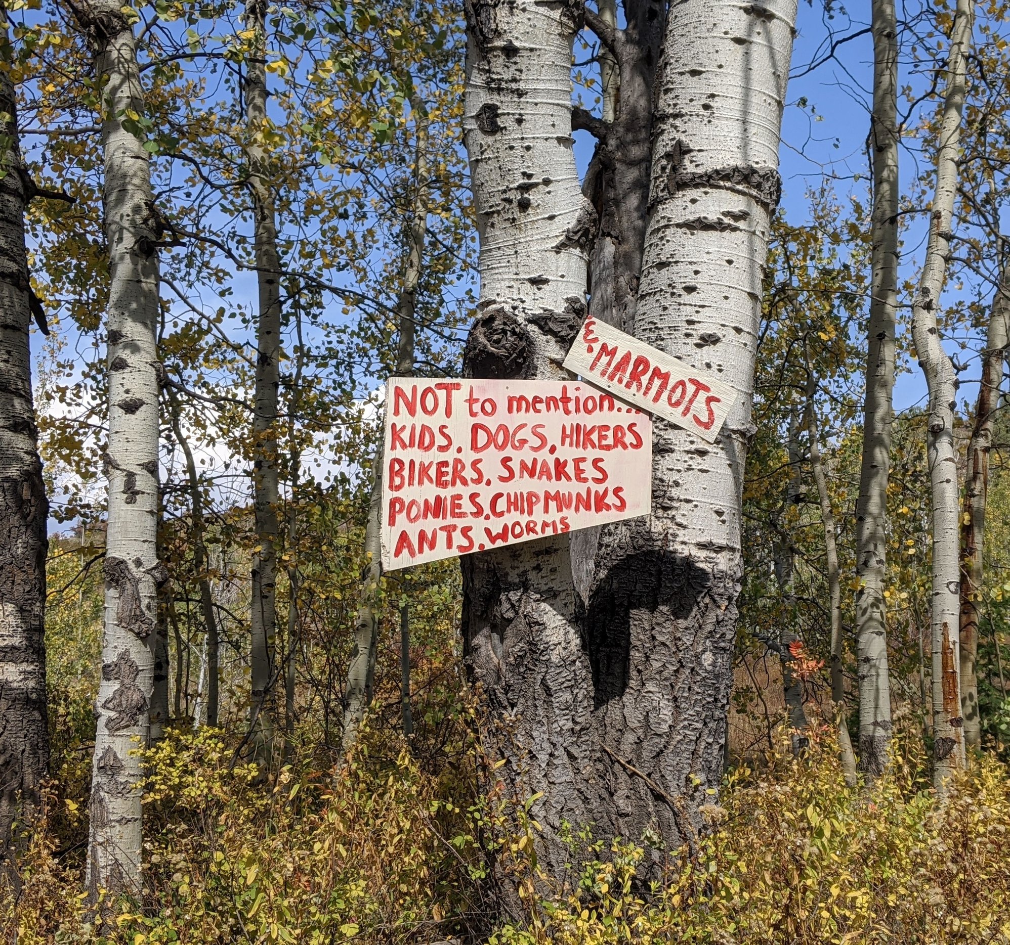
It’s 38 F when we pull into the parking lot of the Buffalo Pass Recreation Area in the Routt National Forest. The Dry Lake campground parking area is busy with cars, bikers, horse trailers and various 4x4s.
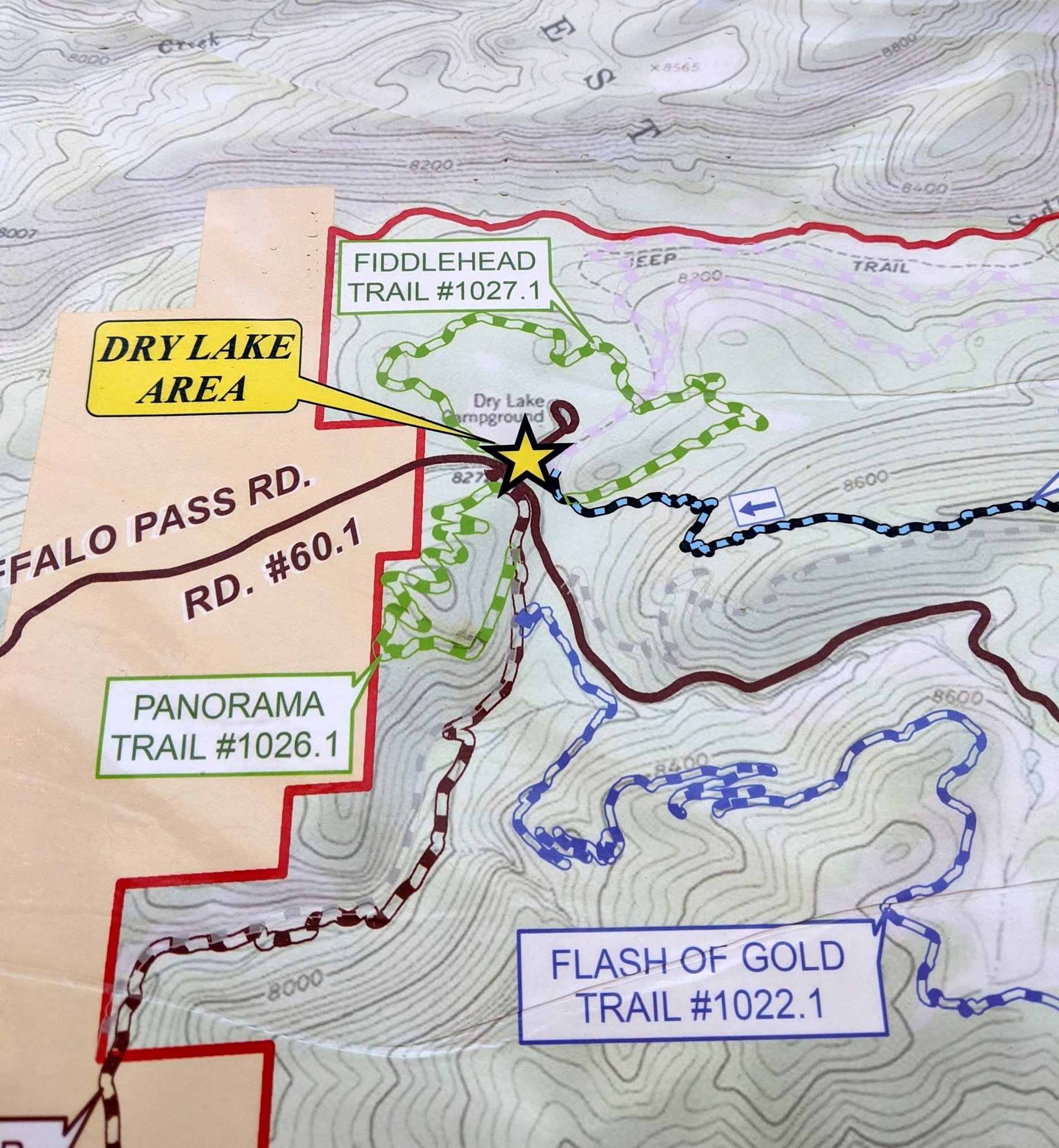
We walk three loop trails, the Panorama, the Fiddlehead and the Soda Creek Loop (our favorite) – 7.5 miles, 3:45 hours, one blister, no smoke. We see hundreds of downed and uprooted trees, many of which had fallen onto the trails, but have been cleaned up. The area looks like an aspen and pine cemetery; lots of destruction. The leaves are past peak, many seem to have just dried up and fallen to the ground, probably a result of the early winter storm. Despite the busy parking lot, we only see two other hikers.
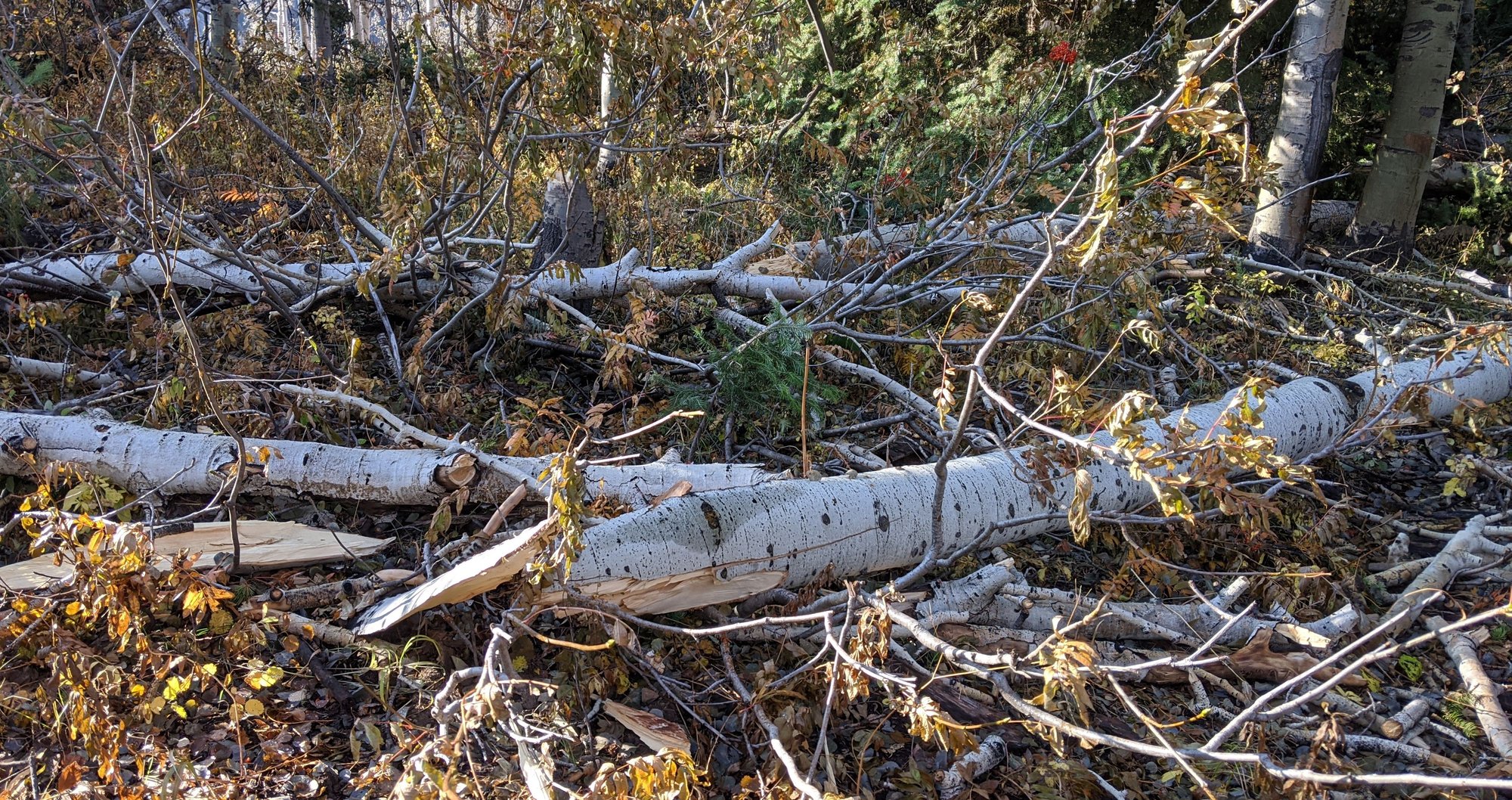
Downed trees
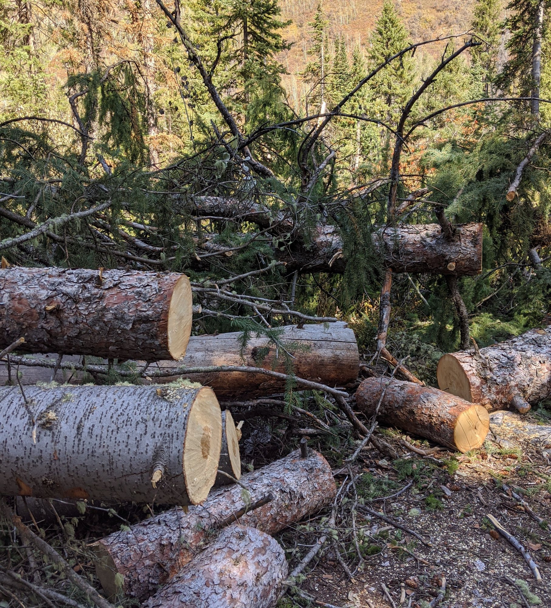
Trees removed from trail
It’s a very peaceful morning, a pleasant 73 F when we finish.
Then an alfresco lunch at our new favorite Mexican joint - Cinco de Mayo. This time a Tinga chicken burrito for me and a pork Confi Carnita burrito for Bill. Excellent again.
Later, a hot shower, and an encore visit to the Steamboat Brau Haus, then a run to City Market for sushi and a salad for dinner in our room.
To be continued...
It’s 38 F when we pull into the parking lot of the Buffalo Pass Recreation Area in the Routt National Forest. The Dry Lake campground parking area is busy with cars, bikers, horse trailers and various 4x4s.
We walk three loop trails, the Panorama, the Fiddlehead and the Soda Creek Loop (our favorite) – 7.5 miles, 3:45 hours, one blister, no smoke. We see hundreds of downed and uprooted trees, many of which had fallen onto the trails, but have been cleaned up. The area looks like an aspen and pine cemetery; lots of destruction. The leaves are past peak, many seem to have just dried up and fallen to the ground, probably a result of the early winter storm. Despite the busy parking lot, we only see two other hikers.
Downed trees
Trees removed from trail
It’s a very peaceful morning, a pleasant 73 F when we finish.
Then an alfresco lunch at our new favorite Mexican joint - Cinco de Mayo. This time a Tinga chicken burrito for me and a pork Confi Carnita burrito for Bill. Excellent again.
Later, a hot shower, and an encore visit to the Steamboat Brau Haus, then a run to City Market for sushi and a salad for dinner in our room.
To be continued...
Oct 10th, 2020, 09:19 PM
#23
I'm enjoying the read, thanks for sharing. I gasped out loud at the cost of medical treatment for your wrist. And that was without surgery!
Also interesting to read that mask wearing and distancing seems to be optional? Do they fine individuals or businesses for not following the rules?
Also interesting to read that mask wearing and distancing seems to be optional? Do they fine individuals or businesses for not following the rules?
Oct 11th, 2020, 06:57 AM
#24
Hi Kay -
I too, gasped at the cost of my wrist when I added up all the bills!
The state wide CO mask mandate went into effect in July. Prior to that, only some counties had a mandate in place.
When we took the first trip to Durango in June, we were surprised how the restrictions differed from county to county, which is partly why I mentioned it. Durango, which is in La Plata county had more restrictions in place than Del Norte which is in Rio Grande County or Mancos, which is in Montezuma County.
Many food outlets in Durango were still closed to indoor seating when we visited in June too, whereas the same did not seem to be the case in Del Norte and Mancos. Individual businesses have been able to apply for variances since this all began, so that accounts for some of the differences as well.
Every town felt so different, it was a bit bizarre.
The CO mask mandate is still in place though, and when I mention someone not wearing a mask during our September road trip, they are in violation of the CO mask mandate if they are indoors. The state has set up a website for reporting businesses that do not comply and I came very close to reporting a few places but I didn't have sufficient photos to back up my allegations.
I've not heard of any individuals being fined, which is probably part of the problem.
Some businesses don't seem to be enforcing the mandate amongst their customers. I still see people in my town shopping in stores without masks, yet no one enforces it. This despite obvious signage advising that a mask is required to enter. I've also seen people enter an establishment with a mask and then immediately take it off. There are a lot of idiots out there.
From the CO state website:
When do I have to wear a mask?
The situations in which you do have to wear a mask are very far-reaching. The state says:- When entering or moving within any public indoor space.
- While using or waiting to use public (buses, light-rail) or non-personal (taxis, car services, ride-shares) transportation services.
When do I not have to wear a mask in public?
The state says you do not have to wear a mask if or when you are:- Hearing-impaired or otherwise disabled or who are communicating with someone who is hearing impaired or otherwise disabled and where the ability to see the mouth is essential to communication.
- Seated at a food service establishment.
- Exercising alone or with others from the individual’s household, and a face covering would interfere with the activity.
- Receiving a personal service where the temporary removal of the face-covering is necessary to perform the service.
- Entering a business or receiving services and are asked to temporarily remove a face covering for identification purposes.
- Are actively engaged in a public safety role such as law enforcement, firefighters, or emergency medical personnel.
- Officiating at a religious service.
- Giving a speech for broadcast or an audience.
Last edited by Melnq8; Oct 11th, 2020 at 07:00 AM.
Oct 11th, 2020, 07:19 AM
#25
September 24 -
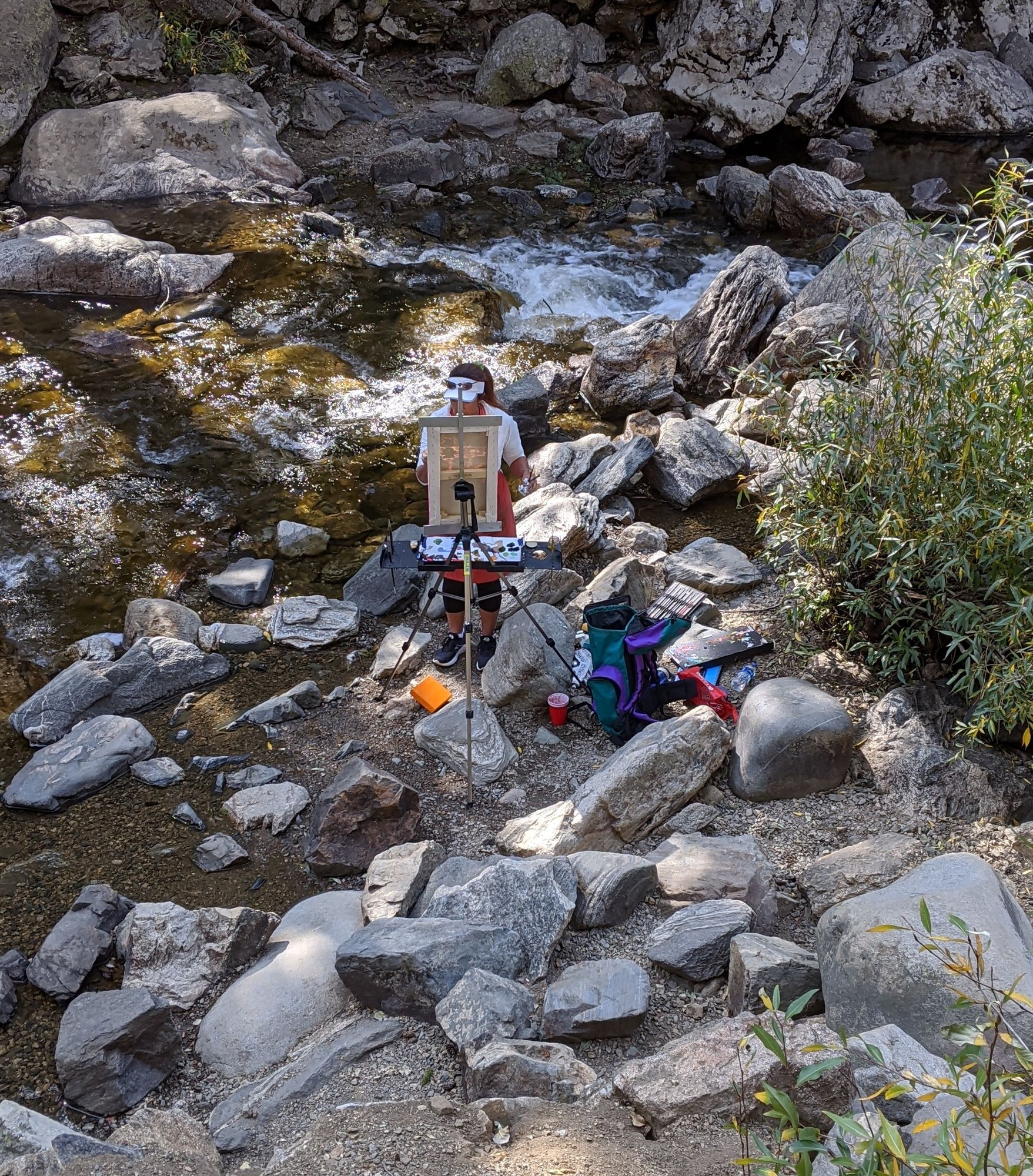
Our last morning in Steamboat Springs is spent hiking 5.5 miles in Fish Creek Canyon, tackling the rock and root riddled obstacle course of a track to the second waterfall.
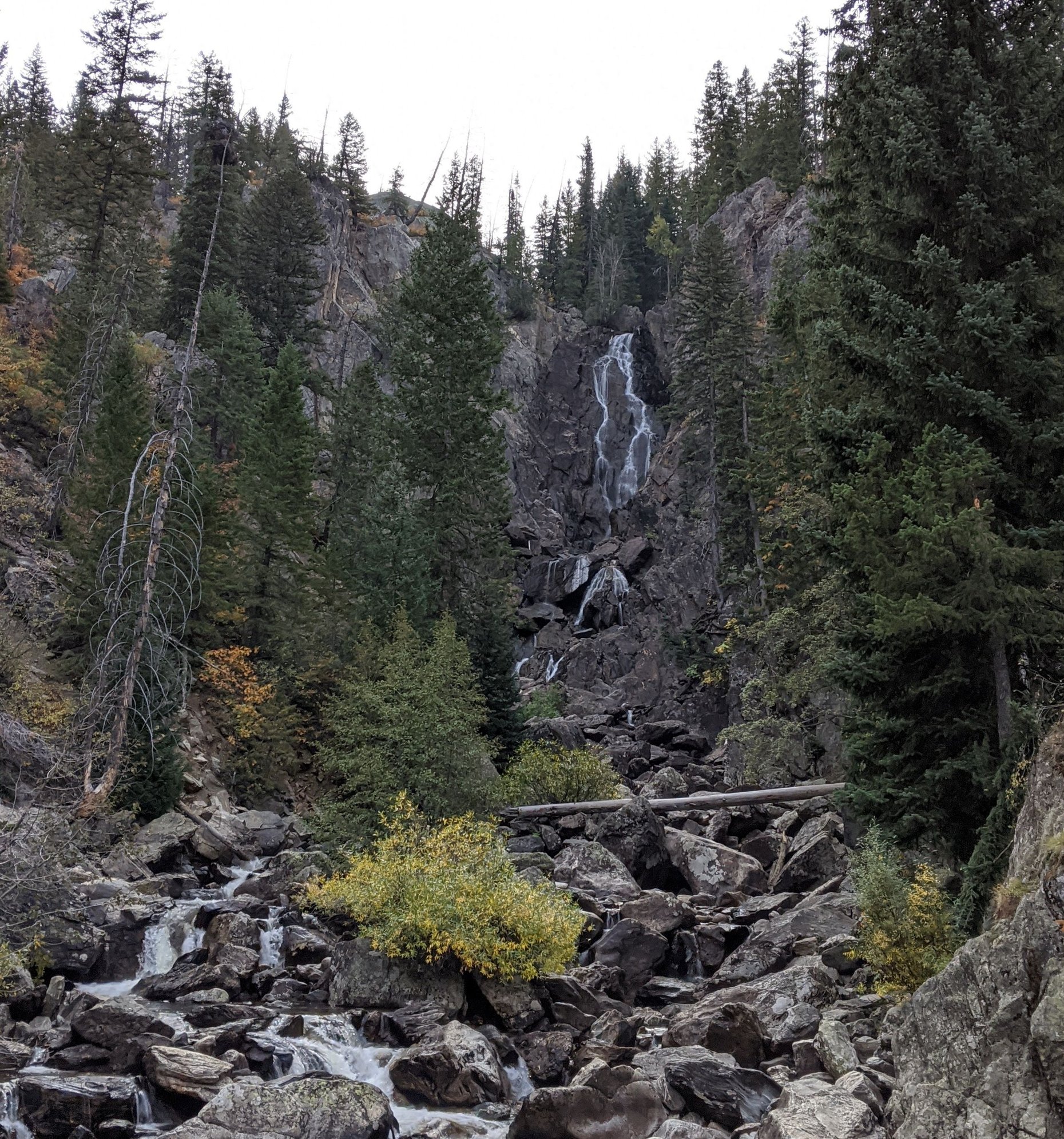
Fish Creek Canyon
Fish Creek Canyon
Fish Creek Canyon
Fish Creek Canyon
It's a pretty hike; I bail on the last treacherous 1/2 mile...where there are waterfalls there are wet slippery rocks, and where there are wet slippery rocks, there are potential broken bones for clumsy hikers. Once broken, twice shy.
I sit on a rock and wait for Bill as he climbs the last bit to the waterfall; he's not bothered by wet rocks. He later tells me this was his favorite Steamboat hike.
Fish Creek Canyon is one of the most popular destinations around Steamboat Springs, no doubt due to its close proximity to town. We’ve been here before, but were unable to do much hiking due to some knee issues (getting old is hell). There’s a $5 charge, free with National Parks Pass.
Our MO is to get out early and therefore we have the trail to ourselves for a while, but it turns into a super highway as we make our descent, necessitating the wearing of masks for the bulk of the hike down. Some hikers do the same, but many do not.
It's a chilly 36 degrees when we start the hike, 76 degrees when we finish 3:45 later.
And then…you guessed it… lunch at Cindo de Mayo – same meal – still good – and dinner provisions from City Market. Evidently those 130 restaurants were lost on us
To be continued...
Our last morning in Steamboat Springs is spent hiking 5.5 miles in Fish Creek Canyon, tackling the rock and root riddled obstacle course of a track to the second waterfall.
Fish Creek Canyon
Fish Creek Canyon
Fish Creek Canyon
Fish Creek Canyon
It's a pretty hike; I bail on the last treacherous 1/2 mile...where there are waterfalls there are wet slippery rocks, and where there are wet slippery rocks, there are potential broken bones for clumsy hikers. Once broken, twice shy.
I sit on a rock and wait for Bill as he climbs the last bit to the waterfall; he's not bothered by wet rocks. He later tells me this was his favorite Steamboat hike.
Fish Creek Canyon is one of the most popular destinations around Steamboat Springs, no doubt due to its close proximity to town. We’ve been here before, but were unable to do much hiking due to some knee issues (getting old is hell). There’s a $5 charge, free with National Parks Pass.
Our MO is to get out early and therefore we have the trail to ourselves for a while, but it turns into a super highway as we make our descent, necessitating the wearing of masks for the bulk of the hike down. Some hikers do the same, but many do not.
It's a chilly 36 degrees when we start the hike, 76 degrees when we finish 3:45 later.
And then…you guessed it… lunch at Cindo de Mayo – same meal – still good – and dinner provisions from City Market. Evidently those 130 restaurants were lost on us
To be continued...
Last edited by Melnq8; Oct 11th, 2020 at 07:22 AM.
Oct 11th, 2020, 07:41 AM
#26
September 25 -
We leave Steamboat Springs around 8:30 am and head west on US 40 towards Hayden and Craig. Our plan is to avoid as much of I-70 as possible and Glenwood Canyon in particular, where the human caused Grizzly Creek Fire has wreaked havoc since August 10.
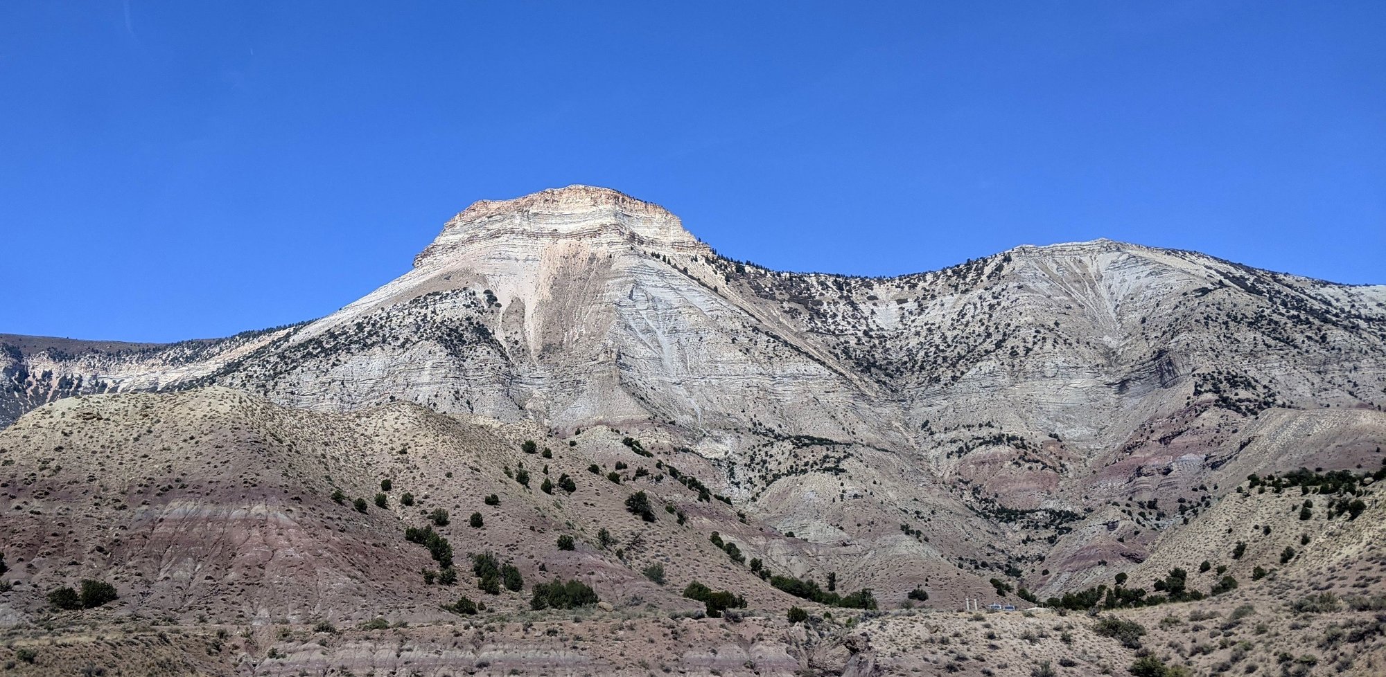
Mesas
Just past Meeker, we join S Highway 13, a pleasant drive with little traffic and not much relief. Soon we’re on US 6 west, surrounded by unexpectedly pretty, yet thirsty-looking mesas.
Near Rifle we join I-70 west for the final 42 miles to Palisade.
When planning this trip, our intention was to spend two nights in Palisade, but I ran into problems finding accommodation, so we booked a cheap and cheerful motel in Grand Junction (12 miles from Palisade) where we’d spent a night a few years ago.
The drive into Palisade always catches me off guard…the lush green valley to the south is such a contrast to the looming bone dry mesas to the north. Although we’ve made this drive a few times, it still surprises me.
Some three and a half hours after leaving Steamboat Springs, we’re pulling into Palisade.
It’s time for lunch, so we make a beeline for Maison La Belle Vie (House of Beautiful Life), knowing we like the wine here (French owner, Australian wine maker, what's not to like?) and having had a decent platter here in the past.
We get sidetracked by Herman’s Produce, which is usually closed when we visit, as we hot weather wimps avoid the Western Slope in the summer months.
We peruse the vast array of local fruit, vegetables and canned jams, jellies, salsas, and honeys, leaving with some peach jam and sweet fire relish.
Palisade is Colorado’s fruit growing area, known for its peaches, cherries, apples, apricots, plums, berries, and hit-and-miss wine. While it doesn’t hold a candle to other wine growing regions we’ve visited across the world, it’s all we have.
I’m always amused at the street names in Palisade; 35-8/10 Road, 37-3/10 Road, 38-1/4 Road, G-1/4 Road.
Maison La Belle Vie is busy. The tasting room is closed, a sign tell us to take a seat on the patio, and to choose wisely as once selected no changes are allowed. Per state mandate, masks are required until seated and tables appropriately spaced. Yes, this will do nicely.
We’re brought a menu and soon we’re sipping a bottle of 2018 Syrah Blend and noshing on a meat and cheese platter under the trees.
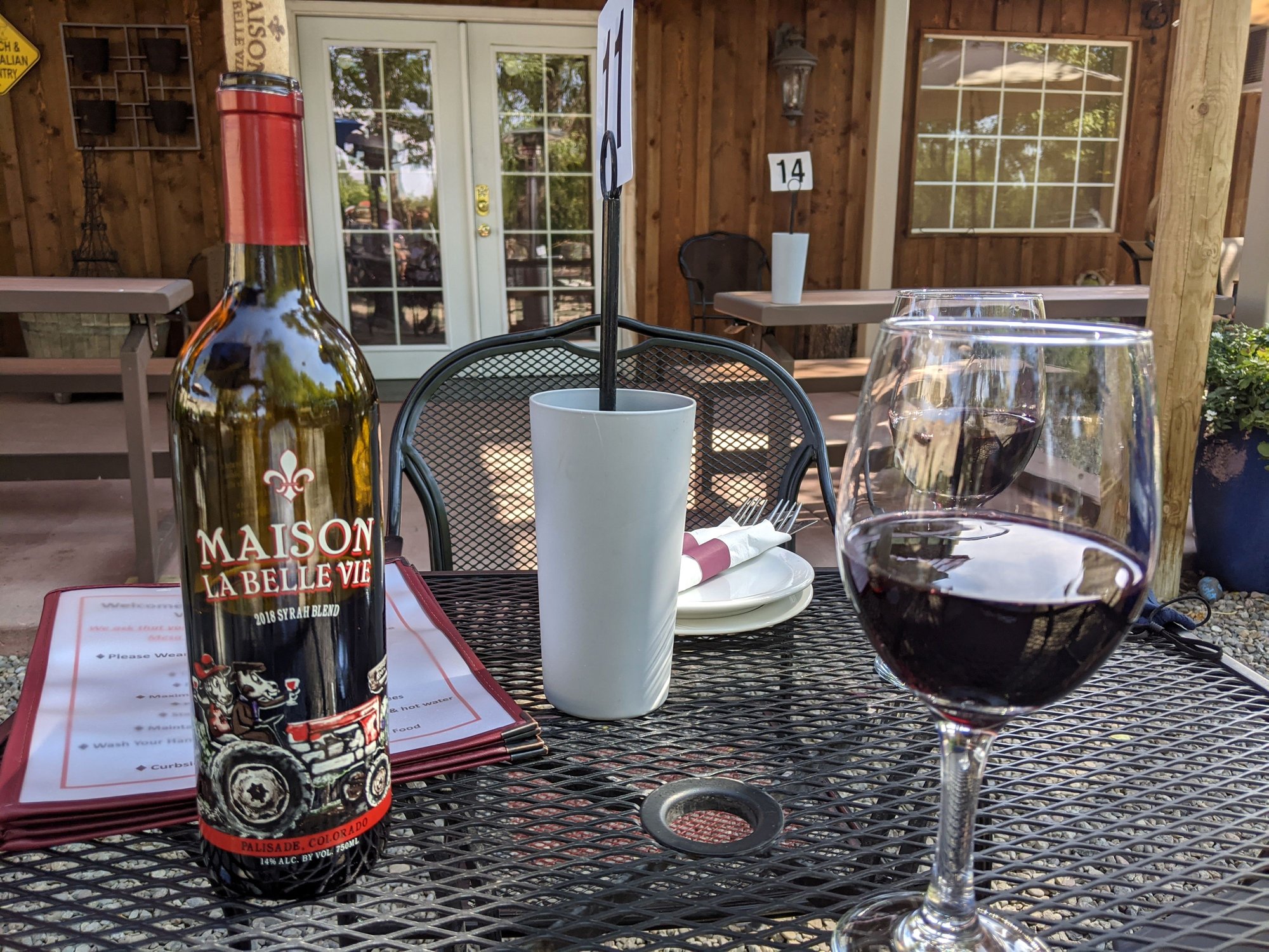
Maison La Belle Vie
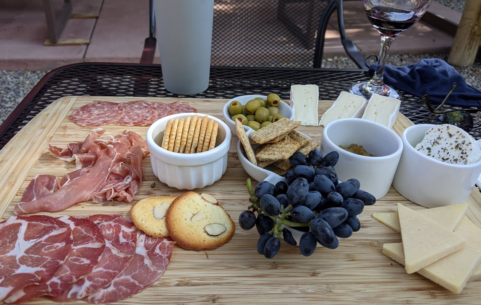
Maison La Belle Vie
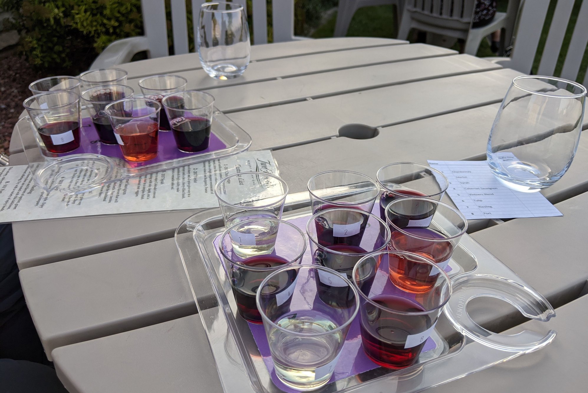
It’s a toasty 91 F when we finish lunch and head to another of our favorites, Red Fox Cellars. They’ve moved their tasting room outdoors on the patio, but it’s not as well shaded as Maison La Belle Vie and we’re quickly overheated. We both choose their Avant Garde Wine Flight, a bargain at $4 for four tastes. We leave with two bottles of their Rye Whiskey Barrel Aged Cab Franc.
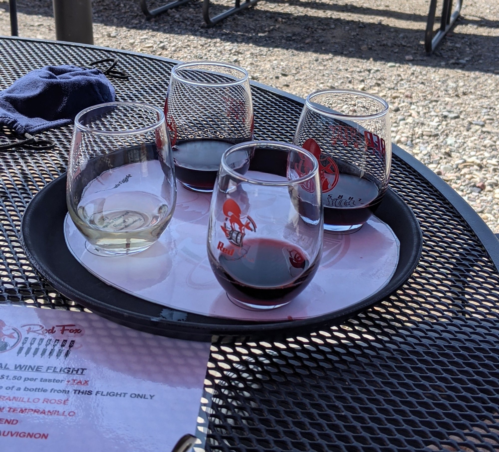
Red Fox Cellars
No visit to the area would be complete without at least one stop at Enstrom Candies in downtown Grand Junction; we head there post haste. Their almond toffee is fabulous, but today we’re here for ice cream; two scoops of almond toffee for Bill, one scoop each of peach and almond toffee for me. Yum. We peruse the goods and pick up a bag of almond toffee crumbs to take home.
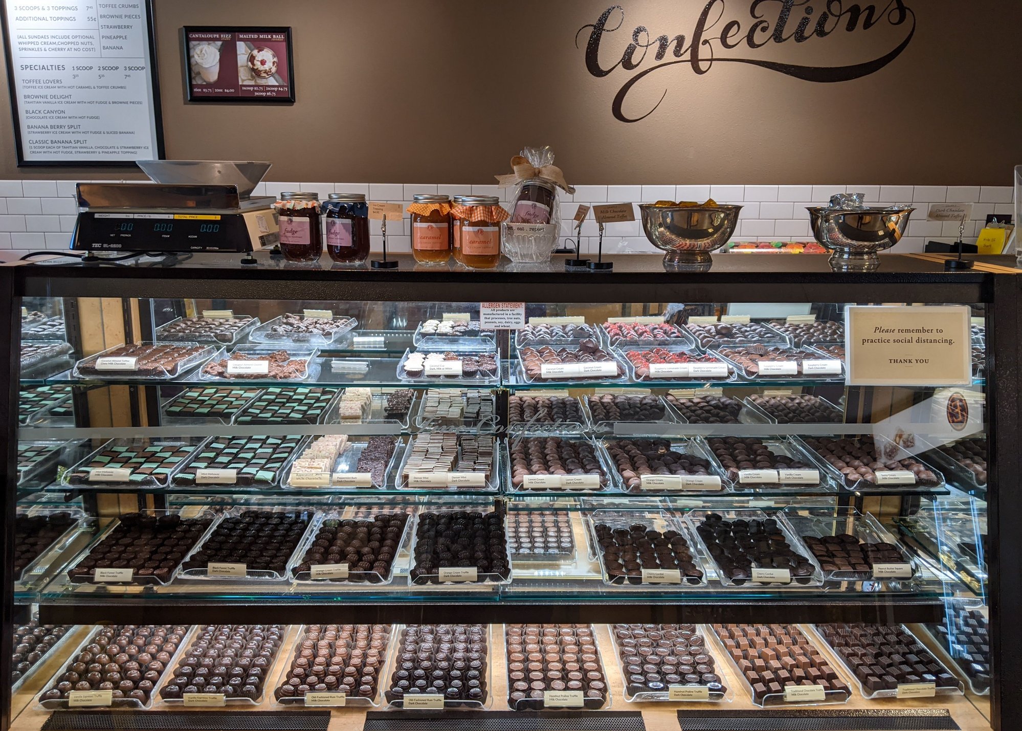
Enstrom Candies
It’s hot; we’re tired. We head to the motel (Palomino Inn) to hide in the air conditioning.
To be continued...
We leave Steamboat Springs around 8:30 am and head west on US 40 towards Hayden and Craig. Our plan is to avoid as much of I-70 as possible and Glenwood Canyon in particular, where the human caused Grizzly Creek Fire has wreaked havoc since August 10.
Mesas
Just past Meeker, we join S Highway 13, a pleasant drive with little traffic and not much relief. Soon we’re on US 6 west, surrounded by unexpectedly pretty, yet thirsty-looking mesas.
Near Rifle we join I-70 west for the final 42 miles to Palisade.
When planning this trip, our intention was to spend two nights in Palisade, but I ran into problems finding accommodation, so we booked a cheap and cheerful motel in Grand Junction (12 miles from Palisade) where we’d spent a night a few years ago.
The drive into Palisade always catches me off guard…the lush green valley to the south is such a contrast to the looming bone dry mesas to the north. Although we’ve made this drive a few times, it still surprises me.
Some three and a half hours after leaving Steamboat Springs, we’re pulling into Palisade.
It’s time for lunch, so we make a beeline for Maison La Belle Vie (House of Beautiful Life), knowing we like the wine here (French owner, Australian wine maker, what's not to like?) and having had a decent platter here in the past.
We get sidetracked by Herman’s Produce, which is usually closed when we visit, as we hot weather wimps avoid the Western Slope in the summer months.
We peruse the vast array of local fruit, vegetables and canned jams, jellies, salsas, and honeys, leaving with some peach jam and sweet fire relish.
Palisade is Colorado’s fruit growing area, known for its peaches, cherries, apples, apricots, plums, berries, and hit-and-miss wine. While it doesn’t hold a candle to other wine growing regions we’ve visited across the world, it’s all we have.
I’m always amused at the street names in Palisade; 35-8/10 Road, 37-3/10 Road, 38-1/4 Road, G-1/4 Road.
Maison La Belle Vie is busy. The tasting room is closed, a sign tell us to take a seat on the patio, and to choose wisely as once selected no changes are allowed. Per state mandate, masks are required until seated and tables appropriately spaced. Yes, this will do nicely.
We’re brought a menu and soon we’re sipping a bottle of 2018 Syrah Blend and noshing on a meat and cheese platter under the trees.
Maison La Belle Vie
Maison La Belle Vie
It’s a toasty 91 F when we finish lunch and head to another of our favorites, Red Fox Cellars. They’ve moved their tasting room outdoors on the patio, but it’s not as well shaded as Maison La Belle Vie and we’re quickly overheated. We both choose their Avant Garde Wine Flight, a bargain at $4 for four tastes. We leave with two bottles of their Rye Whiskey Barrel Aged Cab Franc.
Red Fox Cellars
No visit to the area would be complete without at least one stop at Enstrom Candies in downtown Grand Junction; we head there post haste. Their almond toffee is fabulous, but today we’re here for ice cream; two scoops of almond toffee for Bill, one scoop each of peach and almond toffee for me. Yum. We peruse the goods and pick up a bag of almond toffee crumbs to take home.
Enstrom Candies
It’s hot; we’re tired. We head to the motel (Palomino Inn) to hide in the air conditioning.
To be continued...
Last edited by Melnq8; Oct 11th, 2020 at 07:45 AM.
Oct 11th, 2020, 01:45 PM
#27
September 26 -
Our motel room is small, but clean, comfortable and very well maintained. The only drawback…it’s on a busy street and therefore noisy.
We begin our day at Randy’s Southside Diner, which is just across the parking lot from our motel. Signage tells patrons to wear masks, yet we see several people enter without them.
The food is pretty ordinary. Service is friendly but glacially slow.
We’d planned to spend our one full day in Grand Junction hiking at Colorado National Monument, but with a temperature forecast of 89 F and an elevation of only 4,700-7,000 feet, we change our minds and head up to Grand Mesa National Forest, which at 10,750 feet will be much cooler. We’ve not been before, and have found a promising drive loop online.
The morning is hazy; we head out on I-70 east, then turn on Highway 65 towards Collbran. We’re now on the Grand Mesa Scenic and Historic Byway. This should be good.
I’ve since learned that Grand Mesa is the largest flat-topped mountain in the world with an area of about 500 square miles.
As we drive up towards the mesa through the canyon we see big horn sheep and copious blooming sunflowers. Our partially filled plastic water bottles begin to crackle and pop as the elevation rises; the mesa is 6,000 feet above the surrounding river valleys.
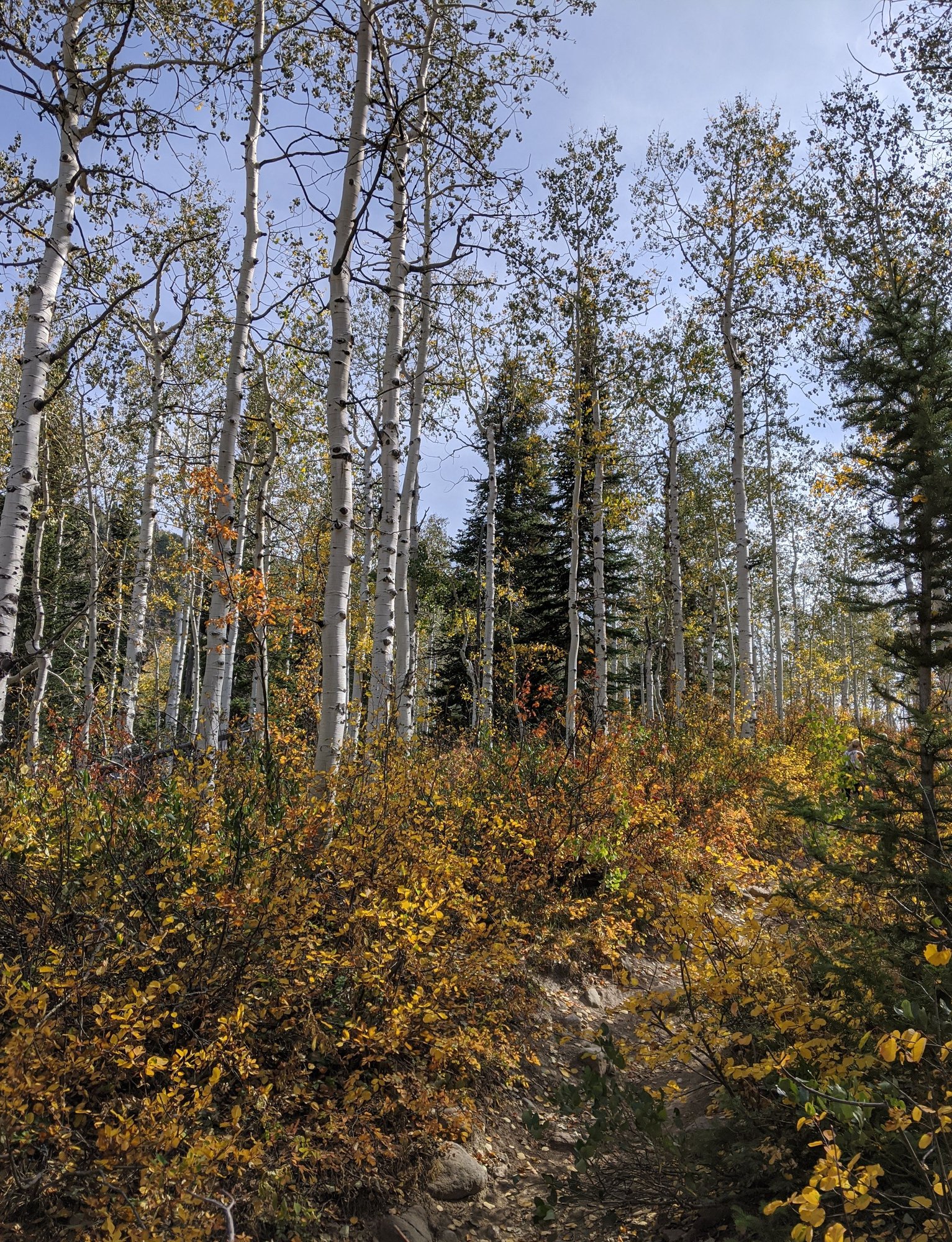
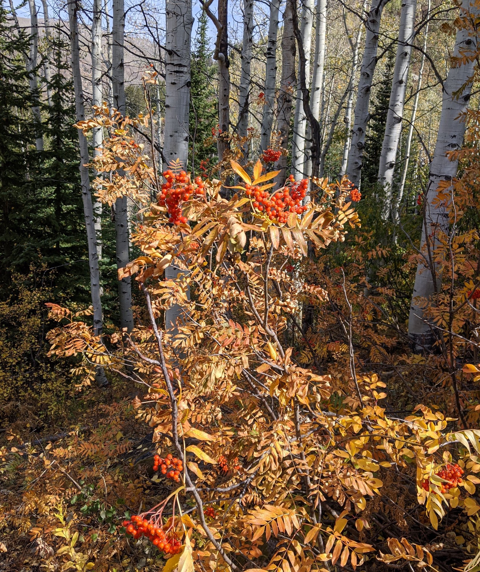
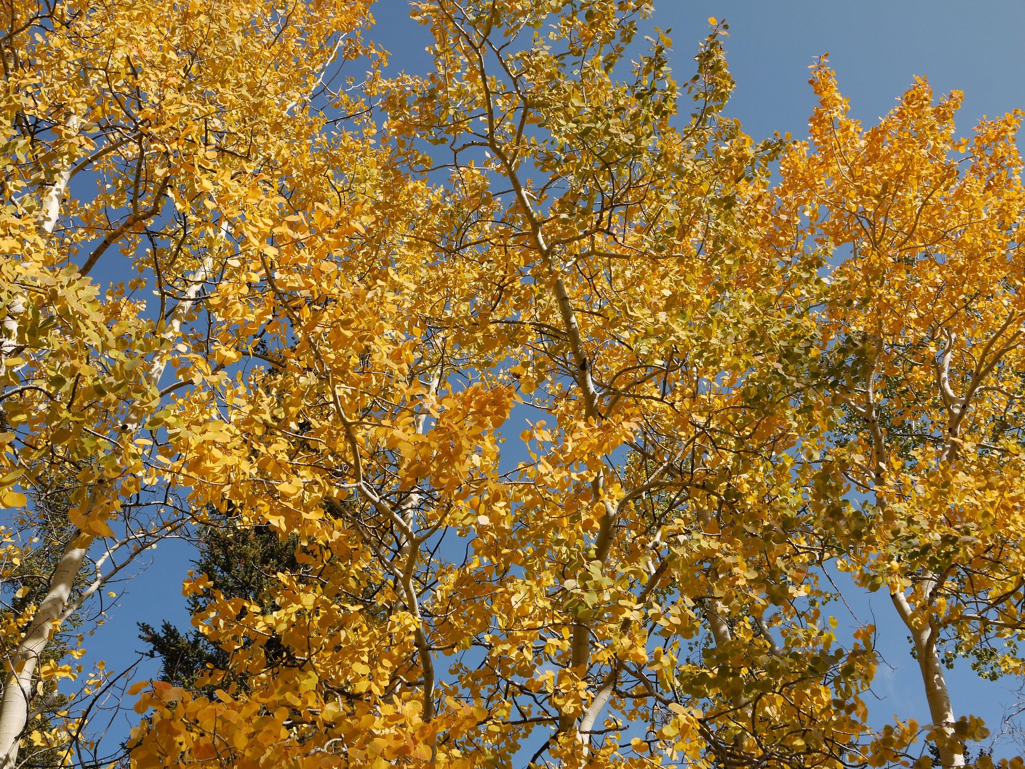
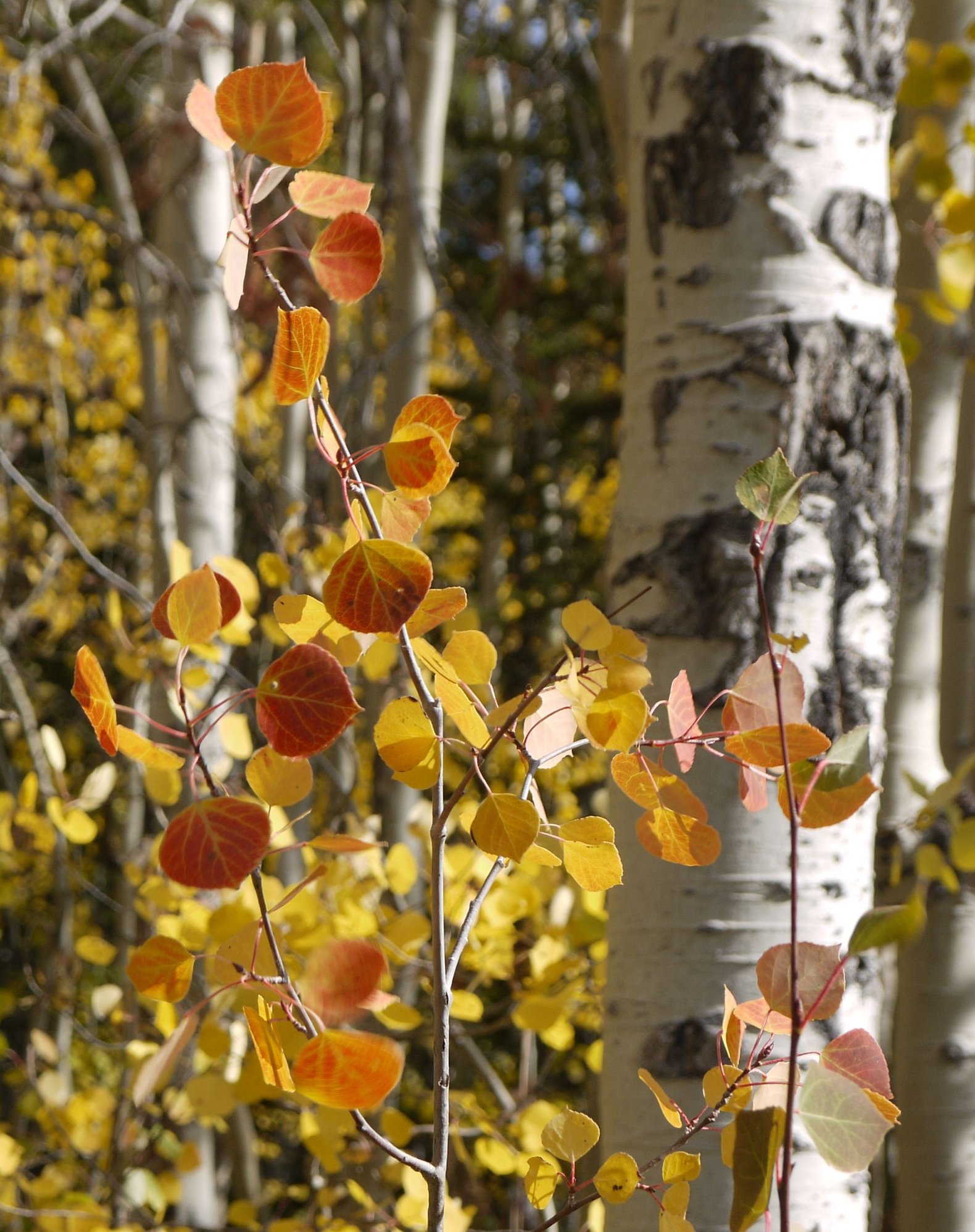
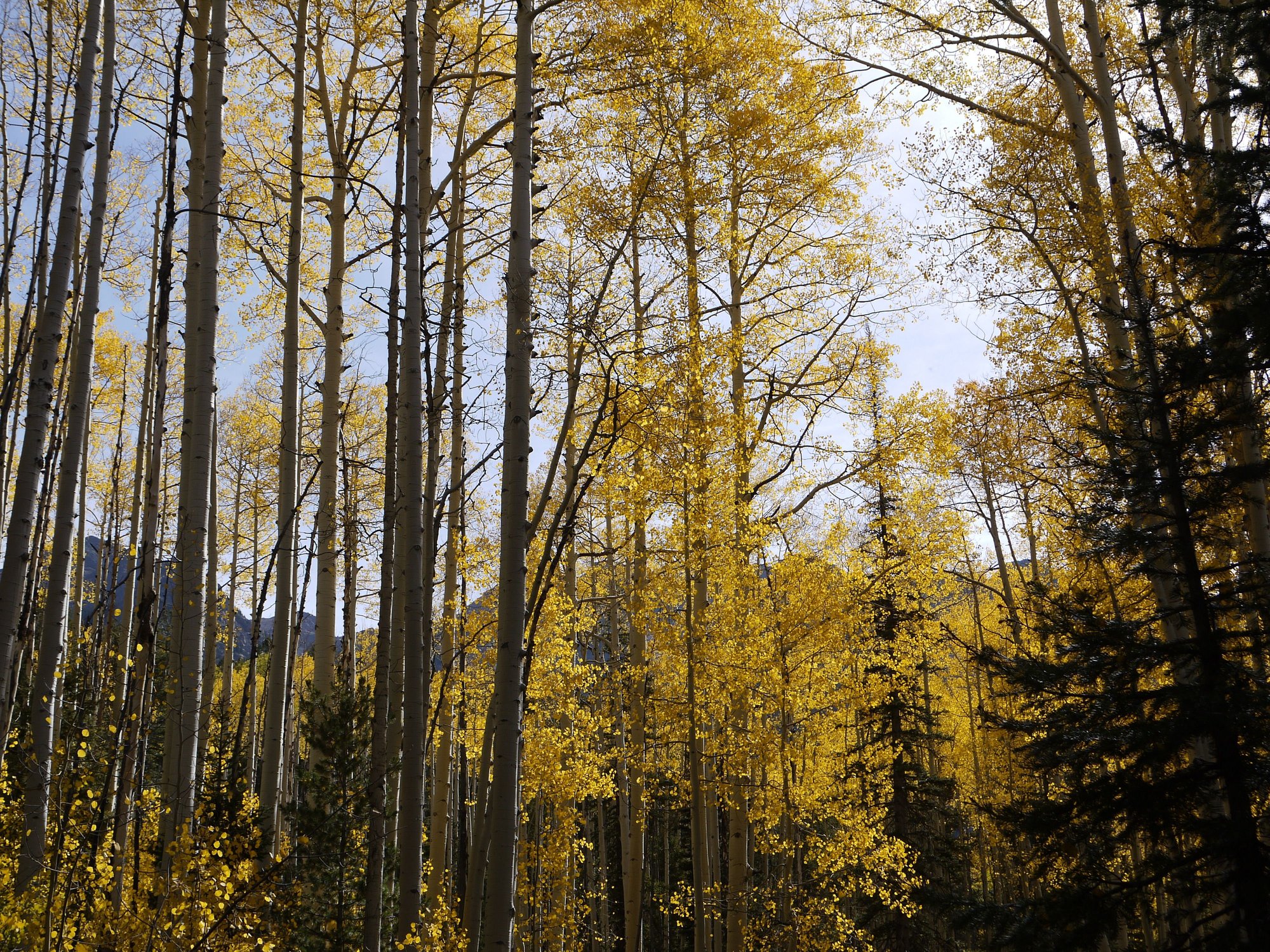
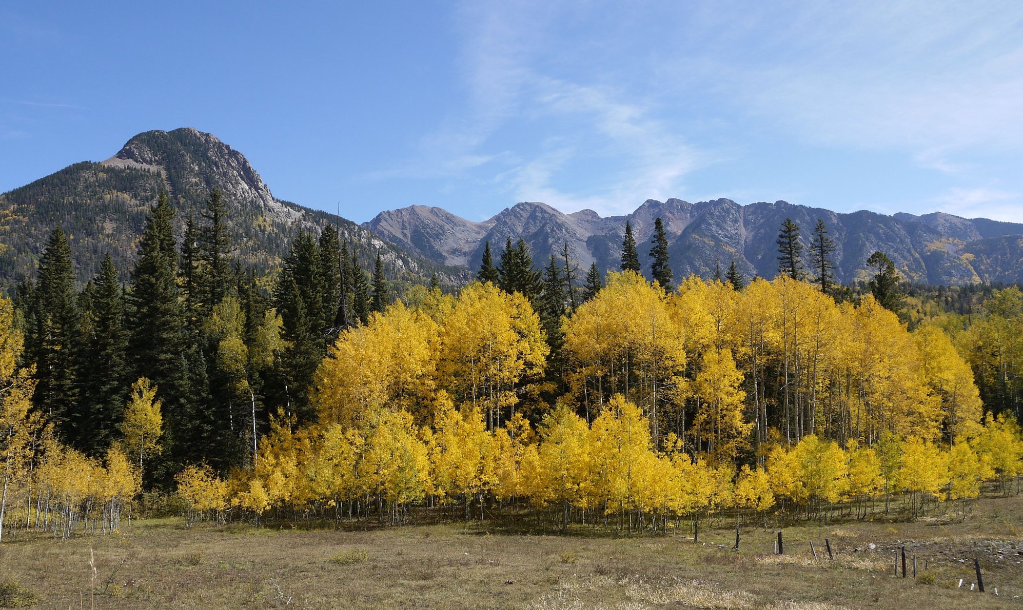
This is definitely a pretty drive and an unexpected surprise. Local honey is being sold alongside the road, we pass the Powder Horn Ski Area and enter the Grand Mesa National Forest, awash in autumn yellow and red. WOW. We definitely timed this right. The forest up here looks really healthy, a nice change from the dead trees we see too often here in Colorado.
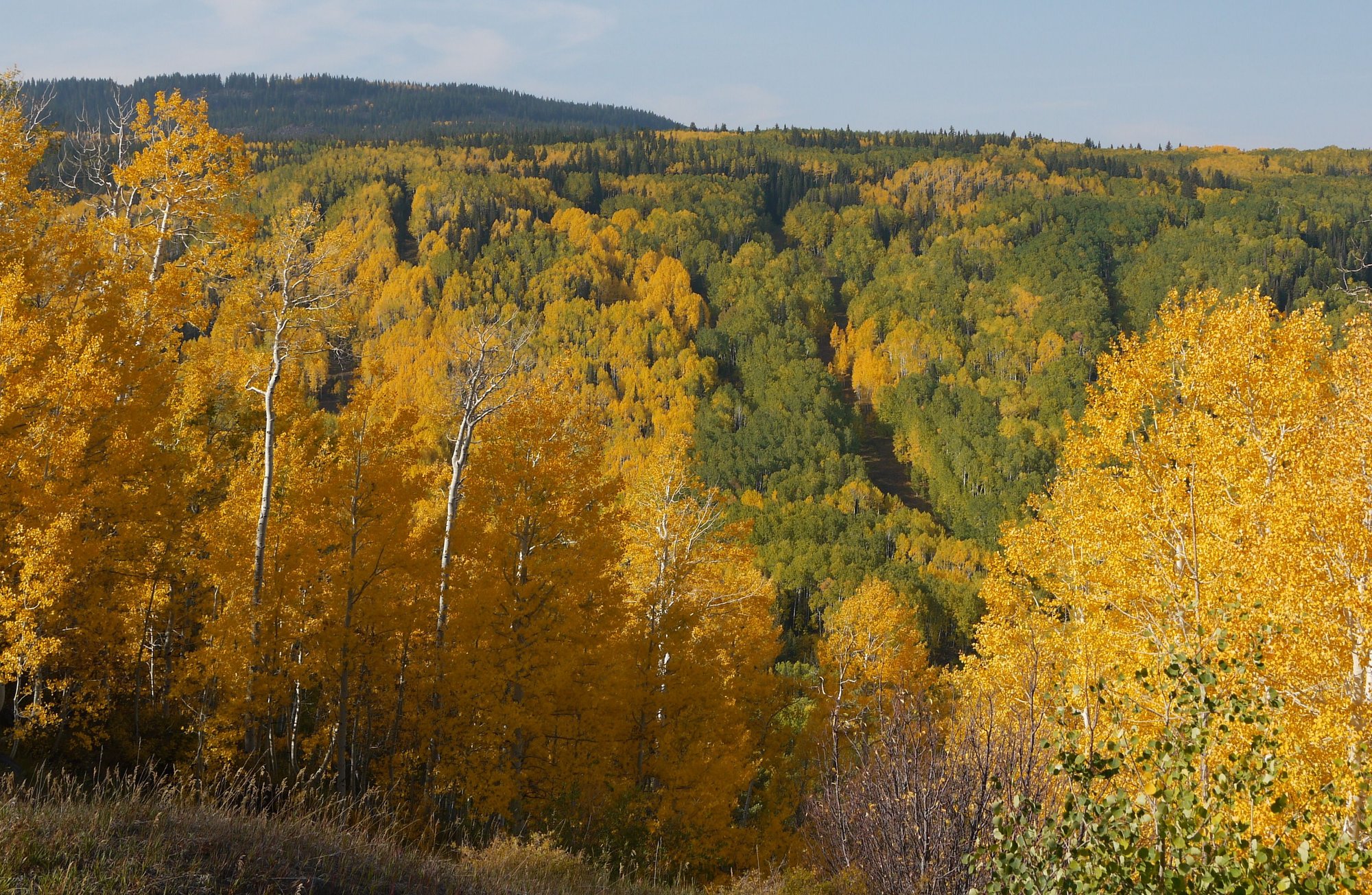
Grand Mesa National Forest
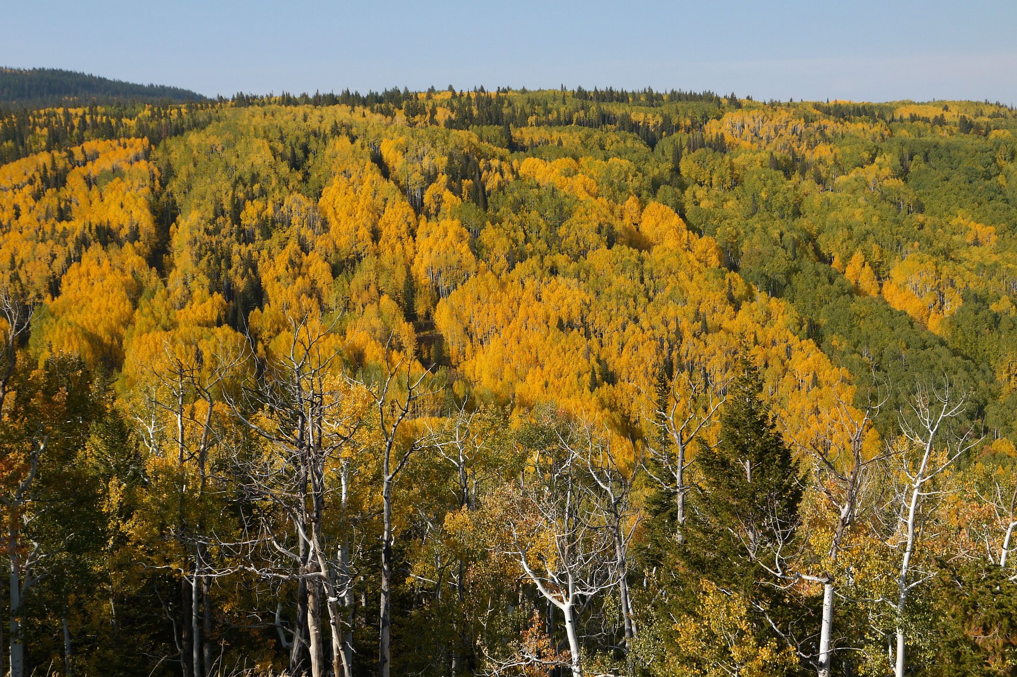
Grand Mesa National Forest
Grand Mesa National Forest
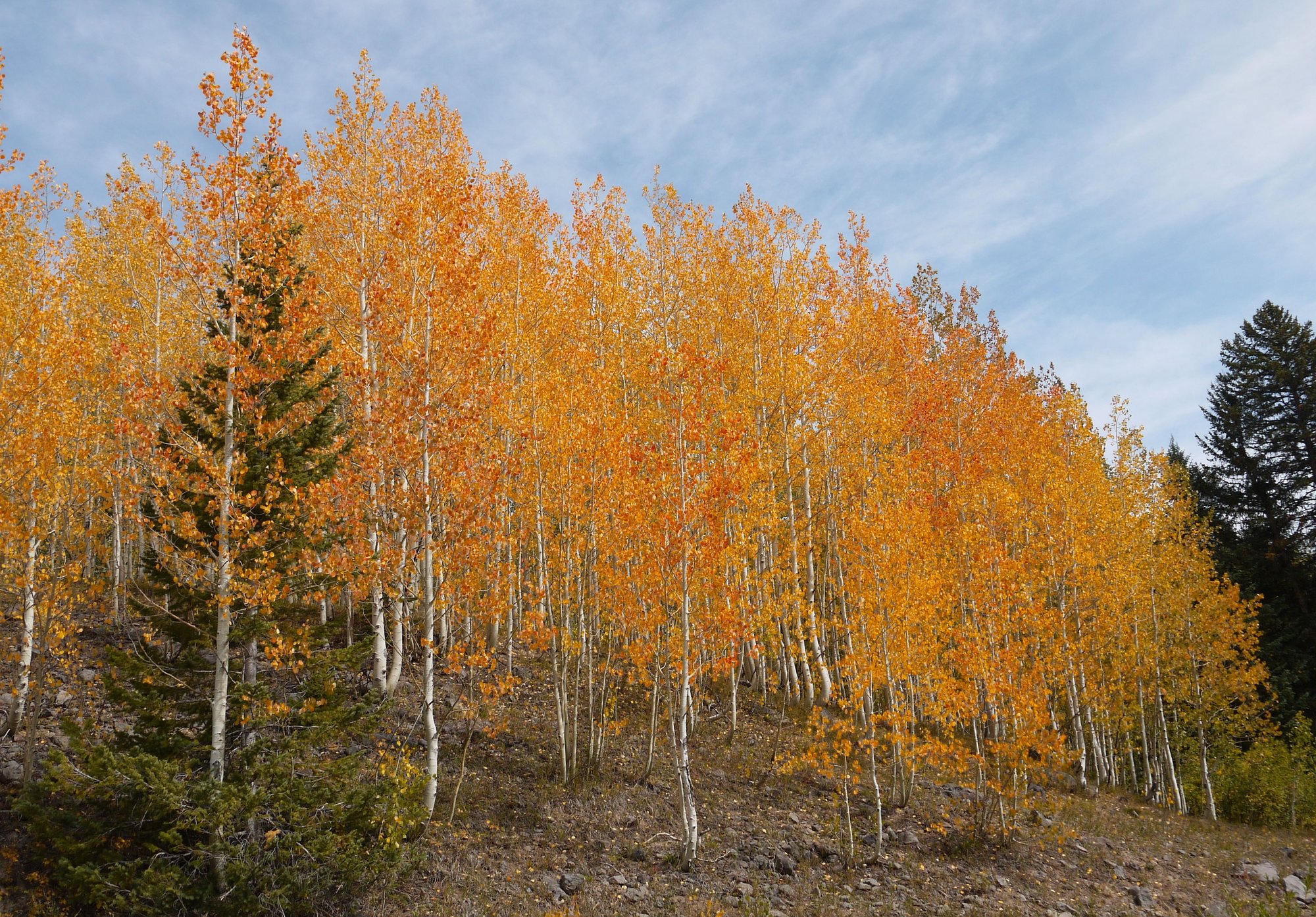
Grand Mesa National Forest
It’s Saturday, and busy with leaf peepers. We decide to walk the Mesa Top Trail, but bail after a few minutes – it’s dusty, flat and not that interesting. So we backtrack to the Griffith Lake Trail, which isn’t much of a trail at all, and entirely too steep for me. There are some 400 miles of hiking trails up here, but we’ve not done sufficient research so we’re a bit clueless.
It’s a lovely 56 F; we explore the Land of Lakes Trail, which is just a paved walkway to an overlook. As we get ready to leave, we see an unmarked trail to the right of the parking lot, so we investigate and follow it to a different overlook and back, almost getting lost on the return as there are absolutely no markers (2.5 miles and pleasant enough).
Unmarked trail
Unmarked trail
We continue our driving loop to Cedaredge, passing orchards and road side stands selling apple cider; we also pass a few cellar doors. I’d love to stop for some cider, but something’s up with the car; several warning lights have illuminated. We pull over and consult the car’s manual; it’s a mystery. I Google and see that Grand Junction has a Subaru dealership and it’s open until 6 pm. We decide to hightail it there.
The drive back is barren and desolate; Bill describes Grand Mesa as ‘a chunk of pretty surrounded by a bunch of ugly’.
Two hours at the Subaru dealership later we’re headed to another of our favorite wineries, Two Rivers, where we settle in at a table on the shady lawn for a late afternoon tasting. Lovely spot this. We purchase four bottles of wine, including two of their rose-styled offering Tulip, no one more surprised than us, as we’re generally not Rose fans.
Two Rivers
Then it’s back to Enstrom Candies before they close for an encore ice cream fix. Oink, oink.
Hoping to find Grand Junction’s version of Cinco de Mayo, we head to a highly rated hole-in-the-wall I’ve scoped out in advance; Birrieria Y Taqueria El Asadero. It’s after six on a Saturday night, we’re the only customers, and there’s not a mask in sight amongst the staff. Hmmmm. We almost change our minds, but are enthusiastically welcomed, so we order at the counter and settle in at a table. The food is not quite what we expect, but it does the trick. They close the restaurant when we leave; it’s only 7 pm.
It’s been a 12 hour day, we’re done.
To be continued...
Our motel room is small, but clean, comfortable and very well maintained. The only drawback…it’s on a busy street and therefore noisy.
We begin our day at Randy’s Southside Diner, which is just across the parking lot from our motel. Signage tells patrons to wear masks, yet we see several people enter without them.
The food is pretty ordinary. Service is friendly but glacially slow.
We’d planned to spend our one full day in Grand Junction hiking at Colorado National Monument, but with a temperature forecast of 89 F and an elevation of only 4,700-7,000 feet, we change our minds and head up to Grand Mesa National Forest, which at 10,750 feet will be much cooler. We’ve not been before, and have found a promising drive loop online.
The morning is hazy; we head out on I-70 east, then turn on Highway 65 towards Collbran. We’re now on the Grand Mesa Scenic and Historic Byway. This should be good.
I’ve since learned that Grand Mesa is the largest flat-topped mountain in the world with an area of about 500 square miles.
As we drive up towards the mesa through the canyon we see big horn sheep and copious blooming sunflowers. Our partially filled plastic water bottles begin to crackle and pop as the elevation rises; the mesa is 6,000 feet above the surrounding river valleys.
This is definitely a pretty drive and an unexpected surprise. Local honey is being sold alongside the road, we pass the Powder Horn Ski Area and enter the Grand Mesa National Forest, awash in autumn yellow and red. WOW. We definitely timed this right. The forest up here looks really healthy, a nice change from the dead trees we see too often here in Colorado.
Grand Mesa National Forest
Grand Mesa National Forest
Grand Mesa National Forest
Grand Mesa National Forest
It’s Saturday, and busy with leaf peepers. We decide to walk the Mesa Top Trail, but bail after a few minutes – it’s dusty, flat and not that interesting. So we backtrack to the Griffith Lake Trail, which isn’t much of a trail at all, and entirely too steep for me. There are some 400 miles of hiking trails up here, but we’ve not done sufficient research so we’re a bit clueless.
It’s a lovely 56 F; we explore the Land of Lakes Trail, which is just a paved walkway to an overlook. As we get ready to leave, we see an unmarked trail to the right of the parking lot, so we investigate and follow it to a different overlook and back, almost getting lost on the return as there are absolutely no markers (2.5 miles and pleasant enough).
Unmarked trail
Unmarked trail
We continue our driving loop to Cedaredge, passing orchards and road side stands selling apple cider; we also pass a few cellar doors. I’d love to stop for some cider, but something’s up with the car; several warning lights have illuminated. We pull over and consult the car’s manual; it’s a mystery. I Google and see that Grand Junction has a Subaru dealership and it’s open until 6 pm. We decide to hightail it there.
The drive back is barren and desolate; Bill describes Grand Mesa as ‘a chunk of pretty surrounded by a bunch of ugly’.
Two hours at the Subaru dealership later we’re headed to another of our favorite wineries, Two Rivers, where we settle in at a table on the shady lawn for a late afternoon tasting. Lovely spot this. We purchase four bottles of wine, including two of their rose-styled offering Tulip, no one more surprised than us, as we’re generally not Rose fans.
Two Rivers
Then it’s back to Enstrom Candies before they close for an encore ice cream fix. Oink, oink.
Hoping to find Grand Junction’s version of Cinco de Mayo, we head to a highly rated hole-in-the-wall I’ve scoped out in advance; Birrieria Y Taqueria El Asadero. It’s after six on a Saturday night, we’re the only customers, and there’s not a mask in sight amongst the staff. Hmmmm. We almost change our minds, but are enthusiastically welcomed, so we order at the counter and settle in at a table. The food is not quite what we expect, but it does the trick. They close the restaurant when we leave; it’s only 7 pm.
It’s been a 12 hour day, we’re done.
To be continued...
Oct 11th, 2020, 06:36 PM
#28
All those chocolates and you didn't buy any? I would have been tempted to say box them up, I'll take the lot
On your comment about non-mask-wearers, as my husband often says, 'the world is in no danger of running out of idiots any time soon'.
Glad you are out and enjoying your part of the world. We visited Durango, Ouray, Telluride, Grand Junction etc etc once, as part of a long driving holiday, and loved it.
Oct 12th, 2020, 05:53 AM
#29
Oddly enough Kay, I didn't buy any chocolate, other than the bag of toffee crumbles. That's so not me. I did snag a few toffee samples though
We're currently planning a January road trip to Utah, and may pass through Palisade and Grand Junction again, so I'll have to rectify that next time. And it'll be cooler, so I can load up without fear of melting.
We're currently planning a January road trip to Utah, and may pass through Palisade and Grand Junction again, so I'll have to rectify that next time. And it'll be cooler, so I can load up without fear of melting.
Oct 12th, 2020, 06:09 AM
#30
September 27 -
We decide to give Randy’s Southside Diner another chance. It’s not busy when we arrive; our order is taken quickly, but then…nothing. Forty-minutes later, just as I’m getting up to leave, our food finally appears; it’s okay, but not worth the wait. By the time we leave the restaurant is entirely too full and no one seems to be concerned about social distancing.
We’re back on the road just before 10 am. This is our third visit to Grand Junction; a place once described to me by a resident as ‘a resort town’ (enter guffaw here). While it has a few nice bits (golf course, a winery or two, Enstrom Candies, nearby Grand Mesa and is well situated for access to Moab), the town just doesn’t appeal to us.
Our route takes us east towards Delta on US 50, retracing our steps through the same section of ugly we drove yesterday. Soon we’re passing the corn stalks and pumpkin patches of Olathe, the source of the much coveted Olathe sweet corn that hits the farmers markets and grocery stores every August.
Then we pass through Montrose and work our way to Ridgway, the San Juan Mountains barely visible through the haze. The RV sites at the Ridgway Reservoir are busy, but the water level is disturbingly low, vehicles are parked where there is usually water.
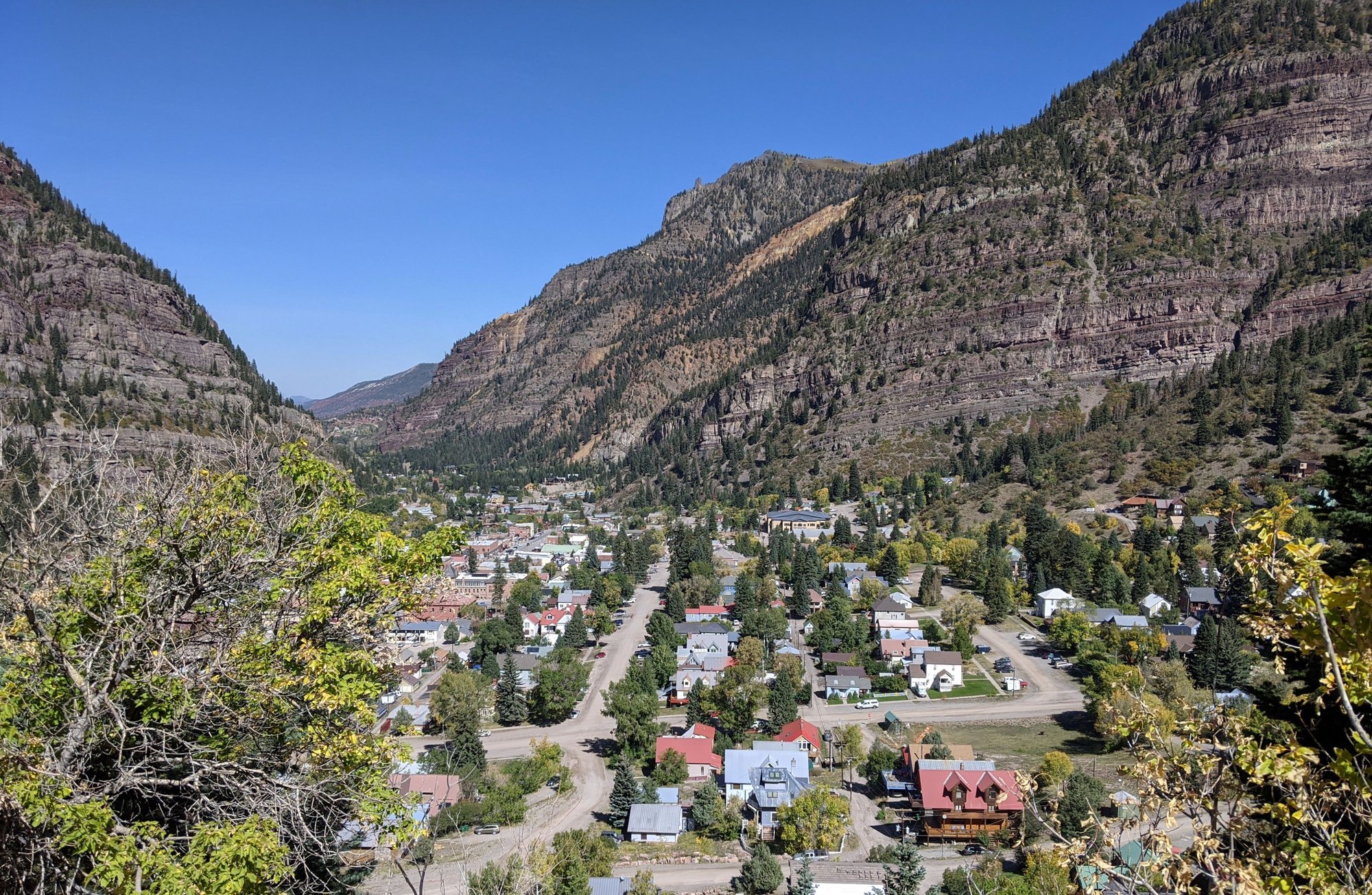
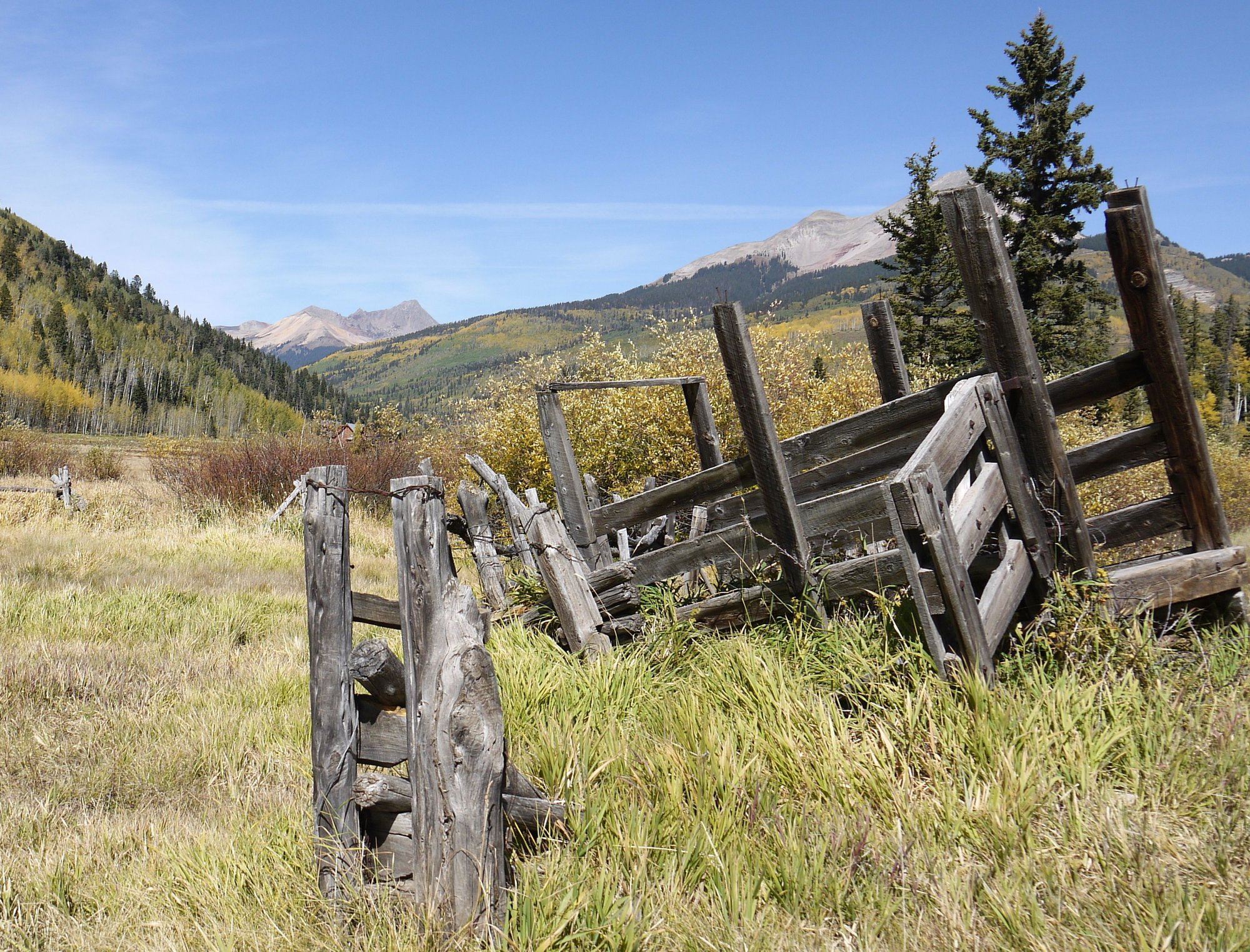
Next up is the small town of Ouray; one of our favorite spots in CO; it’s hopping; the RV Park is full; pedestrians are everywhere; we’ve never seen it so busy.
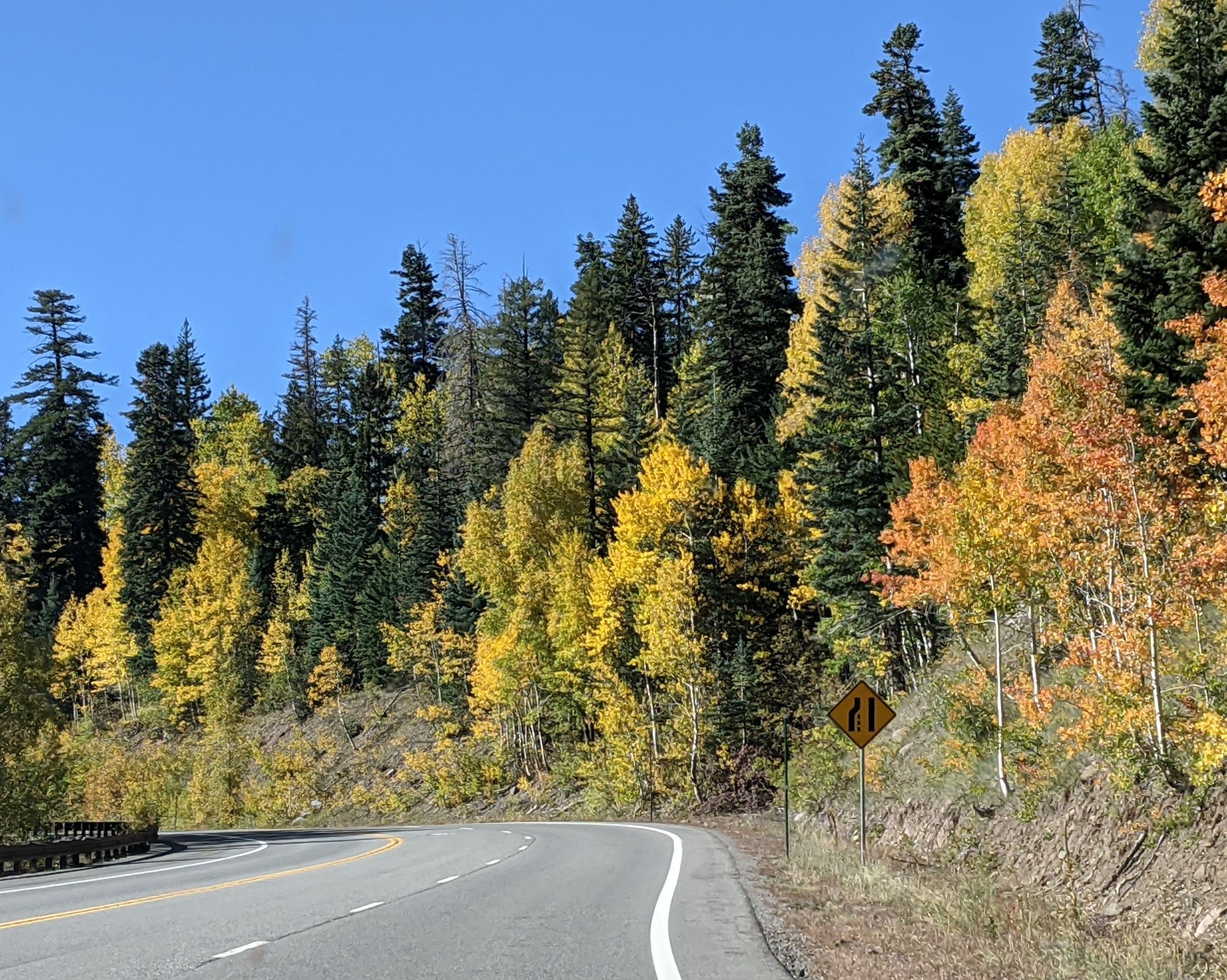
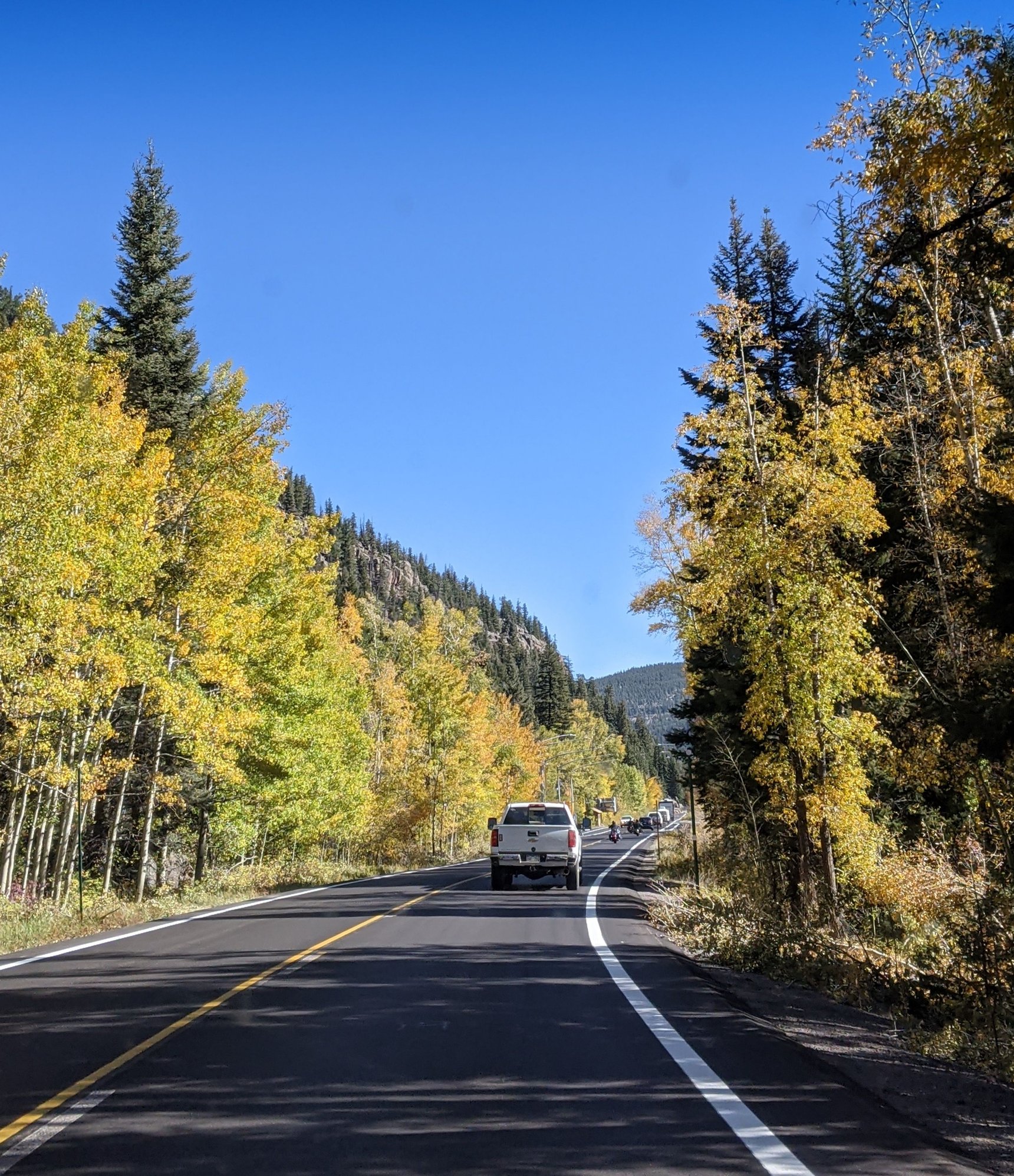
We begin the climb up Red Mountain Pass (11,018 feet); it’s Sunday, the day is beautiful, the leaf peepers are thick. It’s slow going, down to one lane in spots due to road work. As a passenger this pass always gives me the heebie-jeebies. I don’t care for the drop offs on my side of the car. It’s 56 F; the landscape is a sea of yellow leaves; we’ve timed this right. We see a vehicle advertising Cannabis Farm tours. Hmmmm.
Overlooking Ouray
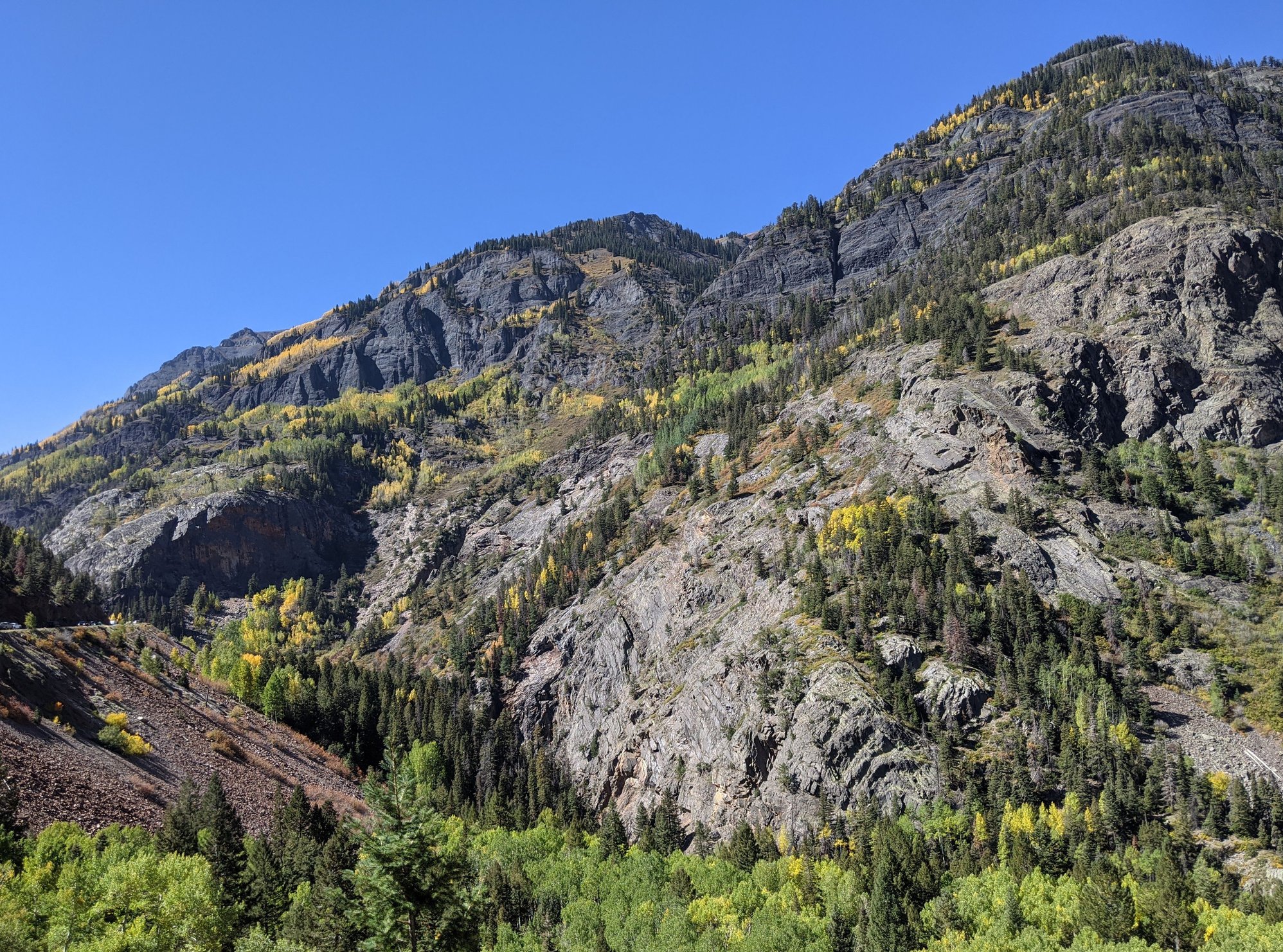
Red Mountain Pass
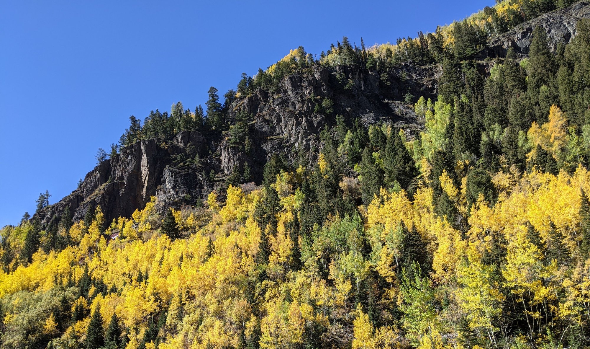
Red Mountain Pass
Red Mountain Pass
We make a pit stop in Silverton, people are everywhere. The Durango and Silverton Narrow Gauge Railroad resumed operations on June 23, the aspen leaves are at peak; everyone seems to be on the road today.
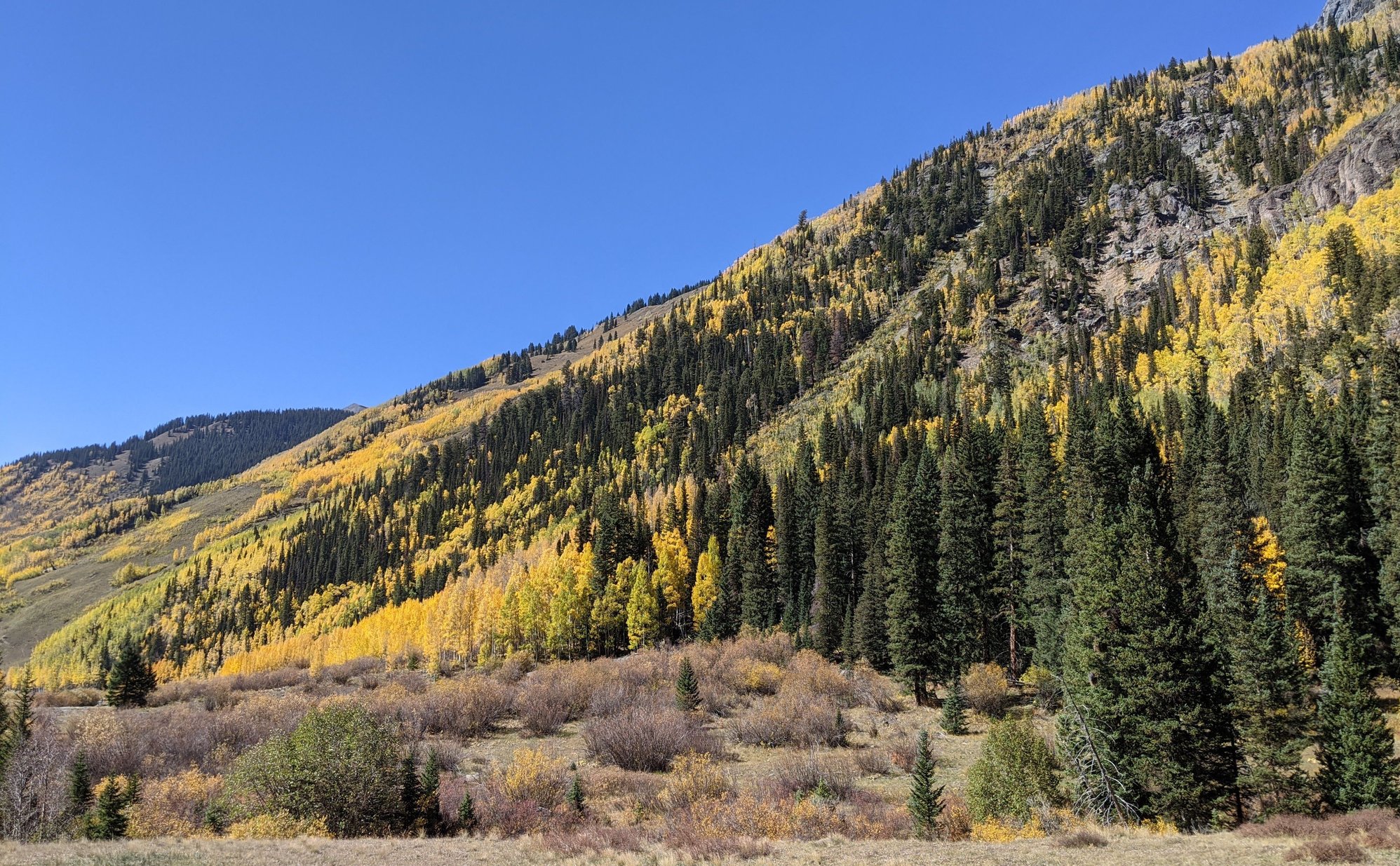
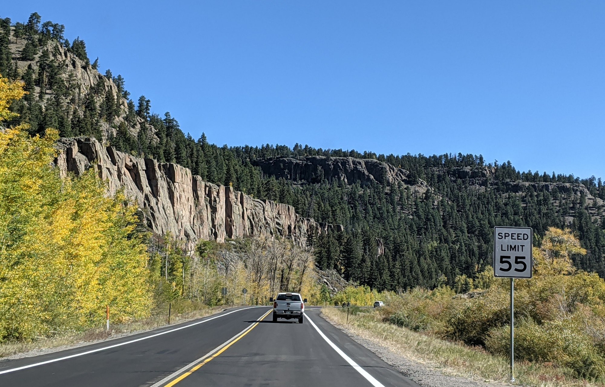
Our drive resumes, taking us over 10,970 foot high Molas Pass and then 10,640 foot high Coal Bank Pass. For the first time in a week, the haze is gone. Yippee!
Molas/Coal Bank Pass
Molas/Coal Bank Pass
Molas/Coal Bank Pass
I get a phone call from the proprietor of our accommodation explaining their contactless check in procedure and instructions on where to find the key to our room, etc.
Then a second pit stop, this time at Nugget Mountain Inn for a beverage break before we make the final descent into Durango (82 F).
After going through the Lysol wipe routine and getting settled in our accommodation, we head downtown for a late lunch. A section of Main Avenue has been blocked to traffic; outdoor tables from several restaurants line the streets.
Our destination is Switchback Tacos, chosen from the short list of eateries I’d loaded into my phone before we left home. We’re two of six customers inside. We both order three street tacos; they’re good, but insubstantial and expensive for what we get.
Self-catering our dinners worked so well in Steamboat that we decide to do it here as well; we pop into City Market for sushi and salad before returning to the hotel.
To be continued...
We decide to give Randy’s Southside Diner another chance. It’s not busy when we arrive; our order is taken quickly, but then…nothing. Forty-minutes later, just as I’m getting up to leave, our food finally appears; it’s okay, but not worth the wait. By the time we leave the restaurant is entirely too full and no one seems to be concerned about social distancing.
We’re back on the road just before 10 am. This is our third visit to Grand Junction; a place once described to me by a resident as ‘a resort town’ (enter guffaw here). While it has a few nice bits (golf course, a winery or two, Enstrom Candies, nearby Grand Mesa and is well situated for access to Moab), the town just doesn’t appeal to us.
Our route takes us east towards Delta on US 50, retracing our steps through the same section of ugly we drove yesterday. Soon we’re passing the corn stalks and pumpkin patches of Olathe, the source of the much coveted Olathe sweet corn that hits the farmers markets and grocery stores every August.
Then we pass through Montrose and work our way to Ridgway, the San Juan Mountains barely visible through the haze. The RV sites at the Ridgway Reservoir are busy, but the water level is disturbingly low, vehicles are parked where there is usually water.
Next up is the small town of Ouray; one of our favorite spots in CO; it’s hopping; the RV Park is full; pedestrians are everywhere; we’ve never seen it so busy.
We begin the climb up Red Mountain Pass (11,018 feet); it’s Sunday, the day is beautiful, the leaf peepers are thick. It’s slow going, down to one lane in spots due to road work. As a passenger this pass always gives me the heebie-jeebies. I don’t care for the drop offs on my side of the car. It’s 56 F; the landscape is a sea of yellow leaves; we’ve timed this right. We see a vehicle advertising Cannabis Farm tours. Hmmmm.
Overlooking Ouray
Red Mountain Pass
Red Mountain Pass
Red Mountain Pass
We make a pit stop in Silverton, people are everywhere. The Durango and Silverton Narrow Gauge Railroad resumed operations on June 23, the aspen leaves are at peak; everyone seems to be on the road today.
Our drive resumes, taking us over 10,970 foot high Molas Pass and then 10,640 foot high Coal Bank Pass. For the first time in a week, the haze is gone. Yippee!
Molas/Coal Bank Pass
Molas/Coal Bank Pass
Molas/Coal Bank Pass
I get a phone call from the proprietor of our accommodation explaining their contactless check in procedure and instructions on where to find the key to our room, etc.
Then a second pit stop, this time at Nugget Mountain Inn for a beverage break before we make the final descent into Durango (82 F).
After going through the Lysol wipe routine and getting settled in our accommodation, we head downtown for a late lunch. A section of Main Avenue has been blocked to traffic; outdoor tables from several restaurants line the streets.
Our destination is Switchback Tacos, chosen from the short list of eateries I’d loaded into my phone before we left home. We’re two of six customers inside. We both order three street tacos; they’re good, but insubstantial and expensive for what we get.
Self-catering our dinners worked so well in Steamboat that we decide to do it here as well; we pop into City Market for sushi and salad before returning to the hotel.
To be continued...
Oct 12th, 2020, 09:27 AM
#31
September 28 –
Our accommodation is spotless, spacious and comfortable. The television is huge, the Roku system a nice touch. They've discontinued daily room cleaning and breakfast and instead offer a 15% discount on coffee at the Durango Joe’s kiosk a few doors down. All in all a good choice, although not as quiet as we’d have liked and the overpowering floral scent of cleaning products is gag-inducing.
After a coffee run, we head downtown to Durango Bagel for a bite to eat. The shop is closed for indoor dining, so we queue up at the window, a bit chilly at 40 F; we eat in the car.
We’ve discussed the possibility of returning to Cascade Creek to hike the trail of the broken wrist, but I’m not mentally ready for that one yet.
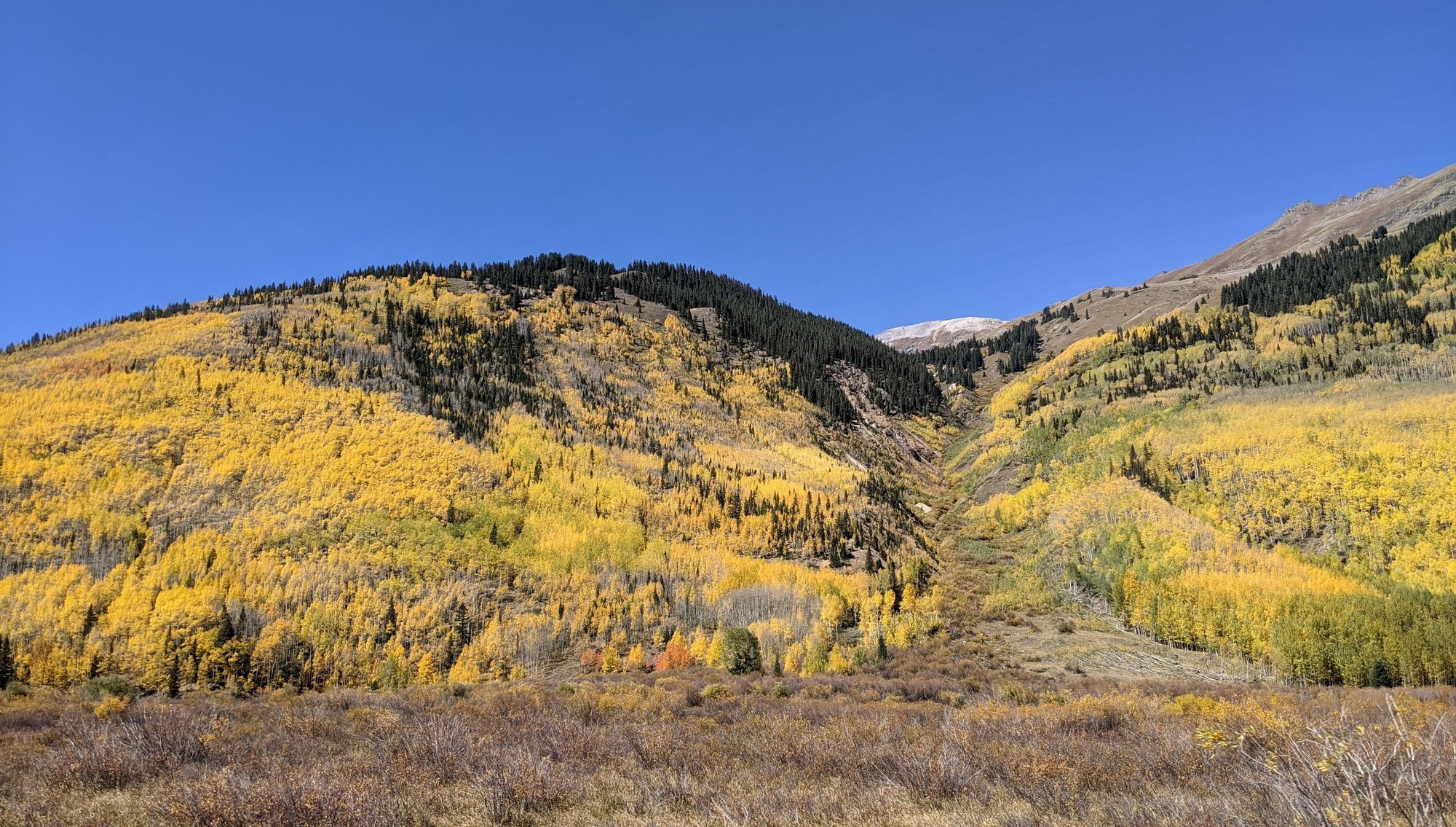
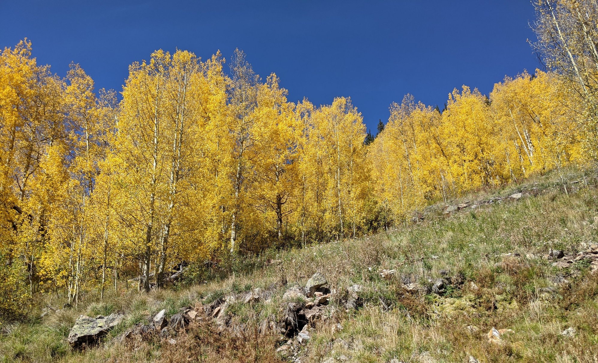
So we opt to hike to Spud Lake instead; we head north on Hwy 550 for about 25 miles, then turn onto Old Lime Creek Highway, which is anything but; it’s a seriously rough 4x4 road. Fearing damage we ditch the Outback and walk the last ˝ mile to the trailhead.
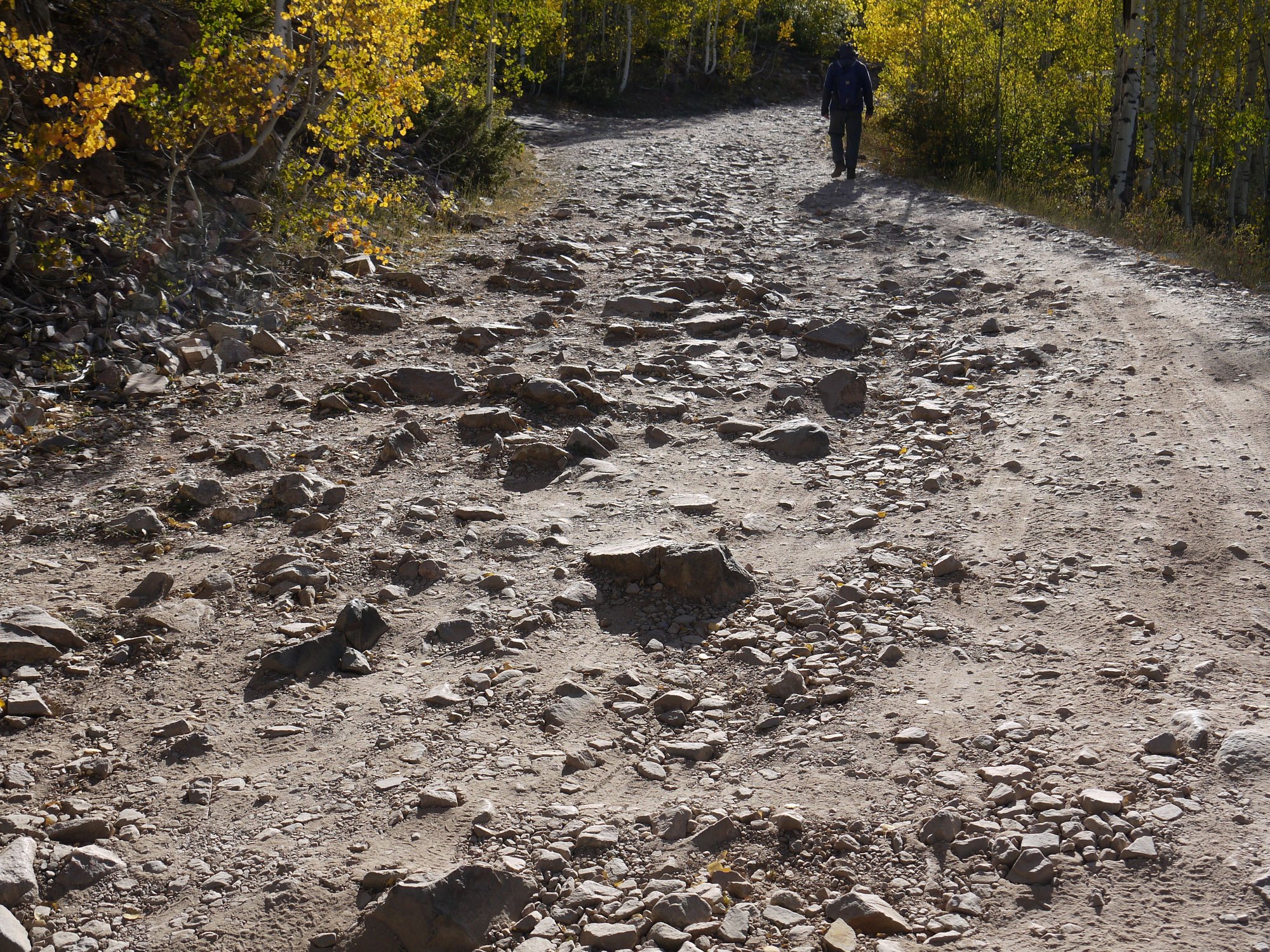
Old Lime Creek "Highway"
The trail is a rock minefield, but a beauty, the changing aspens gorgeous. We spend the next 2:45 hours and 4.5 miles hiking to and around the lake, which offers views of Potato Hill (Spud Mountain), the Hermosa Cliffs and the West Needle Mountains.
Spud Lake Trail
Spud Lake Trail
Spud Lake
Spud Lake Trail
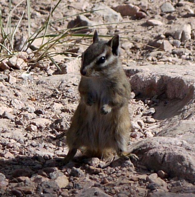
Hopeful critter, Spud Lake
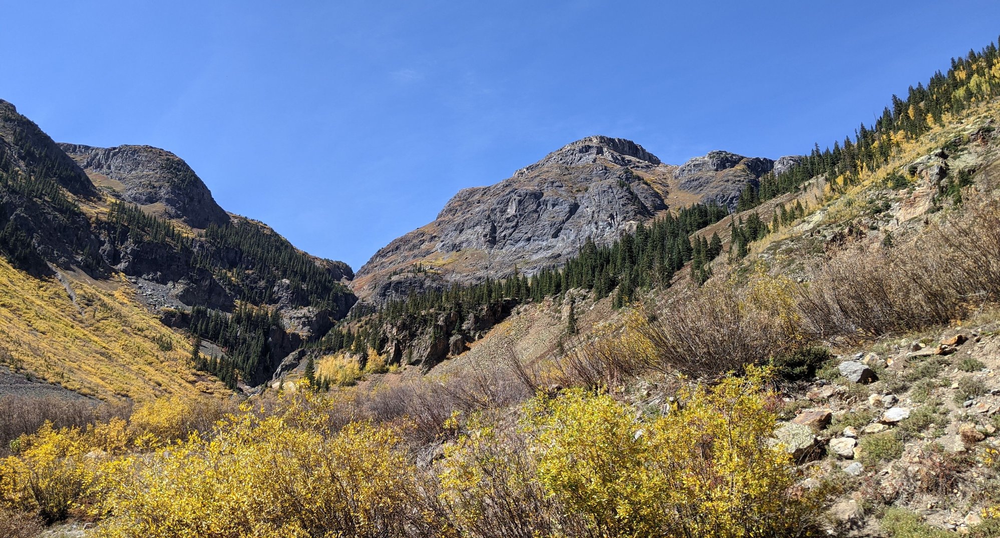
Afterwards we continue driving up Highway 550 to the summit of Coal Bank Pass for photos; it’s much quieter and cooler today than when we drove through yesterday.
Coal Bank Pass
Coal Bank Pass
Near Coal Bank Pass
Near Coal Bank Pass
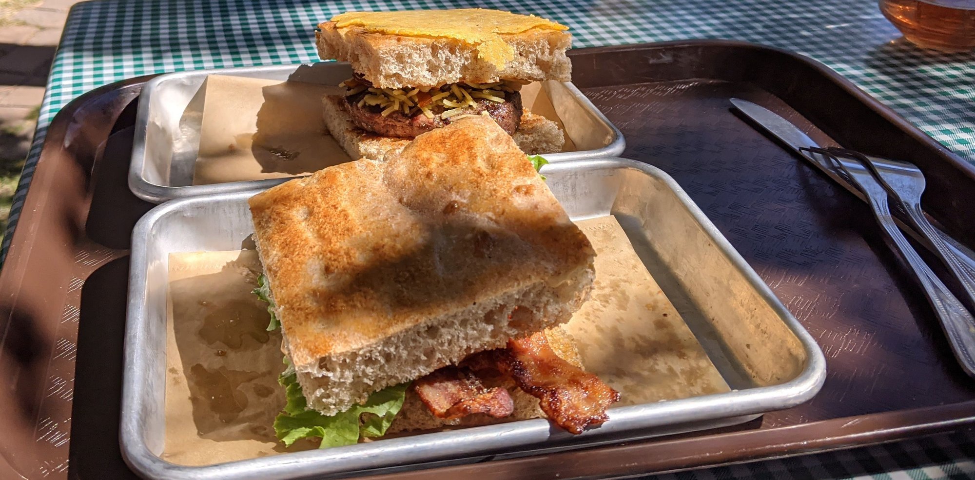
Then a nice alfresco lunch at another place I’ve scoped out, nearby James Ranch Grill; the closest we’ve come to replicating our oft missed leisurely lunches in Western Australia…yet not at all the same. A JR Patty Melt and a beer for Bill and an Inside Out Cheese Melt and a local cider for me. Yum.
Alfresco lunch, James Ranch Grill
To be continued…
Our accommodation is spotless, spacious and comfortable. The television is huge, the Roku system a nice touch. They've discontinued daily room cleaning and breakfast and instead offer a 15% discount on coffee at the Durango Joe’s kiosk a few doors down. All in all a good choice, although not as quiet as we’d have liked and the overpowering floral scent of cleaning products is gag-inducing.
After a coffee run, we head downtown to Durango Bagel for a bite to eat. The shop is closed for indoor dining, so we queue up at the window, a bit chilly at 40 F; we eat in the car.
We’ve discussed the possibility of returning to Cascade Creek to hike the trail of the broken wrist, but I’m not mentally ready for that one yet.
So we opt to hike to Spud Lake instead; we head north on Hwy 550 for about 25 miles, then turn onto Old Lime Creek Highway, which is anything but; it’s a seriously rough 4x4 road. Fearing damage we ditch the Outback and walk the last ˝ mile to the trailhead.
Old Lime Creek "Highway"
The trail is a rock minefield, but a beauty, the changing aspens gorgeous. We spend the next 2:45 hours and 4.5 miles hiking to and around the lake, which offers views of Potato Hill (Spud Mountain), the Hermosa Cliffs and the West Needle Mountains.
Spud Lake Trail
Spud Lake Trail
Spud Lake
Spud Lake Trail
Hopeful critter, Spud Lake
Afterwards we continue driving up Highway 550 to the summit of Coal Bank Pass for photos; it’s much quieter and cooler today than when we drove through yesterday.
Coal Bank Pass
Coal Bank Pass
Near Coal Bank Pass
Near Coal Bank Pass
Then a nice alfresco lunch at another place I’ve scoped out, nearby James Ranch Grill; the closest we’ve come to replicating our oft missed leisurely lunches in Western Australia…yet not at all the same. A JR Patty Melt and a beer for Bill and an Inside Out Cheese Melt and a local cider for me. Yum.
Alfresco lunch, James Ranch Grill
To be continued…
Oct 12th, 2020, 10:19 AM
#32
Join Date: Oct 2009
Posts: 555
Likes: 0
Received 0 Likes
on
0 Posts
Just lovely! You timed it so well for that color! I am supposed to go to Frisco tomorrow, but am still on the fence, I've got another couple hours to cancel at airbnb.  (Just worried about air quality.)
(Just worried about air quality.)
 Oct 12th, 2020, 10:49 AM
#33
Rocket - we were worried about air quality as well, but it really wasn't an issue. Sure, we could smell smoke in Steamboat Springs and there was haze until we got to the Western Slope, but that was a few weeks ago.
The weather has been unusually warm, and it's incredibly dry, but if it were me I'd go ahead and go.
Where are you coming from?
The weather has been unusually warm, and it's incredibly dry, but if it were me I'd go ahead and go.
Where are you coming from?
Oct 12th, 2020, 11:07 AM
#34
September 29 –
The morning brings a chilly 36 F. After coffee and breakfast sandwiches we head north on Highway 550 towards Purgatory and locate Lower Hermosa Creek Road, which leads us to the south end of the 18.6 mile Hermosa Creek Trail.
We walk six miles, three in and three back; it’s certainly not one of the nicer hikes we’ve taken, due in no small part to the extensive fire damage, a result of the 416 Fire of 2018 that was caused by hot cinders from the Silverton and Durango historic coal-fired train. The 416 Fire destroyed 54,000 acres and closed the San Juan National Forest for the first time in its 113 year history.
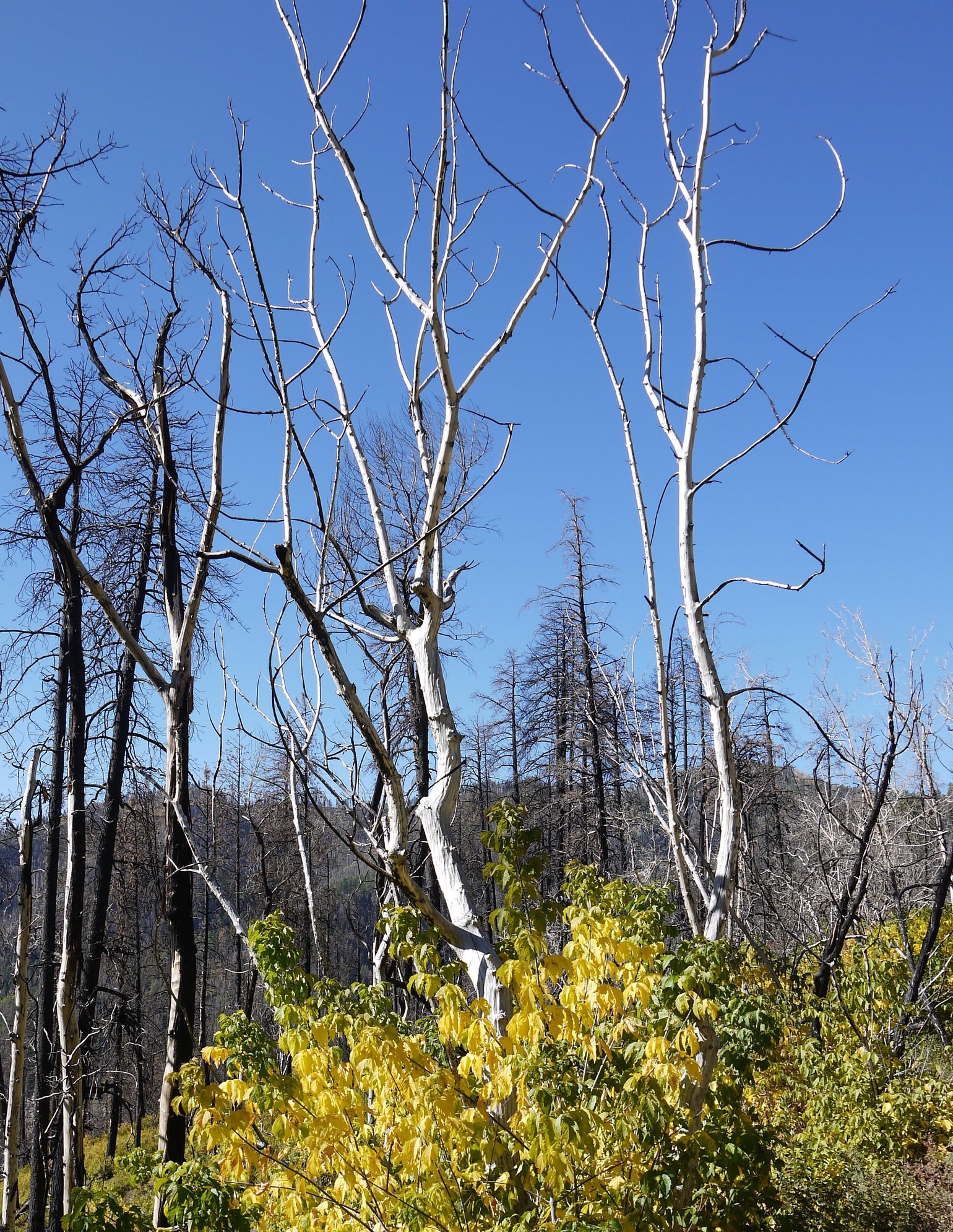
Hermosa Creek Trail
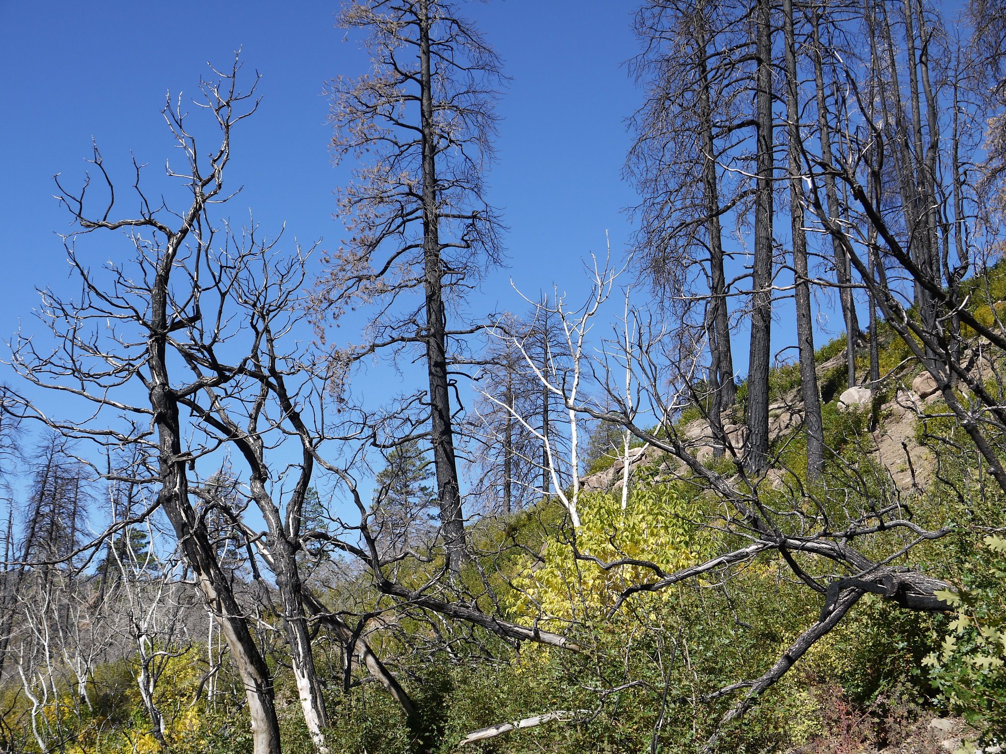
Hermosa Creek Trail
We learn from a passing hiker that the northern end is the prettier option (but of course) and he suggests that we check out La Plata Canyon.
Afterwards, we have an encore lunch at James Ranch Grill, another JR patty melt for Bill, a lovely BLT for me, cider for both. Good again.
Lunch at James Ranch Grill
And then just because we’d never been, a drive out to Lemon Reservoir and Vallecito Lake, finding both extremely low, and yet more evidence of fire damage, this from the Vallecito Fire of 2012 when some 1,000 acres in the San Juan National Forest burned.
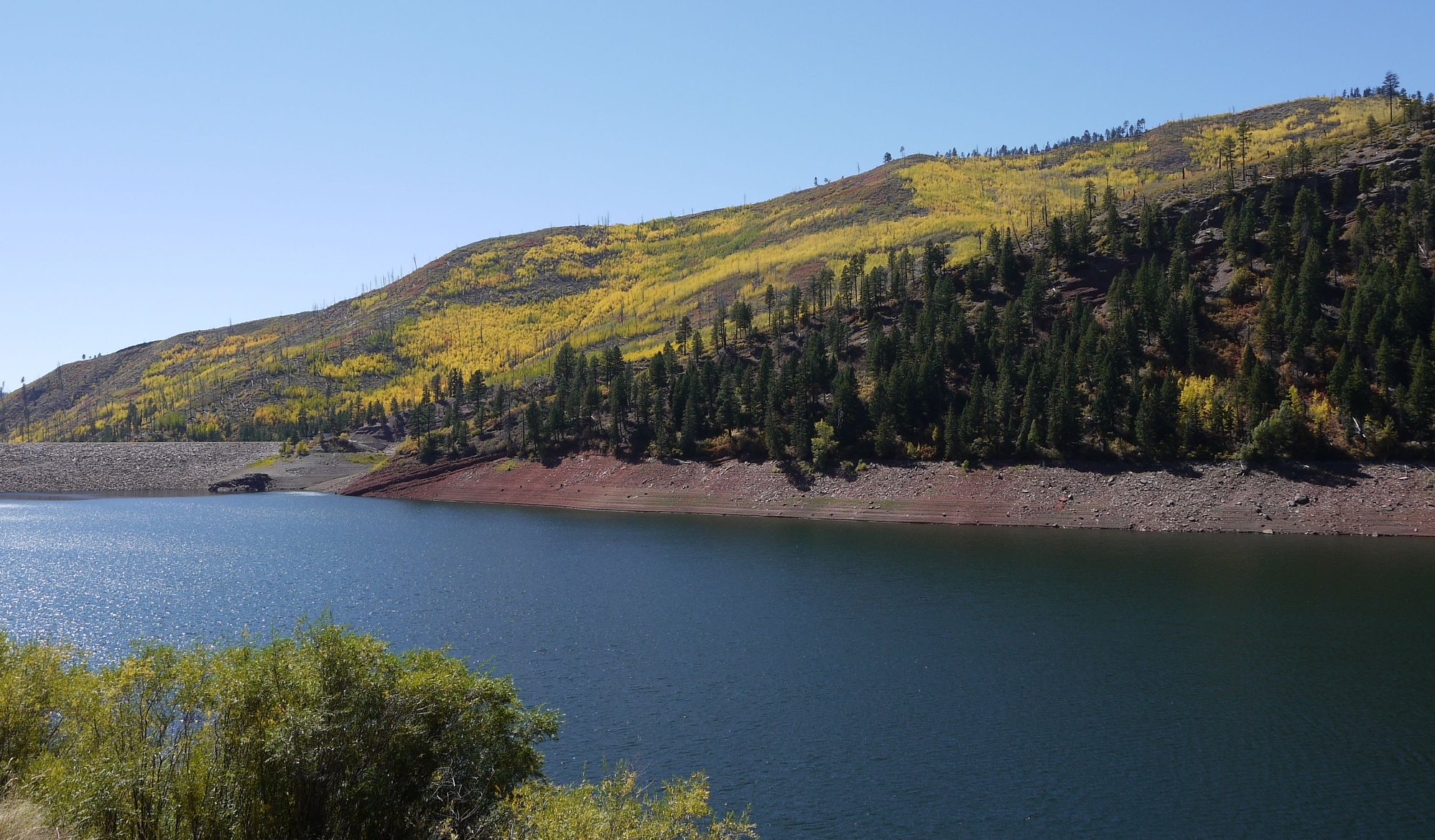
Lemon Reservoir
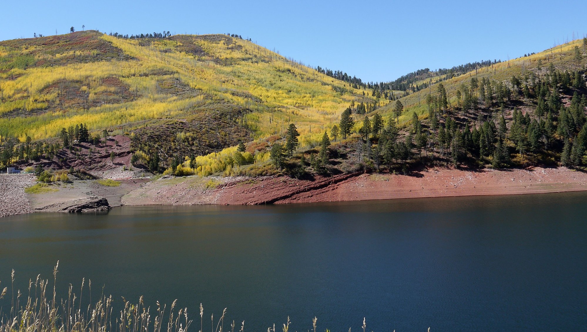
Lemon Reservoir
To be continued…
The morning brings a chilly 36 F. After coffee and breakfast sandwiches we head north on Highway 550 towards Purgatory and locate Lower Hermosa Creek Road, which leads us to the south end of the 18.6 mile Hermosa Creek Trail.
We walk six miles, three in and three back; it’s certainly not one of the nicer hikes we’ve taken, due in no small part to the extensive fire damage, a result of the 416 Fire of 2018 that was caused by hot cinders from the Silverton and Durango historic coal-fired train. The 416 Fire destroyed 54,000 acres and closed the San Juan National Forest for the first time in its 113 year history.
Hermosa Creek Trail
Hermosa Creek Trail
We learn from a passing hiker that the northern end is the prettier option (but of course) and he suggests that we check out La Plata Canyon.
Afterwards, we have an encore lunch at James Ranch Grill, another JR patty melt for Bill, a lovely BLT for me, cider for both. Good again.
Lunch at James Ranch Grill
And then just because we’d never been, a drive out to Lemon Reservoir and Vallecito Lake, finding both extremely low, and yet more evidence of fire damage, this from the Vallecito Fire of 2012 when some 1,000 acres in the San Juan National Forest burned.
Lemon Reservoir
Lemon Reservoir
To be continued…
Oct 12th, 2020, 11:19 AM
#35
September 30 –
It’s 44 F when we leave our hotel in search of breakfast. As we drive through town I spot Doughworks, and recognizing it from my short list, we turn around to investigate. I immediately regret not stopping here two days ago.
In addition to a full service restaurant in the back, this place offers a large variety of take out and tables at the front of the store. Bill has a burrito, I reluctantly forgo the tempting doughnuts and pastries and settle for a bagel. Both very good.
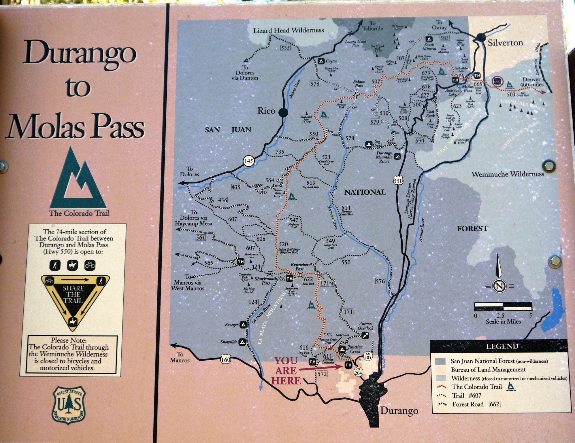
We next head to Junction Creek Road where we enter the San Juan National Forest and park at the Colorado Trail/Junction Creek trailhead. Here we find Colorado’s version of Western Australia’s Bibbulmun, the 485 mile Colorado Trail, which runs from Waterton Canyon in southwest Denver to Durango.
The car park is near empty when we arrive. We hike as far as the Junction Creek Bridge (five miles return, 2:45). This is a very pretty and highly trafficked trail that runs along the creek.
Colorado Trail
Colorado Trail
Colorado Trail
We encounter more and more people hiking in as we hike out; we put on our face masks every time we encounter a passing hiker, some of them do as well, but many do not.
It’s 74 F and the car park is full when we finish.
Afterwards we take 550 south and 160 west towards Hesperus and follow CR 124 into the La Plata Canyon until the road goes to crap and forces us to turn around. It's pretty through here; last night we read up on the area and discovered there are quite a few trails back here, but evidently they're well hidden.
We’d hoped to have lunch at Kennebec Café, which seems to be the only option in Hesperus, but they’re closed, so we return to Durango for a late fast food lunch instead. We then pick up dinner provisions and return to our room, where we settle in with G&Ts and put that huge TV and Roku to use; we’re soon totally immersed in The Handmaid’s Tale… yikes.
To be continued...
It’s 44 F when we leave our hotel in search of breakfast. As we drive through town I spot Doughworks, and recognizing it from my short list, we turn around to investigate. I immediately regret not stopping here two days ago.
In addition to a full service restaurant in the back, this place offers a large variety of take out and tables at the front of the store. Bill has a burrito, I reluctantly forgo the tempting doughnuts and pastries and settle for a bagel. Both very good.
We next head to Junction Creek Road where we enter the San Juan National Forest and park at the Colorado Trail/Junction Creek trailhead. Here we find Colorado’s version of Western Australia’s Bibbulmun, the 485 mile Colorado Trail, which runs from Waterton Canyon in southwest Denver to Durango.
The car park is near empty when we arrive. We hike as far as the Junction Creek Bridge (five miles return, 2:45). This is a very pretty and highly trafficked trail that runs along the creek.
Colorado Trail
Colorado Trail
Colorado Trail
We encounter more and more people hiking in as we hike out; we put on our face masks every time we encounter a passing hiker, some of them do as well, but many do not.
It’s 74 F and the car park is full when we finish.
Afterwards we take 550 south and 160 west towards Hesperus and follow CR 124 into the La Plata Canyon until the road goes to crap and forces us to turn around. It's pretty through here; last night we read up on the area and discovered there are quite a few trails back here, but evidently they're well hidden.
We’d hoped to have lunch at Kennebec Café, which seems to be the only option in Hesperus, but they’re closed, so we return to Durango for a late fast food lunch instead. We then pick up dinner provisions and return to our room, where we settle in with G&Ts and put that huge TV and Roku to use; we’re soon totally immersed in The Handmaid’s Tale… yikes.
To be continued...
Oct 12th, 2020, 12:08 PM
#36
October 1 –
It’s been a good trip, but we’re ready to go home. Did it scratch our itchy feet? Sort of, but it certainly wasn’t a substitute for the international trips we had planned. There are just too many people on the roads, too many people on the trails and well, just too many people. And COVID travel seems to mean paying more and getting much less.
We've had wonderful weather, but our state is a tinderbox in desperate need of rain.
Before leaving town we make one last stop at Doughworks; a burrito to eat on site for Bill, and a massive apple fritter for the road. I give in to temptation and buy two doughnuts, one for now one for later. We’ve barely left town and I’m wishing I’d bought a dozen to take home; those babies are good.
We take 550 south to 160 east, surprised at the number of cars on the road, most going in the opposite direction.
Soon we're driving through Bayfield and then Pagosa Springs, which is very busy, but not packed like it was when we passed through in June. It’s a very pretty drive and we’re reminded of why we like this corner of the state so much.
Driving towards Pagosa Springs
Driving towards Pagosa Springs
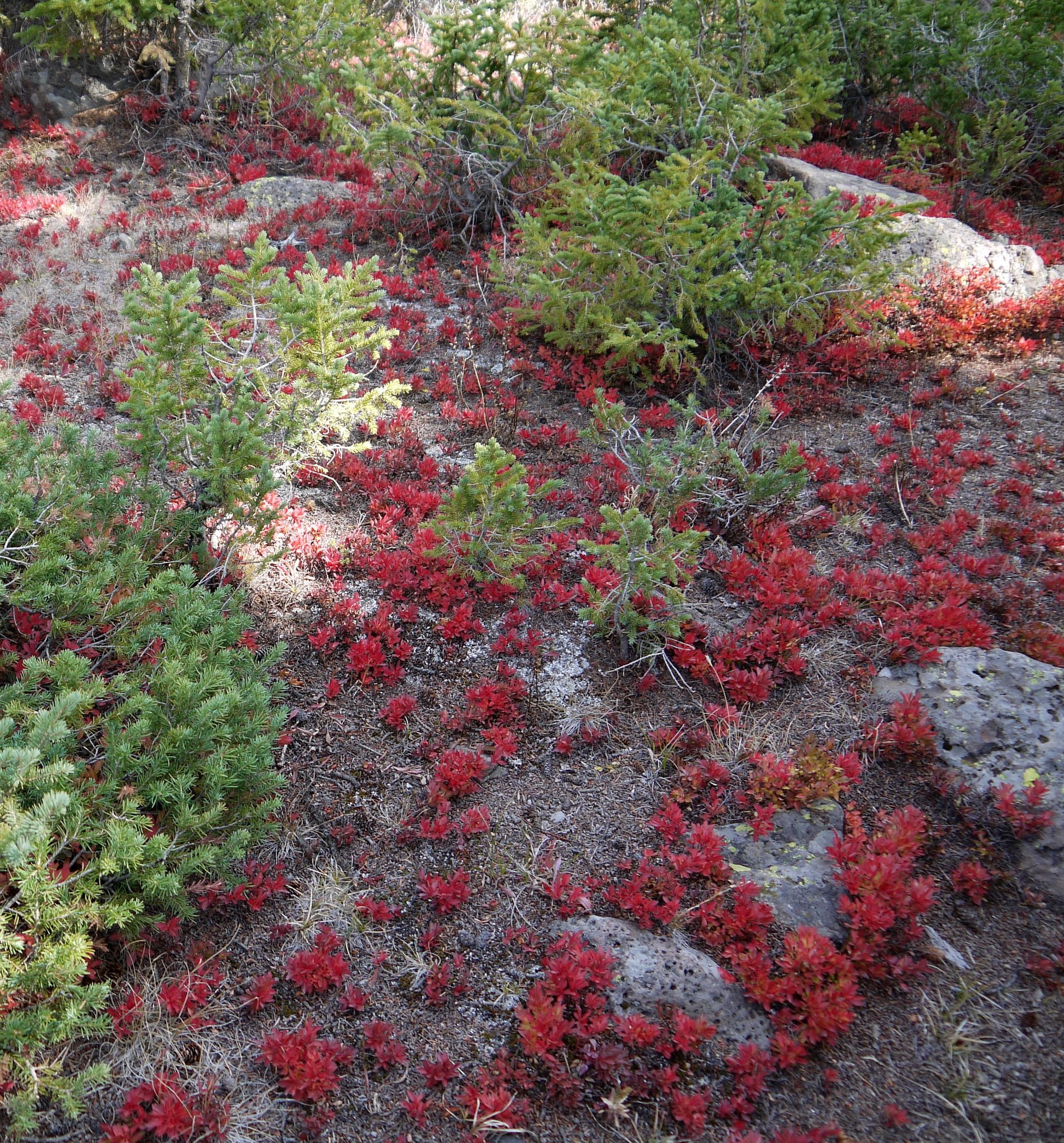
We inch over 10,856 foot high Wolf Creek Pass, aglow in yellow aspen, but there are way too many dead pine trees, victims of pine beetle, bark beetle and mistletoe, more evidence of global warming and drought.
Wolf Creek Pass
Wolf Creek Pass
Wolf Creek Pass
Soon, we’ve crossed the Continental Divide and we’re easing our way down into South Fork and Del Norte.
The haze is back as we pick up CO 112 towards Center, the Sangre de Cristo range barely visible.
We motor through the San Luis Valley bread basket, our surroundings painfully dry, then through the thriving metropolis of Villa Grove with its population of 325. The landscape gets pretty again as we approach and cross Poncha Pass (9,010 feet) and then drive alongside the snowless Collegiate Peaks.
We join Highway 24 east, and some 5:15 hours after leaving Durango and 1,335 miles since we left 11 days ago, we’re home.
----------------------------------------------------------
It’s been a good trip, but we’re ready to go home. Did it scratch our itchy feet? Sort of, but it certainly wasn’t a substitute for the international trips we had planned. There are just too many people on the roads, too many people on the trails and well, just too many people. And COVID travel seems to mean paying more and getting much less.
We've had wonderful weather, but our state is a tinderbox in desperate need of rain.
Before leaving town we make one last stop at Doughworks; a burrito to eat on site for Bill, and a massive apple fritter for the road. I give in to temptation and buy two doughnuts, one for now one for later. We’ve barely left town and I’m wishing I’d bought a dozen to take home; those babies are good.
We take 550 south to 160 east, surprised at the number of cars on the road, most going in the opposite direction.
Soon we're driving through Bayfield and then Pagosa Springs, which is very busy, but not packed like it was when we passed through in June. It’s a very pretty drive and we’re reminded of why we like this corner of the state so much.
Driving towards Pagosa Springs
Driving towards Pagosa Springs
We inch over 10,856 foot high Wolf Creek Pass, aglow in yellow aspen, but there are way too many dead pine trees, victims of pine beetle, bark beetle and mistletoe, more evidence of global warming and drought.
Wolf Creek Pass
Wolf Creek Pass
Wolf Creek Pass
Soon, we’ve crossed the Continental Divide and we’re easing our way down into South Fork and Del Norte.
The haze is back as we pick up CO 112 towards Center, the Sangre de Cristo range barely visible.
We motor through the San Luis Valley bread basket, our surroundings painfully dry, then through the thriving metropolis of Villa Grove with its population of 325. The landscape gets pretty again as we approach and cross Poncha Pass (9,010 feet) and then drive alongside the snowless Collegiate Peaks.
We join Highway 24 east, and some 5:15 hours after leaving Durango and 1,335 miles since we left 11 days ago, we’re home.
----------------------------------------------------------
Oct 13th, 2020, 03:12 AM
#37
Join Date: Jan 2020
Posts: 1,330
Likes: 0
Received 0 Likes
on
0 Posts
Thanks for the rest of the report. I loved 160 going east at the end of one of our trips, much nicer than taking 70.
I hope the wrist is a faint memory now. I still am leery of black ice in my driveway, so totally understand your reluctance to postpone the trip to the scene of the break.
I hope the wrist is a faint memory now. I still am leery of black ice in my driveway, so totally understand your reluctance to postpone the trip to the scene of the break.
Oct 13th, 2020, 06:16 AM
#39
Thanks for the report Mel. A bittersweet ending, along with good times, and some memorably beautiful photos. You do like your Mexican food!
This year has been different on all our trails. My friend and I have sought out relatively unknown places throughout the summer, but now many of them are burned by the Cameron Peak fire.
Regarding your non-return to the Wrist Trail, I had a traumatic backcountry experience decades ago, and still have never returned to the site, though I came close to going last year.
Anyway, great report, thanks for sharing.

