


Into the Great Wide Open: Winter Edition
 Jan 25th, 2020 | 06:19 AM
#1
Original Poster


Joined: Jan 2003
Posts: 21,148
Likes: 83
Into the Great Wide Open: Winter Edition
Last April we embarked on our first Into the Great Wide Open, the objective of which was to take a trip that didn’t involve getting on a plane yet offered something new for a couple of jaded Coloradans.
The plan was to avoid as many other tourists as possible by hitting the most popular spots on our itinerary between Mon-Thurs, and to go early enough in the season to avoid the heat in toasty Utah, while also incorporating some natural hot springs, moderate hikes and good food.
https://www.fodors.com/community/uni...-trip-1666843/
After that trip we wondered what a similar road trip might be like in the dead of winter.
We decided to find out.
And so, the Winter Edition:
A quest for winter hiking, natural hot springs, good food, nice scenery, and as few other tourists as possible.
The itinerary: Home-Ouray-Moab-Pagosa Springs-Ojo Caliente-Nathrop/Buena Vista-Home. Eight nights, three states, 1,395 miles and…no broken windshield!
January 15 -
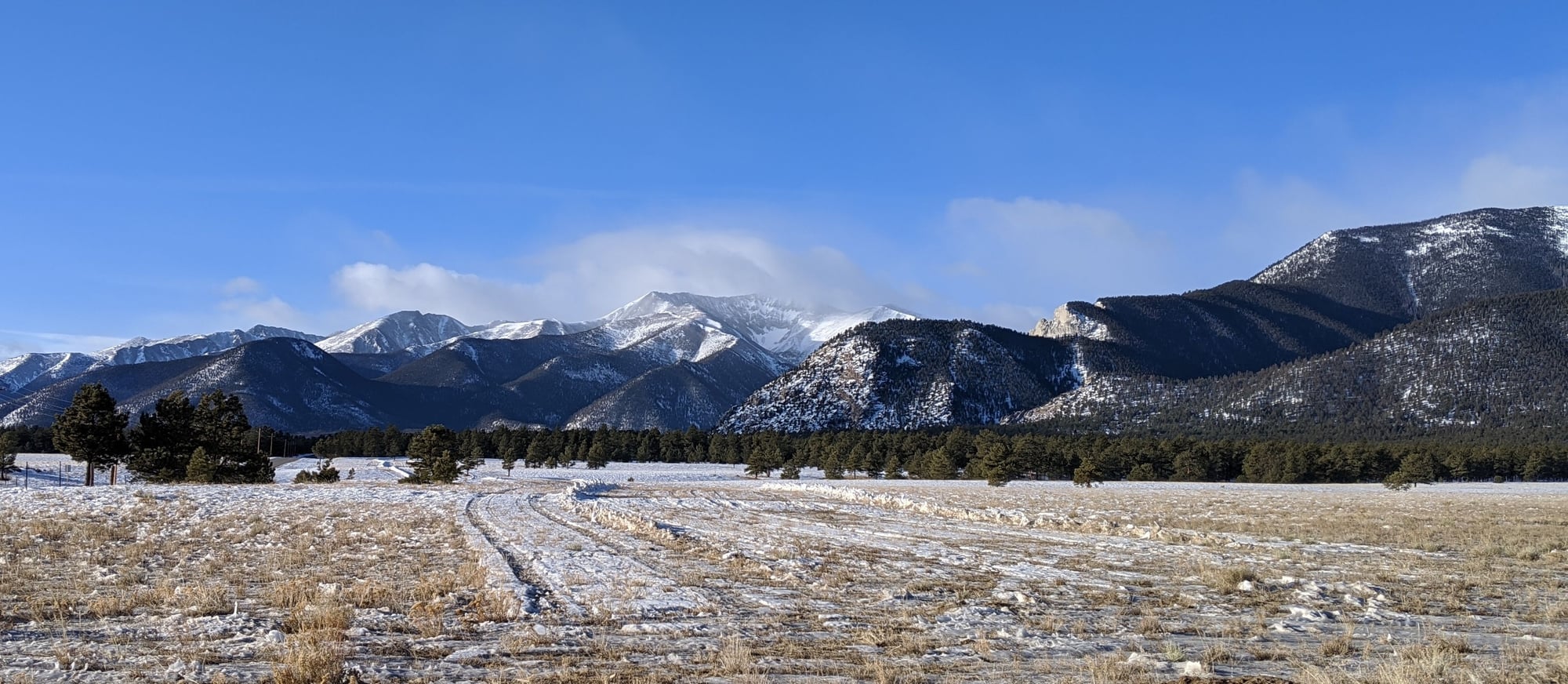
We left our home in Colorado and drove west on Highway 24 towards Buena Vista, 31 F, clear roads and not a cloud in the sky. The views of the Sawatch Range and Collegiate Peaks from Wilkerson Pass clear enough for a decent photograph.
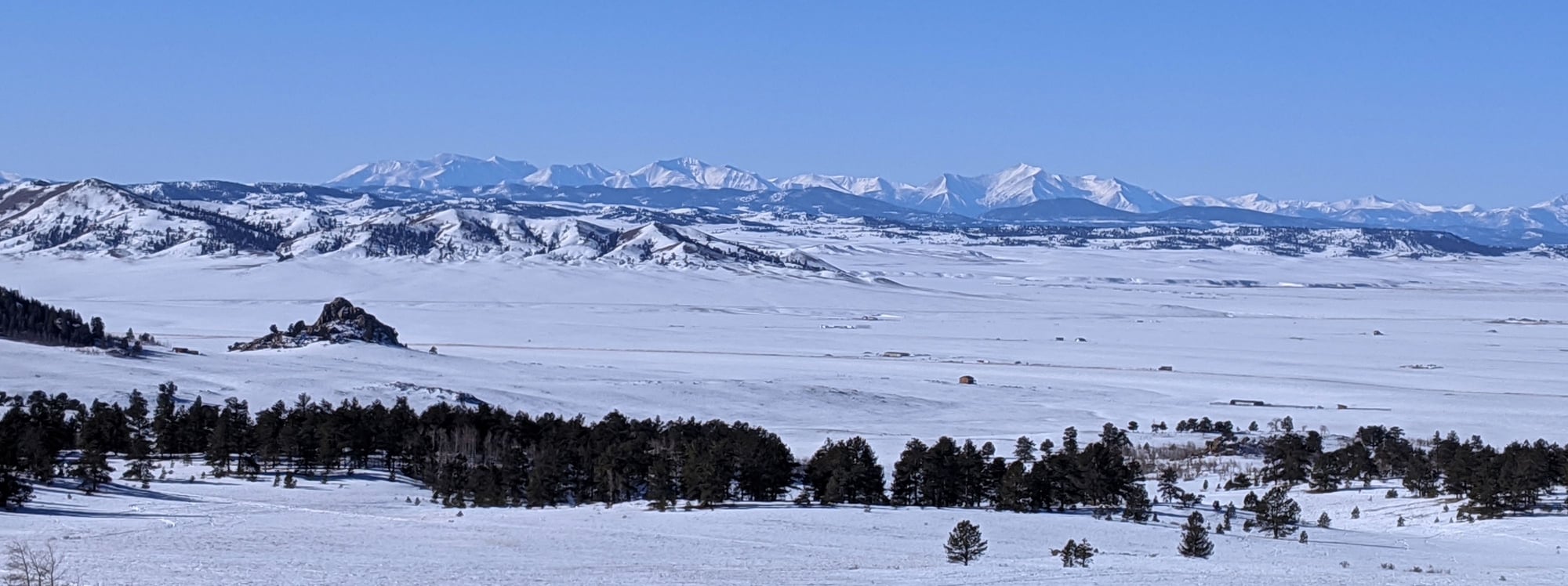
We drove through South Park, our eyes peeled for bison and antelope, but not seeing any (we saw hundreds of antelope when we last drove through in early December). And a nice change – no wind blowing snow across the road.
The temperature dipped to 19 F in the cold spot near Hartsel – I can’t drive through here without thinking about the Planned Parenthood killer – may he burn in hell.
We turned on to 285, then eventually joined Hwy 50 and worked our way over Monarch Pass – the road clear despite a nine inch snowfall a few days earlier. The temperature a balmy 34 F…until we reached the other side… where it dipped to 15 F and then 10 F near Dawson Creek, Bill commenting that the 30 miles between the west side of Monarch and Gunnison always seems to take forever.
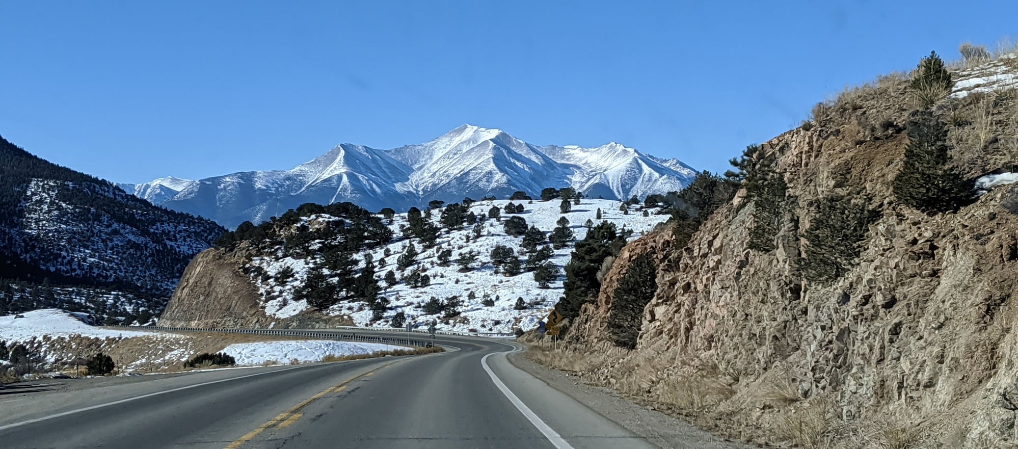
Shot through a dirty windshield
Between Buena Vista and Salida
Upon arrival in Gunnison - 17 F – we stopped for lunch at the Gunnisack. Bill tucked into – and thoroughly enjoyed - a bacon Angus cheeseburger disguised as a salad. I went for the jalapeno beer cheese soup. Very good. Cute place, not sure how we’ve missed it in the past.
Then it was back on Highway 50, skirting the partly ice covered Blue Mesa Reservoir and eventually joining 550 to Montrose.

Blue Mesa Reservoir, near Gunnison
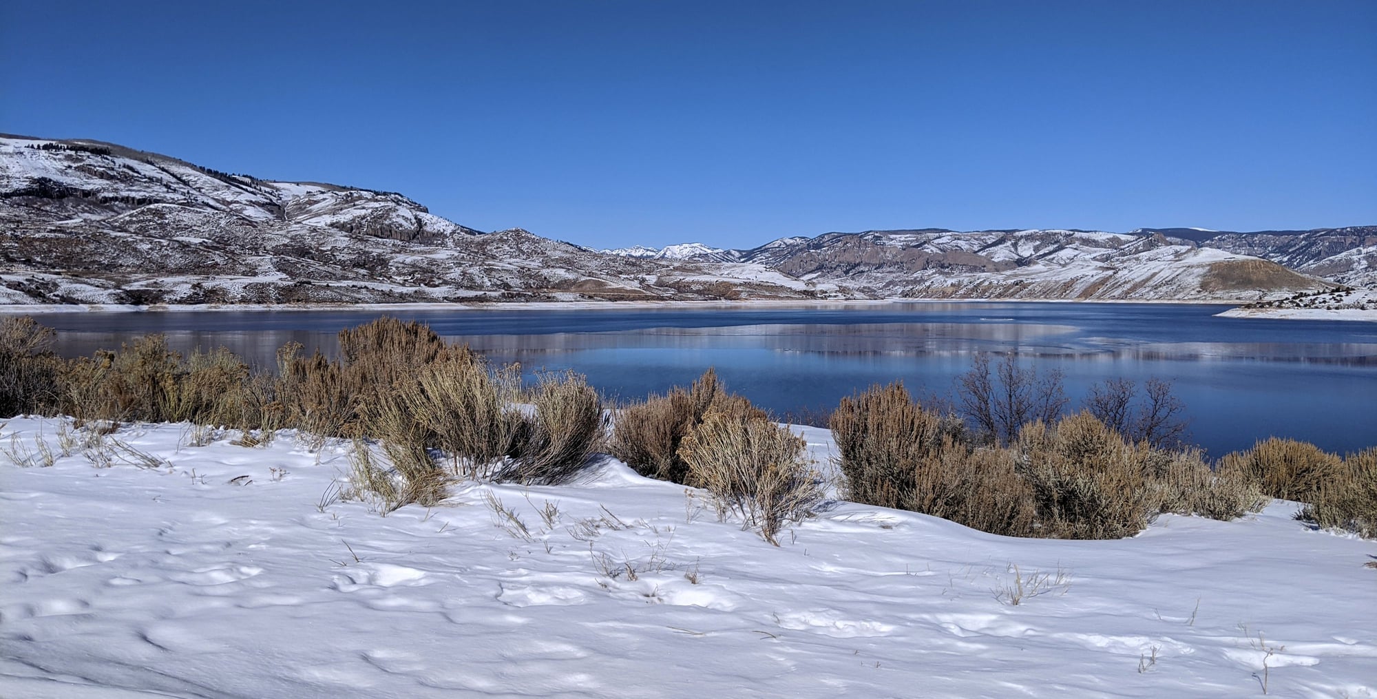
Blue Mesa Reservoir, near Gunnison
Approach to Ouray
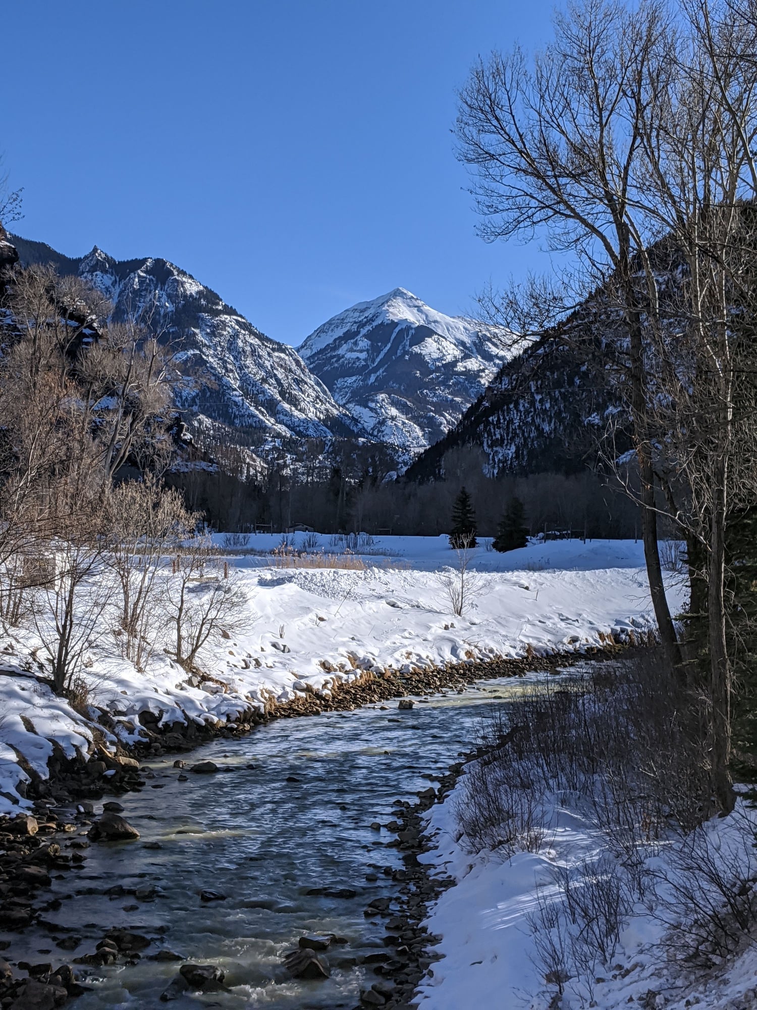
Just over six hours after leaving home, we checked into our favorite Ouray accommodation, The Box Canyon Lodge, which has made a few improvements since our last visit – new fluffy towels and cozy warm robes – no more freezing treks to the hot tubs – an excellent addition.
We wasted no time donning our swimming togs, then had a nice soak while the sun went down. A doe lounged above us, enjoying the heat from the springs and watching us watch her.
Later we walked next door to the Mineshaft restaurant in the Twin Peaks Hotel – their dining area only open in summer (al fresco) – we ordered a pizza to go. The walk was hazardous due to all the ice, but worth the effort – an excellent pepperoni pizza scarfed in our hotel room – good and saucy.
To be continued…
The plan was to avoid as many other tourists as possible by hitting the most popular spots on our itinerary between Mon-Thurs, and to go early enough in the season to avoid the heat in toasty Utah, while also incorporating some natural hot springs, moderate hikes and good food.
https://www.fodors.com/community/uni...-trip-1666843/
After that trip we wondered what a similar road trip might be like in the dead of winter.
We decided to find out.
And so, the Winter Edition:
A quest for winter hiking, natural hot springs, good food, nice scenery, and as few other tourists as possible.
The itinerary: Home-Ouray-Moab-Pagosa Springs-Ojo Caliente-Nathrop/Buena Vista-Home. Eight nights, three states, 1,395 miles and…no broken windshield!
January 15 -
We left our home in Colorado and drove west on Highway 24 towards Buena Vista, 31 F, clear roads and not a cloud in the sky. The views of the Sawatch Range and Collegiate Peaks from Wilkerson Pass clear enough for a decent photograph.
We drove through South Park, our eyes peeled for bison and antelope, but not seeing any (we saw hundreds of antelope when we last drove through in early December). And a nice change – no wind blowing snow across the road.
The temperature dipped to 19 F in the cold spot near Hartsel – I can’t drive through here without thinking about the Planned Parenthood killer – may he burn in hell.
We turned on to 285, then eventually joined Hwy 50 and worked our way over Monarch Pass – the road clear despite a nine inch snowfall a few days earlier. The temperature a balmy 34 F…until we reached the other side… where it dipped to 15 F and then 10 F near Dawson Creek, Bill commenting that the 30 miles between the west side of Monarch and Gunnison always seems to take forever.
Shot through a dirty windshield
Between Buena Vista and Salida
Upon arrival in Gunnison - 17 F – we stopped for lunch at the Gunnisack. Bill tucked into – and thoroughly enjoyed - a bacon Angus cheeseburger disguised as a salad. I went for the jalapeno beer cheese soup. Very good. Cute place, not sure how we’ve missed it in the past.
Then it was back on Highway 50, skirting the partly ice covered Blue Mesa Reservoir and eventually joining 550 to Montrose.
Blue Mesa Reservoir, near Gunnison
Blue Mesa Reservoir, near Gunnison
Approach to Ouray
Just over six hours after leaving home, we checked into our favorite Ouray accommodation, The Box Canyon Lodge, which has made a few improvements since our last visit – new fluffy towels and cozy warm robes – no more freezing treks to the hot tubs – an excellent addition.
We wasted no time donning our swimming togs, then had a nice soak while the sun went down. A doe lounged above us, enjoying the heat from the springs and watching us watch her.
Later we walked next door to the Mineshaft restaurant in the Twin Peaks Hotel – their dining area only open in summer (al fresco) – we ordered a pizza to go. The walk was hazardous due to all the ice, but worth the effort – an excellent pepperoni pizza scarfed in our hotel room – good and saucy.
To be continued…

 Jan 25th, 2020 | 10:49 AM
#4
Original Poster
Joined: Jan 2003
Posts: 21,148
Likes: 83
January 16 –
We were up and out the door before sunrise, backtracking the nine miles to Ridgway for breakfast at our favorite establishment there, Kate’s Kitchen - the first and only customers. Lemon ricotta blueberry pancakes for me (note for next time, request half an order) chorizo burrito with green chile for Bill, excellent both.
We’ve yet to find a good breakfast option in Ouray, unfortunately.
Our Ouray digs before sunrise
Then we sought out Cimarron Bookstore and Coffee Shop for proper coffee (I can’t abide drip) – nice latte, cute little place, friendly service.
Then it was back to Ouray for one last soak in the hot springs before check-out - the day cloudy, a storm was moving in.
We were back on the road just before 11 am, taking 550 to Ridgway again, then turning left towards Telluride on CO 62 – lots of snowplows out pre-treating the roads, not a snowflake in sight.
Just past Telluride we joined CO 145 and drove through San Miguel Canyon via the Scenic Byway.
We eventually made the descent into the hole of Naturita (“little nature”), a junky little town even uglier than usual with naked trees and winter grey. Evidently old vehicles come here to die; antler collecting looks like it might be the town hobby.
A few miles past Naturita we turned onto Hwy 90 and eventually motored through Bedrock, another sad town with a post office the size of a shed and Bedrock Store, where Wikipedia tells me scenes from Thelma and Louise were filmed. Who knew?
Soon we were dodging free roaming cows, some sauntering down the middle of the highway. Then more squiggles, through a pretty canyon; surprised when a flock of wild turkeys frantically crossed the road in front of us.
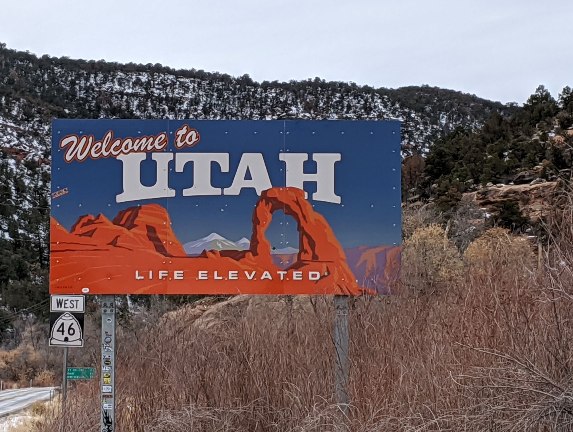
Before long we were on Hwy 46 and crossing the border into Utah, the roads winding, the asphalt covered in a white film (treated for snow?) the pungent smell of La Sal’s stockyard following us for miles.
We eventually joined US 191 - and then a miracle – a rest stop with toilet facilities, which seem to have gone the way of the dinosaur in our home state.
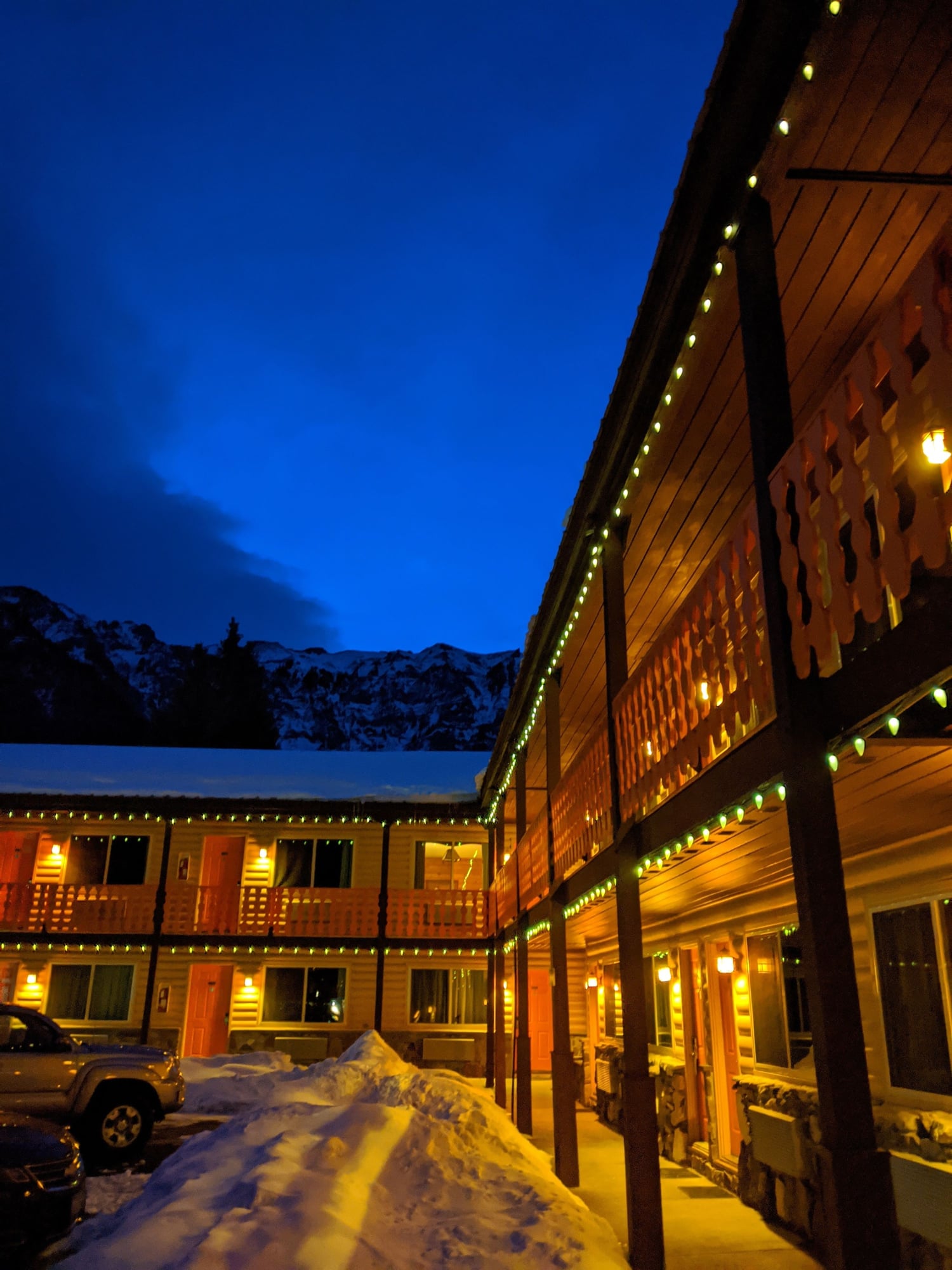
We arrived in Moab – 39 F, a tinge of red dirt on most everything - some three hours after leaving Ouray. We had a quick lunch and then drove to our hotel (Hyatt Place), marveling at how wonderfully empty the streets were – very unlike our pre-season, but still entirely too busy visit last April. I love it already.
We were greeted by TJ, who thoroughly explained every possible feature of the hotel, offered future help, told us to ask if we needed absolutely anything – a nice welcome, he must have been bored to tears.
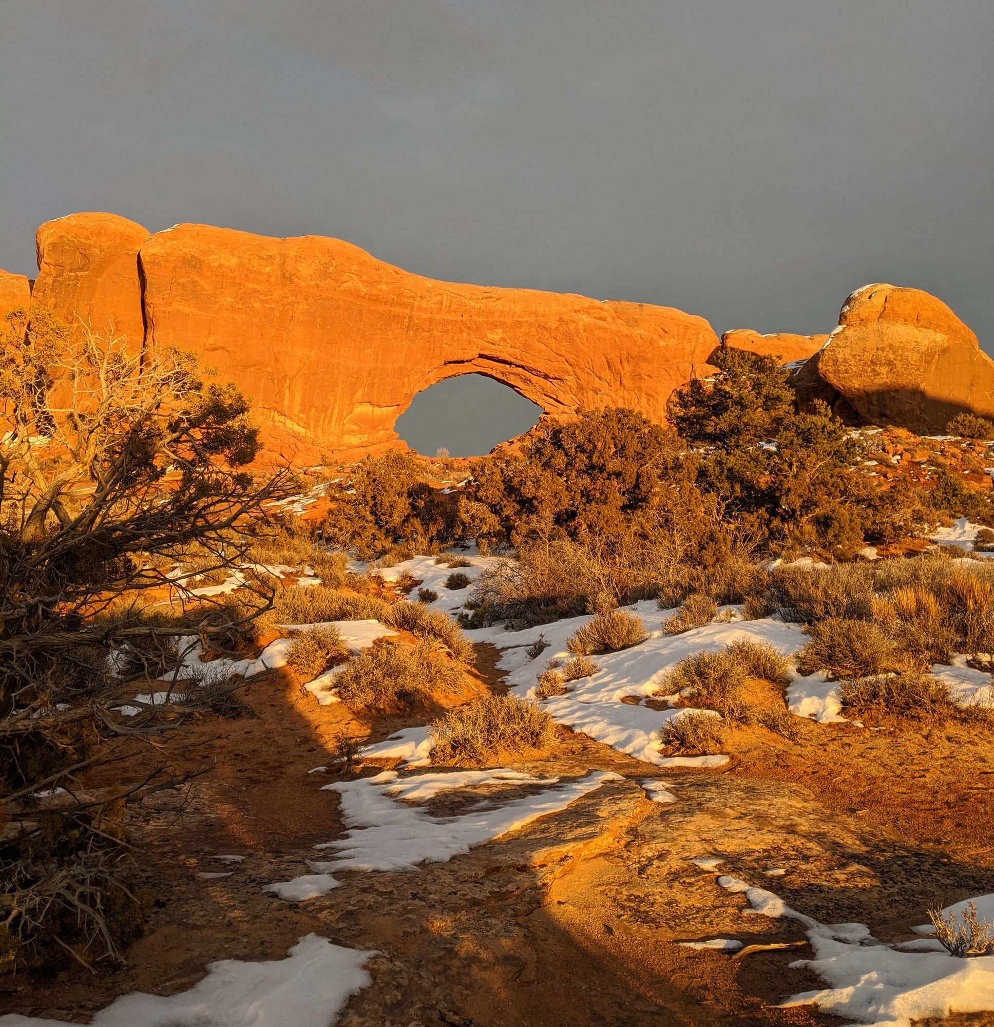
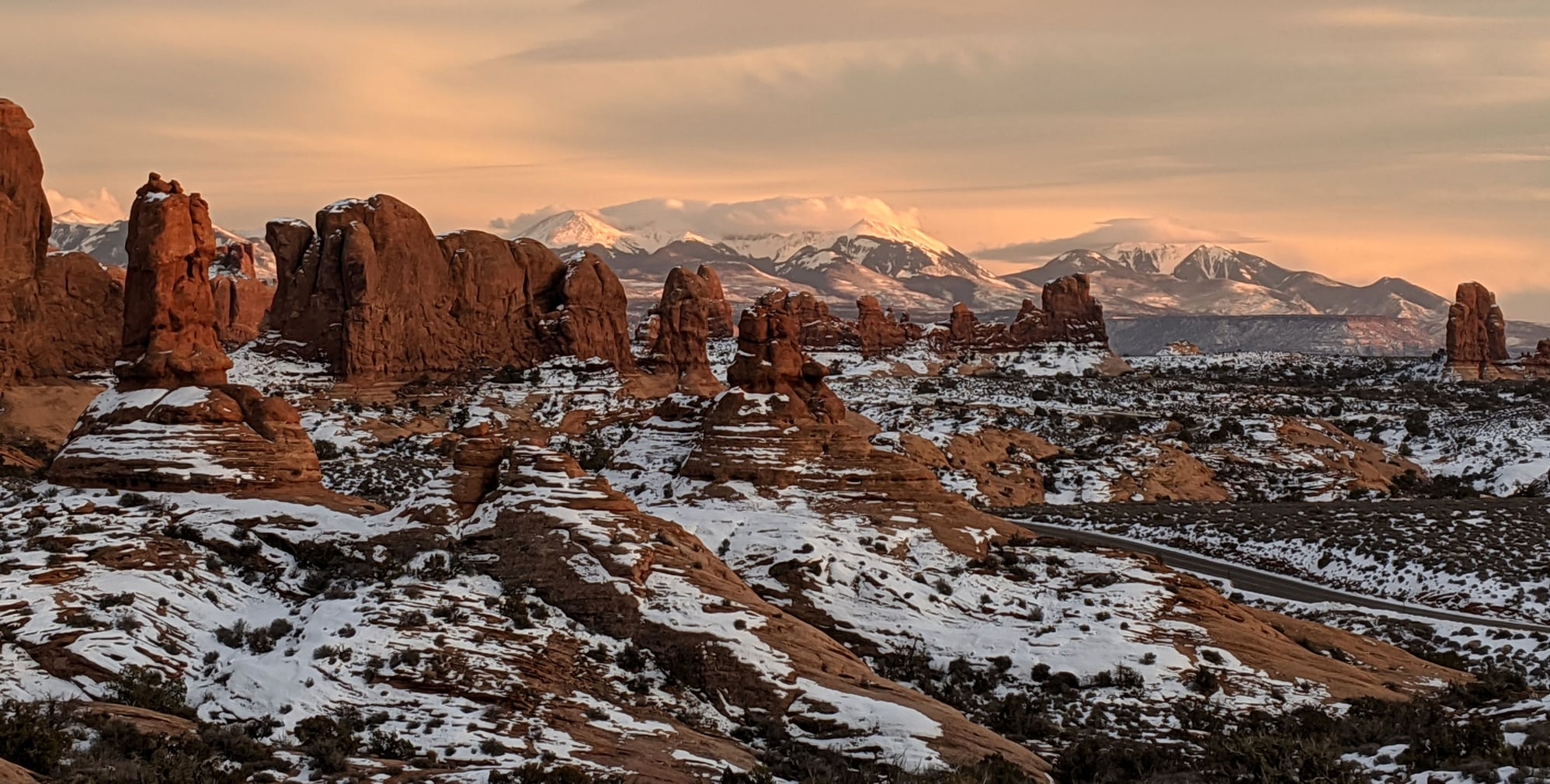
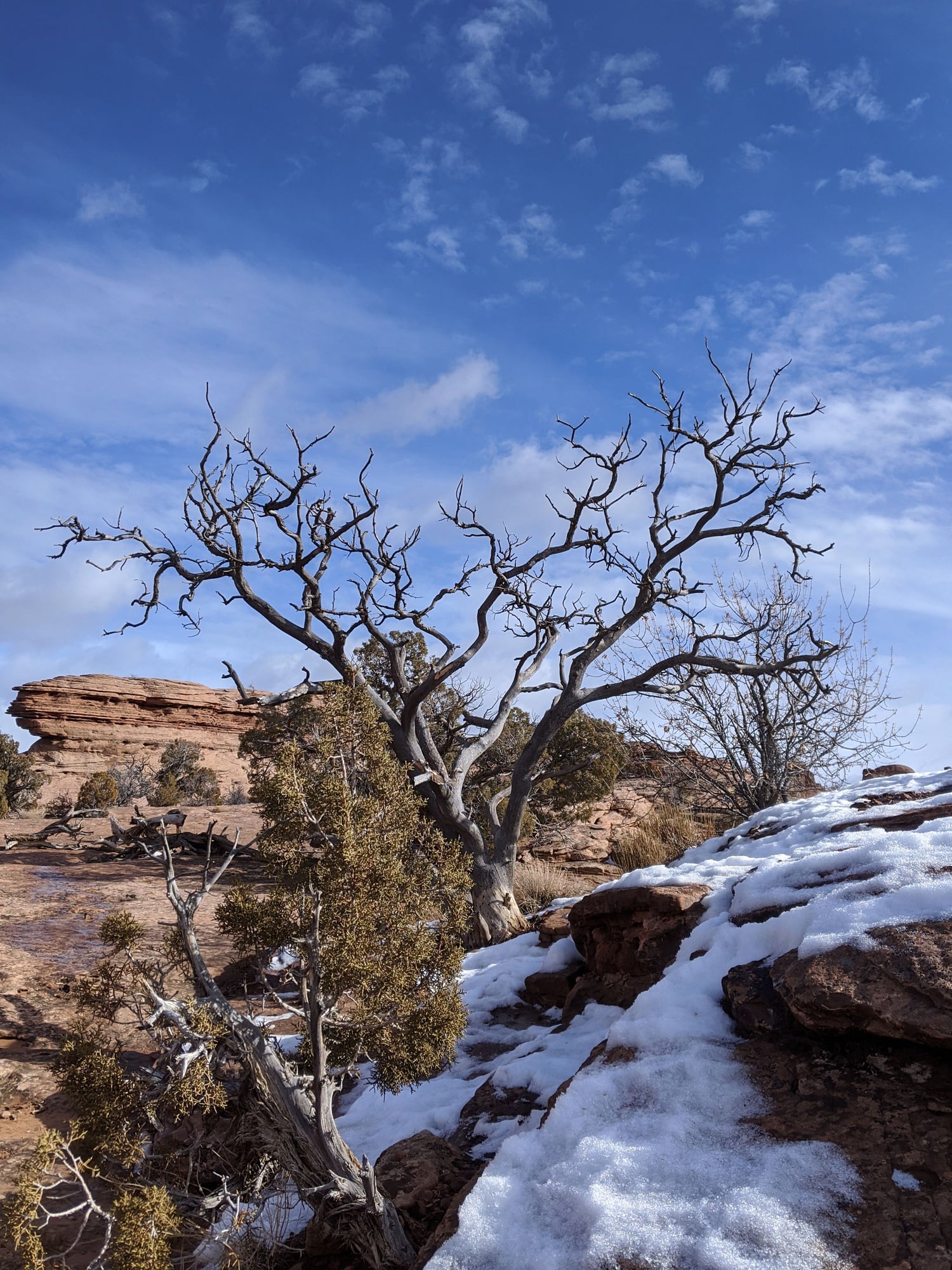
We got settled then drove to Arches – 3:30 pm and gloomy. We checked in at the Visitor’s Center (I counted four cars in the parking lot, joy!) and asked about walking conditions – the suggestion was made that with so little daylight we just visit Double Arch and The Windows.
Once in the parking lot of Double Arch we put on our traction cleats and walked up to the arch and then over to The Windows, about 2 miles round trip, lots of snow and ice on the trails.
We saw only two other people at Double Arch – last April I could barely get a photo without a couple dozen people wandering into it.
There were more people at The Windows…six. There was a couple with a dog on the trail; pet owners who seem to think the NO PETS rule doesn’t apply to them annoy me to no end; I politely reminded them.
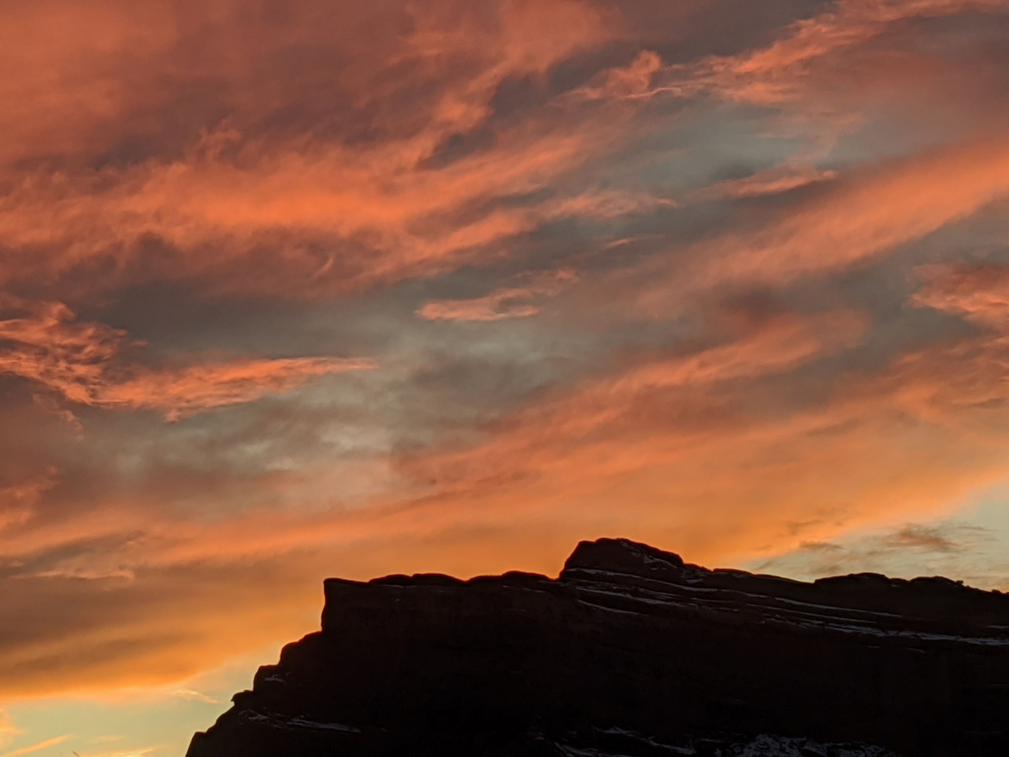
The sun made an appearance just in time to set, the clouds wild-looking, the twilight beautiful.

Later, as I waited to use the microwave in the hotel, a German couple well into their golden years ordered a glass of wine at the bar and were asked for ID, which led to confused raised eyebrows.
The couple explained their passports were in their room and they’d bring them down later, but they were refused a drink until they could prove they were 21. It was interesting to watch their reactions and to hear the employee’s long explanation as to why she needed ID – she could lose her job, this was UT, she was required by law, etc. A long discussion about the legal drinking age in Germany ensued. The guests asked to see the manager.
The simple solution of course was to go get the passports, but I couldn’t help but feel for these perplexed foreign visitors wading through our conflicting and sometimes puritanical attitudes towards alcohol.
Prost! Germany meets Utah, if that isn’t a culture clash I don’t know what is.
To be continued…
We were up and out the door before sunrise, backtracking the nine miles to Ridgway for breakfast at our favorite establishment there, Kate’s Kitchen - the first and only customers. Lemon ricotta blueberry pancakes for me (note for next time, request half an order) chorizo burrito with green chile for Bill, excellent both.
We’ve yet to find a good breakfast option in Ouray, unfortunately.
Our Ouray digs before sunrise
Then we sought out Cimarron Bookstore and Coffee Shop for proper coffee (I can’t abide drip) – nice latte, cute little place, friendly service.
Then it was back to Ouray for one last soak in the hot springs before check-out - the day cloudy, a storm was moving in.
We were back on the road just before 11 am, taking 550 to Ridgway again, then turning left towards Telluride on CO 62 – lots of snowplows out pre-treating the roads, not a snowflake in sight.
Just past Telluride we joined CO 145 and drove through San Miguel Canyon via the Scenic Byway.
We eventually made the descent into the hole of Naturita (“little nature”), a junky little town even uglier than usual with naked trees and winter grey. Evidently old vehicles come here to die; antler collecting looks like it might be the town hobby.
A few miles past Naturita we turned onto Hwy 90 and eventually motored through Bedrock, another sad town with a post office the size of a shed and Bedrock Store, where Wikipedia tells me scenes from Thelma and Louise were filmed. Who knew?
Soon we were dodging free roaming cows, some sauntering down the middle of the highway. Then more squiggles, through a pretty canyon; surprised when a flock of wild turkeys frantically crossed the road in front of us.
Before long we were on Hwy 46 and crossing the border into Utah, the roads winding, the asphalt covered in a white film (treated for snow?) the pungent smell of La Sal’s stockyard following us for miles.
We eventually joined US 191 - and then a miracle – a rest stop with toilet facilities, which seem to have gone the way of the dinosaur in our home state.
We arrived in Moab – 39 F, a tinge of red dirt on most everything - some three hours after leaving Ouray. We had a quick lunch and then drove to our hotel (Hyatt Place), marveling at how wonderfully empty the streets were – very unlike our pre-season, but still entirely too busy visit last April. I love it already.
We were greeted by TJ, who thoroughly explained every possible feature of the hotel, offered future help, told us to ask if we needed absolutely anything – a nice welcome, he must have been bored to tears.
We got settled then drove to Arches – 3:30 pm and gloomy. We checked in at the Visitor’s Center (I counted four cars in the parking lot, joy!) and asked about walking conditions – the suggestion was made that with so little daylight we just visit Double Arch and The Windows.
Once in the parking lot of Double Arch we put on our traction cleats and walked up to the arch and then over to The Windows, about 2 miles round trip, lots of snow and ice on the trails.
We saw only two other people at Double Arch – last April I could barely get a photo without a couple dozen people wandering into it.
There were more people at The Windows…six. There was a couple with a dog on the trail; pet owners who seem to think the NO PETS rule doesn’t apply to them annoy me to no end; I politely reminded them.
The sun made an appearance just in time to set, the clouds wild-looking, the twilight beautiful.
Later, as I waited to use the microwave in the hotel, a German couple well into their golden years ordered a glass of wine at the bar and were asked for ID, which led to confused raised eyebrows.
The couple explained their passports were in their room and they’d bring them down later, but they were refused a drink until they could prove they were 21. It was interesting to watch their reactions and to hear the employee’s long explanation as to why she needed ID – she could lose her job, this was UT, she was required by law, etc. A long discussion about the legal drinking age in Germany ensued. The guests asked to see the manager.
The simple solution of course was to go get the passports, but I couldn’t help but feel for these perplexed foreign visitors wading through our conflicting and sometimes puritanical attitudes towards alcohol.
Prost! Germany meets Utah, if that isn’t a culture clash I don’t know what is.
To be continued…
Jan 25th, 2020 | 12:03 PM
#7
Original Poster
Joined: Jan 2003
Posts: 21,148
Likes: 83
January 17 –
Hyatt Place offers a decent breakfast – I was pleased to see Nutella. We left around 8:30 and headed back to Arches - 45 F and windy, skies bluish, it had rained overnight.
As we entered the park we saw ominous clouds overhead moving our way – 37 F here.
Our plan for the morning was to hike to Delicate Arch, which we’d missed last time due to concerns about my wonky knee, and the abundance of other people doing the same thing.
The description of this hike in the Arches Visitor Guide (listed as difficult):
This trail climbs 480 feet up a steep slickrock slope. The trail has no shade and some exposure to heights. Just before you get to Delicate Arch, the trail follows a narrow rock ledge for about 200 yards, which is often icy in winter.
The Delicate Arch car park was near empty; we were off to a good start. However, as we pulled into the lot those clouds were suddenly directly overhead and released a torrent of graupel.

We listened to Elton John while we waited out the storm, which passed pretty quickly.
The hike took us about two hours; we clocked it at 3:14 miles. We saw 15-20 people, including an enthusiastic young man who told us he’d spent 30 minutes at the top completely alone, and a group of selfie-armed inappropriately dressed and shod Asians (no idea if they made it to the top).
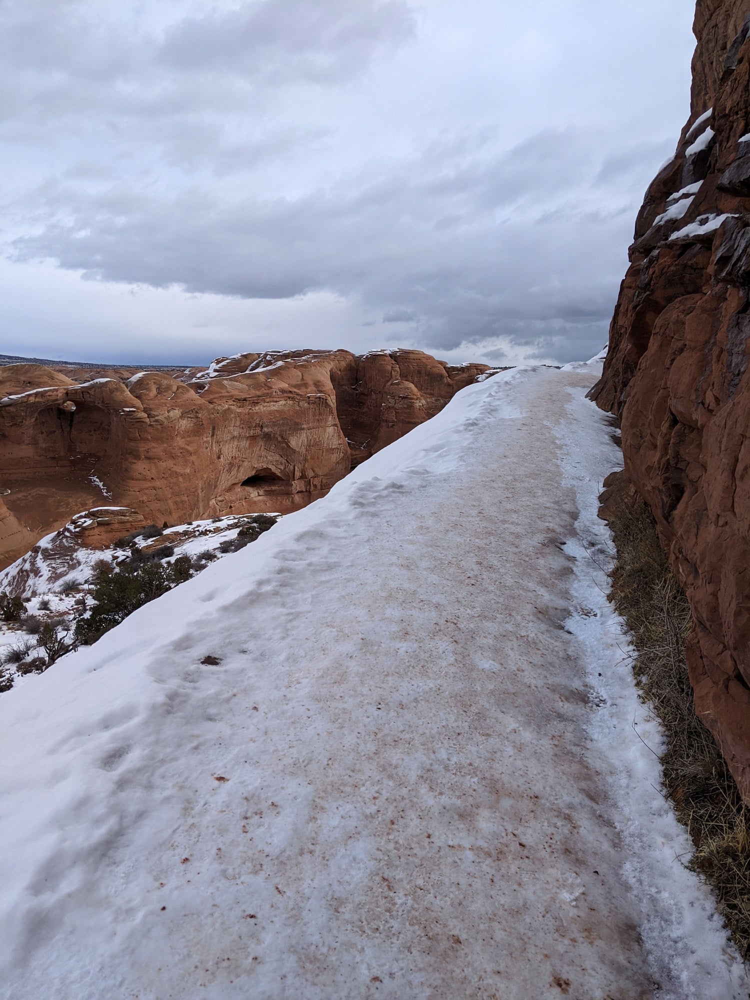
The hike wasn’t nearly as bad as my knee had expected. It was more moderate than difficult, although perhaps the warning was intended for those afraid of heights. We absolutely needed our traction cleats, especially for the last section along the ledge, which was completely covered in ice. There was also plentiful snow and mud. Our traction cleats also did a lot better on the bare rock than we expected.
Final climb to Delicate Arch
We had the arch to ourselves for a bit, but didn’t linger as the wind was so incredibly ferocious we feared it would blow us over the side.

Delicate Arch
Hike to Delicate Arch
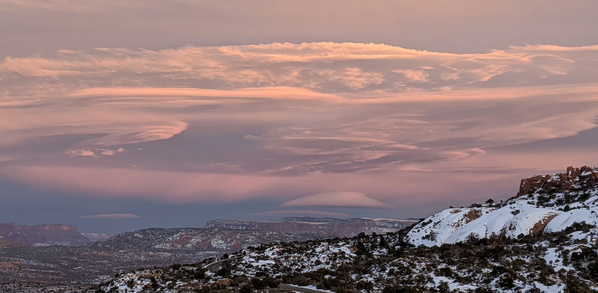
Overall a very nice hike. The sun made an appearance, and then the clouds returned.
After a very cold and windy picnic at the Delicate Arch viewpoint picnic area, we decided to check out Devil’s Garden and Double O Arch, which we’d also missed last time as the parking lot was completely full.
Not today, there were just a few cars in the lot.
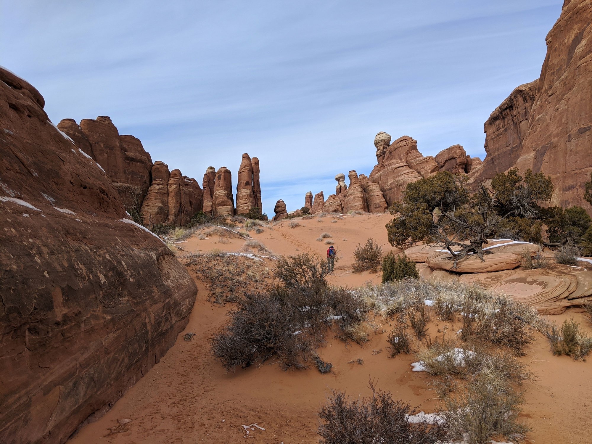
The traction cleats went back on and we set out to explore the area. It was really pretty back here, we both enjoyed it and decided this is our favorite part of Arches.
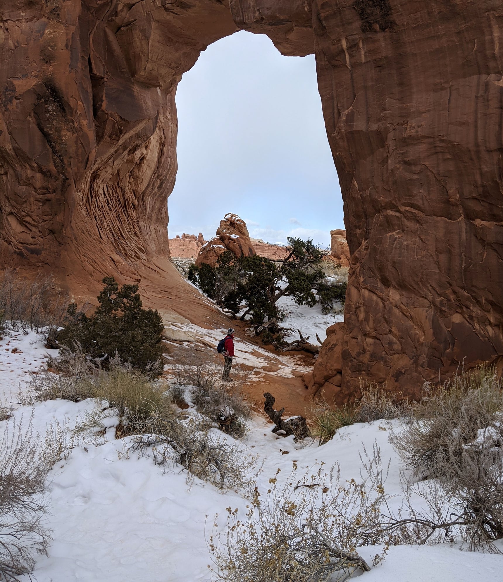
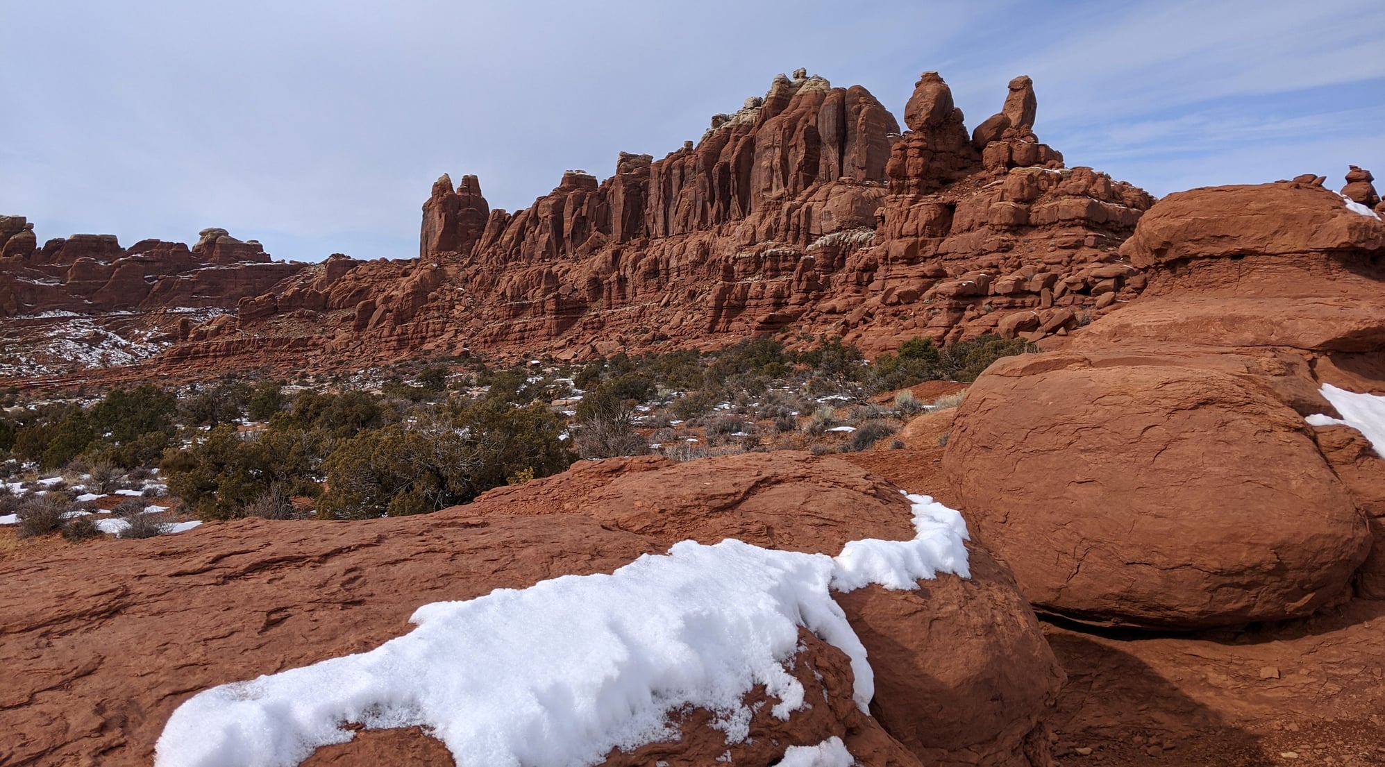
Pine Tree Arch
Devil's Garden
Devil's Garden
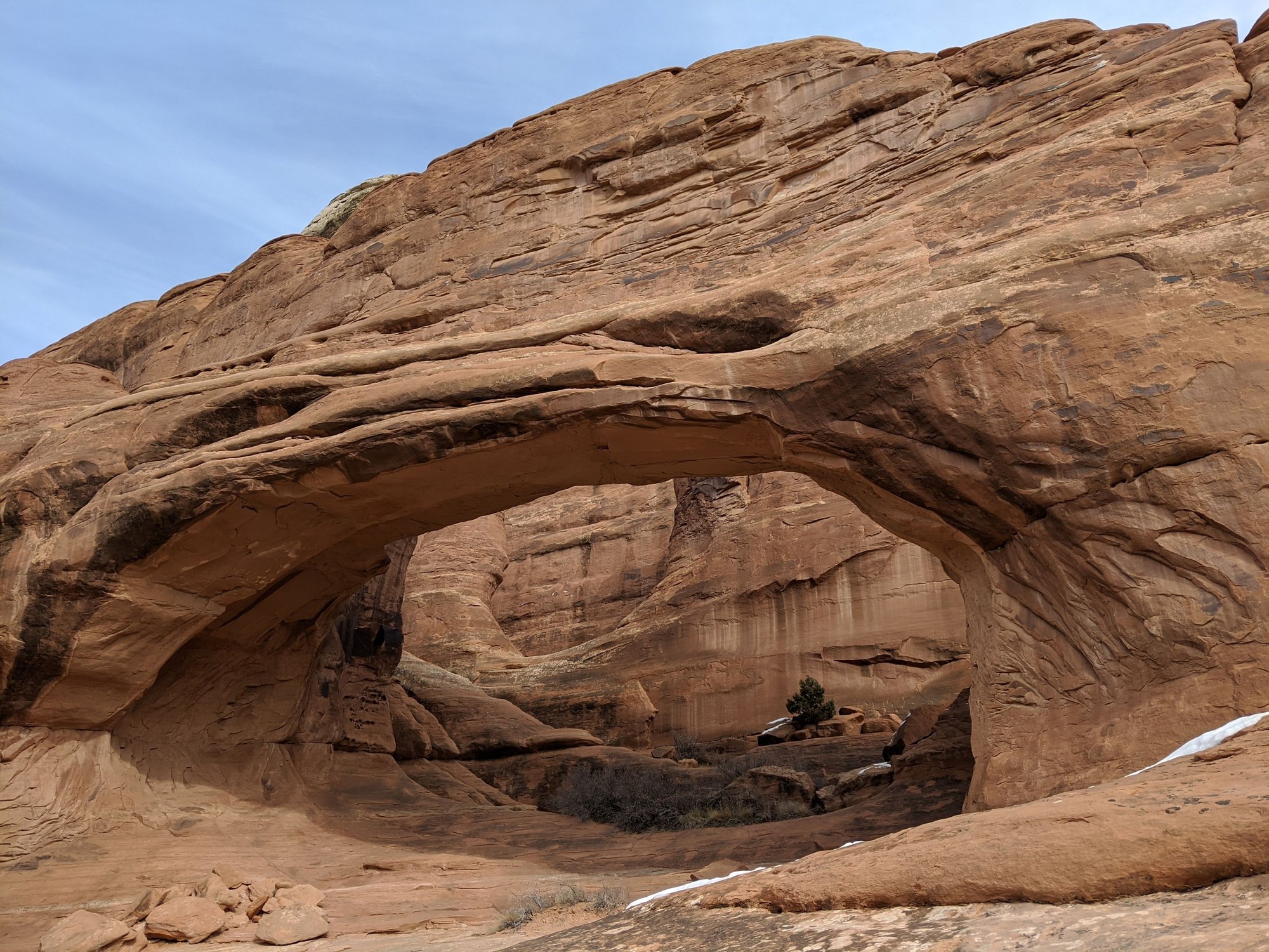
The hike to Double O Arch is listed as difficult and described as follows:
The trail beyond Landscape Arch climbs steeply over sandstone slabs. There are uneven surfaces and narrow ledges with steep drop-offs. Spur trails lead to more arches. Dark Angel is .5 miles beyond Double O Arch.
The weather was a mixed bag of cold, wind, snow and then brilliant sunshine.
When we got to Landscape Arch the trail ended, so we backtracked to the Primitive Trail that we thought led to Double O Arch. We encountered two young women, who’d unsuccessfully been looking for the trail. After some poking around, we found what we thought was the trail and the two women went that way. We walked in for a bit but one look at what lay ahead and we thought better of it.
Landscape Arch
It’d been a six mile, four hour hike day.
We decided to take advantage of the sunshine and drove down 128 for a bit to take photos.
Highway 128
Highway 128
Highway 128
Then it was back to the hotel to watch the sun go down from the hotel’s hot tub.
Later we had an a la carte dinner at El Charro Loco - beef tacos for Bill, cheese enchiladas with tomatillo sauce for me – the food was good, but the service was glacially slow (there was a huge take out order in front of us). The restaurant isn’t licensed, so no margaritas, which kept our bill down.
To be continued…
Hyatt Place offers a decent breakfast – I was pleased to see Nutella. We left around 8:30 and headed back to Arches - 45 F and windy, skies bluish, it had rained overnight.
As we entered the park we saw ominous clouds overhead moving our way – 37 F here.
Our plan for the morning was to hike to Delicate Arch, which we’d missed last time due to concerns about my wonky knee, and the abundance of other people doing the same thing.
The description of this hike in the Arches Visitor Guide (listed as difficult):
This trail climbs 480 feet up a steep slickrock slope. The trail has no shade and some exposure to heights. Just before you get to Delicate Arch, the trail follows a narrow rock ledge for about 200 yards, which is often icy in winter.
The Delicate Arch car park was near empty; we were off to a good start. However, as we pulled into the lot those clouds were suddenly directly overhead and released a torrent of graupel.
We listened to Elton John while we waited out the storm, which passed pretty quickly.
The hike took us about two hours; we clocked it at 3:14 miles. We saw 15-20 people, including an enthusiastic young man who told us he’d spent 30 minutes at the top completely alone, and a group of selfie-armed inappropriately dressed and shod Asians (no idea if they made it to the top).
The hike wasn’t nearly as bad as my knee had expected. It was more moderate than difficult, although perhaps the warning was intended for those afraid of heights. We absolutely needed our traction cleats, especially for the last section along the ledge, which was completely covered in ice. There was also plentiful snow and mud. Our traction cleats also did a lot better on the bare rock than we expected.
Final climb to Delicate Arch
We had the arch to ourselves for a bit, but didn’t linger as the wind was so incredibly ferocious we feared it would blow us over the side.
Delicate Arch
Hike to Delicate Arch
Overall a very nice hike. The sun made an appearance, and then the clouds returned.
After a very cold and windy picnic at the Delicate Arch viewpoint picnic area, we decided to check out Devil’s Garden and Double O Arch, which we’d also missed last time as the parking lot was completely full.
Not today, there were just a few cars in the lot.
The traction cleats went back on and we set out to explore the area. It was really pretty back here, we both enjoyed it and decided this is our favorite part of Arches.
Pine Tree Arch
Devil's Garden
Devil's Garden
The hike to Double O Arch is listed as difficult and described as follows:
The trail beyond Landscape Arch climbs steeply over sandstone slabs. There are uneven surfaces and narrow ledges with steep drop-offs. Spur trails lead to more arches. Dark Angel is .5 miles beyond Double O Arch.
The weather was a mixed bag of cold, wind, snow and then brilliant sunshine.
When we got to Landscape Arch the trail ended, so we backtracked to the Primitive Trail that we thought led to Double O Arch. We encountered two young women, who’d unsuccessfully been looking for the trail. After some poking around, we found what we thought was the trail and the two women went that way. We walked in for a bit but one look at what lay ahead and we thought better of it.
Landscape Arch
It’d been a six mile, four hour hike day.
We decided to take advantage of the sunshine and drove down 128 for a bit to take photos.
Highway 128
Highway 128
Highway 128
Then it was back to the hotel to watch the sun go down from the hotel’s hot tub.
Later we had an a la carte dinner at El Charro Loco - beef tacos for Bill, cheese enchiladas with tomatillo sauce for me – the food was good, but the service was glacially slow (there was a huge take out order in front of us). The restaurant isn’t licensed, so no margaritas, which kept our bill down.
To be continued…
Trending Topics
Jan 25th, 2020 | 02:20 PM
#9
Original Poster
Joined: Jan 2003
Posts: 21,148
Likes: 83
Jan 18 –
Saturday – more people in the hotel now, but still pretty quiet; 29 F in Moab with high clouds.
We left the hotel around 9:15 and drove to Canyonlands; north on 191 for nine miles, then left on 313 for another 25 miles.
After consulting a park ranger in the visitor’s center (who told us this was the first winter they’ve been open, we assume he meant the visitor’s center, not the park), we decided to embark on the Neck Spring Trail.
The trail is described in the Canyonlands Brochure as follows under Moderate, Mesa Top:
A walk back in time, this loop trail passes historic ranching features and two springs where cowboys watered cattle. With minor elevation changes, this trail is a great way to see some varied plant life.
Sounds innocuous, right? The ranger showed us a photo of some slickrock we’d need to climb to get out of the canyon, but somehow that bit didn’t register with me.
He also gave us a print out of the track, which described it as follows:
This is a loop trail with a round trip distance of 5.8 miles and an elevation change of 300 feet. The climb back to the rim is steep but short…For safety’s sake please do not build additional rock cairns or create new routes by walking through sandy areas. It may be fun for you, but deceptive to other hikers who may become lost or injured…
It was 26 F when we set out on the hike. At some point the clouds burned off and left us with a spectacular day.
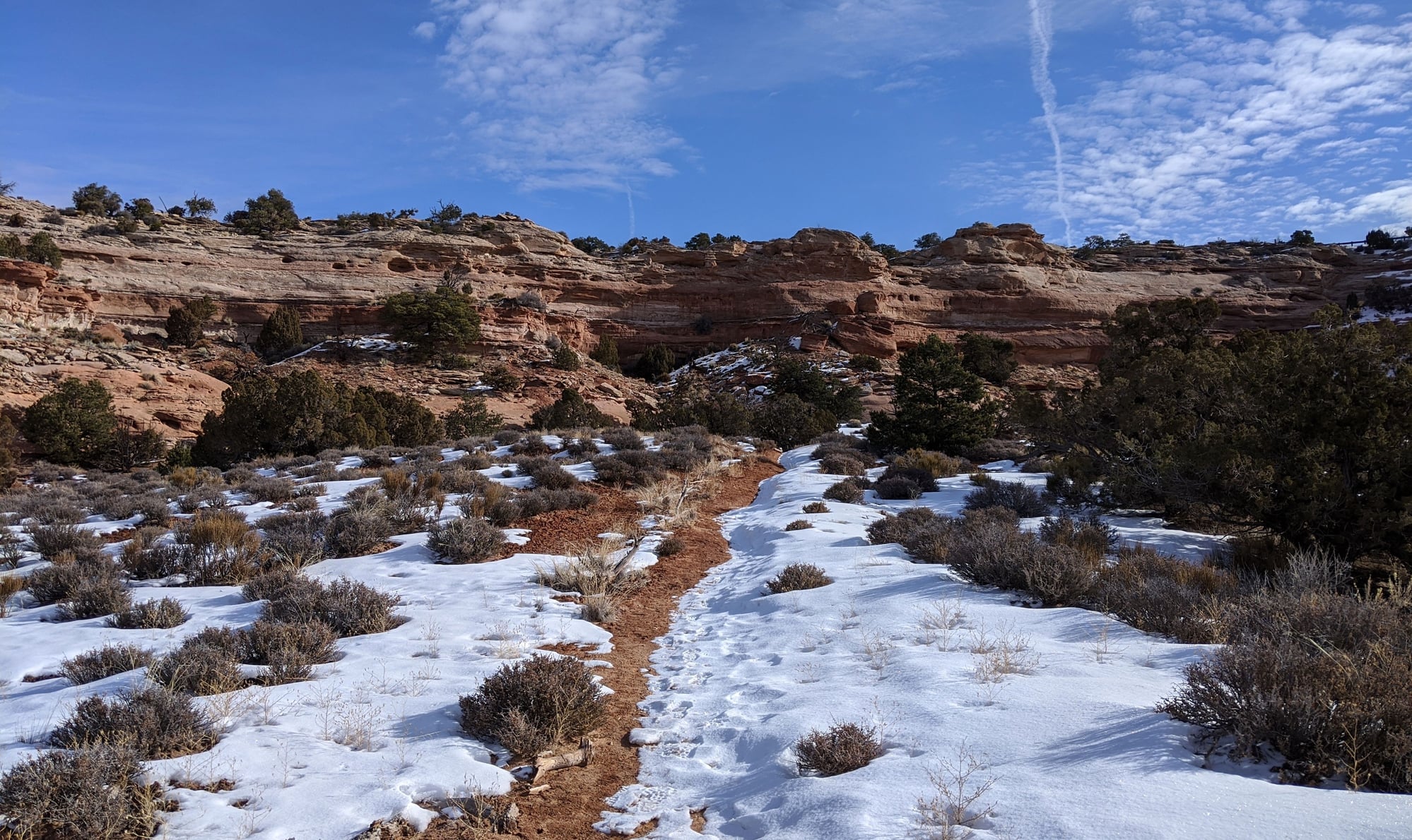
The hike turned out to be a rather undulating and meandering trek below the canyon's rim. It crossed two streams… and the pi�ce de r�sistance, the aforementioned steep but short climb back to the rim, which was a doozy. I’m a lot of things, but I’m not a rock climber; especially when that rock is covered in ice. I didn’t think I was going to make it.
And those cairns….we would have been lost without them, as the trail would have been impossible to follow otherwise. We had to wonder if the rangers came out on a regular basis in the winter to clear snow from the cairns, which would be hidden otherwise.
This will forever be remembered as the track that killed my traction cleats (and tried to kill me).
But, the views were beautiful, the silence absolute, and we saw not another soul.
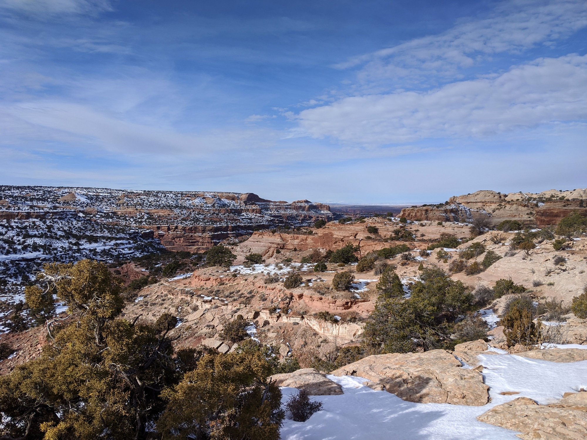
Neck Spring Trail, Canyonlands
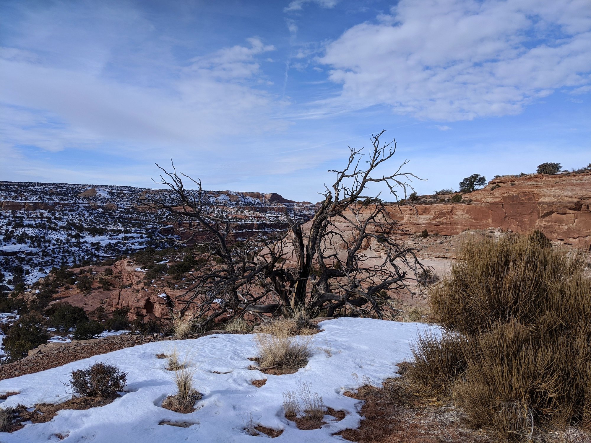
Neck Spring Trail, Canyonlands
Neck Spring Trail, Canyonlands
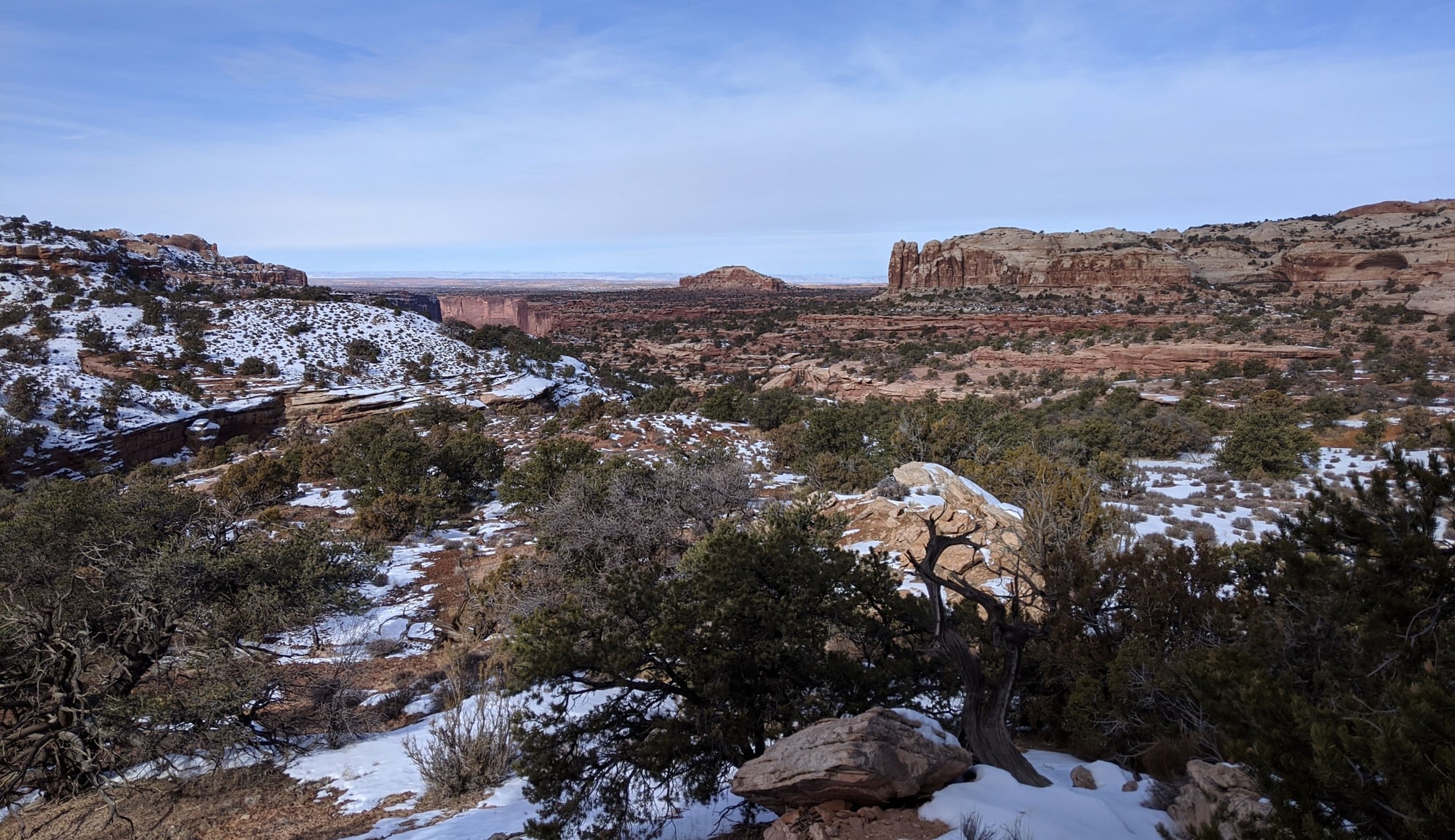
Neck Spring Trail, Canyonlands
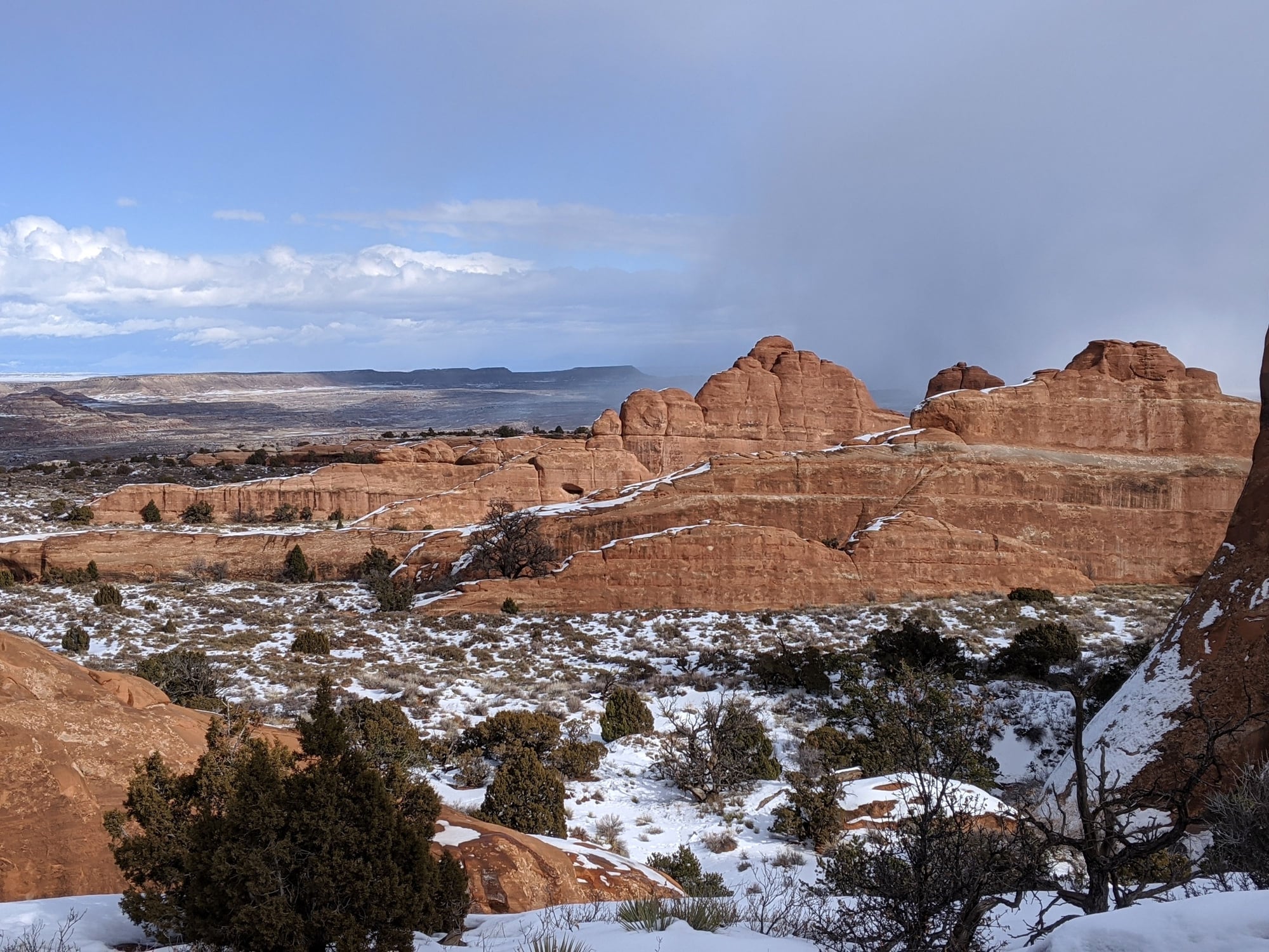
After the scary rock climb, we sat atop said rock and had a picnic while taking in the expansive views that surrounded us. The hike took us 4.5 hours, and turned out to be our favorite of the trip.
The temperature had climbed to 37 F by the time we finished.
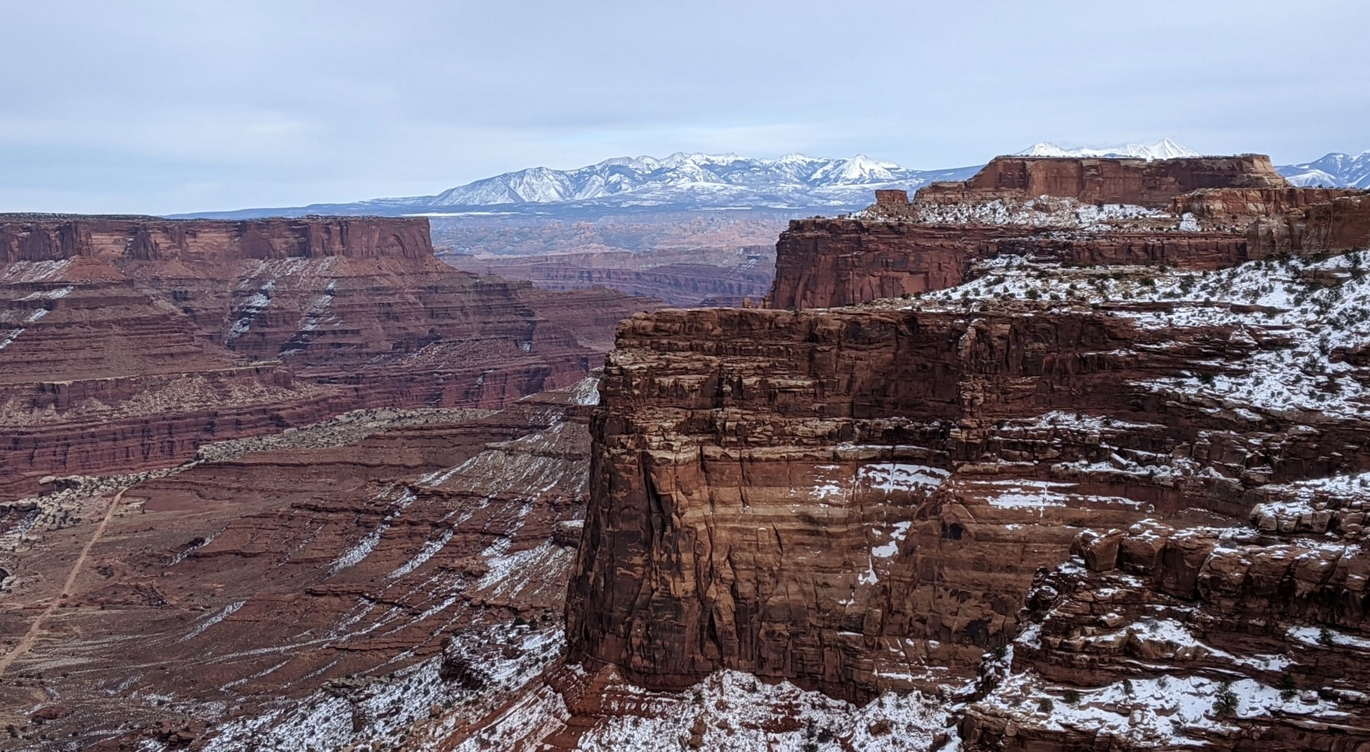
Shafer Canyon, Canyonlands
Near Canyonlands
Then it was back to the hotel to soak in the hot tub – which we no longer had to ourselves - four other people.
Dinner was at Moab Brewery - so this is where everyone hangs out! Busy. Excellent service, lots of servers, a whirlwind of activity. Bill had the spicy chicken burrito which he said was excellent, chased down with a $3 pint of beer. I had a nice beer cheese soup with a glass of house made root beer. We both really liked this place. And Bill wasn’t asked for ID!
To be continued…
Saturday – more people in the hotel now, but still pretty quiet; 29 F in Moab with high clouds.
We left the hotel around 9:15 and drove to Canyonlands; north on 191 for nine miles, then left on 313 for another 25 miles.
After consulting a park ranger in the visitor’s center (who told us this was the first winter they’ve been open, we assume he meant the visitor’s center, not the park), we decided to embark on the Neck Spring Trail.
The trail is described in the Canyonlands Brochure as follows under Moderate, Mesa Top:
A walk back in time, this loop trail passes historic ranching features and two springs where cowboys watered cattle. With minor elevation changes, this trail is a great way to see some varied plant life.
Sounds innocuous, right? The ranger showed us a photo of some slickrock we’d need to climb to get out of the canyon, but somehow that bit didn’t register with me.
He also gave us a print out of the track, which described it as follows:
This is a loop trail with a round trip distance of 5.8 miles and an elevation change of 300 feet. The climb back to the rim is steep but short…For safety’s sake please do not build additional rock cairns or create new routes by walking through sandy areas. It may be fun for you, but deceptive to other hikers who may become lost or injured…
It was 26 F when we set out on the hike. At some point the clouds burned off and left us with a spectacular day.
The hike turned out to be a rather undulating and meandering trek below the canyon's rim. It crossed two streams… and the pi�ce de r�sistance, the aforementioned steep but short climb back to the rim, which was a doozy. I’m a lot of things, but I’m not a rock climber; especially when that rock is covered in ice. I didn’t think I was going to make it.
And those cairns….we would have been lost without them, as the trail would have been impossible to follow otherwise. We had to wonder if the rangers came out on a regular basis in the winter to clear snow from the cairns, which would be hidden otherwise.
This will forever be remembered as the track that killed my traction cleats (and tried to kill me).
But, the views were beautiful, the silence absolute, and we saw not another soul.
Neck Spring Trail, Canyonlands
Neck Spring Trail, Canyonlands
Neck Spring Trail, Canyonlands
Neck Spring Trail, Canyonlands
After the scary rock climb, we sat atop said rock and had a picnic while taking in the expansive views that surrounded us. The hike took us 4.5 hours, and turned out to be our favorite of the trip.
The temperature had climbed to 37 F by the time we finished.
Shafer Canyon, Canyonlands
Near Canyonlands
Then it was back to the hotel to soak in the hot tub – which we no longer had to ourselves - four other people.
Dinner was at Moab Brewery - so this is where everyone hangs out! Busy. Excellent service, lots of servers, a whirlwind of activity. Bill had the spicy chicken burrito which he said was excellent, chased down with a $3 pint of beer. I had a nice beer cheese soup with a glass of house made root beer. We both really liked this place. And Bill wasn’t asked for ID!
To be continued…
Jan 25th, 2020 | 08:38 PM
#10
Joined: Jul 2004
Posts: 6,339
Likes: 8
Excellent, a Melnq report in my own backyard! Fantastic photos and reporting. Loved the story of the Germans and the wine, brought back memories of ordering drinks in Utah restaurants some years ago, or trying to.
Signing on for more. Thanks.
Signing on for more. Thanks.
Jan 26th, 2020 | 09:47 AM
#12
Original Poster
Joined: Jan 2003
Posts: 21,148
Likes: 83
Jan 19 �
The breakfast room and hotel parking lot were busier than we�d seen so far this trip, but still pretty quiet, especially for a Sunday.
We left the hotel around 9:15, 28 F. We took 191 north to 128 east, planning to walk the Fisher Towers Trail, which had been described as an easy 4.4 mile hike.
The ice patches on the Colorado River were abundant, traffic non-existent. More of those high clouds overhead (we were beginning to see a trend � high clouds in the morning sunshine in the afternoon).
There was only one other car in the Fisher Towers parking lot. The sign at the trail head said it was a moderate hike and to allow four hours.
We hiked in for about 20 minutes and then changed our minds; too much mud, too much dog crap, too little interest in scrambling over rocks. We just weren�t feeling the love.
On to plan B.
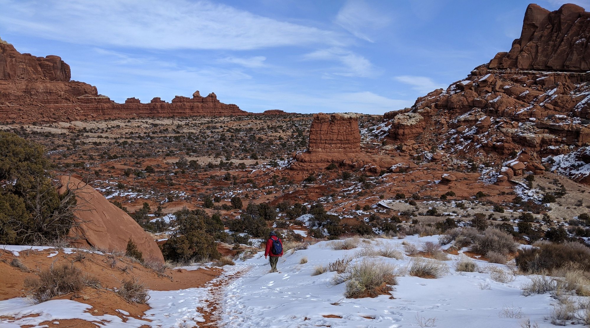
We decided to head back to Arches. Once inside the park, we turned off the main road just past Sand Dune Arch and followed the dirt track some ~9 miles to the trail head for Tower Arch, another difficult rated hike miles off the beaten path. It seemed to take forever to get there at 25 mph and felt very remote.
There was only one other car in the parking lot; it left as we arrived. We put on our traction cleats (fortunately I�d packed a spare; this one more substantial) and set out.
From the Arches National Park brochure:
The trail climbs a steep, short rock wall (oh no, another one!) cuts across a valley, and then meanders through sandstone fins and sand dunes.
Oh baby. A tough snow and ice covered rock wall met us right off the bat. As we looked back down over what we�d just come up, we realized that we might have to walk back via the four wheel drive road, which would add about 4.5 miles to the hike, and might put us back in the parking lot after dark. Our traction cleats were absolutely needed to get over that wall, so we were surprised to see two people up here in tennis shoes.
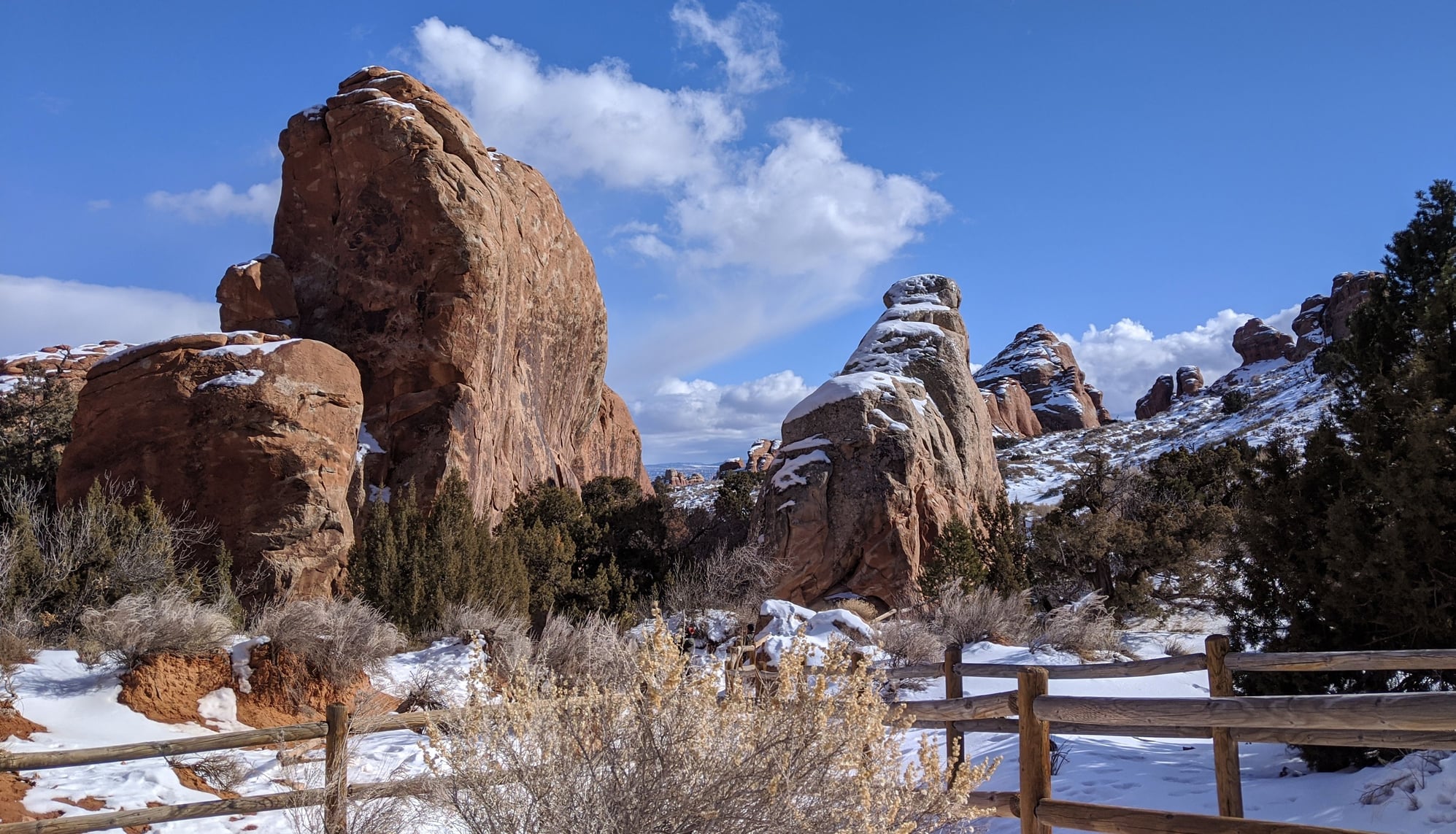
The effort was so worth it though, I really enjoyed this hike. We had a very late picnic under Tower Arch, the views tremendous, not another soul in sight. It was a beautiful sunny day, 31 F.
Hike to Tower Arch
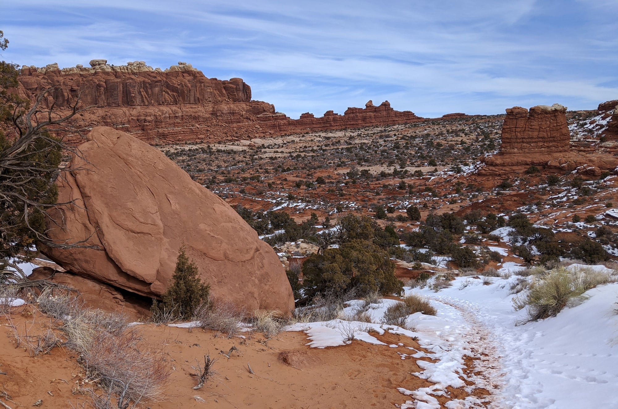
Hike to Tower Arch
Hike to Tower Arch
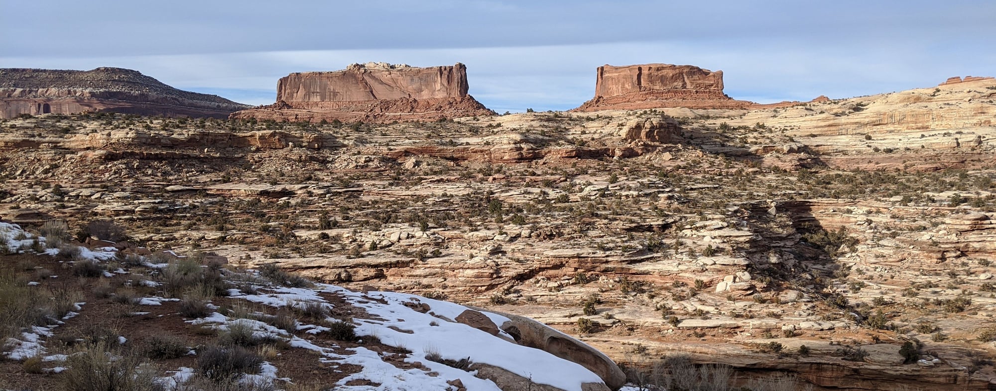
Tower Arch

Views from Tower Arch
Tower Arch hike, return
La Sal Mountains as seen from Tower Arch
After lunch, we sucked it up and returned the way we�d come, worried about whether or not we�d be able to get back down that wall. I had to sit on my butt and scooch over the scariest bits, but we took it slow and easy; we survived.
A very nice hike overall, we clocked it at 2.67 miles, took us 2:10, only saw four other people.
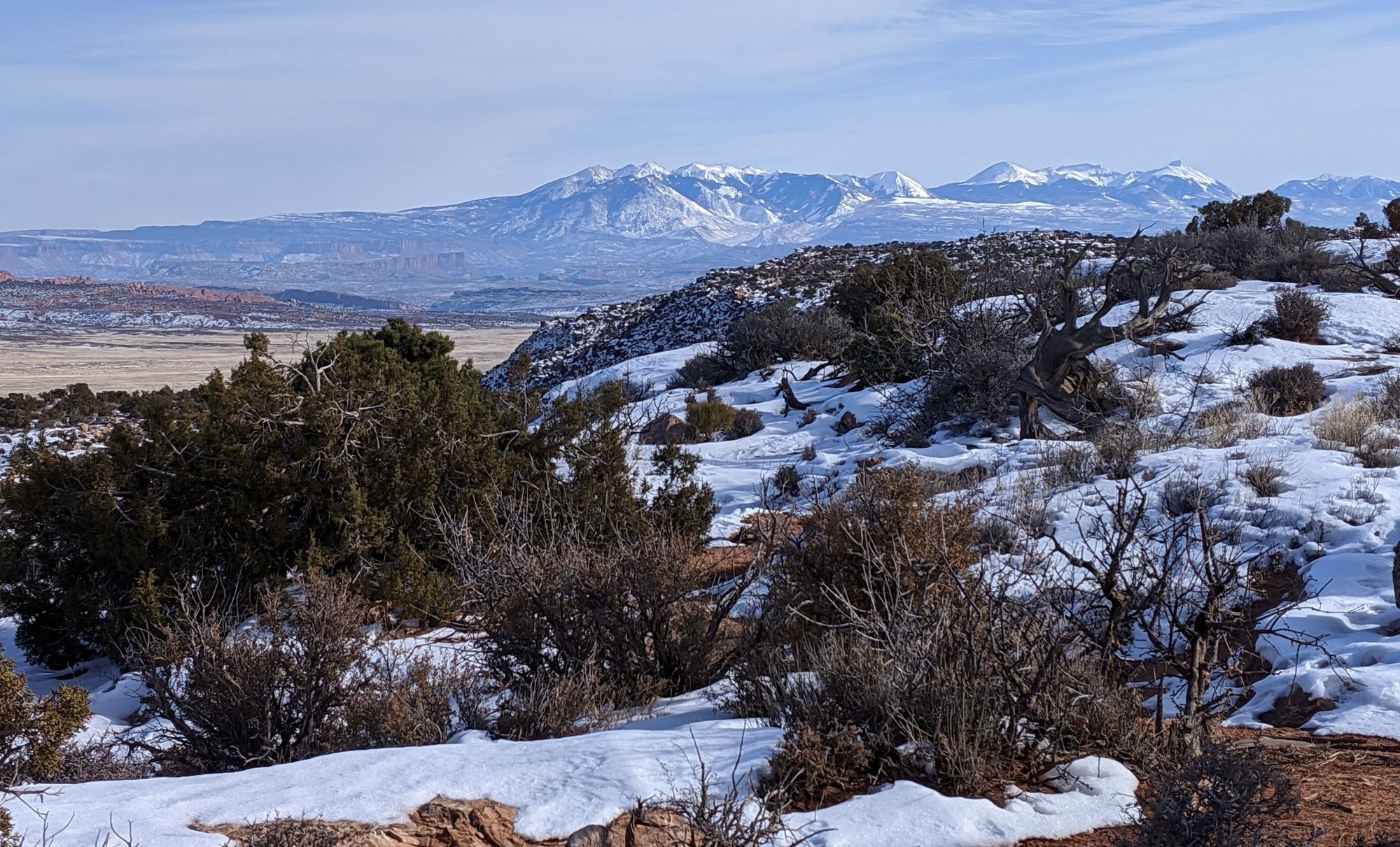
We then made one last drive through the park, stopping for some fabulous views of the La Sal Mountains from the Fiery Furnace viewpoint (Fiery Furnace was closed during our stay, and guarded by a Park Ranger probably to prevent the clueless from going in and getting themselves lost or injured).
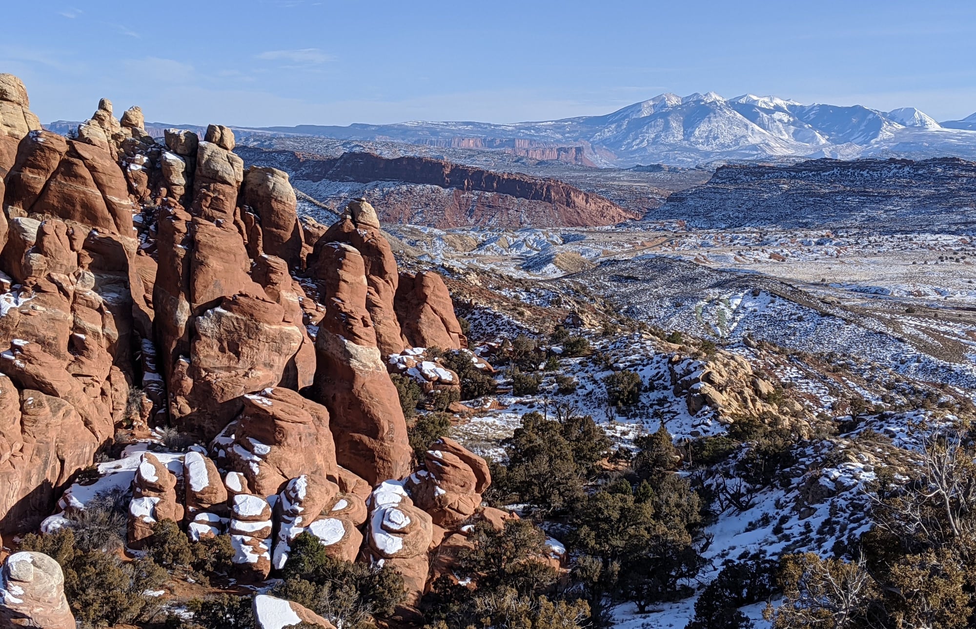
La Sal Mountains as seen from Fiery Furnace Viewpoint
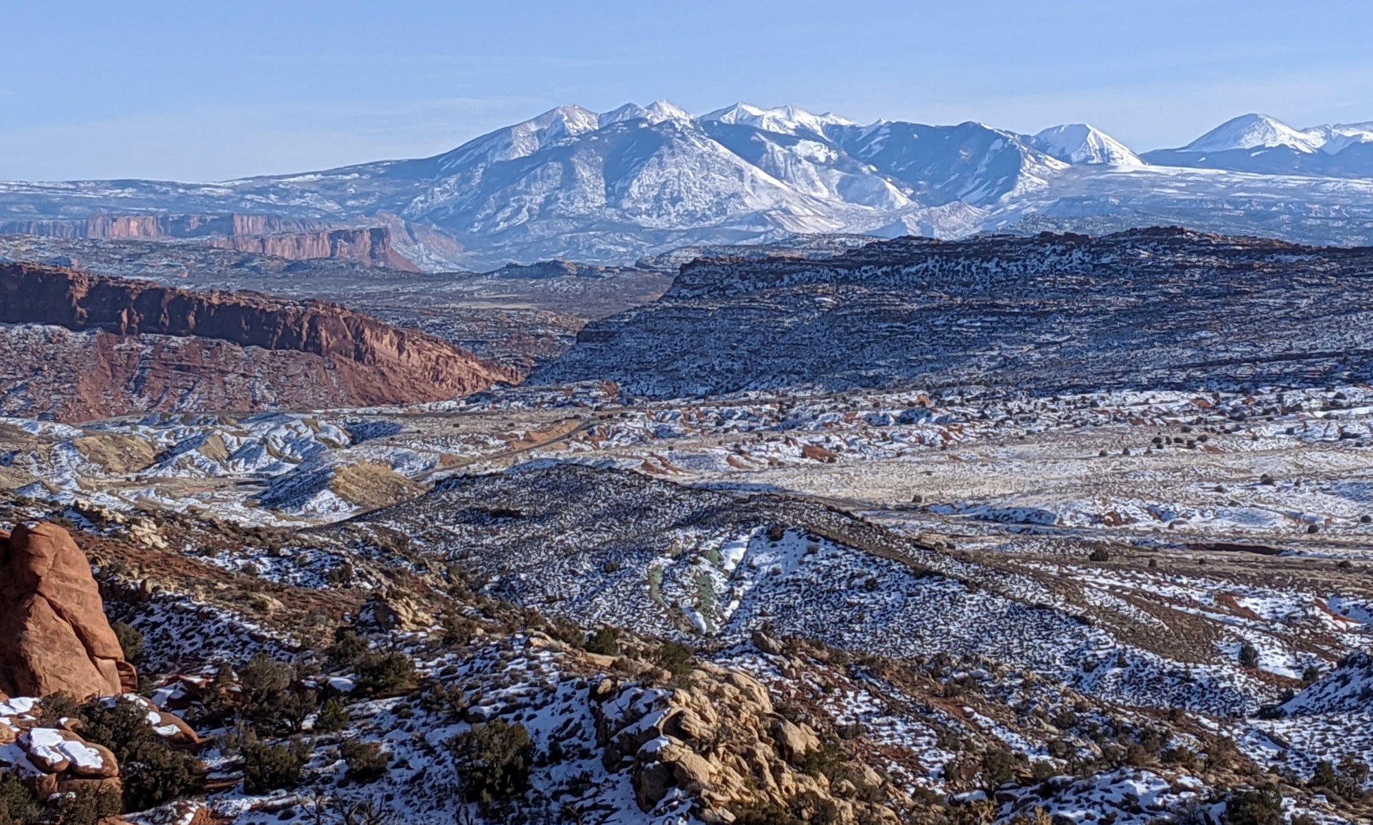
La Sal Mountains as see from Fiery Furnace Viewpoint
Then it was back to the hotel for one last soak in the hot tub.
We returned to Moab Brewery for dinner � not nearly as busy this time, service much slower. Bill tried their Trippel, and liked it so much he bought a few bottles to take home. We were told they can sell beer to take away on Sunday only because they make it on site; UT alcohol laws are a bit baffling.
We both had the fajita chicken salad, which was very good. I had another root beer.
On the way out, I bought two scoops of gelato to go, root beer float and almond butter, tasty.
To be continued�
The breakfast room and hotel parking lot were busier than we�d seen so far this trip, but still pretty quiet, especially for a Sunday.
We left the hotel around 9:15, 28 F. We took 191 north to 128 east, planning to walk the Fisher Towers Trail, which had been described as an easy 4.4 mile hike.
The ice patches on the Colorado River were abundant, traffic non-existent. More of those high clouds overhead (we were beginning to see a trend � high clouds in the morning sunshine in the afternoon).
There was only one other car in the Fisher Towers parking lot. The sign at the trail head said it was a moderate hike and to allow four hours.
We hiked in for about 20 minutes and then changed our minds; too much mud, too much dog crap, too little interest in scrambling over rocks. We just weren�t feeling the love.
On to plan B.
We decided to head back to Arches. Once inside the park, we turned off the main road just past Sand Dune Arch and followed the dirt track some ~9 miles to the trail head for Tower Arch, another difficult rated hike miles off the beaten path. It seemed to take forever to get there at 25 mph and felt very remote.
There was only one other car in the parking lot; it left as we arrived. We put on our traction cleats (fortunately I�d packed a spare; this one more substantial) and set out.
From the Arches National Park brochure:
The trail climbs a steep, short rock wall (oh no, another one!) cuts across a valley, and then meanders through sandstone fins and sand dunes.
Oh baby. A tough snow and ice covered rock wall met us right off the bat. As we looked back down over what we�d just come up, we realized that we might have to walk back via the four wheel drive road, which would add about 4.5 miles to the hike, and might put us back in the parking lot after dark. Our traction cleats were absolutely needed to get over that wall, so we were surprised to see two people up here in tennis shoes.
The effort was so worth it though, I really enjoyed this hike. We had a very late picnic under Tower Arch, the views tremendous, not another soul in sight. It was a beautiful sunny day, 31 F.
Hike to Tower Arch
Hike to Tower Arch
Hike to Tower Arch
Tower Arch
Views from Tower Arch
Tower Arch hike, return
La Sal Mountains as seen from Tower Arch
After lunch, we sucked it up and returned the way we�d come, worried about whether or not we�d be able to get back down that wall. I had to sit on my butt and scooch over the scariest bits, but we took it slow and easy; we survived.
A very nice hike overall, we clocked it at 2.67 miles, took us 2:10, only saw four other people.
We then made one last drive through the park, stopping for some fabulous views of the La Sal Mountains from the Fiery Furnace viewpoint (Fiery Furnace was closed during our stay, and guarded by a Park Ranger probably to prevent the clueless from going in and getting themselves lost or injured).
La Sal Mountains as seen from Fiery Furnace Viewpoint
La Sal Mountains as see from Fiery Furnace Viewpoint
Then it was back to the hotel for one last soak in the hot tub.
We returned to Moab Brewery for dinner � not nearly as busy this time, service much slower. Bill tried their Trippel, and liked it so much he bought a few bottles to take home. We were told they can sell beer to take away on Sunday only because they make it on site; UT alcohol laws are a bit baffling.
We both had the fajita chicken salad, which was very good. I had another root beer.
On the way out, I bought two scoops of gelato to go, root beer float and almond butter, tasty.
To be continued�
Jan 26th, 2020 | 12:55 PM
#13
Original Poster
Joined: Jan 2003
Posts: 21,148
Likes: 83
Jan 20 -
I’d noticed numerous semi-trucks parked alongside the shoulder of 191 near Moab over the past few nights. I assume they’d stopped to sleep, but I’ve never seen this so close to a town. So I took to Google, which told me that semi-trucks constitute 30% of the traffic that passes through Moab. There’s a truck stop 50 miles south in Monticello, a stop 51 miles to the north in Green River and a stop 113 miles to the east in Grand Junction. So maybe these trucks were headed west? Things that make you go hummm.
But I digress.
There were even more people in the breakfast room than we’d seen previously, which seemed odd on a Monday, but perhaps Martin Luther King Jr Day played a part.
Short drive today, so we hung out in the hotel until 11 am, then packed up the car and drove into town. Our destination, the Doughbird, which I’d shortlisted for their doughnuts (they also sell chicken!)
Unfortunately, they were closed for the season.
So we backtracked and went to Sweet Cravings, which I’d also read good things about. We both had lattes – not good - they tasted like warm milk that had been wafted over with a coffee bean, or made with drip instead of espresso. The brownie, however, was very good.
We left Moab under cloudy skies and the threat of an oncoming storm and worked our way south via 191, eventually turning left onto S 491 at Monticello.
The sky seemed to go on forever, the gloom refusing to lift, the landscape flat.
Eventually we entered Colorado, and motored through Dove Creek, which we'd never heard of, but now know is the self-proclaimed Pinto Bean Capital of the World.
We passed the turn off to Hovenweep National Monument, which we visited last April, albeit from a different direction.
We arrived in Cortez, turned left onto 160 towards Durango, the GPS taking us on a weird convoluted route through town.
Then, a Colorado rest area! We passed the entrance to Mesa Verde National Park, reminding us that we need to visit someday.
We detoured to Mancos, via Business 160, and wandered through town until we located Chavolo’s. We’d discovered this little gem on our trip last April.
Our fears about them being closed on a Monday were unfounded. In fact Monday turned out to be ideal since they were offering a lunch special – fajitas for $8.95, which we both ordered. Wow, the biggest order of fajitas we’d ever seen, plus all the fixins. We wouldn't need dinner.
Here we learned about the locally brewed cider, Fenceline, so before leaving town we went across the street to a liquor store and picked up a four pack. Bill was chuffed to find Einstock White Ale - in tiny Mancos of all places - which he hadn’t seen since our visit to Iceland in 2017, so we bought a six pack of that as well.
Then it was back on 160 where we clipped the edge of Durango under still ominous grey skies.
We arrived in Pagosa Springs four hours after leaving Moab, me having that same discombobulated feeling I had last time we were here, that Pagosa Springs felt like two separate and distinct towns.
Lots of snow here.
Before checking into our hotel, we drove to Healing Waters to enquire about their facilities. Our original plan had been to spend the evening in their hot springs, but after discovering their main pool was only 92-95 degrees and the hassle involved with changing into and out of our swimsuits onsite, then having to drive to/from our accommodation in the dark cold…we decided to give it a pass. Besides, we had two more natural hot springs stops in our very near future.
Note: The Springs Resort and Spa is the big player in Pagosa. We’d considered staying here but at almost $300 a night we couldn’t justify the cost with the short amount of time we’d spend using their facilities. They also offer one time entry for $30 each. Maybe next time.
So, we checked into our lodging (First Inn) and hunkered down for the storm.
To be continued…
Jan 27th, 2020 | 06:27 AM
#14
Joined: Jul 2004
Posts: 6,339
Likes: 8
Those were some tough hiking conditions! Fantastic photos and worth it to have those places largely to yourself I think. Good thing you had extra cleats. I'm loving my Stabilicers these days if you're on the market for new ones. They are great on everything except really hard ice.
> Bill tried their Trippel, and liked it so much he bought a few bottles to take home. We were told they can sell beer to take away on Sunday only because they make it on site; UT alcohol laws are a bit baffling.
Indeed. I once brought home a six pack of Wasatch Brewery Polygamy Porter, largely for the novelty value but I thought it tasted pretty good. The tagline is "Why Have Just One!". I guess the beer is illegal to sell in North Carolina.
We once had a lousy cappuccino in Moab, the kind that gives coffee a bad name. Wonder if was the same joint?
You've mentioned several places I've never heard of, thanks.
Jan 29th, 2020 | 12:44 PM
#16
Original Poster
Joined: Jan 2003
Posts: 21,148
Likes: 83
Jan 21
Well, it was bound to happen, the storm found us. We woke to several inches of the white stuff and it was still coming down.
We’d both had a good sleep in a quiet back room of the newly refurbished First Inn (I was surprised I liked the memory foam bed). They’ve done a good job with decor here, despite the unfortunate headboard, which hit us in the back of the head when sitting up.
The inn’s continental breakfast didn’t appeal, so we drove a mile down the road to Boulder Coffee Company for good lattes, a breakfast bagel and a breakfast burrito. Cute place.
We checked out at 11 am and headed out of town on 160, quickly turning south on 84, 35 F and snowing. A truck passed us, veered back into the lane too quickly and showered us with a barrage of rocks, bringing expletives from Bill...@$%#$^&* Texan! We thought for a minute we’d be going home with a cracked windshield as we had last year, but we got lucky this time.
Our destination was Ojo Caliente, NM; we knew we’d be too early to check in, so we decided to make a detour to Taos for lunch at Orlando’s; Bill was still talking about the excellent create-your-own-bowl he had in early December and was eager for an encore.
I re-programmed the GPS and we soon found ourselves on the innocuous looking US 64.
Fifteen miles in we smelled trouble. The snow had become serious, the conditions blizzard-like. The snow was getting deeper and deeper, we were breaking trail, not another vehicle in sight.
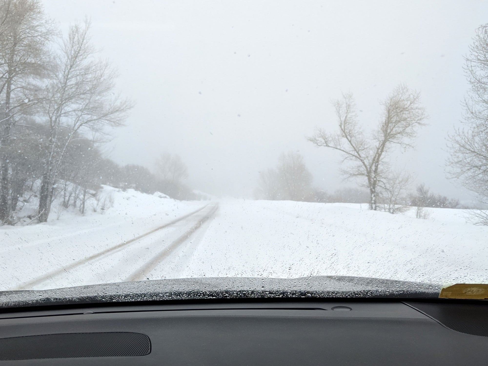
Uh-oh
Not knowing what might lay ahead, we thought better of it and turned around.
Later that evening I Googled US 64 and discovered that we had been headed to Brazos Summit (there had been no sign to indicate this).
https://www.dangerousroads.org/north...os-summit.html
Brazos Summit is a high mountain pass at an elevation of 3.202m (10,507ft) above sea level, located on the San Juan Range of the Rocky Mountains sometimes called the Tusas Mountains, in northern New Mexico, in USA. It’s one of the highest mountain roads of New Mexico….
The summit is located between Tierra Amarilla and Tres Piedras…(exactly where we were headed).
With such a high summit altitude the road can be closed anytime due to snowfall...
Back on 84 the snow was much lighter, the roads merely wet. We passed Echo Amphitheater and eventually drove through the tiny community of Abiquiu.
Having decided to find lunch in Espa�ola instead, we turned onto 285; a quick internet search led us to La Cocina New Mexican restaurant, whose site indicated they had margaritas. Well….this is New Mexico and as it happens their liquor laws are almost as confusing as Utah’s*. This place only had a beer and wine license. Not wanting a wine margarita, I opted for sangria, which wasn’t bad.
The food was good and plentiful, a cheese enchilada plate for me, tacos for Bill. The sopapillas were excellent, although I wish restaurants would bring them out after the meal so they’d still be hot.
*https://ij.org/action-post/liquor-li...ost-1-million/
https://www.abqjournal.com/896517/over-2.html
After lunch, we backtracked 16 miles to Ojo Caliente, got settled and then spent a few hours soaking in their mineral springs. Lovely.
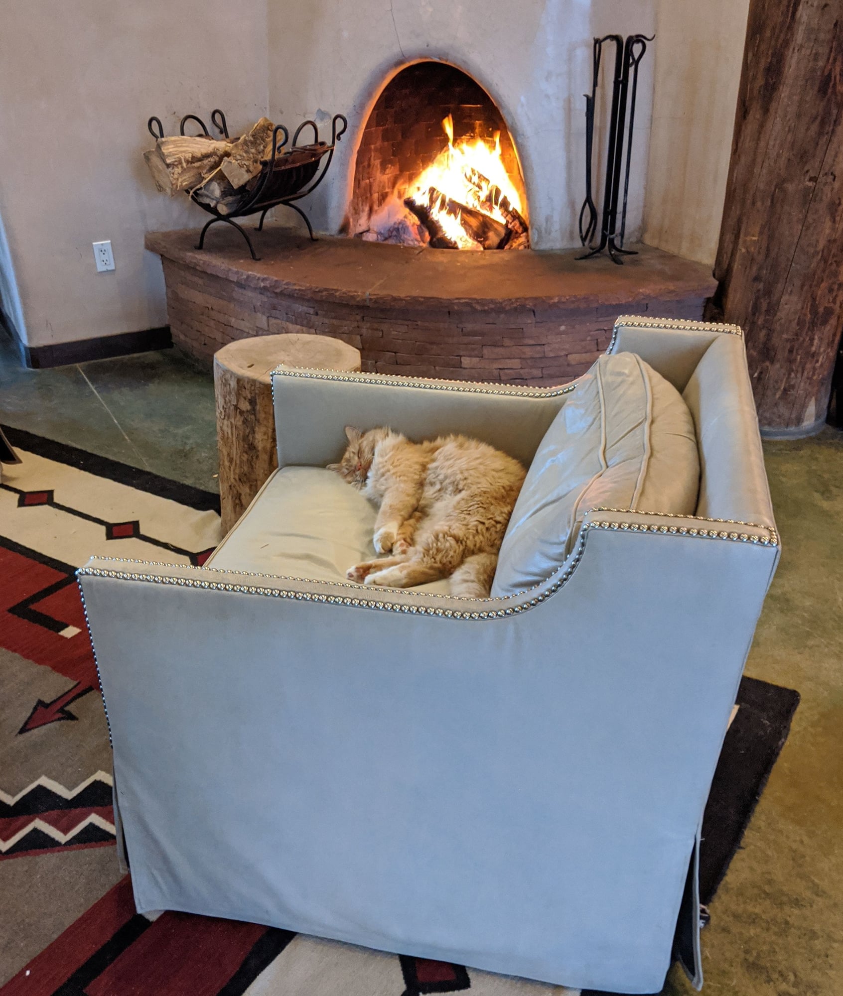
One of Ojo's resident cats in the best seat in the house
I’d made a dinner booking in their Artesian restaurant, but we weren’t very hungry, so we cancelled the booking and shared a margarita flat bread in the bar instead – delicious.
To be continued…
Well, it was bound to happen, the storm found us. We woke to several inches of the white stuff and it was still coming down.
We’d both had a good sleep in a quiet back room of the newly refurbished First Inn (I was surprised I liked the memory foam bed). They’ve done a good job with decor here, despite the unfortunate headboard, which hit us in the back of the head when sitting up.
The inn’s continental breakfast didn’t appeal, so we drove a mile down the road to Boulder Coffee Company for good lattes, a breakfast bagel and a breakfast burrito. Cute place.
We checked out at 11 am and headed out of town on 160, quickly turning south on 84, 35 F and snowing. A truck passed us, veered back into the lane too quickly and showered us with a barrage of rocks, bringing expletives from Bill...@$%#$^&* Texan! We thought for a minute we’d be going home with a cracked windshield as we had last year, but we got lucky this time.
Our destination was Ojo Caliente, NM; we knew we’d be too early to check in, so we decided to make a detour to Taos for lunch at Orlando’s; Bill was still talking about the excellent create-your-own-bowl he had in early December and was eager for an encore.
I re-programmed the GPS and we soon found ourselves on the innocuous looking US 64.
Fifteen miles in we smelled trouble. The snow had become serious, the conditions blizzard-like. The snow was getting deeper and deeper, we were breaking trail, not another vehicle in sight.
Uh-oh
Not knowing what might lay ahead, we thought better of it and turned around.
Later that evening I Googled US 64 and discovered that we had been headed to Brazos Summit (there had been no sign to indicate this).
https://www.dangerousroads.org/north...os-summit.html
Brazos Summit is a high mountain pass at an elevation of 3.202m (10,507ft) above sea level, located on the San Juan Range of the Rocky Mountains sometimes called the Tusas Mountains, in northern New Mexico, in USA. It’s one of the highest mountain roads of New Mexico….
The summit is located between Tierra Amarilla and Tres Piedras…(exactly where we were headed).
With such a high summit altitude the road can be closed anytime due to snowfall...
Back on 84 the snow was much lighter, the roads merely wet. We passed Echo Amphitheater and eventually drove through the tiny community of Abiquiu.
Having decided to find lunch in Espa�ola instead, we turned onto 285; a quick internet search led us to La Cocina New Mexican restaurant, whose site indicated they had margaritas. Well….this is New Mexico and as it happens their liquor laws are almost as confusing as Utah’s*. This place only had a beer and wine license. Not wanting a wine margarita, I opted for sangria, which wasn’t bad.
The food was good and plentiful, a cheese enchilada plate for me, tacos for Bill. The sopapillas were excellent, although I wish restaurants would bring them out after the meal so they’d still be hot.
*https://ij.org/action-post/liquor-li...ost-1-million/
https://www.abqjournal.com/896517/over-2.html
After lunch, we backtracked 16 miles to Ojo Caliente, got settled and then spent a few hours soaking in their mineral springs. Lovely.
One of Ojo's resident cats in the best seat in the house
I’d made a dinner booking in their Artesian restaurant, but we weren’t very hungry, so we cancelled the booking and shared a margarita flat bread in the bar instead – delicious.
To be continued…
Jan 30th, 2020 | 09:21 AM
#17
Original Poster
Joined: Jan 2003
Posts: 21,148
Likes: 83
Jan 22 –
The storm had passed, we woke to a beautiful sunny day – 37 F.
After an early breakfast in the Artesian Restaurant (Huevos Rancheros for Bill, blue corn Pi�on nut pancakes for me, both very good), we headed out for our last soak.
Ojo Caliente fosters an atmosphere of tranquility and peace, and the mineral pools are designated as a ‘whisper zone’. Overnight guests have ‘exclusive access’ to the pools between 7:30 and 9:30, and this is our favorite time to soak, as fewer people are around.
So imagine our surprise when we went out for a peaceful soak to discover that a large group of day visitors had been admitted early and were taking photos of themselves and others in their group in several of the pools. Every single one of them had a cell phone and/or camera, a few had small tripods and they were being raucous and disruptive.
I took the matter up with a gentleman in reception and was told that today was ‘social media day’. What???
Needless to say, our final soak was rather disappointing.
We left at 11 am and headed south on 285, glancing at US 64 as we passed, looking innocuous once again.
The speed limit increased as we crossed back into Colorado, the snow covered Sangre de Cristo Mountains to our right.
Ninety minutes after leaving Ojo Caliente we were in Alamosa, where we sought out Emma’s Authentic Food of the Southwest, another on-the-fly find (our standby, The Rubi Slipper is no longer open for lunch unfortunately). We both had Emma’s Special, a plate with one red and one green enchilada, a taco, the ubiquitous rice and beans and a sopapilla (or is it sopaipilla?) with honey butter. And margaritas! The real ones, with tequila.
Once again we were surprised at how some non-descript small towns have such good food (population 9,871) and wondered for the 100th time why the restaurants and cafes in our town can’t seem to pull that off.
Back on 285 we passed a convertible with its top down – 37 F, brrrr. The snow became more abundant as we passed through Villa Grove, now surrounded by majestic mountains.
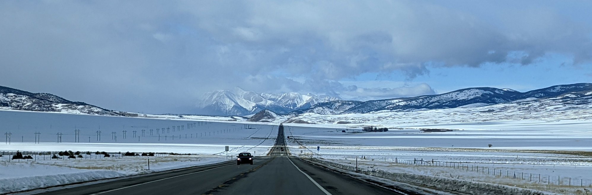
We worked our way over Poncha Pass (9,010 feet), made a pit stop at the tiny Poncha Springs visitor’s center (closed) and then wound our way towards Nathrop, making a detour at Big Bend for some nice views of the Arkansas River.
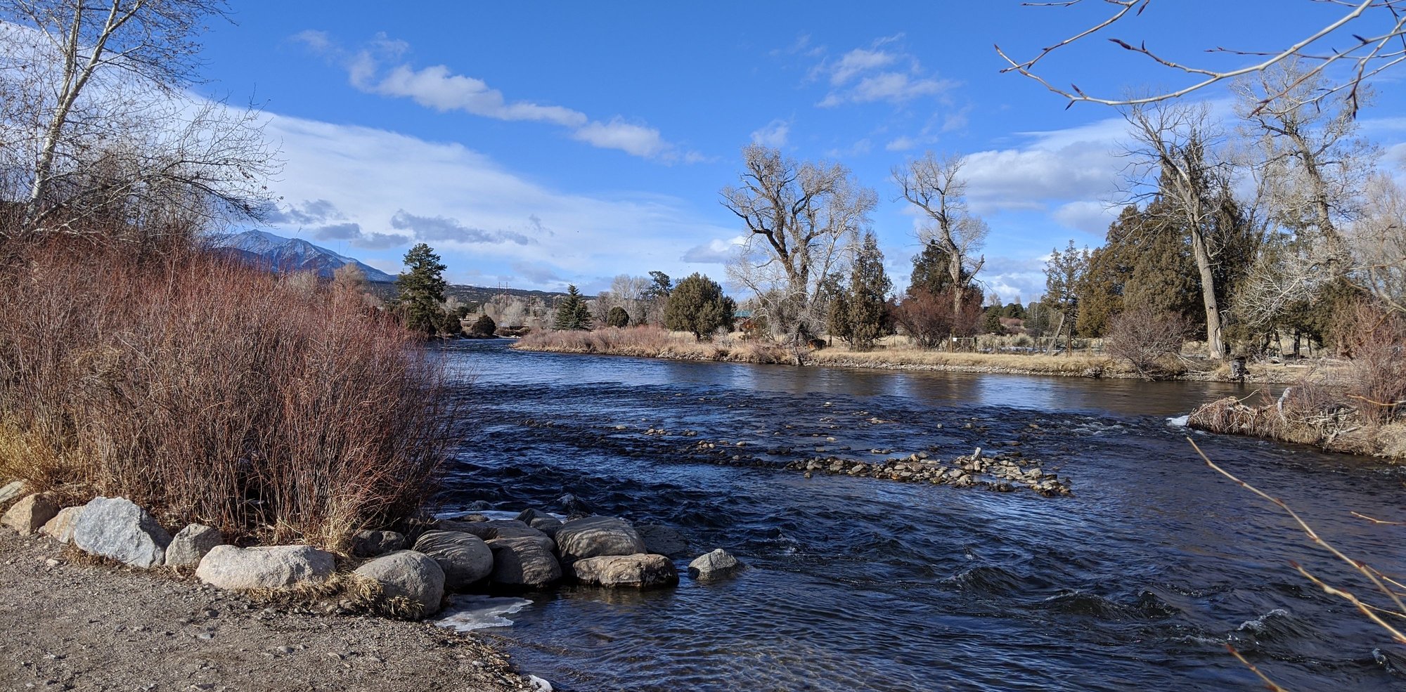
Arkansas River
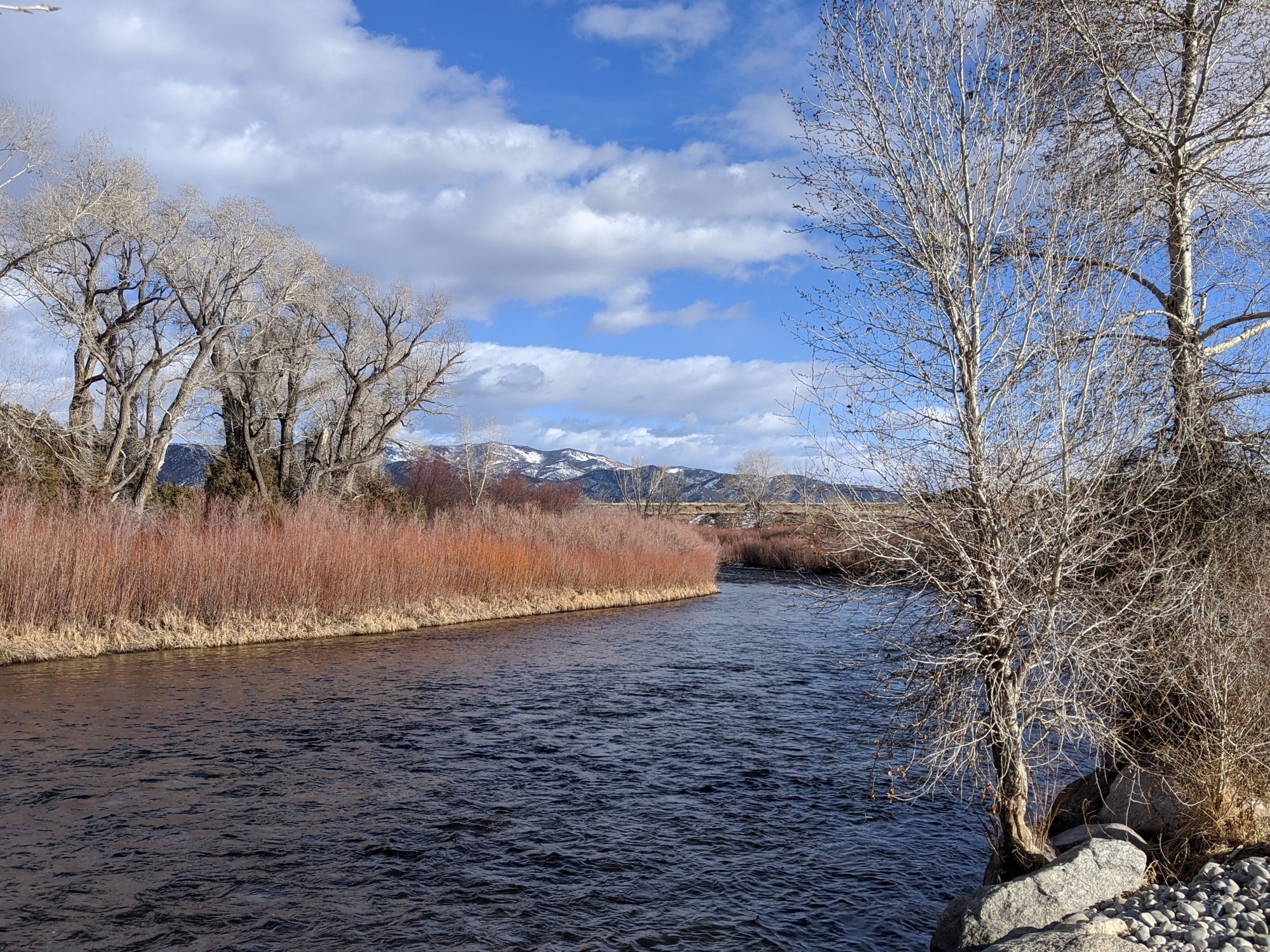
Arkansas River
A few miles later we were pulling into Mount Princeton Hot Springs, our accommodation for the final night of our road trip, where we’d booked a room in the lodge.
We checked in, got settled, put on our swimming togs - and you guessed it – walked down to the hot springs (an icy trek) for a good long soak.
Fortunately we weren’t hungry enough for dinner as our favorite restaurant in Buena Vista is no longer in business.
Jan 23 -
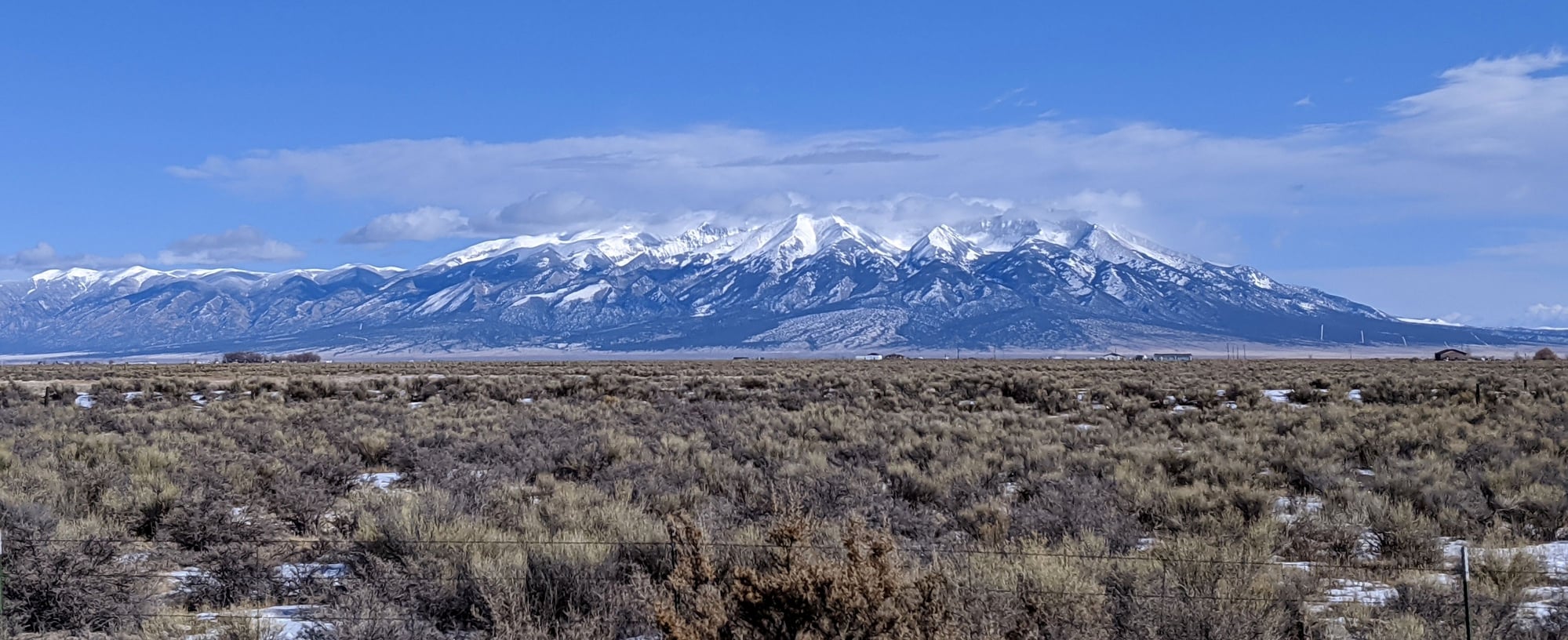
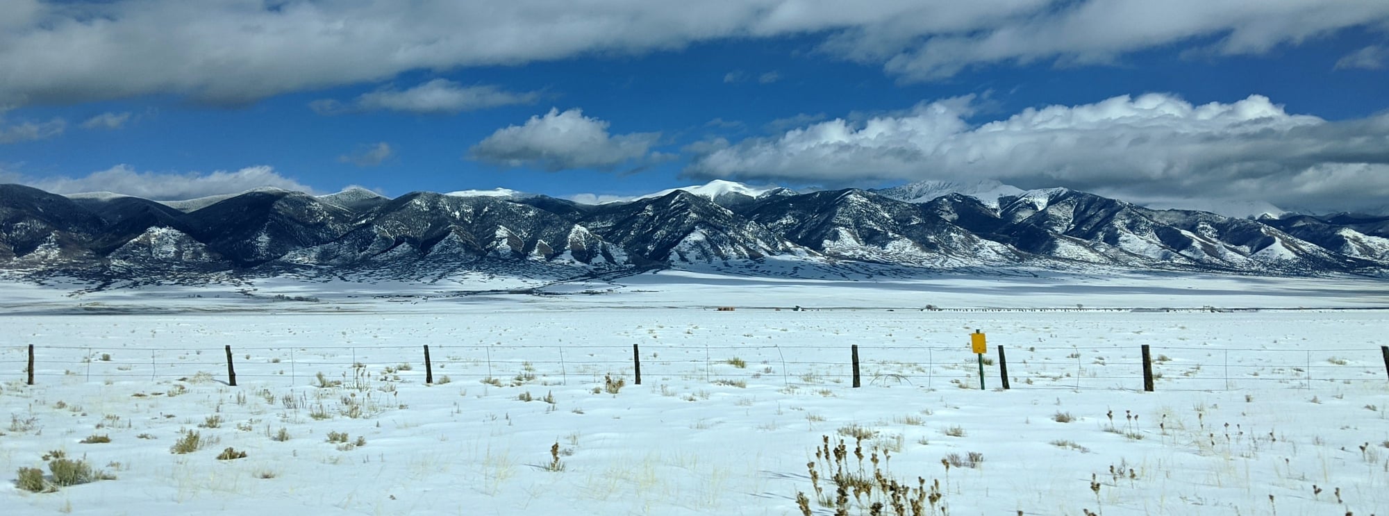
We woke to a beautiful winter day – 26 F. We wanted to squeeze in one last soak before check-out, so we left early and drove into Buena Vista for breakfast at Jan’s (1/2 breakfast burrito for both, good, but expensive for what we got).
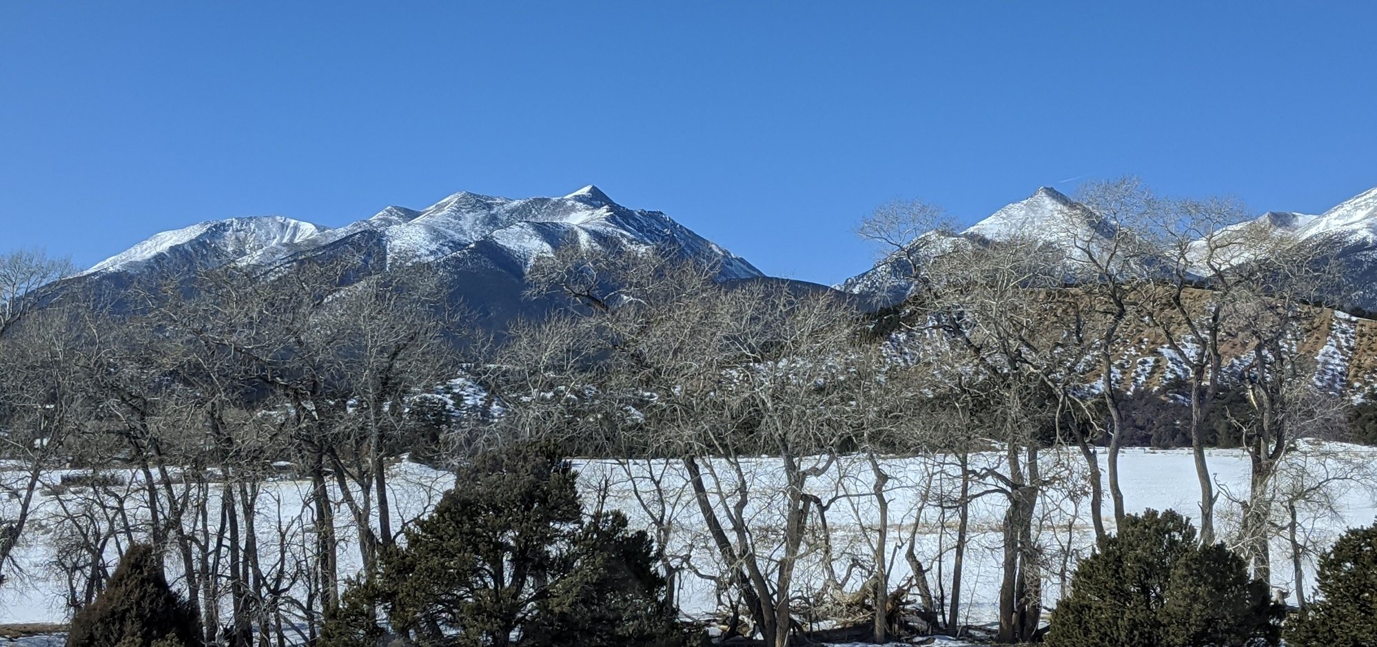
Then we drove to the Roastery for lattes (very good) before heading back to Nathrop for that last soak, me having to stop several times to take photos. Those fabulous views never fail to please - especially when set against a bright blue sky!

Drive from Buena Vista to Nathrop
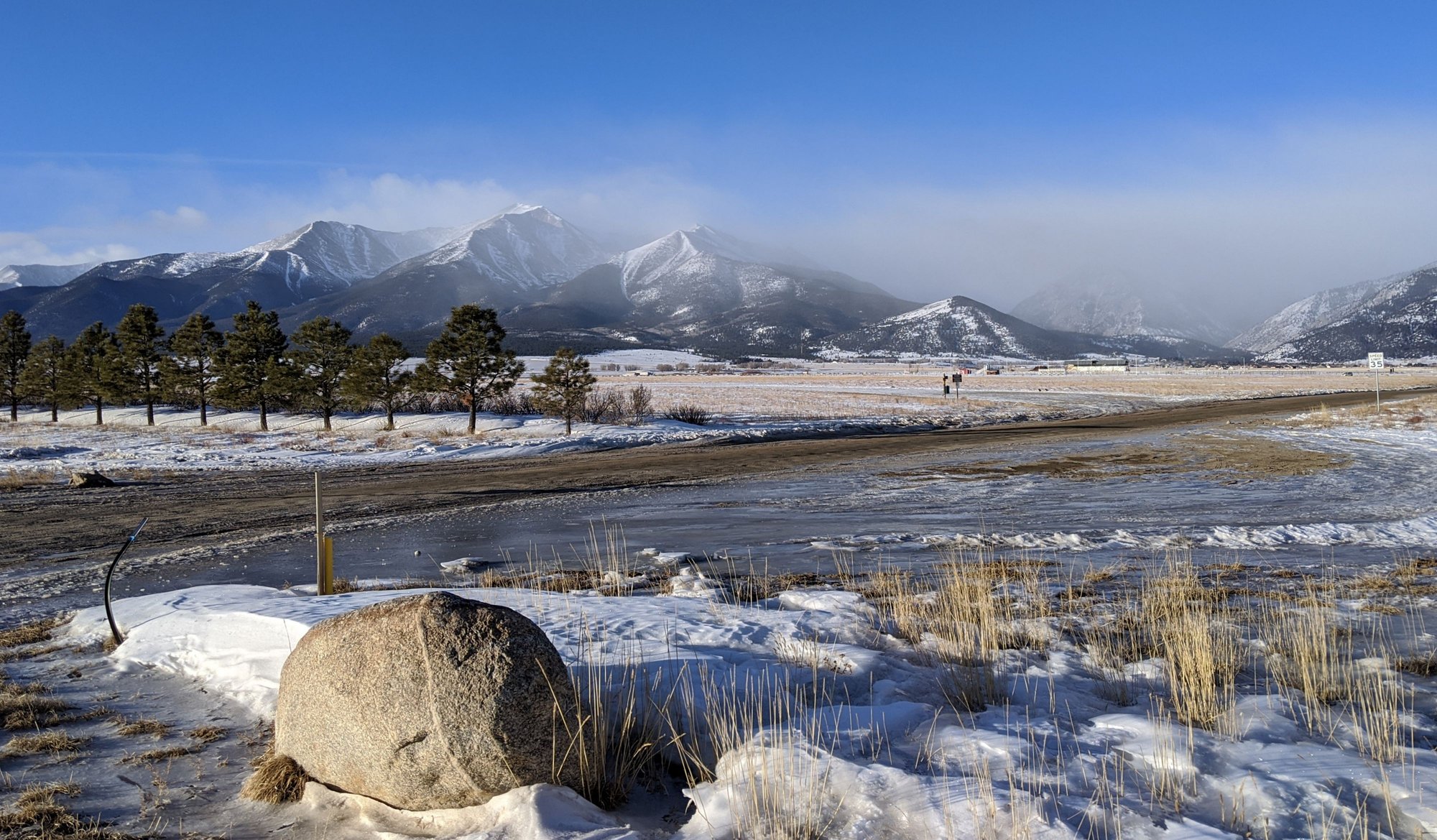
Drive from Buena Vista to Nathrop
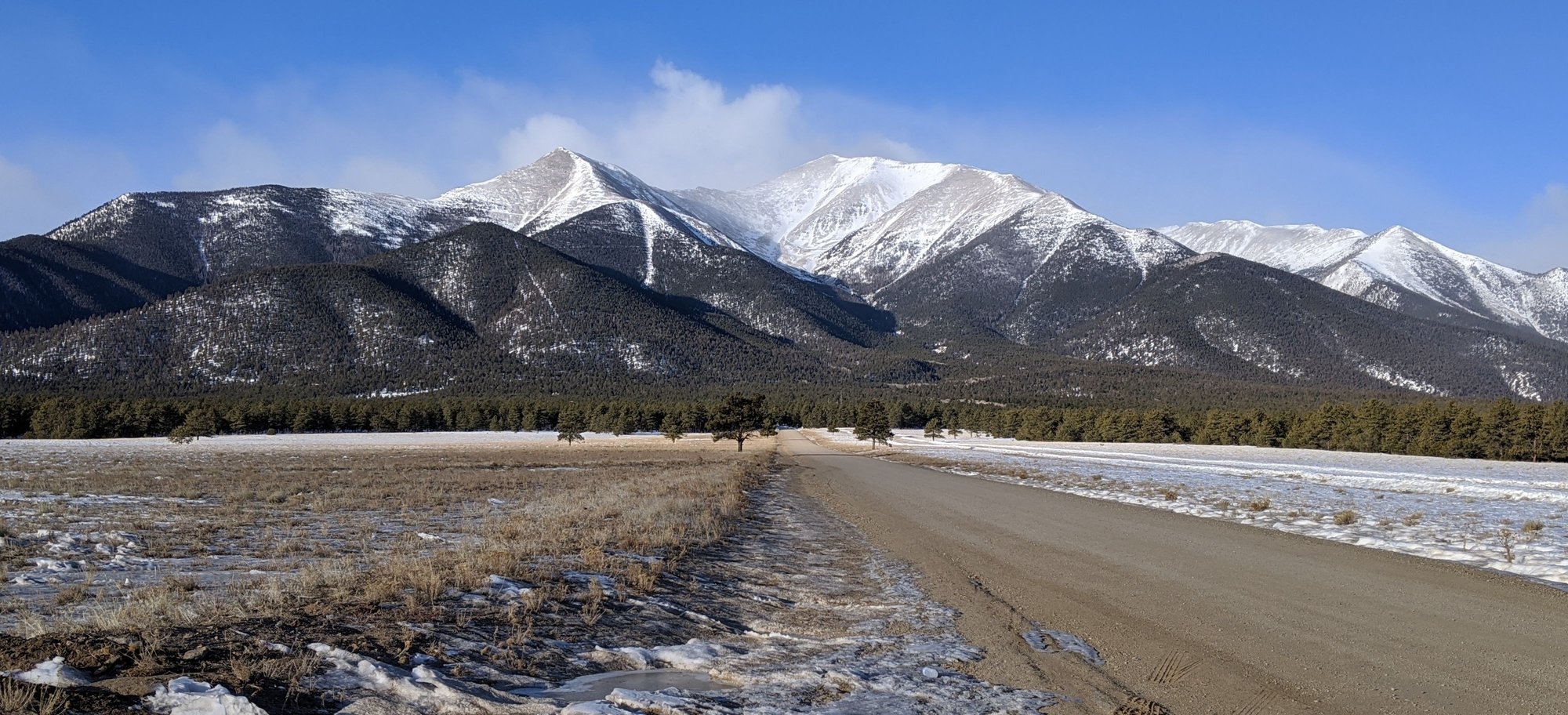
Drive from Buena Vista to Nathrop
Drive from Buena Vista to Nathrop
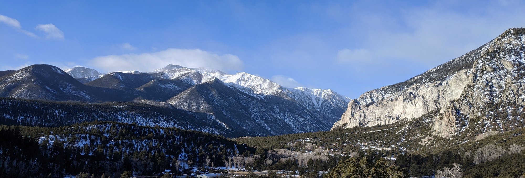
Nathrop
We left Nathrop at 11 am, followed 285 to US 24 and worked our way back through South Park, the roads pretty clear despite the blowing snow. We saw no bison, but several dozen antelope hunkered down hiding from the wind.
Before we knew it we were back home, thankful to have had such beautiful weather and so few other tourists in Moab and wondering if we should do it all again next year.
Thanks for tuning in!
The storm had passed, we woke to a beautiful sunny day – 37 F.
After an early breakfast in the Artesian Restaurant (Huevos Rancheros for Bill, blue corn Pi�on nut pancakes for me, both very good), we headed out for our last soak.
Ojo Caliente fosters an atmosphere of tranquility and peace, and the mineral pools are designated as a ‘whisper zone’. Overnight guests have ‘exclusive access’ to the pools between 7:30 and 9:30, and this is our favorite time to soak, as fewer people are around.
So imagine our surprise when we went out for a peaceful soak to discover that a large group of day visitors had been admitted early and were taking photos of themselves and others in their group in several of the pools. Every single one of them had a cell phone and/or camera, a few had small tripods and they were being raucous and disruptive.
I took the matter up with a gentleman in reception and was told that today was ‘social media day’. What???
Needless to say, our final soak was rather disappointing.
We left at 11 am and headed south on 285, glancing at US 64 as we passed, looking innocuous once again.
The speed limit increased as we crossed back into Colorado, the snow covered Sangre de Cristo Mountains to our right.
Ninety minutes after leaving Ojo Caliente we were in Alamosa, where we sought out Emma’s Authentic Food of the Southwest, another on-the-fly find (our standby, The Rubi Slipper is no longer open for lunch unfortunately). We both had Emma’s Special, a plate with one red and one green enchilada, a taco, the ubiquitous rice and beans and a sopapilla (or is it sopaipilla?) with honey butter. And margaritas! The real ones, with tequila.
Once again we were surprised at how some non-descript small towns have such good food (population 9,871) and wondered for the 100th time why the restaurants and cafes in our town can’t seem to pull that off.
Back on 285 we passed a convertible with its top down – 37 F, brrrr. The snow became more abundant as we passed through Villa Grove, now surrounded by majestic mountains.
We worked our way over Poncha Pass (9,010 feet), made a pit stop at the tiny Poncha Springs visitor’s center (closed) and then wound our way towards Nathrop, making a detour at Big Bend for some nice views of the Arkansas River.
Arkansas River
Arkansas River
A few miles later we were pulling into Mount Princeton Hot Springs, our accommodation for the final night of our road trip, where we’d booked a room in the lodge.
We checked in, got settled, put on our swimming togs - and you guessed it – walked down to the hot springs (an icy trek) for a good long soak.
Fortunately we weren’t hungry enough for dinner as our favorite restaurant in Buena Vista is no longer in business.
Jan 23 -
We woke to a beautiful winter day – 26 F. We wanted to squeeze in one last soak before check-out, so we left early and drove into Buena Vista for breakfast at Jan’s (1/2 breakfast burrito for both, good, but expensive for what we got).
Then we drove to the Roastery for lattes (very good) before heading back to Nathrop for that last soak, me having to stop several times to take photos. Those fabulous views never fail to please - especially when set against a bright blue sky!
Drive from Buena Vista to Nathrop
Drive from Buena Vista to Nathrop
Drive from Buena Vista to Nathrop
Drive from Buena Vista to Nathrop
Nathrop
We left Nathrop at 11 am, followed 285 to US 24 and worked our way back through South Park, the roads pretty clear despite the blowing snow. We saw no bison, but several dozen antelope hunkered down hiding from the wind.
Before we knew it we were back home, thankful to have had such beautiful weather and so few other tourists in Moab and wondering if we should do it all again next year.
Thanks for tuning in!

