


Hurricane Ridge
 Jan 25th, 2023 | 11:42 AM
#1
Original Poster
Joined: Jun 2013
Posts: 18
Likes: 0
Hurricane Ridge
Does anyone know what visiting The Olympic National Park is like during February. Is the Hurricane Ridge open through the week? For lengthy complicated reasons we�re going to travel Pacific Coast Highway from Seattle to LA during February. The park sounds amazing and we�d love to explore, but looks like lots of closures.
Any good advice for areas to visit on the PCH 101?
all appreciated.
Any good advice for areas to visit on the PCH 101?
all appreciated.
 Jan 26th, 2023 | 07:19 AM
#2


Joined: Jan 2003
Posts: 19,873
Likes: 79
Required reading: Hurricane Ridge in Winter - Olympic National Park (U.S. National Park Service) (nps.gov)
Especially this part, assuming you'll be in a rented/hired vehicle:
Rental car companies do not allow the use of tire chains, so unless you want to risk some major penalties (not to mention getting stuck in deep snow) I'd say that's a pretty definitive answer to your question. By the way, the same applies to Mount Rainier National Park, in case you were wondering.
As to the rest of your question, we need a bit more information. First, "PCH" is strictly a southern California term. US 101 has a number of local or regional nicknames, including the "Redwood Highway" and "El Camino Real," but mostly it's just "101." In greater LA, actually the term "PCH" applies mainly to California SR 1, which separates from US 101 at Oxnard and doesn't rejoin until Dana Point in southern Orange County, a distance of around 120 miles. Actual US 101 becomes the Ventura, Hollywood and Santa Ana and Sam Diego freeways, set far from the beach.
So back to your question. How many days will you have, who's traveling, and what are your interests?
While Olympic NP is glorious most of the time, I'd probably say that February is not one of the times I'd spend days circling the peninsula. Hurricane Ridge is pretty much a no-go, and while the rain forests on the Pacific coast (the Hoh and Quinault valleys) are accessible, they will be so wet and likely muddy that any kind of walking is - probably - going to be not much fun. The wild Pacific beaches in the park - those around La Push, Ruby Beach near Kalaloch - will also be accessible but represent a huge detour from Seattle, and one should be aware that there are also many wild and lovely beaches in Oregon and in California that might well stand in as substitutes.
I've driven from Seattle to LA during the winter on numerous occasions, and this is the route I usually take - https://goo.gl/maps/gqRPh1jpbNkhwdH19 . This involves heading south from Seattle on I-5 through Portland and south through the Willamette Valley to Oregon SR 38 near Cottage Grove, then west on SR 38 to US 101 at Reedsport. SR 38 is the quickest and most scenic route through the Coast Range to the coast, and once on 101, you still have the most scenic portion of the Oregon coast ahead of you: basically, from Bandon to the California state line.
Once you've crossed into California, you're in the redwoods, IMO the highlight of the trip, for the next couple hundred miles. South of San Francisco, stay on 101 all the way to San Luis Obispo and Santa Barbara before entering the LA area.
This map - https://goo.gl/maps/u3cnRQVACEtE2C2P6 - adds a couple of detours along the way that you might find worthwhile. The first is Multnomah Falls, along the "waterfall zone" of the Columbia River Gorge just east of Portland. In the winter the waterfalls along this section of the road are nothing short of spectacular.
The second is the Samuel Boardman Scenic Corridor along the southern Oregon coast. The scenery from around Port Orford to Brookings is nonstop spectacular, and this is probably the most spectacular stretch of all.
Third and fourth are located in or just south of Carmel, on the Monterey Peninsula south of San Francisco. The old Spanish mission in Carmel is very lovely, and Point Lobos State Natural Reserve, just south of Carmel, is a stunningly beautiful place. Unfortunately, Calif. Hwy 1 south of Point Lobos is closed due to landslides, so you'll have to return to US 101 and sadly miss the Big Sur coast.
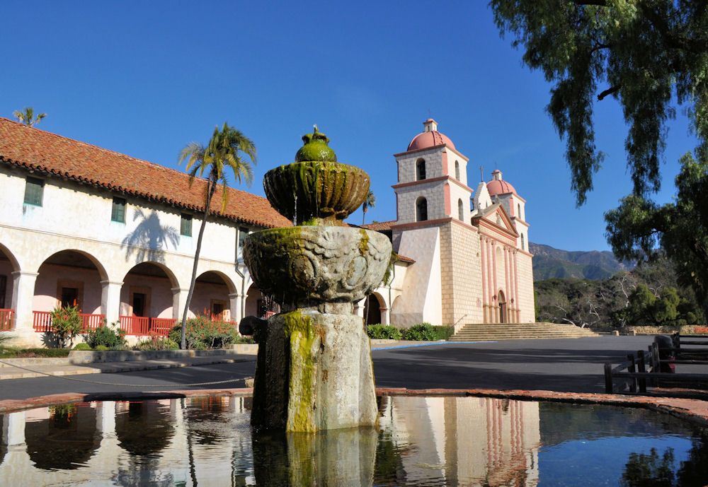
The last detour is in the beautiful city of Santa Barbara, and its Mission Santa Barbara, the "queen of the missions." Hopefully by the time you're at this beautiful place the weather will have become more California-like; if so it's a heart-stopper.
Anyway, hope this helps. Come back with more questions.
Especially this part, assuming you'll be in a rented/hired vehicle:
Originally Posted by NPS
All vehicles, including 4-wheel-drive vehicles, are required to carry tire chains and must be below the Heart O' the Hills entrance station by 5 pm during the winter season.
As to the rest of your question, we need a bit more information. First, "PCH" is strictly a southern California term. US 101 has a number of local or regional nicknames, including the "Redwood Highway" and "El Camino Real," but mostly it's just "101." In greater LA, actually the term "PCH" applies mainly to California SR 1, which separates from US 101 at Oxnard and doesn't rejoin until Dana Point in southern Orange County, a distance of around 120 miles. Actual US 101 becomes the Ventura, Hollywood and Santa Ana and Sam Diego freeways, set far from the beach.
So back to your question. How many days will you have, who's traveling, and what are your interests?
While Olympic NP is glorious most of the time, I'd probably say that February is not one of the times I'd spend days circling the peninsula. Hurricane Ridge is pretty much a no-go, and while the rain forests on the Pacific coast (the Hoh and Quinault valleys) are accessible, they will be so wet and likely muddy that any kind of walking is - probably - going to be not much fun. The wild Pacific beaches in the park - those around La Push, Ruby Beach near Kalaloch - will also be accessible but represent a huge detour from Seattle, and one should be aware that there are also many wild and lovely beaches in Oregon and in California that might well stand in as substitutes.
I've driven from Seattle to LA during the winter on numerous occasions, and this is the route I usually take - https://goo.gl/maps/gqRPh1jpbNkhwdH19 . This involves heading south from Seattle on I-5 through Portland and south through the Willamette Valley to Oregon SR 38 near Cottage Grove, then west on SR 38 to US 101 at Reedsport. SR 38 is the quickest and most scenic route through the Coast Range to the coast, and once on 101, you still have the most scenic portion of the Oregon coast ahead of you: basically, from Bandon to the California state line.
Once you've crossed into California, you're in the redwoods, IMO the highlight of the trip, for the next couple hundred miles. South of San Francisco, stay on 101 all the way to San Luis Obispo and Santa Barbara before entering the LA area.
This map - https://goo.gl/maps/u3cnRQVACEtE2C2P6 - adds a couple of detours along the way that you might find worthwhile. The first is Multnomah Falls, along the "waterfall zone" of the Columbia River Gorge just east of Portland. In the winter the waterfalls along this section of the road are nothing short of spectacular.
The second is the Samuel Boardman Scenic Corridor along the southern Oregon coast. The scenery from around Port Orford to Brookings is nonstop spectacular, and this is probably the most spectacular stretch of all.
Third and fourth are located in or just south of Carmel, on the Monterey Peninsula south of San Francisco. The old Spanish mission in Carmel is very lovely, and Point Lobos State Natural Reserve, just south of Carmel, is a stunningly beautiful place. Unfortunately, Calif. Hwy 1 south of Point Lobos is closed due to landslides, so you'll have to return to US 101 and sadly miss the Big Sur coast.
The last detour is in the beautiful city of Santa Barbara, and its Mission Santa Barbara, the "queen of the missions." Hopefully by the time you're at this beautiful place the weather will have become more California-like; if so it's a heart-stopper.
Anyway, hope this helps. Come back with more questions.
Last edited by Gardyloo; Jan 26th, 2023 at 07:33 AM.
Jan 26th, 2023 | 07:29 AM
#3
Joined: Jan 2003
Posts: 17,749
Likes: 0
We really enjoy Hurricane Ridge in the winter, but we are snowshoers. Hr is only open on weekends in the winter, and there is a shuttle service that will take you. This might be your best bet if you are in a rental car so that you don't have to deal with the chain issue. Here is the link for the shuttle.
https://www.hikeolympic.com/hurrican...winter-shuttle
https://www.hikeolympic.com/hurrican...winter-shuttle
Jan 26th, 2023 | 07:37 AM
#4
Joined: Nov 2010
Posts: 11,752
Likes: 17
We really enjoy Hurricane Ridge in the winter, but we are snowshoers. Hr is only open on weekends in the winter, and there is a shuttle service that will take you. This might be your best bet if you are in a rental car so that you don't have to deal with the chain issue. Here is the link for the shuttle.
https://www.hikeolympic.com/hurrican...winter-shuttle
https://www.hikeolympic.com/hurrican...winter-shuttle
Jan 26th, 2023 | 07:55 AM
#5
Joined: Jan 2003
Posts: 17,749
Likes: 0
tomfuller--There is snowshoe rental there. https://www.olympicnationalparks.com...wboard-tubing/
Yes, you definitely need them to go past the lodge
Yes, you definitely need them to go past the lodge
Jan 26th, 2023 | 11:42 PM
#6
Original Poster
Joined: Jun 2013
Posts: 18
Likes: 0
Required reading: Hurricane Ridge in Winter - Olympic National Park (U.S. National Park Service) (nps.gov)
Especially this part, assuming you'll be in a rented/hired vehicle:
Rental car companies do not allow the use of tire chains, so unless you want to risk some major penalties (not to mention getting stuck in deep snow) I'd say that's a pretty definitive answer to your question. By the way, the same applies to Mount Rainier National Park, in case you were wondering.
As to the rest of your question, we need a bit more information. First, "PCH" is strictly a southern California term. US 101 has a number of local or regional nicknames, including the "Redwood Highway" and "El Camino Real," but mostly it's just "101." In greater LA, actually the term "PCH" applies mainly to California SR 1, which separates from US 101 at Oxnard and doesn't rejoin until Dana Point in southern Orange County, a distance of around 120 miles. Actual US 101 becomes the Ventura, Hollywood and Santa Ana and Sam Diego freeways, set far from the beach.
So back to your question. How many days will you have, who's traveling, and what are your interests?
While Olympic NP is glorious most of the time, I'd probably say that February is not one of the times I'd spend days circling the peninsula. Hurricane Ridge is pretty much a no-go, and while the rain forests on the Pacific coast (the Hoh and Quinault valleys) are accessible, they will be so wet and likely muddy that any kind of walking is - probably - going to be not much fun. The wild Pacific beaches in the park - those around La Push, Ruby Beach near Kalaloch - will also be accessible but represent a huge detour from Seattle, and one should be aware that there are also many wild and lovely beaches in Oregon and in California that might well stand in as substitutes.
I've driven from Seattle to LA during the winter on numerous occasions, and this is the route I usually take - https://goo.gl/maps/gqRPh1jpbNkhwdH19 . This involves heading south from Seattle on I-5 through Portland and south through the Willamette Valley to Oregon SR 38 near Cottage Grove, then west on SR 38 to US 101 at Reedsport. SR 38 is the quickest and most scenic route through the Coast Range to the coast, and once on 101, you still have the most scenic portion of the Oregon coast ahead of you: basically, from Bandon to the California state line.
Once you've crossed into California, you're in the redwoods, IMO the highlight of the trip, for the next couple hundred miles. South of San Francisco, stay on 101 all the way to San Luis Obispo and Santa Barbara before entering the LA area.
This map - https://goo.gl/maps/u3cnRQVACEtE2C2P6 - adds a couple of detours along the way that you might find worthwhile. The first is Multnomah Falls, along the "waterfall zone" of the Columbia River Gorge just east of Portland. In the winter the waterfalls along this section of the road are nothing short of spectacular.
The second is the Samuel Boardman Scenic Corridor along the southern Oregon coast. The scenery from around Port Orford to Brookings is nonstop spectacular, and this is probably the most spectacular stretch of all.
Third and fourth are located in or just south of Carmel, on the Monterey Peninsula south of San Francisco. The old Spanish mission in Carmel is very lovely, and Point Lobos State Natural Reserve, just south of Carmel, is a stunningly beautiful place. Unfortunately, Calif. Hwy 1 south of Point Lobos is closed due to landslides, so you'll have to return to US 101 and sadly miss the Big Sur coast.
The last detour is in the beautiful city of Santa Barbara, and its Mission Santa Barbara, the "queen of the missions." Hopefully by the time you're at this beautiful place the weather will have become more California-like; if so it's a heart-stopper.
Anyway, hope this helps. Come back with more questions.
Jan 27th, 2023 | 06:45 PM
#7
Joined: Jan 2003
Posts: 17,749
Likes: 0
Lake Quinault Lodge is beautiful, in a rustic way. We have loved our stays there. PA still has a lot to see nearby, even if HR is not an option for you. Marymere Falls is not far, and Dungeness Spit is a beautiful area to walk and explore.
Trending Topics
Jan 28th, 2023 | 02:15 PM
#8
Joined: Mar 2003
Posts: 23,439
Likes: 0
As a slower alternative to US 101 in northern California, you can take SR 1 from Leggett all the way to San Francisco and again SR 1 from Pacifica to Monterey.
https://flic.kr/p/2jgToNX https://flic.kr/p/g5UMiJ
https://flic.kr/p/8oUVqN https://flic.kr/p/b9bj1x https://flic.kr/p/RqRiQJ
https://flic.kr/p/2jgToNX https://flic.kr/p/g5UMiJ
https://flic.kr/p/8oUVqN https://flic.kr/p/b9bj1x https://flic.kr/p/RqRiQJ

Thread
Original Poster
Forum
Replies
Last Post
Daydreamer
United States
14
Jun 10th, 2006 03:01 AM
jewelhawg
United States
11
Oct 13th, 2004 10:57 AM


