


Got rocks? A winter visit to Utah’s Orogenous Zones
 Jan 23rd, 2022 | 09:36 AM
#1
Original Poster


Joined: Jan 2003
Posts: 21,148
Likes: 83
Got rocks? A winter visit to Utah’s Orogenous Zones
This trip was planned for January 2021, but like so many others in the past two years, quickly became a COVID casualty when cases in Utah skyrocketed.
Because we’d had such a good time visiting Arches and Canyonlands in January of 2020 – and because we just can’t deal with Utah’s stifling heat and oppressive crowds in the high season - we thought we’d give the remaining three of the Mighty 5 a go in January. Crazy? We were about to find out.
Putting together the itinerary was easy enough, as I’d already done so for the cancelled 2021 trip; I deleted a night in Grand Junction and added a night in Moab, and changed a hotel or two, but otherwise, it was the same.
The itinerary:
Grand Junction, CO – one night
Torrey, UT – three nights
Escalante, UT – two nights
Bryce Canyon, UT – three nights
Zion, UT – three nights
St. George, UT – two nights
Moab, UT – two nights
Interestingly enough, almost every hotel had substantially increased its rates; some that had offered breakfast no longer did so, and in every single case, the cancellation policy had changed – to the hotel’s benefit of course.
Also interesting, yet not surprising – many of the restaurants I’d earmarked as open in the off season in 2021 were no longer open, or had gone out of business altogether.
So, for the first time in recent memory, we had to pack as if we were camping.
Self-catering from a hotel room isn’t without its challenges; I’d packed shelf stable items that could be warmed in a microwave and fresh food that could chilled in a small fridge. That’s about as exciting as it was going to get. We might not be eating like kings, but we certainly weren’t going to go hungry.
We’d kept a close eye on the weather and changed our original routing via Leadville, Tennessee Pass, Minturn, and I-70 as a storm from the north moved in just prior to our departure.
We opted to take a different route via Monarch Pass, Gunnison, Montrose and Delta instead. We generally try to avoid the busiest bits of I-70 anyway; it's fraught with problems and gives us both the heebie-jeebies.
Monarch Pass was due to receive two inches of snow the night prior to our departure, but our hope was that it would be cleared by the time we reached it around lunchtime.
In preparation for the trip, we had the Outback serviced and purchased snow tires. The AWD tires still had enough tread to be legal for winter driving in CO, but we decided to play it safe and give dedicated snow tires a go this year.
Between our luggage, our winter clothing and hiking gear, food and two coolers, the Outback was rather full, but we were ready to go.
To be continued...
Last edited by Melnq8; Jan 23rd, 2022 at 09:45 AM.

 Jan 23rd, 2022 | 11:50 AM
#5
Original Poster
Joined: Jan 2003
Posts: 21,148
Likes: 83
January 6 –
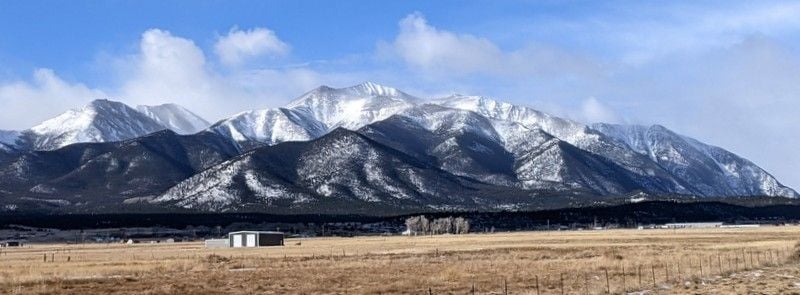
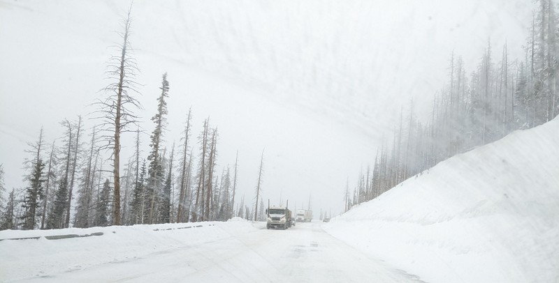
It was 15 F when we left our Colorado mountain home around 8:30 am, driving the 5.5 hours to Grand Junction. Our route took us via Hartsel, Buena Vista and Monarch Pass, which was slow going thanks to the blowing snow and snow pack. Not surprising, the snow chain law was in effect for commercial vehicles and we were glad to have those new snow tires as we crossed the 11,312 foot high pass.
Near Salida
Monarch Pass through a dirty windshield
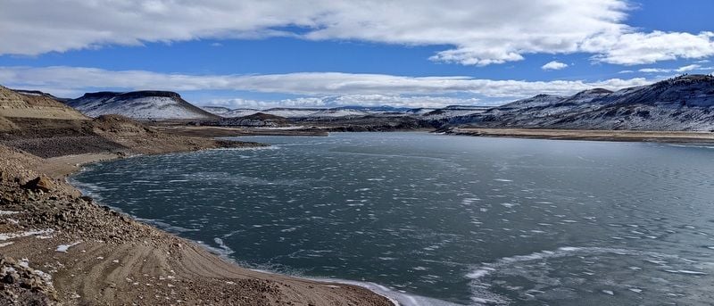
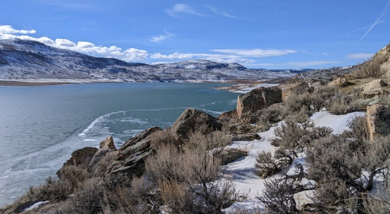
We then continued on to Gunnison where we stopped for a quick lunch before skirting Blue Mesa Reservoir and working our way to Montrose, Delta (50 F here) and eventually Fruita, CO.
Blue Mesa Reservoir
Blue Mesa Reservoir
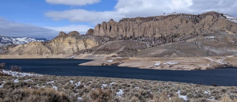
Blue Mesa Reservoir
FYI – there’s road construction on Highway 50 between mile markers 123 and 127 (Little Blue Creek Canyon) and one normally has to time their arrival well as the road is only open for limited hours, but it’s been suspended until March 2022, so no worries in the winter.
https://www.us50info.com/
After the obligatory coffee and almond toffee ice cream stop at Enstrom's, we took a quick drive up to Colorado National Monument to soak up the views, then popped in to visit a niece and her family for an overdue catch-up.
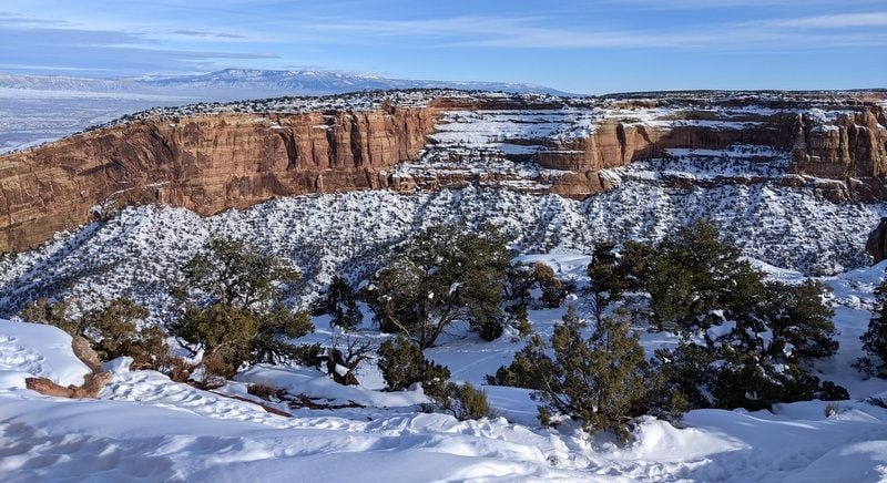
Colorado National Monument
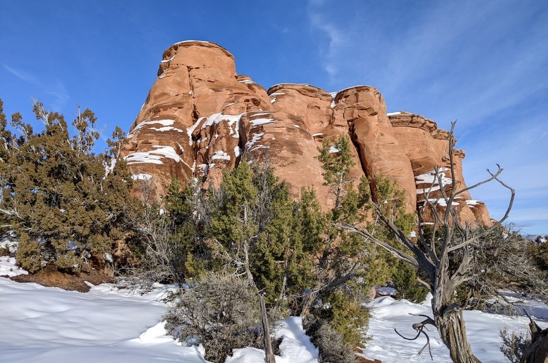
Colorado National Monument
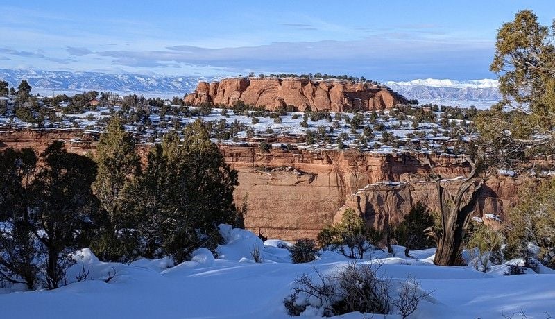
Colorado National Monument
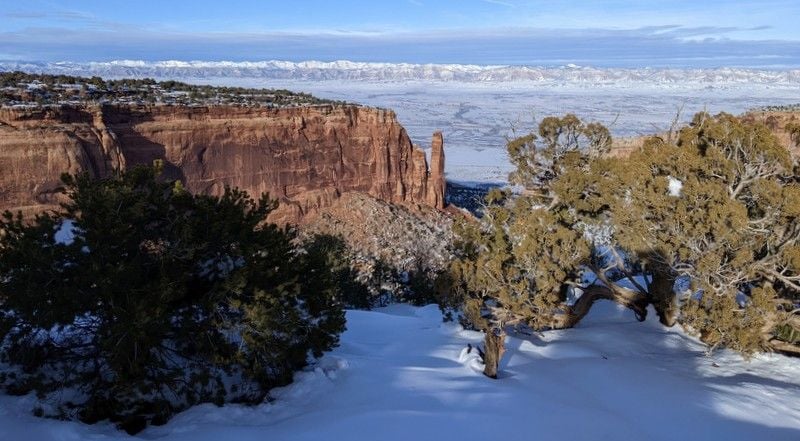
Colorado National Monument

Colorado National Monument
We love Indian food, so I’d earmarked Guru's in Grand Junction, where we had a very good meal before crashing in our lovely hotel on the campus of Colorado Mesa University, our favorite place to stay in the area (Hotel Maverick - we’d taken advantage of a winter special, $138).
To be continued...
It was 15 F when we left our Colorado mountain home around 8:30 am, driving the 5.5 hours to Grand Junction. Our route took us via Hartsel, Buena Vista and Monarch Pass, which was slow going thanks to the blowing snow and snow pack. Not surprising, the snow chain law was in effect for commercial vehicles and we were glad to have those new snow tires as we crossed the 11,312 foot high pass.
Near Salida
Monarch Pass through a dirty windshield
We then continued on to Gunnison where we stopped for a quick lunch before skirting Blue Mesa Reservoir and working our way to Montrose, Delta (50 F here) and eventually Fruita, CO.
Blue Mesa Reservoir
Blue Mesa Reservoir
Blue Mesa Reservoir
FYI – there’s road construction on Highway 50 between mile markers 123 and 127 (Little Blue Creek Canyon) and one normally has to time their arrival well as the road is only open for limited hours, but it’s been suspended until March 2022, so no worries in the winter.
https://www.us50info.com/
After the obligatory coffee and almond toffee ice cream stop at Enstrom's, we took a quick drive up to Colorado National Monument to soak up the views, then popped in to visit a niece and her family for an overdue catch-up.
Colorado National Monument
Colorado National Monument
Colorado National Monument
Colorado National Monument
Colorado National Monument
We love Indian food, so I’d earmarked Guru's in Grand Junction, where we had a very good meal before crashing in our lovely hotel on the campus of Colorado Mesa University, our favorite place to stay in the area (Hotel Maverick - we’d taken advantage of a winter special, $138).
To be continued...
Jan 23rd, 2022 | 12:20 PM
#6
Original Poster
Joined: Jan 2003
Posts: 21,148
Likes: 83
January 7 –
Our day started with a gut-busting breakfast for Bill at the aptly named Pufferbelly's. I'm not much of a breakfast eater, so I chose to reserve my calories for an early lunch of ice cream at Enstrom's instead; we had a short drive today, 3.5 hours.
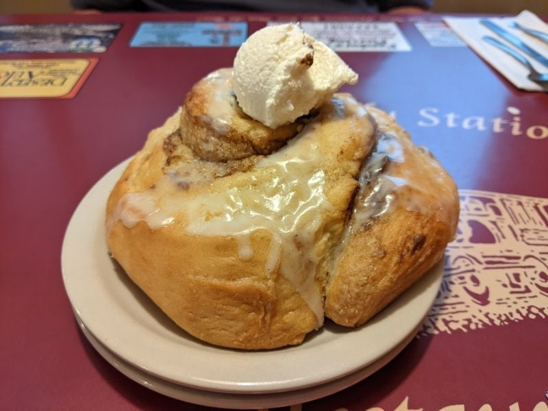
Pufferbelly's
We then headed west on I-70 through some 70 miles of nothingness to Green River, soon leaving the snow behind. No trees, no hills, not so much as an antelope to look at. The landscape looked inhospitable and hot, but it was only 46 F. We were now in the land of rocks, commercial semis and the remnants of shredded re-tread tires.
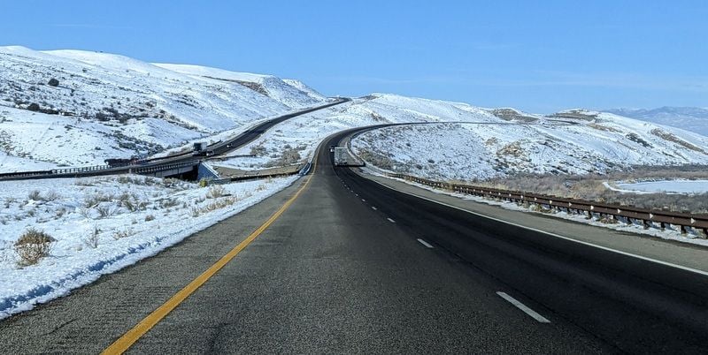
Leaving CO on I-70 west
Things became slightly more interesting after Green River - in the form of Utahn jebels - we half expected to see camels.
We joined Utah 24 to Hanksville and worked our way through the lonely desert, not another car in sight. We passed the entrance to Goblin Valley State Park and the occasional sand dune.
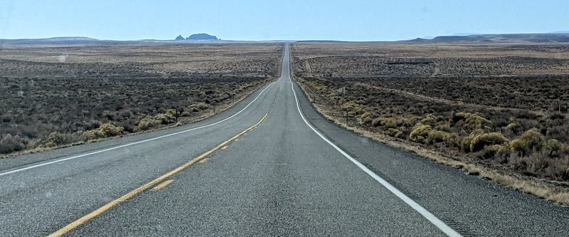
UT 24
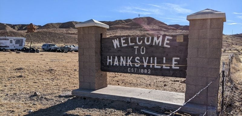
Hanksville consisted of a handful of trailers, an abandoned hotel, a gas station and the biggest building by far, the UT Department of Transportation.
As exciting as it looks
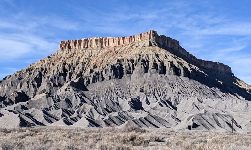
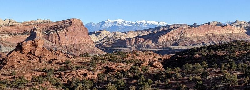
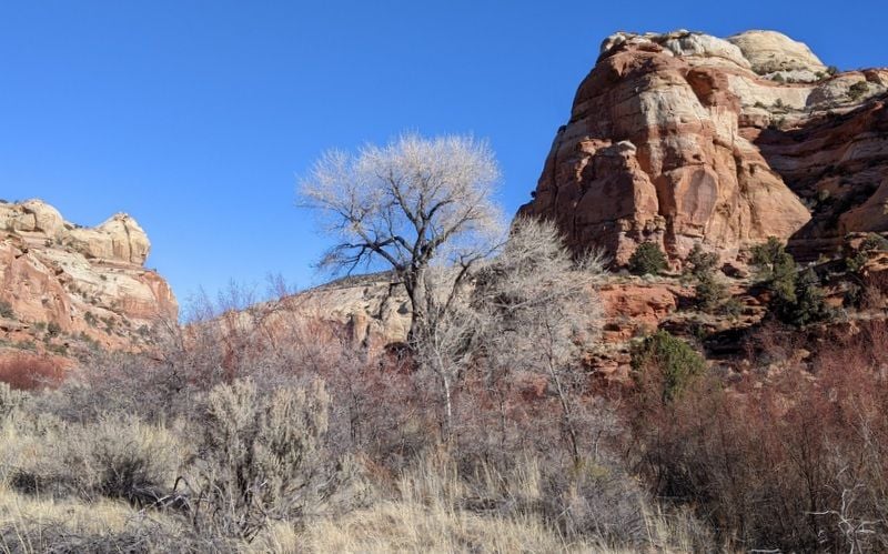
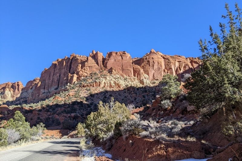
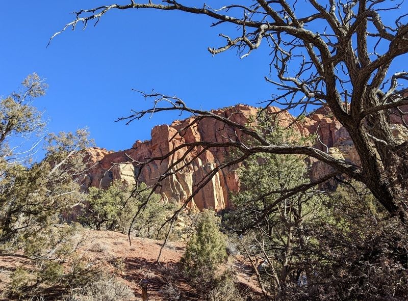
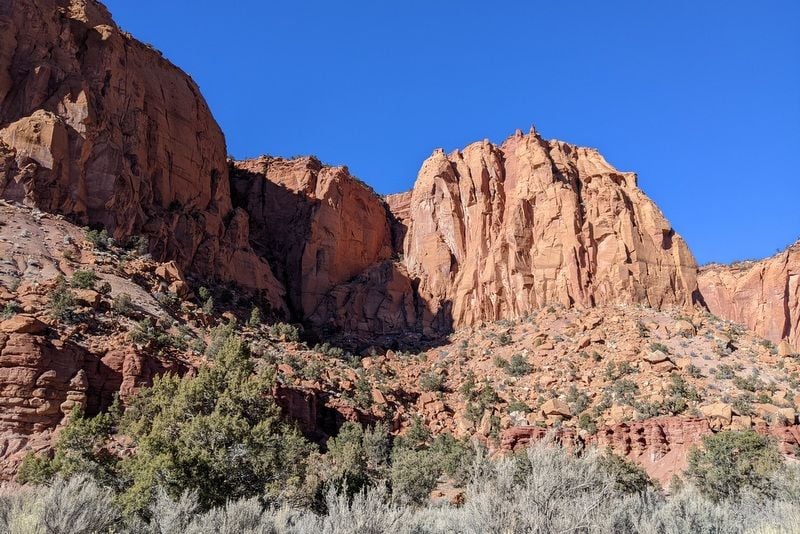
The landscape progressively became more interesting as we approached Fruita, Utah and Capitol Reef National Park.
Approaching Capitol Reef
Approaching Capitol Reef

Approaching Capitol Reef
Now this was something.
I hadn’t made the connection between Fruita, UT and fruit (duh), so I was surprised to see orchards, albeit leafless and dormant. I’ve since learned that these orchards are famous, and a“historical agricultural site with over 3,000 fruit, berry and nut trees. During picking season, (park) staff will post "U-Pick" signs where fruit is available for harvest”. Huh.
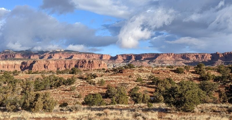
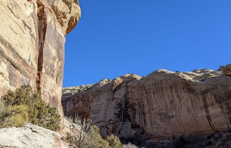
We stopped at the Capitol Reef Visitor’s Center; just in time for a 3 pm Geological Talk, so we sat in; just the two of us and one other visitor; it was a nice afternoon, 52 F.

Capitol Reef
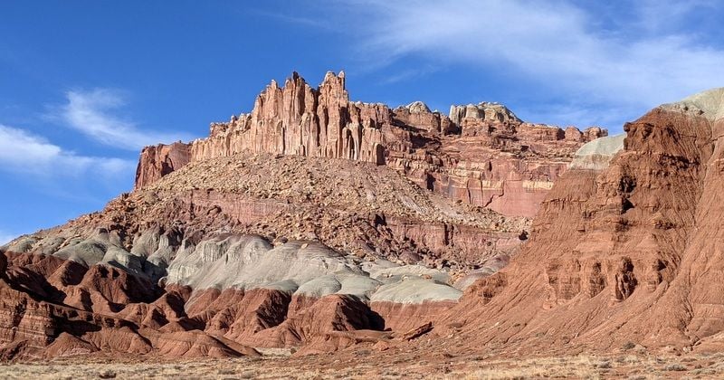
Capitol Reef
Capitol Reef
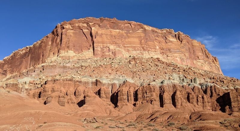
Capitol Reef
Capitol Reef
Capitol Reef
After some cursory exploring, we got settled in our hotel, Red Sands, in the metropolis of Torrey, UT (population 316), our Capitol Reef base for the next three nights ($181 plus the redemption of two Hotels.com free nights we’d earned).
As it turned out, only three rooms of this 60 room hotel were occupied during our stay. I’d booked a Cathedral Room, which was very spacious; KS bed, couch with table, small fridge, microwave and more surface area than I’ve seen in a hotel, which came in handy for those self-catered meals. The hotel has a pool and hot tub (which we had to ourselves). No breakfast, but coffee, tea, hot chocolate and oatmeal were offered. The attached restaurant was only open from Wed-Sat mornings from 7-10 am.
This should be interesting.
To be continued...
Our day started with a gut-busting breakfast for Bill at the aptly named Pufferbelly's. I'm not much of a breakfast eater, so I chose to reserve my calories for an early lunch of ice cream at Enstrom's instead; we had a short drive today, 3.5 hours.
Pufferbelly's
We then headed west on I-70 through some 70 miles of nothingness to Green River, soon leaving the snow behind. No trees, no hills, not so much as an antelope to look at. The landscape looked inhospitable and hot, but it was only 46 F. We were now in the land of rocks, commercial semis and the remnants of shredded re-tread tires.
Leaving CO on I-70 west
Things became slightly more interesting after Green River - in the form of Utahn jebels - we half expected to see camels.
We joined Utah 24 to Hanksville and worked our way through the lonely desert, not another car in sight. We passed the entrance to Goblin Valley State Park and the occasional sand dune.
UT 24
Hanksville consisted of a handful of trailers, an abandoned hotel, a gas station and the biggest building by far, the UT Department of Transportation.
As exciting as it looks
The landscape progressively became more interesting as we approached Fruita, Utah and Capitol Reef National Park.
Approaching Capitol Reef
Approaching Capitol Reef
Approaching Capitol Reef
Now this was something.
I hadn’t made the connection between Fruita, UT and fruit (duh), so I was surprised to see orchards, albeit leafless and dormant. I’ve since learned that these orchards are famous, and a“historical agricultural site with over 3,000 fruit, berry and nut trees. During picking season, (park) staff will post "U-Pick" signs where fruit is available for harvest”. Huh.
We stopped at the Capitol Reef Visitor’s Center; just in time for a 3 pm Geological Talk, so we sat in; just the two of us and one other visitor; it was a nice afternoon, 52 F.
Capitol Reef
Capitol Reef
Capitol Reef
Capitol Reef
Capitol Reef
Capitol Reef
After some cursory exploring, we got settled in our hotel, Red Sands, in the metropolis of Torrey, UT (population 316), our Capitol Reef base for the next three nights ($181 plus the redemption of two Hotels.com free nights we’d earned).
As it turned out, only three rooms of this 60 room hotel were occupied during our stay. I’d booked a Cathedral Room, which was very spacious; KS bed, couch with table, small fridge, microwave and more surface area than I’ve seen in a hotel, which came in handy for those self-catered meals. The hotel has a pool and hot tub (which we had to ourselves). No breakfast, but coffee, tea, hot chocolate and oatmeal were offered. The attached restaurant was only open from Wed-Sat mornings from 7-10 am.
This should be interesting.
To be continued...

Trending Topics
Jan 23rd, 2022 | 02:42 PM
#8
Original Poster
Joined: Jan 2003
Posts: 21,148
Likes: 83
January 8 -
Our first full day in Capitol Reef was a long one...eight hours. We’d checked the weather forecast the night before and were expecting a partly cloudy day.
So imagine our surprise when we pulled the curtains and saw this:
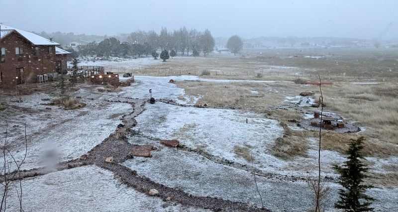
View from hotel window
Fortunately the mini blizzard was a distant memory by 9:30 – the nasty wind remained for a while, but eventually we were left with beautiful blue skies and temps in the low to mid-40's. Perfect hiking weather.
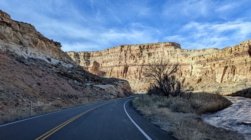
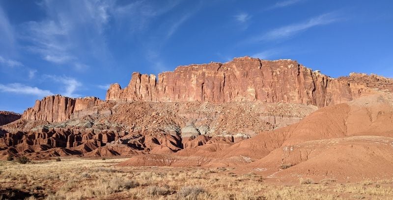
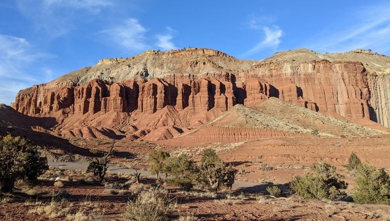
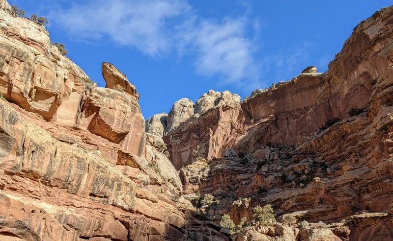
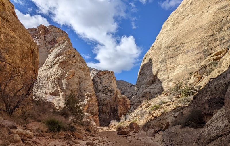
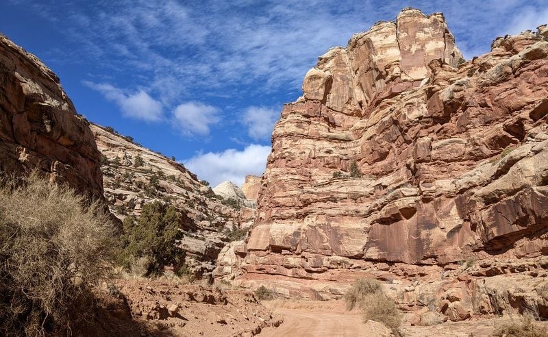
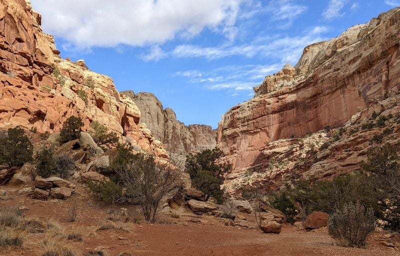
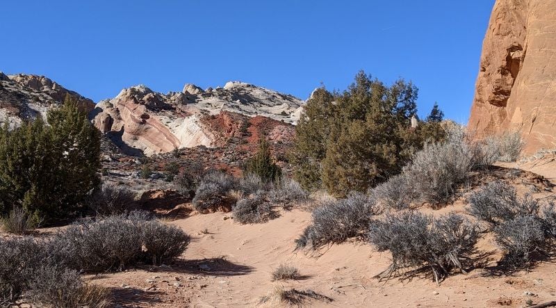
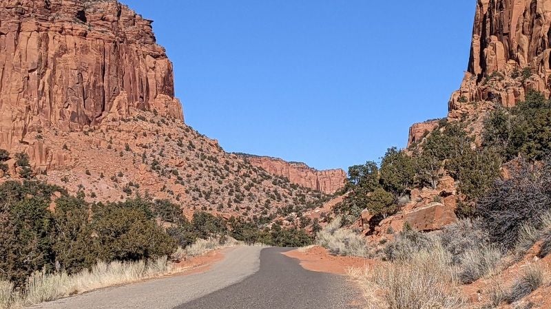
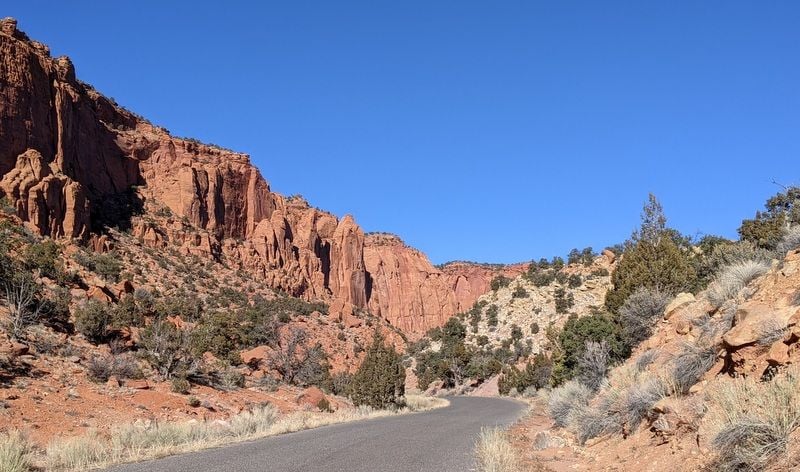
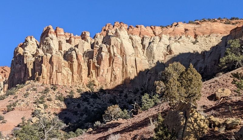
Our day began on the Scenic Road ($20 or annual parks pass needed, no charge for the rest of the park and no distinct entrance and exit), where we left the asphalt and followed the dirt road to its end, and then set out on the sheer-sided Capitol Gorge Trail. Back here we were protected from the wind, and the trail was easy and pleasant. I suspect this area is shaded year round.
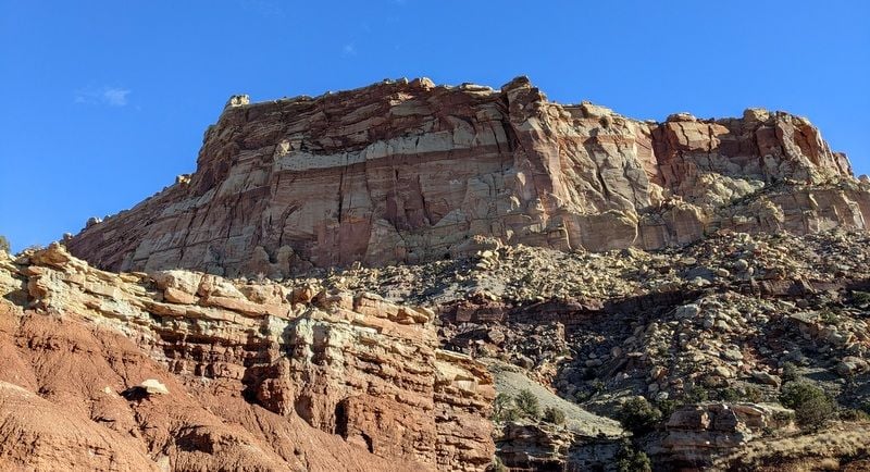
Scenic Drive
Scenic Drive
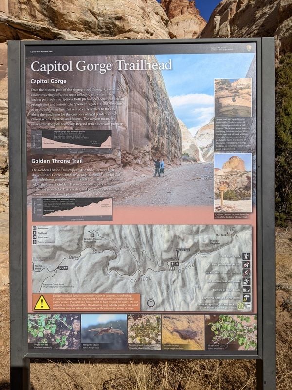
Capitol Gorge Trail
Capitol Gorge Trail
Scenic Drive
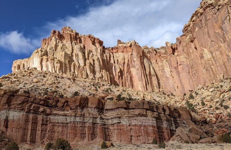
Scenic Drive
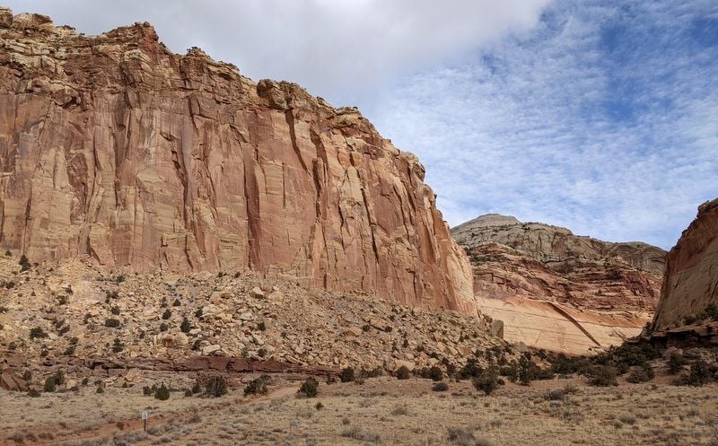
Scenic Drive
Scenic Drive
Bill made the steep and rugged detour up to The Tanks, but my wonky knees took one look and said "hell no".
The silence was incredible and we only saw one other person. There were two cars in the parking lot when we started, six when we finished. Beauty.
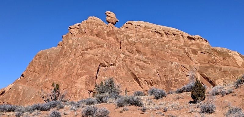
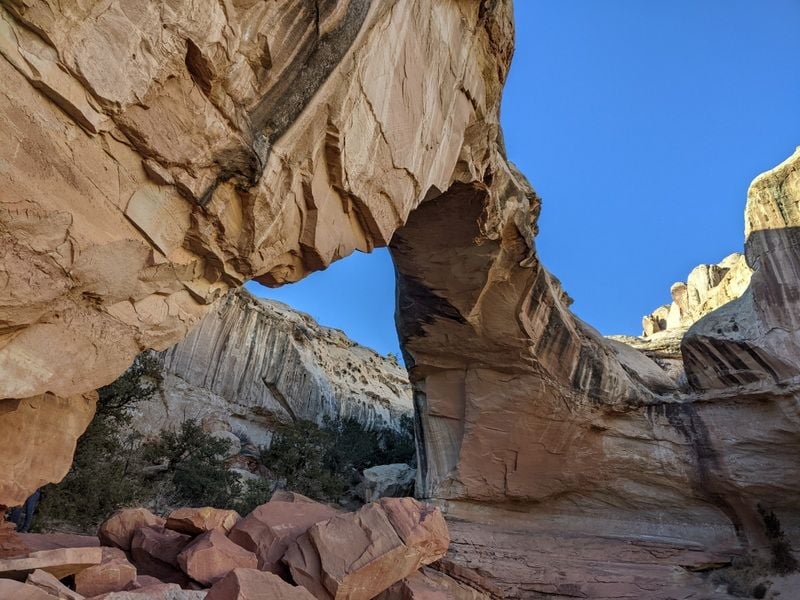
After a very cold and windy picnic lunch, we decided to give the trail to Cassidy Arch a go (accessed from Grand Wash Road) - named after Butch Cassidy who used to hide out in the canyon's nooks and crannies with the Sundance Kid. The National Park brochure described the hike as having a 670 foot elevation change, yet the sign at the trailhead indicated a 950 foot elevation change.
My money’s on the 950 feet. It was a knee cruncher and took us 2.5 hours to hike 3.5 miles, which pretty much says it all.
There were quite a few people on Cassidy’s Arch trail, but it certainly wasn’t busy.
Cassidy's Arch Trail
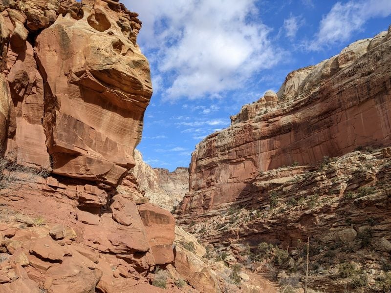
Hike to Cassidy's Arch
Hike to Cassidy's Arch
Hike to Cassidy's Arch

Hike to Cassidy's Arch
Scenic Drive
We rounded out the day by exploring the short Goosenecks Trail and then hiking up to Sunset Point for, well, the sunset.
We logged over eight miles and took a gazillion photos. It sure is pretty here.
Later we drove through Torrey to see the bits we’d not yet seen. There’s not much to it; two gas stations (gas was $3.64), a couple of hotels (most appeared closed) and a handful of restaurants, only two that seemed to be open (Wingstrands and Subway).
Bill had a hamburger at Wingstrands for his dinner, but I took a pass. We were the only customers there. Expectations were low. He said it was okay, but certainly nothing to get excited about.
To be continued…
Our first full day in Capitol Reef was a long one...eight hours. We’d checked the weather forecast the night before and were expecting a partly cloudy day.
So imagine our surprise when we pulled the curtains and saw this:
View from hotel window
Fortunately the mini blizzard was a distant memory by 9:30 – the nasty wind remained for a while, but eventually we were left with beautiful blue skies and temps in the low to mid-40's. Perfect hiking weather.
Our day began on the Scenic Road ($20 or annual parks pass needed, no charge for the rest of the park and no distinct entrance and exit), where we left the asphalt and followed the dirt road to its end, and then set out on the sheer-sided Capitol Gorge Trail. Back here we were protected from the wind, and the trail was easy and pleasant. I suspect this area is shaded year round.
Scenic Drive
Scenic Drive
Capitol Gorge Trail
Capitol Gorge Trail
Scenic Drive
Scenic Drive
Scenic Drive
Scenic Drive
Bill made the steep and rugged detour up to The Tanks, but my wonky knees took one look and said "hell no".
The silence was incredible and we only saw one other person. There were two cars in the parking lot when we started, six when we finished. Beauty.
After a very cold and windy picnic lunch, we decided to give the trail to Cassidy Arch a go (accessed from Grand Wash Road) - named after Butch Cassidy who used to hide out in the canyon's nooks and crannies with the Sundance Kid. The National Park brochure described the hike as having a 670 foot elevation change, yet the sign at the trailhead indicated a 950 foot elevation change.
My money’s on the 950 feet. It was a knee cruncher and took us 2.5 hours to hike 3.5 miles, which pretty much says it all.
There were quite a few people on Cassidy’s Arch trail, but it certainly wasn’t busy.
Cassidy's Arch Trail
Hike to Cassidy's Arch
Hike to Cassidy's Arch
Hike to Cassidy's Arch
Hike to Cassidy's Arch
Scenic Drive
We rounded out the day by exploring the short Goosenecks Trail and then hiking up to Sunset Point for, well, the sunset.
We logged over eight miles and took a gazillion photos. It sure is pretty here.
Later we drove through Torrey to see the bits we’d not yet seen. There’s not much to it; two gas stations (gas was $3.64), a couple of hotels (most appeared closed) and a handful of restaurants, only two that seemed to be open (Wingstrands and Subway).
Bill had a hamburger at Wingstrands for his dinner, but I took a pass. We were the only customers there. Expectations were low. He said it was okay, but certainly nothing to get excited about.
To be continued…
Last edited by Melnq8; Jan 23rd, 2022 at 02:47 PM.
 Jan 24th, 2022 | 11:47 AM
#11
Original Poster
Joined: Jan 2003
Posts: 21,148
Likes: 83
January 9 –
It was 14 F and windy when we woke up – that’s a ‘feels like’ temperature of 5 degrees. Yowsa.
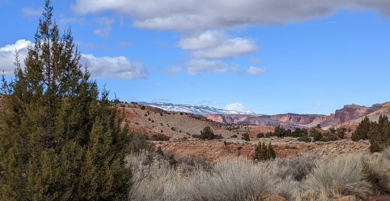
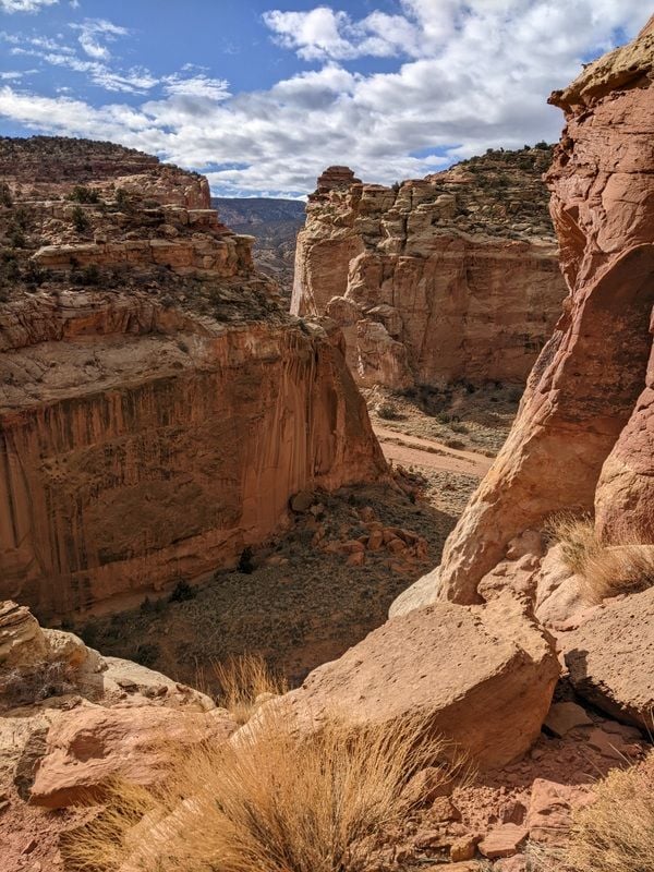
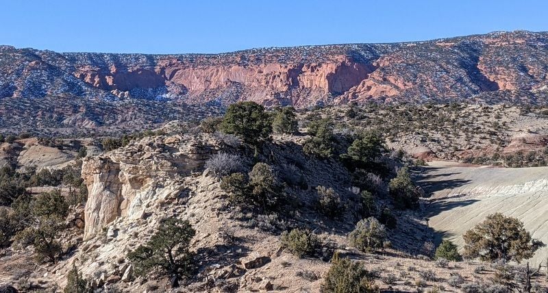
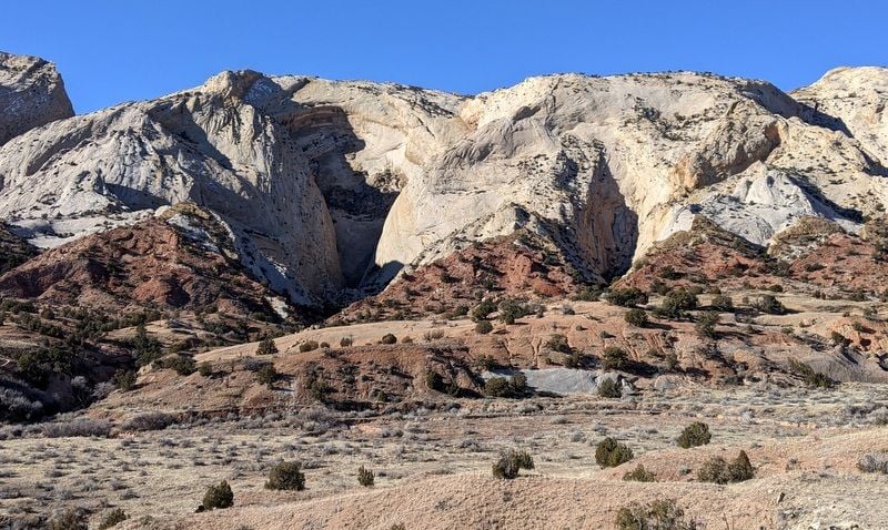
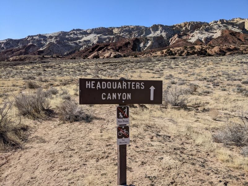
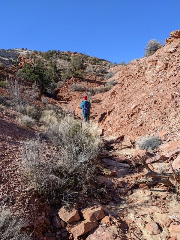
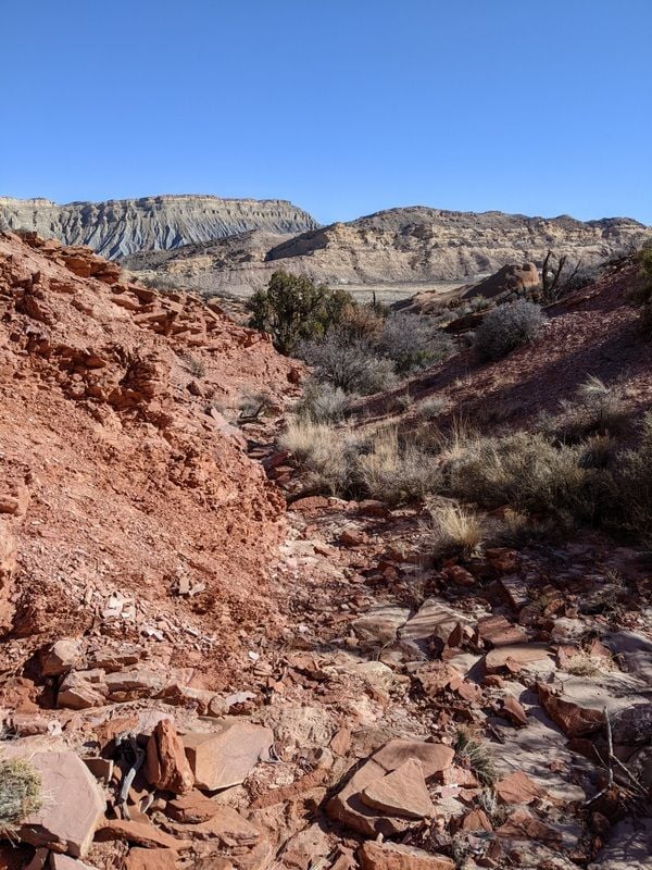
After a quick stop at the Visitor’s Center we set out to explore Capitol Reef’s South District (Waterpocket) via Notom-Bullfrog Road, hoping it would warm up a bit before we reached our intended hike, Headquarters Canyon.
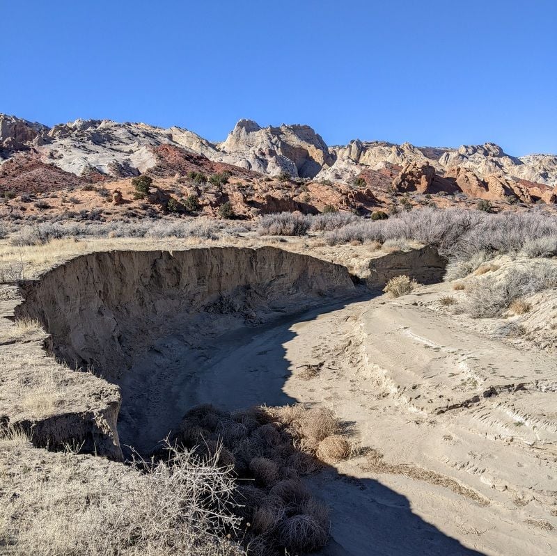
The drive took us outside of the park’s boundaries and then back in again, some 36 miles, half on dirt road. The trailhead was challenging to locate, and even more challenging to navigate. The directions were vague; "cut across a sagebrush flat, cross the dry drainage of a creek, then cross a couple of dry washes and descend to a wide stony gulch".
Notom-Bullfrog Road
Notom-Bullfrog Road
Notom-Bullfrog Road, trailhead
Tumbleweed collection point, Headquarters Canyon Trail
It took a few attempts, but we think we found what we were looking for, a narrow slot canyon. Rather, Bill found it after scaling a steep rock wall that I said hell no to. I stayed below and kept my eye out for mountain lions.
The large cat paw prints in the sand had set off my alarm bells…I was questioning the wisdom of being out here in the sticks with no cell service, and not another person in sight. I couldn’t get back to the car fast enough.
Headquarters Canyon Trail
Where did the trail go?
Please tell me this isn't the trail
Views from near Headquarters Canyon Trail

From inside slot canyon
Views from Notom-Bullfrog Road
Views from Notom-Bullfrog Road
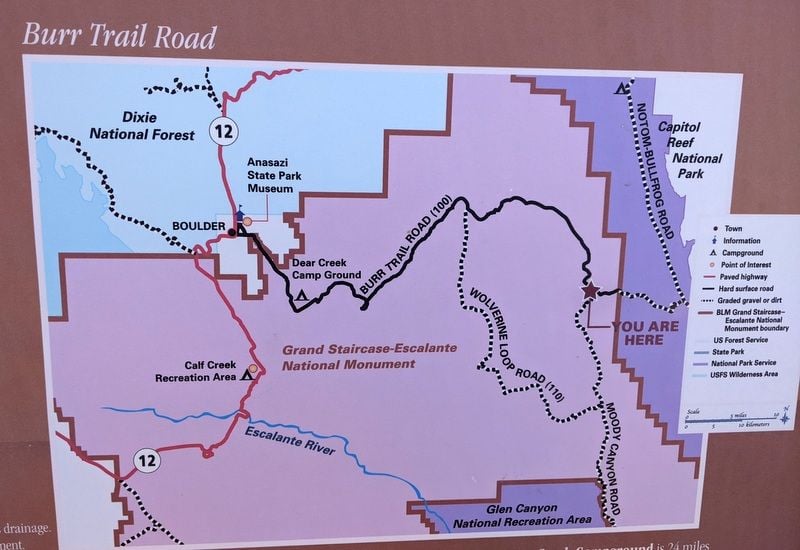
We were intrigued with the switchbacks cut into the mountain of rock that lay before us; this is the Burr Trail Road that leads to Boulder, via 42 miles of dirt. We briefly considering taking it, but those switchbacks intimated me a bit, and doing so would add considerable time to our return drive to Torrey, so we thought better of it. More on that later.
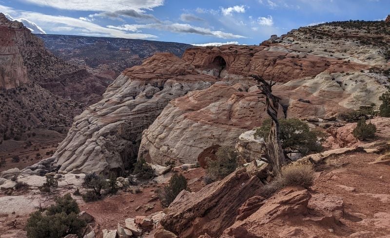
Instead, we returned the way we’d come and next sought out the Hickman’s Bridge Trail, a 400 foot climb that leads to a 133 foot high natural bridge. A nice hike with plentiful rock steps, and a bonus…mountain goats.
Hickman's Bridge Trail
Hickman's Bridge Trail
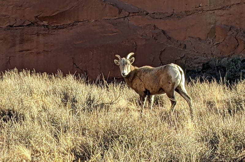
Hickman's Bridge Trail
January days are short, and this one seemed to vanish.
To be continued...
It was 14 F and windy when we woke up – that’s a ‘feels like’ temperature of 5 degrees. Yowsa.
After a quick stop at the Visitor’s Center we set out to explore Capitol Reef’s South District (Waterpocket) via Notom-Bullfrog Road, hoping it would warm up a bit before we reached our intended hike, Headquarters Canyon.
The drive took us outside of the park’s boundaries and then back in again, some 36 miles, half on dirt road. The trailhead was challenging to locate, and even more challenging to navigate. The directions were vague; "cut across a sagebrush flat, cross the dry drainage of a creek, then cross a couple of dry washes and descend to a wide stony gulch".
Notom-Bullfrog Road
Notom-Bullfrog Road
Notom-Bullfrog Road, trailhead
Tumbleweed collection point, Headquarters Canyon Trail
It took a few attempts, but we think we found what we were looking for, a narrow slot canyon. Rather, Bill found it after scaling a steep rock wall that I said hell no to. I stayed below and kept my eye out for mountain lions.
The large cat paw prints in the sand had set off my alarm bells…I was questioning the wisdom of being out here in the sticks with no cell service, and not another person in sight. I couldn’t get back to the car fast enough.
Headquarters Canyon Trail
Where did the trail go?
Please tell me this isn't the trail
Views from near Headquarters Canyon Trail
From inside slot canyon
Views from Notom-Bullfrog Road
Views from Notom-Bullfrog Road
We were intrigued with the switchbacks cut into the mountain of rock that lay before us; this is the Burr Trail Road that leads to Boulder, via 42 miles of dirt. We briefly considering taking it, but those switchbacks intimated me a bit, and doing so would add considerable time to our return drive to Torrey, so we thought better of it. More on that later.
Instead, we returned the way we’d come and next sought out the Hickman’s Bridge Trail, a 400 foot climb that leads to a 133 foot high natural bridge. A nice hike with plentiful rock steps, and a bonus…mountain goats.
Hickman's Bridge Trail
Hickman's Bridge Trail
Hickman's Bridge Trail
January days are short, and this one seemed to vanish.
To be continued...
Last edited by Melnq8; Jan 24th, 2022 at 11:49 AM.
Jan 24th, 2022 | 12:51 PM
#12
Original Poster
Joined: Jan 2003
Posts: 21,148
Likes: 83
January 10 -
It was 19 F and blowing a gale when we left Torrey and detoured to Bicknell (population 230) and Loa (population 524) to pick up a few provisions at the only grocery store in the area (Royal’s Food Town). Bicknell looked bigger than Torrey, but still sleepy. It even has a high school, which I suspect accommodates several small towns in the area. We also filled the tank in Loa, which had the lowest gas price we’d seen thus far ($3.32).
We knew pickins’ would be slim in these one horse towns of Utah - even more so in January - and we’d packed accordingly, but the minute Bill learned that our accommodation in Escalante had access to a grill, his mind went to steak.
After raiding the grocery store, we backtracked to Torrey on UT 24 and then joined UT 12 west towards Escalante. I wasn’t expecting much from the 90 minute drive, so what lay ahead was a huge surprise.
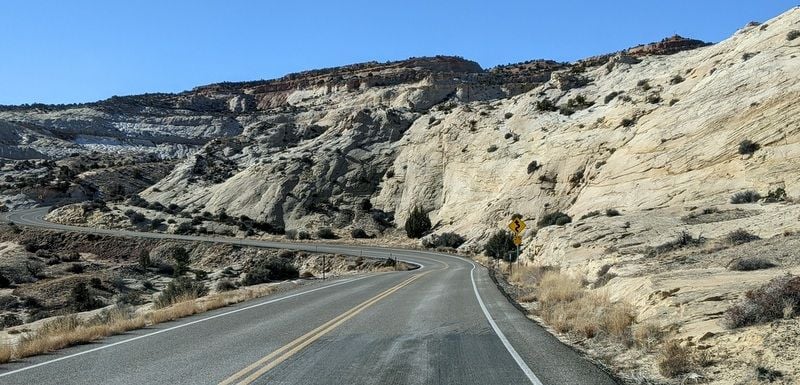
First we entered Dixie National Forest, the landscape changing from rocks to Ponderosa pines. We began to climb and encountered quite a bit of snow as we motored up Boulder Mountain pass (elevation 9,606), the highest point of Utah’s Scenic Byway 12. The views were fabulous. There’s a massive aspen grove that must be spectacular in autumn...and we only saw six cars between Torrey and Boulder.
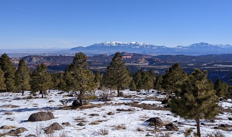
Loab Hollow Overlook
Aspen grove
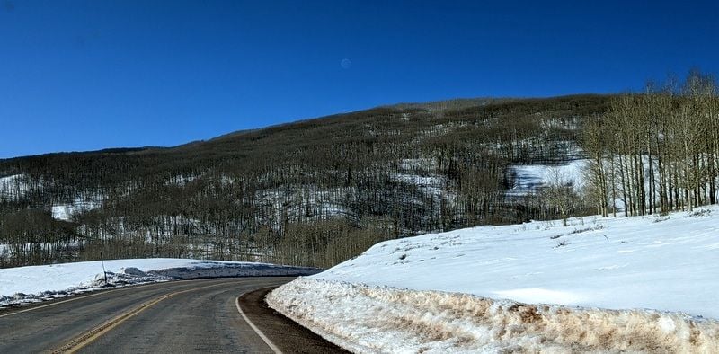
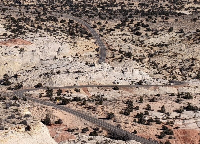
Then came the roller coaster of a ride atop The Hogback; where the highway narrows and runs along the top of a steep ridge with drop offs on both sides, few guardrails and one tight turn after another…and then descends at a 14% grade. It was wild; and one of the most memorable drives of our 17 day trip.
https://scenicusa.net/021110.html
UT 12 Scenic Byway

UT 12 Scenic Byway
UT 12 Scenic Byway
Utah 12 Scenic Byway
UT 12 Scenic Byway
We stopped to admire the road we’d just come up at the scenic overlook, where we learned all about the Million Dollar Road which was built by the Civilian Conservation Corps.
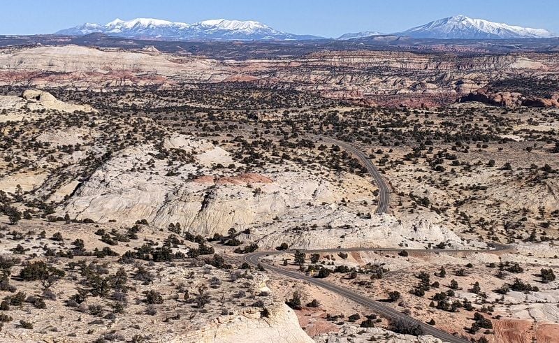
UT 12 as seen from overlook
UT 12 as seen from overlook

Once in Escalante, we got settled into our home for the next two nights, The Ponderosa Inn, a former restaurant that has been remodeled into five rooms of accommodation. A great idea, and a cute little place. The rooms are small, but comfortable, warm and well-equipped ($216 for two nights).
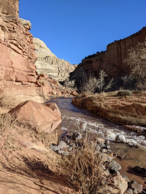
After a quick stop to the closed Visitor’s Center, we attempted the drive to Hell’s Backbone Road hoping to see the historic wooden bridge that stands 1,500 feet above a gorge near the Box/Death Hollow Wilderness Area, but it was impassable, wrong time of year. So we settled for a short hike on the Escalante River Trail.
I have no idea. Pine Creek Road, Escalante
With a population of 695, Escalante felt like a boom town after Torrey, and even though we’d just arrived I was already regretting that we’d only be there for two nights. Looks like plenty to do at Grand Staircase-Escalante National Monument.
To be continued...
It was 19 F and blowing a gale when we left Torrey and detoured to Bicknell (population 230) and Loa (population 524) to pick up a few provisions at the only grocery store in the area (Royal’s Food Town). Bicknell looked bigger than Torrey, but still sleepy. It even has a high school, which I suspect accommodates several small towns in the area. We also filled the tank in Loa, which had the lowest gas price we’d seen thus far ($3.32).
We knew pickins’ would be slim in these one horse towns of Utah - even more so in January - and we’d packed accordingly, but the minute Bill learned that our accommodation in Escalante had access to a grill, his mind went to steak.
After raiding the grocery store, we backtracked to Torrey on UT 24 and then joined UT 12 west towards Escalante. I wasn’t expecting much from the 90 minute drive, so what lay ahead was a huge surprise.
First we entered Dixie National Forest, the landscape changing from rocks to Ponderosa pines. We began to climb and encountered quite a bit of snow as we motored up Boulder Mountain pass (elevation 9,606), the highest point of Utah’s Scenic Byway 12. The views were fabulous. There’s a massive aspen grove that must be spectacular in autumn...and we only saw six cars between Torrey and Boulder.
Loab Hollow Overlook
Aspen grove
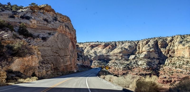
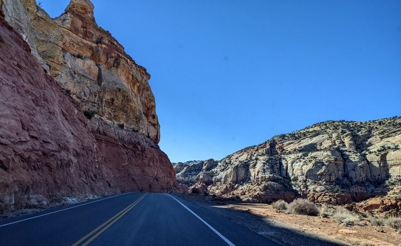
Then came the roller coaster of a ride atop The Hogback; where the highway narrows and runs along the top of a steep ridge with drop offs on both sides, few guardrails and one tight turn after another…and then descends at a 14% grade. It was wild; and one of the most memorable drives of our 17 day trip.
https://scenicusa.net/021110.html
UT 12 Scenic Byway
UT 12 Scenic Byway
UT 12 Scenic Byway
Utah 12 Scenic Byway
UT 12 Scenic Byway
We stopped to admire the road we’d just come up at the scenic overlook, where we learned all about the Million Dollar Road which was built by the Civilian Conservation Corps.
UT 12 as seen from overlook
UT 12 as seen from overlook
Once in Escalante, we got settled into our home for the next two nights, The Ponderosa Inn, a former restaurant that has been remodeled into five rooms of accommodation. A great idea, and a cute little place. The rooms are small, but comfortable, warm and well-equipped ($216 for two nights).
After a quick stop to the closed Visitor’s Center, we attempted the drive to Hell’s Backbone Road hoping to see the historic wooden bridge that stands 1,500 feet above a gorge near the Box/Death Hollow Wilderness Area, but it was impassable, wrong time of year. So we settled for a short hike on the Escalante River Trail.
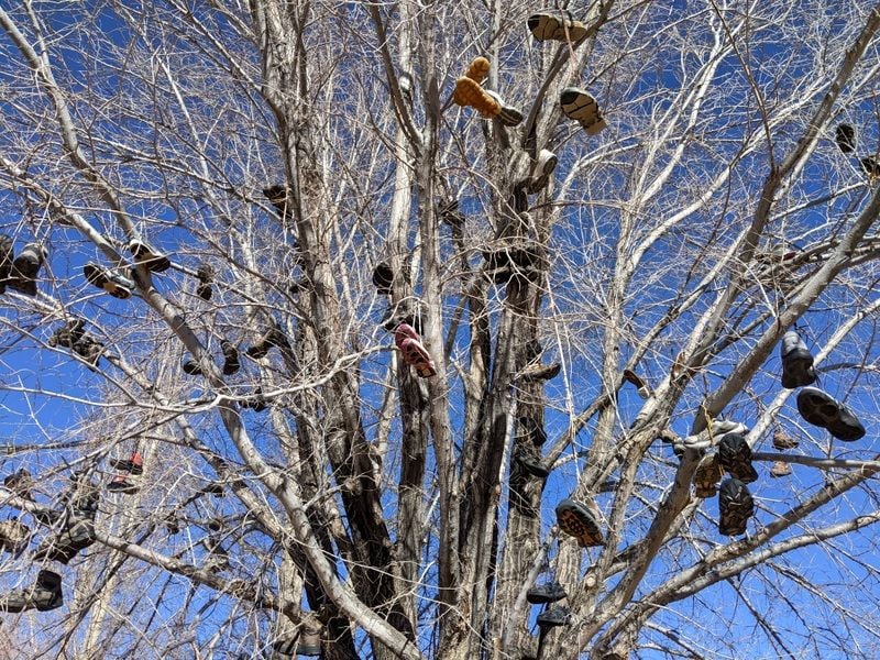
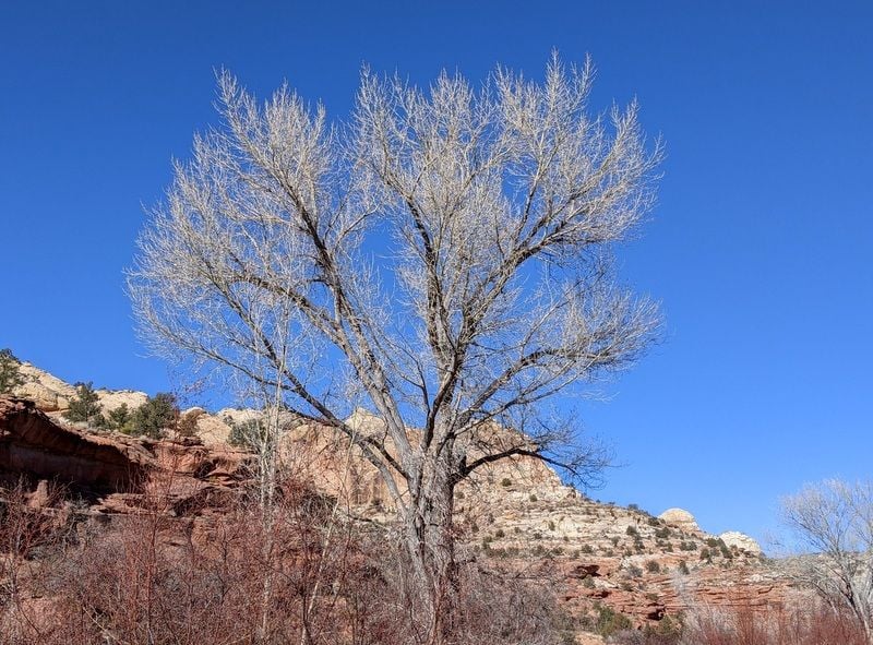
I have no idea. Pine Creek Road, Escalante
With a population of 695, Escalante felt like a boom town after Torrey, and even though we’d just arrived I was already regretting that we’d only be there for two nights. Looks like plenty to do at Grand Staircase-Escalante National Monument.
To be continued...
Last edited by Melnq8; Jan 24th, 2022 at 01:02 PM.
 Jan 25th, 2022 | 06:13 AM
#17
Joined: Jul 2004
Posts: 6,339
Likes: 8
Those were some adventurous days! You are really lucking out on the weather, cold temps notwithstanding. So far at least.
Re your "I have no idea" tree: neither do I, but Wikipedia claims to:
https://en.wikipedia.org/wiki/Shoe_tossing
https://en.wikipedia.org/wiki/Shoe_t...ecorated_plant)
They are kind of ugly, IMHO.
Re your "I have no idea" tree: neither do I, but Wikipedia claims to:
https://en.wikipedia.org/wiki/Shoe_tossing
https://en.wikipedia.org/wiki/Shoe_t...ecorated_plant)
They are kind of ugly, IMHO.
Jan 25th, 2022 | 08:09 AM
#19
Joined: Jul 2004
Posts: 6,339
Likes: 8
Yeah, there are random shoes hanging on poles, power lines, and fences out in the eastern CO grasslands. I always interpreted them to mean "drunk person passed by here". Kind of like seeing random cairns on hiking trails, which means "lost person passed by here".
Jan 25th, 2022 | 08:45 AM
#20
Original Poster
Joined: Jan 2003
Posts: 21,148
Likes: 83
January 11 –
Our only full day in Grand Staircase-Escalante National Monument was a busy one. We backtracked 17 miles towards Boulder and hiked the sandy and undulating 6.7 mile trail to Lower Calf Creek Falls, so named for its use as a natural pen for calves back in the late 1800’s and early 1900’s.
It was a chilly 23 F when we started and a whopping 33 F when we finished three hours later. The shaded canyon was damn cold; never have I been so happy to see the sun when it finally rose above the canyon walls.
It was a great hike to the 126 foot high falls; the trail peaceful; we only saw five people.

Lower Calf Creek Falls Trail
Lower Calf Creek Falls Trail
Lower Calf Creek Falls Trail
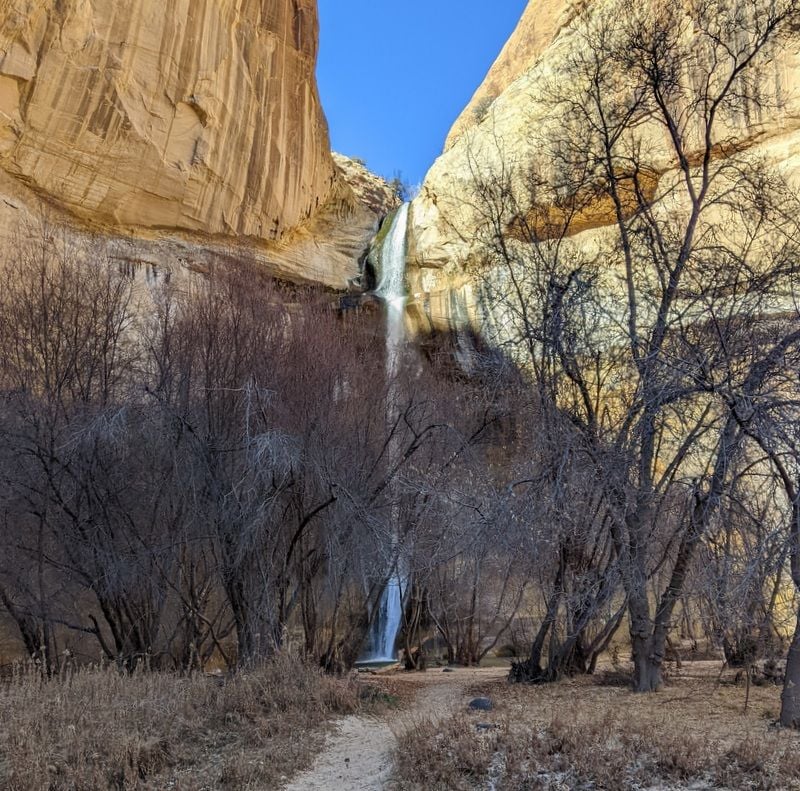
Approaching Lower Calf Creek Falls
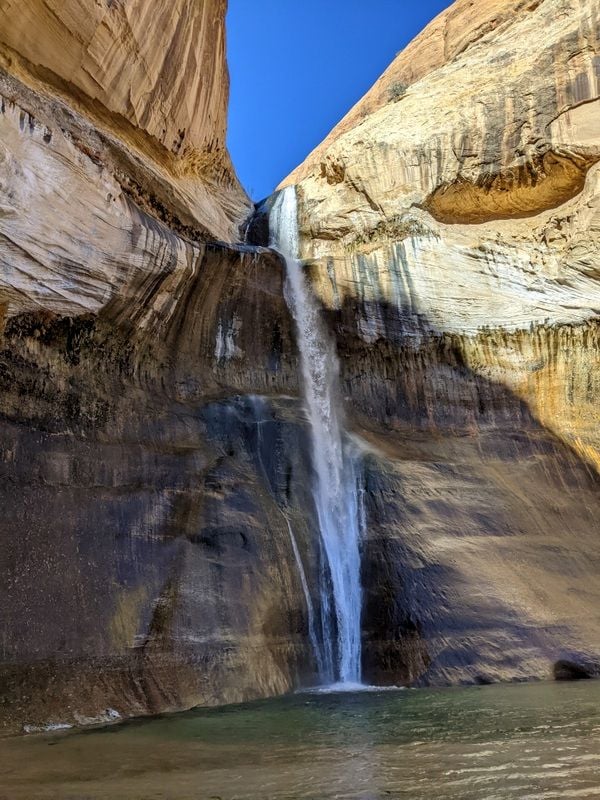
And there they are - Lower Calf Creek Falls
Near picnic area, Lower Calf Creek Falls
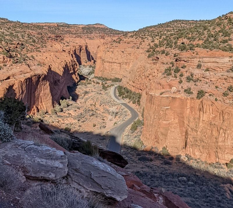
After lunch in the now sunny picnic area, we kept driving towards Boulder – going over that wild Hogback again - and turned off on the Burr Trail Road. We'd toyed with taking this road from the southern end of Capitol Reef a few days ago, but thought better of it after getting a good look at the gravel switchbacks that wound up the mountain. We'd since learned that Burr Trail Road is paved from the Boulder side, so we decided to give it a go.
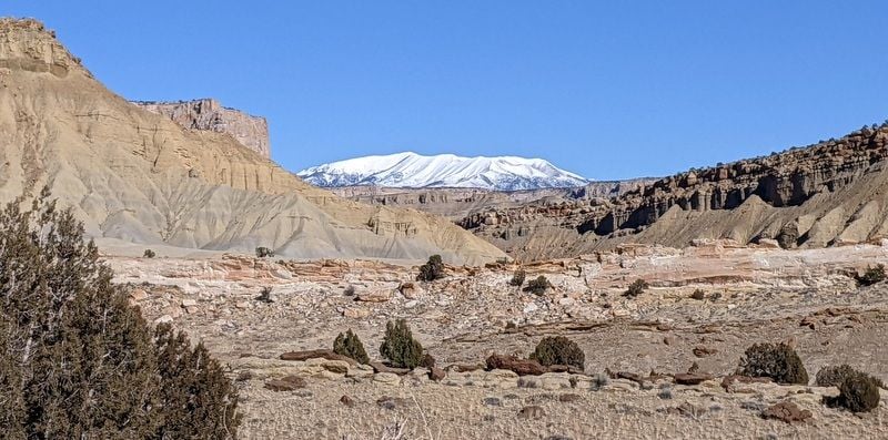
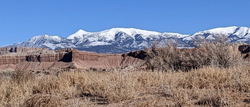
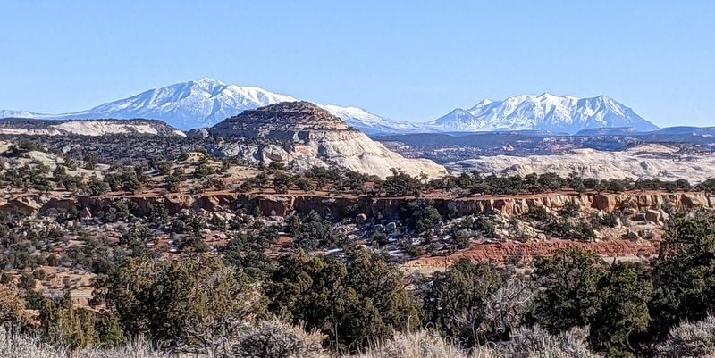
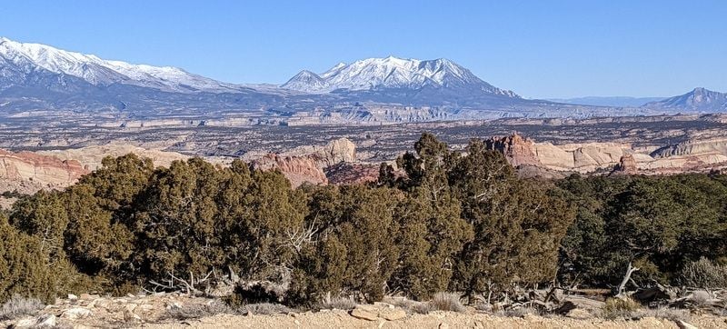
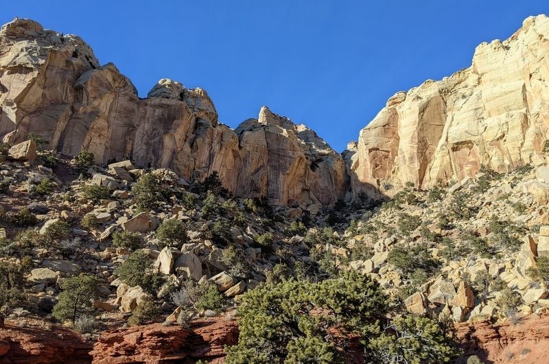
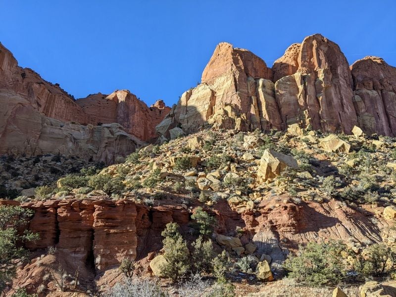
Oh. My. I'm so glad we didn't miss this. It was spectacular. The road made a steep descent into Long Canyon with some 10 miles of gorgeous rock formations - and then climbed back up towards Capitol Reef. We drove the 30 miles to the Capitol Reef park boundary, where the road turns to gravel. We admired the distant views of the Henry Mountains, and then turned back.
We saw not another soul, and the silence was wonderful.
Burr Trail Road
Burr Trail Road
Burr Trail Road
Burr Trail Road
Burr Trail Road
Burr Trail Road
Burr Trail Road
Burr Trail Road
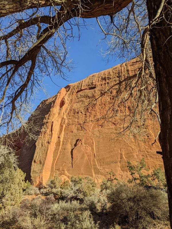
Capitol Reef Park Boundary, Burr Trail Road
Burr Trail Road
Burr Trail Road
On the way back to Boulder, we stopped to explore Long Canyon Slot, then worked our way back to Escalante via the Hogback one last time (which is more fun traveling towards Escalante IMO) and that incredibly scenic roller coaster, The Million Dollar Road.
Burr Trail Road, headed back to Boulder
Burr Trail Road, headed back to Boulder
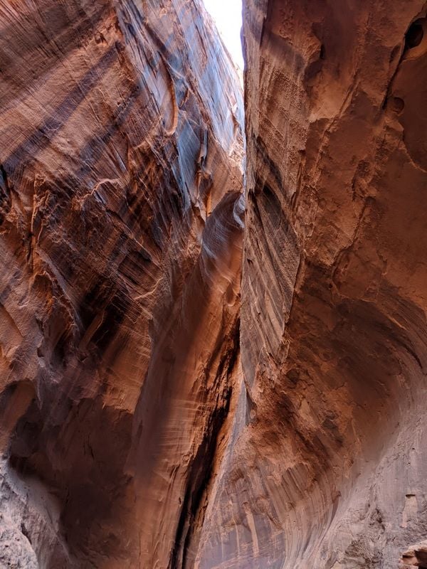
Long Canyon Slot

Long Canyon Slot
Near Long Canyon Slot
Burr Trail Road from above
It had been a wonderful day.
To be continued...
Our only full day in Grand Staircase-Escalante National Monument was a busy one. We backtracked 17 miles towards Boulder and hiked the sandy and undulating 6.7 mile trail to Lower Calf Creek Falls, so named for its use as a natural pen for calves back in the late 1800’s and early 1900’s.
It was a chilly 23 F when we started and a whopping 33 F when we finished three hours later. The shaded canyon was damn cold; never have I been so happy to see the sun when it finally rose above the canyon walls.
It was a great hike to the 126 foot high falls; the trail peaceful; we only saw five people.
Lower Calf Creek Falls Trail
Lower Calf Creek Falls Trail
Lower Calf Creek Falls Trail
Approaching Lower Calf Creek Falls
And there they are - Lower Calf Creek Falls
Near picnic area, Lower Calf Creek Falls
After lunch in the now sunny picnic area, we kept driving towards Boulder – going over that wild Hogback again - and turned off on the Burr Trail Road. We'd toyed with taking this road from the southern end of Capitol Reef a few days ago, but thought better of it after getting a good look at the gravel switchbacks that wound up the mountain. We'd since learned that Burr Trail Road is paved from the Boulder side, so we decided to give it a go.
Oh. My. I'm so glad we didn't miss this. It was spectacular. The road made a steep descent into Long Canyon with some 10 miles of gorgeous rock formations - and then climbed back up towards Capitol Reef. We drove the 30 miles to the Capitol Reef park boundary, where the road turns to gravel. We admired the distant views of the Henry Mountains, and then turned back.
We saw not another soul, and the silence was wonderful.
Burr Trail Road
Burr Trail Road
Burr Trail Road
Burr Trail Road
Burr Trail Road
Burr Trail Road
Burr Trail Road
Burr Trail Road
Capitol Reef Park Boundary, Burr Trail Road
Burr Trail Road
Burr Trail Road
On the way back to Boulder, we stopped to explore Long Canyon Slot, then worked our way back to Escalante via the Hogback one last time (which is more fun traveling towards Escalante IMO) and that incredibly scenic roller coaster, The Million Dollar Road.
Burr Trail Road, headed back to Boulder
Burr Trail Road, headed back to Boulder
Long Canyon Slot
Long Canyon Slot
Near Long Canyon Slot
Burr Trail Road from above
It had been a wonderful day.
To be continued...
Last edited by Melnq8; Jan 25th, 2022 at 08:48 AM.

