

The "Path of the Gods" (Sentiero degli Dei) hiking trail on the Amalfi Coast
 Jul 14th, 2023, 07:09 PM
#1
The "Path of the Gods" (Sentiero degli Dei) hiking trail on the Amalfi Coast
The name of this hike clearly reflects some Madison Avenue-style puffery: a more appropriate name for it might be the "Path of the Mules and Mule-drivers," since that is what this actually is: an improved and well-signposted adaptation of a network of mule tracks and paths that villagers used to get between the small upland villages along the south-facing spine of the Monti Lattari and the Sorrentino peninsula in older times. The path was apparently improved and opened in the mid-1990's.
I'll attach a link to a photo album I've posted on Flickr, as well as a couple of the "money shots".
I'll attach a link to a photo album I've posted on Flickr, as well as a couple of the "money shots".
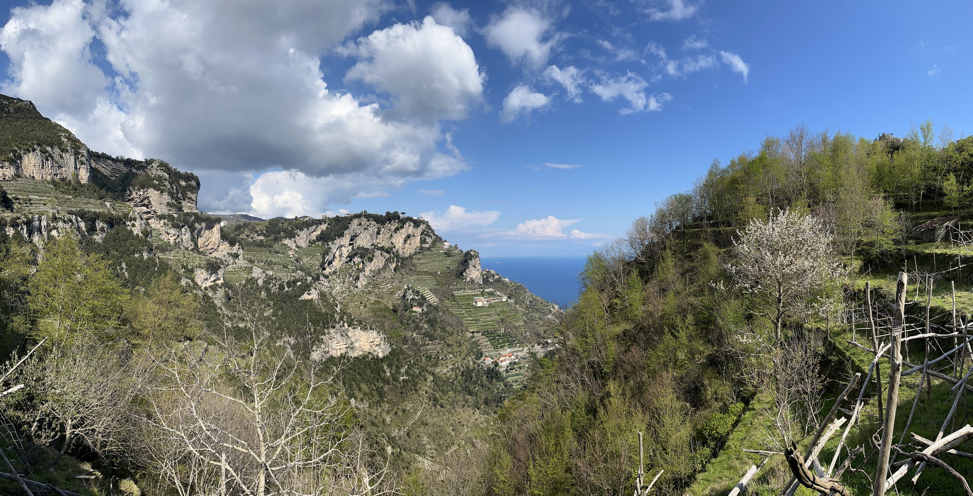
Looking west towards the end of the Sorrentino peninsula and the island of Capri from the "Path of the Gods"
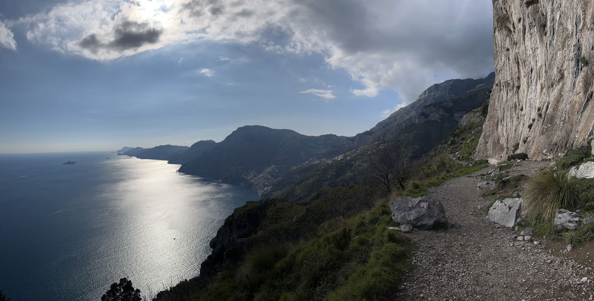
Approaching the Col de Serra, about a mile or so into the "Path of the Gods"
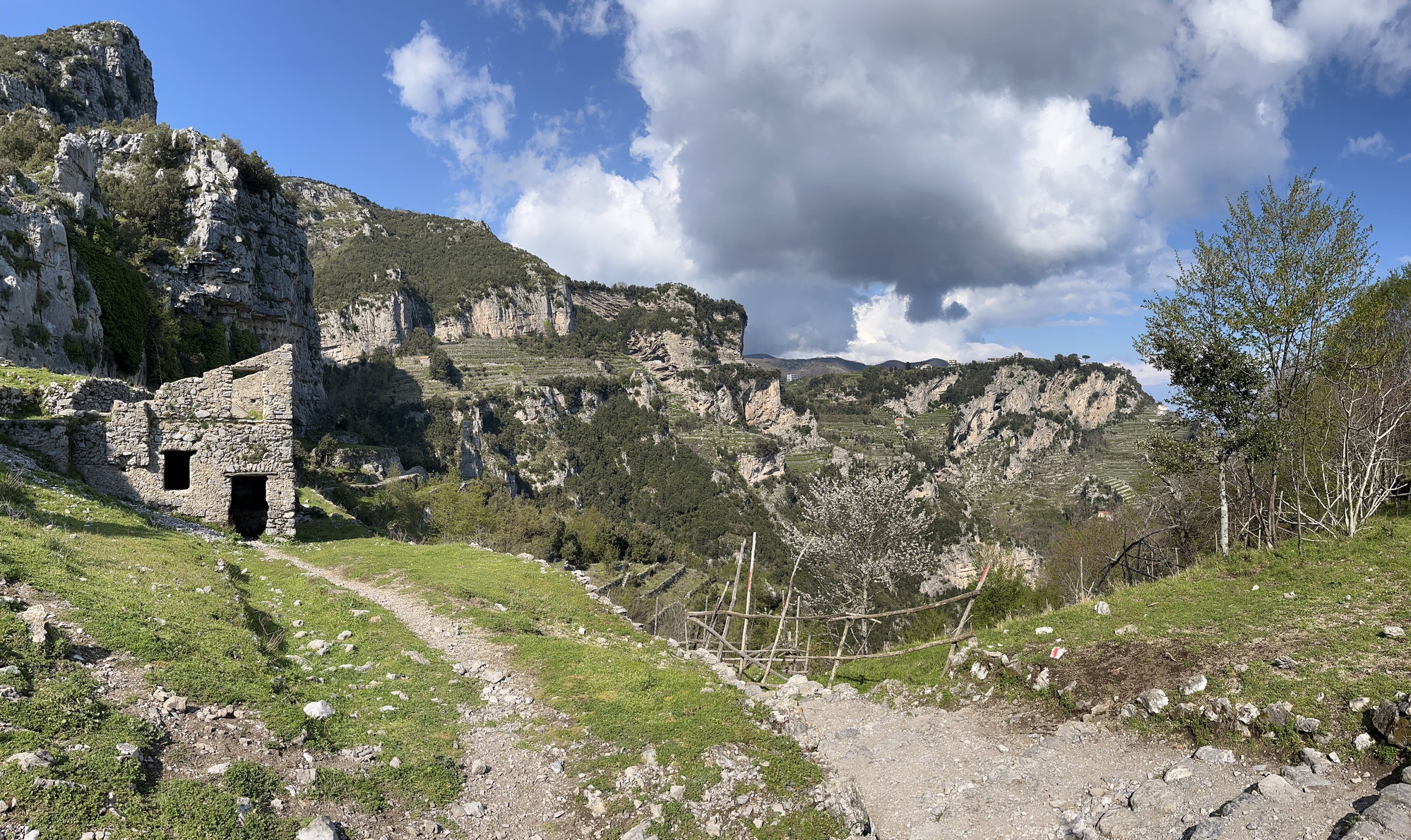
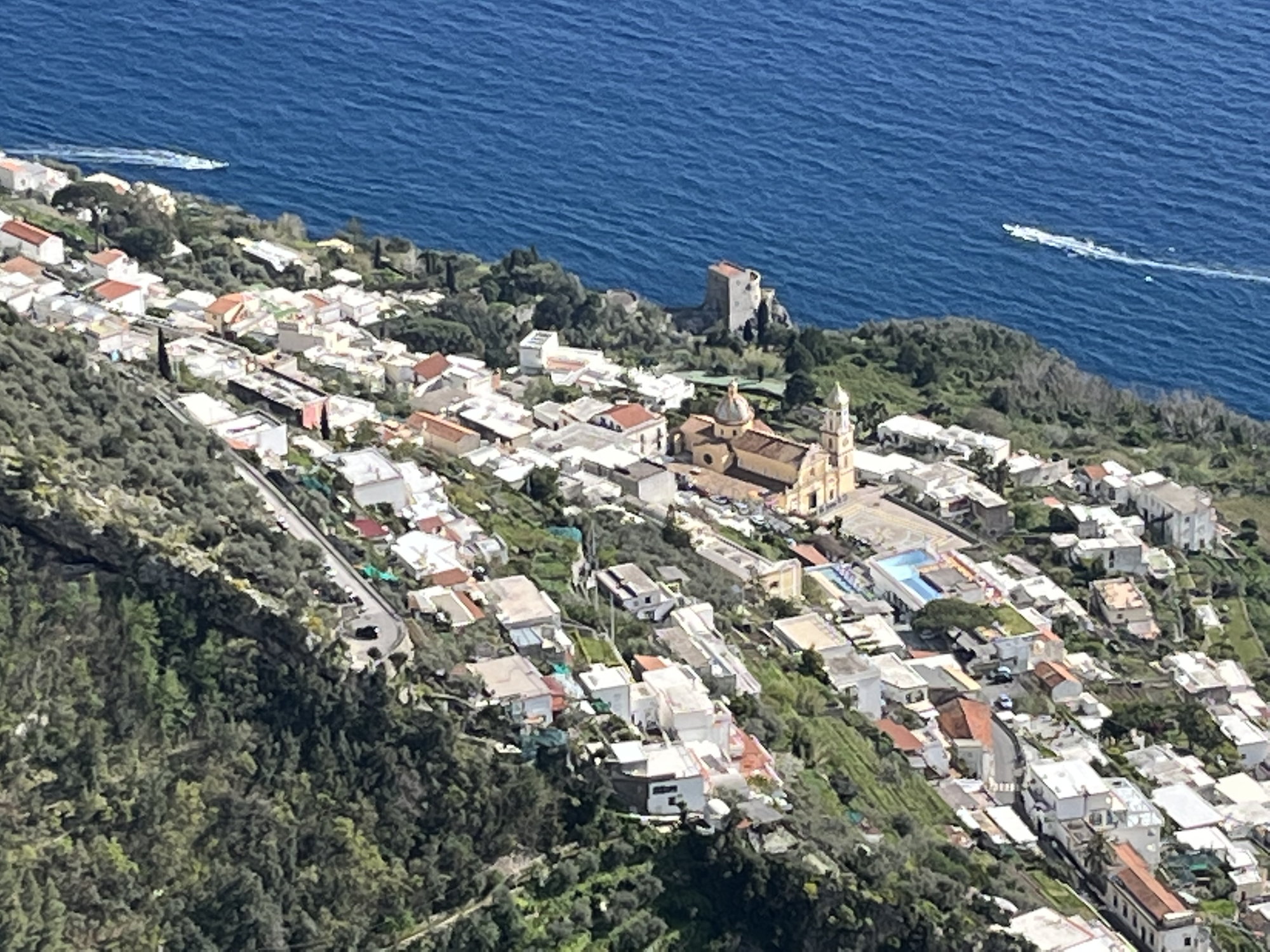
Abandoned farmhouse at the Col de Serra along the "Path of the Gods"
 Jul 16th, 2023, 05:13 PM
#5
When I posted the link above to my album with these photos on Flickr, I did not realize that the link would not allow visitors to see the overall summary of the hike that I posted as part of the album -- which may be of assistance to Fodorites who are either trying to decide whether to do this hike, and if so, how best to approach it. So here's that text:
The "Path of the Gods" is a 4-5 mile trail that runs west along the crest or the southern-facing slopes of the Monti Lattari and the Sorrentino peninsula from the village of Bomerano (part of a larger municipality known as Agerola) towards a very small village called Nocelle (which is the official end of the trail). (From Nocelle, you can choose between various alternative routes for the remaining couple of miles into Positano, which include: (1) descending 1700 steps to the coast highway and walking or catching a bus to Positano from there; (2) arranging for a driver to meet you in Nocelle; or (3) catching a bus or a taxi from Nocelle to Positano.
I would describe the hike as moderately strenuous. My wife and I were both 66 when we did it and are relatively fit, but we were pretty tired by the time we reached Nocelle (after around 3 hours of walking) and were delighted when a local appeared who offered to give us a ride back to our hotel in Positano.
Still, we thought this was unquestionably worth it. As these photographs indicate, the views are stunning, and the trail is not very heavily trafficked, at least in April and starting in the mid-afternoon. (We left Positano with a driver for Bomerano at 2:00; got there and started the trial by around 3:00; and reached Nocelle at about 6 p.m.)
I rate this hike as one of the five best I've taken in my life.
 Jul 19th, 2023, 05:34 PM
#7
And here are a few more photos of the hike
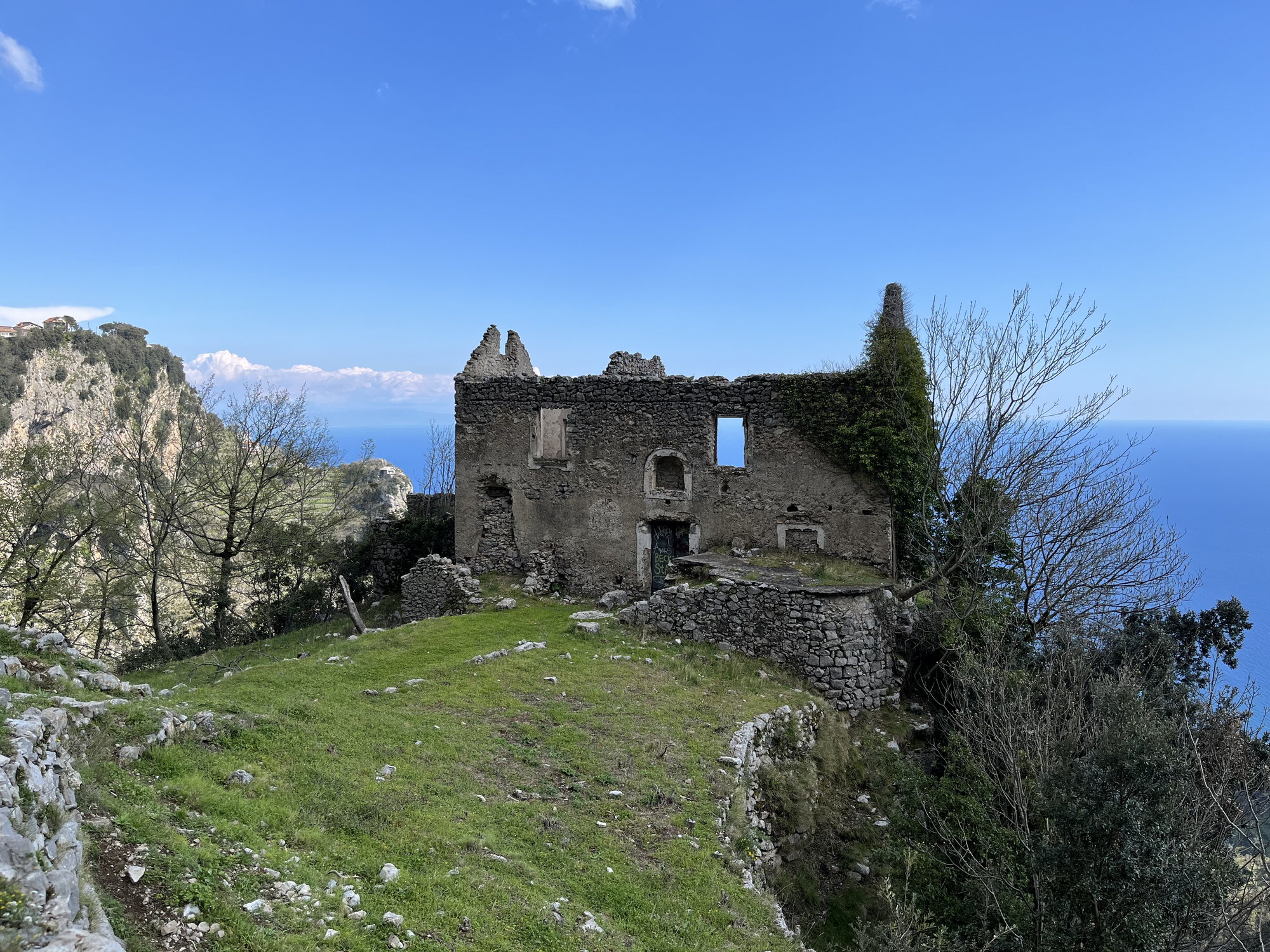
An abandoned farmhouse, which commanded an amazing view
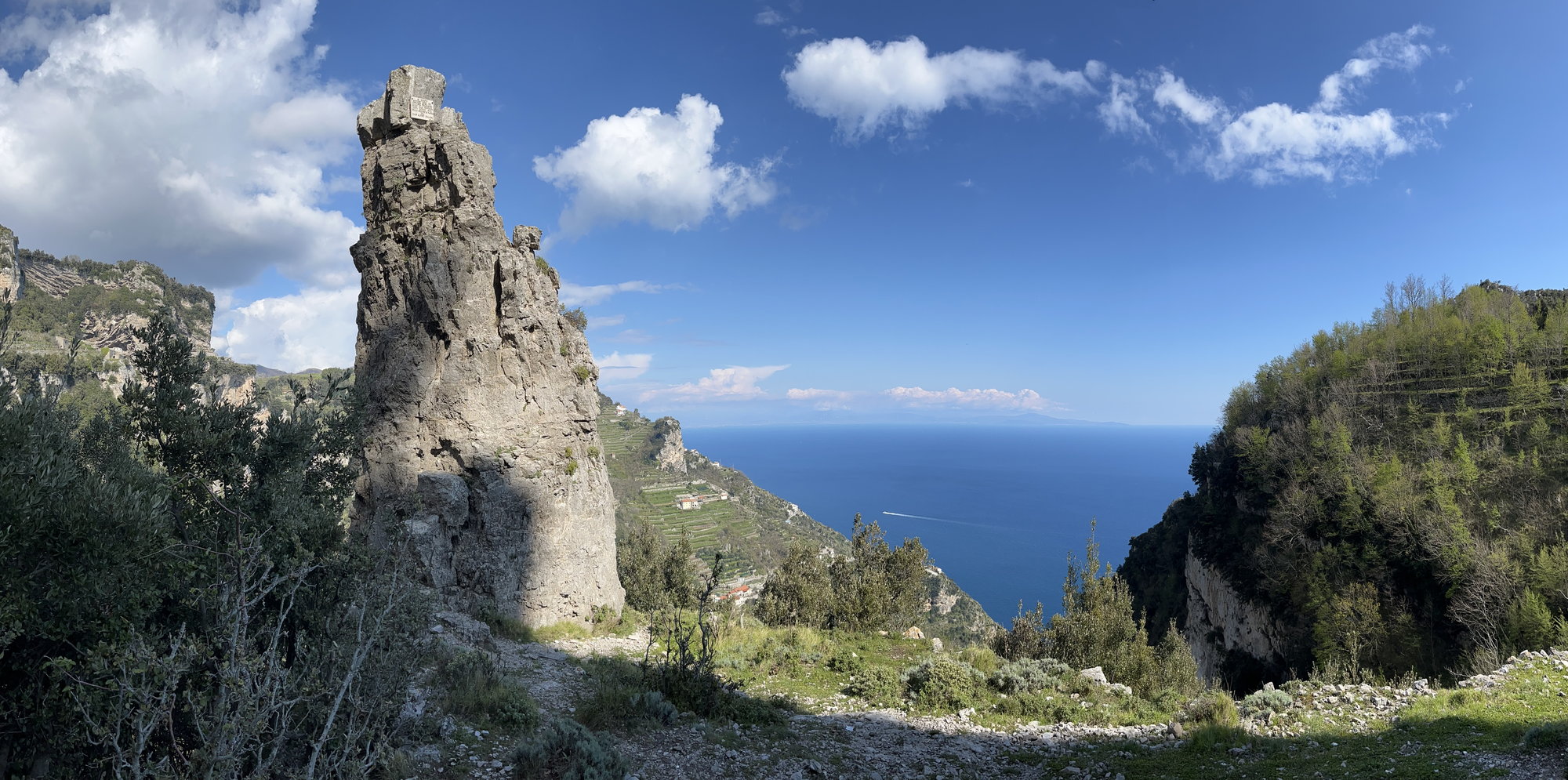
A granite pinnacle beside the trail
The town of Praiano, east of Positano
Last edited by jeffergray; Jul 19th, 2023 at 05:39 PM.
Jul 20th, 2023, 06:21 AM
#9
Join Date: Jan 2004
Posts: 3,416
Likes: 0
Received 0 Likes
on
0 Posts
Beautiful photos! Thanks for sharing. Years ago, we did the small portion from Nocelle to Positano - we didn't have enough time for the longer hike and were traveling with a 12 year-old. Have you hiked in the Dolomites?
Jul 22nd, 2023, 07:11 AM
#10
Thank you, ms_go. I have not yet hiked the Dolomites, but they are definitely on my bucket list. (Actually, the northern Italian Lake District and the Dolomites -- along with Trieste -- are about the only remaining pockets of Italy we haven't explored to at least some degree.) Do you have any recommendations about the Dolomites?
Jul 22nd, 2023, 07:34 AM
#11
Thanks, TPAYT!
As for "One of the five best hikes I've taken in my life" -- here are the other four (and I'm limiting this to day hikes):
1. The hike from Lake Josephine up to Upper Grinnell Lake and the Garden Wall in Glacier National Park
2. The hike through the Samaria Gorge to the south coast of Crete.
3. The loop hike around Naches Peak, just east of Mount Rainier.
4. The Cedar Run - Whiteoak Canyon Loop in Shenandoah National Park.
Honorable Mentions:
a. The hike up Avalanche Creek Canyon to Avalanche Lake in Glacier NP.
b. The hikes to St. Mary Falls and Virginia Falls in Glacier NP.
c. The hike along the Upper Gunpowder Falls to the Prettyboy Reservoir Dam in Baltimore County, Maryland.
d. The hike to Dukes Creek Falls in Chattahoochee National Forest in north Georgia.
And then there was the 80-mile backpacking trip I took through the Cimarron Range of the Sangre de Cristo Mountains of New Mexico with a group from my son's Boy Scout troop.
Last edited by jeffergray; Jul 22nd, 2023 at 07:58 AM.

Thread
Original Poster
Forum
Replies
Last Post
john183
Europe
26
Jul 15th, 2013 07:34 PM
Castellanese
Europe
12
Apr 24th, 2008 04:45 AM
Amanda
Europe
8
Apr 23rd, 2003 01:45 PM


