


Dolomites/Alta Badia: A September week in the shadow of the Sella
 Jan 4th, 2025 | 11:21 AM
#1
Original Poster

Joined: Jan 2004
Posts: 3,618
Likes: 0
Dolomites/Alta Badia: A September week in the shadow of the Sella
Work slowed over the holidays, giving me time to go through photos from a couple of fall trips.
We spent part of September in Northern Italy, including a week (Sept 7-14) in the Dolomites. We Midwest flatlanders enjoy mountains and hiking�and Italy of course, so this has become a favorite destination.
This was part of a longer trip that started in Venice, included some time in Bologna and environs and finished with a brief stop in Rome. This report is only for our time in the mountains�mostly through photos that hopefully that show why we keep going back and, for anyone interested in this area, some of what it offers beyond Ortisei and Cortina.
This was our third trip to the region.
In late July of 2009, we spent a week in the Val Gardena (Selva) with a teen in tow:
Live trip report from the Dolomites and beyond
In late August/early September of 2019, we spent a week in the Val di Fassa (Vigo).
A summer week in the Dolomites, version 2
This year, we chose yet another part of the area�the Alta Badia�with Colfosco (aka Colfosch in Ladin, Kolfuschg in German) as a home base for its proximity to multiple lifts and relatively small size (permanent population of about 500).
We had a car for this portion of the trip, picked up in Venice and dropped in Bolzano. While there are buses between towns and valleys, our visit was during the early stages of winding down from the summer season. We were concerned about reduced schedules, flexibility, and making full use of our limited time.
 Jan 4th, 2025 | 11:32 AM
#2
Original Poster
Joined: Jan 2004
Posts: 3,618
Likes: 0
The appetizer: Asolo
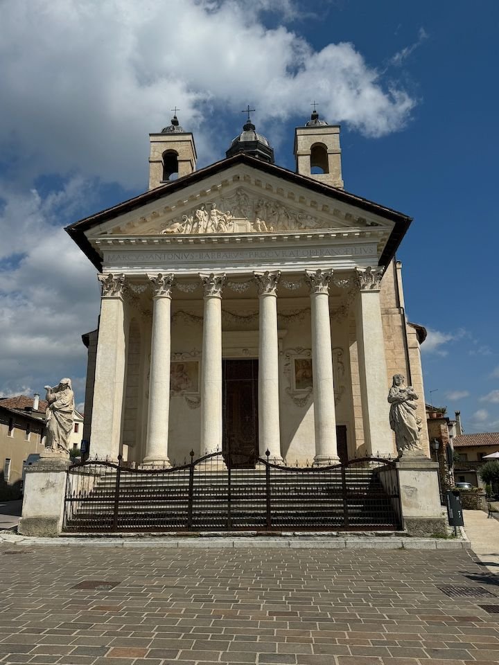
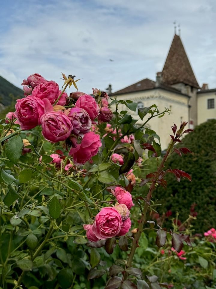
Our transition stop on the way north was the town of Asolo. We spent two nights in Asolo in 1991 as the last stop on our first European trip together. It was a different season (November). The skies were gloomy, not ideal for this town that sits at the intersection of the Veneto plain and the mountains and is known as the �city of one hundred horizons.� It has always been in the back of our minds as a place we�d like to revisit, if our itinerary presented the opportunity. We were pleased to find the center much as we remembered it from 33 years ago�albeit with sun and lovely views this time.
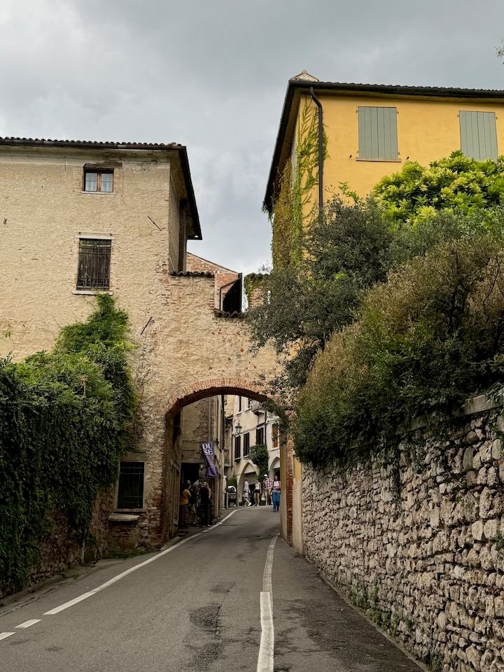
One entry is through this arch near Villa Freya, former home of explorer and writer Freya Stark
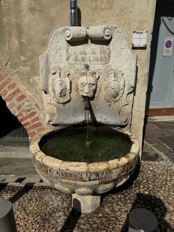
Fontanella Zen (1570s)
Hotel Duse, where we stayed in 1991, is right on the main square
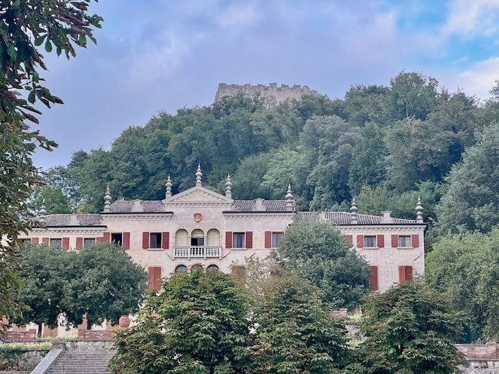
One of the many elaborate villas in the area
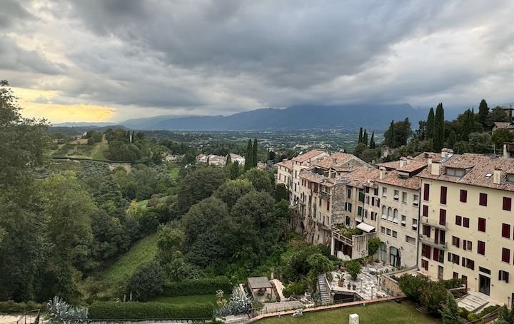
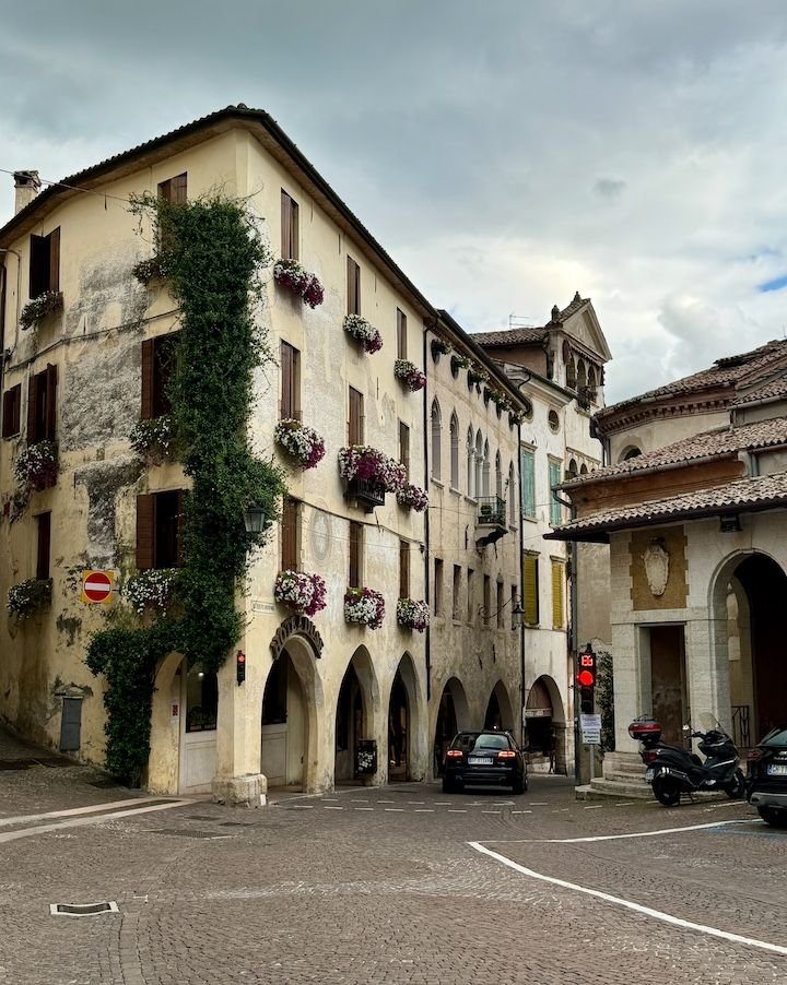
View from the town center
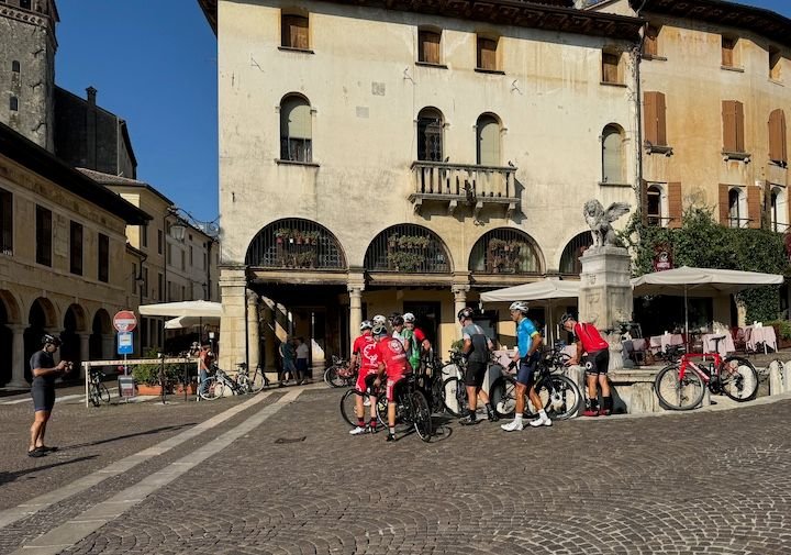
The area is popular with cyclists because it features the same array of terrains encountered in major races. Here, some riders have paused their training to drink from and take a group photo in front of the winged lion fountain in Piazza Garibaldi
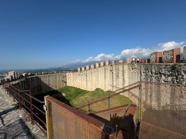
Asolo�s history spans over 2,000 years. Some of it is evident at la Rocca�about 700 steps above town with views across the area and down onto the town, itself
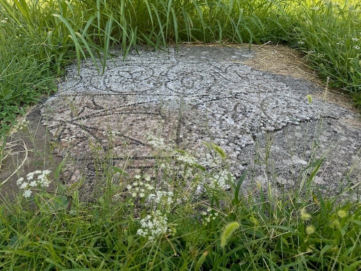
The earliest remnants at La Rocca include mosaics from a 6th century chapel
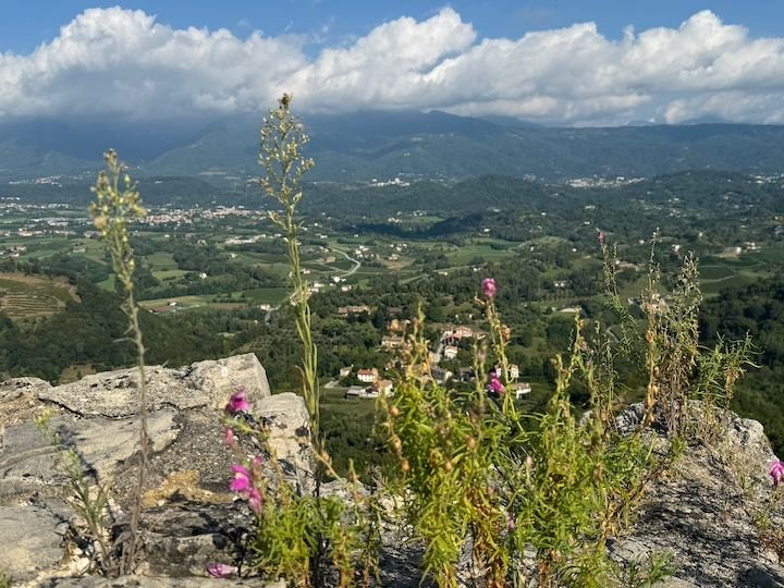
View from La Rocca
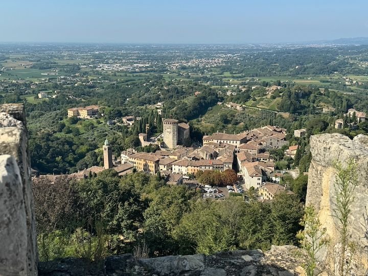
View of Asolo from La Rocca
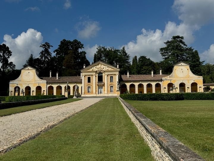
About 10 km from the center of Asolo is Villa Barbaro (aka, Villa di Maser), conceived by Andrea Palladio in the 1550s and part of the UNESCO World Heritage group of Palladian villas. The inside features frescoes by Paolo Veronese. This is a private home, so only six rooms are open for touring, and there are no photos allowed inside.
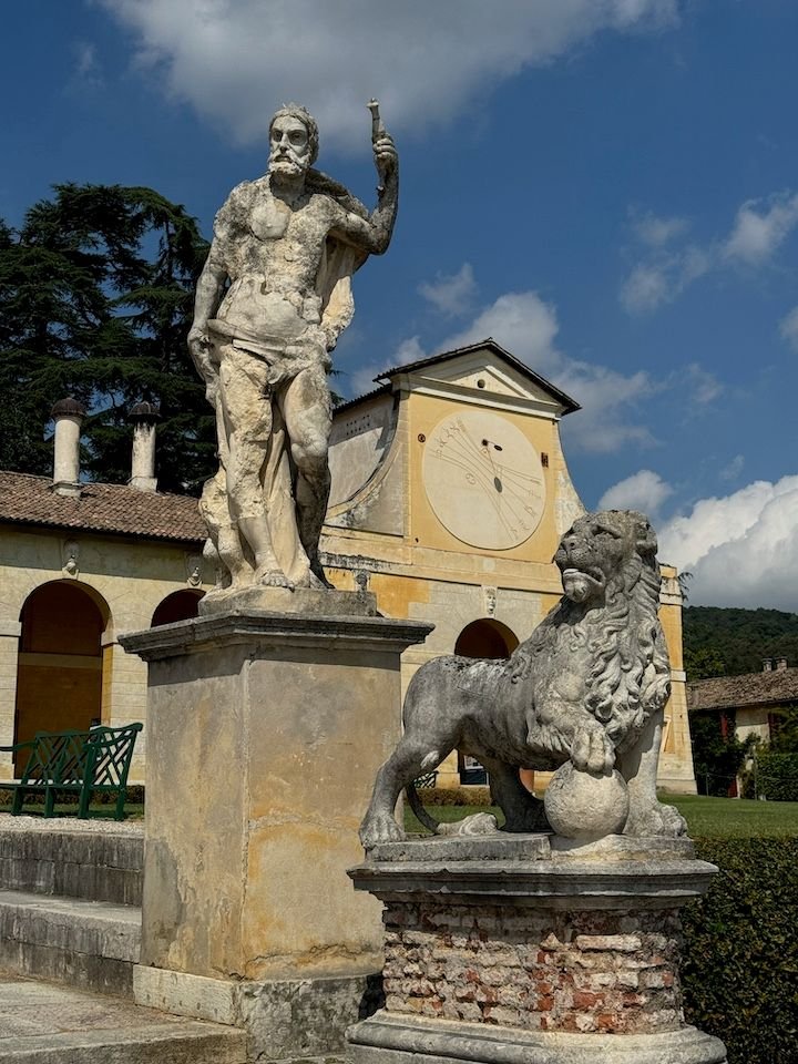
The statues outside are of Olympian gods
The Barbaro temple, built in 1580, is practically in the middle of the road
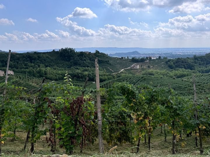
Asolo is about 20 minutes from Valdobbiadene, the heart of the Prosecco region
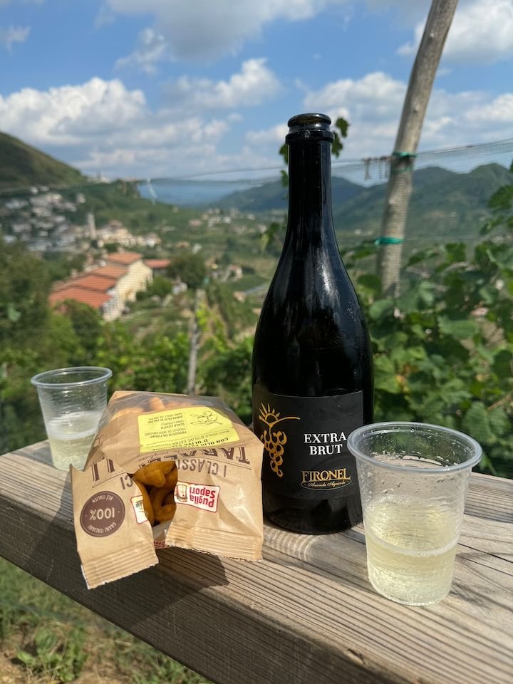
Osteria Senz-Oste, a self-service tasting venue was a one of many recommendations from the owner of our accommodation. Buy your wine, water and snacks from vending machines, and find a seat among the vines.
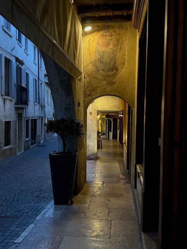
The colonnaded Via Robert Browning on the way back from dinner
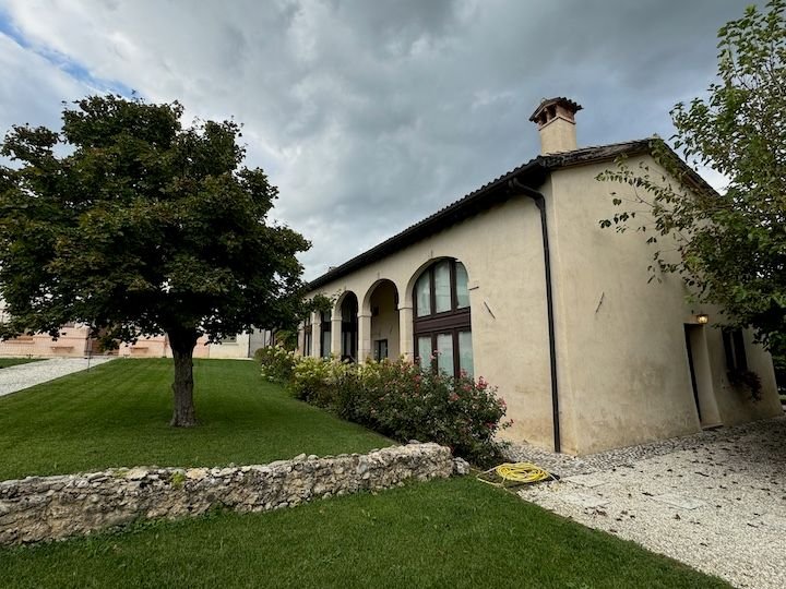
Accommodation: Villa Trieste M, which is about a 10-minute walk down the hill from the center of Asolo. It has several guest rooms in the barchessa, originally the staff quarters and stable for the villa (now under restoration).
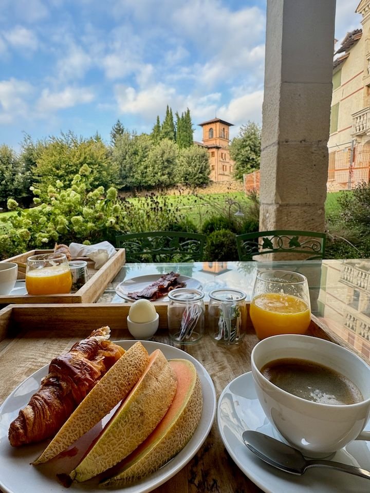
Delicious breakfast on the patio!
Our transition stop on the way north was the town of Asolo. We spent two nights in Asolo in 1991 as the last stop on our first European trip together. It was a different season (November). The skies were gloomy, not ideal for this town that sits at the intersection of the Veneto plain and the mountains and is known as the �city of one hundred horizons.� It has always been in the back of our minds as a place we�d like to revisit, if our itinerary presented the opportunity. We were pleased to find the center much as we remembered it from 33 years ago�albeit with sun and lovely views this time.
One entry is through this arch near Villa Freya, former home of explorer and writer Freya Stark
Fontanella Zen (1570s)
Hotel Duse, where we stayed in 1991, is right on the main square
One of the many elaborate villas in the area
View from the town center
The area is popular with cyclists because it features the same array of terrains encountered in major races. Here, some riders have paused their training to drink from and take a group photo in front of the winged lion fountain in Piazza Garibaldi
Asolo�s history spans over 2,000 years. Some of it is evident at la Rocca�about 700 steps above town with views across the area and down onto the town, itself
The earliest remnants at La Rocca include mosaics from a 6th century chapel
View from La Rocca
View of Asolo from La Rocca
About 10 km from the center of Asolo is Villa Barbaro (aka, Villa di Maser), conceived by Andrea Palladio in the 1550s and part of the UNESCO World Heritage group of Palladian villas. The inside features frescoes by Paolo Veronese. This is a private home, so only six rooms are open for touring, and there are no photos allowed inside.
The statues outside are of Olympian gods
The Barbaro temple, built in 1580, is practically in the middle of the road
Asolo is about 20 minutes from Valdobbiadene, the heart of the Prosecco region
Osteria Senz-Oste, a self-service tasting venue was a one of many recommendations from the owner of our accommodation. Buy your wine, water and snacks from vending machines, and find a seat among the vines.
The colonnaded Via Robert Browning on the way back from dinner
Accommodation: Villa Trieste M, which is about a 10-minute walk down the hill from the center of Asolo. It has several guest rooms in the barchessa, originally the staff quarters and stable for the villa (now under restoration).
Delicious breakfast on the patio!
Jan 4th, 2025 | 11:42 AM
#3
Original Poster
Joined: Jan 2004
Posts: 3,618
Likes: 0
To the mountains, but not until the bikes have their day
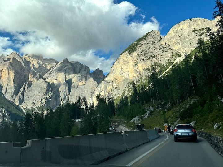
Asolo to Colfosco is about 2.5 hours. Because the forecast for the week ahead was iffy, we hoped to arrive early enough to start hiking right away. Then we learned it was Sellaronda Bike Day. The roads ringing the Sella Group�which include the Campolongo, Gardena, Sella, and Pordoi passes�would be closed from 8:30 am to 4:30 pm so that cyclists could enjoy the roads without motor vehicles. Great idea, but it meant that the town of Colfosco and our accommodation would be inaccessible until late afternoon. We used our time to enjoy a bit more of the area around Asolo (see above) and then took a less direct route over the Falzarego pass, arriving in the adjacent town of Corvara right around the time the road reopened.
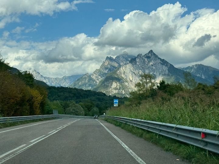
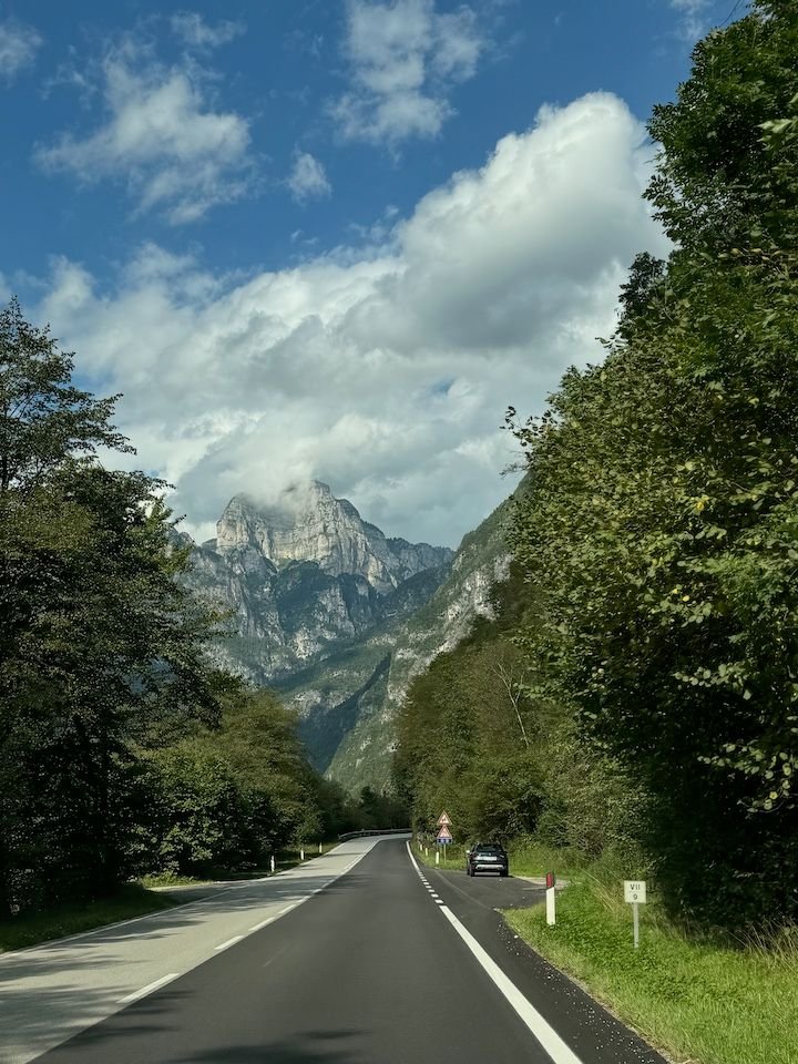
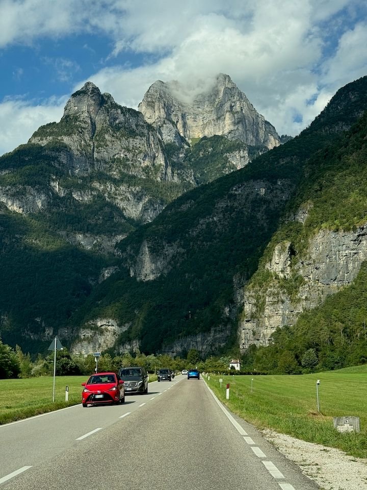
It was a stunning drive. But whatever route you take into the heart of the Dolomites, the scenery just keeps getting better and better and better.
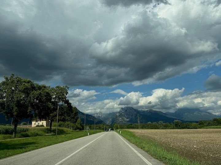
Heading out of the Veneto and towards the mountains
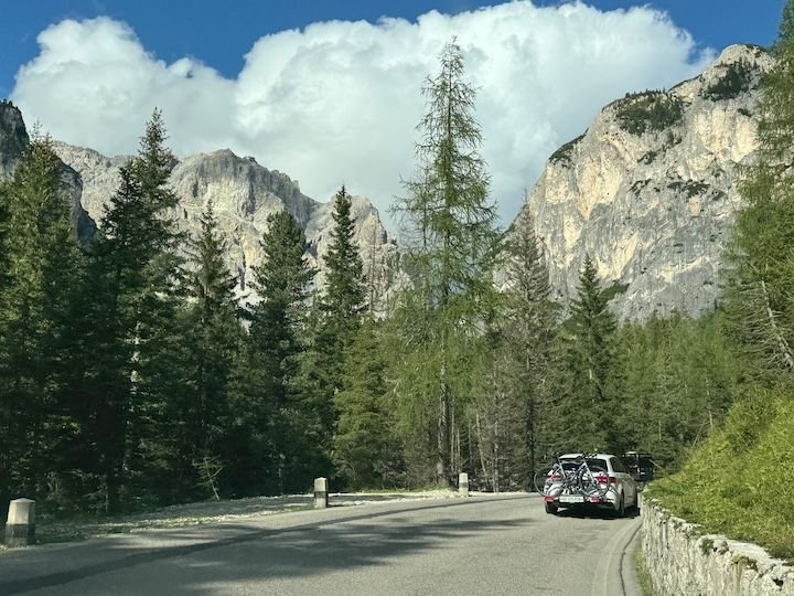
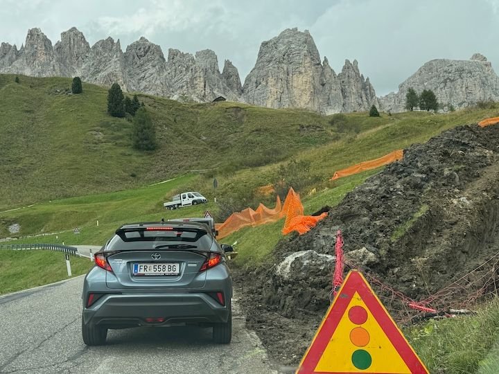
One of many road construction stops
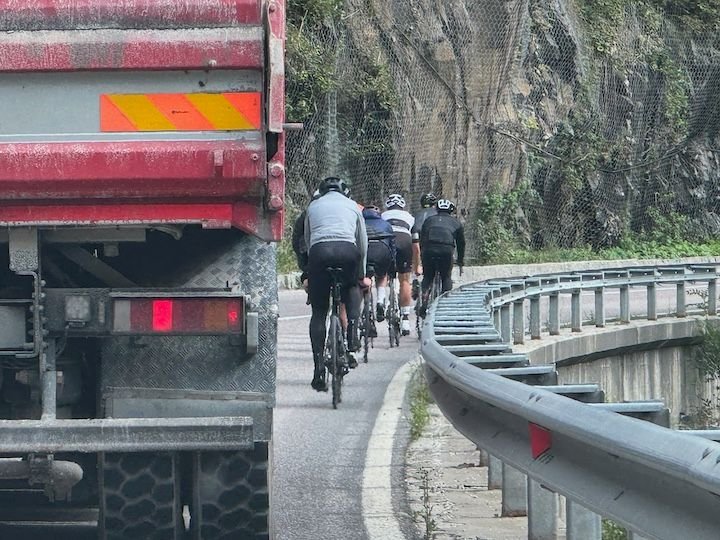
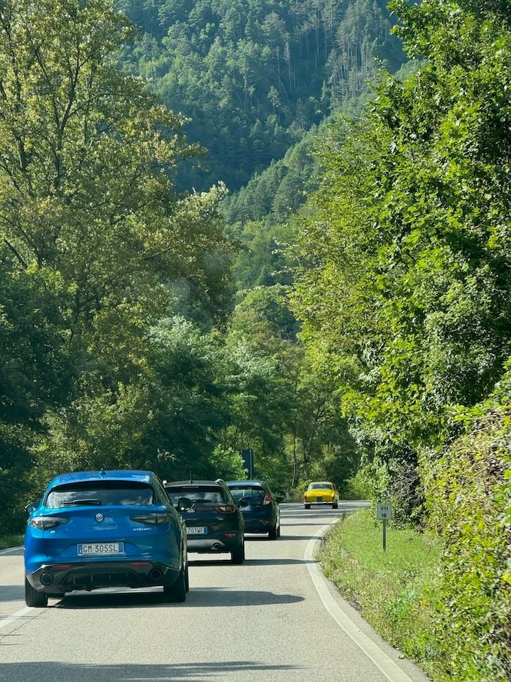
Between bikes, buses, and trucks on switchbacks, and stoplights for one-way traffic in construction zones, driving anywhere takes longer than expected.
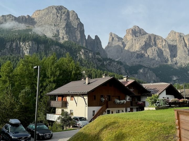
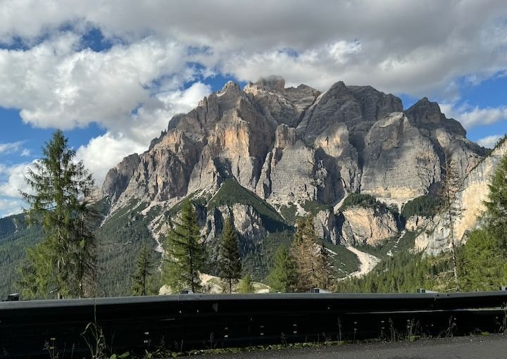
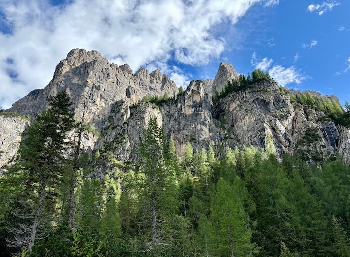
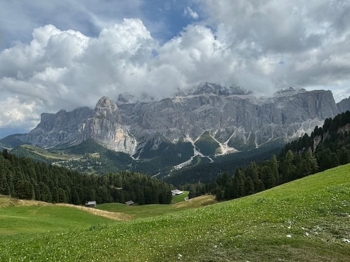
Arrived at our destination in Colfosco--our balcony view for the next week. At night, we could see Rifugio Pisciad� at the top of the Sella Massif in the upper right, twinkling like a star in the dark sky.
Asolo to Colfosco is about 2.5 hours. Because the forecast for the week ahead was iffy, we hoped to arrive early enough to start hiking right away. Then we learned it was Sellaronda Bike Day. The roads ringing the Sella Group�which include the Campolongo, Gardena, Sella, and Pordoi passes�would be closed from 8:30 am to 4:30 pm so that cyclists could enjoy the roads without motor vehicles. Great idea, but it meant that the town of Colfosco and our accommodation would be inaccessible until late afternoon. We used our time to enjoy a bit more of the area around Asolo (see above) and then took a less direct route over the Falzarego pass, arriving in the adjacent town of Corvara right around the time the road reopened.
It was a stunning drive. But whatever route you take into the heart of the Dolomites, the scenery just keeps getting better and better and better.
Heading out of the Veneto and towards the mountains
One of many road construction stops
Between bikes, buses, and trucks on switchbacks, and stoplights for one-way traffic in construction zones, driving anywhere takes longer than expected.
Arrived at our destination in Colfosco--our balcony view for the next week. At night, we could see Rifugio Pisciad� at the top of the Sella Massif in the upper right, twinkling like a star in the dark sky.
Jan 4th, 2025 | 11:44 AM
#4
Original Poster
Joined: Jan 2004
Posts: 3,618
Likes: 0
Some logistics
Lift passes: Alta Badia has a summer pass good on about 20 lifts, with options for number of days (1, any 3 of 4, any 5 of 7, etc.). There�s also a Dolomiti Super Summer Card that covers about 100 lifts throughout the whole region, also with options. Of course, you can also buy lift tickets on an as-needed basis, but this can add up quickly.
Here was the problem: The weather forecast for our week was anything but clear. How much use would we get from a lift card? And which one? Your guess is as good as ours! We opted for 3-day Alta Badia passes at �68 per person. We certainly did get our money�s worth�our rides just on that card would have totaled �142.90 p/p if purchased individually. Ultimately, though, we would have been better off with the Dolomiti Super Summer Card, as we also used a few lifts beyond our area (e.g., Val Gardena). If you�re spending more than a couple of days in a particular region of the Dolomites and lifts aren�t included on the tourist card (as is the case in some parts), then this may require some research and planning.
Hiking equipment: I like to have hiking poles, particularly for steep or rocky downhills. But we traveled carryon-only, meaning the poles stayed at home. Just as I found in Switzerland a couple of years ago, poles are easy to rent. I emailed a Colfosco sporting goods store prior to our trip to reserve a set (6� per day), and they were ready for pick-up on arrival.


Trending Topics
Jan 4th, 2025 | 12:26 PM
#8
Original Poster
Joined: Jan 2004
Posts: 3,618
Likes: 0
He drove. I enjoyed the views 
Sunday: What goes up must come down
Forecast: dry in the morning, but ambiguous after that
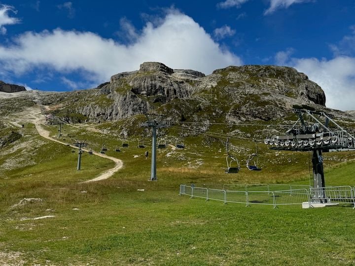
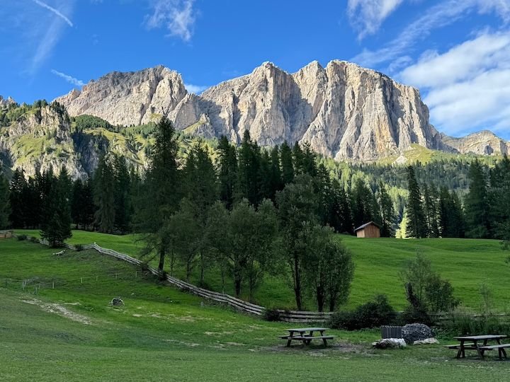
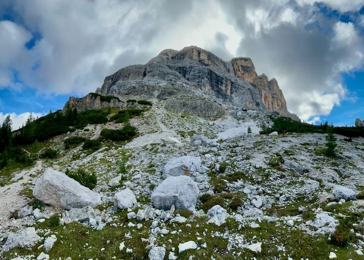
We started by taking the Col Pradat lift from Colfosco to the base of Sassongher, the peak that rises from valley on the north side of town.
Our host suggested hiking around the base of Sassongher to Rifugio Gardenacia, where there was some sort of festival that day. This is a serious hike to be sure. About an hour in, we thought about turning back due to building clouds but decided to go a bit further on a different trail that appeared to be less �vertical.� When we reached a marker indicating we were just 40 minutes from Rifugio Puez (we�ve been there before), we decided to go for it.
Ultimately, this became a 7-hour hike, 30,000+ steps, 1,000-foot elevation gain and 2,000+ descent�our most intensive hiking day of the trip. We did end up soaked, but fortunately not until we were down in a flat valley. That walk down from Rifugio Puez would have been significantly more challenging in the rain.
On that note: We�ve hiked in this area and a good portion of this trail before, so we had some idea what to expect. Alltrails rates this as a �hard� hike (although not via ferrata level of difficulty). The trails are well marked, but the weather can turn quickly. Cell signals are not always great. Have a map and a plan and trust your gut. Several days later, there was a death on a trail probably not a kilometer from where we had been. More on that later.
Top of the Col Pradat lift. There's a decent restaurant here, but we never made it back up for lunch.
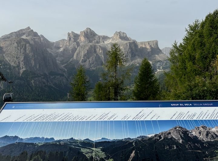
Signs for understanding what you're looking at
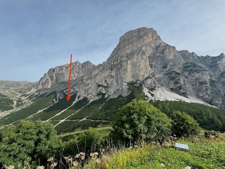
We'd be taking the upper of two trails leading out from Col Pradat
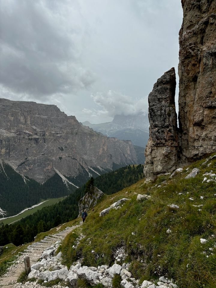
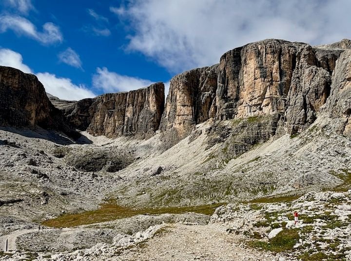
Out of the trees and into the rocky terrain
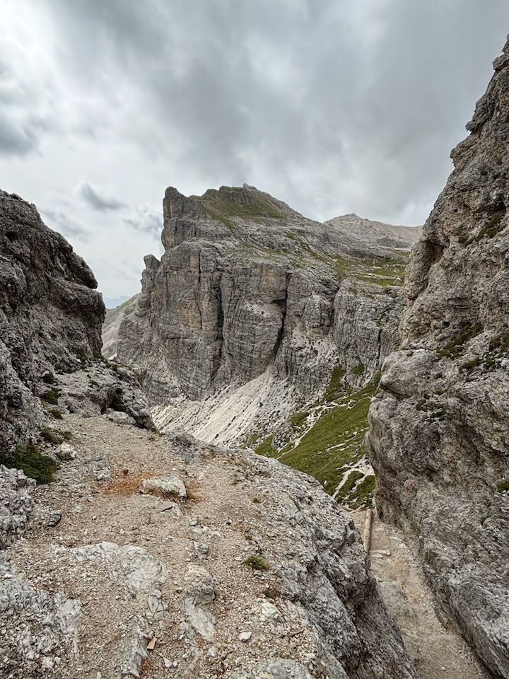
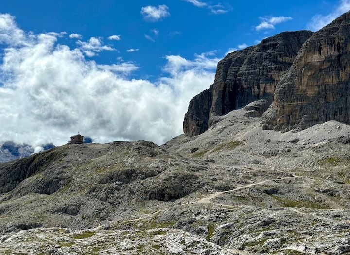
Approaching Rifugio Puez
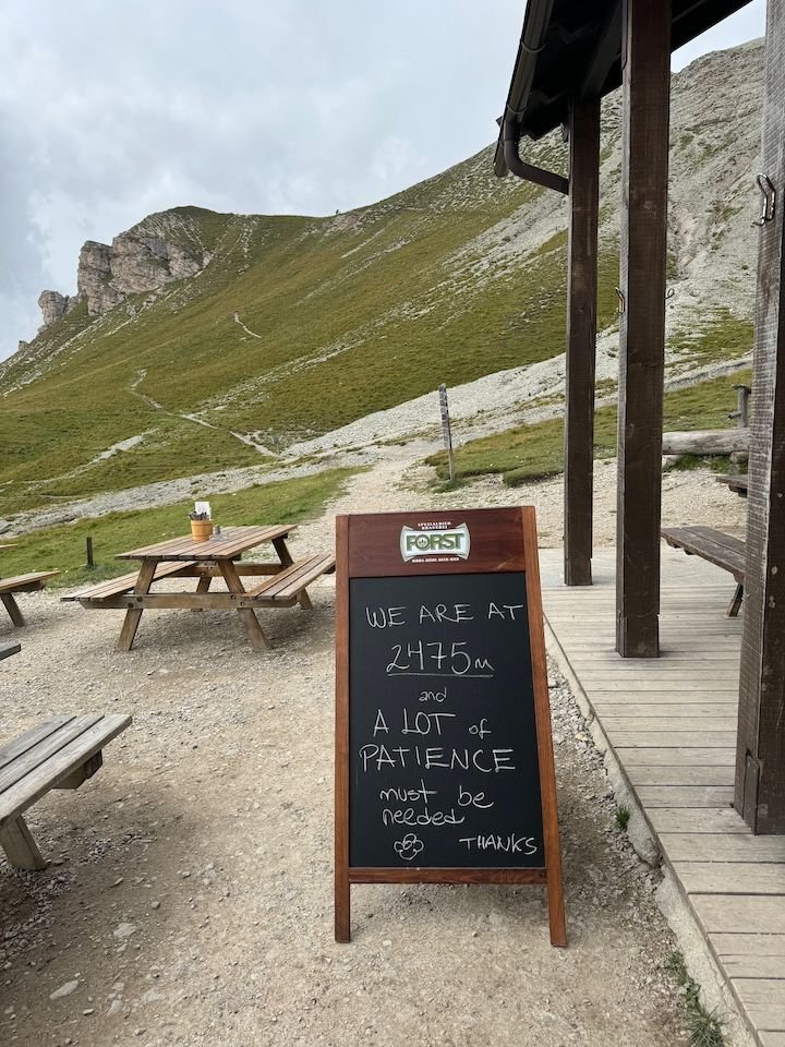
Rifugio Puez is remote�at 2475 meters, with no roads in or out. Staff and supplies come in by helicopter.
Not fancy, but it hit the spot
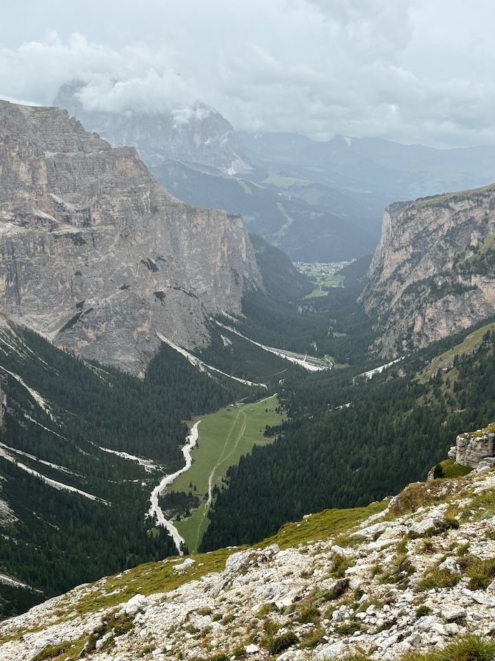
After lunch, we'll be heading down to that valley (Vallunga). The Val Gardena town of Selva is at the far end.
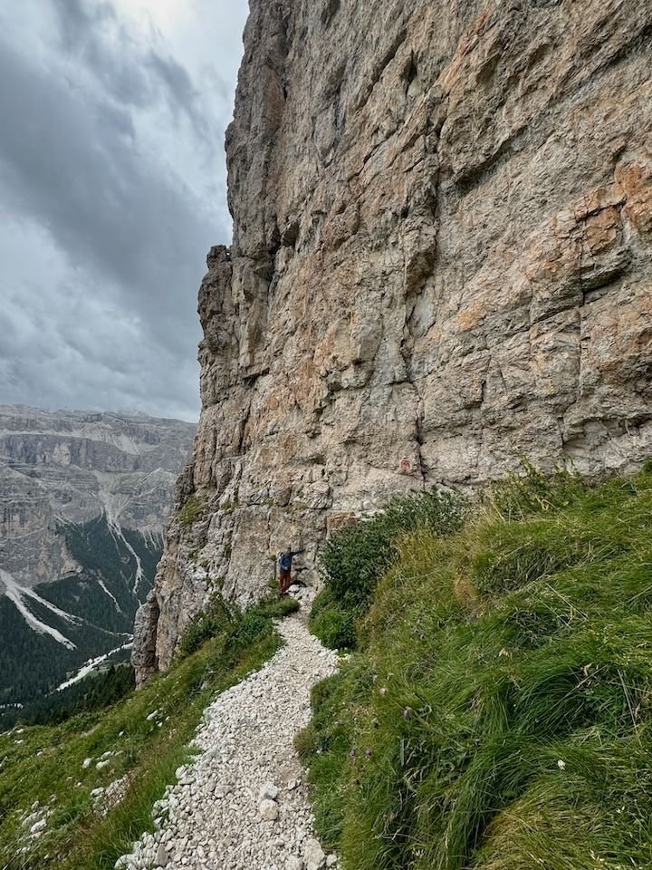
If you look hard, you can see mr_go up against the rock wall
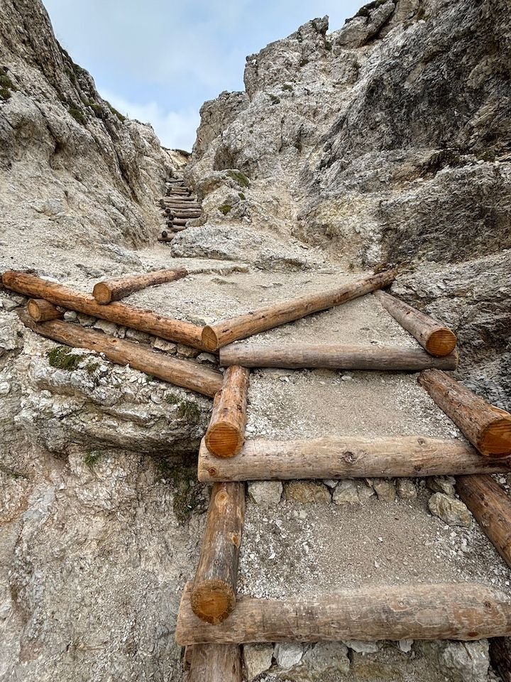
Some "steps" to assist with the descent
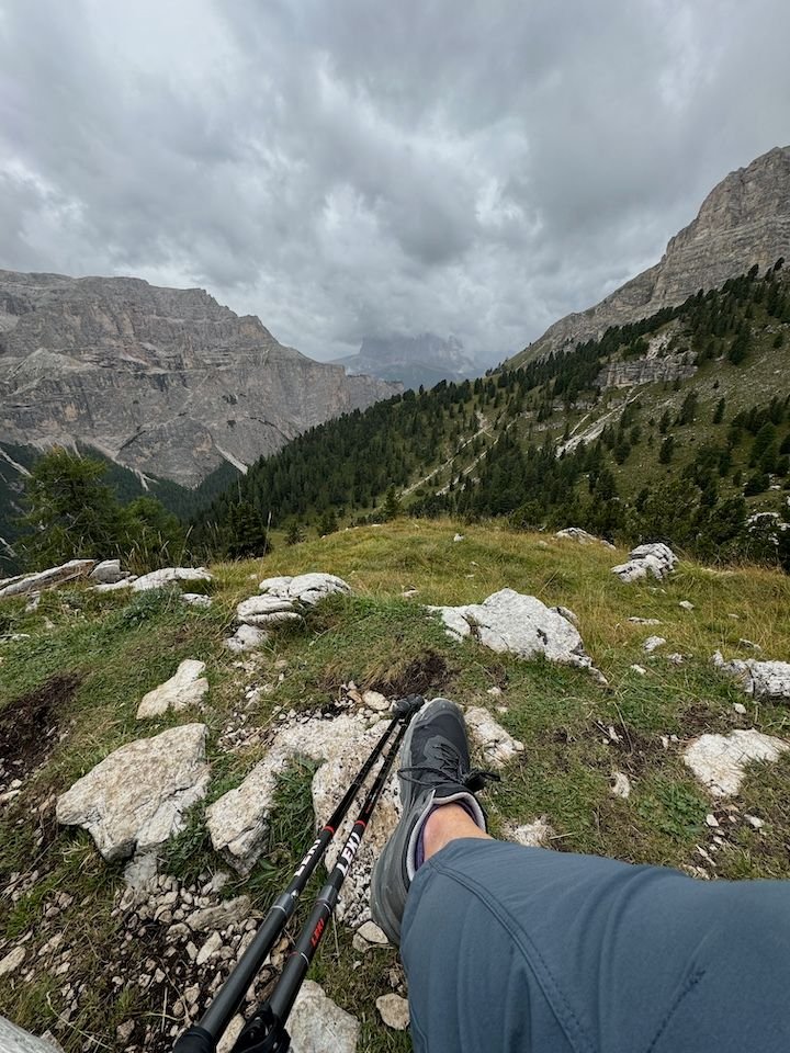
Rest break
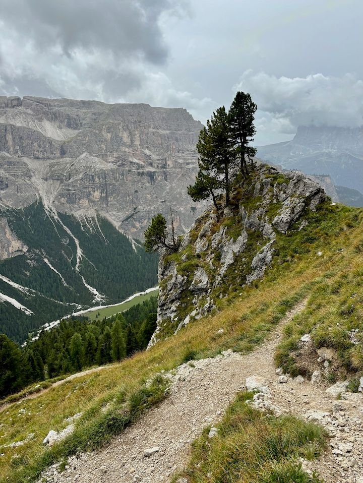
View back from rest break--those rounded cliff walls in the upper right are where we were a few photos back
An hour later, we finally reached the flat Vallunga
This way to Selva. At this point, it started to rain.
We weren�t sure how we�d get from Selva back to Colfosco. The direct bus only runs a couple of times per day, and our timing wasn�t great. As we passed the Dantercepies lift station on the way into Selva, the lightbulb went on. We could take that lift (different valley�not on our pass, so an extra �17 pp).
From the top station of Dantercepies, it is a 15-minute (flat) walk along the base of the Gran Cir to Rifugio Jimmi and the Plans/Frara gondola lift station, which was on our Alta Badia lift pass and descends back into Colfosco.
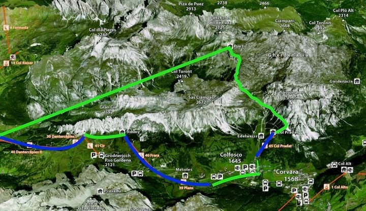
A rough drawing map of our day--blue is lifts and green is hiking
Sunday: What goes up must come down
Forecast: dry in the morning, but ambiguous after that
We started by taking the Col Pradat lift from Colfosco to the base of Sassongher, the peak that rises from valley on the north side of town.
Our host suggested hiking around the base of Sassongher to Rifugio Gardenacia, where there was some sort of festival that day. This is a serious hike to be sure. About an hour in, we thought about turning back due to building clouds but decided to go a bit further on a different trail that appeared to be less �vertical.� When we reached a marker indicating we were just 40 minutes from Rifugio Puez (we�ve been there before), we decided to go for it.
Ultimately, this became a 7-hour hike, 30,000+ steps, 1,000-foot elevation gain and 2,000+ descent�our most intensive hiking day of the trip. We did end up soaked, but fortunately not until we were down in a flat valley. That walk down from Rifugio Puez would have been significantly more challenging in the rain.
On that note: We�ve hiked in this area and a good portion of this trail before, so we had some idea what to expect. Alltrails rates this as a �hard� hike (although not via ferrata level of difficulty). The trails are well marked, but the weather can turn quickly. Cell signals are not always great. Have a map and a plan and trust your gut. Several days later, there was a death on a trail probably not a kilometer from where we had been. More on that later.
Top of the Col Pradat lift. There's a decent restaurant here, but we never made it back up for lunch.
Signs for understanding what you're looking at
We'd be taking the upper of two trails leading out from Col Pradat
Out of the trees and into the rocky terrain
Approaching Rifugio Puez
Rifugio Puez is remote�at 2475 meters, with no roads in or out. Staff and supplies come in by helicopter.
Not fancy, but it hit the spot
After lunch, we'll be heading down to that valley (Vallunga). The Val Gardena town of Selva is at the far end.
If you look hard, you can see mr_go up against the rock wall
Some "steps" to assist with the descent
Rest break
View back from rest break--those rounded cliff walls in the upper right are where we were a few photos back
An hour later, we finally reached the flat Vallunga
This way to Selva. At this point, it started to rain.
We weren�t sure how we�d get from Selva back to Colfosco. The direct bus only runs a couple of times per day, and our timing wasn�t great. As we passed the Dantercepies lift station on the way into Selva, the lightbulb went on. We could take that lift (different valley�not on our pass, so an extra �17 pp).
From the top station of Dantercepies, it is a 15-minute (flat) walk along the base of the Gran Cir to Rifugio Jimmi and the Plans/Frara gondola lift station, which was on our Alta Badia lift pass and descends back into Colfosco.
A rough drawing map of our day--blue is lifts and green is hiking
Jan 4th, 2025 | 01:04 PM
#9
Original Poster
Joined: Jan 2004
Posts: 3,618
Likes: 0
Monday: �Recovery� day
Forecast: dry and partly sunny
With only a couple of days of weather �certainty� and a pass that covered lifts across the Alta Badia, we wanted to get as much of a taste of our area�s trails and views as we could�while not being as tough on the legs as the day before.
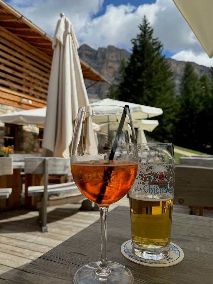
One of the reasons we picked Colfosco is because there are four lifts from the town, with abundant trails beyond them. Even better, it�s possible to take a lift, hike to another, take it, hike more, and so on. We spent a good part of the day alternating between lifts, views, and some hiking, with a light lunch at Rifugio Col Alt above Corvara.
We made a few friends around Colfosco
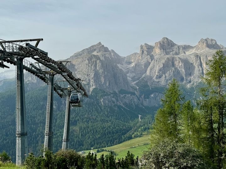
The Borest gondola transports passengers 1.3 km between Colfosco and the adjacent town of Corvara
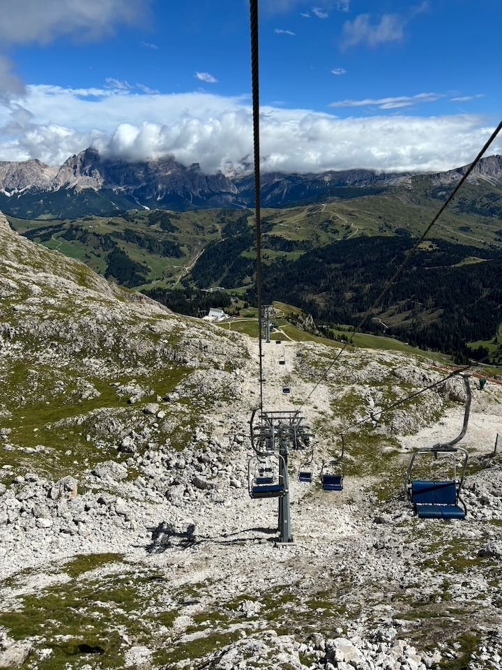
From Corvara, we took the Bo� gondola to the top of the Sella Massif--view here from the top of the lift. Corvara is visible in the valley.
From the Bo� station, the Vallon chairlift takes you even higher. It was quite windy, and I'm not fond of chairlifts to start with, so mr_go went up and I watched and explored.
View from the top of the Vallon lift
View towards Rifugio Franz Kostner
Taking the chairlift back down
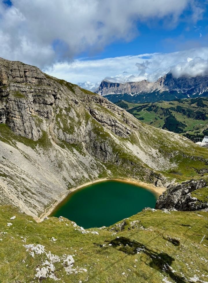
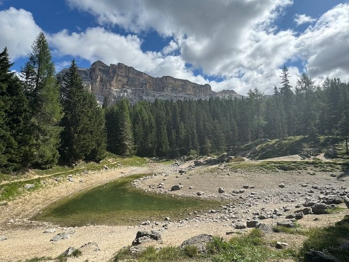
View of the small alpine lake on the way down
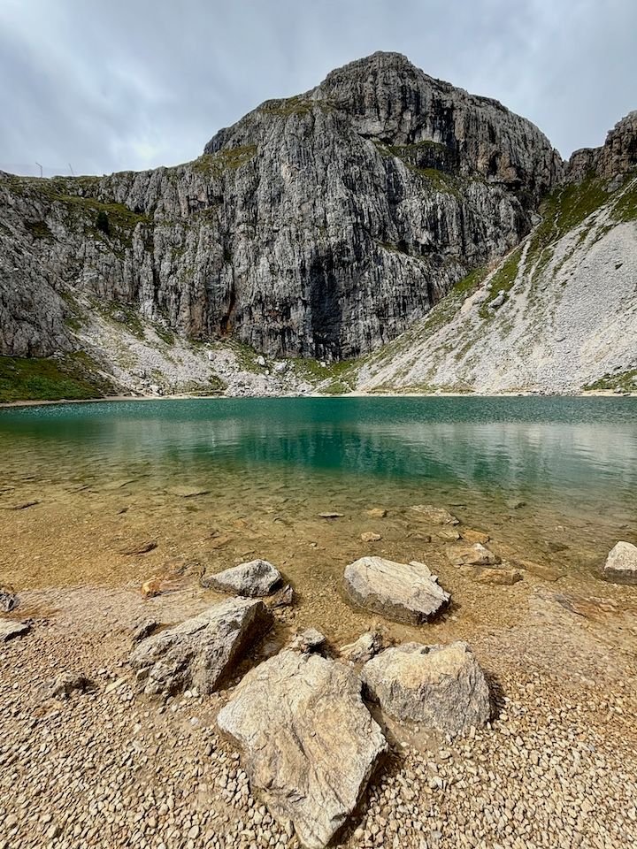
We later hiked back up to the lake
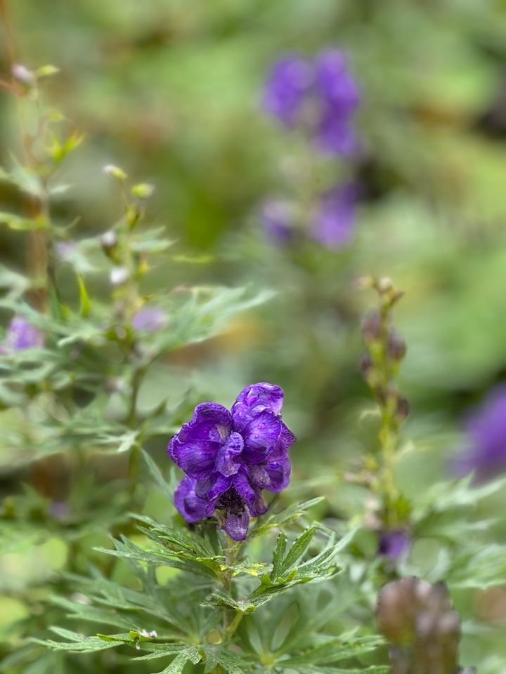
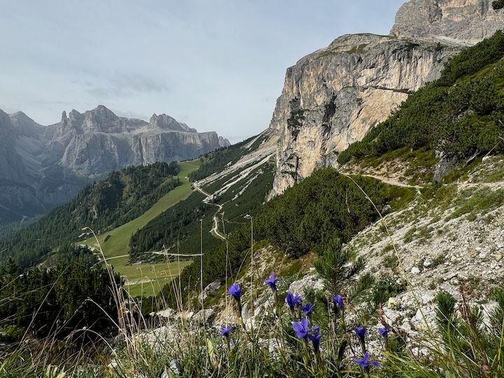
Lake flowers
Top of Bo� station, looking north
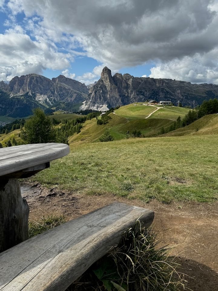
Once back in Corvara, we took the Col Alt lift, which goes up to one side of an expansive ski and hiking area accessible from Corvara, San Cassiano and La Valle.
Top of the Col Alt gondola. That's Colfosco down in the valley below.
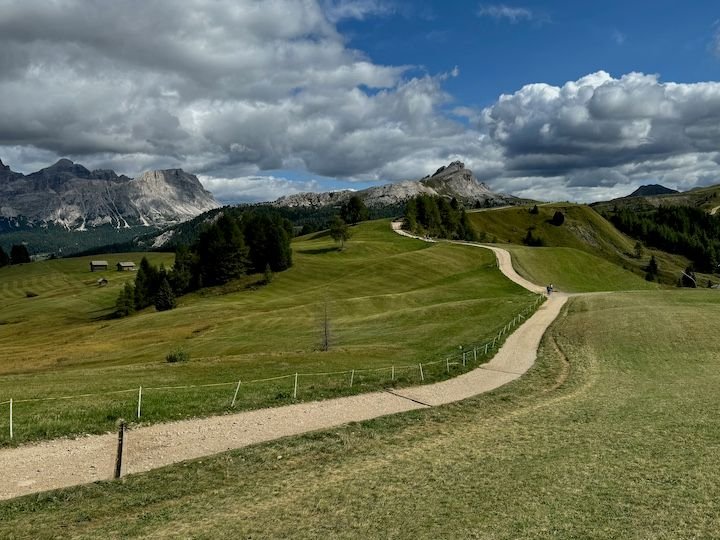
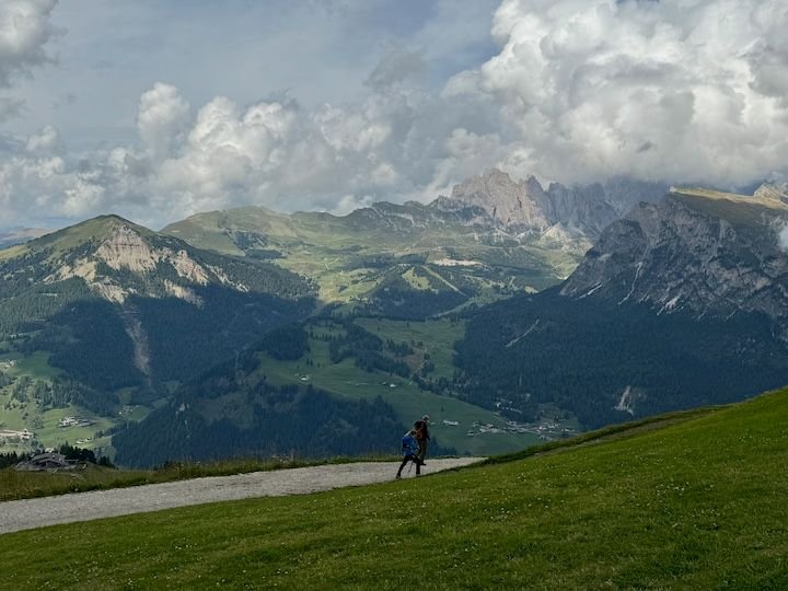
Some of the expansive area beyond Col Alt. We explored a bit, and were back up in this area the following day.
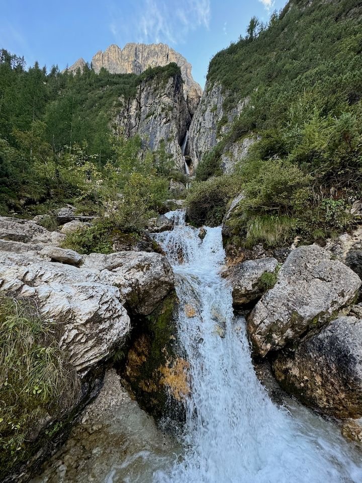
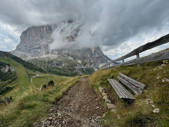
Once back in Colfosco, we ended the day with the approximately one-hour (each way) and relatively flat Borest trail to the Pisciad� falls on the north face of the Sella Massif. A beautiful walk, especially at golden hour.
Rough map of today's exploring--blue for lifts, green for hiking
This day was intended to be easy on the legs, but we still managed over 18,000 steps�although none of it as challenging as the day before.
Forecast: dry and partly sunny
With only a couple of days of weather �certainty� and a pass that covered lifts across the Alta Badia, we wanted to get as much of a taste of our area�s trails and views as we could�while not being as tough on the legs as the day before.
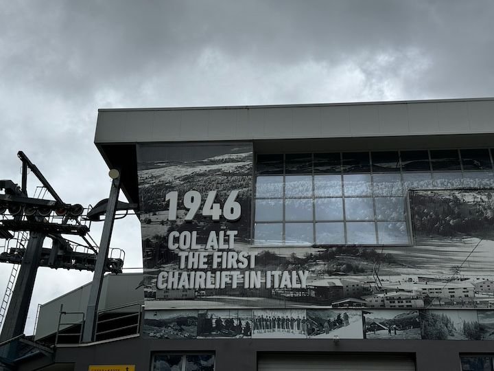
One of the reasons we picked Colfosco is because there are four lifts from the town, with abundant trails beyond them. Even better, it�s possible to take a lift, hike to another, take it, hike more, and so on. We spent a good part of the day alternating between lifts, views, and some hiking, with a light lunch at Rifugio Col Alt above Corvara.
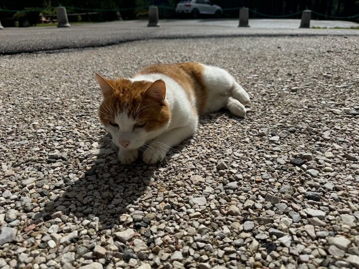
We made a few friends around Colfosco
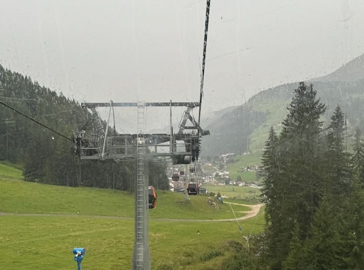
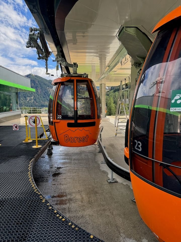
The Borest gondola transports passengers 1.3 km between Colfosco and the adjacent town of Corvara
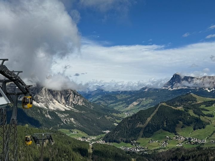
From Corvara, we took the Bo� gondola to the top of the Sella Massif--view here from the top of the lift. Corvara is visible in the valley.
From the Bo� station, the Vallon chairlift takes you even higher. It was quite windy, and I'm not fond of chairlifts to start with, so mr_go went up and I watched and explored.
View from the top of the Vallon lift
View towards Rifugio Franz Kostner
Taking the chairlift back down
View of the small alpine lake on the way down
We later hiked back up to the lake
Lake flowers
Top of Bo� station, looking north
Once back in Corvara, we took the Col Alt lift, which goes up to one side of an expansive ski and hiking area accessible from Corvara, San Cassiano and La Valle.
Top of the Col Alt gondola. That's Colfosco down in the valley below.
Some of the expansive area beyond Col Alt. We explored a bit, and were back up in this area the following day.
Once back in Colfosco, we ended the day with the approximately one-hour (each way) and relatively flat Borest trail to the Pisciad� falls on the north face of the Sella Massif. A beautiful walk, especially at golden hour.
Rough map of today's exploring--blue for lifts, green for hiking
This day was intended to be easy on the legs, but we still managed over 18,000 steps�although none of it as challenging as the day before.
Jan 4th, 2025 | 02:17 PM
#11
Original Poster
Joined: Jan 2004
Posts: 3,618
Likes: 0
Tuesday: Oh, the panorama
Forecast: dry, mostly sunny
About 30 minutes north of Colfosco is the town of Badia. From here, there is a two-part lift to the base of Sas dla Crusc, where you can access various hiking trails. The first and longer part of the current ride is a chairlift (a new gondola lift is under construction). I�m generally not fond of these�you know, heights and fear of falling�but it was a sunny day with little wind, so up we went.

The first part of the ride up is a long chairlift. A new gondola is under construction.
The upper station at the base of Sas dla Crusc
View from the top
More views
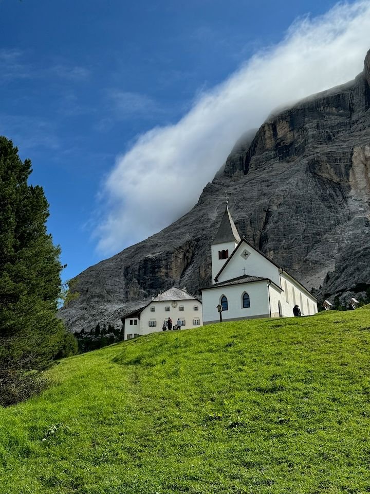
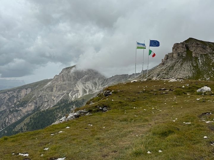
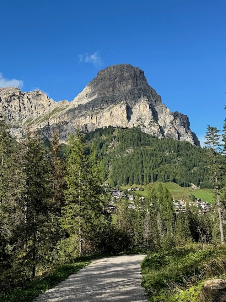
The Sanctuary of Santa Croce sits on a site with a long religious history�once a pagan place of worship in pre-Christian times. Records suggest a church has been on this site since the late 1400s. The church gives its name to the mountain above. It is a popular pilgramage site even today.
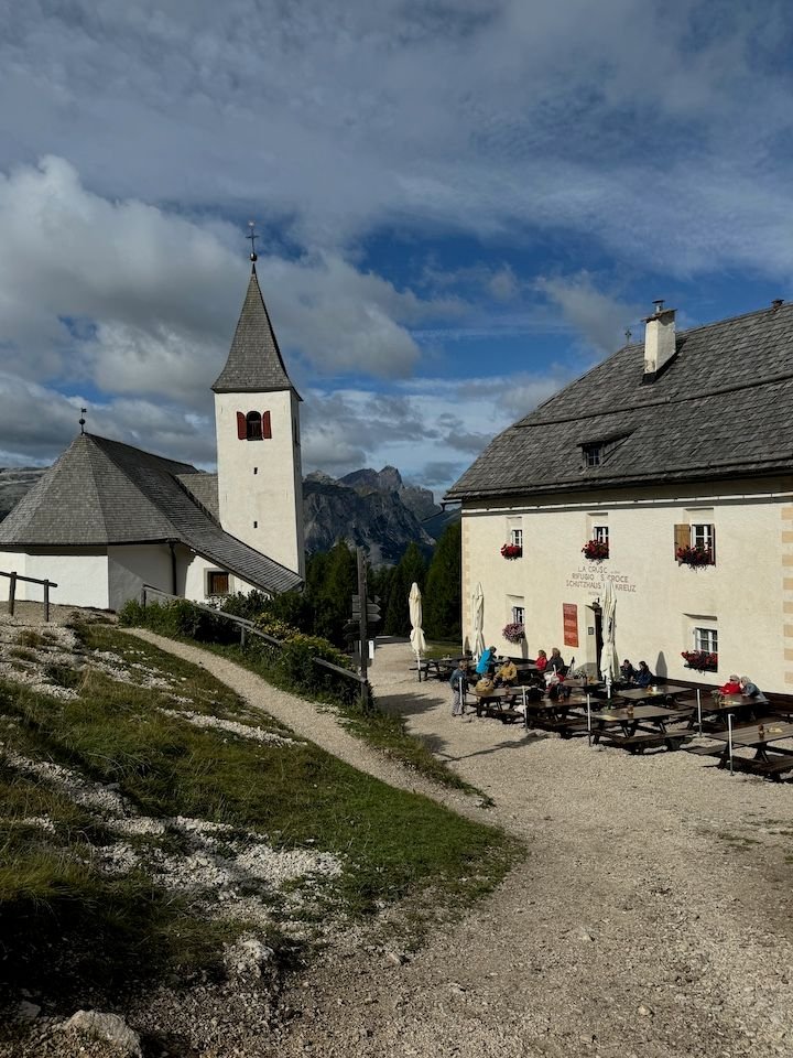
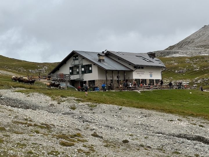
Adjacent rifugio is popular spot for coffee and strudel
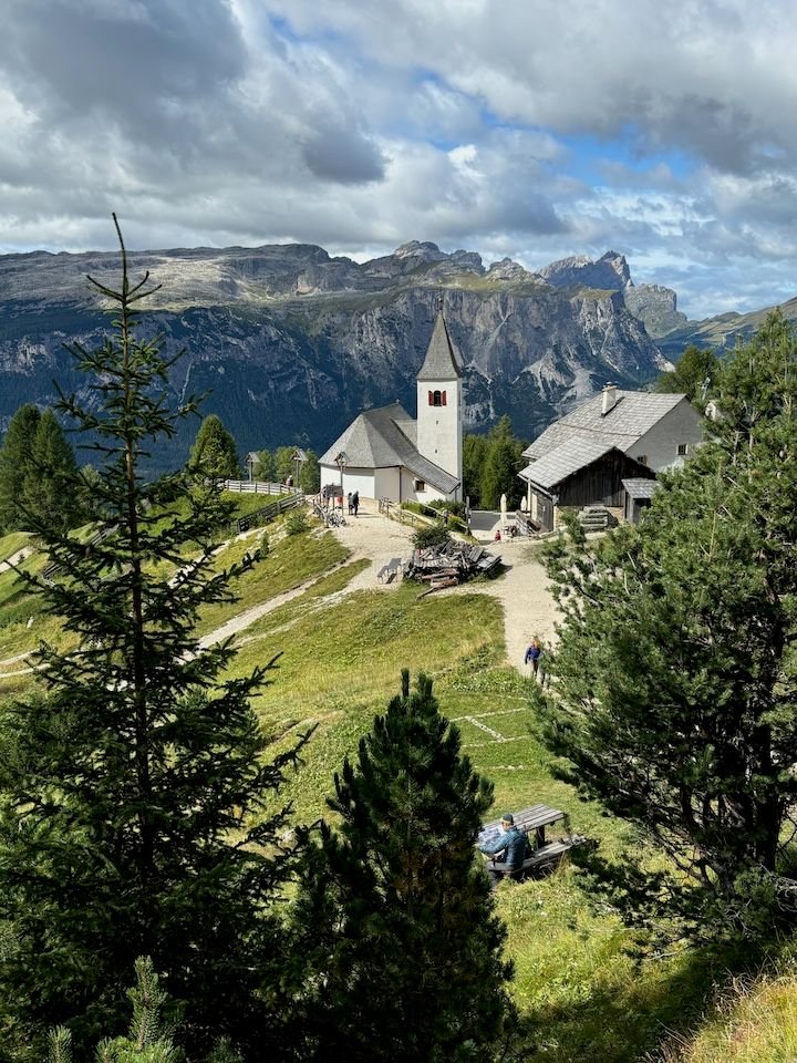
Views from the beginning of the trail above the church
While the rifugio was busy, the trails were quiet. We encountered just a few people.
Rocky areas of the trail below Sas dla Crusc
View across the Val Badia
We hiked for about an hour before heading down toward the mid-station for lunch
This part of the hike took us through the trees

Well marked trails
Looks a little dry in this area
Many of the mountain huts have very good food. Utia Le, whose kitchen specializes in traditional Ladin cuisine, is no exception.
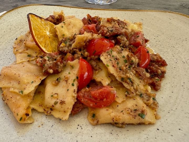
Ravioli di zucca
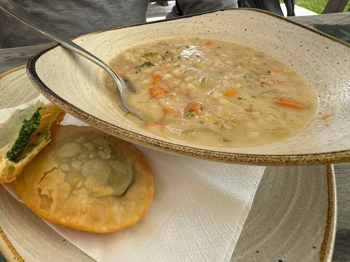
Barley soup with tutres (fried bread stuffed with spinach)
Forecast: dry, mostly sunny
About 30 minutes north of Colfosco is the town of Badia. From here, there is a two-part lift to the base of Sas dla Crusc, where you can access various hiking trails. The first and longer part of the current ride is a chairlift (a new gondola lift is under construction). I�m generally not fond of these�you know, heights and fear of falling�but it was a sunny day with little wind, so up we went.
The first part of the ride up is a long chairlift. A new gondola is under construction.
The upper station at the base of Sas dla Crusc
View from the top
More views
The Sanctuary of Santa Croce sits on a site with a long religious history�once a pagan place of worship in pre-Christian times. Records suggest a church has been on this site since the late 1400s. The church gives its name to the mountain above. It is a popular pilgramage site even today.
Adjacent rifugio is popular spot for coffee and strudel
Views from the beginning of the trail above the church
While the rifugio was busy, the trails were quiet. We encountered just a few people.
Rocky areas of the trail below Sas dla Crusc
View across the Val Badia
We hiked for about an hour before heading down toward the mid-station for lunch
This part of the hike took us through the trees
Well marked trails
Looks a little dry in this area
Many of the mountain huts have very good food. Utia Le, whose kitchen specializes in traditional Ladin cuisine, is no exception.
Ravioli di zucca
Barley soup with tutres (fried bread stuffed with spinach)
Jan 4th, 2025 | 02:28 PM
#12
Original Poster
Joined: Jan 2004
Posts: 3,618
Likes: 0
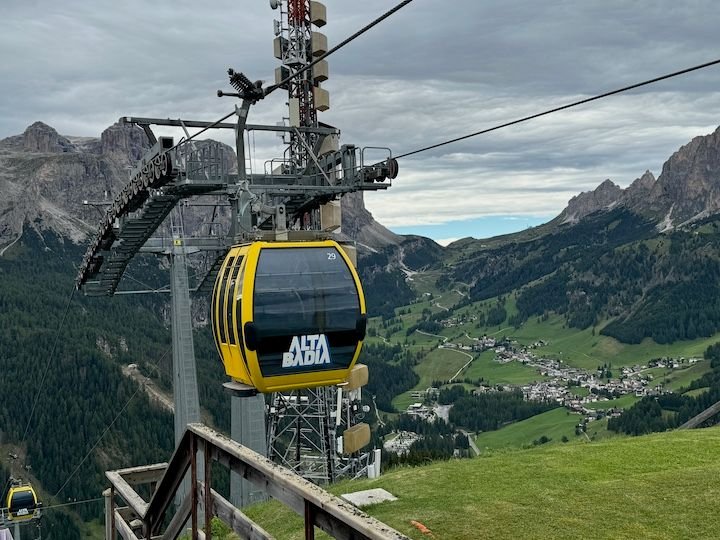
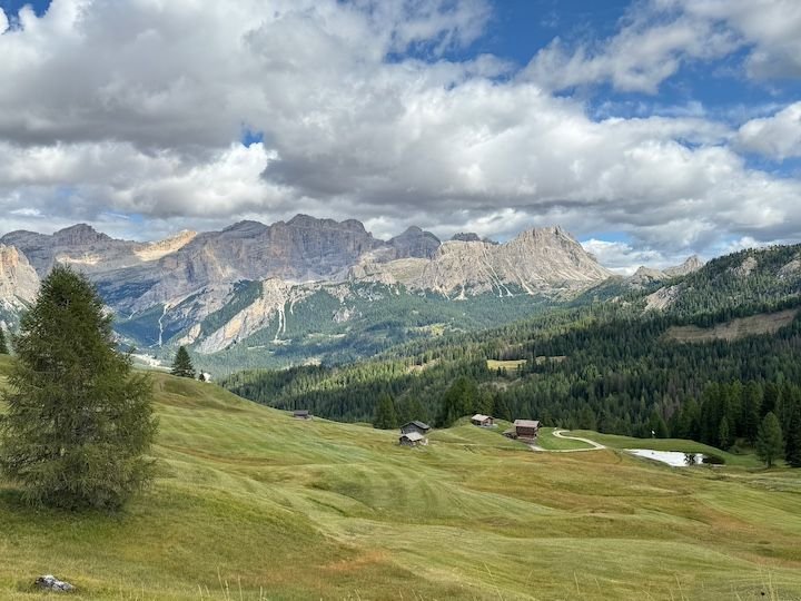
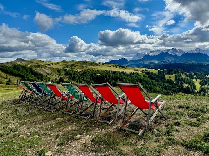
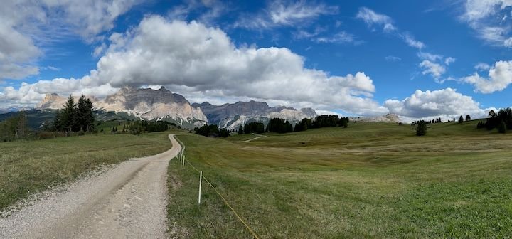
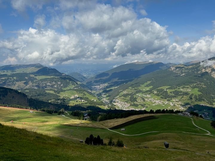
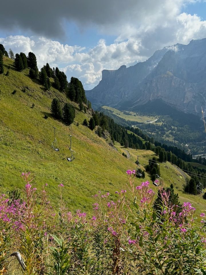
After lunch, we took the chairlift back down and drove to San Cassiano, where we took the Piz Sorega gondola to the large plateau that sits above and connects Corvara, La Villa and San Cassiano—providing expansive hiking and skiing opportunities across all seasons. We could have hiked for days around here.
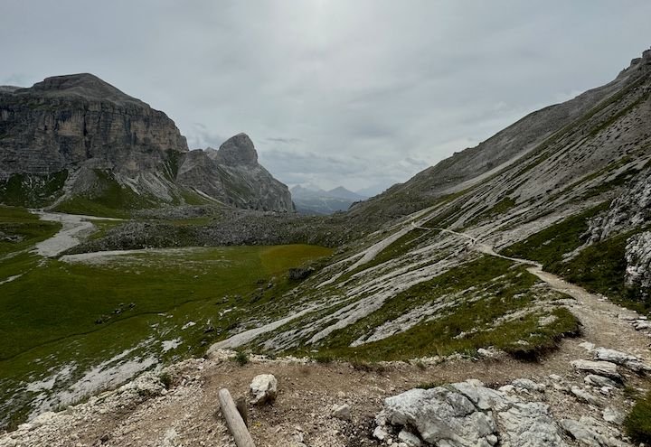
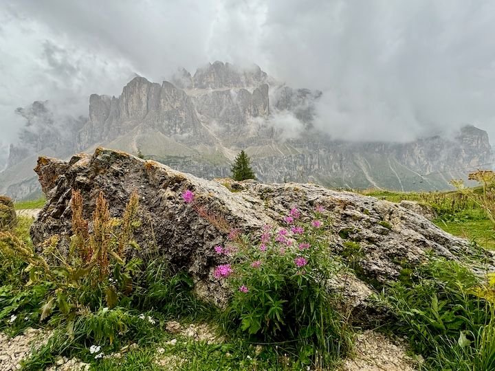
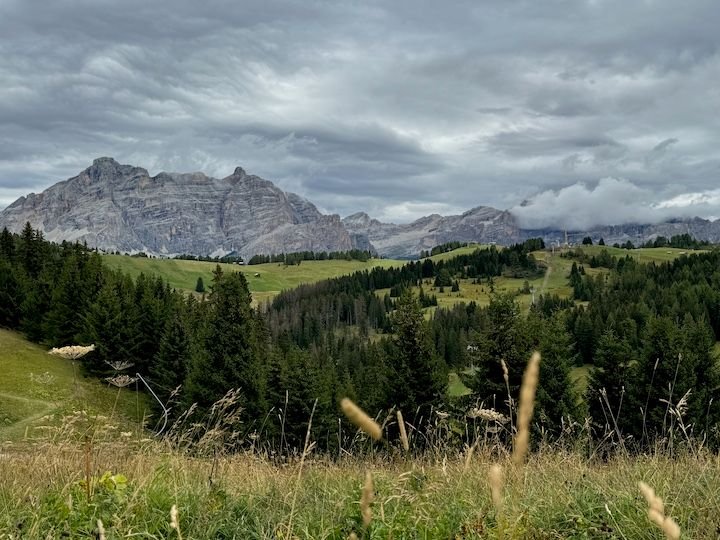
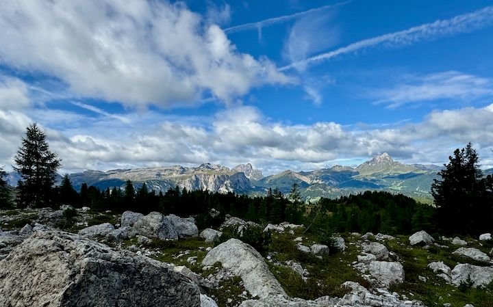
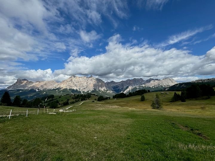
From the upper station, a gravel road with a steady upward grade leads toward Rifugio Alpino Pralongia. While the trail was not especially crowded, we did share it with other walkers, a few mountain bikers, and an occasional motor vehicle. About three-quarters of the way to the rifugio (~45 minutes, because we stopped so often for photos) is Panorama Point. Holy moly, they aren’t kidding. The 360-degree vista from here has it all: Marmolada (and its glaciers), the Sella Group, Sassongher, Puez Group and Ciampani, Sas dla Crusc, Lavarela, Lagazuoi, SetSas. Amazing!
Almost 24,000 steps today.
Top of the Piz Sorega lift above San Cassiano
The large plateau here sits above the towns of Corvara, La Villa and San Cassiano with views across the heart of the Dolomites
Seating for enjoying the view toward Marmolada and its glaciers
The road out toward Rifugio Alpino Pralongia
At Panorama Point
On our way back to the gondola
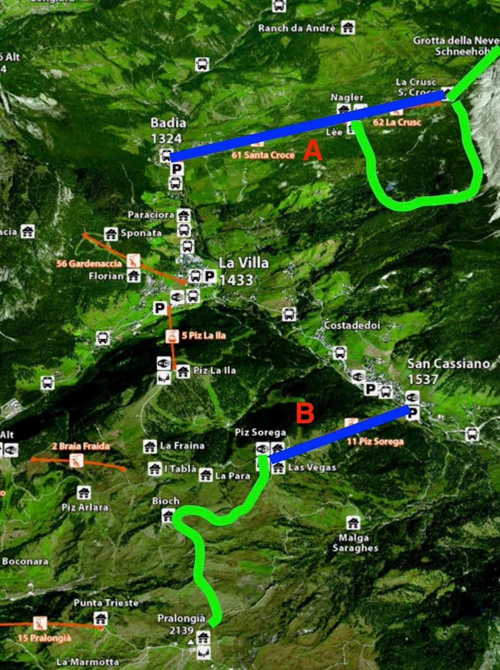
Today's exploring--blue for lifts and green for hiking
From the upper station, a gravel road with a steady upward grade leads toward Rifugio Alpino Pralongia. While the trail was not especially crowded, we did share it with other walkers, a few mountain bikers, and an occasional motor vehicle. About three-quarters of the way to the rifugio (~45 minutes, because we stopped so often for photos) is Panorama Point. Holy moly, they aren’t kidding. The 360-degree vista from here has it all: Marmolada (and its glaciers), the Sella Group, Sassongher, Puez Group and Ciampani, Sas dla Crusc, Lavarela, Lagazuoi, SetSas. Amazing!
Almost 24,000 steps today.
Top of the Piz Sorega lift above San Cassiano
The large plateau here sits above the towns of Corvara, La Villa and San Cassiano with views across the heart of the Dolomites
Seating for enjoying the view toward Marmolada and its glaciers
The road out toward Rifugio Alpino Pralongia
At Panorama Point
On our way back to the gondola
Today's exploring--blue for lifts and green for hiking
Last edited by ms_go; Jan 4th, 2025 at 02:45 PM.
Jan 4th, 2025 | 03:39 PM
#14
Joined: May 2008
Posts: 10,493
Likes: 1
From someone who "plans" last-minute, plays a lot by ear and doesn't document much when she travels, I appreciate your reports. They are so helpful for future trips ...and maybe past? Help me understand: your photos from the Sunday hike--Rifugio Puez, a number of vistas from the trail, the chapel down in Vallunga, etc.--all look very familiar to me but I have only been to the Dolomites once, based in Val Gardena. Is this hike done from Selva too? I did a couple long, mid- to semi-difficult hikes when I was there.
Looking forward to more. I definitely plan to return to the Dolomites one of these days, although I am less keen on hiking solo for safety reasons now that I am in my 50s!
Looking forward to more. I definitely plan to return to the Dolomites one of these days, although I am less keen on hiking solo for safety reasons now that I am in my 50s!
Jan 4th, 2025 | 03:52 PM
#15
Original Poster
Joined: Jan 2004
Posts: 3,618
Likes: 0
My knees survived, I think. It was my quads that hurt for days.
Thank you, cats53! Glad you are enjoying. We love this area, and I love sharing our experiences there.
Wednesday: Back where it all began
Forecast: mostly cloudy, chance of rain increasing through the afternoon
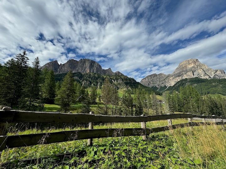
On the first day of our first trip to the Dolomites in 2009, we took the Ciampinoi lift from Selva di Val Gardena/Wolkenstein to the base of the Sassolungo/Langkofel and then walked some of the path around it. With our Alta Badia lift pass now expired, we decided to drive to Selva, look around for old time�s sake, and then repeat that very first day of hiking (but longer)�complete with lunch at Rifugio Emilio Comici. This is not a terribly challenging hike. It�s relatively flat with the exception of the steep downhill walk from the top station of Ciampinoi, and steep walk back up to catch the gondola back to Selva.
Selva seemed a little more built up and bustling than we remembered, and there were definitely more people on the trails here than we�d encountered the three days before�no doubt due to the popularity of the Val Gardena over other areas.
18,000+ steps today.
Val Gardena from the Ciampinoi top station. The large town at the end is Ortisei.
The walk from the station starts with a brief but steep downhill portion
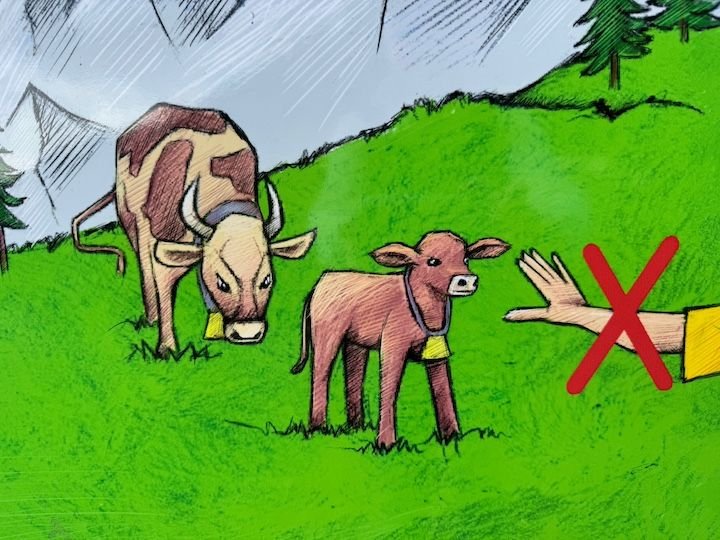
Once downhill, there's a short portion that goes through a pasture--so be aware
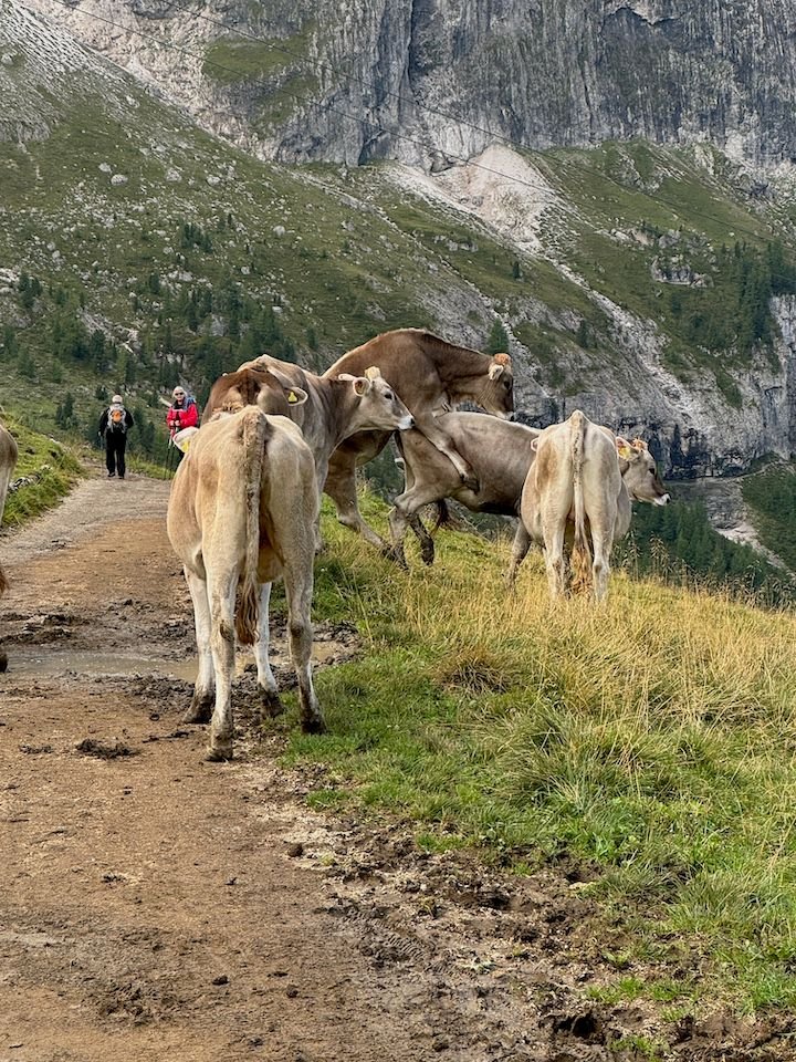
Sure enough, they were on the trail--and one was feeling a little bullish. That sent several of us scrambling into the brush to get around them.
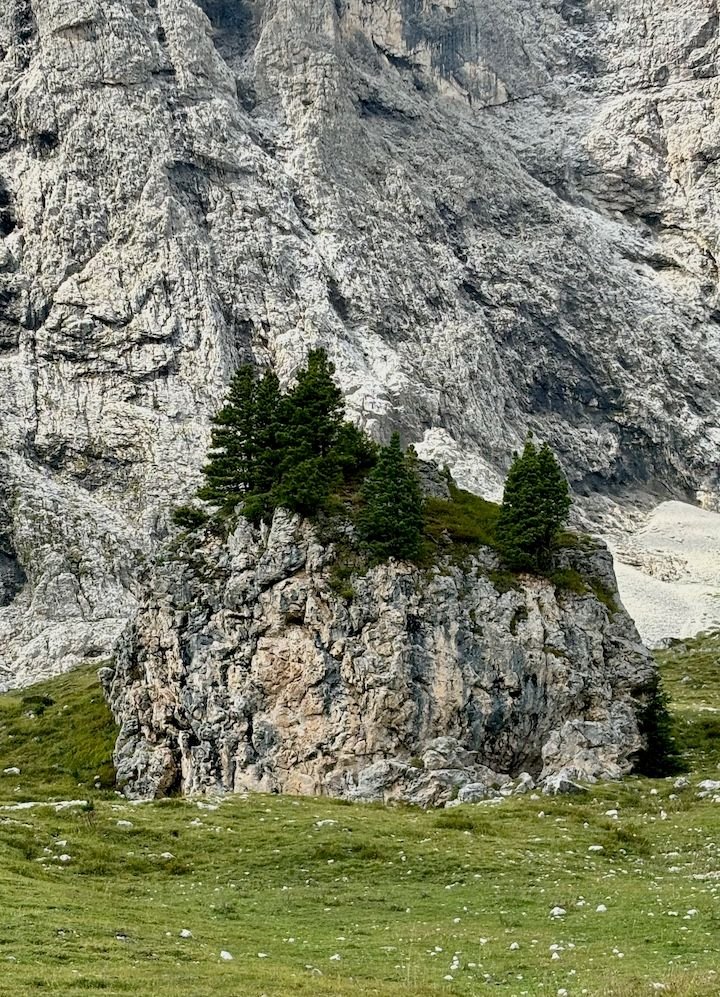
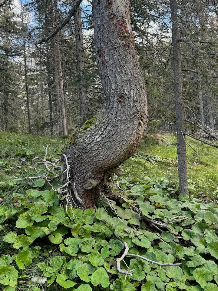
Walking around the base of the Sassolungo. We were fascinated by the small rocks with trees growing out of them.
At one point, the trail branched. We took the route not indicated for bikes or strollers.
Along the trail.
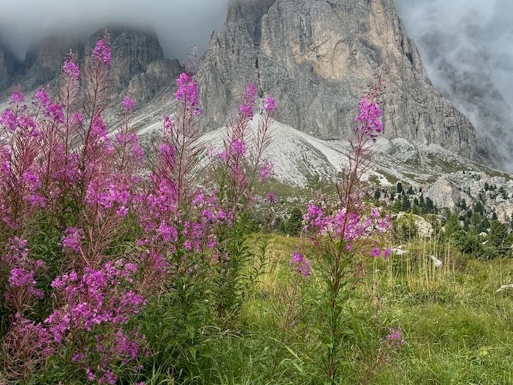
Still some flowers late in the season
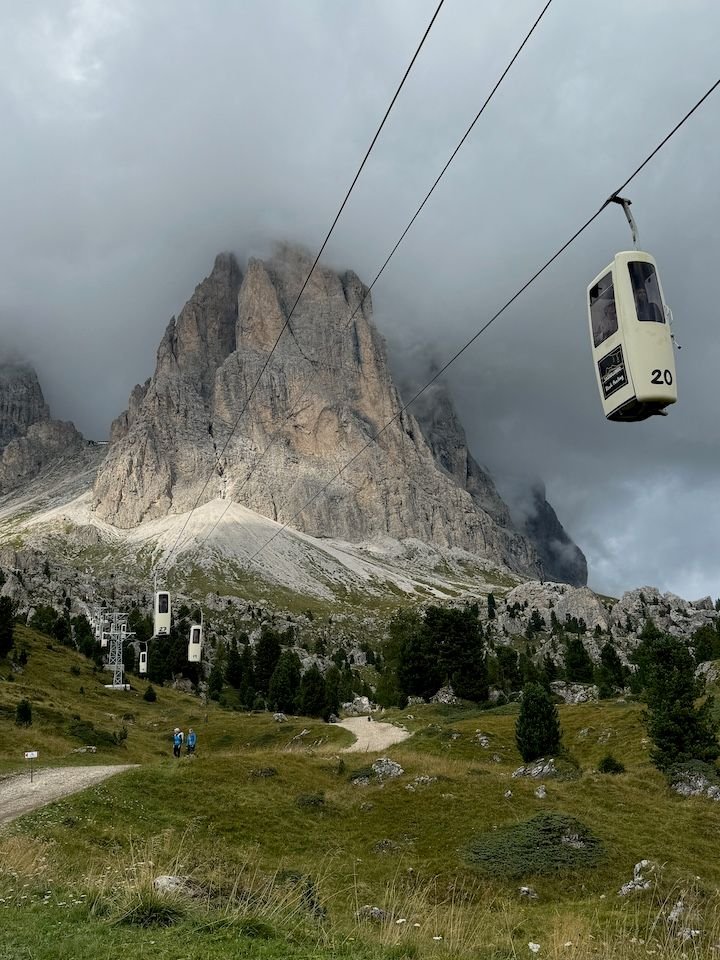
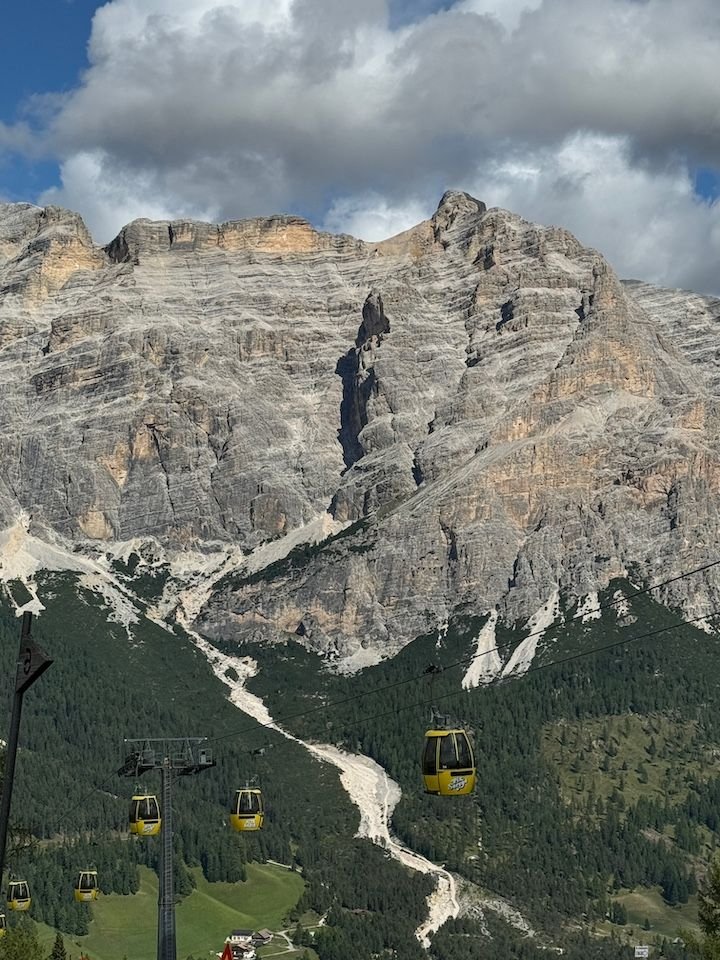
Eventually we came to the lift station at Passo Sella, with the famous telecabin gondolas--or as we call them, the flying phone booths. These are a real trip. They go right straight up the cliff face. We did this during our 2009 trip.
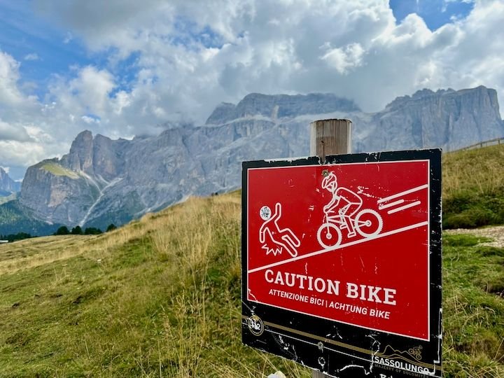
Here, our trail connected with the mountain biking trail.
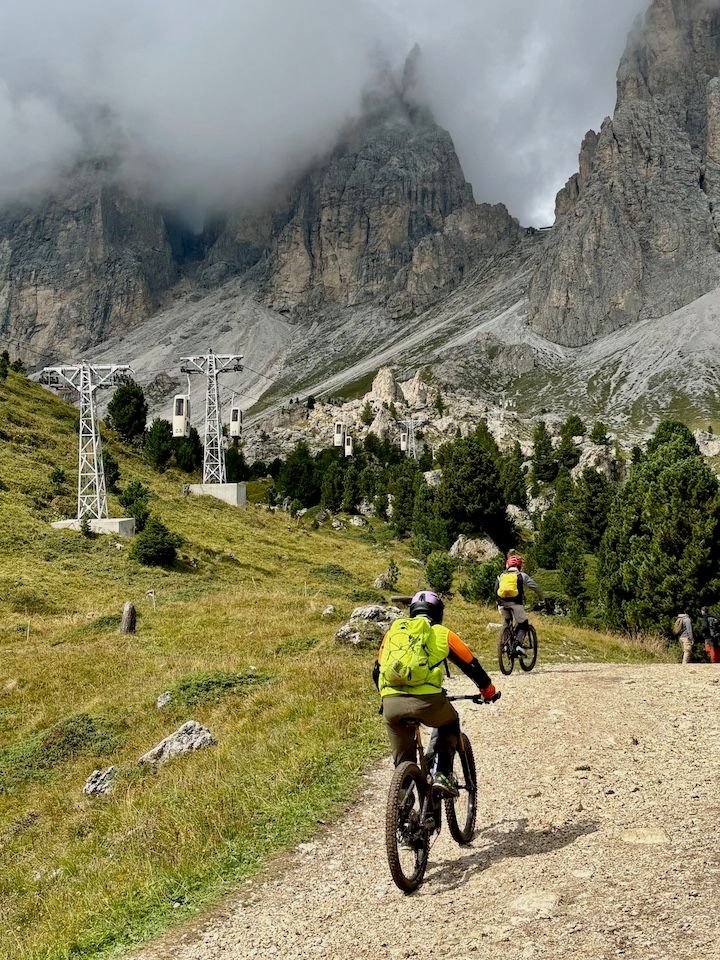
Bikers under the telecabin lifts
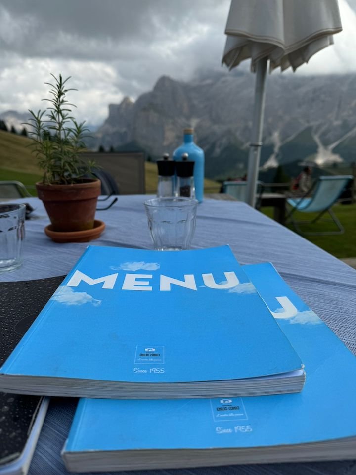
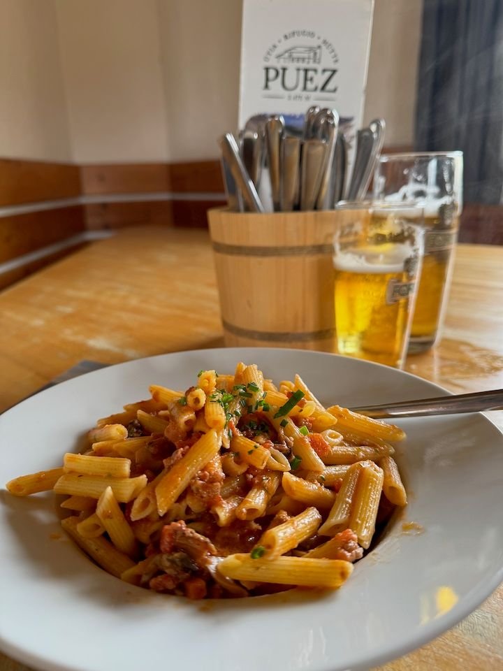
Eventually we circled around and headed back to lunch at Rifugio Emilio Comici, which has a massive menu (also known for seafood)
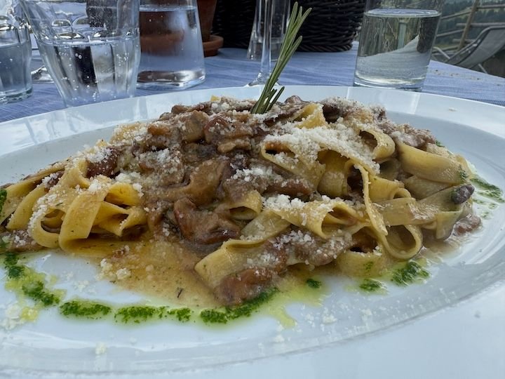
Tagliatelle with mushrooms
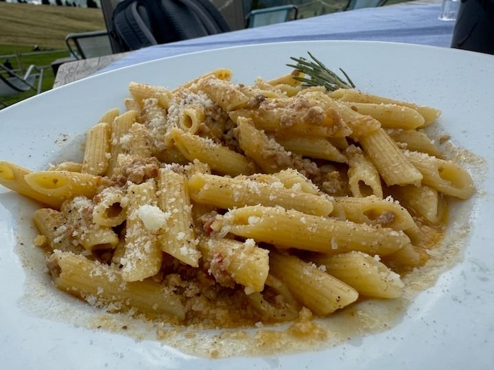
Penne with ragu
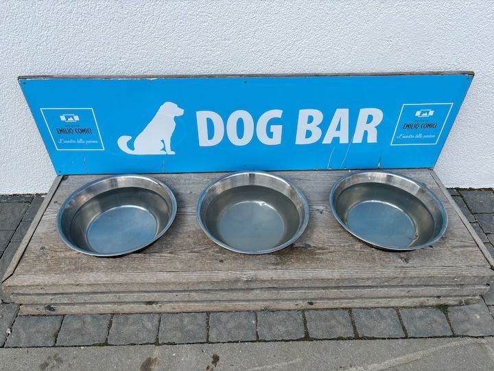
Even something for the dogs
View from the front lawn of the rifugio
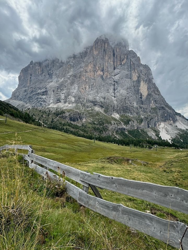
Sassolungo, on the walk back to the lift station
Looking across the valley
Appropriately placed bench on the very steep walk up to the lift station
Resting at the top in the last bit of sun. The weather was about to change.
Road construction on the Gardena Pass, on the way back to Colfosco. Gran Cir in the distance.
Thank you, cats53! Glad you are enjoying. We love this area, and I love sharing our experiences there.
Wednesday: Back where it all began
Forecast: mostly cloudy, chance of rain increasing through the afternoon
On the first day of our first trip to the Dolomites in 2009, we took the Ciampinoi lift from Selva di Val Gardena/Wolkenstein to the base of the Sassolungo/Langkofel and then walked some of the path around it. With our Alta Badia lift pass now expired, we decided to drive to Selva, look around for old time�s sake, and then repeat that very first day of hiking (but longer)�complete with lunch at Rifugio Emilio Comici. This is not a terribly challenging hike. It�s relatively flat with the exception of the steep downhill walk from the top station of Ciampinoi, and steep walk back up to catch the gondola back to Selva.
Selva seemed a little more built up and bustling than we remembered, and there were definitely more people on the trails here than we�d encountered the three days before�no doubt due to the popularity of the Val Gardena over other areas.
18,000+ steps today.
Val Gardena from the Ciampinoi top station. The large town at the end is Ortisei.
The walk from the station starts with a brief but steep downhill portion
Once downhill, there's a short portion that goes through a pasture--so be aware
Sure enough, they were on the trail--and one was feeling a little bullish. That sent several of us scrambling into the brush to get around them.
Walking around the base of the Sassolungo. We were fascinated by the small rocks with trees growing out of them.
At one point, the trail branched. We took the route not indicated for bikes or strollers.
Along the trail.
Still some flowers late in the season
Eventually we came to the lift station at Passo Sella, with the famous telecabin gondolas--or as we call them, the flying phone booths. These are a real trip. They go right straight up the cliff face. We did this during our 2009 trip.
Here, our trail connected with the mountain biking trail.
Bikers under the telecabin lifts
Eventually we circled around and headed back to lunch at Rifugio Emilio Comici, which has a massive menu (also known for seafood)
Tagliatelle with mushrooms
Penne with ragu
Even something for the dogs
View from the front lawn of the rifugio
Sassolungo, on the walk back to the lift station
Looking across the valley
Appropriately placed bench on the very steep walk up to the lift station
Resting at the top in the last bit of sun. The weather was about to change.
Road construction on the Gardena Pass, on the way back to Colfosco. Gran Cir in the distance.
Jan 4th, 2025 | 04:06 PM
#16
Original Poster
Joined: Jan 2004
Posts: 3,618
Likes: 0
From someone who "plans" last-minute, plays a lot by ear and doesn't document much when she travels, I appreciate your reports. They are so helpful for future trips ...and maybe past? Help me understand: your photos from the Sunday hike--Rifugio Puez, a number of vistas from the trail, the chapel down in Vallunga, etc.--all look very familiar to me but I have only been to the Dolomites once, based in Val Gardena. Is this hike done from Selva too? I did a couple long, mid- to semi-difficult hikes when I was there.
Looking forward to more. I definitely plan to return to the Dolomites one of these days, although I am less keen on hiking solo for safety reasons now that I am in my 50s!
Looking forward to more. I definitely plan to return to the Dolomites one of these days, although I am less keen on hiking solo for safety reasons now that I am in my 50s!
Jan 4th, 2025 | 04:20 PM
#17
Original Poster
Joined: Jan 2004
Posts: 3,618
Likes: 0
Thursday: Winter comes early
Forecast: cold rain, changing to snow later in the day
Hiking was out of the question, and walking around towns wouldn�t have been enjoyable either. We researched indoor attractions in the region and found The Lumen Museum of Mountain Photography, located (appropriately) on a mountaintop above Brunico/Bruneck. It is accessible via the Kronplatz II lift, the base station for which was about a 45-minute drive from our apartment.
This turned out to be a fantastic, modern museum with four floors of displays combining the discipline of photography and the subject of mountains�mostly these mountains. There are various interactive elements, including a virtual reality film where you�re in a helicopter riding above the peaks. Side bonus: a very good restaurant/cafe attached to the museum.
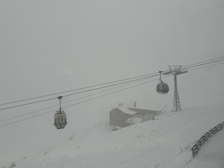
There�s a long, 4-kilometer gondola ride (12 minutes) to the top of the Kronplatz�elevation 2,275 meters (about 7,500 feet). The man selling tickets at the lower station casually said, �You know it�s snowing at the top of the mountain, right?� That became evident about halfway up.
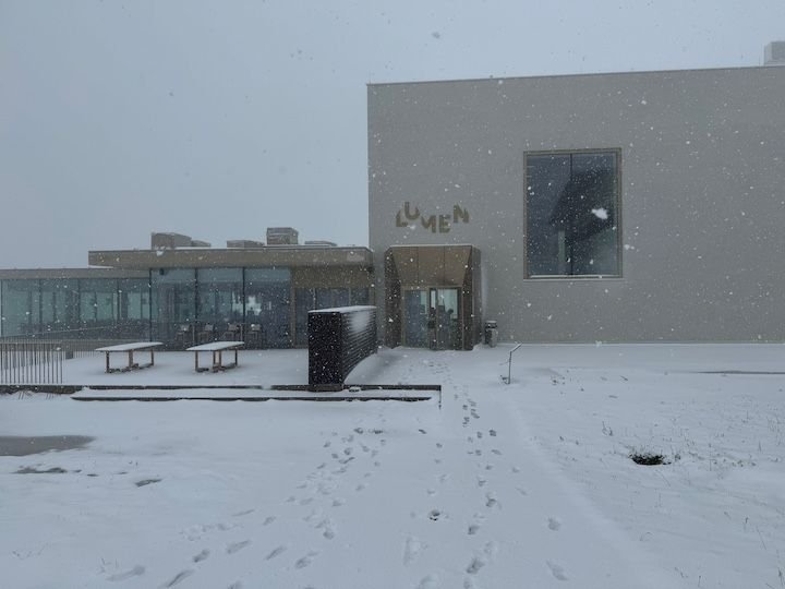
The Lumen Museum is at the site of the original Kronplatz lift station.
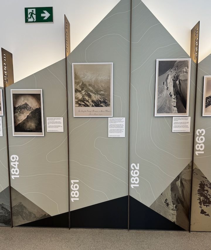
Exhibits start with some of the earliest photography techniques (e.g., daguerreotype) and images produced in the 1800s
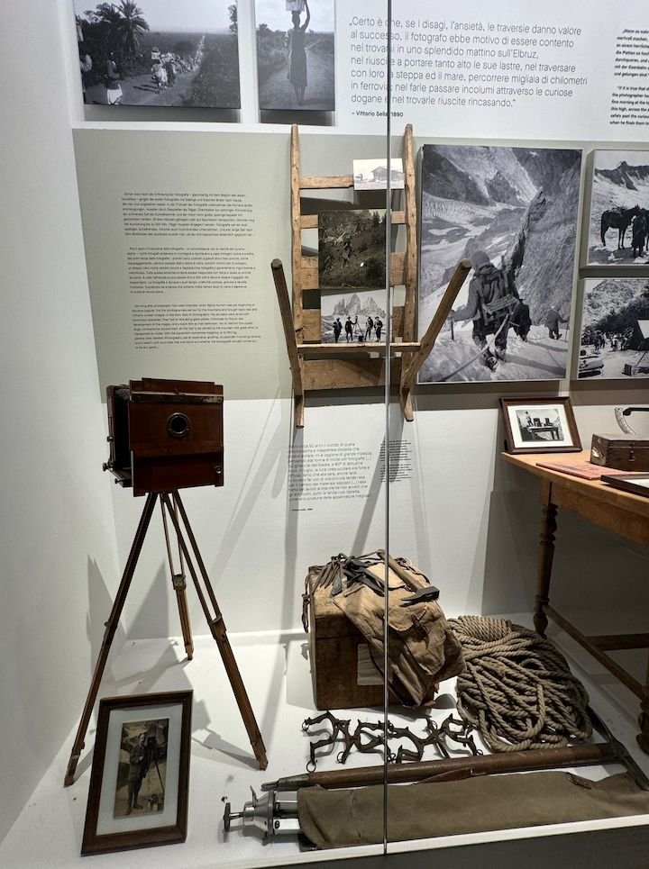
Exhibits about some early equipment and how they got it up into the mountains.
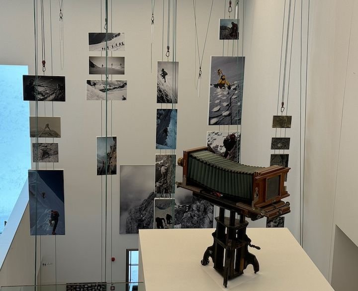
This set of photos mounted on ropes all covers images of rope-climbing teams.
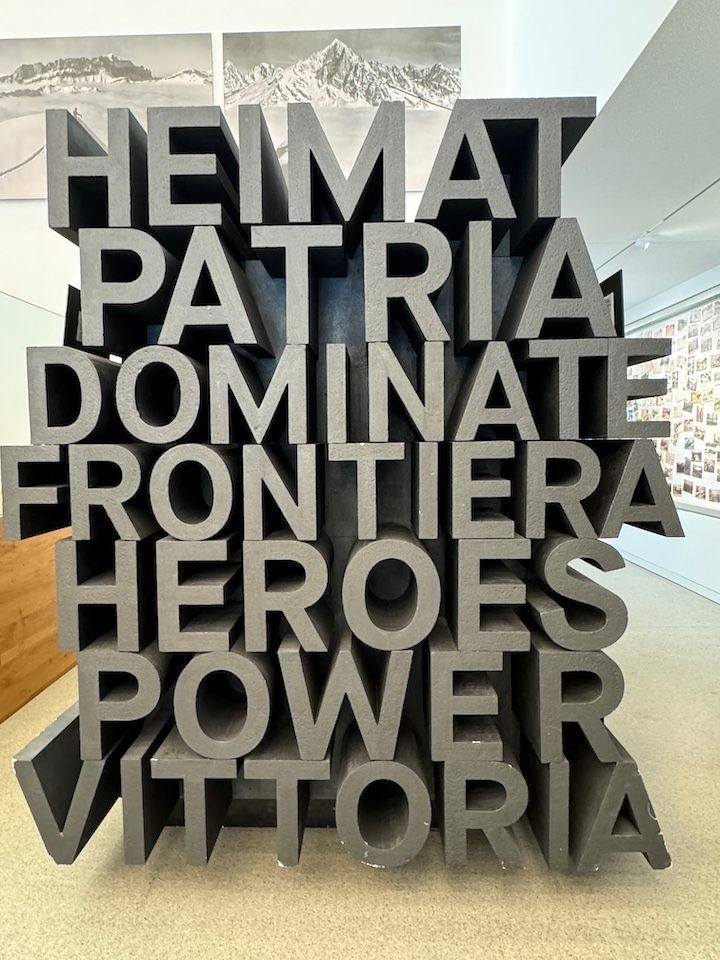
Part of the "political mountain" exhibit.
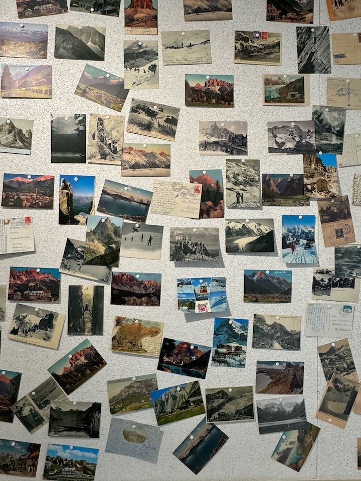
With advances in photography came "mountain marketing" in the form of postcards, advertising various peaks, hotels, etc.
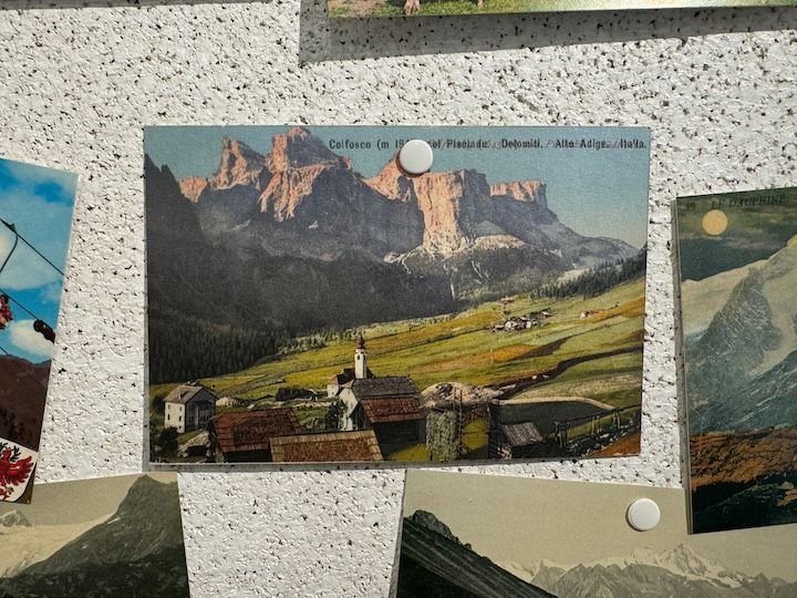
An old postcard from Rifugio Pisciadu, which we can see from our apartment (when the cloud cover isn't too low)
One of the many exhibits
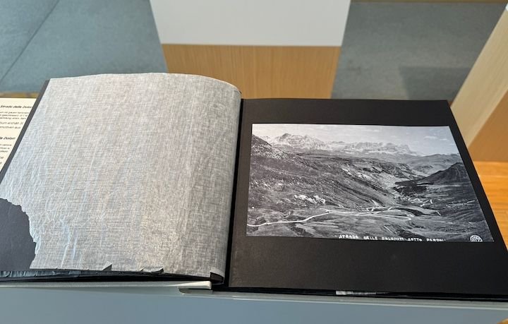
Old book of silver gelatin prints of photos from the Strada Dolomiti (Great Dolomite Road)
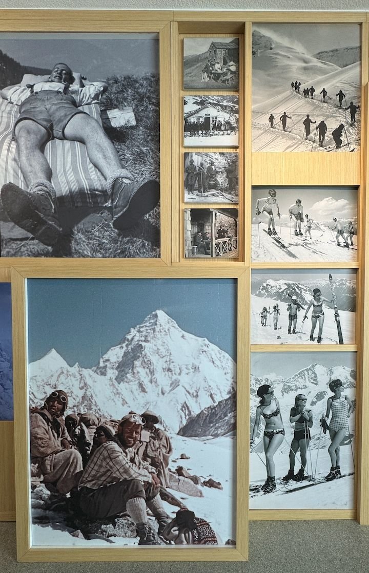
One of many sets of old photos, these from around the 1940s
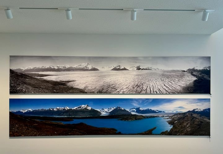
Display on global warming
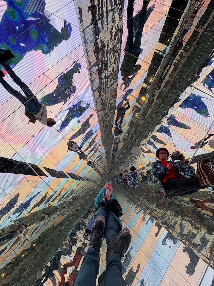
Room of mirrors
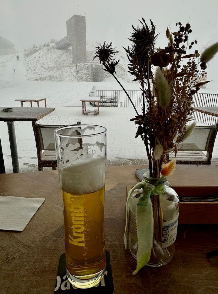
View from the restaurant
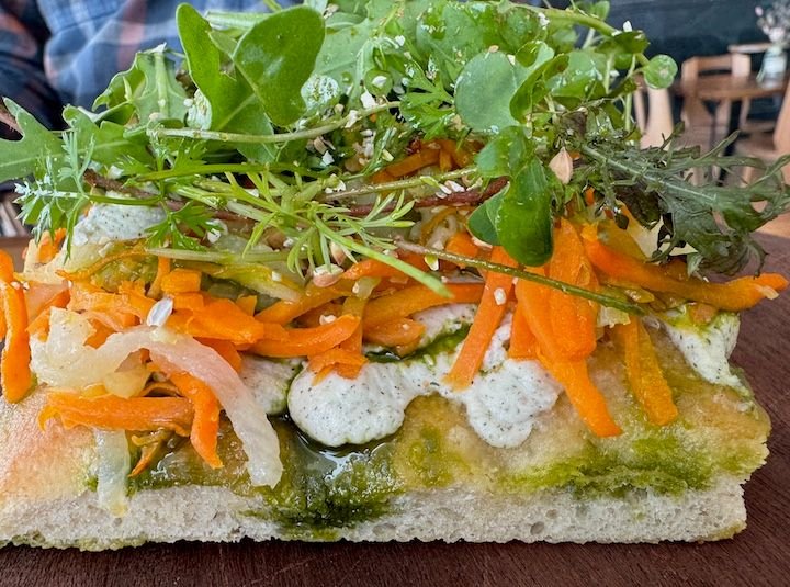
The food here was also a pleasant surprise, including this vegetable focaccia
This wasn�t an inexpensive excursion, as the roundtrip lift ticket costs 34� per person, in addition to the museum entrance fee (some of that may have been offset if we had the right tourist passes, but we were staying in a different valley). There is another museum (Messner Mountain Museum) nearby. A French couple asked us about it as we were getting back on the gondola to go down, but none of us could see it through the snow let alone a way to get there.
We returned to the valleys. By the time we were halfway back to Colfosco, raindrops had turned to snowflakes. By the time we reached La Villa, the snow was sticking to the grass on the surrounding hills. And by the time we reached Colfosco, the snow was sticking to the pavement. We were glad to be off the road and with some extra time on our hands for a load of laundry.
Sad postscript to this day: We learned the next morning that a couple on a hut-to-hut hike from Rifugio Genoa (above Bressanone) to Rifugio Puez was caught in the unexpectedly heavy snowstorm, and one perished from exposure before a rescue team could reach them. They were 2km from Rifugio Puez�only about 1km above the trail we took when leaving there four days earlier.
Forecast: cold rain, changing to snow later in the day
Hiking was out of the question, and walking around towns wouldn�t have been enjoyable either. We researched indoor attractions in the region and found The Lumen Museum of Mountain Photography, located (appropriately) on a mountaintop above Brunico/Bruneck. It is accessible via the Kronplatz II lift, the base station for which was about a 45-minute drive from our apartment.
This turned out to be a fantastic, modern museum with four floors of displays combining the discipline of photography and the subject of mountains�mostly these mountains. There are various interactive elements, including a virtual reality film where you�re in a helicopter riding above the peaks. Side bonus: a very good restaurant/cafe attached to the museum.
There�s a long, 4-kilometer gondola ride (12 minutes) to the top of the Kronplatz�elevation 2,275 meters (about 7,500 feet). The man selling tickets at the lower station casually said, �You know it�s snowing at the top of the mountain, right?� That became evident about halfway up.
The Lumen Museum is at the site of the original Kronplatz lift station.
Exhibits start with some of the earliest photography techniques (e.g., daguerreotype) and images produced in the 1800s
Exhibits about some early equipment and how they got it up into the mountains.
This set of photos mounted on ropes all covers images of rope-climbing teams.
Part of the "political mountain" exhibit.
With advances in photography came "mountain marketing" in the form of postcards, advertising various peaks, hotels, etc.
An old postcard from Rifugio Pisciadu, which we can see from our apartment (when the cloud cover isn't too low)
One of the many exhibits
Old book of silver gelatin prints of photos from the Strada Dolomiti (Great Dolomite Road)
One of many sets of old photos, these from around the 1940s
Display on global warming
Room of mirrors
View from the restaurant
The food here was also a pleasant surprise, including this vegetable focaccia
This wasn�t an inexpensive excursion, as the roundtrip lift ticket costs 34� per person, in addition to the museum entrance fee (some of that may have been offset if we had the right tourist passes, but we were staying in a different valley). There is another museum (Messner Mountain Museum) nearby. A French couple asked us about it as we were getting back on the gondola to go down, but none of us could see it through the snow let alone a way to get there.
We returned to the valleys. By the time we were halfway back to Colfosco, raindrops had turned to snowflakes. By the time we reached La Villa, the snow was sticking to the grass on the surrounding hills. And by the time we reached Colfosco, the snow was sticking to the pavement. We were glad to be off the road and with some extra time on our hands for a load of laundry.
Sad postscript to this day: We learned the next morning that a couple on a hut-to-hut hike from Rifugio Genoa (above Bressanone) to Rifugio Puez was caught in the unexpectedly heavy snowstorm, and one perished from exposure before a rescue team could reach them. They were 2km from Rifugio Puez�only about 1km above the trail we took when leaving there four days earlier.
Jan 4th, 2025 | 04:33 PM
#18
Original Poster
Joined: Jan 2004
Posts: 3,618
Likes: 0
Friday: Warming up in Bressanone
Forecast: dry, partly sunny
We always have an idea or two for �rain days� in our back pocket. This wasn�t necessarily a �rain� day, but since it had snowed across the region the day before, we knew the hiking trails would be messy, and we didn�t have the right footwear or apparel. On previous trips, we�ve visited Bolzano and Trento. This time, our back-up plan included Bressanone (aka Brixen). We wiped about a half a foot of snow off the car (with our hands) but were happy to see that the road had been nicely cleared. We took the longer route to Bressanone via Badia and the Val Pusteria rather than going over the Gardena Pass. Chains or snow tires are required on the passes during bad weather. We definitely didn�t have the former, and probably not the latter.
Bressanone is in a valley south of the Brenner Pass and north of Bolzano. It is one of the oldest towns in Tyrol. It was a bishop�s seat for 1,000 years, and the oldest district, Stufels, has neolithic origins. Bressanone has more of an Austrian feel, and we found German a bit more prevalent than Italian.
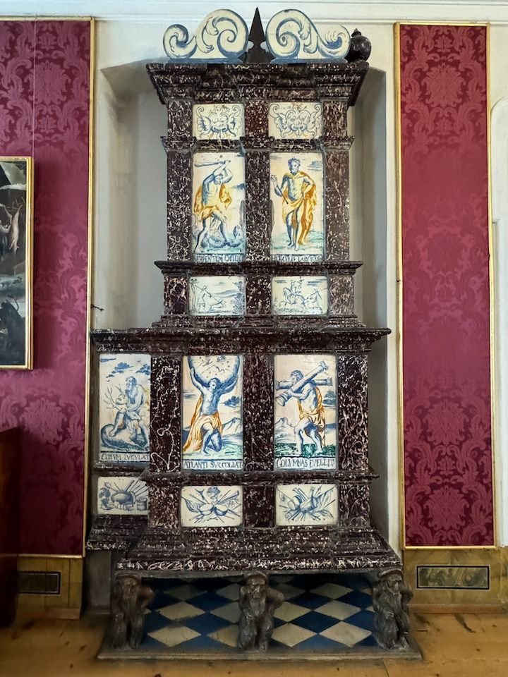
There�s plenty to see, including the bishop�s (Hofburg) palace, with a mind-blowing collection of miniature nativity and other figures�room after room of them. I�ve never seen anything like it!
Hofgarten (Giardino di Corte) dates to 1570
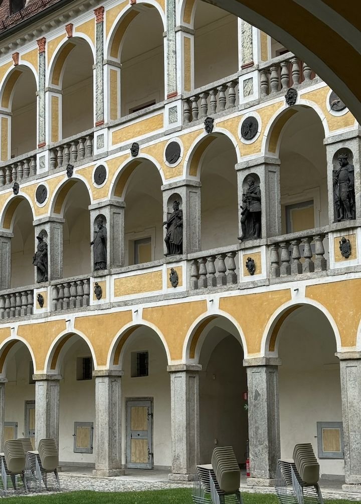
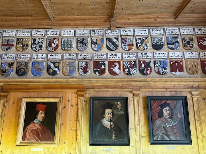
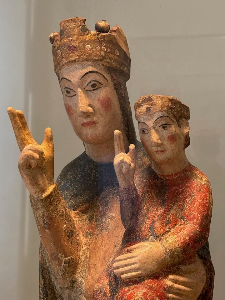
The Bishop�s/Hofburg palace was constructed as residence for the prince-bishops of Bressanone in 1250. It was the seat of the bishops until 1964. The palace houses the Diocesan Museum, the Cathedral Treasure, and the extensive nativity scene collection.
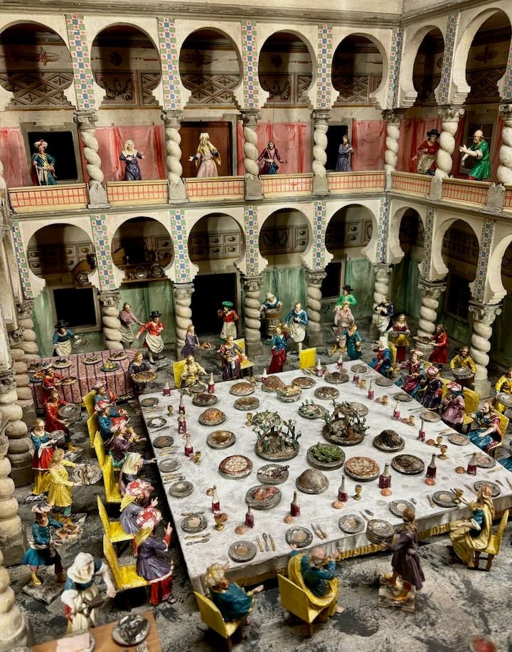
The nativity scene collection includes about 5,000 figurines as well as Christmas cribs from Bressanone, Tyrol, Naples and Sicily. There are literally rooms of these displays, each display in this degree of detail.
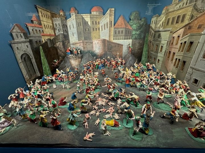
Some are a little gruesome.
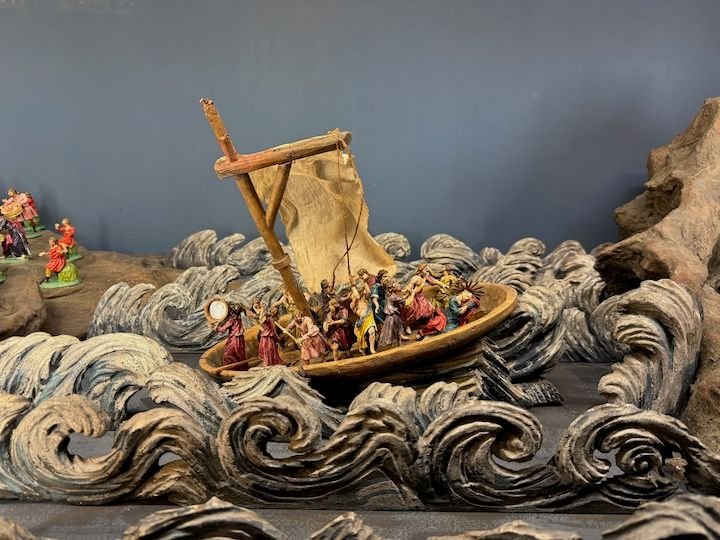
Yet another one...
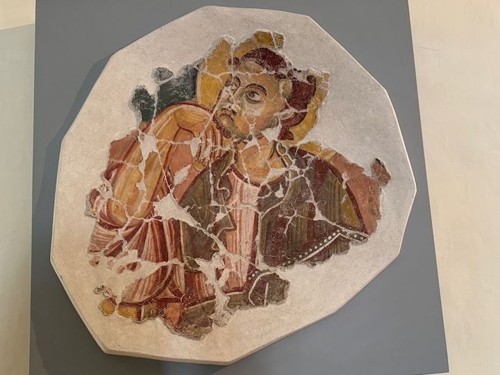
This and the next few photos are from the Diocesan Museum.
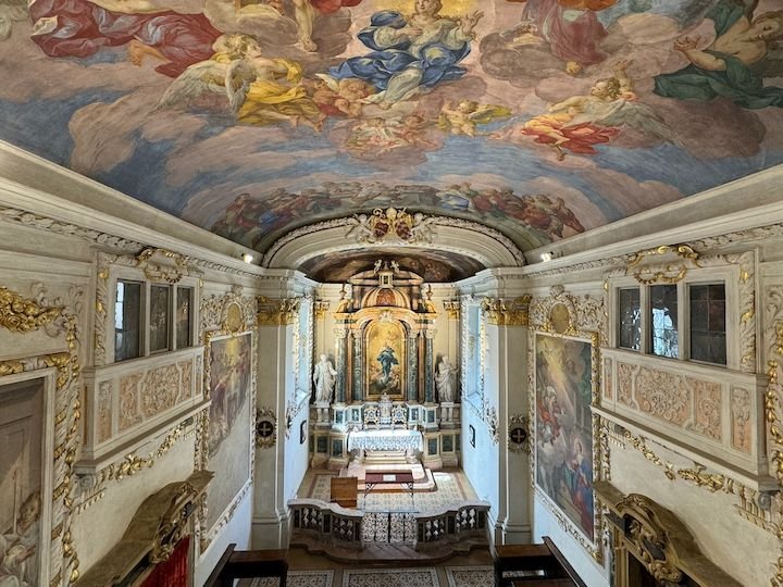
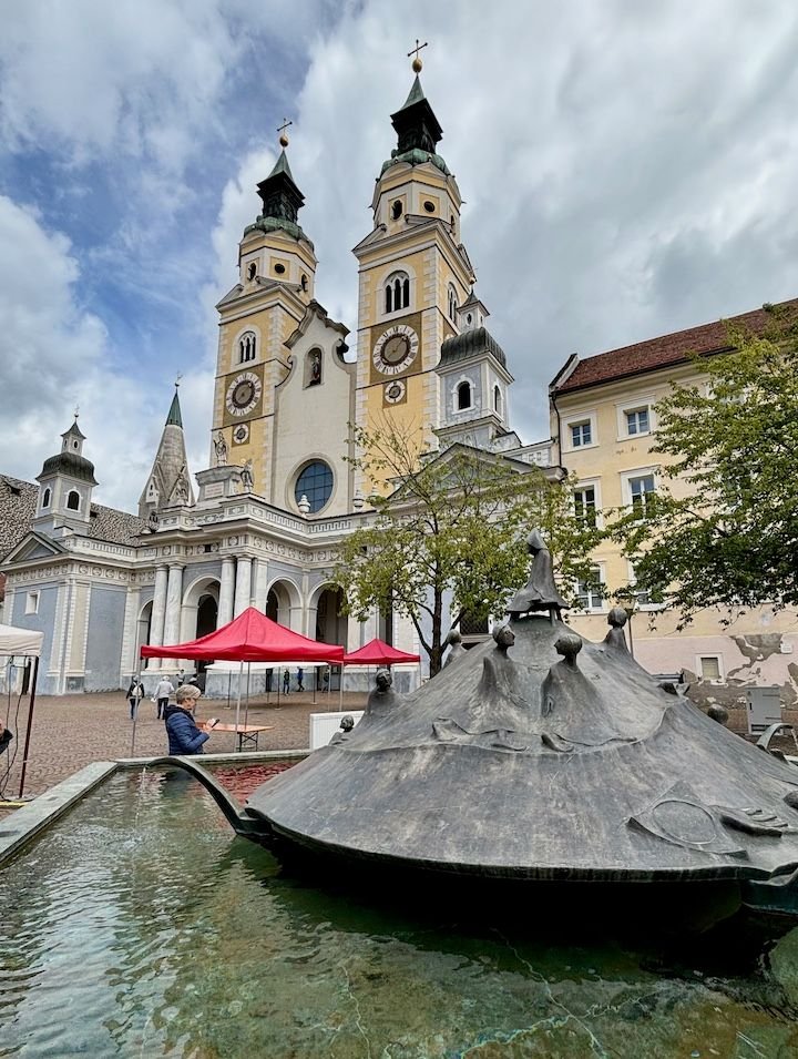
Cathedral square (we had lunch here). Bressanone Cathedral dates to 980, and the current Baroque structure was built between 1745 and 1754.
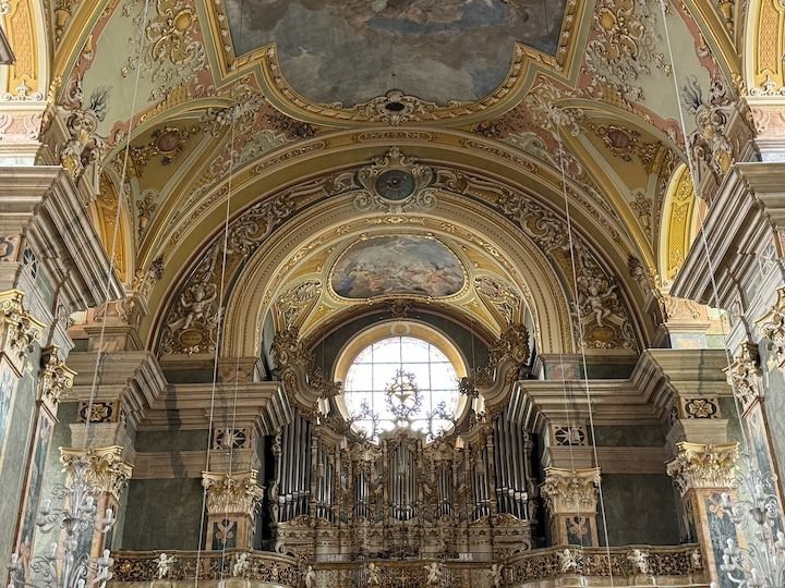
Part of the Baroque interior
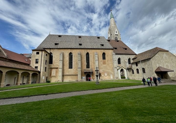
Across the courtyard/cloister from the cathedral is the more modest St. Michael�s church, with history dating to the 11th century.
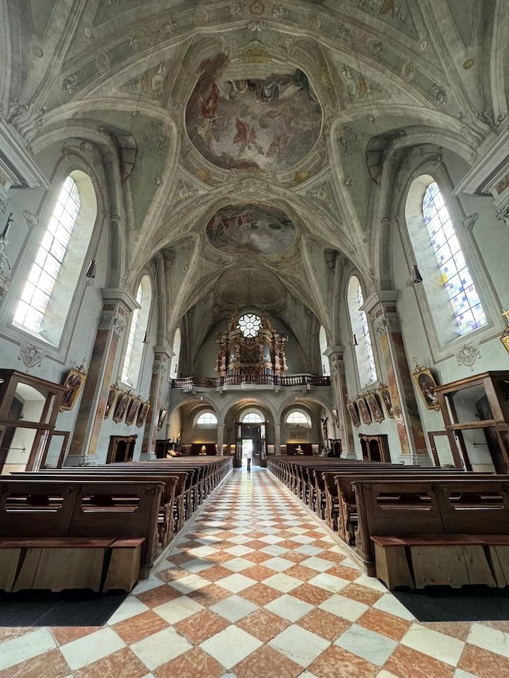
Inside St. Michaels
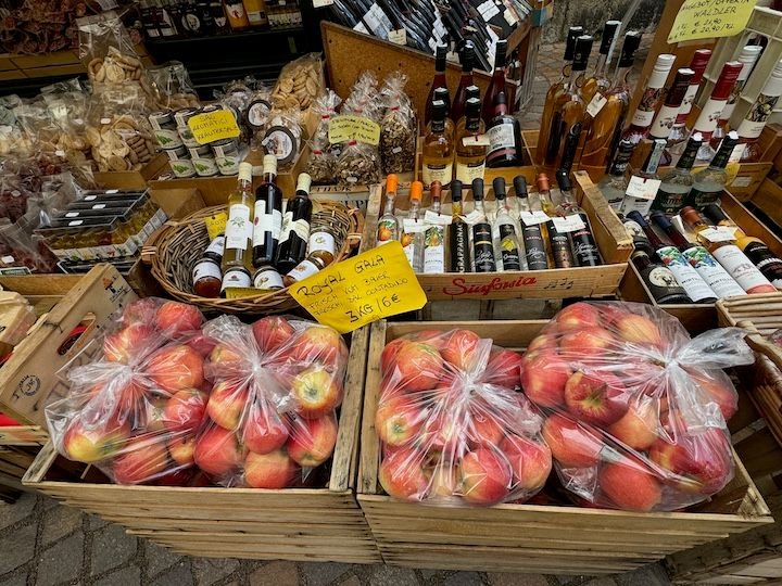
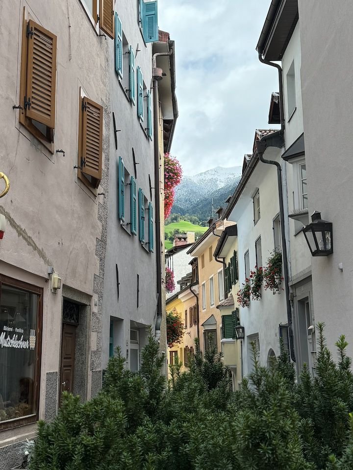
Bressanone is surrounded by vineyards and orchards, so not surprising to see apples in the market.
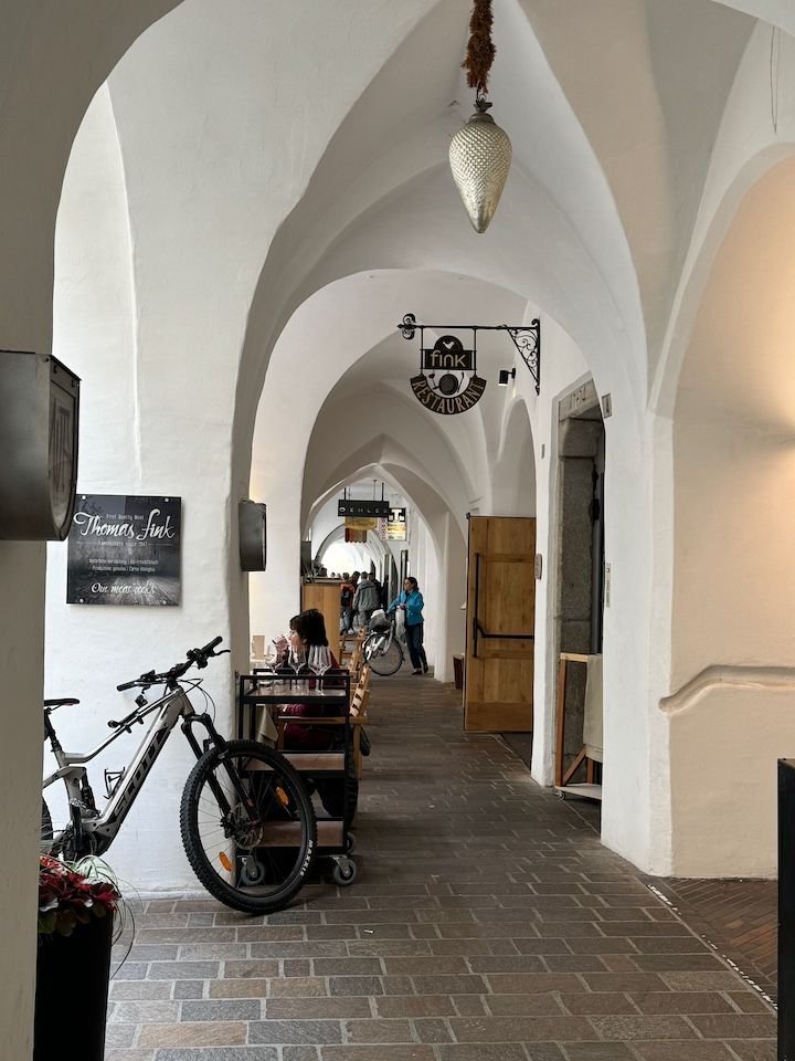
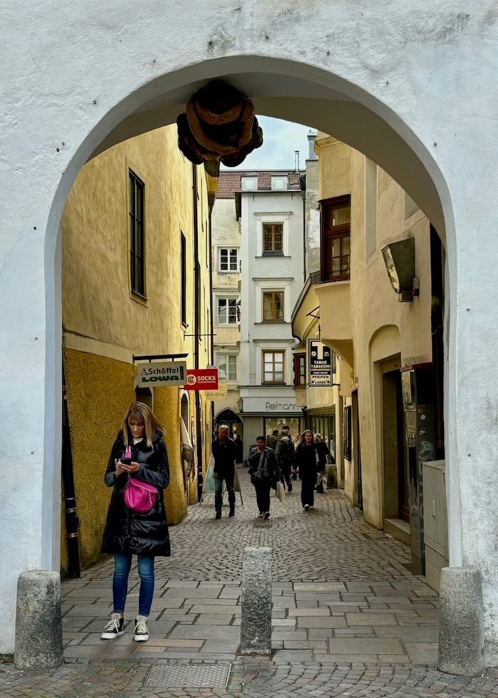
Medieval arcades under the vaults of the houses.
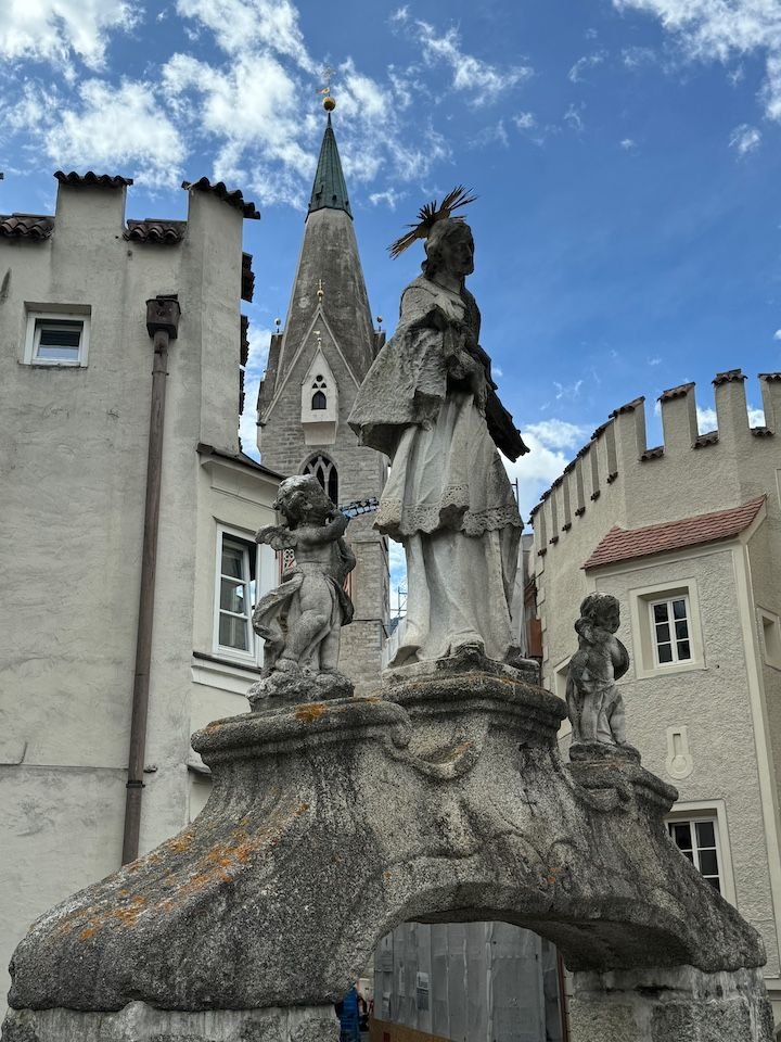
Statue on the Adler bridge, which connects the old town with the even older Stufels neighborhood.
From the Middle Ages until relatively recently, Stufels was home to small traders, artisans and servants as well as people looking for cheap housing. Today, Stufels has become known as an artists� quarter.
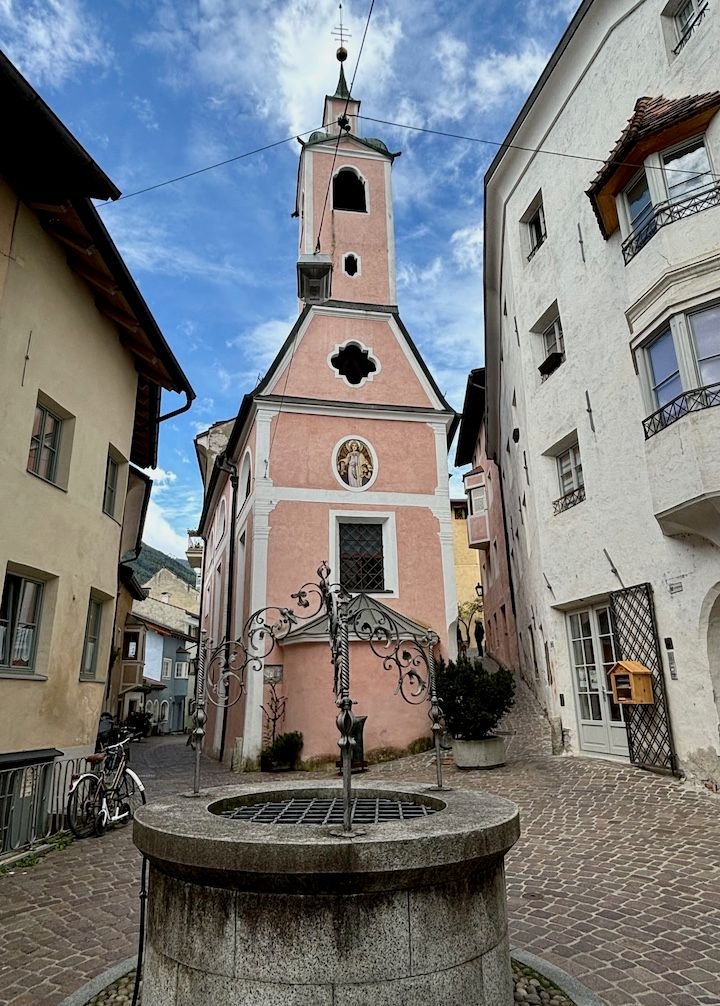
Ziggelplatz square in Stufles. A draw well has always been located here, but the well has been rebuilt more recently.
You can see the snow on the mountains above the city
Forecast: dry, partly sunny
We always have an idea or two for �rain days� in our back pocket. This wasn�t necessarily a �rain� day, but since it had snowed across the region the day before, we knew the hiking trails would be messy, and we didn�t have the right footwear or apparel. On previous trips, we�ve visited Bolzano and Trento. This time, our back-up plan included Bressanone (aka Brixen). We wiped about a half a foot of snow off the car (with our hands) but were happy to see that the road had been nicely cleared. We took the longer route to Bressanone via Badia and the Val Pusteria rather than going over the Gardena Pass. Chains or snow tires are required on the passes during bad weather. We definitely didn�t have the former, and probably not the latter.
Bressanone is in a valley south of the Brenner Pass and north of Bolzano. It is one of the oldest towns in Tyrol. It was a bishop�s seat for 1,000 years, and the oldest district, Stufels, has neolithic origins. Bressanone has more of an Austrian feel, and we found German a bit more prevalent than Italian.
There�s plenty to see, including the bishop�s (Hofburg) palace, with a mind-blowing collection of miniature nativity and other figures�room after room of them. I�ve never seen anything like it!
Hofgarten (Giardino di Corte) dates to 1570
The Bishop�s/Hofburg palace was constructed as residence for the prince-bishops of Bressanone in 1250. It was the seat of the bishops until 1964. The palace houses the Diocesan Museum, the Cathedral Treasure, and the extensive nativity scene collection.
The nativity scene collection includes about 5,000 figurines as well as Christmas cribs from Bressanone, Tyrol, Naples and Sicily. There are literally rooms of these displays, each display in this degree of detail.
Some are a little gruesome.
Yet another one...
This and the next few photos are from the Diocesan Museum.
Cathedral square (we had lunch here). Bressanone Cathedral dates to 980, and the current Baroque structure was built between 1745 and 1754.
Part of the Baroque interior
Across the courtyard/cloister from the cathedral is the more modest St. Michael�s church, with history dating to the 11th century.
Inside St. Michaels
Bressanone is surrounded by vineyards and orchards, so not surprising to see apples in the market.
Medieval arcades under the vaults of the houses.
Statue on the Adler bridge, which connects the old town with the even older Stufels neighborhood.
From the Middle Ages until relatively recently, Stufels was home to small traders, artisans and servants as well as people looking for cheap housing. Today, Stufels has become known as an artists� quarter.
Ziggelplatz square in Stufles. A draw well has always been located here, but the well has been rebuilt more recently.
You can see the snow on the mountains above the city
Jan 4th, 2025 | 04:37 PM
#19
Original Poster
Joined: Jan 2004
Posts: 3,618
Likes: 0
Saturday: Departure
Forecast: dry and cold
We bid arrivederci to our lovely hosts (more on that below) and headed towards Bolzano. This time, we took the Gardena Pass, where there was still some blowing snow on the highest parts of the road. Our drive took us through the Val Gardena, including Selva, Santa Cristina and the outskirts of Ortisei and then down through Castelrotto towards Bolzano. It�s a pretty drive, and not a particularly fast one.
Most of the rental car offices in Bolzano are near (but not right at) the airport, a fair distance from the train station. An Avis agent called a taxi for us.
If you have time to kill waiting for a train, as we did, the Parkhotel Laurin a few blocks away has a nice bar/bistro with good small plates.
And that�s it for our latest (but not last) trip to the Dolomites.
The next part of our trip was of a very different flavor: Bologna, Ravenna, Parma and a final night in Rome�some new for us, and some repeat. Not sure I will get around to reporting on these destinations, but they�ve all been well covered here.
I'll add some notes on Colfosco and our excellent apartment in the next few days.
Jan 4th, 2025 | 06:55 PM
#20
Joined: Jan 2015
Posts: 4,257
Likes: 19
I’ve been on a digital detox diet - but was researching our upcoming NZ trip, and happily found this (or it found me)
I love reading about these destinations, how people put together their hiking trips, how best to accommodate the changeable weather.
Thanks for the report and photos.
I love reading about these destinations, how people put together their hiking trips, how best to accommodate the changeable weather.
Thanks for the report and photos.

