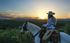
Hiking
The best way to experience Zion Canyon is to walk beneath, between and, if you can bear it (and have good balance), along its towering cliffs. Trails vary, from paved and flat river strolls to precarious cliffside scrambles. Whether you're heading out for a day of rock hopping or an hour of meandering, pack and consume plenty of drinking water to counteract the effects of a high-altitude workout in the arid climate.
Keeping the sun at bay is a real challenge at Zion National Park. Put on sunscreen before you set out, and reapply at regular intervals. Because the park's hikes usually include uneven surfaces and elevation changes, wear sturdy shoes or hiking boots. Many veteran hikers carry good walking sticks, too, as they're invaluable along trails that ford or follow the Virgin River or its tributaries.
Zion is one of the most popular parks in the country, so it can be hard to envision just how alone you'll be on some of the less traveled trails. If you want to do a backcountry hike, make a reservation. Let park rangers know where you're going and when you plan to return.
Park rangers warn hikers to remain on alert for flash floods; these walls of water can appear out of nowhere, even when the sky above you is clear. You can learn more about hiking safety and obtain a trail map at the visitor centers or online (www.nps.gov/zion/planyourvisit/hiking-in-zion.htm). A major rockfall in August 2019 severely damaged the Weeping Rock Trail, Hidden Canyon Trail, and Observation Point Trail. As of this writing, these trails were closed until further notice. Check with the visitor center for updates before attempting to hike any of these trails and to get information about other trails that may be closed due to flooding or landslides.
Easy
Emerald Pools Trail. Multiple waterfalls cascade (or drip, in dry weather) into algae-filled pools along this trail, about 3 miles north of Canyon Junction. The path leading to the lower pool is paved and appropriate for strollers and wheelchairs. If you've got any energy left, keep going past the lower pool. The ¼ mile from there to the middle pool becomes rocky and somewhat steep but offers increasingly scenic views. A less crowded and exceptionally enjoyable return route follows the Kayenta Trail, connecting to the Grotto Trail. Allow 50 minutes for the 1¼-mile round-trip hike to the lower pool, and an hour more each round trip to the middle (2 miles) and upper pools (3 miles). Lower, easy. Upper, moderate. Zion National Park, Utah, 84767.
Grotto Trail. This flat trail takes you from Zion Lodge, about 3 miles north of Canyon Junction, to the Grotto picnic area, traveling for the most part along the park road. Allow 20 minutes or less for the walk along the ½-mile trail. If you are up for a longer hike and have two or three hours, connect with the Kayenta Trail after you cross the footbridge, and head for the Emerald Pools. You will begin gaining elevation, and it's a steady, steep climb to the pools, which you will begin to see after about 1 mile. Easy. Zion National Park, Utah, 84767.
Pa'rus Trail. An approximately 1¾-mile, relatively flat, paved walking and biking path, Pa'rus parallels and occasionally crosses the Virgin River. Starting at South Campground, ½ mile north of the South Entrance, the walk proceeds north along the river to the beginning of Zion Canyon Scenic Drive. Along the way you'll take in great views of the Watchman, the Sentinel, the East and West temples, and the Towers of the Virgin. Leashed dogs are allowed on this trail. Wheelchair users may need assistance. Easy. Zion National Park, Utah, 84767.
Riverside Walk. This 2.2-mile round-trip hike shadows the Virgin River. In spring, wildflowers bloom on the opposite canyon wall in lovely hanging gardens. The trail, which begins 6½ miles north of Canyon Junction at the end of Zion Canyon Scenic Drive, is the park's most visited, so be prepared for crowds in high season. Riverside Walk is paved and suitable for strollers and wheelchairs, though some wheelchair users may need assistance. Round-trip it takes about 90 minutes. At the end, the much more challenging Narrows Trail begins. Easy. Zion National Park, Utah, 84767.
Moderate
Canyon Overlook Trail. The parking area just east of Zion–Mt. Carmel Tunnel leads to this popular trail, which is about 1 mile round trip and takes about an hour to finish. From the breathtaking overlook at the trail's end, you can see the West and East temples, the Towers of the Virgin, the Streaked Wall, and other Zion Canyon cliffs and peaks. The elevation change is 160 feet. There's no shuttle to this trail, and the parking area often fills up—try to come very early or late in the day to avoid crowds. Moderate. Zion National Park, Utah, 84767.
Taylor Creek Trail. This trail in the Kolob Canyons area descends parallel to Taylor Creek, sometimes crossing it, sometimes shortcutting benches beside it. The historic Larson Cabin precedes the entrance to the canyon of the Middle Fork, where the trail becomes rougher. After the old Fife Cabin, the canyon bends to the right into Double Arch Alcove, a large, colorful grotto with a high blind arch (or arch "embryo") towering above. To Double Arch it's 2½ miles one-way—about four hours round-trip. The elevation change is 450 feet. Moderate. Zion National Park, Utah, 84767.
Watchman Trail. For a dramatic view of Springdale and a look at lower Zion Creek Canyon and Towers of the Virgin, this strenuous hike begins on a service road east of Watchman Campground. Some springs seep out of the sandstone, nourishing the hanging gardens and attracting wildlife. There are a few sheer cliff edges, so supervise children carefully. Plan on two hours for this 3.3-mile round-trip hike that has a 368-foot elevation change. Moderate. Zion National Park, Utah, 84767.
Difficult
Angels Landing Trail. As much a trial as a trail, this path beneath the Great White Throne, which you access from the Lower West Rim Trail, is one of the park's most challenging hikes. Early on, you work your way through Walter's Wiggles, a series of 21 switchbacks built out of sandstone blocks. From there you traverse sheer cliffs that have chains bolted into the rock face to serve as handrails in some (but not all) places. In spite of its hair-raising nature, this trail is popular. Allow 2½ hours round trip if you stop at Scout's Lookout (2 miles), and 4 hours if you keep going to where the angels (and birds of prey) play. The trail is 5 miles round trip and is not appropriate for children or those who are uneasy about heights. Difficult. Zion National Park, Utah, 84767.
Hidden Canyon Trail. This steep, 2-mile round-trip hike takes you up 850 feet in elevation. Not too crowded, the trail is paved all the way to Hidden Canyon. Allow about three hours for the round-trip hike. A massive rockfall in summer 2019 resulted in the closure of this trail—check with the visitor center for updates. Moderate–Difficult. Zion National Park, Utah, 84767.
The Narrows Trail. After leaving the paved ease of the Gateway to the Narrows trail behind, walk on the riverbed itself. You'll find a pebbly shingle or dry sandbar path, but when the walls of the canyon close in, you'll be forced into the chilly waters of the Virgin River. A walking stick and good shoes are a must. Be prepared to swim, as chest-deep holes may occur even when water levels are low. Check with park rangers about the likelihood of flash floods. A day trip up the lower section of the Narrows is 6 miles one-way to the turnaround point. Allow at least five hours round-trip. Difficult. Zion National Park, Utah, 84767.