


North by Northwest
 Aug 13th, 2025 | 07:35 PM
#1
Original Poster

Joined: Mar 2009
Posts: 928
Likes: 0
North by Northwest
OMG, not another Trip Report! Can't we stay home once in awhile! (directs quotes from my wife). Yes we are on the road agaiin. Third TR this year, Mexico in the winter, England in the Spring and now we are staying in our own country and visiting Olympic National Park in Washington State. We are taking our van, Nike, for about 6 weeks. First leg, today, is Los Angeles to Redding on I-5. We wanted to leave at 7:00 AM, but around 4AM, I hear, "U' up?" Yes we both are wide awake see we hit the road at 6:15. Google says it will be 7 hrs. 45 minutes. Google however doesn't eat or pee so we've figured out that for any trip over 4 hrs or so, you have to add 15 minutes per hour. Works every time. I must warn you the pictures you are about to see are shocking...shockingly boring, but this is how our trip starts.
Los Angeles to Redding
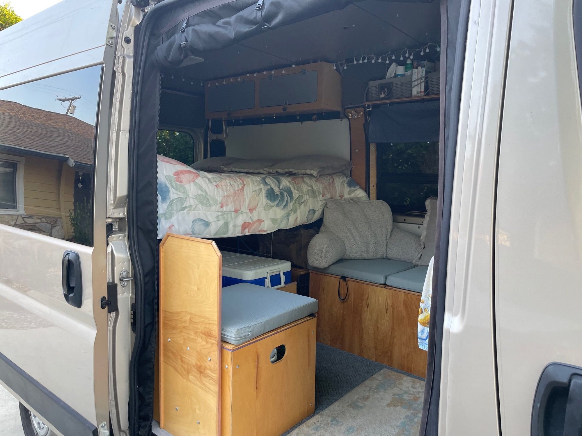
Nike, is packed and ready for action.
A rare shot, very littletraffic on the road ahead of us. Lot's coming into LA
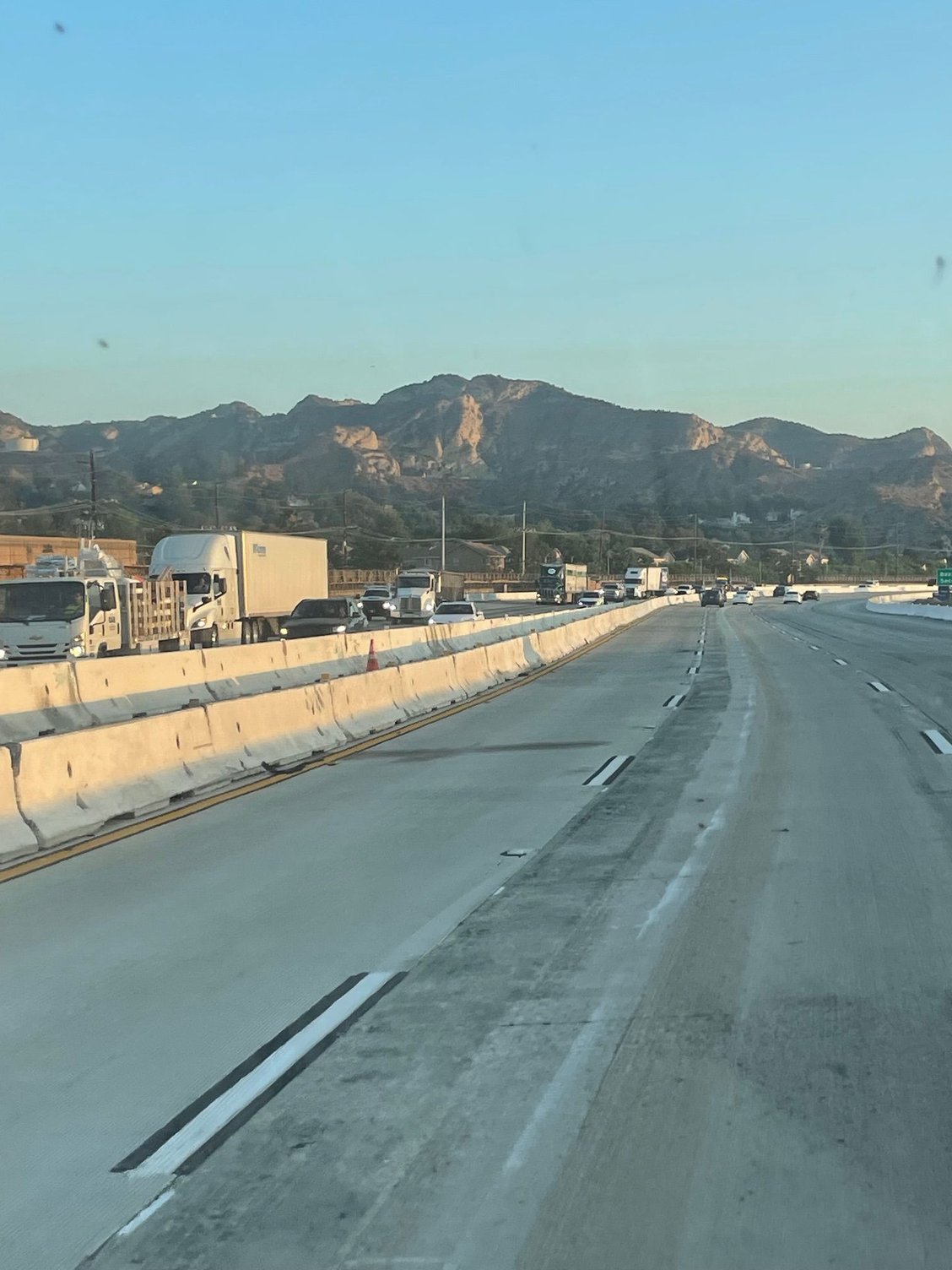
Coming down the Grapevine. Most people think the Grapevine is from Santa Clarita down to the San Joaquin Valley but it's actually about a 7 mile stretch, from Ft. Tejon to the bottom. It used to be covered in "grapevines"
Alright over the hills, let's go
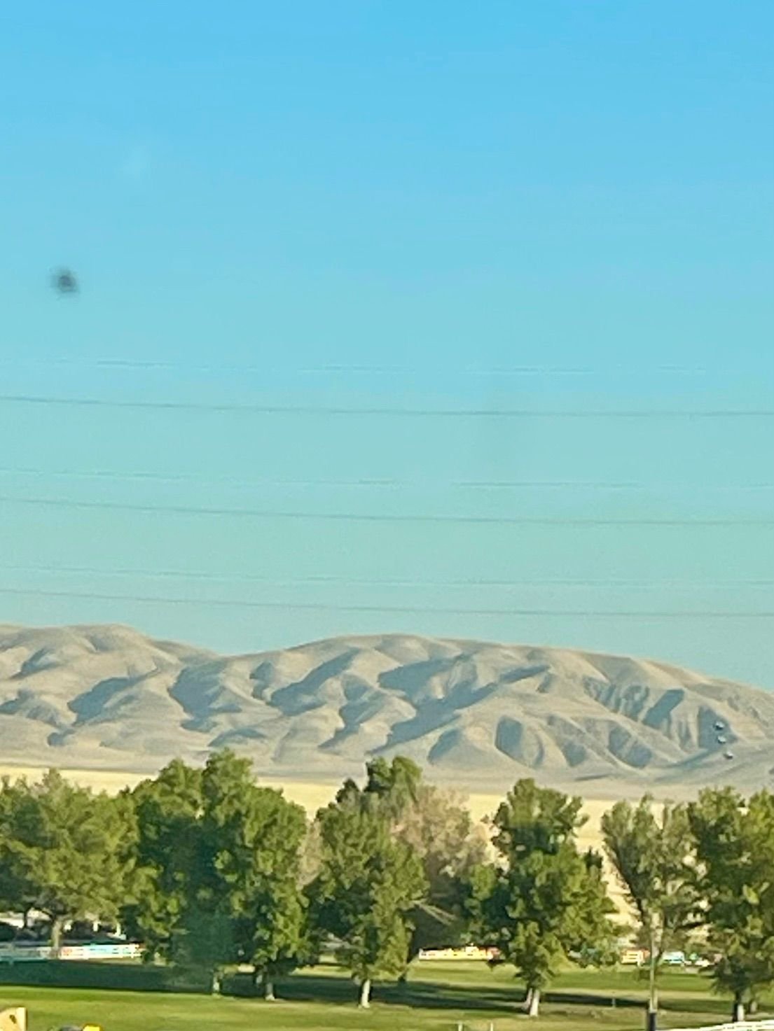
Hills and Trees at the bottom of the Grapevine
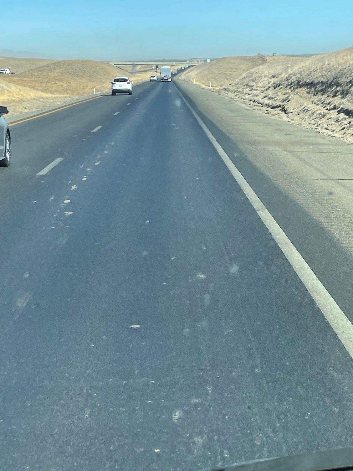
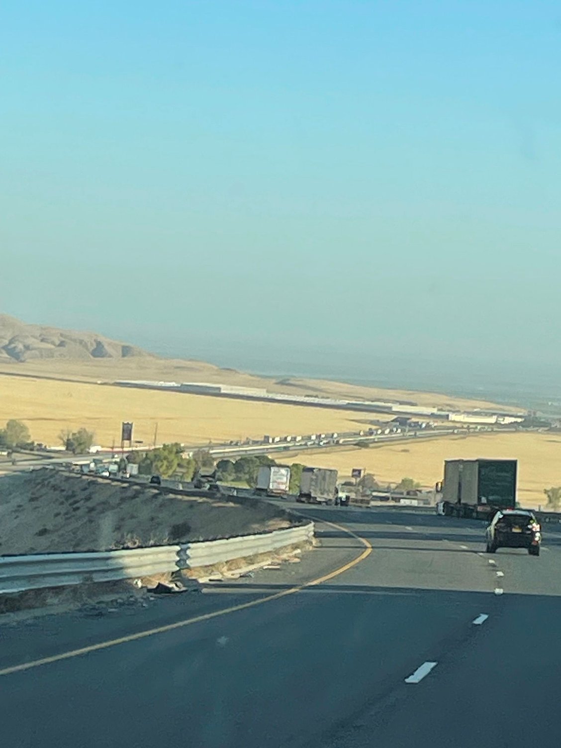
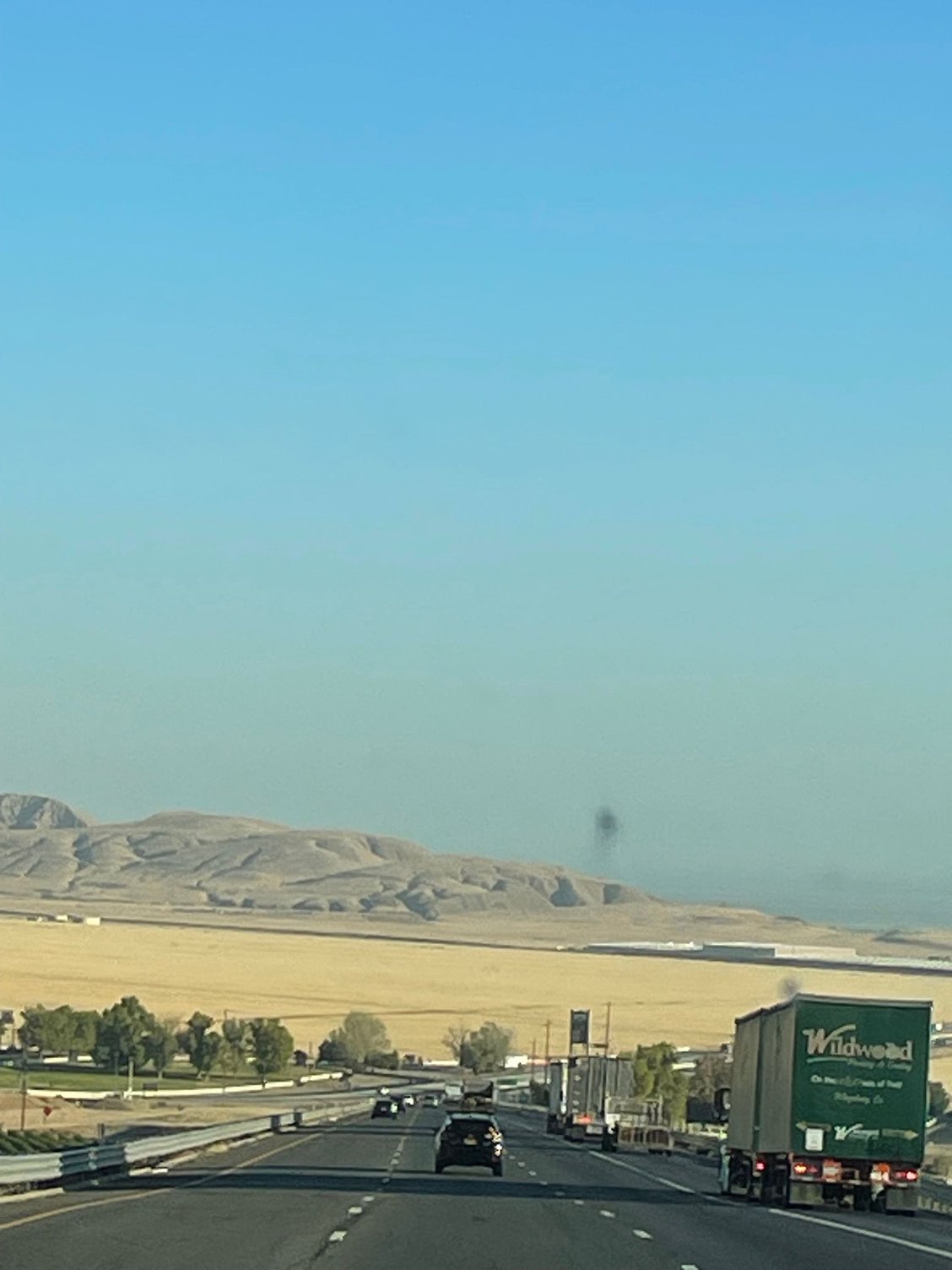
I-5, a desolute, flat humorless road, so straight that when you look into the horizon you can see the back of your own head.
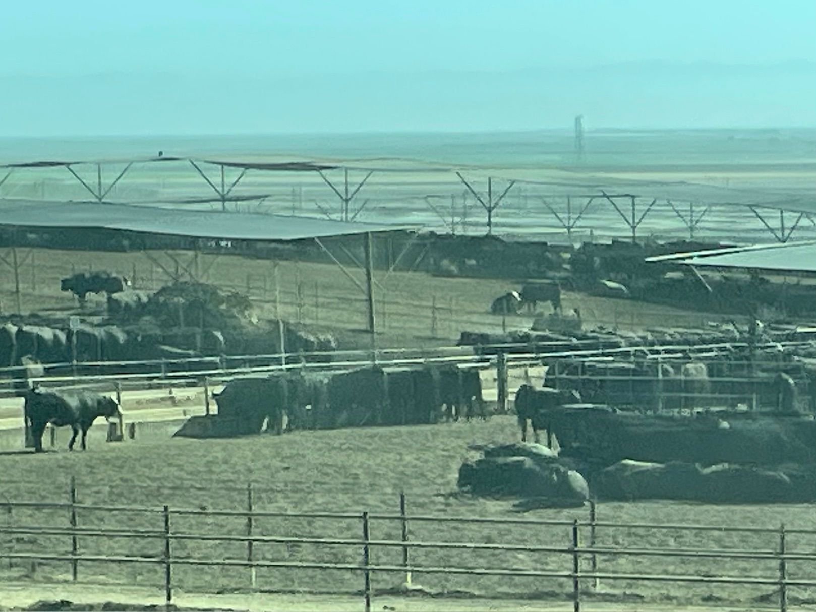
This is big feed lot on 5. You can smell it for about two miles before you see it!
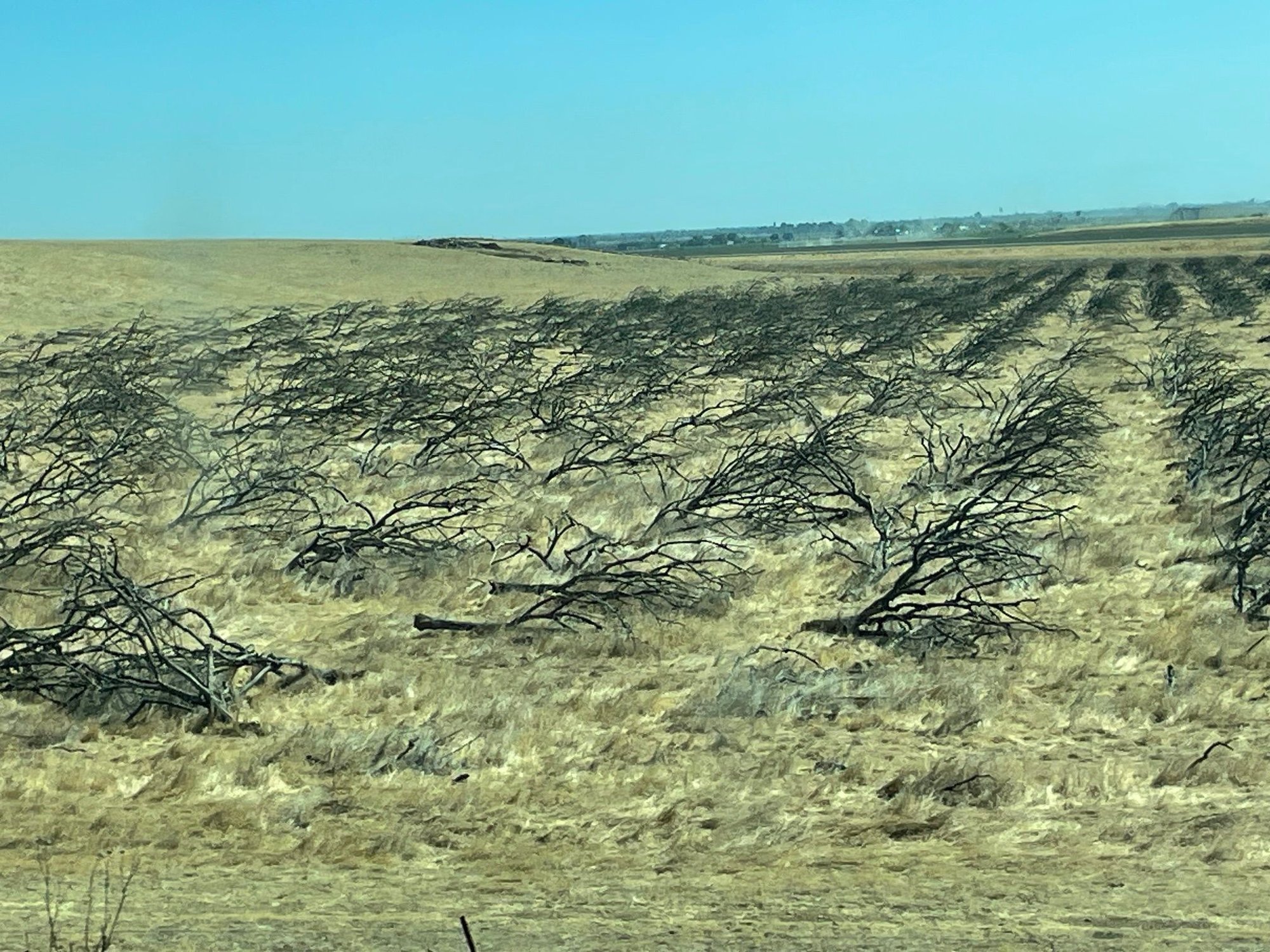
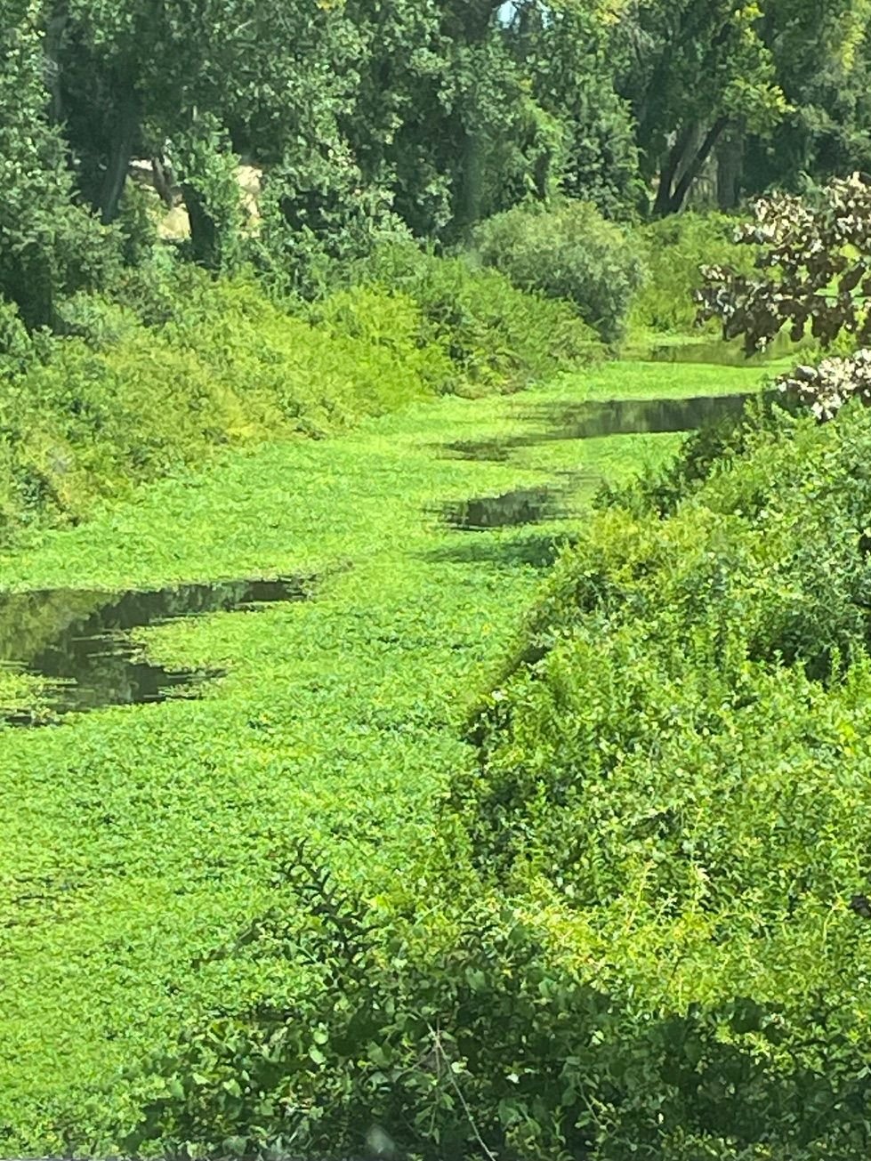
Farmers are having a tough time in what was once one of the largest "bread baskets" in the country. No water. We live in a state with a constant drought. These are dead trees.
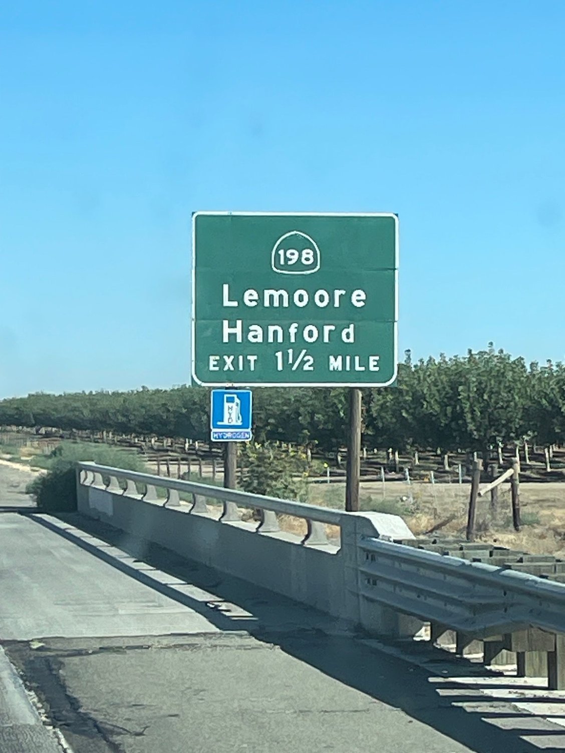
When I was a 19 year old kid from Michigan I came to California to serve in the Air Navy. California, my dream. Only to be dropped into the largest agriculture area in the state at NAS Lemoore. No Beach Boys, no beach, no blondes, no bikinis! Only the local Portuguese farmers...with some pretty daughters.
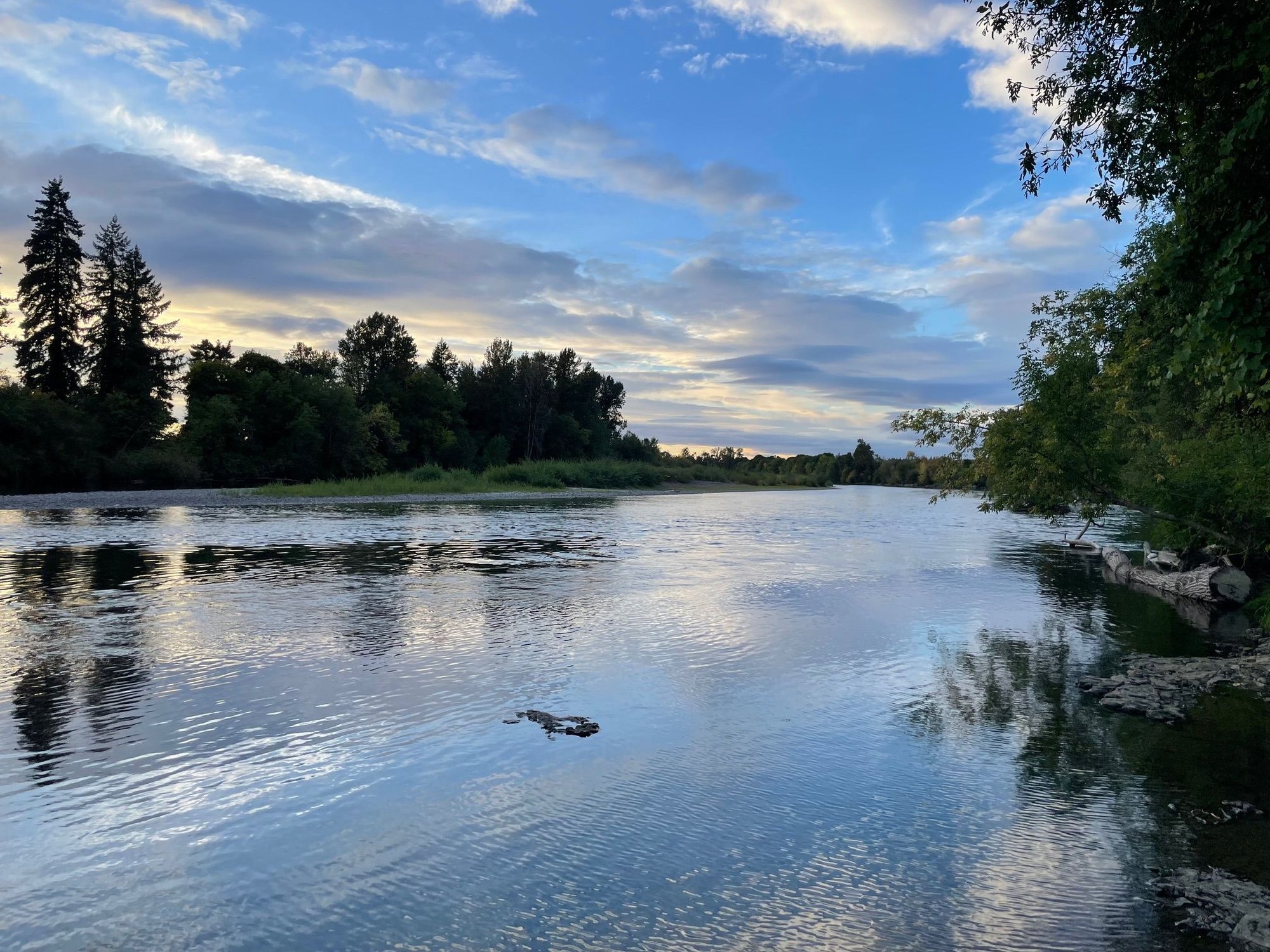
This is a shot in Discovery Park in Sacramento. We stopped for lunch.

Discovery Park, looks at those clouds
Los Angeles to Redding
Nike, is packed and ready for action.
A rare shot, very littletraffic on the road ahead of us. Lot's coming into LA
Coming down the Grapevine. Most people think the Grapevine is from Santa Clarita down to the San Joaquin Valley but it's actually about a 7 mile stretch, from Ft. Tejon to the bottom. It used to be covered in "grapevines"
Alright over the hills, let's go
Hills and Trees at the bottom of the Grapevine
I-5, a desolute, flat humorless road, so straight that when you look into the horizon you can see the back of your own head.
This is big feed lot on 5. You can smell it for about two miles before you see it!
Farmers are having a tough time in what was once one of the largest "bread baskets" in the country. No water. We live in a state with a constant drought. These are dead trees.
When I was a 19 year old kid from Michigan I came to California to serve in the Air Navy. California, my dream. Only to be dropped into the largest agriculture area in the state at NAS Lemoore. No Beach Boys, no beach, no blondes, no bikinis! Only the local Portuguese farmers...with some pretty daughters.
This is a shot in Discovery Park in Sacramento. We stopped for lunch.
Discovery Park, looks at those clouds
 Aug 13th, 2025 | 09:58 PM
#2
Joined: Apr 2013
Posts: 147
Likes: 0
I hope you have a great trip, Tdiddy12. I am already finding your "boring", familiar road and landscape quite interesting. It's so different to what I see here when I hit the road. Thanks for sharing this view through your windscreen. What kind of van is Nike?
Aug 14th, 2025 | 06:30 AM
#3
Original Poster
Joined: Mar 2009
Posts: 928
Likes: 0
Elydah - Nike is a 2021 Dodge Promaster. Kind of a Covid baby. We absolutely love traveling in it. We do lots of short trips and then one big trip each year. This trip takes us up I-5 to Salem and then we are crossing over to the Oregon Coast with around 3 weeks in Washington State. I was so inspired by yk's recent TR that I decided to add in some places she might not have visited. Her photos were so beautiful. If you haven't seen it you should check it out.
Aug 14th, 2025 | 08:07 AM
#4
Original Poster
Joined: Mar 2009
Posts: 928
Likes: 0
A few more pictures from yesterday's journey
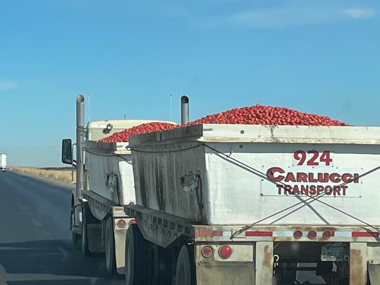
As I said, the San Joaquin Valley is one of the largest agricultural areas in California. We must have passed at least 20 of these trucks taking Roma tomatoes to be processed. But...we have no water and agriculture doesn't represent the percentage of the economy it once did. We have plenty of Apples, but those are Apple computers and phones.
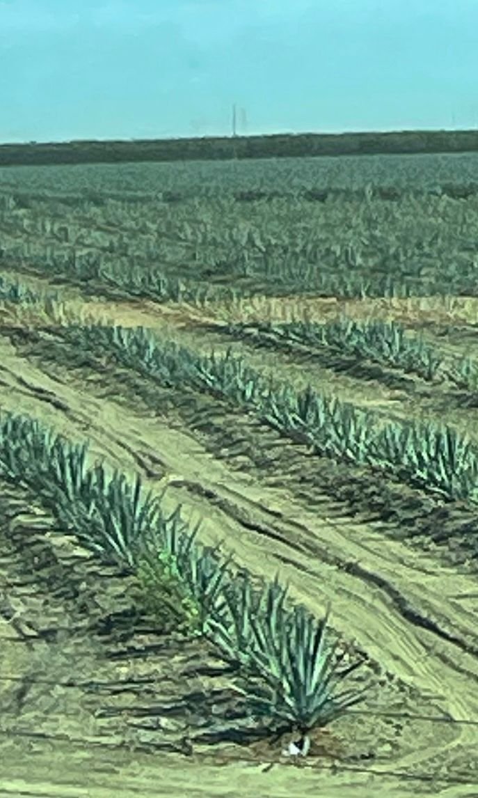
No water, here's a solution, someone has switched from nuts to agave based on this photo. First field I've seen like this Maybe moving from almonds to tequila?
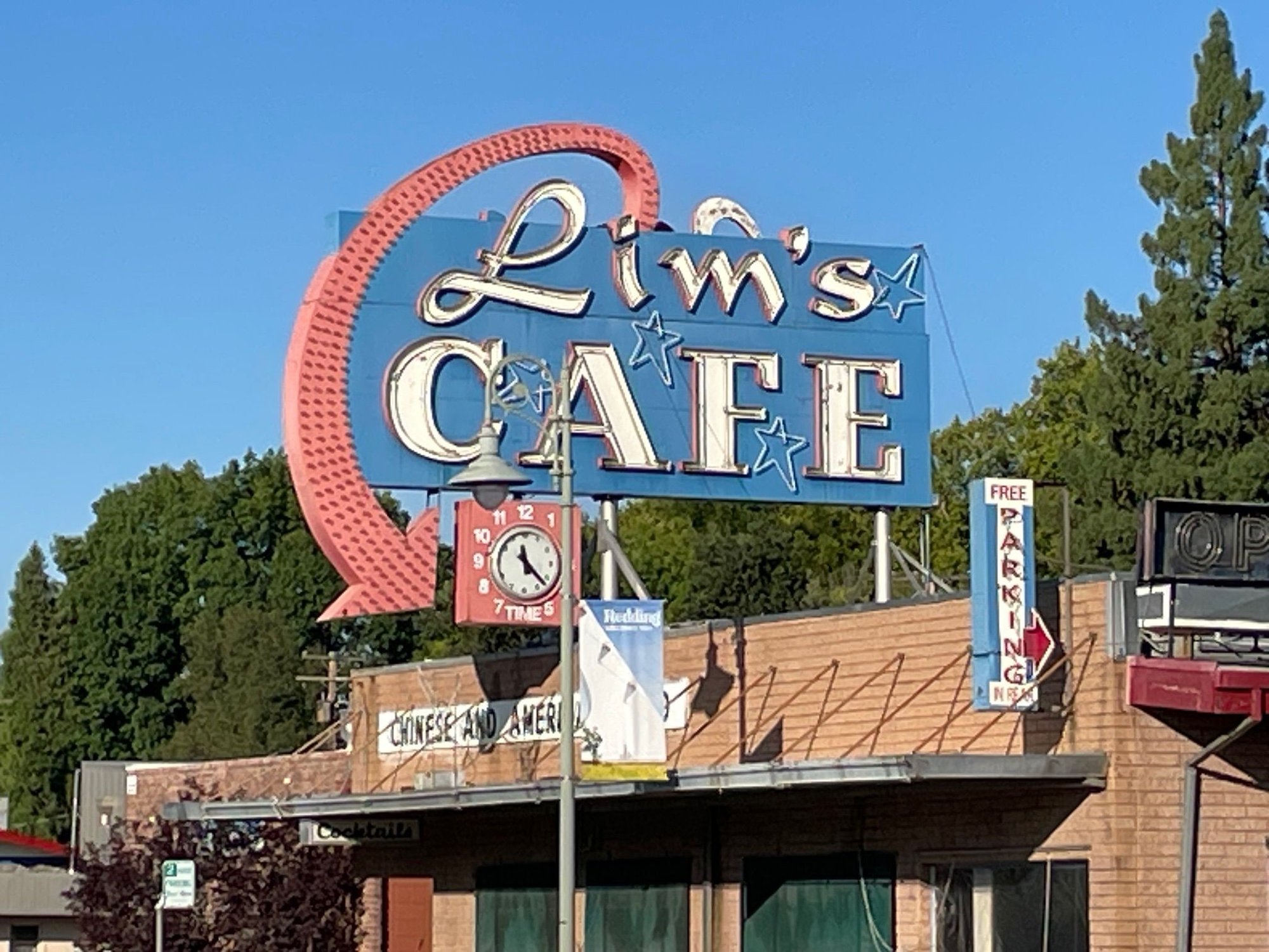
We didn't spend much time in Redding, Ca. A quick stopover on the way North. Redding is where the land starts to get interesting. Lim's Cafe, been here since the 50's, closed now.
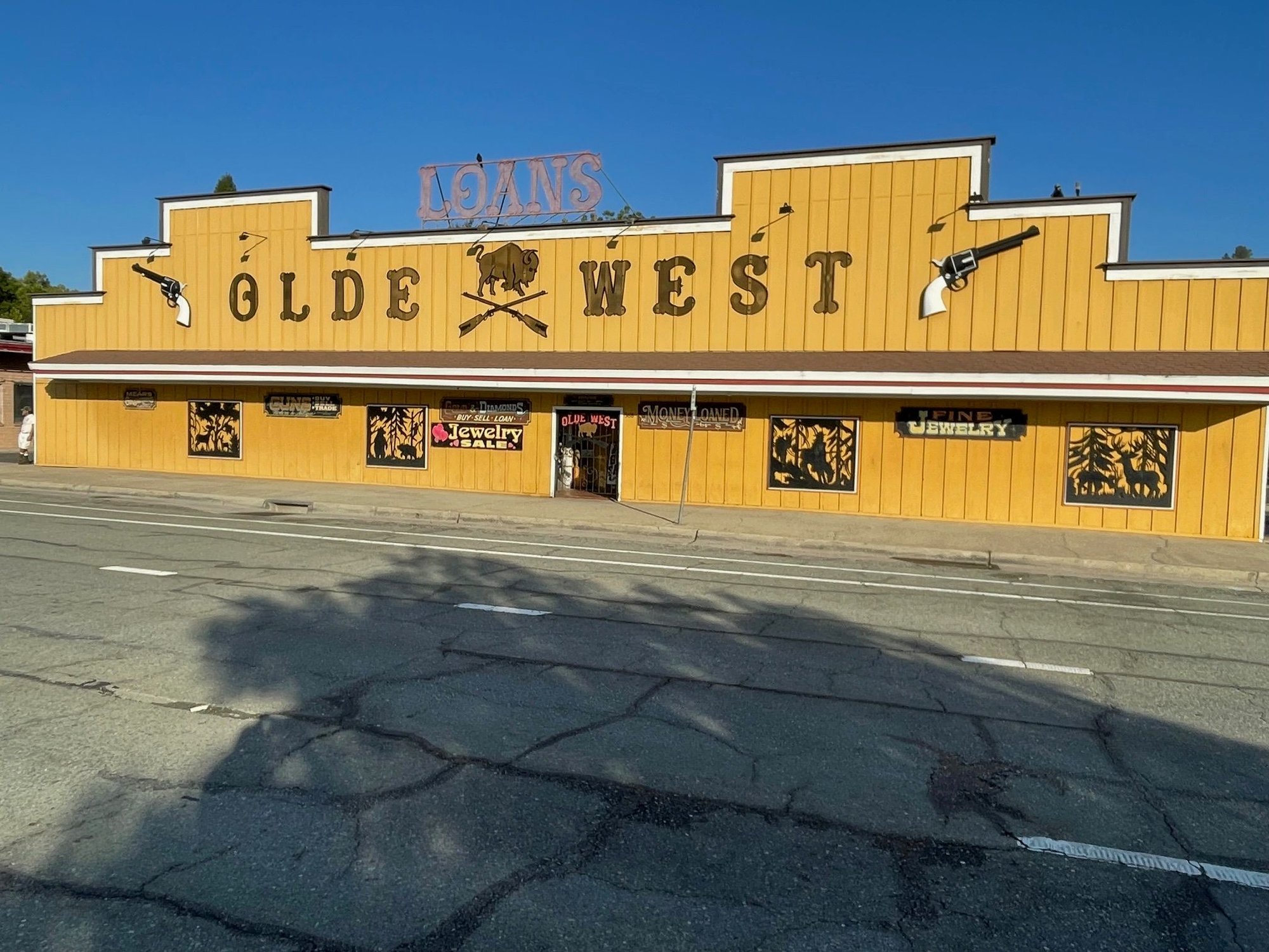
We are staying on N. Market St which used to be the main road, north and south before I-5 was built. This pawn shop is right next store to Lim's. Stop for some Chinese food and pick up a gun!
As I said, the San Joaquin Valley is one of the largest agricultural areas in California. We must have passed at least 20 of these trucks taking Roma tomatoes to be processed. But...we have no water and agriculture doesn't represent the percentage of the economy it once did. We have plenty of Apples, but those are Apple computers and phones.
No water, here's a solution, someone has switched from nuts to agave based on this photo. First field I've seen like this Maybe moving from almonds to tequila?
We didn't spend much time in Redding, Ca. A quick stopover on the way North. Redding is where the land starts to get interesting. Lim's Cafe, been here since the 50's, closed now.
We are staying on N. Market St which used to be the main road, north and south before I-5 was built. This pawn shop is right next store to Lim's. Stop for some Chinese food and pick up a gun!
Aug 16th, 2025 | 12:58 PM
#5
Joined: Jan 2003
Posts: 98,239
Likes: 12
Whoo hoo! What fun. I grew up in Los Angeles and (a few states later back in New England) adopted the PNW. Seattle is my heart and my home.
LOVE reading trip reports. And the photos are always amazing.
THANKYOU! suze, seattle
LOVE reading trip reports. And the photos are always amazing.
THANKYOU! suze, seattle
Aug 16th, 2025 | 03:27 PM
#6
Original Poster
Joined: Mar 2009
Posts: 928
Likes: 0
Redding, California to Salem, Oregon
And God said to California, " I will give you Big Sur, Yosemite, Sequoia and the Redwoods...but you have to take I-5" California said, "No thanks". Then God said, "If you take I-5, I will create it so that everything north of Redding is God's Country." California said, " Deal, and is that where you will be living God?" And God said, "No, I have a little place in Malibu".
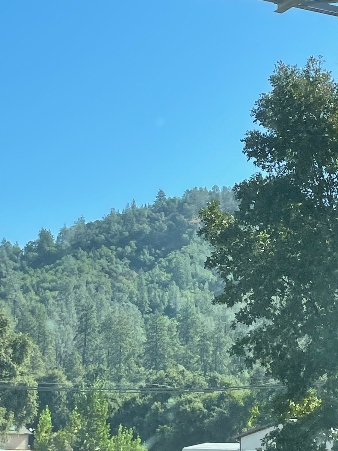
Alright I can't authenticate that this was the actual conversation, however, 10 miles out of Redding I-5 does turn into God's Country. That straight, dusty, boring road turns into a carnival ride. It drops, curves and slides around gorgeous stands of trees. Walnut and Citrus trees are exchanged for towering Pines, and lakes on each side of the road. Eventually you will be greeted by Mt. Shasta and you will stay on this E ticket ride all they way to the Oregon border.
High forests line I-5 as it snakes north.
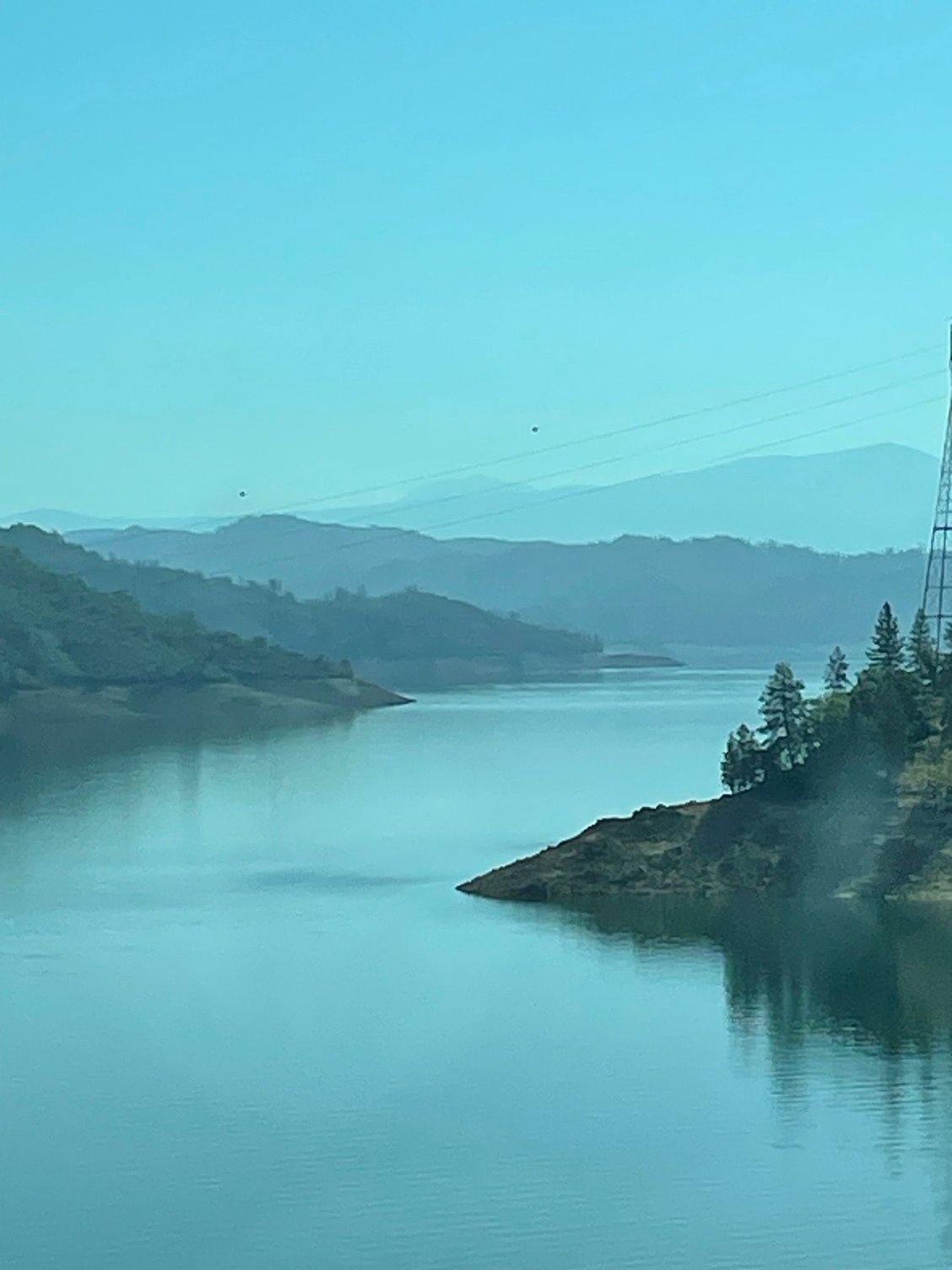
Layered views of Shasta Lake welcome you.

Castle Crags north of Dunsmuir
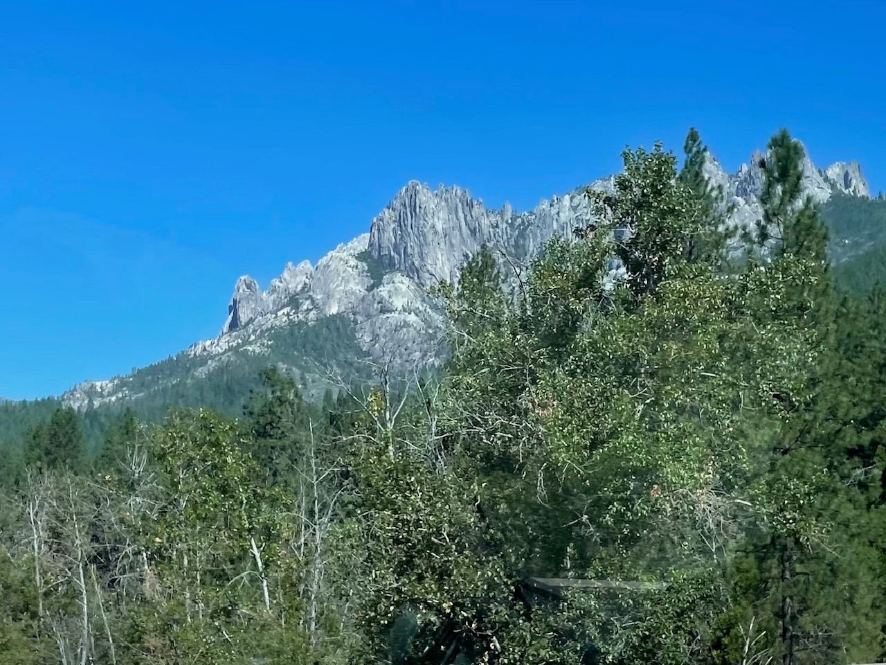
Another shot of the Crags
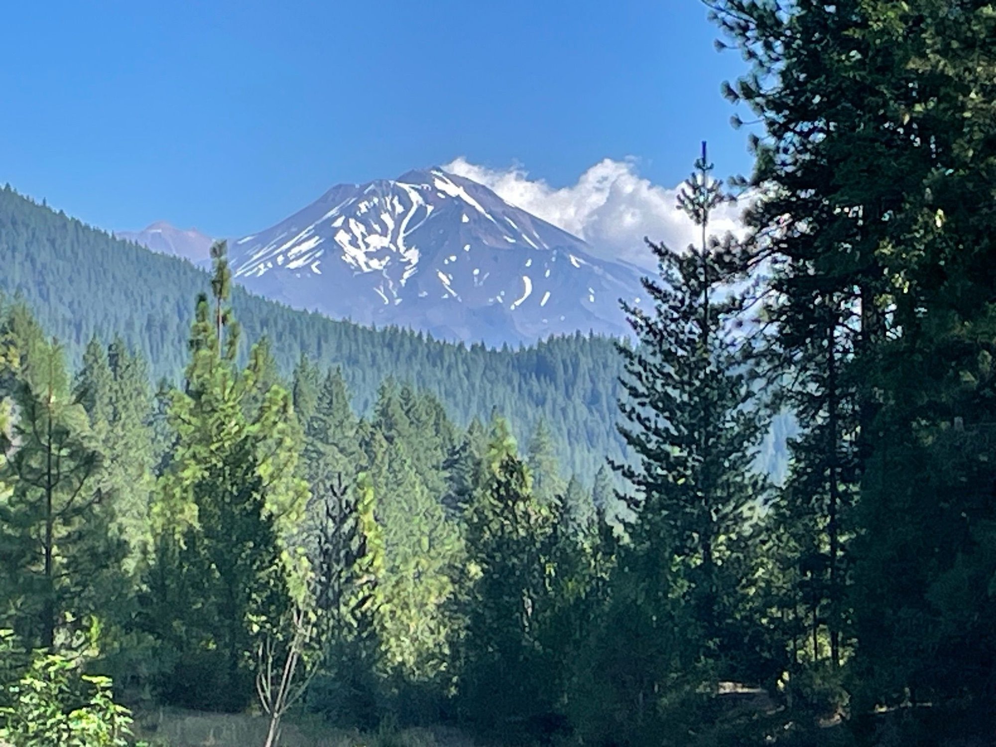
Mt Shasta from a viewing area along the road, looking to the east
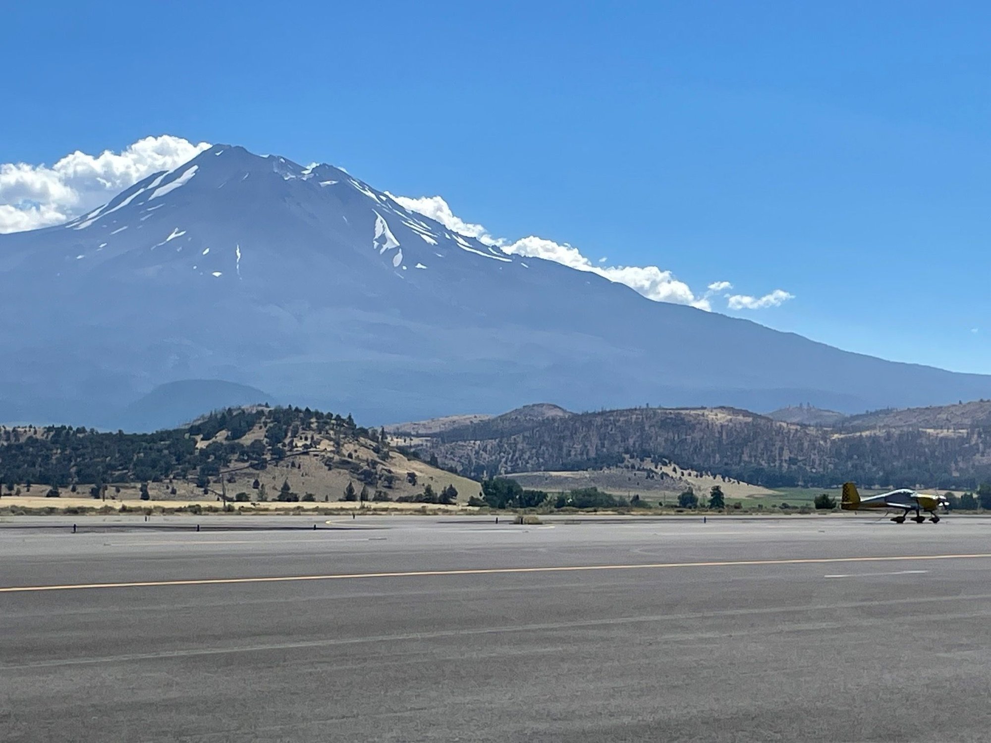
This is at the Weed Rest Area. It has it's own little airport!
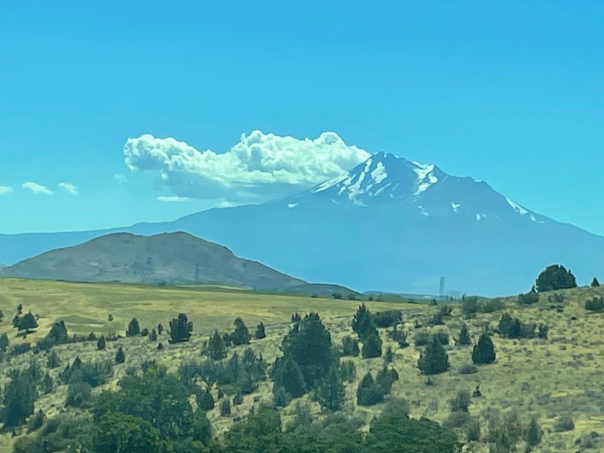
Looking back at Shasta from the North, with a little cloud buddy
And then you are in high plains and farmland.
And God said to California, " I will give you Big Sur, Yosemite, Sequoia and the Redwoods...but you have to take I-5" California said, "No thanks". Then God said, "If you take I-5, I will create it so that everything north of Redding is God's Country." California said, " Deal, and is that where you will be living God?" And God said, "No, I have a little place in Malibu".
Alright I can't authenticate that this was the actual conversation, however, 10 miles out of Redding I-5 does turn into God's Country. That straight, dusty, boring road turns into a carnival ride. It drops, curves and slides around gorgeous stands of trees. Walnut and Citrus trees are exchanged for towering Pines, and lakes on each side of the road. Eventually you will be greeted by Mt. Shasta and you will stay on this E ticket ride all they way to the Oregon border.
High forests line I-5 as it snakes north.
Layered views of Shasta Lake welcome you.
Castle Crags north of Dunsmuir
Another shot of the Crags
Mt Shasta from a viewing area along the road, looking to the east
This is at the Weed Rest Area. It has it's own little airport!
Looking back at Shasta from the North, with a little cloud buddy
And then you are in high plains and farmland.
Aug 16th, 2025 | 03:40 PM
#7
Original Poster
Joined: Mar 2009
Posts: 928
Likes: 0
Welcome to Oregon
Oregon is one beautiful state and we are still on the part of I-5 that is God's Country. We are headed to Jefferson, Oregon where we will spend the night in someone's front yard. Let me explain. We belong to Boondockers Welcome which is an organization that matches up travelers, generally RVers and Van-ners and you can stay for free on their property. Kevin and Eileen were a very welcoming couple and we really enjoyed talking to them in the little town of Jefferson, outside of Salem.
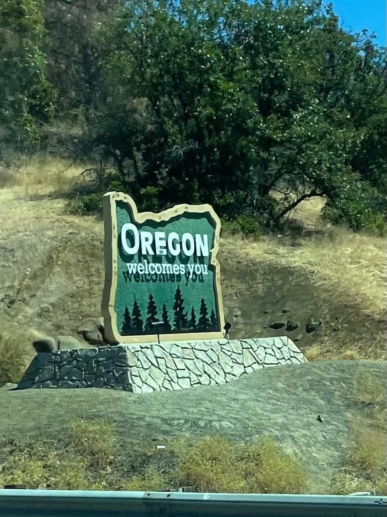
The sign says it all.
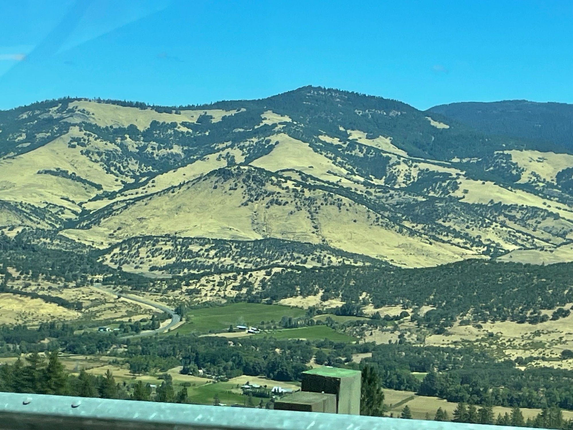
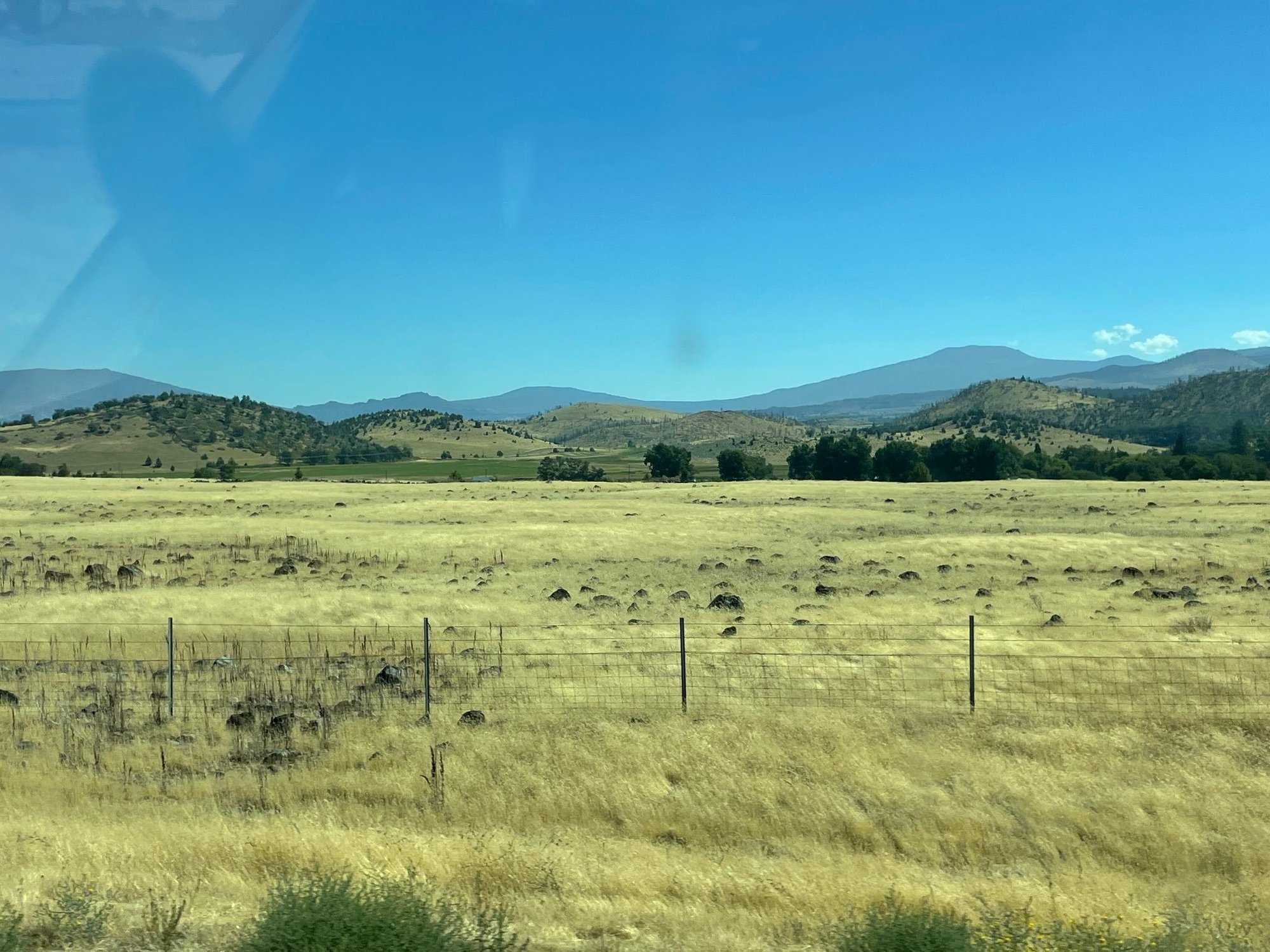
Some Oregon countryside
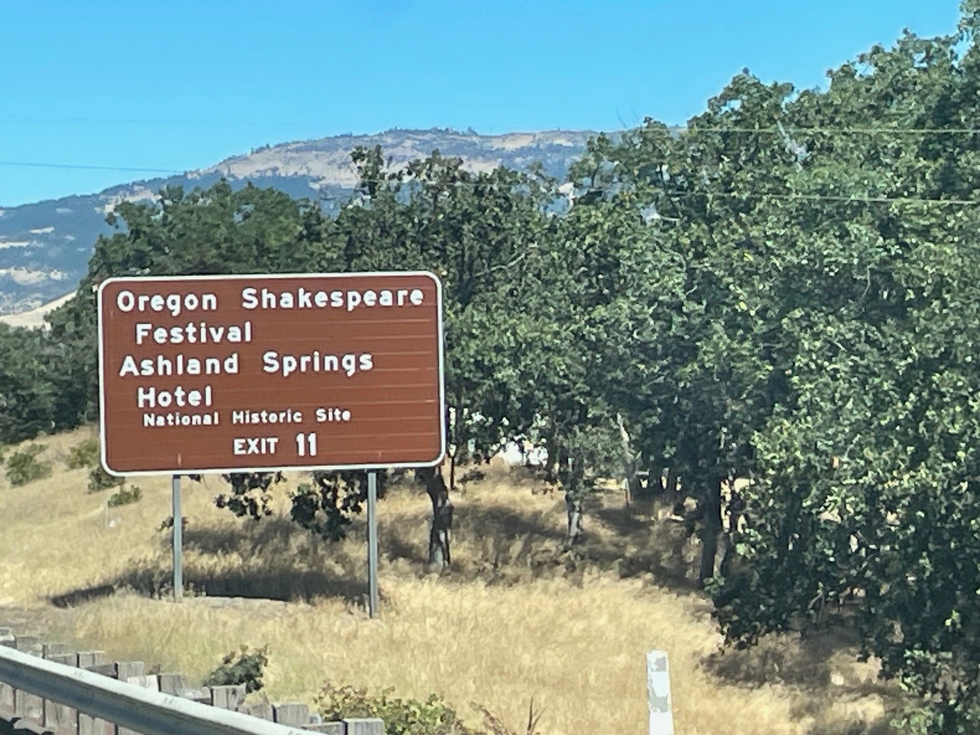
Ashland is famous for it's Shakespeare Festival
Stopped at the Oregon Welcome Center and they were so nice. Loaded us up with maps and free coffee.
This is the bridge into Jefferson
We are staying in Kevin and Eileen's front yard, but we decided to set up our cook stove in a little park on the river.
These are free loaner Life Jackets for tubing on the river. Safety first, what a great idea.
And this is the River you might be tubing on. It's pretty low right now but still a pretty sunset shot.
Oregon is one beautiful state and we are still on the part of I-5 that is God's Country. We are headed to Jefferson, Oregon where we will spend the night in someone's front yard. Let me explain. We belong to Boondockers Welcome which is an organization that matches up travelers, generally RVers and Van-ners and you can stay for free on their property. Kevin and Eileen were a very welcoming couple and we really enjoyed talking to them in the little town of Jefferson, outside of Salem.
The sign says it all.
Some Oregon countryside
Ashland is famous for it's Shakespeare Festival
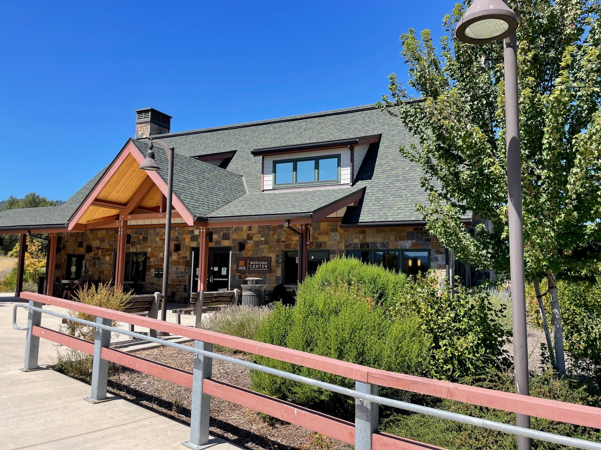
Stopped at the Oregon Welcome Center and they were so nice. Loaded us up with maps and free coffee.
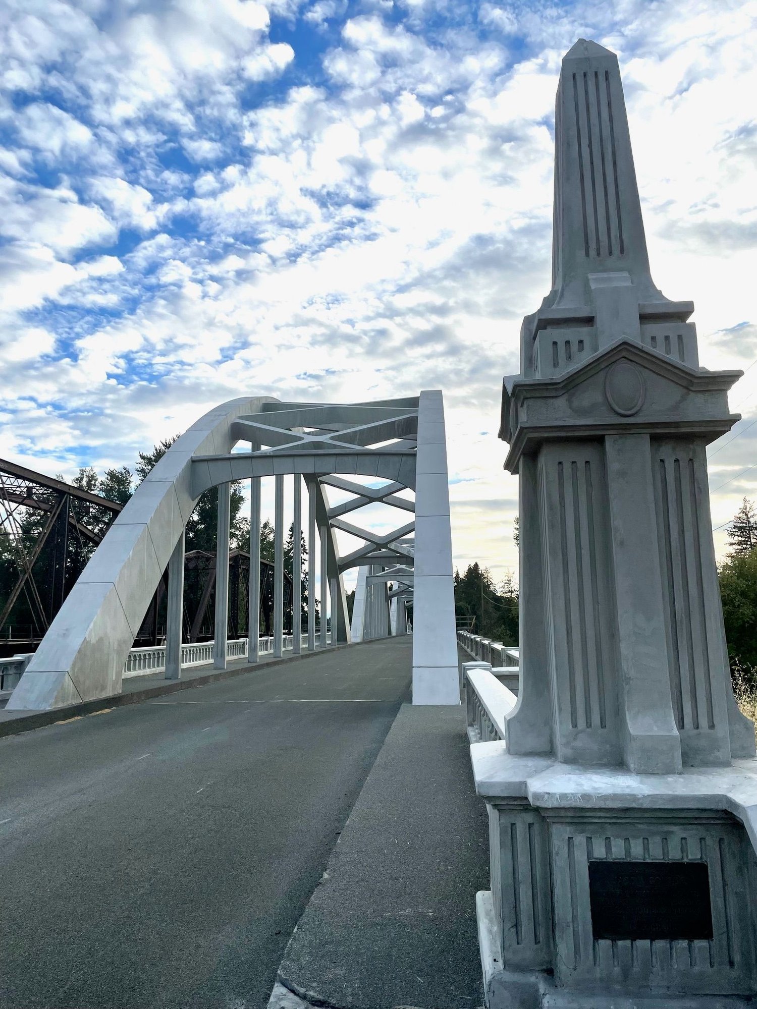
This is the bridge into Jefferson
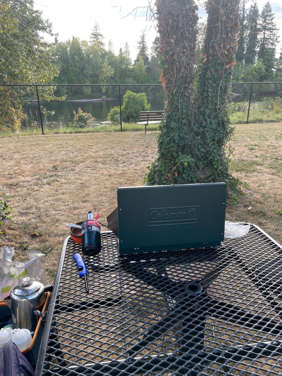
We are staying in Kevin and Eileen's front yard, but we decided to set up our cook stove in a little park on the river.
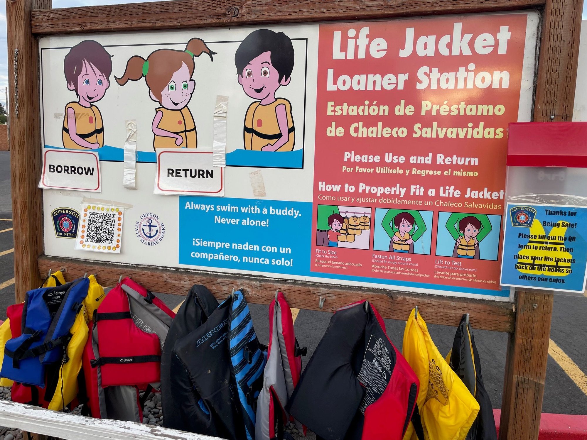
These are free loaner Life Jackets for tubing on the river. Safety first, what a great idea.
And this is the River you might be tubing on. It's pretty low right now but still a pretty sunset shot.
Trending Topics
Aug 17th, 2025 | 05:15 PM
#8
Original Poster
Joined: Mar 2009
Posts: 928
Likes: 0
Jefferson, Oregon to the Oregon Coast
After our Boondockers stay, we are headed to Manzanita on the Oregon Coast for a large family reunion. North to Salem and West on Hwy 22 dumping onto Hwy 101. Had a few stops, first we stopped at the Spirit Mountain Casino and then a quick stop at Tillamook for CHEESE! Moved from farmland to plains and then into the beautiful forest of Suisaw National Forest.

This is what we saw from the road, long fields with hills / mountains in the back.
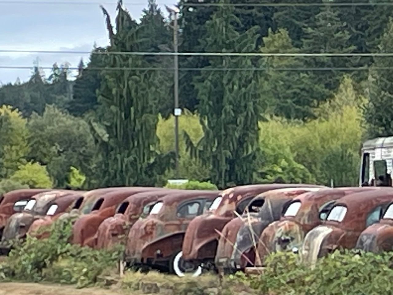
At the Spirit Mt. Casino I saw this line of junked cars, but all from the 30's. It looked like 20 getaway cars from 20 St. Valentine's Day Massacres.
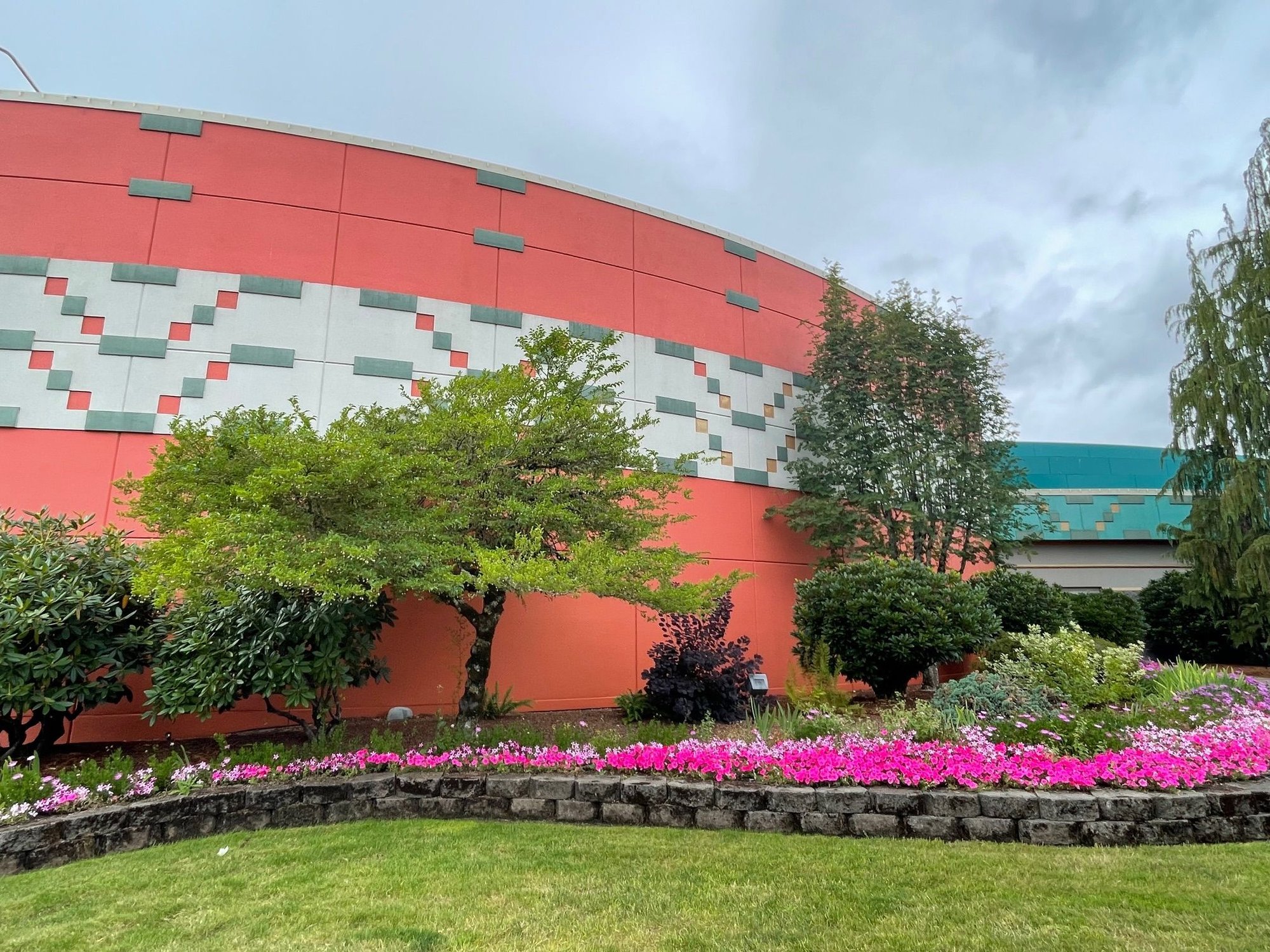
Outside the casino. Very nicely landscaped.
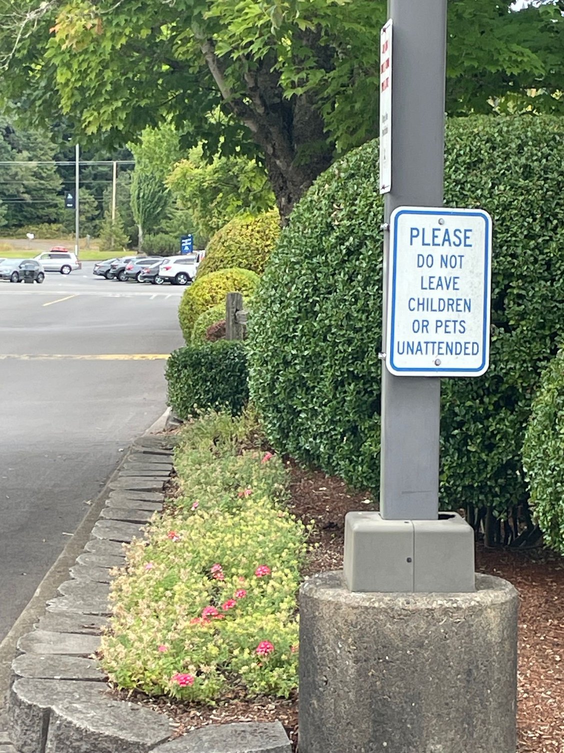
Saw this sign as we were driving out. I can see leaving Grandma or a couple of kids in the car, but what monster would leave Fluffy the beloved family pet.
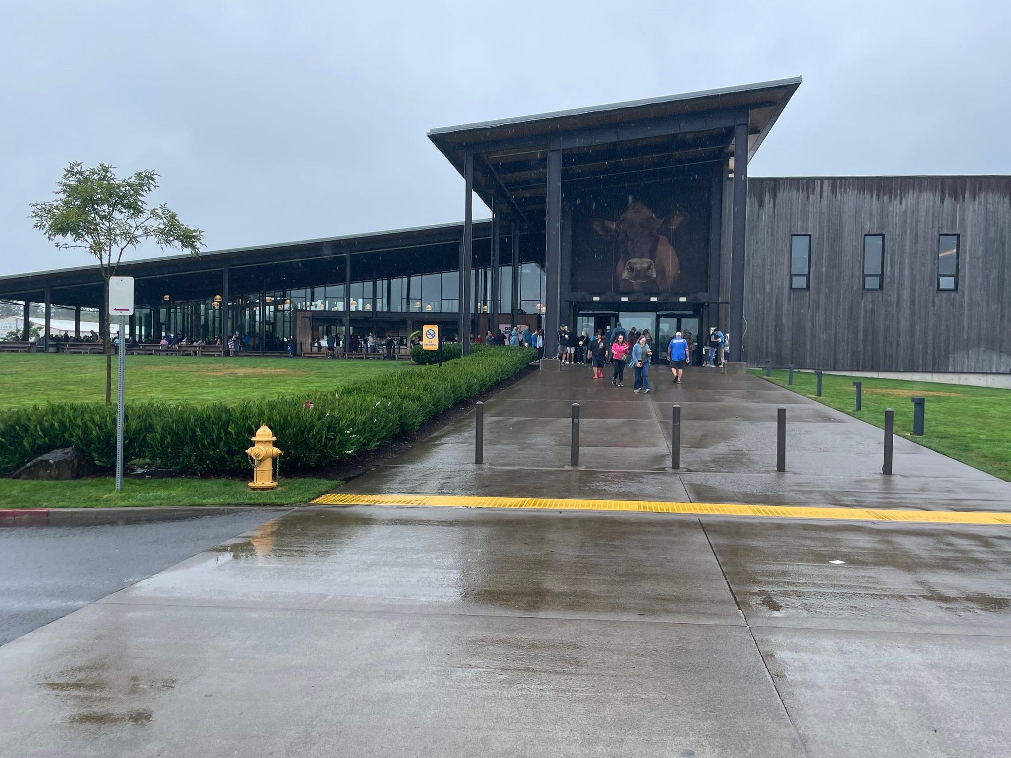
Walking into the Tillamook Creamery, the Holy Grail for Cheddar.
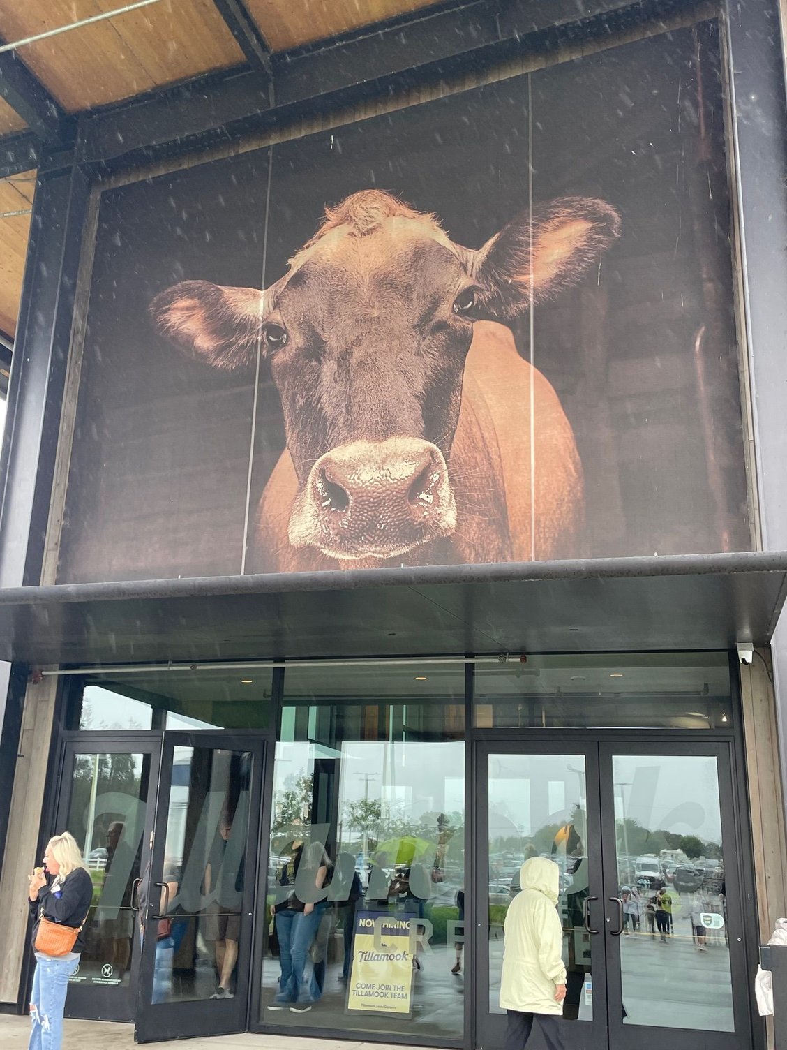
Here's Mrs. Cheddar herself
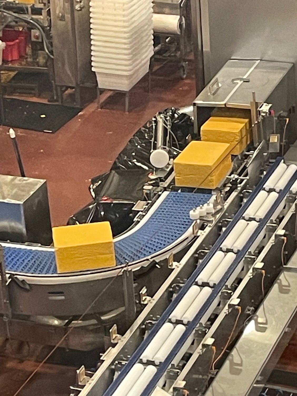
Those are giant blocks of cheese, be still my heart.
After our Boondockers stay, we are headed to Manzanita on the Oregon Coast for a large family reunion. North to Salem and West on Hwy 22 dumping onto Hwy 101. Had a few stops, first we stopped at the Spirit Mountain Casino and then a quick stop at Tillamook for CHEESE! Moved from farmland to plains and then into the beautiful forest of Suisaw National Forest.
This is what we saw from the road, long fields with hills / mountains in the back.
At the Spirit Mt. Casino I saw this line of junked cars, but all from the 30's. It looked like 20 getaway cars from 20 St. Valentine's Day Massacres.
Outside the casino. Very nicely landscaped.
Saw this sign as we were driving out. I can see leaving Grandma or a couple of kids in the car, but what monster would leave Fluffy the beloved family pet.
Walking into the Tillamook Creamery, the Holy Grail for Cheddar.
Here's Mrs. Cheddar herself
Those are giant blocks of cheese, be still my heart.
Aug 17th, 2025 | 05:25 PM
#9
Original Poster
Joined: Mar 2009
Posts: 928
Likes: 0
Manzanita and the Environs
Pulled into Manzanita to pouring rain. Luckily we had Nike, our van, so we just hunkered down, brought out the books and turned on the music. The next day we drove up to Astoria and enjoyed the Coast.
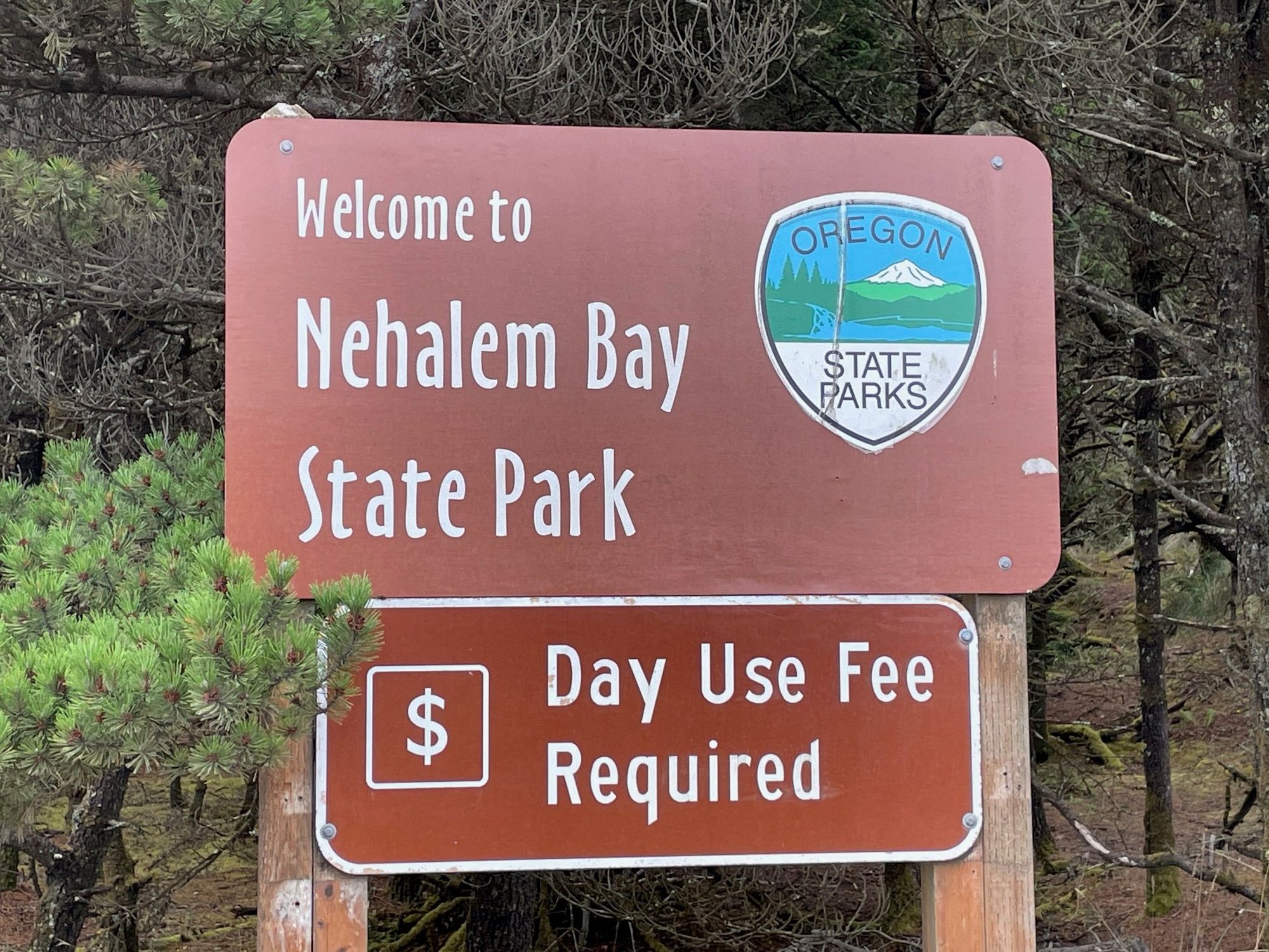
Nehalem Park is right on the beach but there is a pretty good sized berm, so you can hear the ocean but you can't see it.
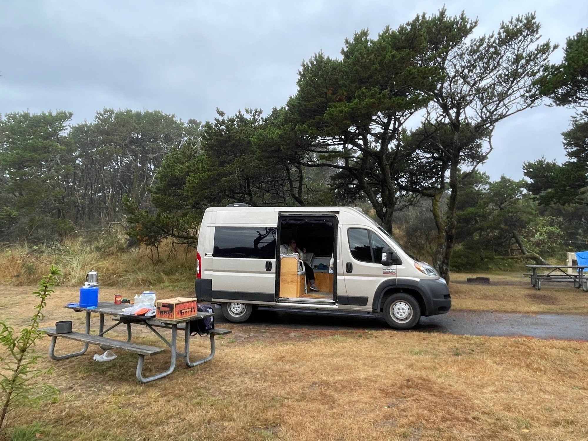
Great site, when it's not raining!
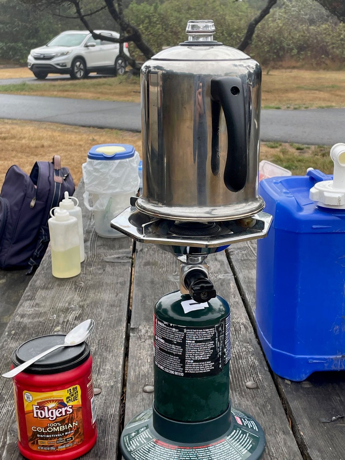
Nothing like a cup of old school coffee from the percolater.
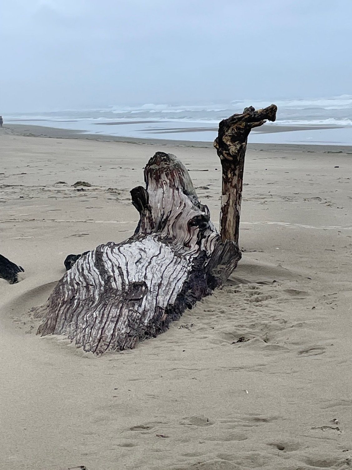
Who left their camel on our beach!
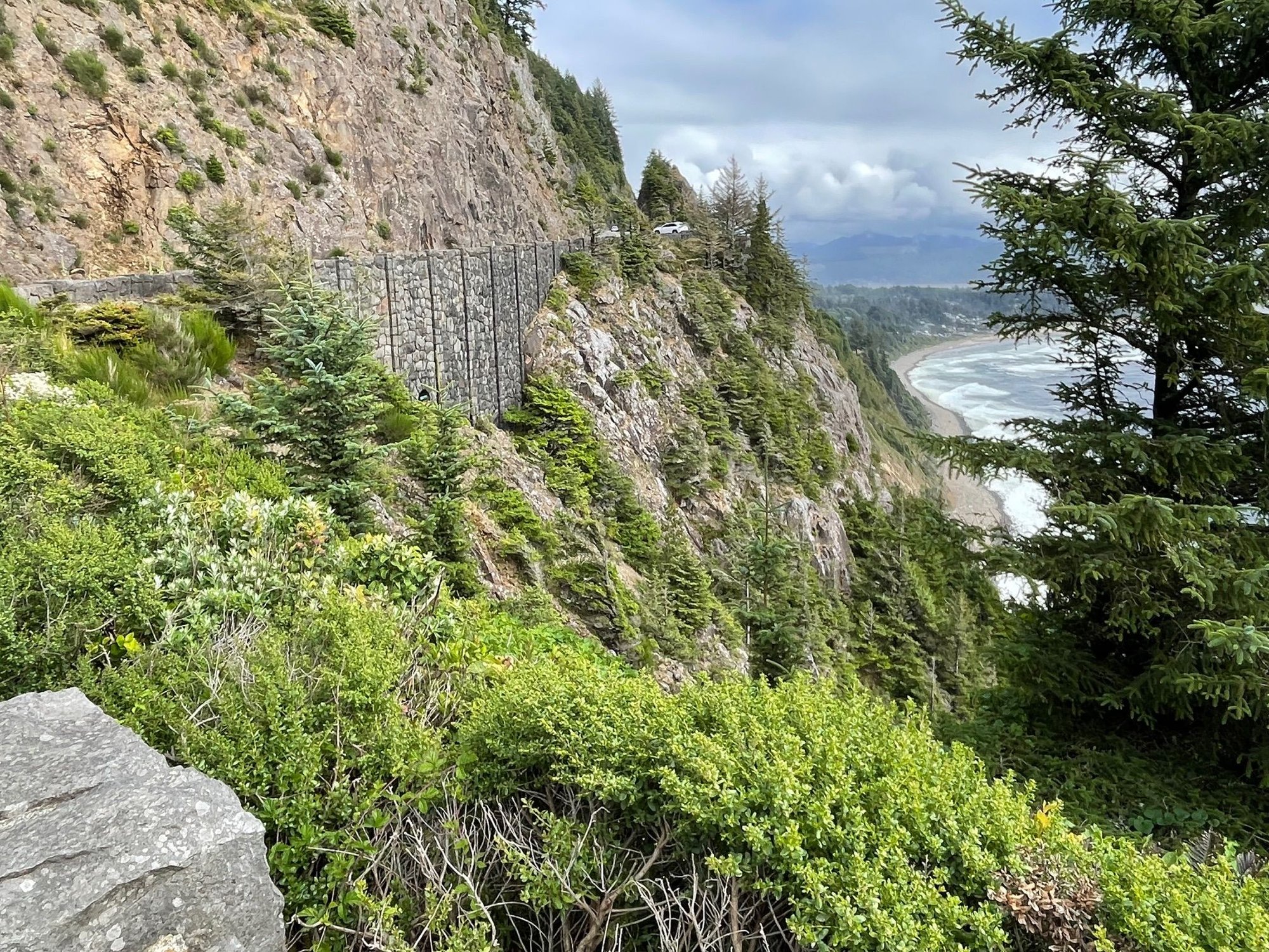
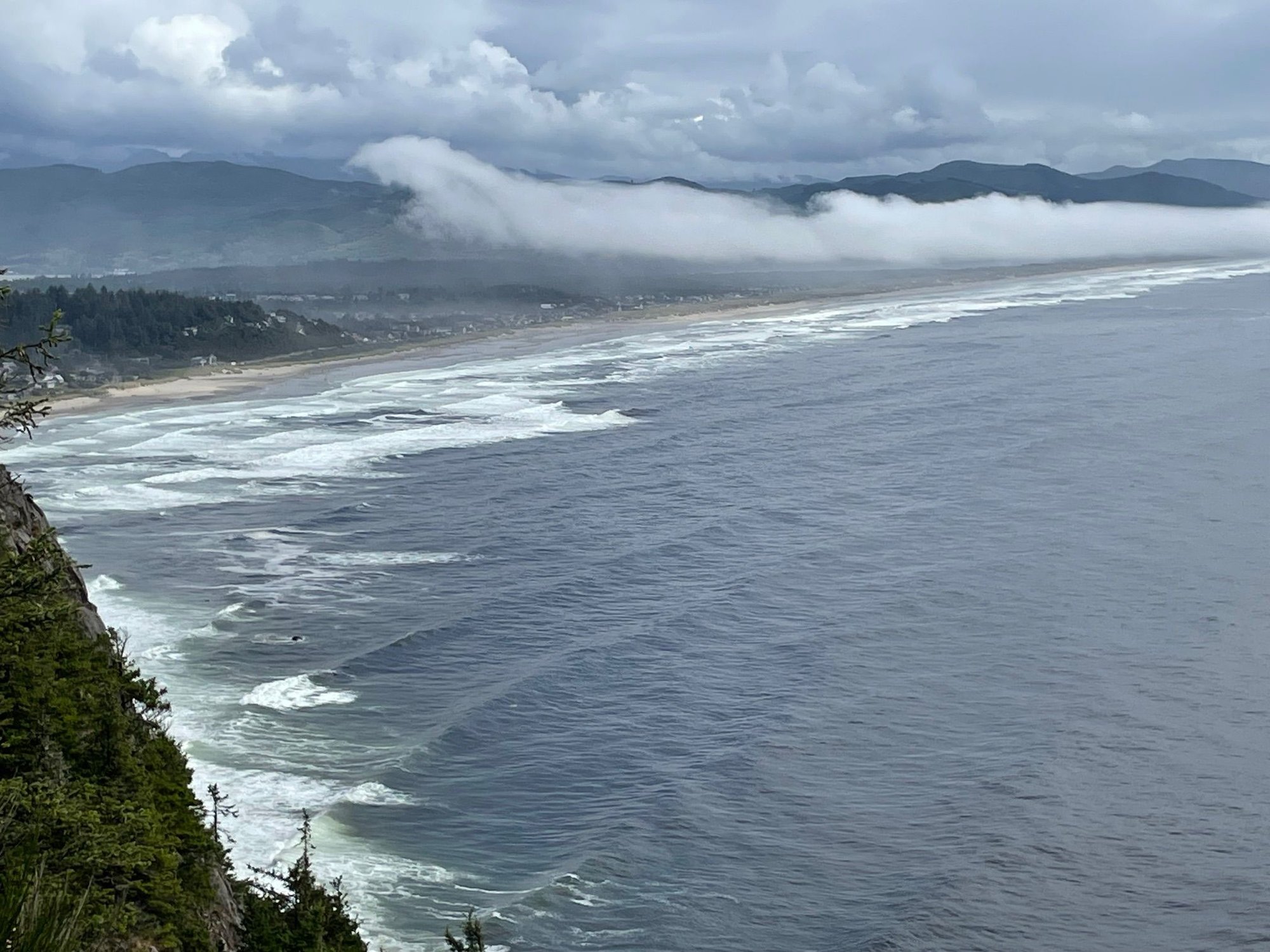
Oregon Coast, so dramatic and beautiful
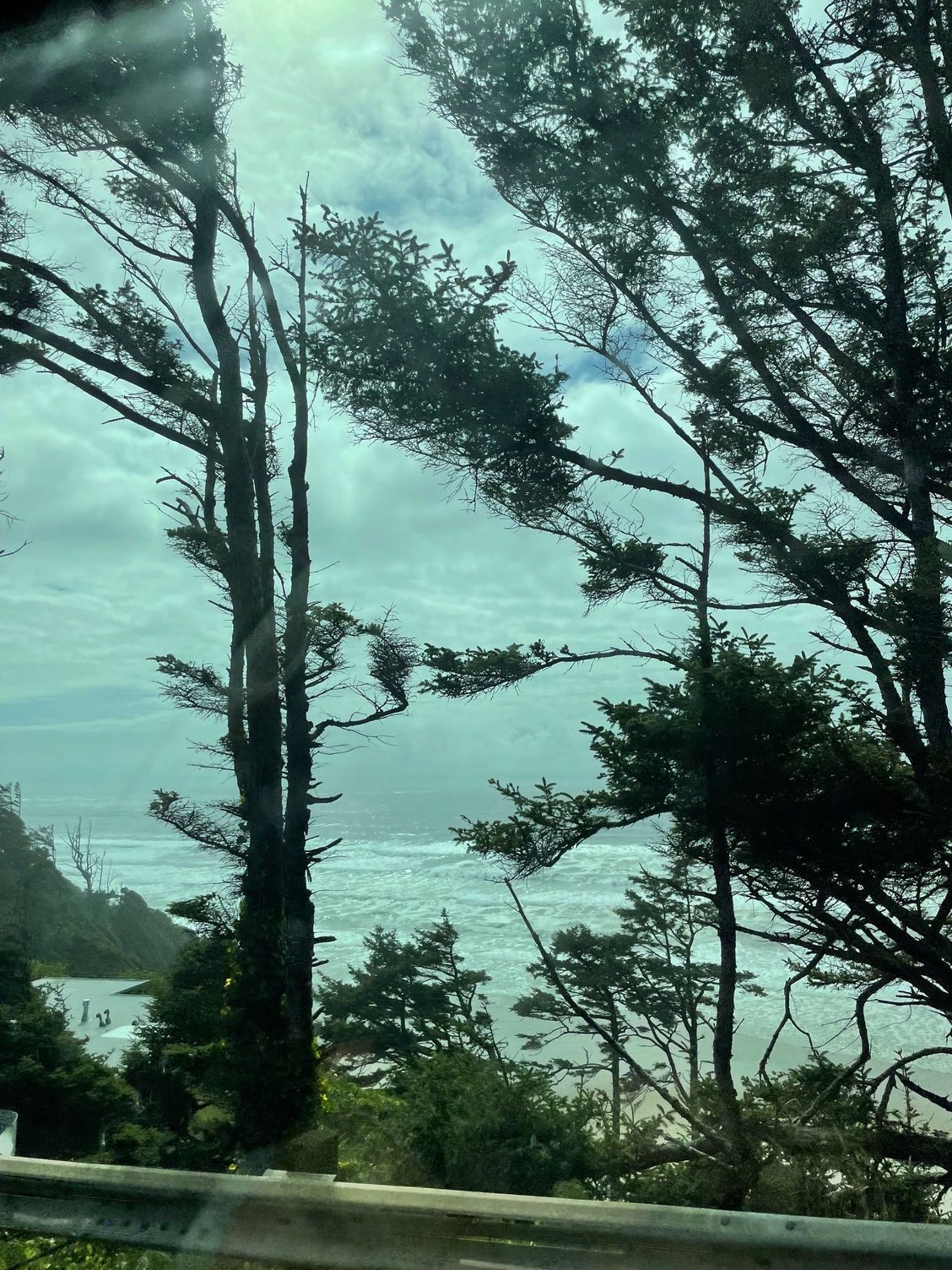
So many trees
Cloud heading through. I took this shot and two minutes later the cloud was gone.
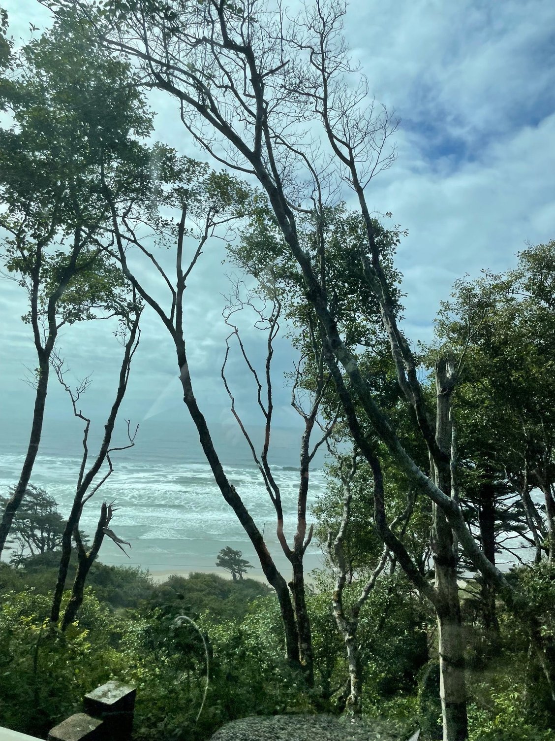
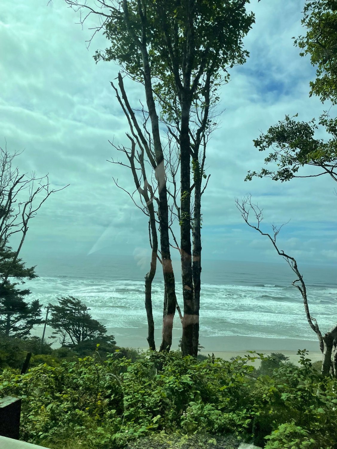
Another tree / beach shot
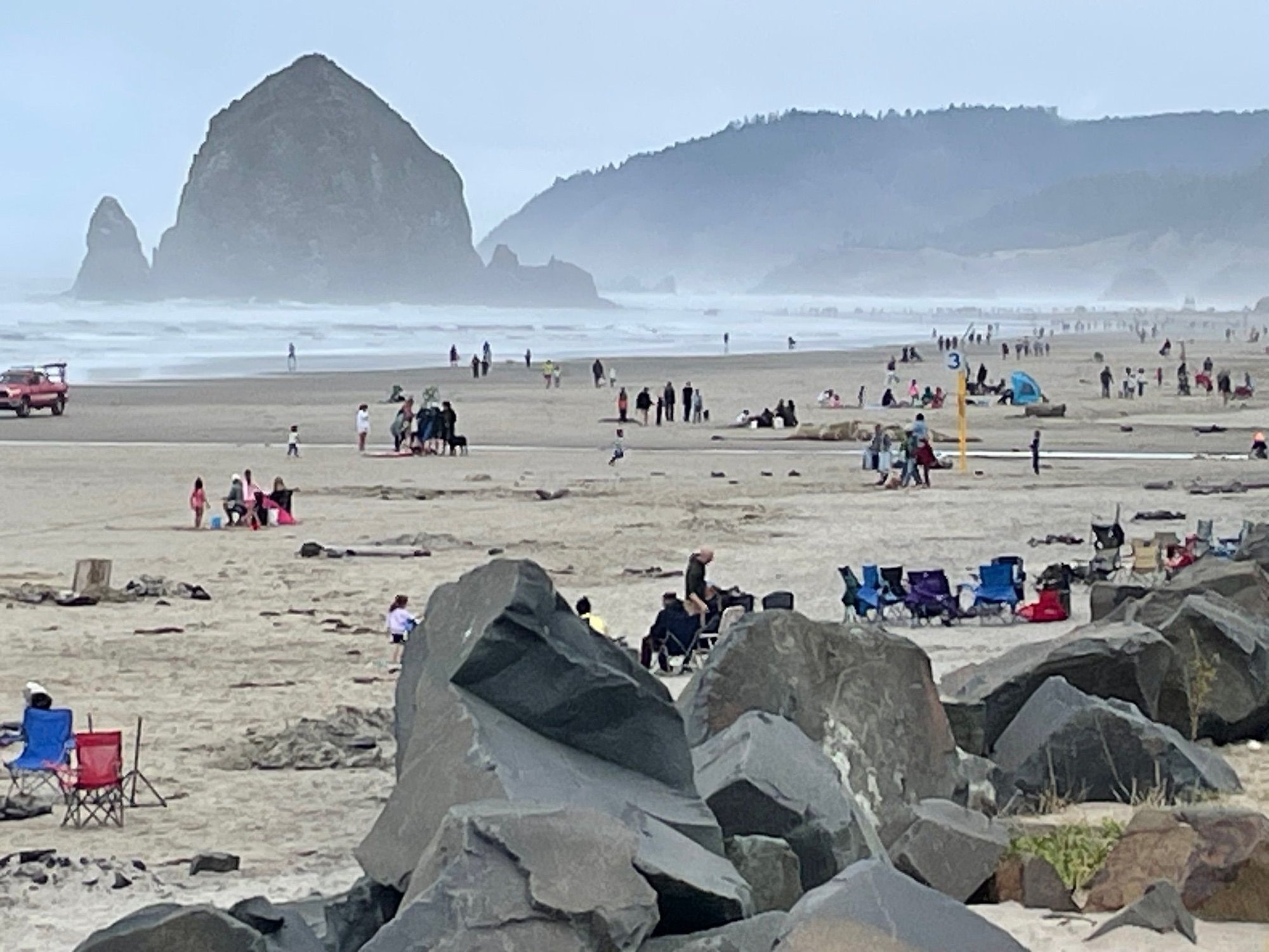
Cannon Beach, pretty crowded for an overcast day
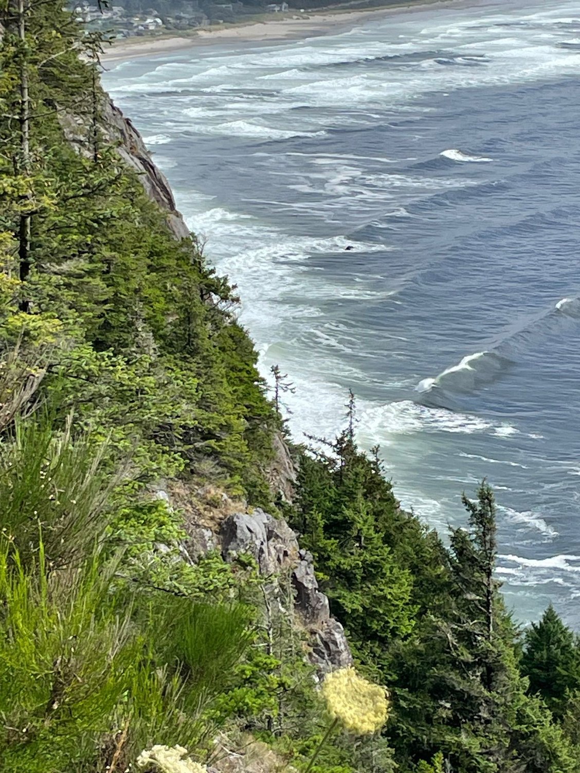
Cliffs
Trees
Pulled into Manzanita to pouring rain. Luckily we had Nike, our van, so we just hunkered down, brought out the books and turned on the music. The next day we drove up to Astoria and enjoyed the Coast.
Nehalem Park is right on the beach but there is a pretty good sized berm, so you can hear the ocean but you can't see it.
Great site, when it's not raining!
Nothing like a cup of old school coffee from the percolater.
Who left their camel on our beach!
Oregon Coast, so dramatic and beautiful
So many trees
Cloud heading through. I took this shot and two minutes later the cloud was gone.
Another tree / beach shot
Cannon Beach, pretty crowded for an overcast day
Cliffs
Trees
Aug 17th, 2025 | 05:35 PM
#10
Original Poster
Joined: Mar 2009
Posts: 928
Likes: 0
Oregon to Washington
Today we left Oregon and drove over the big bridge at Astoria. Washington is so different than Oregon, the coast is not as dramatic but driving through the countryside away from the beach it is all about water. Rivers, sloughs, bays surrounded by fields with cows and the forest in the background. Stopped at Aberdeen then ended at Lake Quinault for one more night of camping before Sol Duc in the Olympic National Park.
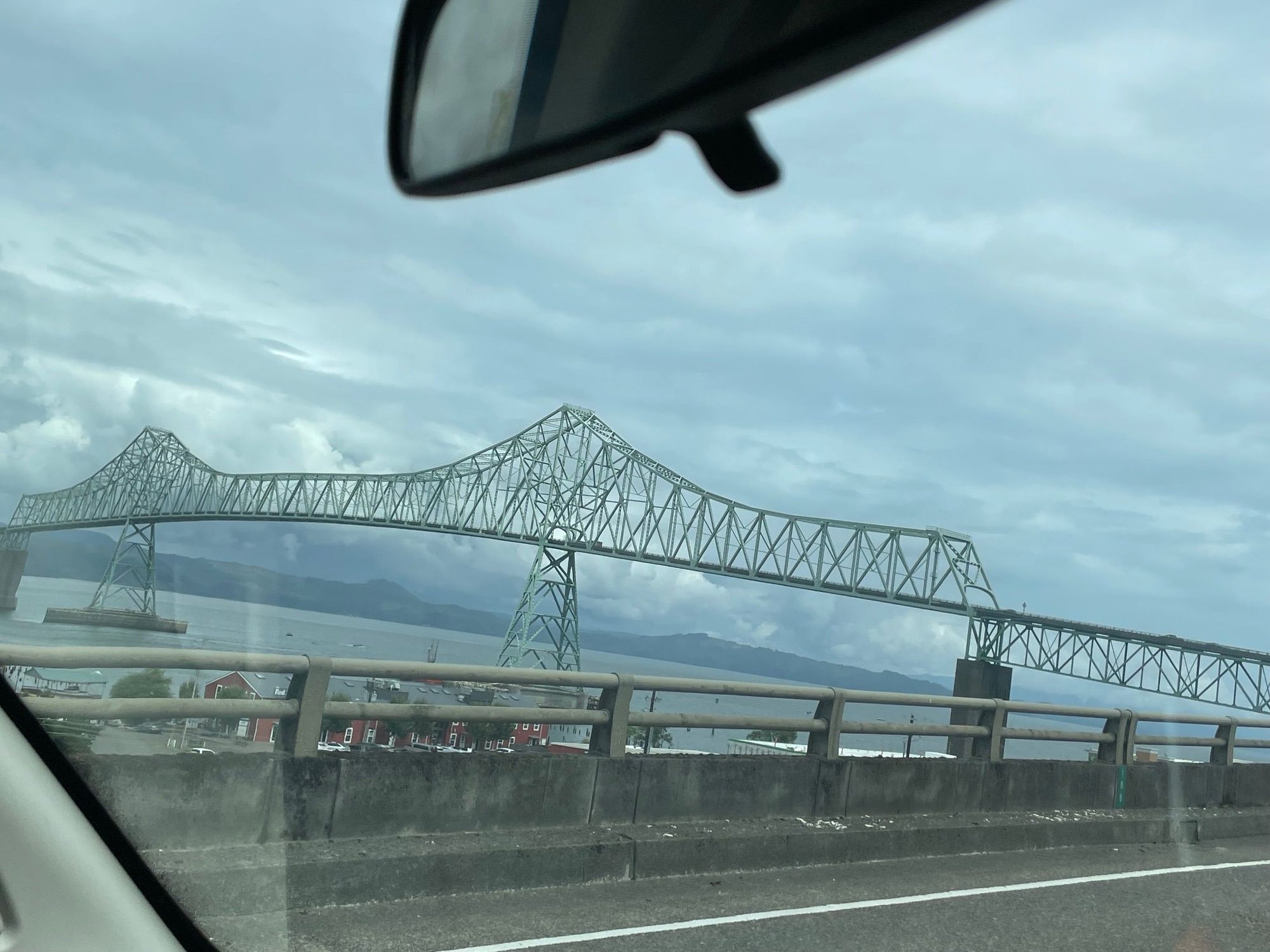
Approaching the Bridge
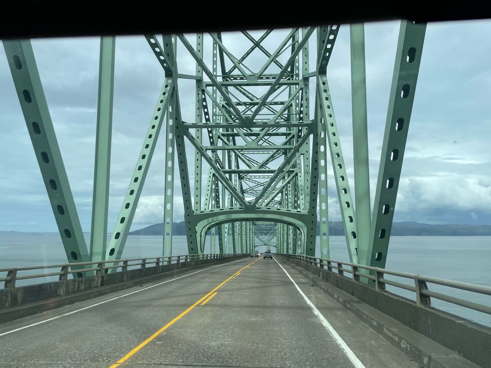
Over the big bridge, it's quite drive.
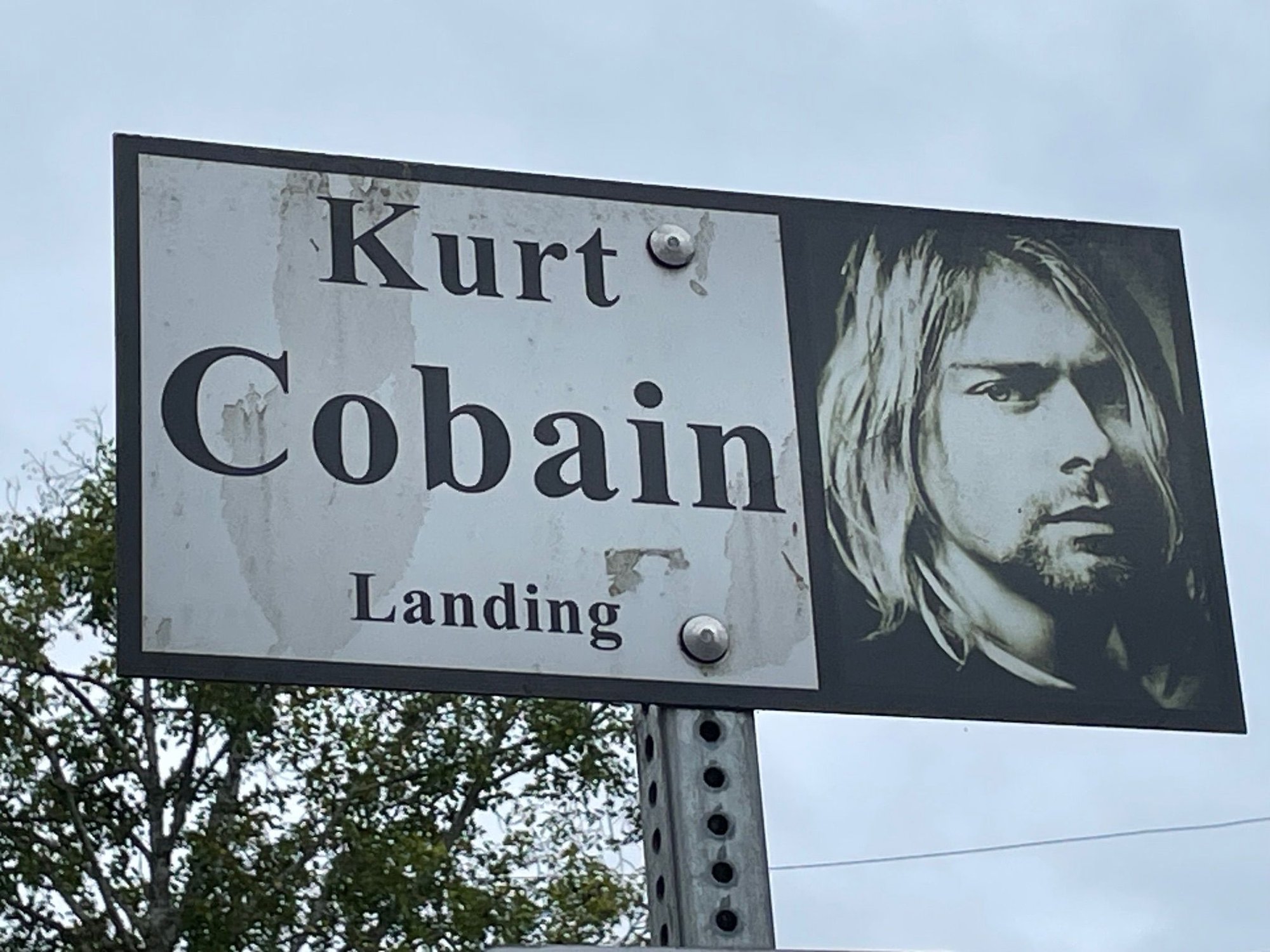
Stopped to pay our respects to Kurt Cobain at Kurt's landing, a pretty beat up bridge with lots of graffiti
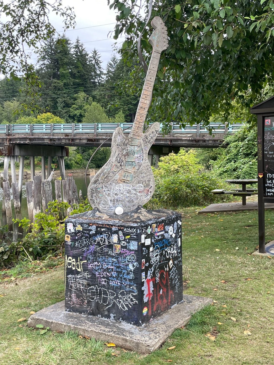
Kurt's guitar statute
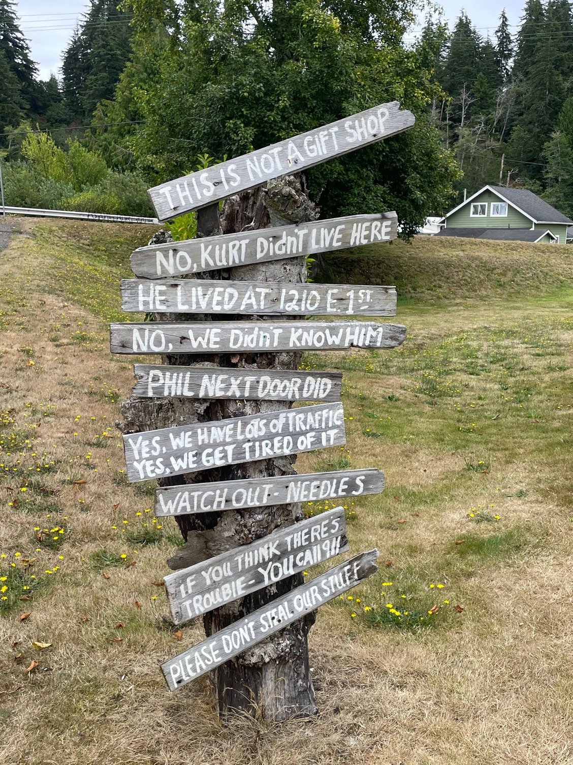
Funny sign posted on the property of the neighbor who lives right next to the bridge.
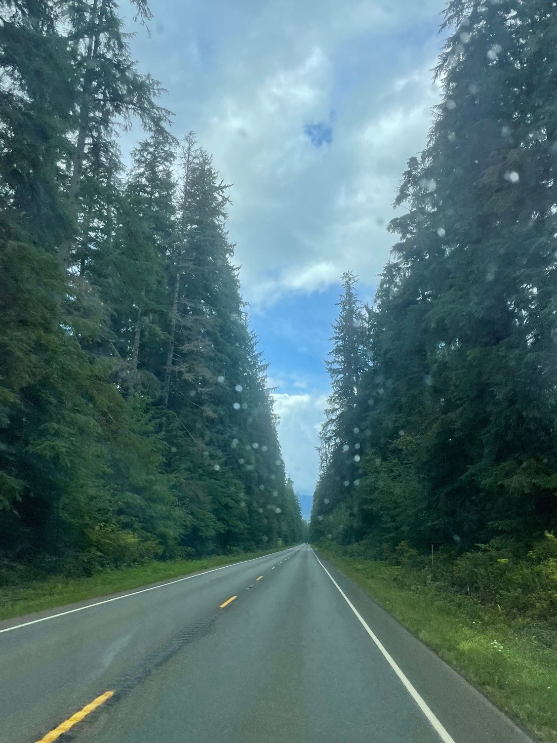
Hwy 101 on the way to Lake Quinault
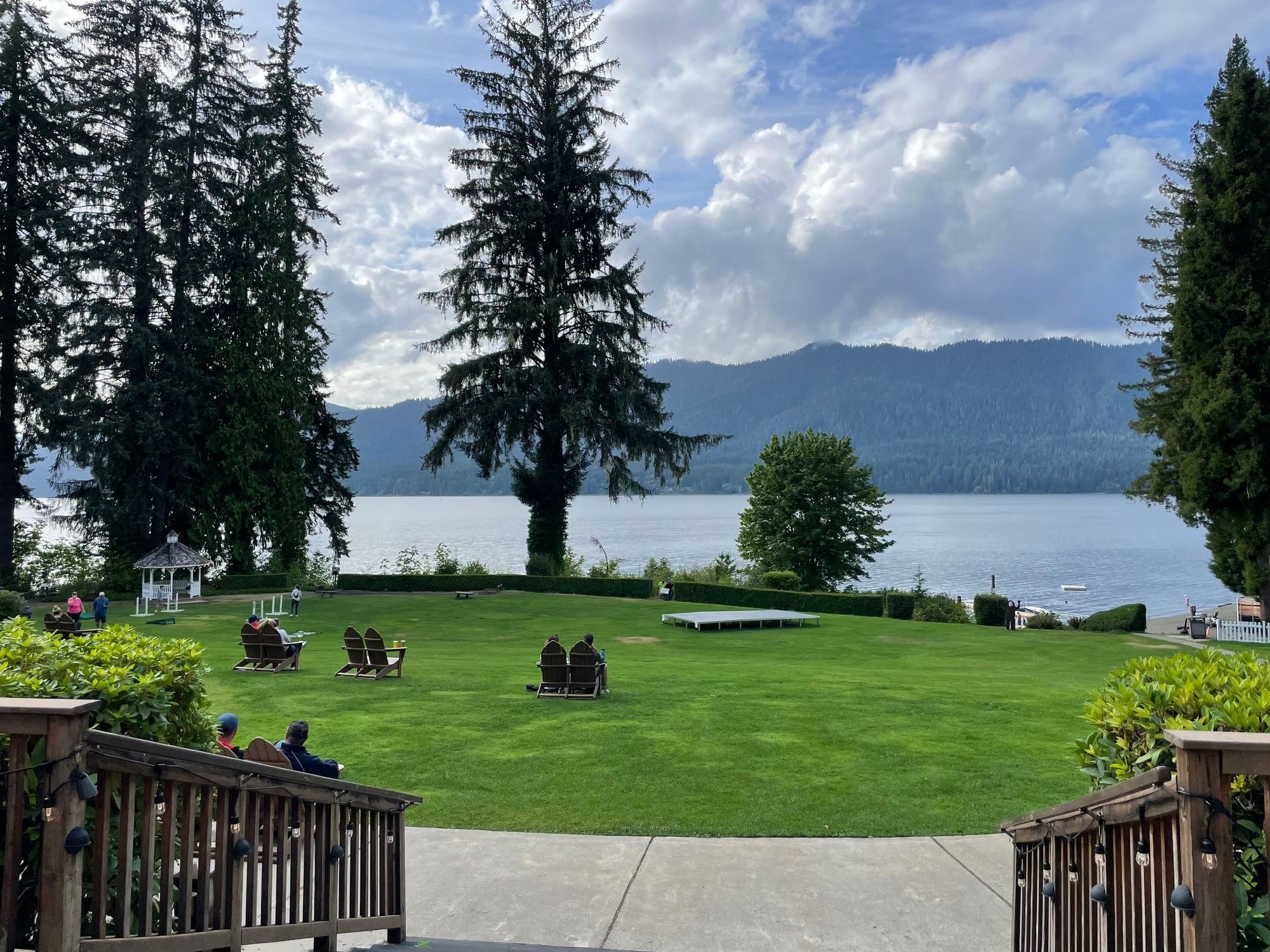
Lake Quinault Lodge. yk did some wonderful pictures from here just a month ago. She stayed here...I'm camping.
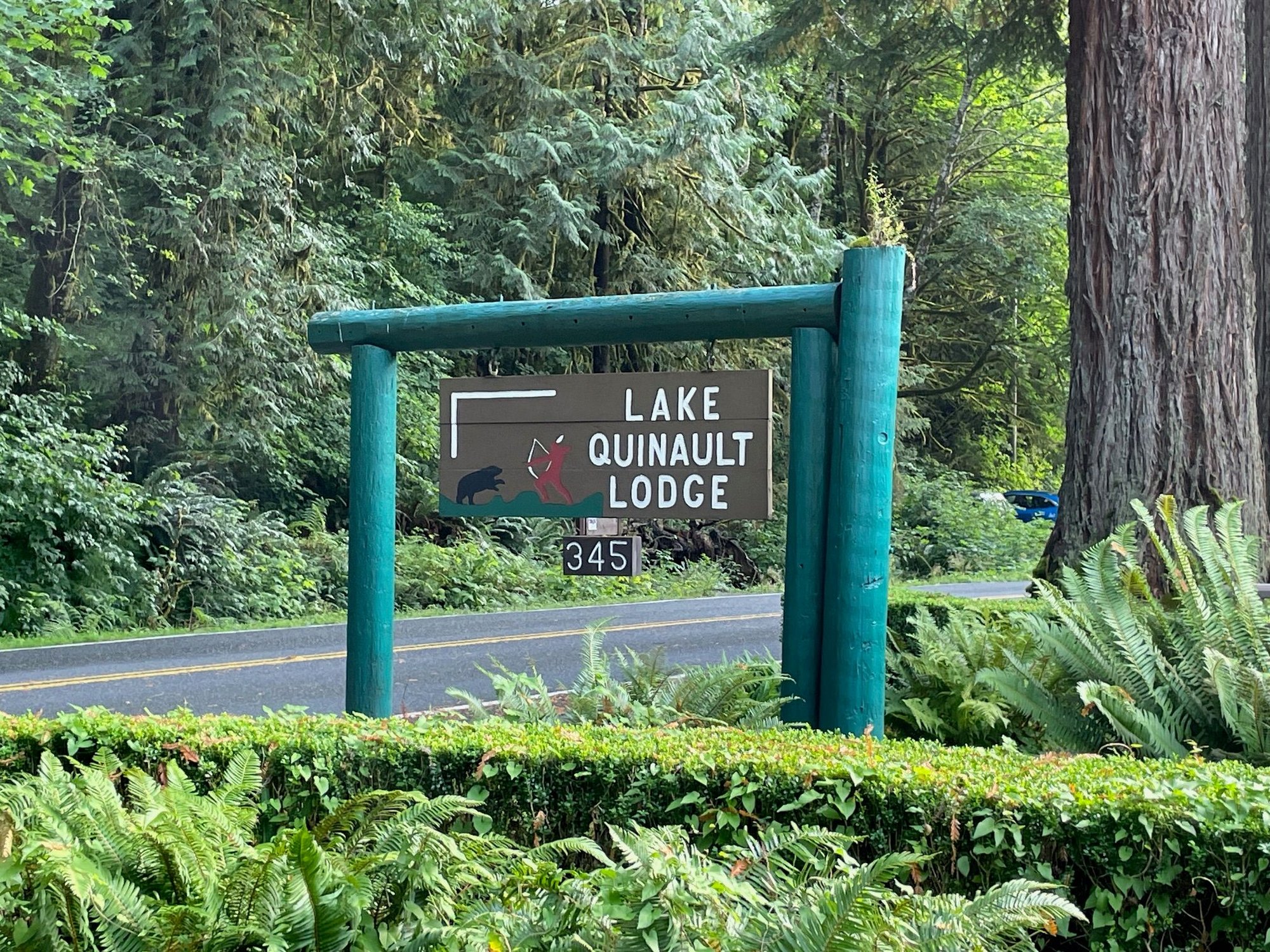
Lodge sign
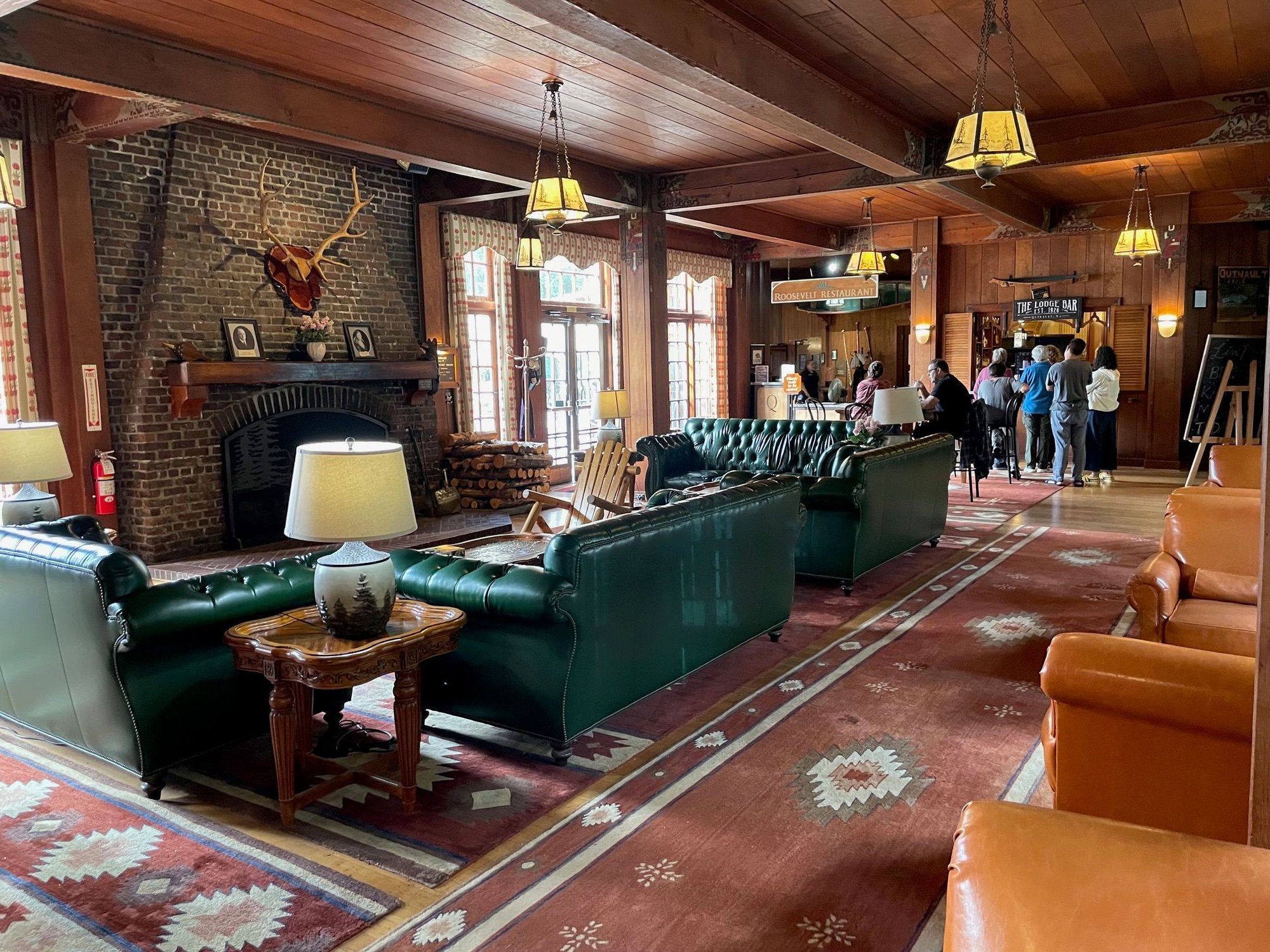
Lobby, it's very classic
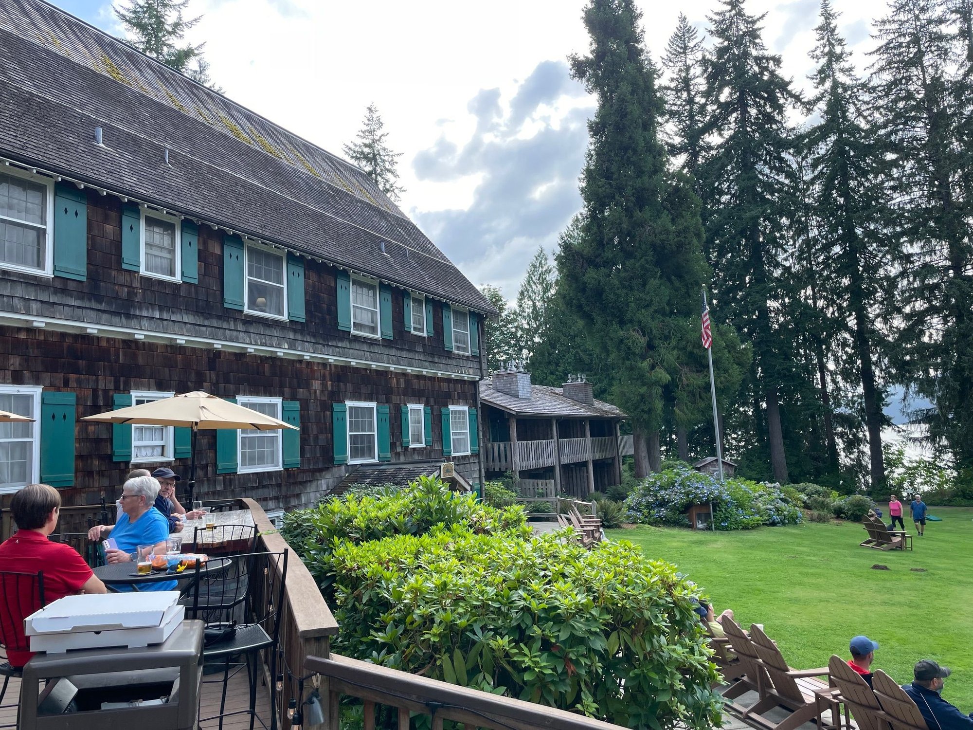
Entrance to the Lodge
Today we left Oregon and drove over the big bridge at Astoria. Washington is so different than Oregon, the coast is not as dramatic but driving through the countryside away from the beach it is all about water. Rivers, sloughs, bays surrounded by fields with cows and the forest in the background. Stopped at Aberdeen then ended at Lake Quinault for one more night of camping before Sol Duc in the Olympic National Park.
Approaching the Bridge
Over the big bridge, it's quite drive.
Stopped to pay our respects to Kurt Cobain at Kurt's landing, a pretty beat up bridge with lots of graffiti
Kurt's guitar statute
Funny sign posted on the property of the neighbor who lives right next to the bridge.
Hwy 101 on the way to Lake Quinault
Lake Quinault Lodge. yk did some wonderful pictures from here just a month ago. She stayed here...I'm camping.
Lodge sign
Lobby, it's very classic
Entrance to the Lodge
Aug 20th, 2025 | 02:44 PM
#11
Original Poster
Joined: Mar 2009
Posts: 928
Likes: 0
Willaby Campground at Lake Quinault
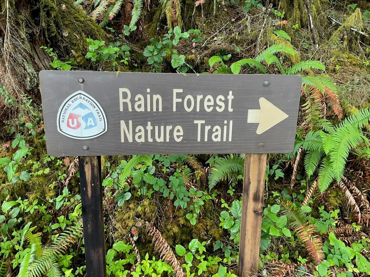
We had a quick one night camping at Willaby Campground. Nice site, looking right out on the lake. Also we took the Lake Quinault Rain Forest Trail. Pro-Tip, it's a great 1/2 mile loop that will show you something similiar to the Hoh Rain Forest without any of the crowds.
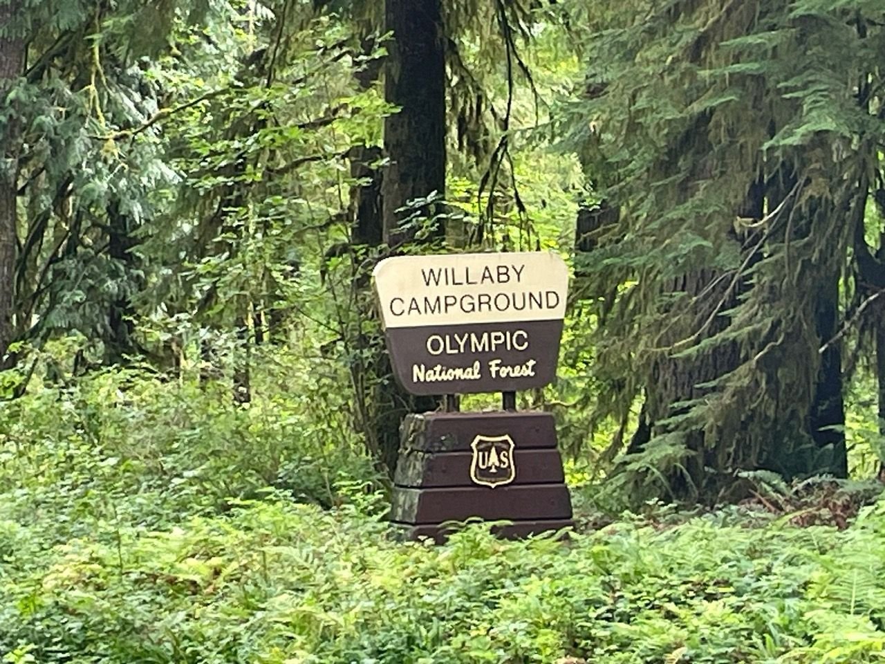
There are three campgrounds on the road to Lake Quinault. This is better for smaller rigs.
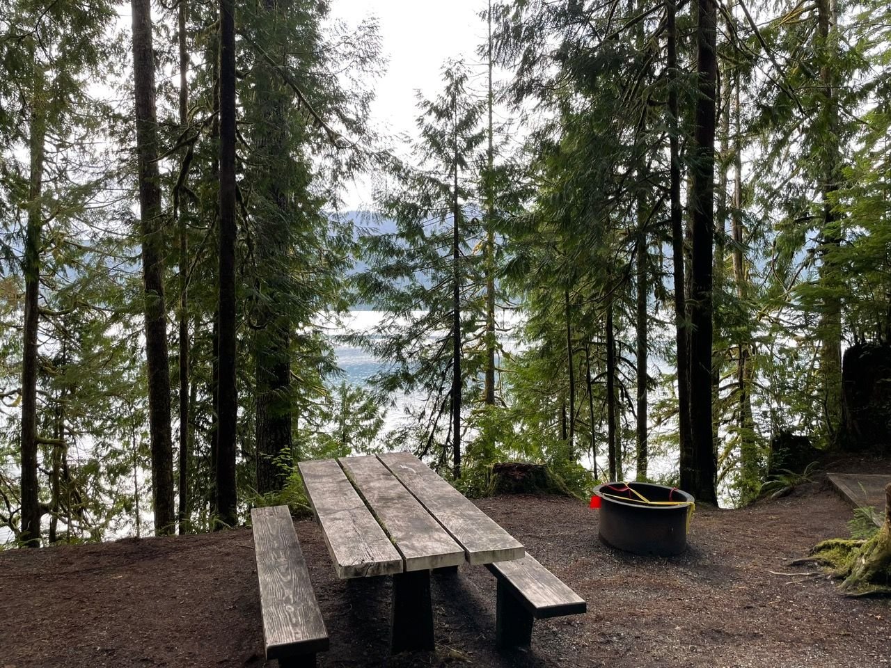
Look at that view!
Highly recommend stopping here on your way north on Hwy 101.
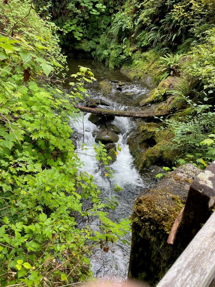
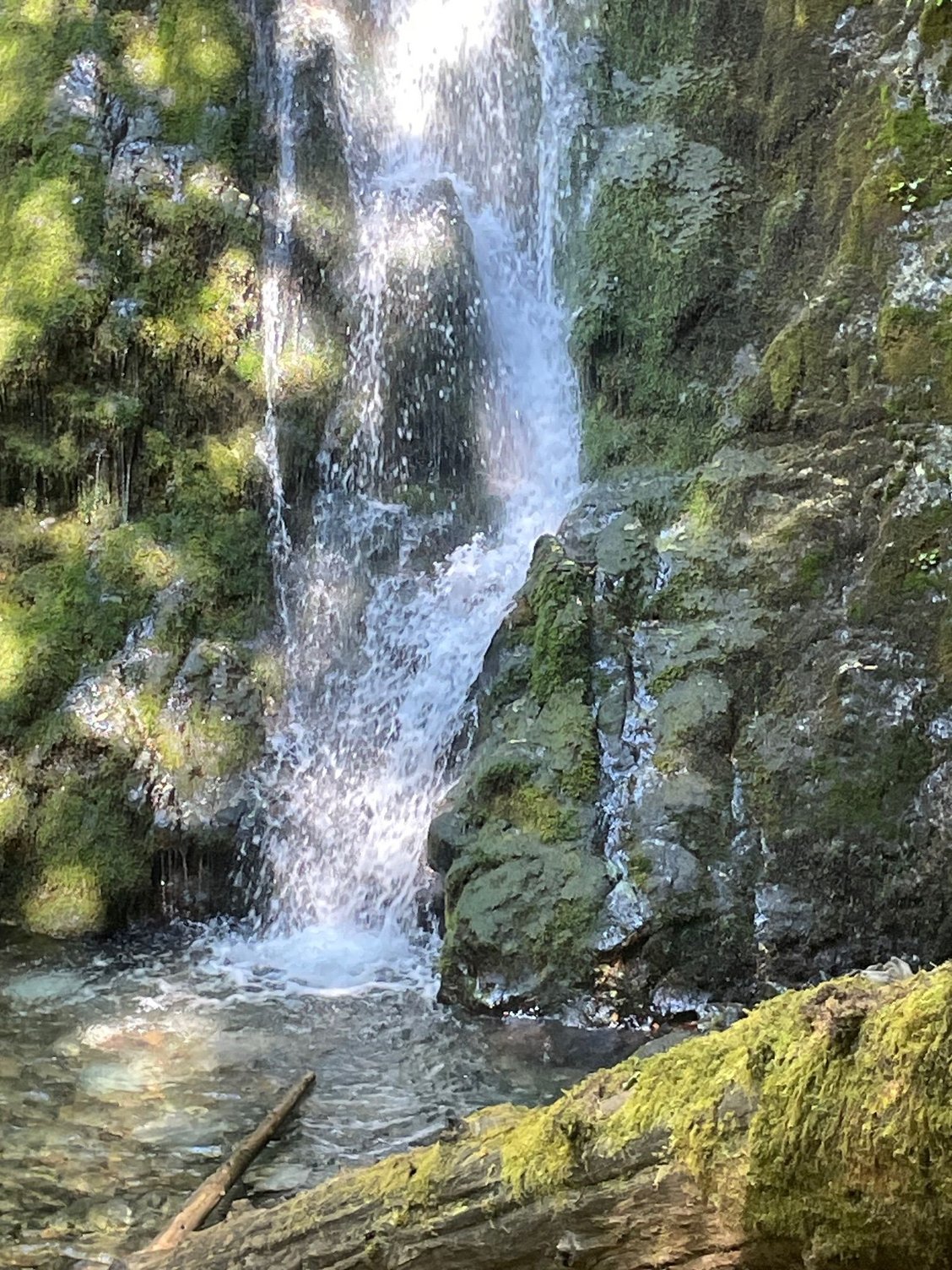
Waterfall on the trail
Moss covered tree.
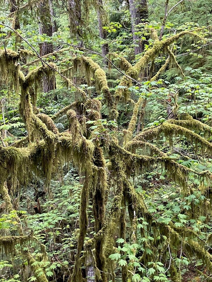
Another tree growing out of the stump of another tree. We named this the Bob Marley tree because of the dreadlocks.
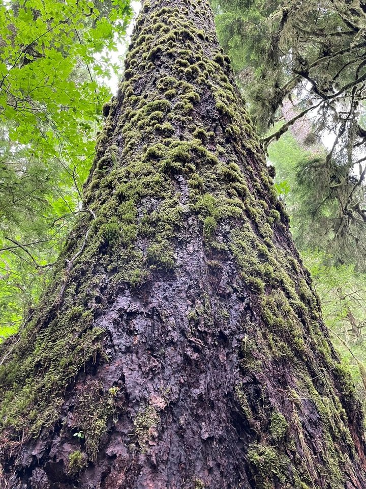
Little moss "bumps" going up the whole tree.
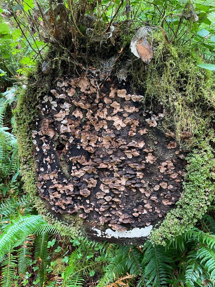
Crazy fungi growth on the cut log of a tree.
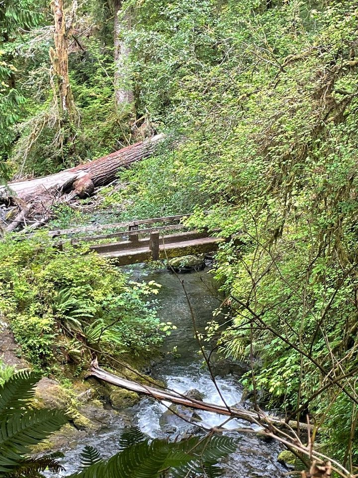
Bridge with water
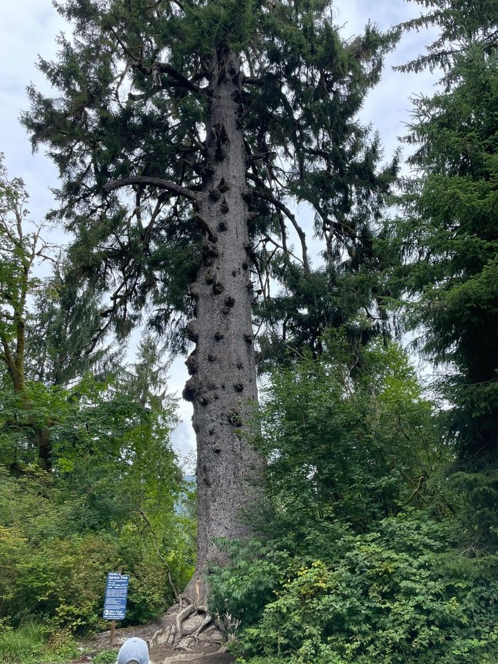
Tallest Sitka Spruce. This would make a lot of Martin guitar tops!
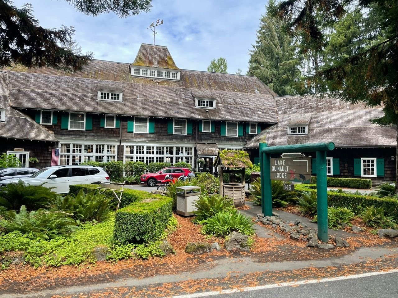
Another shot of the Lake Quinault Lodge. This is actually the main entrance, I posted a shot that was leading to the water before.
We had a quick one night camping at Willaby Campground. Nice site, looking right out on the lake. Also we took the Lake Quinault Rain Forest Trail. Pro-Tip, it's a great 1/2 mile loop that will show you something similiar to the Hoh Rain Forest without any of the crowds.
There are three campgrounds on the road to Lake Quinault. This is better for smaller rigs.
Look at that view!
Highly recommend stopping here on your way north on Hwy 101.
Waterfall on the trail
Moss covered tree.
Another tree growing out of the stump of another tree. We named this the Bob Marley tree because of the dreadlocks.
Little moss "bumps" going up the whole tree.
Crazy fungi growth on the cut log of a tree.
Bridge with water
Tallest Sitka Spruce. This would make a lot of Martin guitar tops!
Another shot of the Lake Quinault Lodge. This is actually the main entrance, I posted a shot that was leading to the water before.
Aug 20th, 2025 | 02:57 PM
#12
Original Poster
Joined: Mar 2009
Posts: 928
Likes: 0
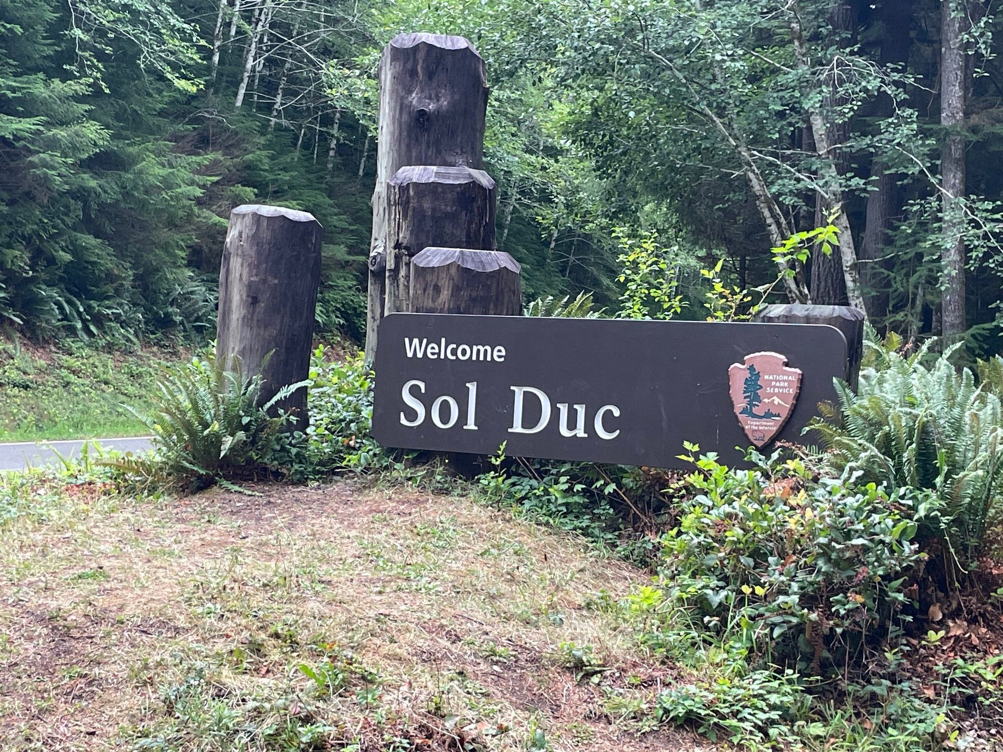
Sol Duc Campground in the Olympic National Park
We have arrived at our final destination for this leg of the big Northwest Trip, Sol Duc Campground. We are in loop A with about 15 family members. A hardy bunch of folks who have been kicked out of some of the finest National Parks in the country. We have a lot of activities planned and the first day was a hike to Sol Duc falls. We are having wonderful weather. Sunny and beautiful.
We're here!
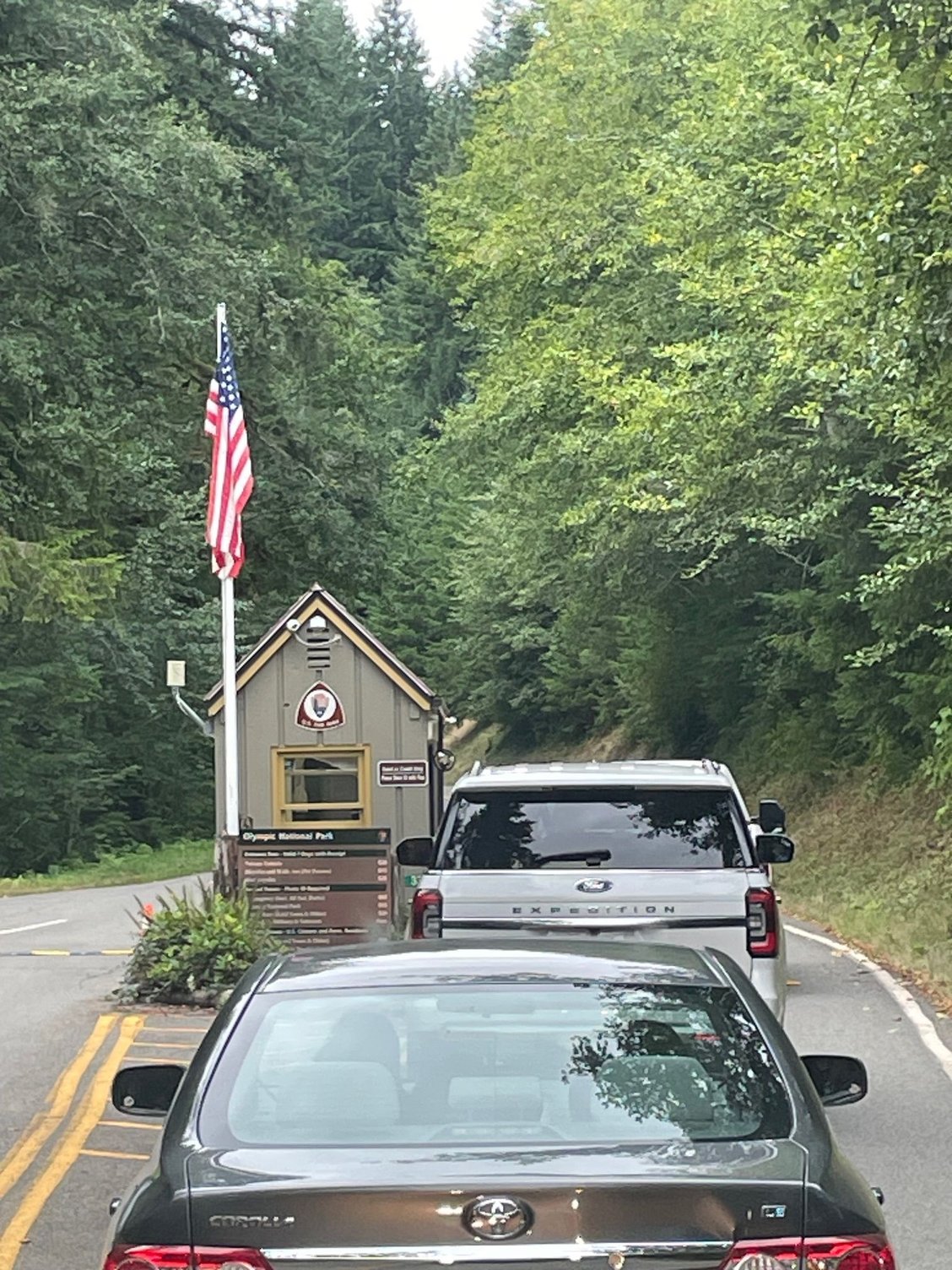
C'mon, c'mon let us in
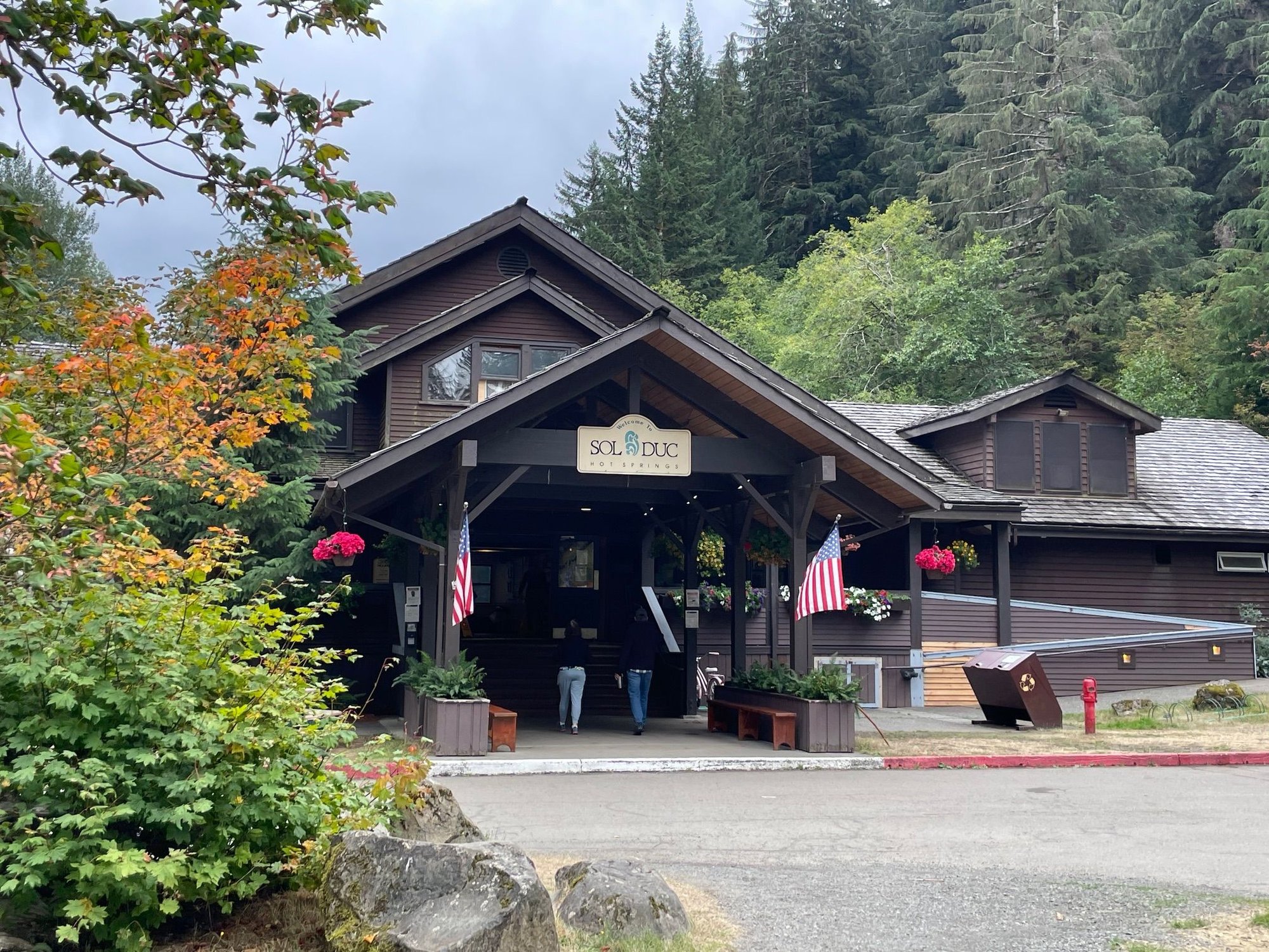
Sol Duc Springs Lodge. More on the springs later
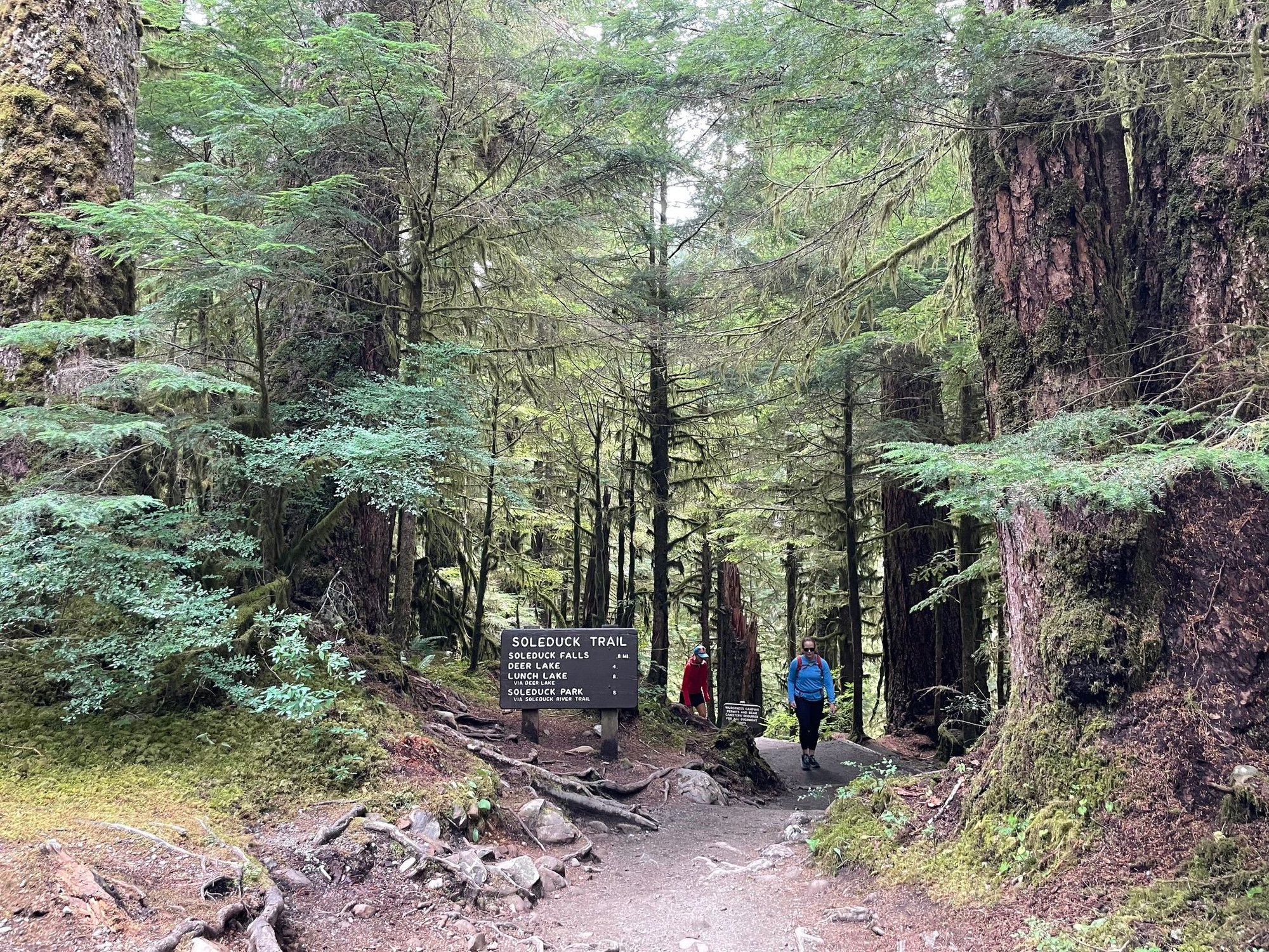
Start of the trail to the falls. yk pointed out the "Sol Duck" in her great TR a month ago.
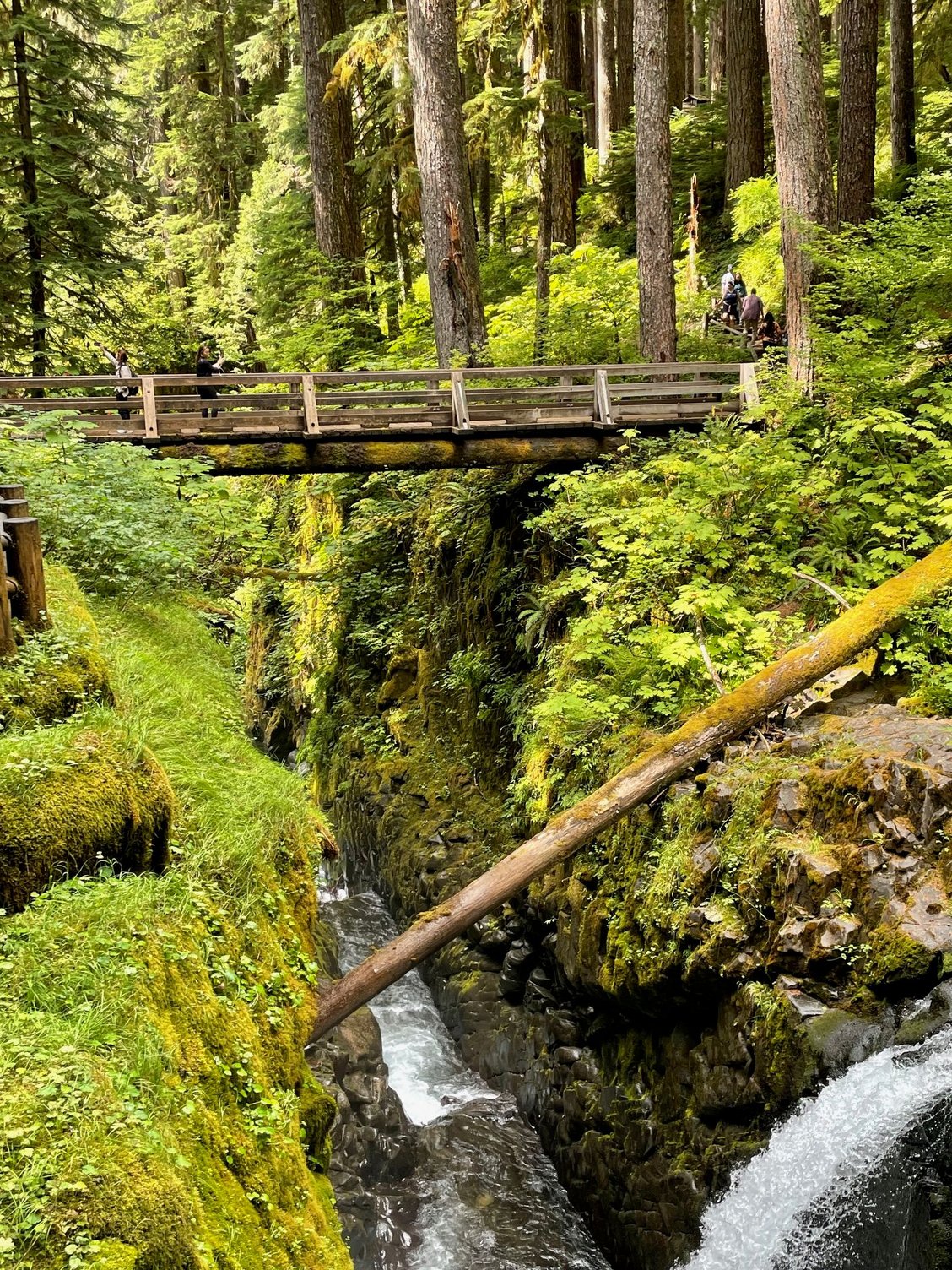
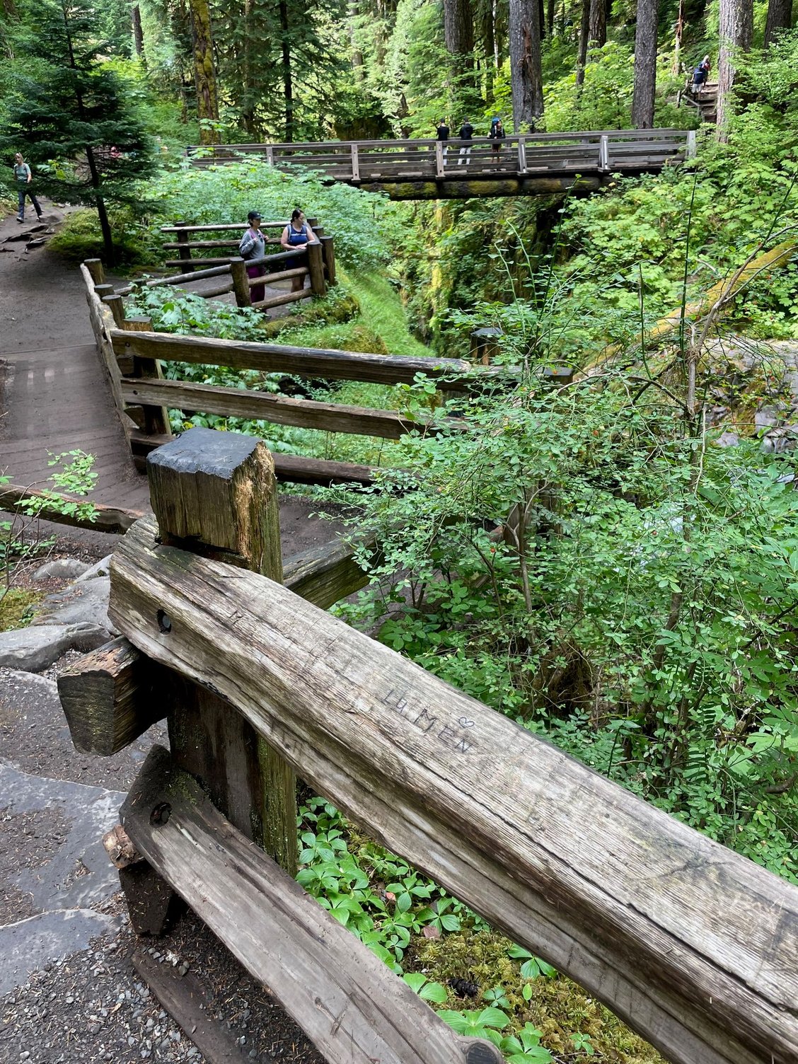
There is a nice bridge looking at the waterfall which is generally packed.
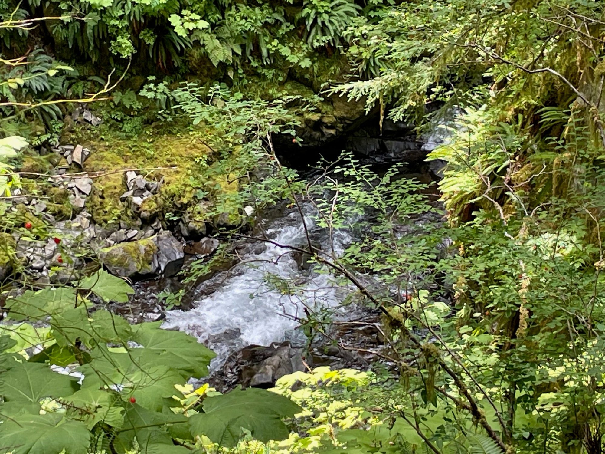
Water at the bottom of the falls
Great wood work, not sure who carried all of this wood up the mountain
Sol Duc Falls
We have arrived at our final destination for this leg of the big Northwest Trip, Sol Duc Campground. We are in loop A with about 15 family members. A hardy bunch of folks who have been kicked out of some of the finest National Parks in the country. We have a lot of activities planned and the first day was a hike to Sol Duc falls. We are having wonderful weather. Sunny and beautiful.
We're here!
C'mon, c'mon let us in
Sol Duc Springs Lodge. More on the springs later
Start of the trail to the falls. yk pointed out the "Sol Duck" in her great TR a month ago.
There is a nice bridge looking at the waterfall which is generally packed.
Water at the bottom of the falls
Great wood work, not sure who carried all of this wood up the mountain
Sol Duc Falls
Aug 20th, 2025 | 03:05 PM
#13
Original Poster
Joined: Mar 2009
Posts: 928
Likes: 0
Lake Crescent and Marymere Falls
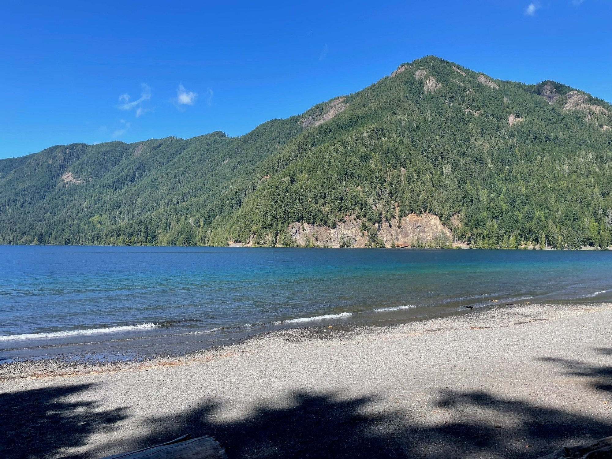
Day 2 and we drove to Lake Crescent which is about an hour away from Sol Duc. The lake is a lot bigger than I thought and so beautiful, people are swimming, kayaking and enjoying the imagine, cold water! We hiked a la group to the Marymere Falls and then lunch at the Lake Crescent Lodge. They have WiFi, hence I have been able to work on my Trip Report. Another sunny day.
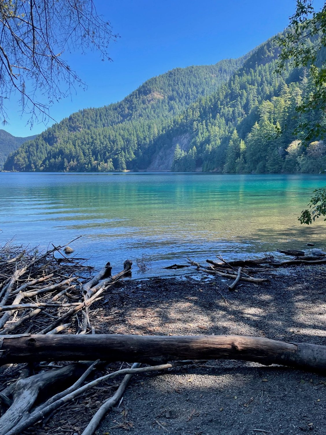
Look at the color of that water.
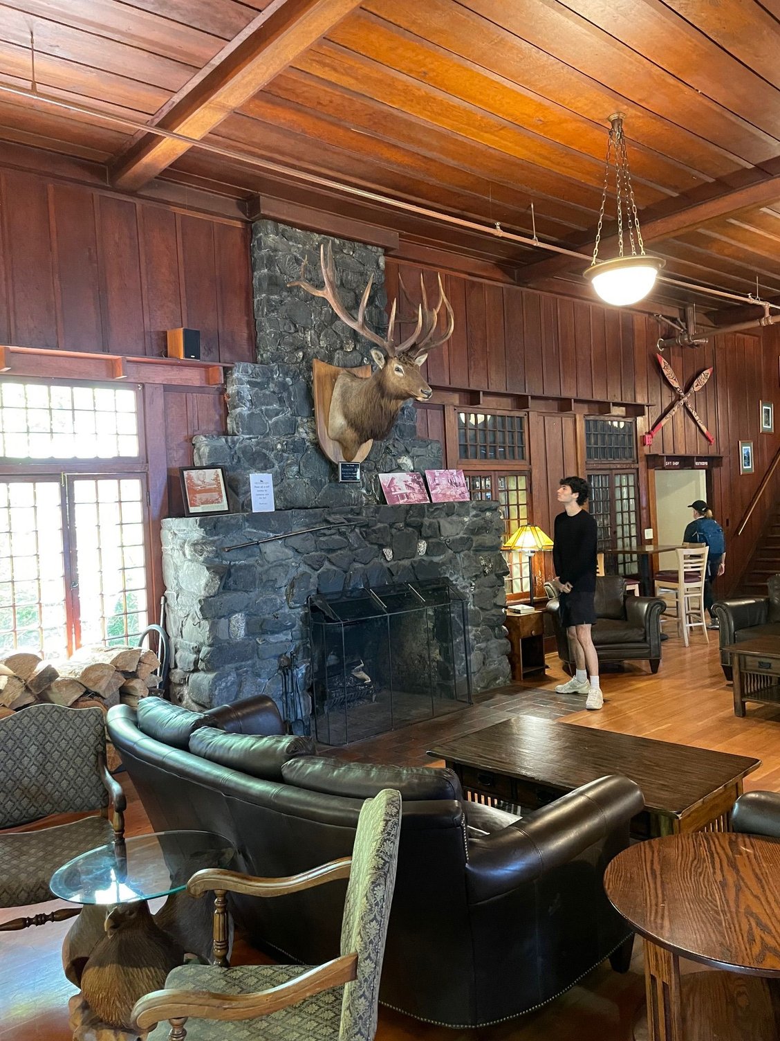
Lake Crescent Lodge with fireplace
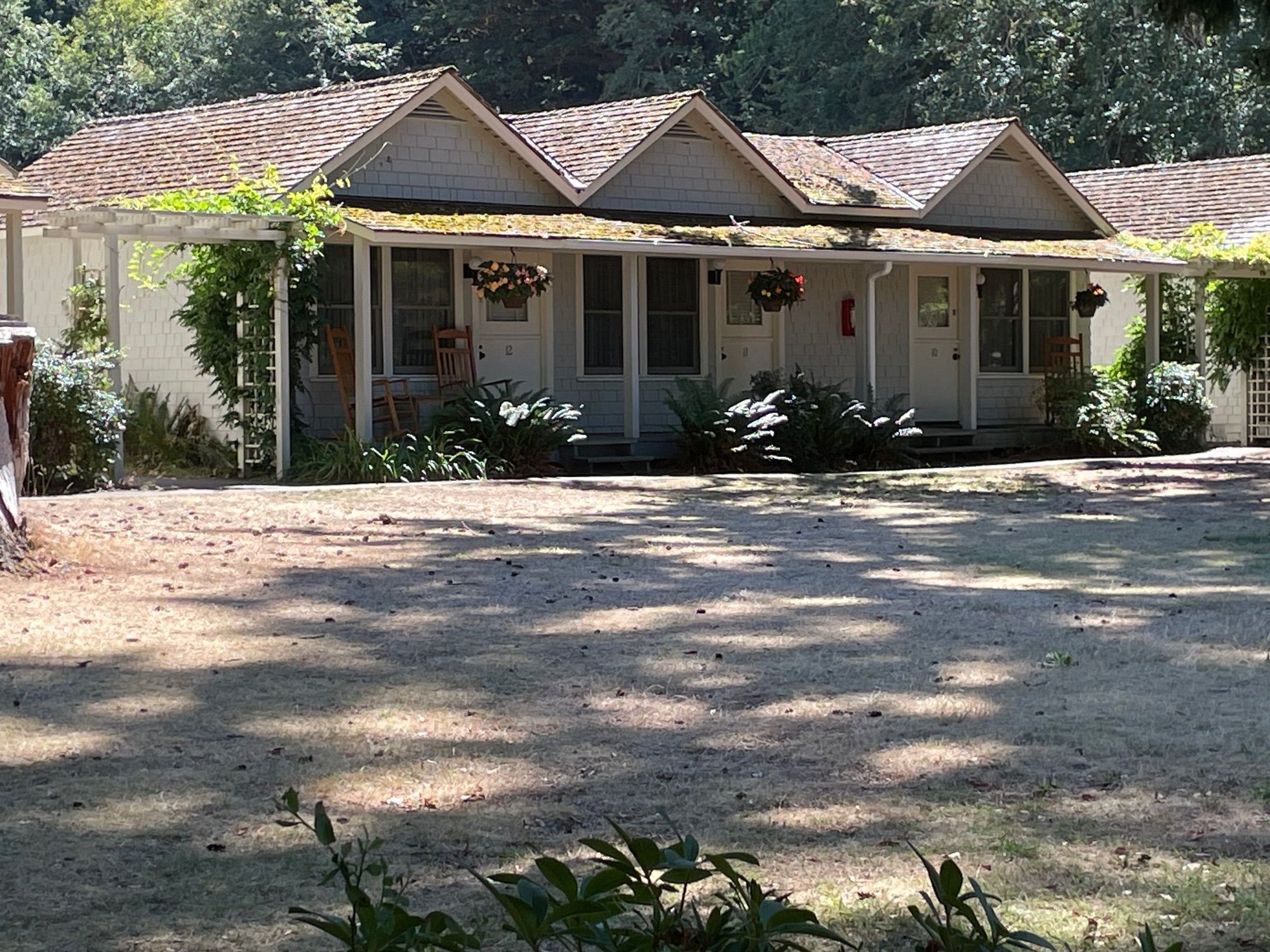
Nice little cottages that look out on the lake.
Here's the view from the cottages. Quite nice
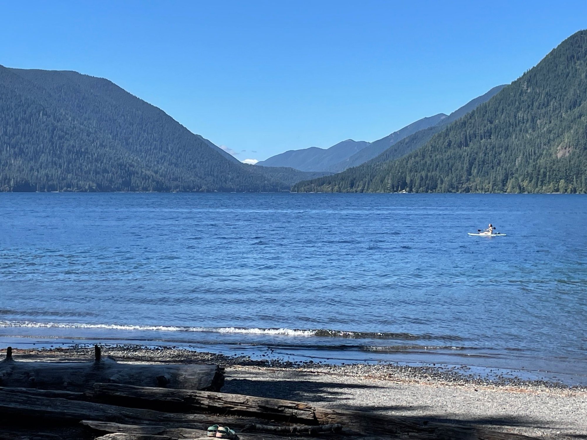
Lake Crescent in all of it's glory
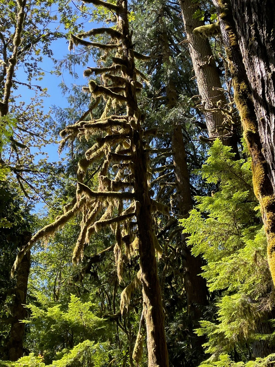
Another one of those velvet moss covered trees
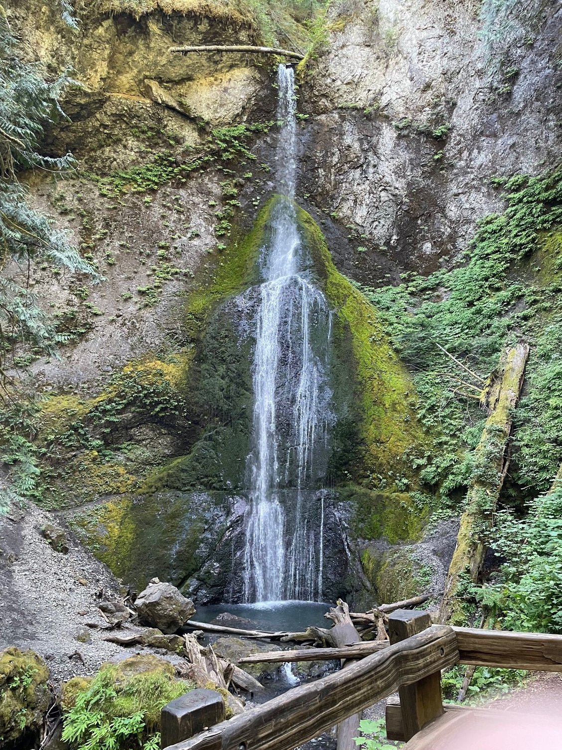
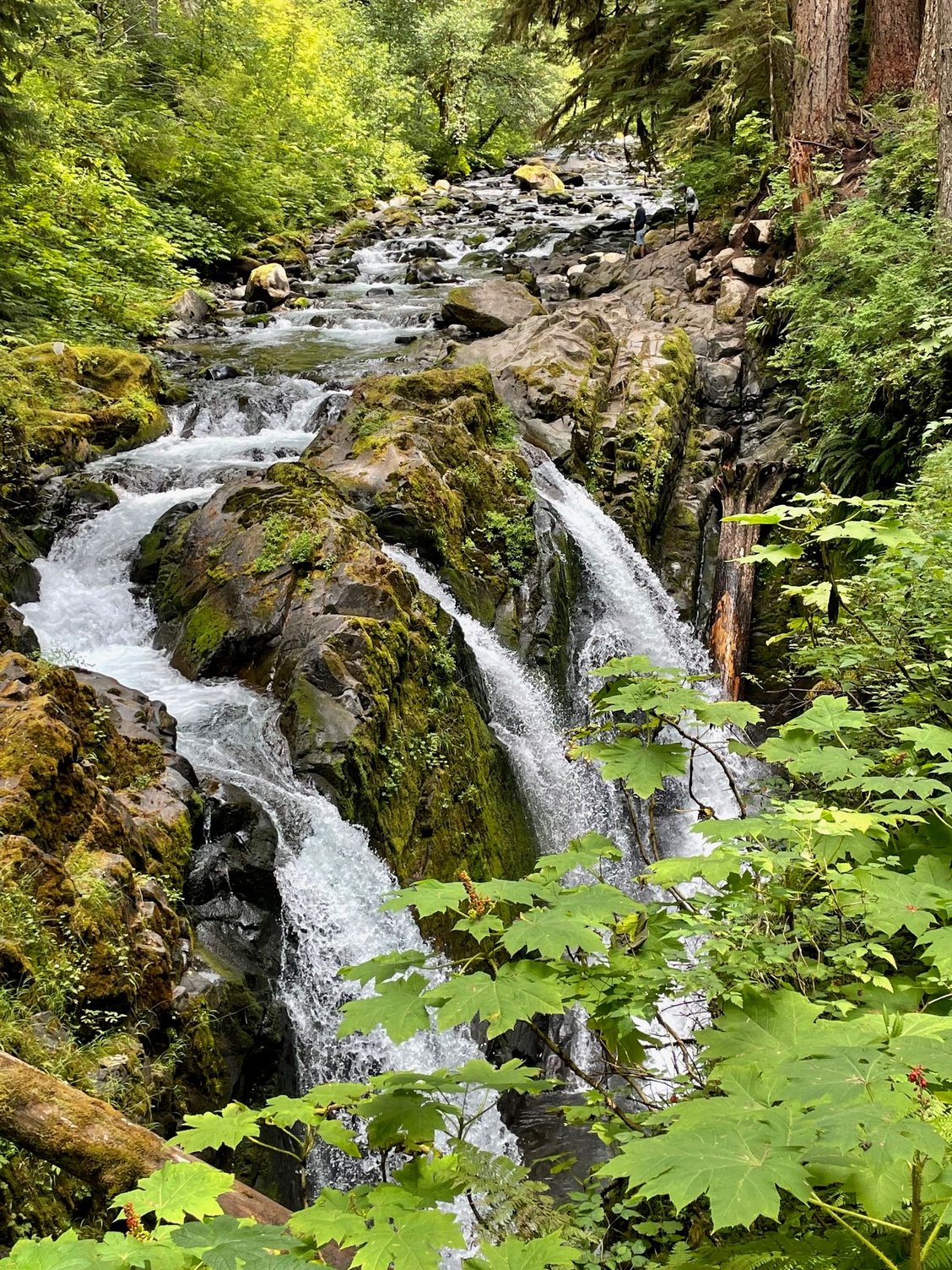
Marymere Falls
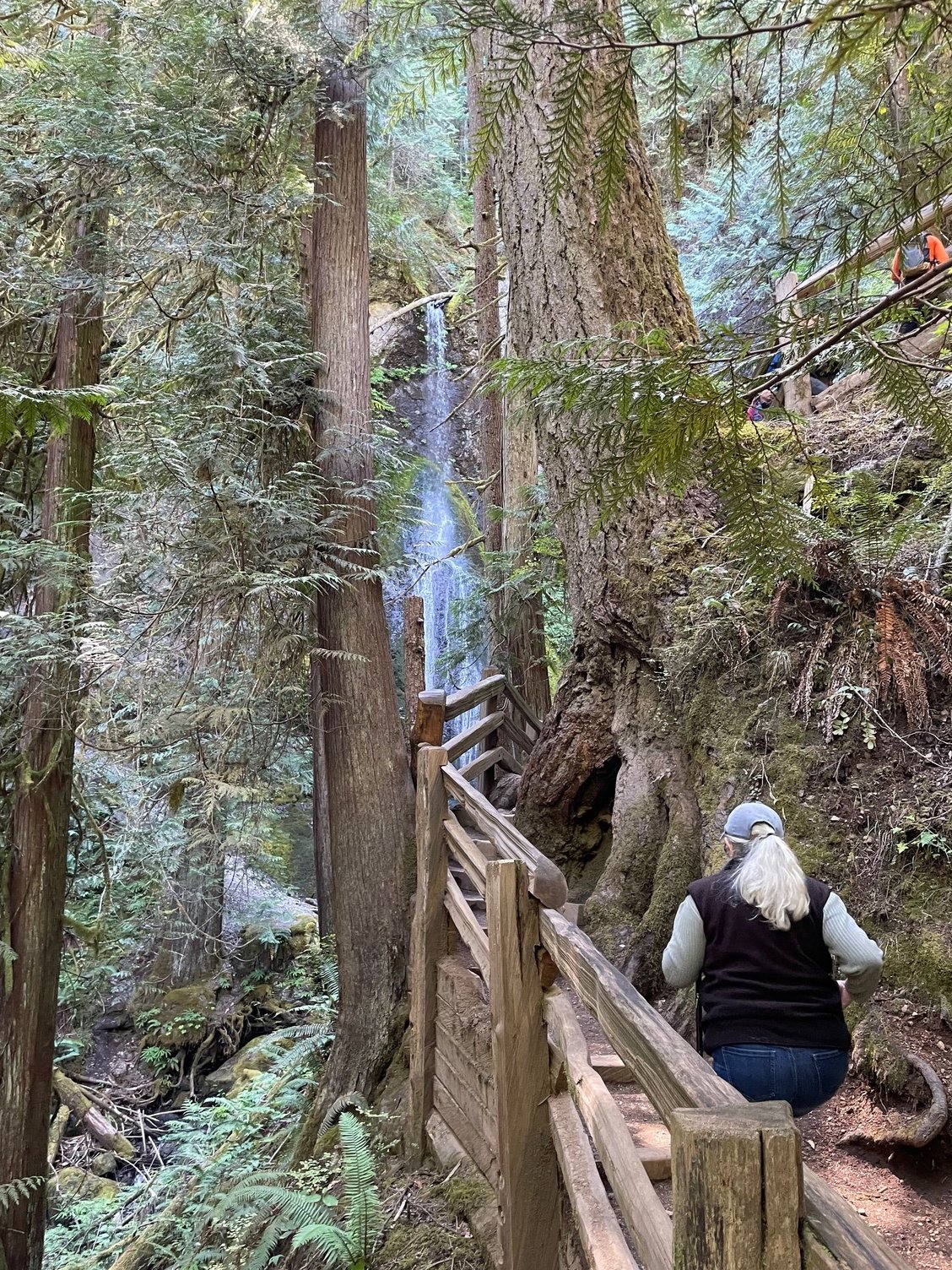
On the trail to the falls.
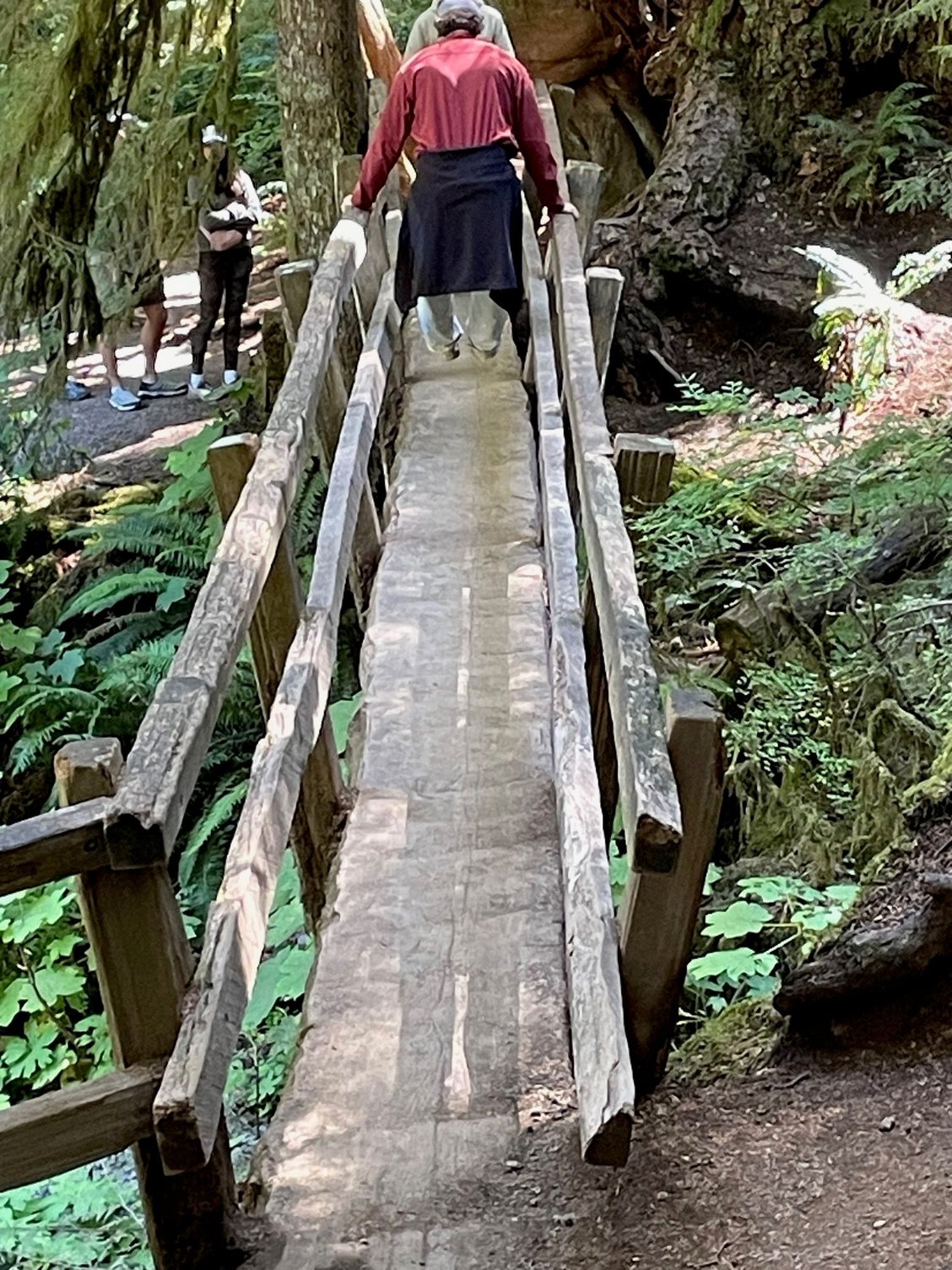
At one point threre is a one lane, walking bridge that is essentially one big split log.
Day 2 and we drove to Lake Crescent which is about an hour away from Sol Duc. The lake is a lot bigger than I thought and so beautiful, people are swimming, kayaking and enjoying the imagine, cold water! We hiked a la group to the Marymere Falls and then lunch at the Lake Crescent Lodge. They have WiFi, hence I have been able to work on my Trip Report. Another sunny day.
Look at the color of that water.
Lake Crescent Lodge with fireplace
Nice little cottages that look out on the lake.
Here's the view from the cottages. Quite nice
Lake Crescent in all of it's glory
Another one of those velvet moss covered trees
Marymere Falls
On the trail to the falls.
At one point threre is a one lane, walking bridge that is essentially one big split log.
 Aug 27th, 2025 | 07:32 AM
#17
Original Poster
Joined: Mar 2009
Posts: 928
Likes: 0
Sunburn1944 - I can imagine kayaking on Lake Crescent would be fun. We visited mid week and it was fairly quiet, then we returned on Saturday and the lake was packed with swimmers and kayaks, canoes, paddle boards. It hit me that even though I think of this as the National Park, for people who live in the area, it's a beach day, much like me going to Malibu. We have also had the most beautiful weather.
suze - I think you live in Seattle is that right? We met a couple from Seattle and they had a propane firepit. No campfires in Washington at this time and we were talking how campfires maybe a thing of the past given all the forest fires. Now I need a propane firepit, one more thing!
Elydah - Lake Crescent is one of the most beautiful lakes I have ever seen. IMO it's better than Lake McDonald in Glacier National Park, and does give Lake Tahoe a run for it's money...although it's hard to beat Lake Tahoe.
Aug 27th, 2025 | 08:04 AM
#18
Original Poster
Joined: Mar 2009
Posts: 928
Likes: 0
Hurricane Ridge Olympic National Park
I haven't posted for almost a week because we have no signal or Wi-Fi, but we have been busy. We did take one day off to stay in the campground, relaxing, cleaning the van and then off to the Sol Duc Hot Springs. The "geezer" pass is $12 and that's good for one and half hours in the pools. At first I thought it was a bit chintzy, but you really are done after and hour and a half. So, new day and on to Hurricane Ridge. Again yk posted some nice pictures and I will add a few more. I have a few suggestions on how to do Hurricane Ridge that may help people at some point.
First we drive into Port Angeles, past the National Park Visitor Center, it's a very nice Visitor Center, but you can visit it later. About 5 miles up you will come to the Entrance Kiosk. Show your pass or pay to enter the Park. Another 12 miles on a good but windy road to Hurricane Ridge. On the way up, maybe 4 or 5 miles, on your left is a great view of the Haro Strait, resist the urge to stop, hit it on the way back. Next stop is a big parking lot, which at 10:30AM had a lot of parking. It is a beautiful view, it's almost like a curtain being drawn back at a movie theater and you think, here is the show! It's not. Hurricane Ridge is still 1 and 1/2 miles ahead. So even though you will see parking, rarer than gold in the Olympics, keep heading right past it. There will be three more opportunities to park, one at the Ridge parking lot, probably full, and then at picnic sites A & B, both about a quarter mile from the actual start of the Hurricane Ridge trail. I'm saying all of this because if you are like me...and everyone else, you will want to stop at the first parking lot for the Visitor Center, bathrooms and wonderful view, but the trail is your ultimate destination, so head there first.
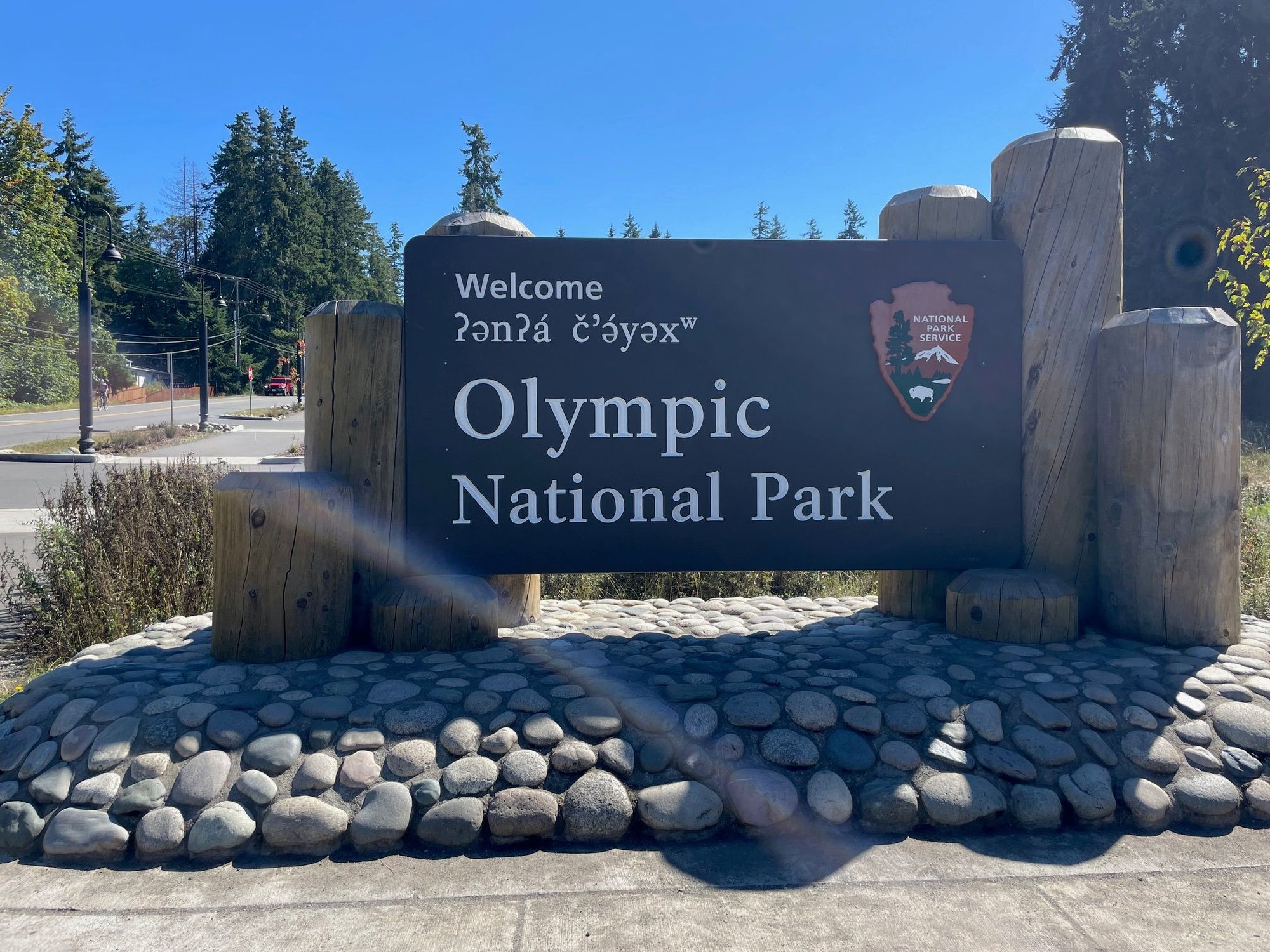
Entrance to the park, keep going, you can come back here.
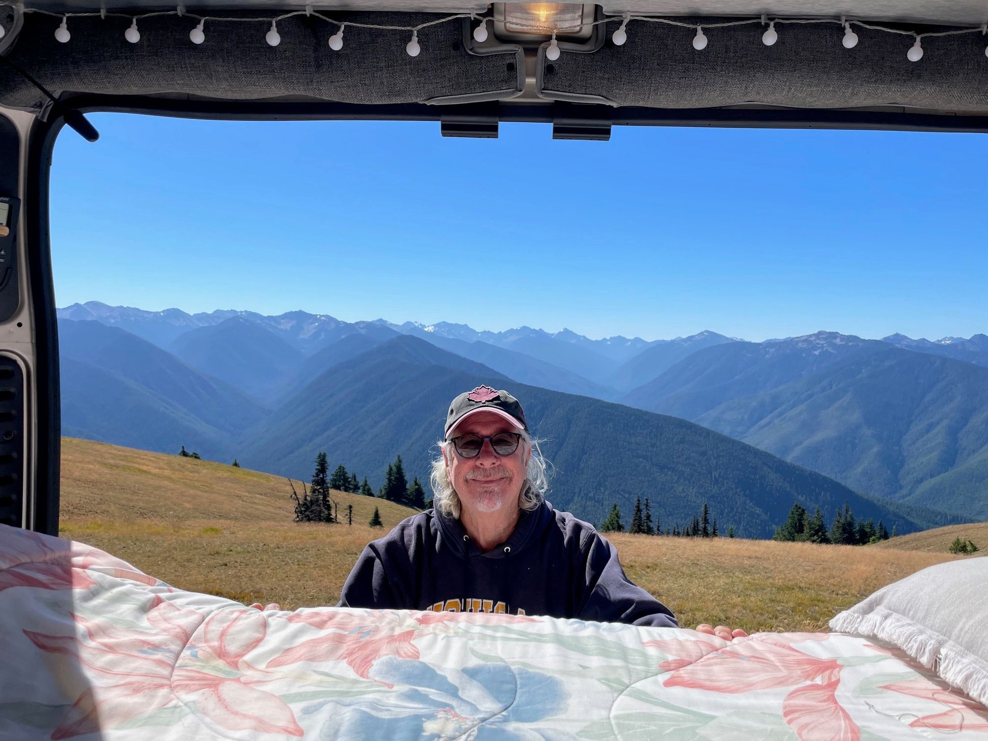
Me at the top of the Ridge at the first parking lot, don't stop yet, keep going!
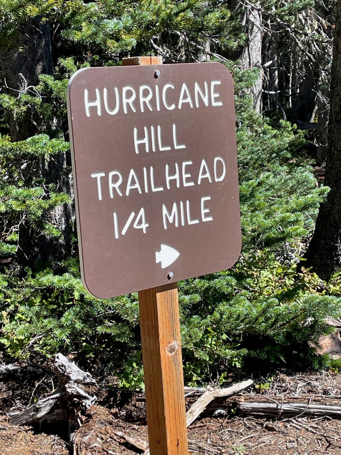
If you are like us, you may not get a parking space at the very top, come back to the picnic area and grab a spot then hike 1/4 mile to the start of the trail.
We didn't have the color that yk posted, I think because it's a month later than her trip
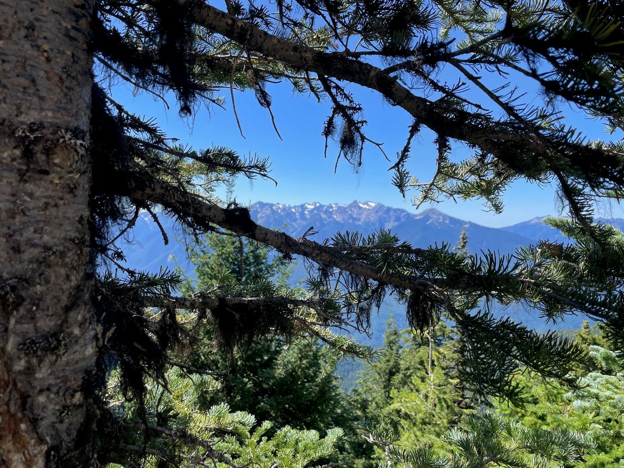
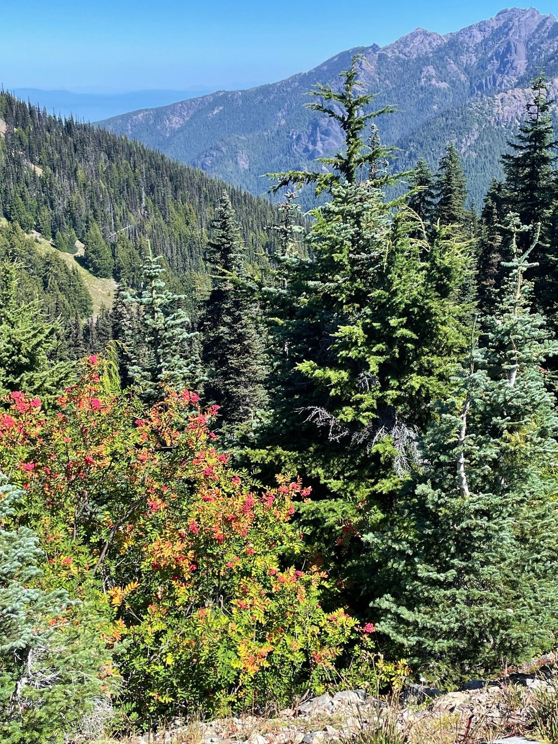
"Arty" shot of the mountains through the trees
Glaciers, probably won't be here long, see 'em while you can.
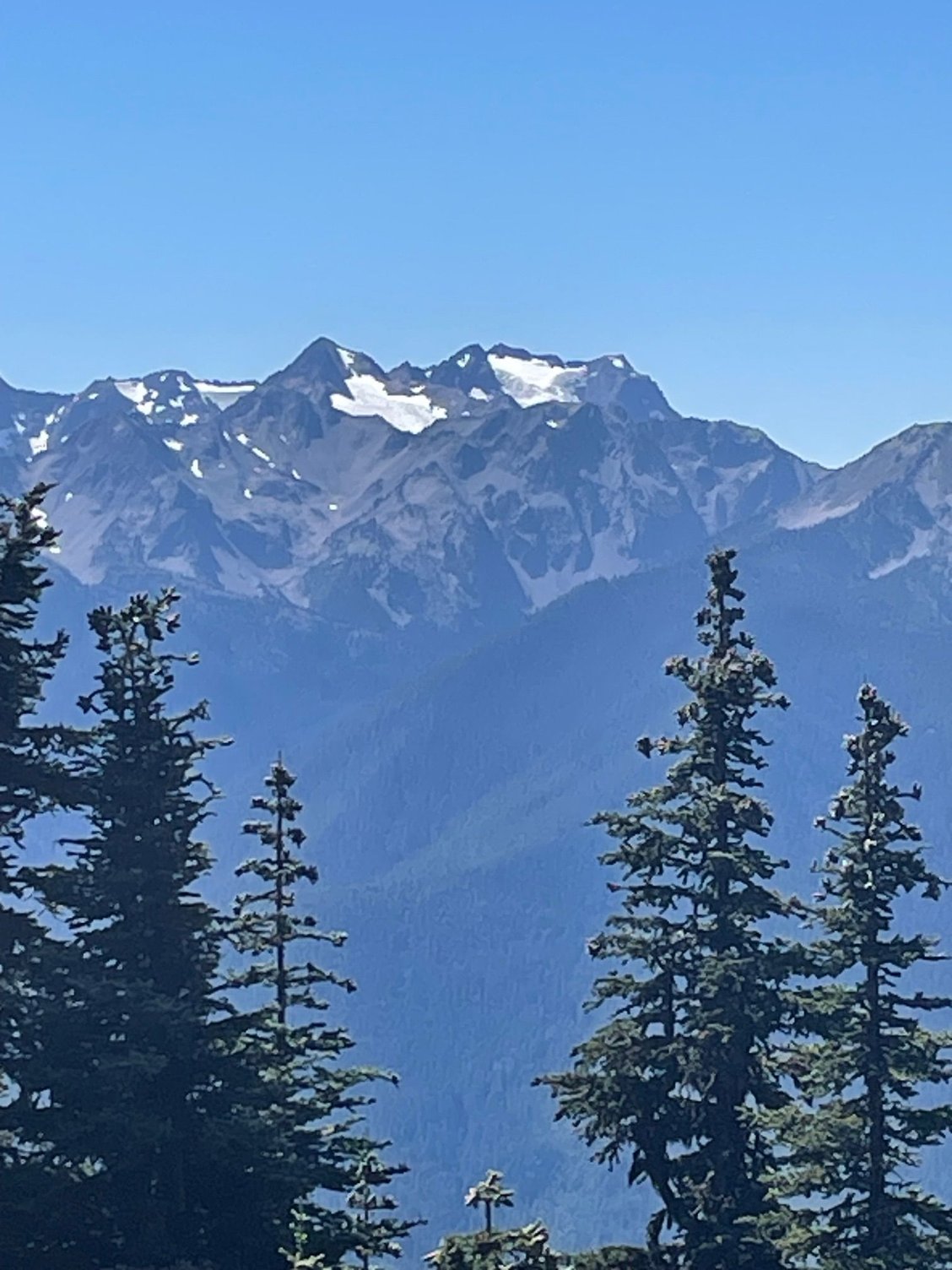
More mountain shots
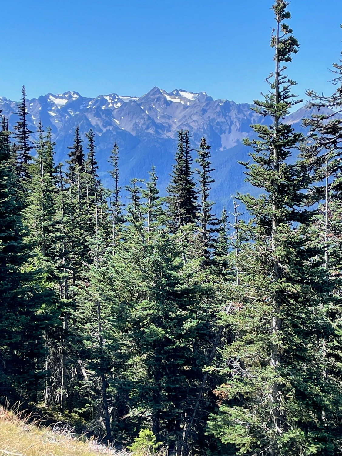
As you are hiking up the trail, you will see these groupings of trees and bushes on the hill side. They looked like little floating ponds to me!
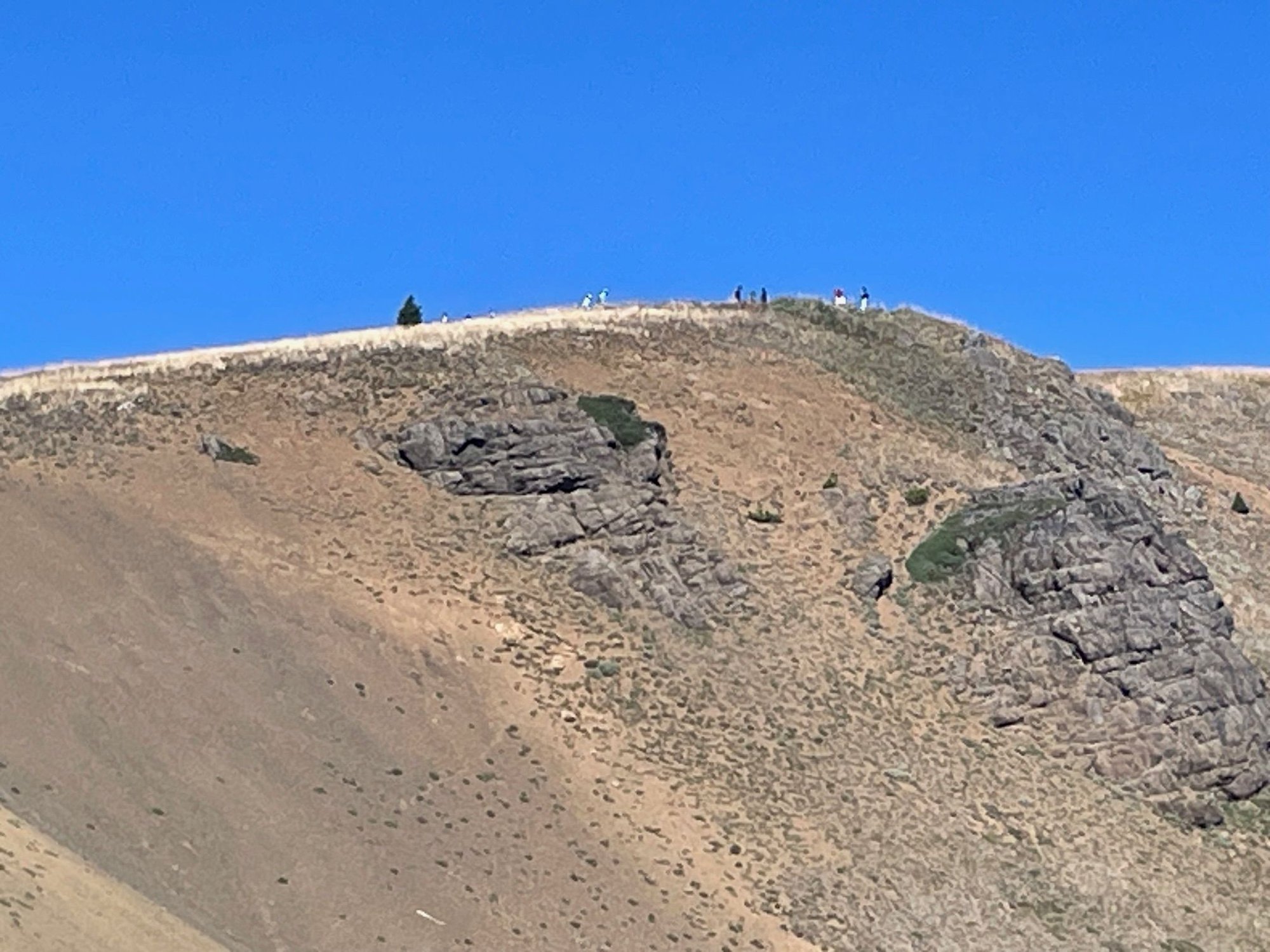
The path to Hurricane Ridge is paved a large part of the way. Hats off to the Park staff who made this happen. We saw a number of wheel chairs on the path. It is steep though. We didn't make it to the top. However, if we ever meet I will lie and say we did!
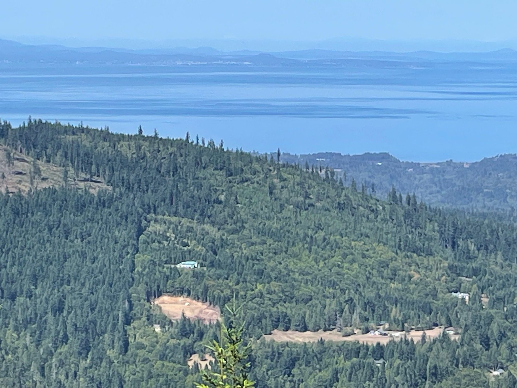
This is a shot from the first pick pull off as you are coming up the hill to the Ridge. Remember, pass it by, catch it on the way back. There is a small thin line across the water, that's Victoria, Canada
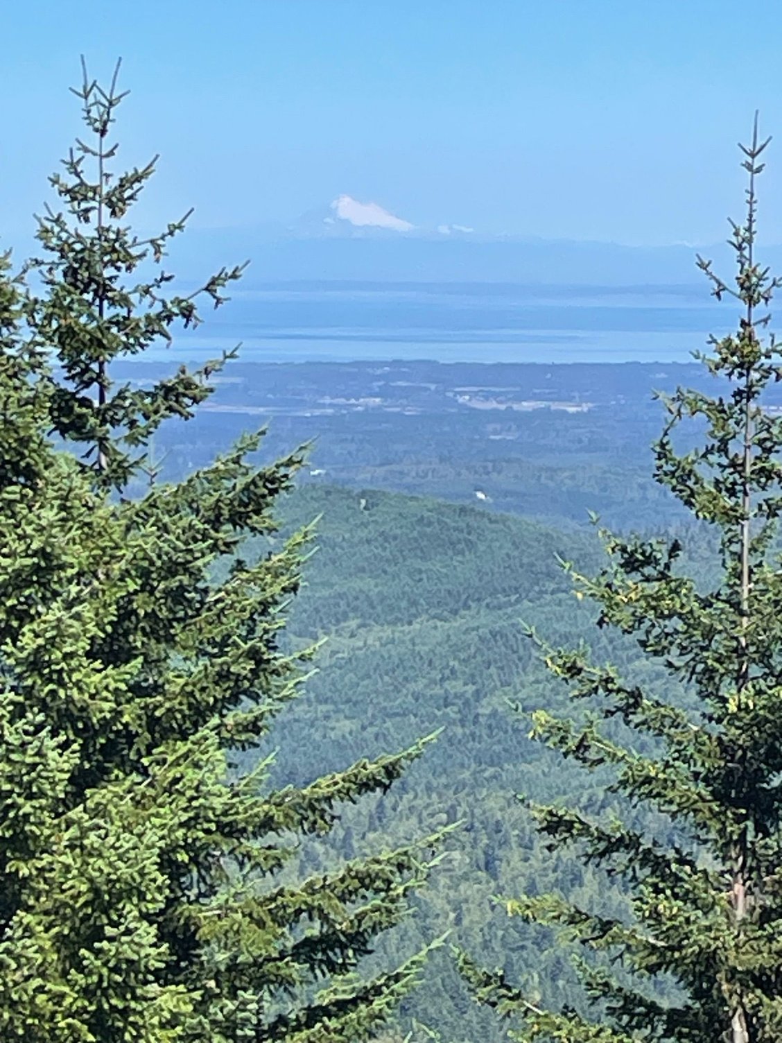
Another shot from that stop. You can see Mt. Baker in the middle. We had a beautiful clear day.
I haven't posted for almost a week because we have no signal or Wi-Fi, but we have been busy. We did take one day off to stay in the campground, relaxing, cleaning the van and then off to the Sol Duc Hot Springs. The "geezer" pass is $12 and that's good for one and half hours in the pools. At first I thought it was a bit chintzy, but you really are done after and hour and a half. So, new day and on to Hurricane Ridge. Again yk posted some nice pictures and I will add a few more. I have a few suggestions on how to do Hurricane Ridge that may help people at some point.
First we drive into Port Angeles, past the National Park Visitor Center, it's a very nice Visitor Center, but you can visit it later. About 5 miles up you will come to the Entrance Kiosk. Show your pass or pay to enter the Park. Another 12 miles on a good but windy road to Hurricane Ridge. On the way up, maybe 4 or 5 miles, on your left is a great view of the Haro Strait, resist the urge to stop, hit it on the way back. Next stop is a big parking lot, which at 10:30AM had a lot of parking. It is a beautiful view, it's almost like a curtain being drawn back at a movie theater and you think, here is the show! It's not. Hurricane Ridge is still 1 and 1/2 miles ahead. So even though you will see parking, rarer than gold in the Olympics, keep heading right past it. There will be three more opportunities to park, one at the Ridge parking lot, probably full, and then at picnic sites A & B, both about a quarter mile from the actual start of the Hurricane Ridge trail. I'm saying all of this because if you are like me...and everyone else, you will want to stop at the first parking lot for the Visitor Center, bathrooms and wonderful view, but the trail is your ultimate destination, so head there first.
Entrance to the park, keep going, you can come back here.
Me at the top of the Ridge at the first parking lot, don't stop yet, keep going!
If you are like us, you may not get a parking space at the very top, come back to the picnic area and grab a spot then hike 1/4 mile to the start of the trail.
We didn't have the color that yk posted, I think because it's a month later than her trip
"Arty" shot of the mountains through the trees
Glaciers, probably won't be here long, see 'em while you can.
More mountain shots
As you are hiking up the trail, you will see these groupings of trees and bushes on the hill side. They looked like little floating ponds to me!
The path to Hurricane Ridge is paved a large part of the way. Hats off to the Park staff who made this happen. We saw a number of wheel chairs on the path. It is steep though. We didn't make it to the top. However, if we ever meet I will lie and say we did!
This is a shot from the first pick pull off as you are coming up the hill to the Ridge. Remember, pass it by, catch it on the way back. There is a small thin line across the water, that's Victoria, Canada
Another shot from that stop. You can see Mt. Baker in the middle. We had a beautiful clear day.
Aug 27th, 2025 | 08:11 AM
#19
Original Poster
Joined: Mar 2009
Posts: 928
Likes: 0
Port Angeles
After Hurrican Ridge, we did laundry in Port Angeles. Also hit the Walmart. Not things you need to add to a TR, but Port Angeles is closest for those type of opportunities. Had dinner at the Rail which was right across from the wharf. Port Angeles is really a nice place to stop, and visit cafes and the historic main street. Should have spent more time there.
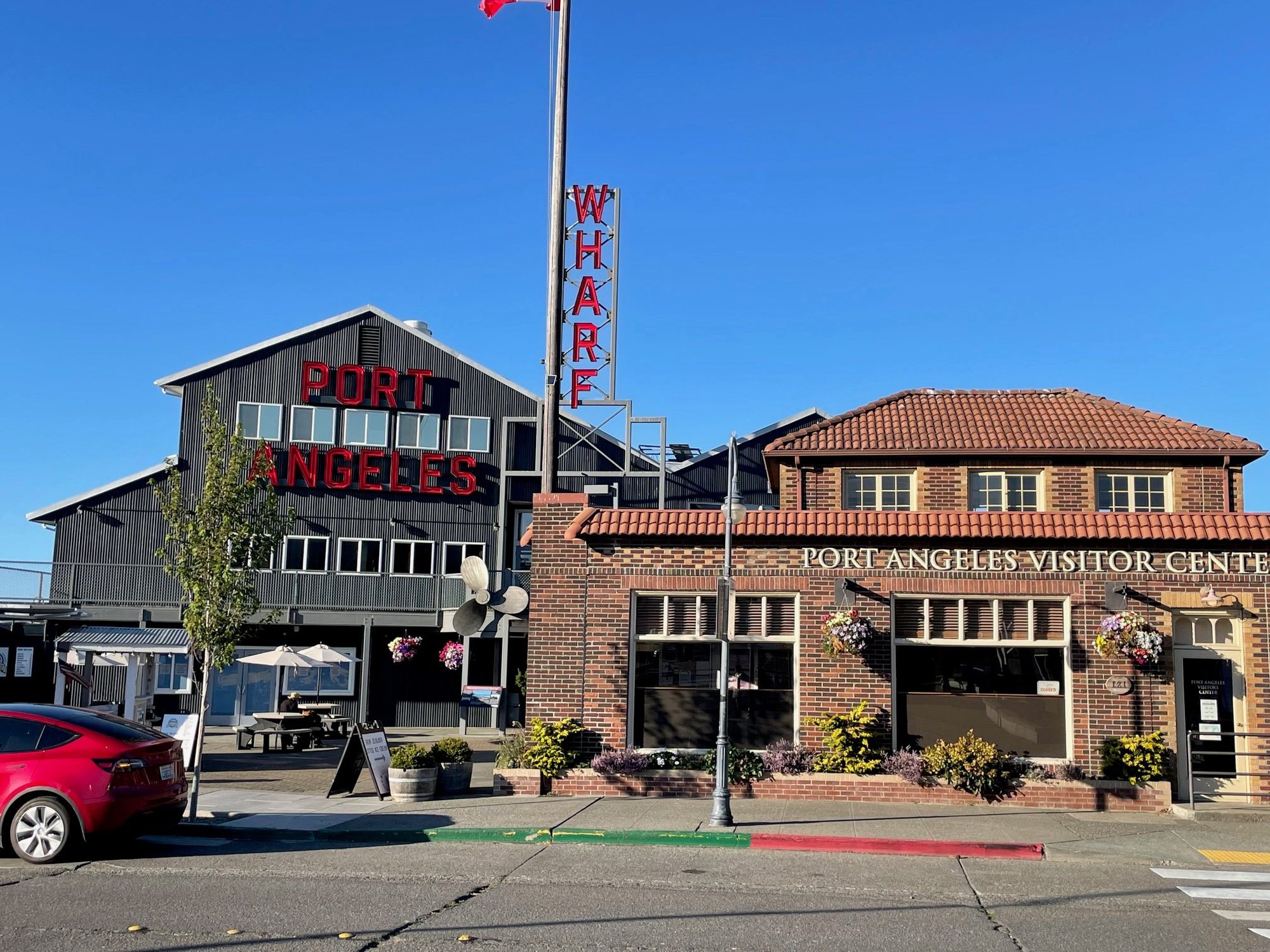
Visitor Center at the Wharf
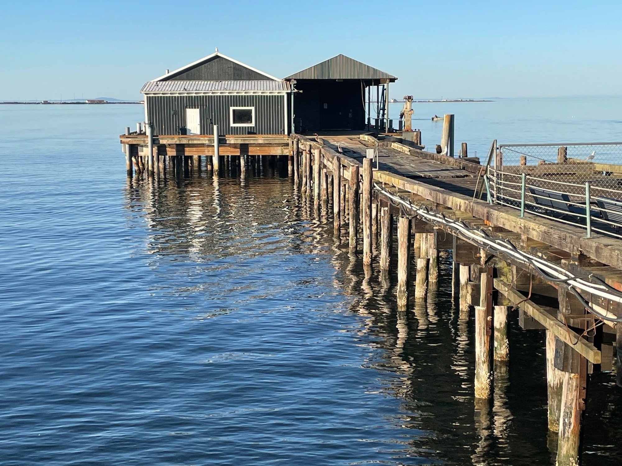
Old wooden pier that is closed now, but great for a picture.
After Hurrican Ridge, we did laundry in Port Angeles. Also hit the Walmart. Not things you need to add to a TR, but Port Angeles is closest for those type of opportunities. Had dinner at the Rail which was right across from the wharf. Port Angeles is really a nice place to stop, and visit cafes and the historic main street. Should have spent more time there.
Visitor Center at the Wharf
Old wooden pier that is closed now, but great for a picture.
Aug 27th, 2025 | 08:24 AM
#20
Original Poster
Joined: Mar 2009
Posts: 928
Likes: 0
Saturday in the Park
On our last day of camping we headed to Madison Falls. We really enjoyed camping at Sol Duc campground. I believe there are only a few campgrounds that you can make reservations and Sol Duc is one of them. That said, there is no Park oversite. There is a Camp Host, who we saw around but we never saw a Park employee the whole time we were there. The Camp Host said that was due to the fact that the campground is 12 miles off Hwy 101 and there have been lots of cuts to Park Staff. The Park Police / Rangers come through maybe once a week. While we stayed there the campsite was full but we did see a couple of instance where people showed up about 10PM, found a place to camp and were gone by 8AM! I'm guessing they didn't pay.
We drove to Madison Fall at the Elwha turn off from Hwy 101. It's a very nice falls and only a small walk from the picnic area and then we met family for dinner at the Lake Crescent Lodge. It was packed as I mentioned above. Tomorrow we move on to Whidbey Island. Olympic National Park is magnificent and we still have once more section to visit in the coming weeks.
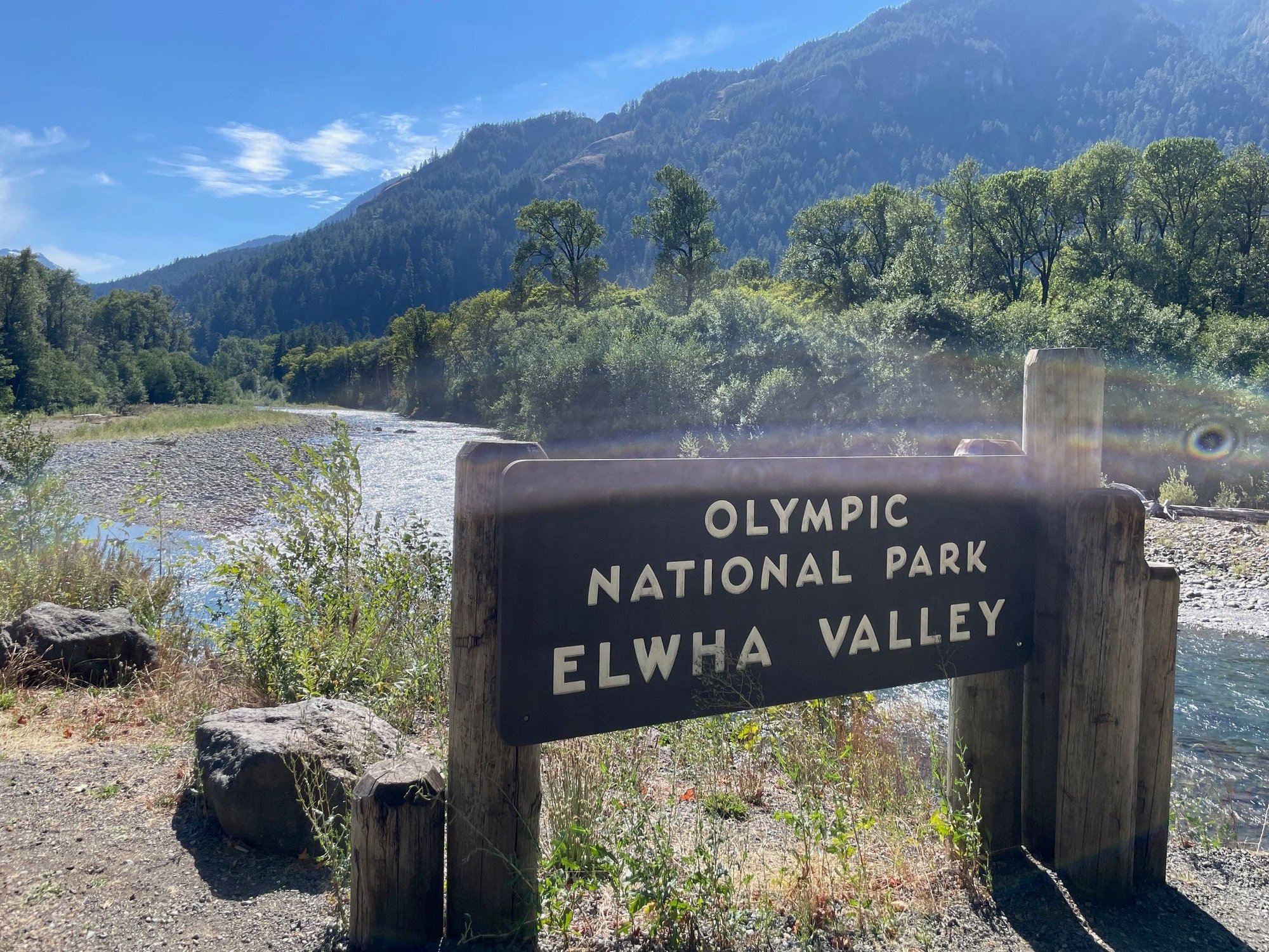
Most of the access to the Elwha Valley is closed. There is a gate blocking the road just past the Falls Parking lot.
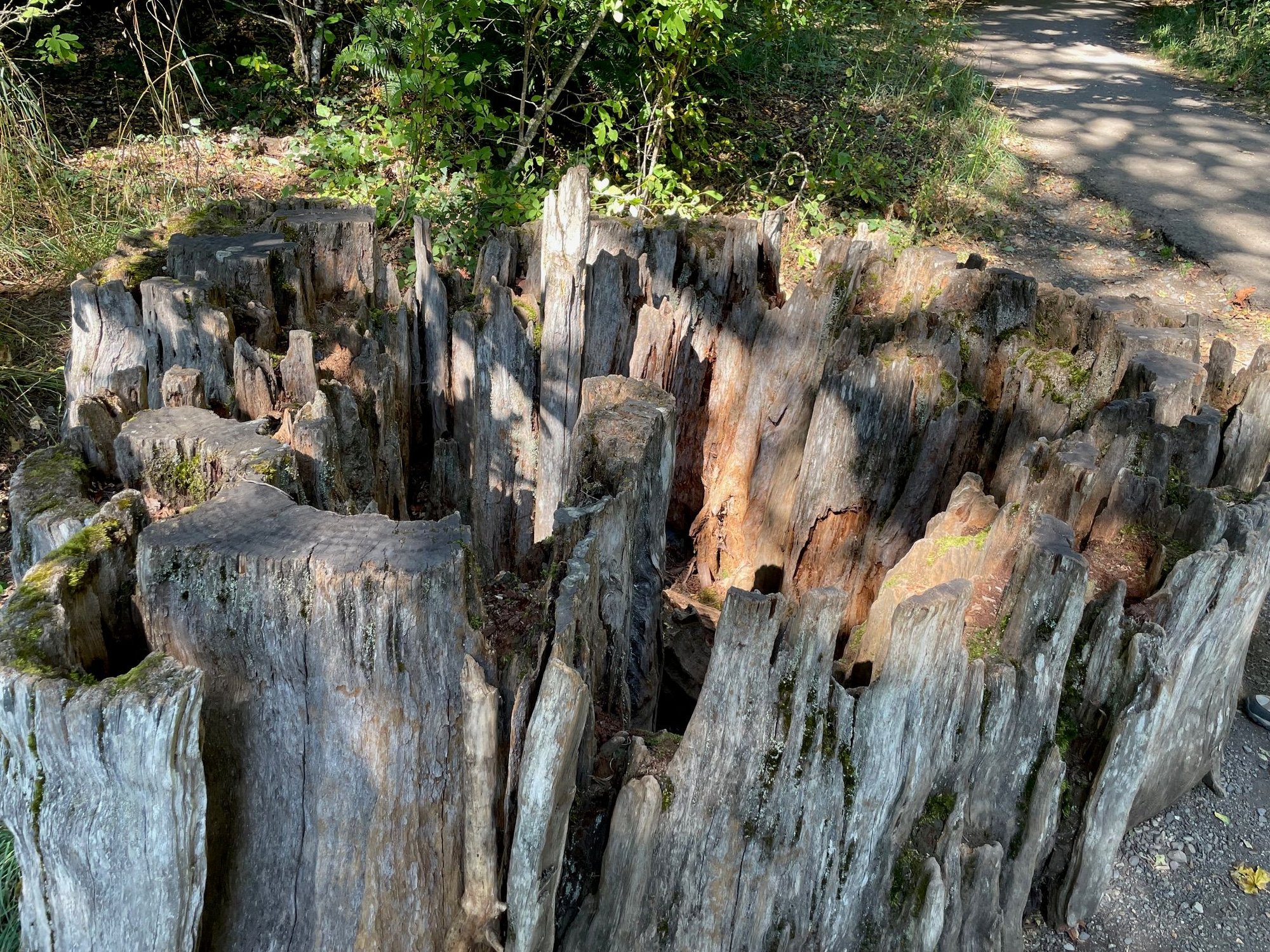
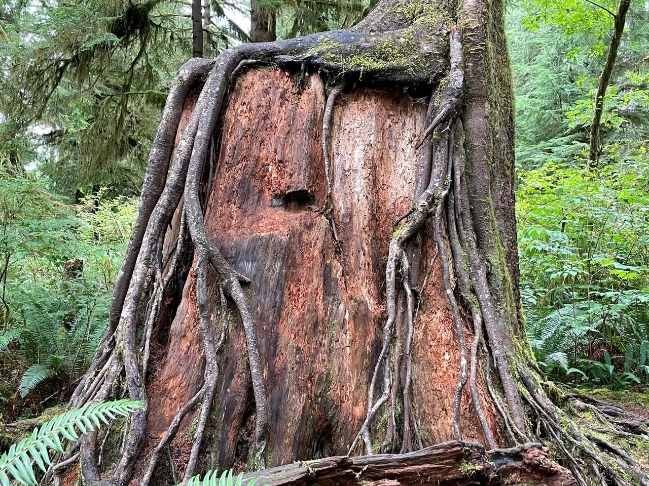
I don't think I captured how interesting this tree stump is, but it's right at the start of the short trail to the falls.
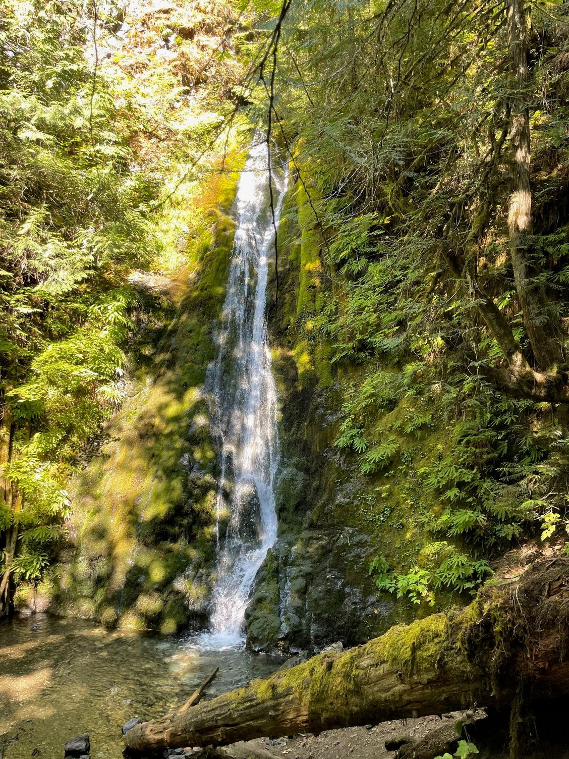
Madison Falls. Nice falls and so close to get to, so that makes it worth it to visit.
Another falls shot. A lot of people standing in the pool for pictures.
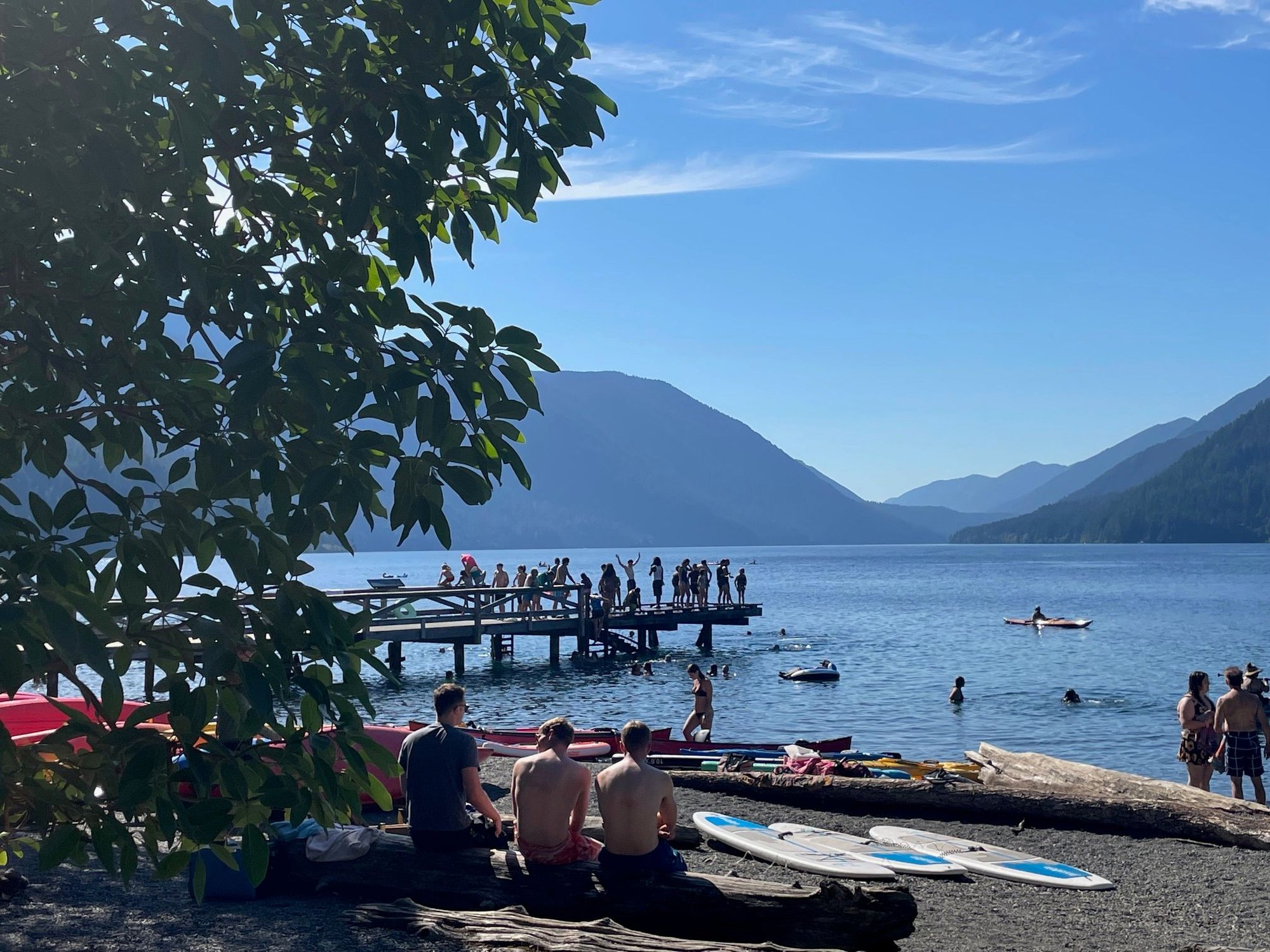
Saturday at Lake Crescent, so much fun
On our last day of camping we headed to Madison Falls. We really enjoyed camping at Sol Duc campground. I believe there are only a few campgrounds that you can make reservations and Sol Duc is one of them. That said, there is no Park oversite. There is a Camp Host, who we saw around but we never saw a Park employee the whole time we were there. The Camp Host said that was due to the fact that the campground is 12 miles off Hwy 101 and there have been lots of cuts to Park Staff. The Park Police / Rangers come through maybe once a week. While we stayed there the campsite was full but we did see a couple of instance where people showed up about 10PM, found a place to camp and were gone by 8AM! I'm guessing they didn't pay.
We drove to Madison Fall at the Elwha turn off from Hwy 101. It's a very nice falls and only a small walk from the picnic area and then we met family for dinner at the Lake Crescent Lodge. It was packed as I mentioned above. Tomorrow we move on to Whidbey Island. Olympic National Park is magnificent and we still have once more section to visit in the coming weeks.
Most of the access to the Elwha Valley is closed. There is a gate blocking the road just past the Falls Parking lot.
I don't think I captured how interesting this tree stump is, but it's right at the start of the short trail to the falls.
Madison Falls. Nice falls and so close to get to, so that makes it worth it to visit.
Another falls shot. A lot of people standing in the pool for pictures.
Saturday at Lake Crescent, so much fun

