


Glacier National Park Trip Report -- August 12-18, 2018
 Aug 16th, 2020 | 09:38 AM
#1
Original Poster

Joined: Oct 2003
Posts: 314
Likes: 4
Glacier National Park Trip Report -- August 12-18, 2018
Recently, while thinking back to our family trip to Glacier National Park in the summer of 2018, I looked it up on the Montana board and found to my surprise that there only seem to have been three trip reports posted for Glacier NP since about 2013! (Although it may also be covered in some longer accounts of trips through this portion of the northern Rockies.) So that inspired me to get busy (albeit belatedly) and do one for our trip.
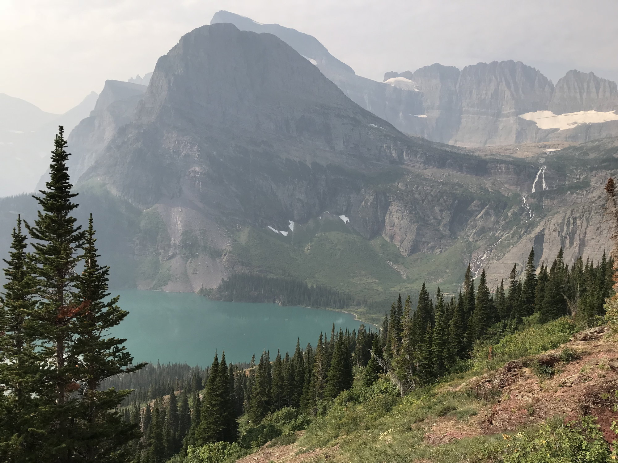
Lower Grinnell Lake, Angel Wing Mountain, Upper Grinnell Falls, and the Salamander Glacier and the Garden Wall in the distance from the Upper Grinnell Lake Trail, Glacier National Park, August 17, 2018
One interesting aspect of this project once I embarked upon it is that what appears to be the last Glacier-focused trip report posted in late August 2018 was done by schlegal1 (A beautiful week in Glacier NP- Trip Report), who was there from July 28th - August 4th, 2018, very shortly before we were there from August 12th-18th. Their report mentions that they were there shortly before the Howe Ridge fire broke out, whereas our trip coincided with the first week of the fire. That makes for some interesting and instructive contrasts between our experiences.
This was a family trip: two parents who were both 61 and our two children, both now in their early twenties (but, heck, still glad to travel with us as long as we pay!). They grew up going to national parks in the west and are totally into it.
I began thinking that we needed to go see Glacier a few years back when I heard that as a result of climate change, the last of the glaciers are expected to be gone by 2030. Having always regretted that I didn�t see Berlin before the Wall fell, or the Three Gorges of the Yangtze before the dam was built, I started planning a trip in 2016 for the summer of 2017. That one had to be scrapped when my son was obligated to attend a fraternity national meeting at the same time, so we cancelled our reservations and made plans to go in August 2018.
For someone like me, who prefers to stay inside the Park�s boundaries, and hopefully in one or more of the legendary Park hostelries, significant advance planning is required, and this is never more true than in the case of Glacier � particularly if you are constrained by school schedules and must go in the summer. Because of the weather, the season in Glacier is pretty short. There is only one east-west road across the Park � the legendary Going-to-the-Sun Road � and it never opens fully until around the third week of June, and sometimes not until the end of the first week of July. This is a function of deep snow at the higher elevations, in particular between the hairpin curve known as �the Loop� and Logan Pass, the main park headquarters.
The National Park Service (NPS) not surprisingly maintains a page with information on the status of Going-to-the-Sun Road � https://www.nps.gov/glac/planyourvisit/gtsrinfo.htm � and you can find out opening dates in past years by googling �going to the sun road opening date 20xx�.
Obviously, however, other portions of Going-to-the-Sun Road are open sooner than that, and the Park is probably less crowded at those times. And, ironically, although we were there in mid-August, Going-to-the-Sun Road wound up being closed basically the whole time we were there as a result of the Howe Ridge fire. The blocked portion was initially near the northern end of Lake McDonald, however, not farther up towards Logan Pass, at least not until we were about ready to leave. And we managed to cope reasonably well with the closure, although it meant a lot of extra driving during the first several days of our visit, when we were staying on the west side of the Park. Details follow below.
So, to the planning. The concessionaire for the in-Park accommodations at Glacier is Xanterra. And the way getting reservations works is that lodgings become available on the first day of the month in question one year in advance. So, since we wanted to visit Glacier in mid-August 2018, that meant that on the morning of August 1, 2017, I had to be on the phone. I started calling a few minutes before 9 a.m. eastern time that morning, and as soon as the phone lines opened, they were busy. We were on vacation elsewhere at that time, and while my family was out and about that day, I was periodically checking in with Xanterra. I finally got through at around 2 p.m. A lot of places had already been snapped up, but I was able to put together what we wanted.
It�s time for a shout-out here to a very competent Xanterra reservations agent named Kat. By a wild coincidence, she was the same one I had dealt with the year before � both in making the reservations originally and then in cancelling them! She was easy to remember because of her name and her engaging personality, and because lining up a week or so of lodging at Glacier is an involved process that can take a while (as you often have to make adjustments for already fully-booked dates) � I think we were on the phone that afternoon in August 2017 for at least half an hour (which helps to explain why it�s so hard to get through). I had pretty defined ideas of what we wanted to do, but I was open to advice and suggestions, and Kat was willing to give them based on her own experiences of the Park (so she wasn�t in some national reservations center in a place like Omaha � or if she was, she�d been to the Park and knew it pretty well).
I turned out to owe a huge debt to Kat for steering me to the Village Inn at Apgar rather than to the Lake McDonald Lodge. She couldn�t have known this, of course � she had other reasons for her recommendation � but a year later it saved us from experiencing an emergency evacuation and several nights of living like refugees in a tent camp.
The itinerary we hammered out in the end looked like this:
August 11th, Saturday � Cedar Creek Lodge in Columbia Falls, Montana (10 miles from the airport in Kalispell)
August 12th, Sunday through August 14th, Tuesday � The Village Inn at Apgar
August 15th, Wednesday through Augusta 17th, Friday � Many Glacier Hotel
August 18th, Saturday � Cedar Creek Lodge.
Otherwise, in terms of familiarizing myself with the Park and what we wanted to see, we relied on the Fodor�s boards, of course, and on the superb Moon Guide to Glacier (Becky Lomax, author), with further back up from Lonely Planet�s Guide to Banff, Jasper, and Glacier and the Falcon Guide entitled �Best Easy Day Hikes in Glacier and Waterton Lakes National Parks.� The Moon Guide is around 350 pages long and has great trail maps, laid out on top of contour maps. I can�t recommend it too highly.
So that�s it for the background and preparation. In the next post: the dramatic beginning of our trip!
 Aug 16th, 2020 | 11:29 AM
#2


Joined: Oct 2005
Posts: 75,008
Likes: 50
"In the next post: the dramatic beginning of our trip!"
OOH - A cliff hanger
Really looking forward to your detailed report -- I've been to many of the NPs out here but never to Glacier and it is starting to be on my radar . . .
OOH - A cliff hanger
Really looking forward to your detailed report -- I've been to many of the NPs out here but never to Glacier and it is starting to be on my radar . . .
 Aug 17th, 2020 | 08:41 AM
#3
Original Poster
Joined: Oct 2003
Posts: 314
Likes: 4
Our Trip Begins: August 11th-12th, 2018
August 11th, Saturday:
We left our home in Baltimore for BWI Airport at 1:45, flew through Denver and changed planes there, catching a flight to Glacier International Airport in Kalispell, Montana and arriving there around 9:30 p.m. local time (which was after midnight in terms of our body clocks). Once we picked up our rental car, it was only about a 10-mile drive to the Cedar Creek Lodge in Columbia Falls, which in turn is about 20 miles from the west entrance to Glacier NP. The Cedar Creek Lodge is also owned by Xanterra (or clearly has a co-operative relationship with it, as you can make reservations through them and they advertise specials for it, especially in the shoulder season). It is pretty new and upscale, with a woodsy-ski lodge feel about it (see photo below). It also had the last queen-size beds we would see until we returned to it a week later for our final night before flying out.
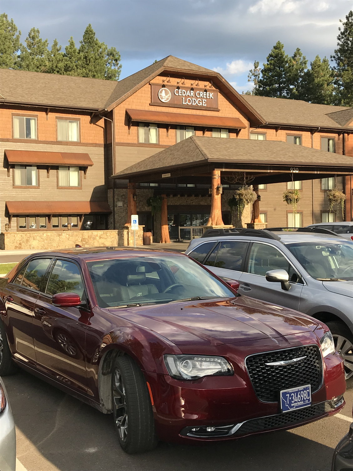
The Cedar Creek Lodge, with our rental car in the foreground
I said in my previous post that I love staying in classic Park Service hostelries inside the Park boundaries. Unfortunately, my wife often does not. She did really like Many Glacier Lodge, but she hated the Village Inn at Apgar where we stayed for the next several nights. She would have much preferred spending all of our time on the west side of the Park at the Cedar Creek Lodge. From my perspective, the additional 40-mile round-trip drive each day to and from the Park entrance was a real disincentive, and waking up and being able to step out your front door and look up Lake McDonald towards the mountains was another huge plus for the Village Inn. But not everyone will see it that way. The Cedar Creek Lodge has an outdoor pool and a hot tub, which the Village Inn does not, and those amenities (along with its modernity) may be especially significant for families. Conversely, the views, the surroundings, and the immediate access to kayaks, canoes, and swimming in a lake at Apgar may matter more to others.
August 12th, Sunday:
The Cedar Creek Lodge offered an excellent breakfast as part of the room charge the next morning. (I think the room charge was around $280/night, but all four of us were able to stay in one room, so when you factored four breakfasts in as well, that wasn�t too bad). While eating breakfast, I looked up and saw a couple we knew from Baltimore walking through the lobby � one of a series of remarkable �small world� encounters we�ve had on vacation trips over the past several years. They were just about to leave for the airport, having come up for a family reunion. They told us that the weather had been beastly hot over the previous several days, even breaking 100 degrees one day, but that projections were for more comfortable temperatures and beautiful weather over the week ahead � �So you�re getting here at a great time!� Well . . . they were right about the temperatures.
Our first order of business was a whitewater rafting trip on the Flathead River, which forms much of the western border of Glacier NP, so we put on our swimsuits and checked out of the hotel before driving to West Glacier to find the offices of the Glacier Raft Company. From there, we were transported in buses about 6 miles south of town along Highway 2 � a drive we would become extremely familiar with over the next several days � to the put-in point at Moccasin Creek. We shared a raft with another family of four and our guide Sydney, who was a nursing student at the University of Montana (Missoula) in the rafting off-season. She was skilled and knowledgeable and good company throughout the trip.
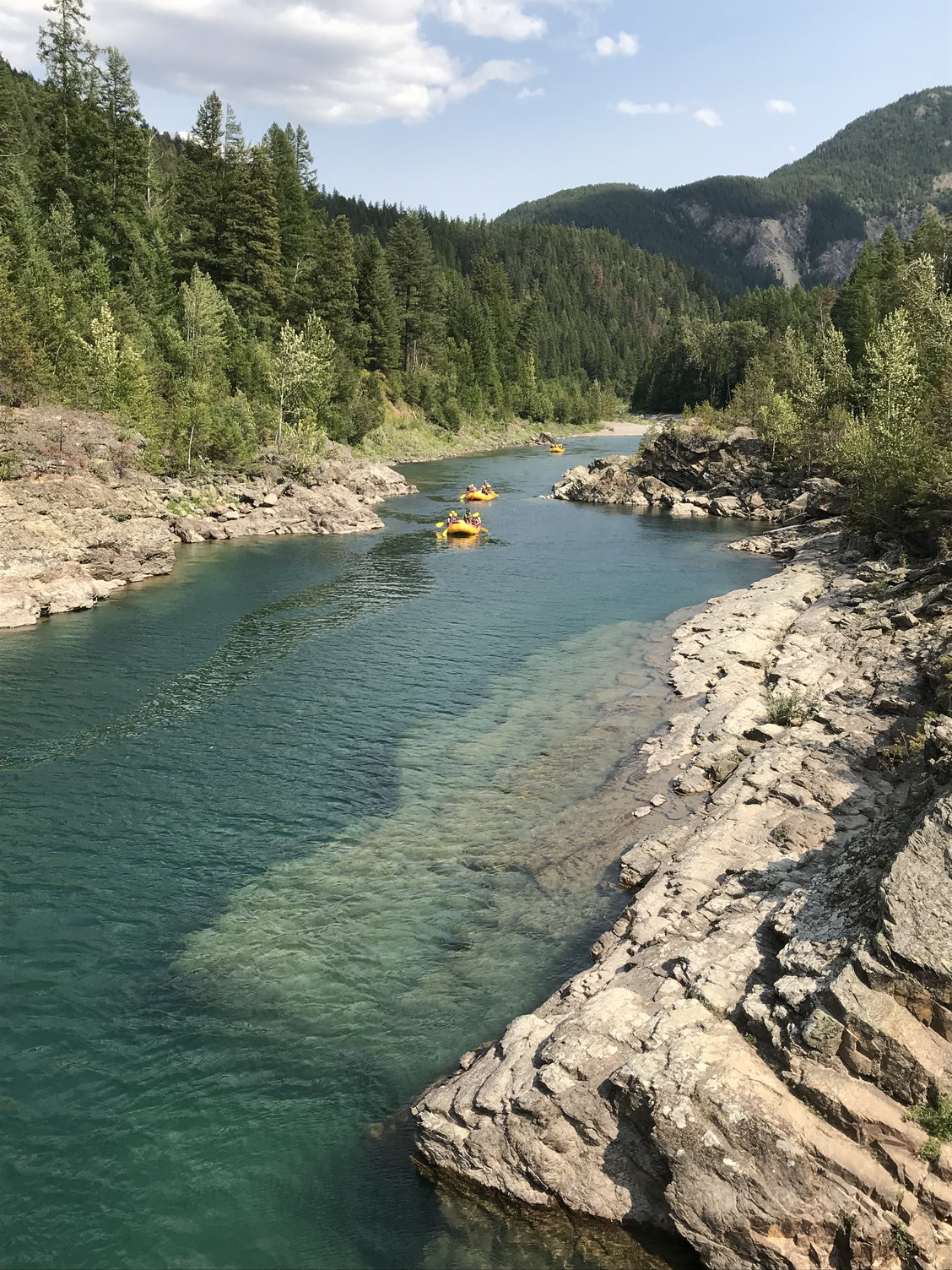
Whitewater rafting on the Flathead River (yes, there is more whitewater than this photo, taken at the very end of the trip, indicates)
The water in the Flathead is somewhat low in August � perhaps especially after a week of days with temperatures in the high 90's � so the ratings of the rapids throughout this trip ranged from Class 1-3, although there was one Sydney described as having �challenging hydraulics� that perhaps edged into a Class 4. The Northern Pacific railroad tracks run along the river for much of your course, while Highway 2 is on a shelf a hundred feet or more above you, so you can�t say this is a completely bucolic experience. But it was enjoyable, and the cold water (50 degrees) kept it quite pleasant at the bottom of the canyon. The ultimate take-out point (you float north) is the modern bridge that connects West Glacier with the Park entrance. From there, we were able to walk over to the raft company�s offices and change into our clothes. We got a late lunch at a restaurant across the street at around 3:30, then drove into the park and looked through the Visitor Center there briefly before heading over (no more than a mile) to the Village Inn at Apgar at the south end of Lake McDonald to check in for our three-night stay.
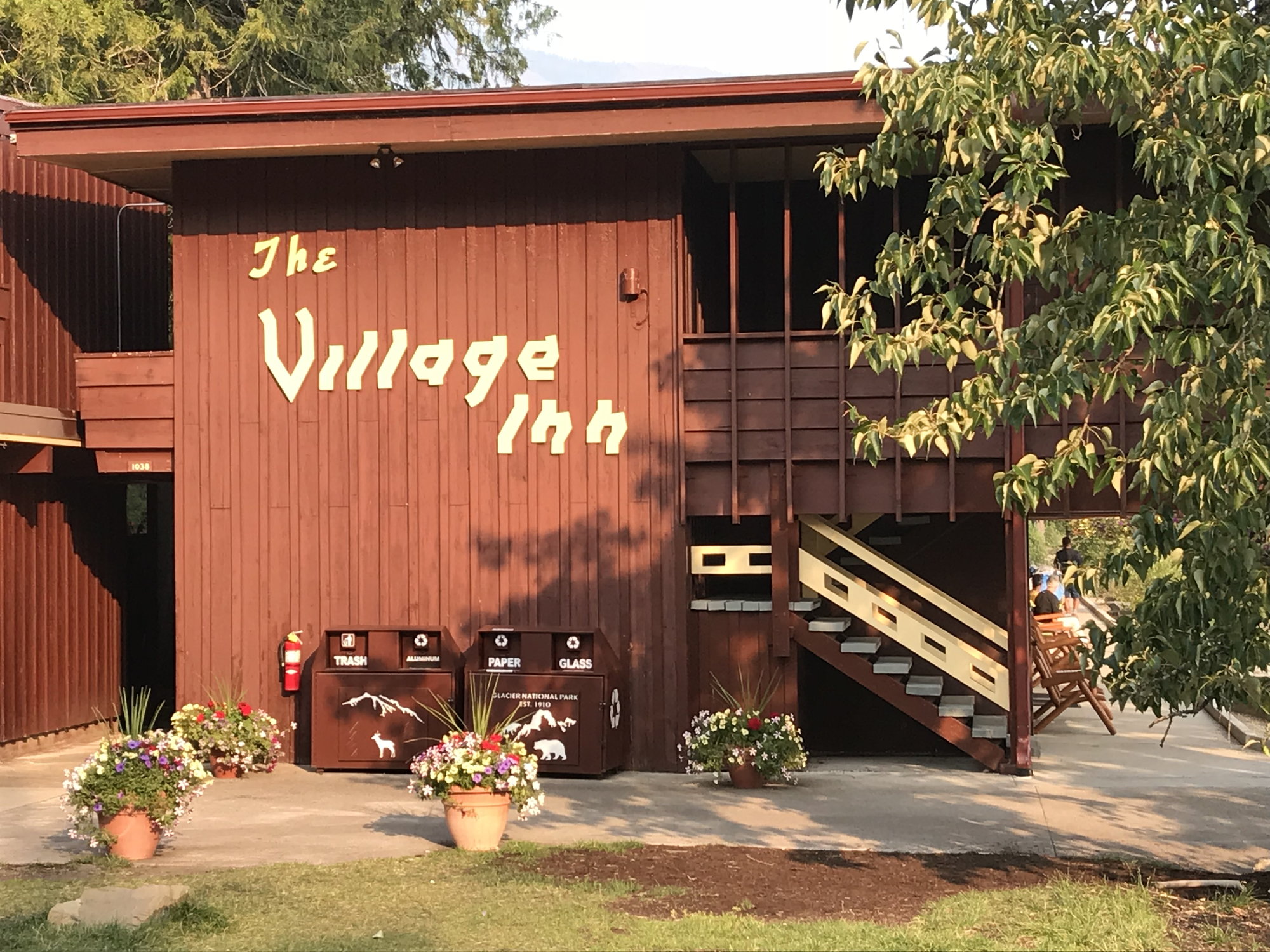
The Village Inn at Apgar
The Village Inn looks like � and is � a somewhat rustic 1950's motor inn, built in 1956, the year of my birth. But it was renovated in 2015, so think of it as a spruced-up time capsule. We had two rooms on the upper (second) floor. The view up Lake McDonald from the balcony/corridor outside our rooms was spectacular, with imposing mountains in the distance � and also a single column of smoke from the northwest side of the upper end of the lake, a place called Howe Ridge. I think we�d first heard about it at check-in � the results of a lightning strike the day before. It wasn�t presented as a big deal � 50 acres or so, in an area that had few structures. To us, it was originally just a curiosity. We�d seen fires before at Yellowstone, anywhere from 20-50 miles away. We took some photos of the column of smoke with kayakers and canoeists on the lake in front of it in the middle distance (the ready availability of these is Apgar�s answer to the pool and the hot tub at the Cedar Creek Lodge).
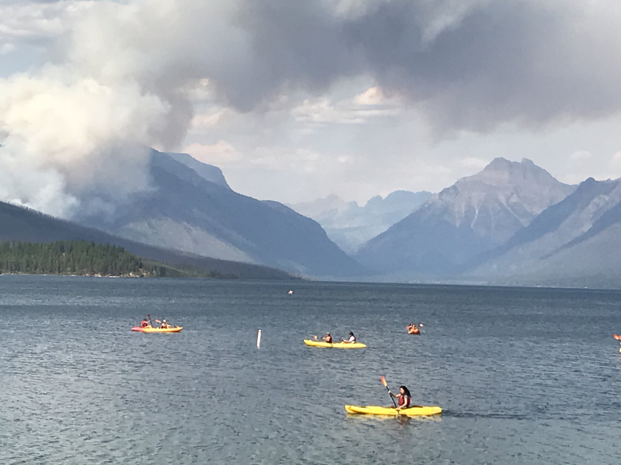
Looking north up Lake McDonald from the Village Inn, with the Howe Ridge fire on the left
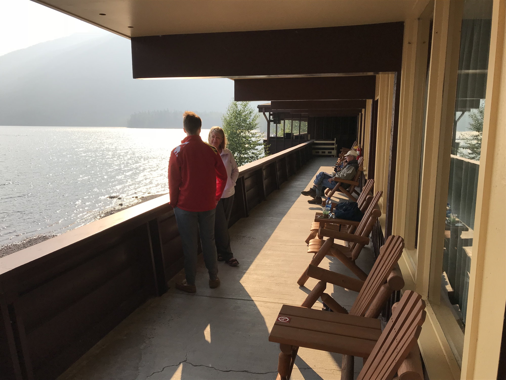
The Village Inn is small, and it has a nice vibe. Everyone enjoys sitting in the Adirondack chairs in front of their rooms looking out across the lake (as Kat had told me), and people chat readily and share information with new arrivals. One couple was from Lexington, Kentucky; they were revisiting scenes from their last trip to Glacier some 40 years earlier.
After relaxing for an hour, I managed to persuade the others that we should take advantage of the several hours of light remaining and go do a short trail called �The Trail of the Cedars� and then the Avalanche Creek Trail, which were about 20 miles north past the upper end of Lake McDonald off Going-to-the-Sun Road. The photos I�d seen of Avalanche Creek during my research had wowed me, and I knew it was a highly popular trail, so I thought the very late afternoon might be a really good time to do it and escape the crowds. That proved to be right . . . but there were to be some unexpected twists as well.
On the drive up Lake McDonald, we stopped at an overlook near the Sprague Creek camping area, where there was a beach along the lake�s edge that also gave us a good view across the water to the area of the Howe Ridge fire. The lake was beautiful in the late afternoon light, but as we looked towards the fire, it seemed like the smoke was heavier and closer to the water than we�d expected and � wait, aren�t those tongues of flame licking up those trees there!?! But we still thought this was just kind of exciting � after all, there was a rather broad and deep lake between us and the area that was burning � so we continued on north to the Avalanche Creek Trail parking area, getting there at about 6:10.
The first part of the trail complex in this area � the �Trail of the Cedars� � is an 0.9 mile loop, part boardwalk, part paved, and fully-wheelchair accessible � that winds through an Old Growth forest featuring three large distinctive trees �Western Red Cedar, Black Cottonwood, and Western Hemlock. We were about halfway along it when the Avalanche Creek Trail split off to the right. I was game; my wife was not. Just then a woman came along and told us that Avalanche Creek was really not to be missed, and the most stunning part of it wasn�t that much farther along in any case. Our kids� votes in favor of continuing then carried the day.
Thank goodness for that hiker�s advice, because Avalanche Creek is stunning. As the Falcon Guide describes it: �Avalanche Gorge . . . was formed by the force of a stream cutting down through argillite beds [a type of dark red rock], creating fantastic bowls and chutes in the rock. The spray from small waterfalls provides the moisture needed to sustain the profusion of mosses that drape the rocks surrounding the gorge.� The gorge is often only a few feet wide, and you look down into it from 10-12 feet above. I knew it was one of the Park�s highlights, but seeing it surpassed my expectations.
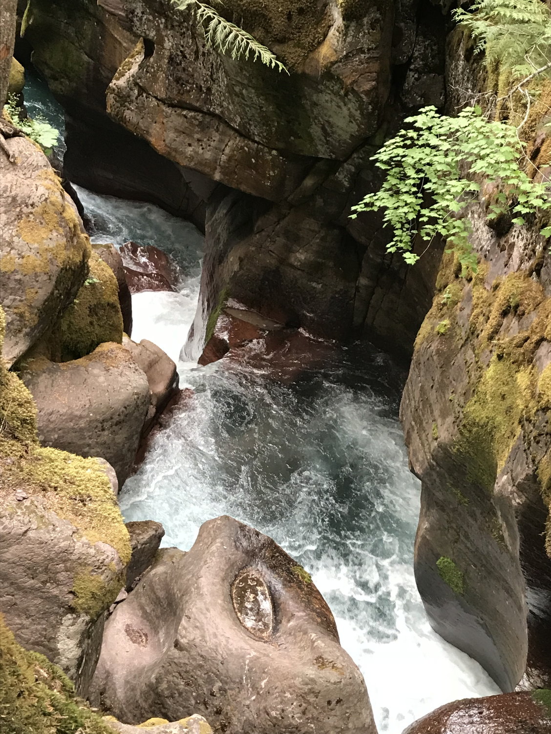
Avalanche Creek (1)
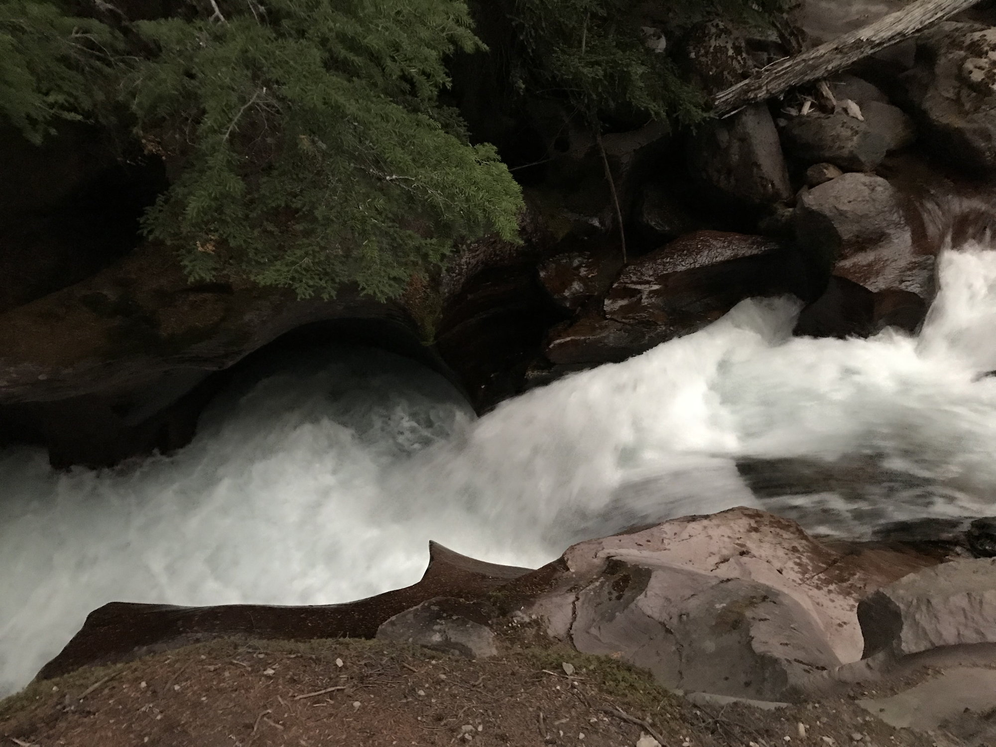
Avalanche Creek (2)
Avalanche Creek (3)
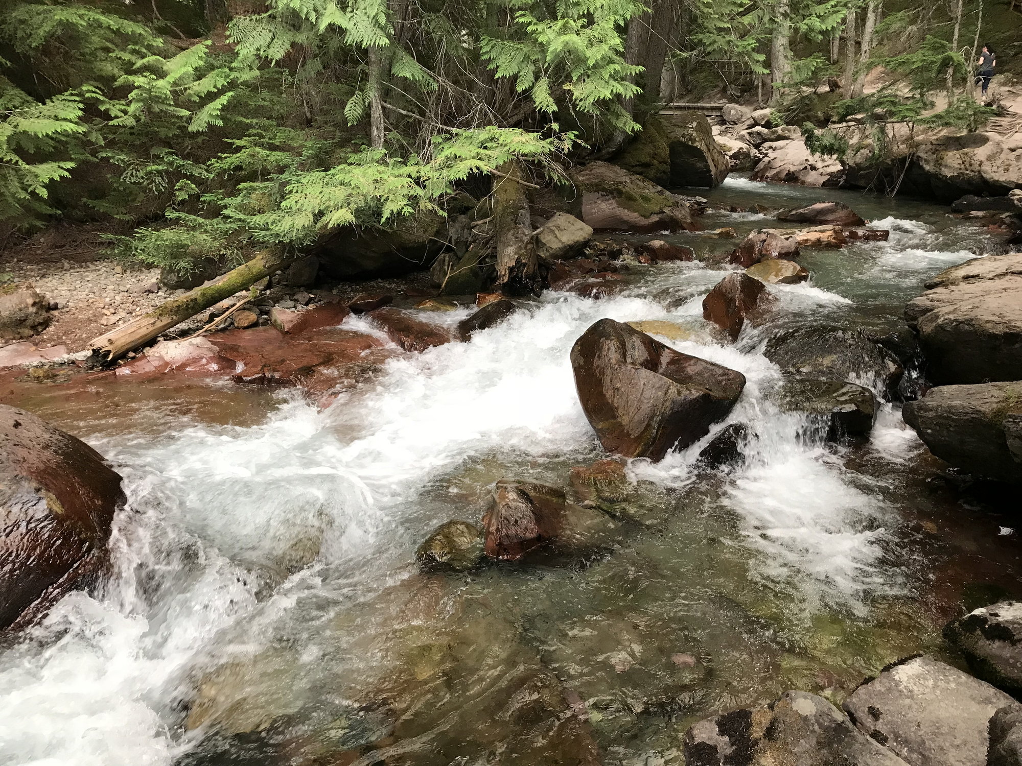
We gradually followed the creek further upstream, past the top of the narrow cleft through which it runs to an area where it spreads out among massive boulders and is still quite scenic. Somewhere along this stretch, another hiker told us that we really should not miss continuing up the trail all the way to Avalanche Lake. So we did � after all, it was only a 4.6 mile round-trip from the parking area, and we were already well along it. We passed through an area where a micro-burst of wind had flattened trees as if smashed down by the edge of a giant hand, and then looked to the northeast up the dramatic Hidden Canyon, which ultimately leads to Hidden Lake below Logan Pass.
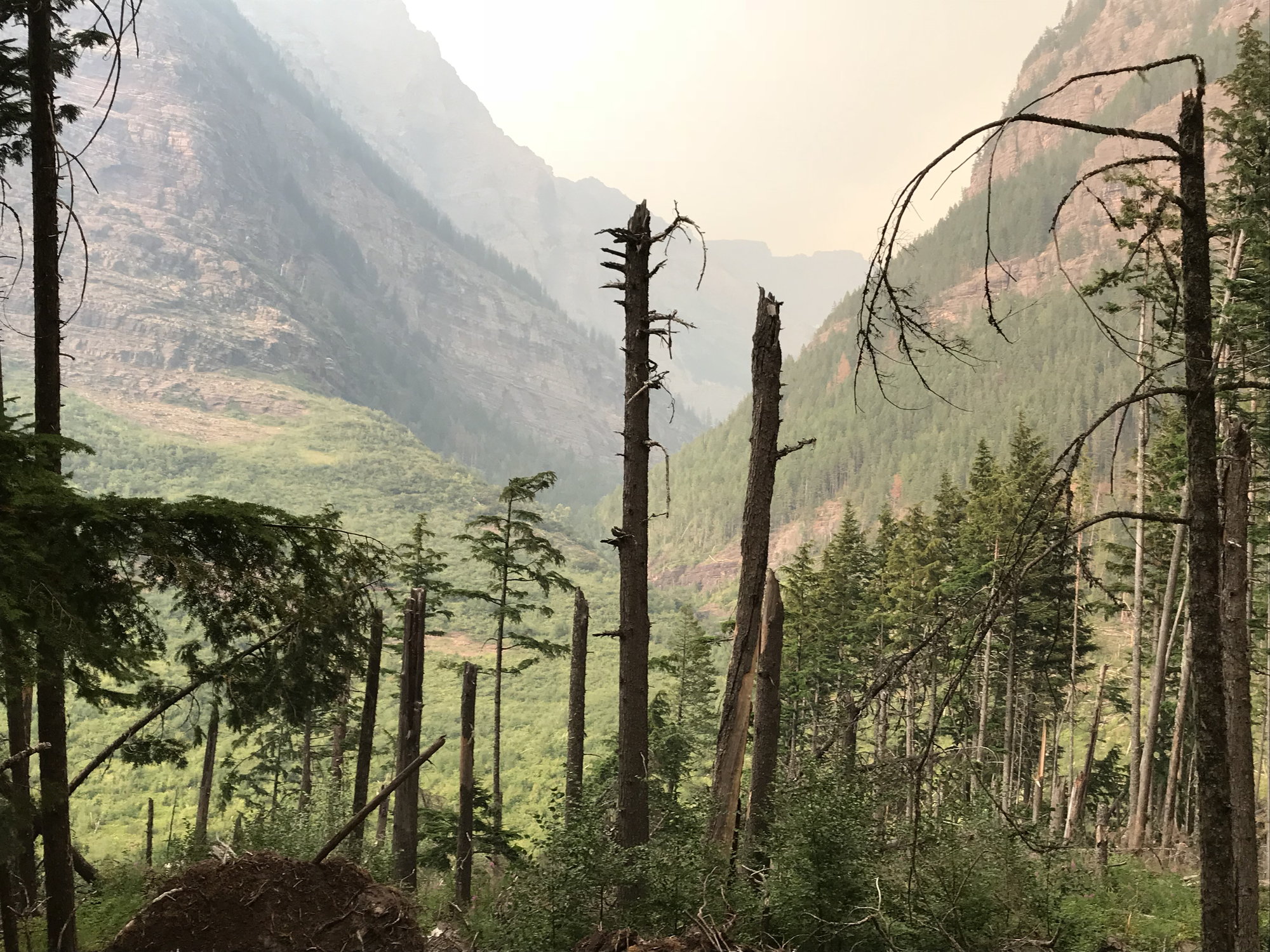
Hidden Canyon
At about 7:35, we emerged from the forest onto the beach at the northwestern end of Avalanche Lake. My 20-year-old son was in the lead at that point, and he called out and ran ahead to the edge of the water, where he turned back to look at me and flung his arms wide in amazement and awe. The lake occupies a huge natural amphitheater, with Bear Hat Mountain looming to the northeast, Mount Brown to the southwest, and Gunsight Mountain to the southeast, with multiple waterfalls streaming down hundreds of feet from the edge of the bowl-like cirque that holds the Sperry Glacier. Beyond that, with sunset approaching and smoke beginning to drift over from the Howe Ridge fire, the entire landscape had become suffused with a brooding rose- and copper-colored light. It was one of the most astonishing and beautiful landscapes I had ever seen in my life. I remember thinking that one of my favorite artists, the Hudson River School painter Frederick Edwin Church, would have loved it, and that with his mastery of late afternoon light, he would have been one of the few who could have done it justice.
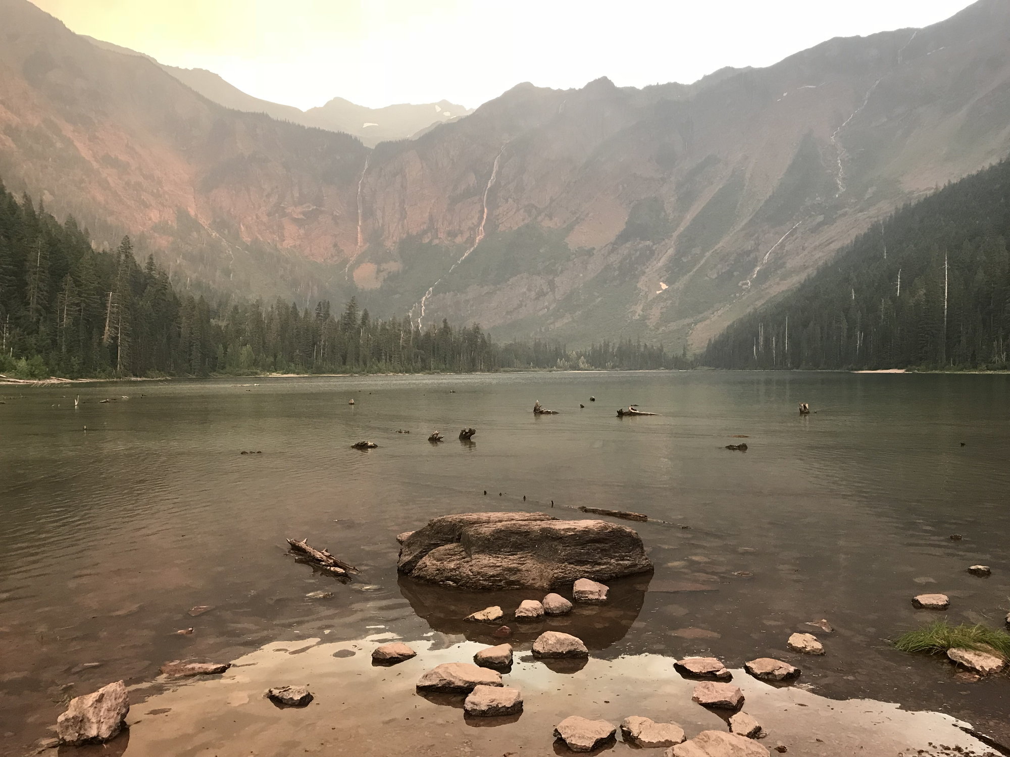
Avalanche Lake
We spent some time taking in this sensational scene, then reluctantly turned back for the trail. There had only been a handful of other visitors there when we reached the lake, and there were no more than a couple still behind us when we left. (Later, I would be told that the beach at Avalanche Lake often has dozens of people on it in the middle of the day.) But I was now uncomfortably aware that we weren�t all that far away from sunset � it occurred at about 8:55 p.m. that day � and for part of that distance back, we would be walking through a dense and well-shaded forest that could be expected to be even darker. In the end, however, this didn�t turn out to be a problem.
We got back to the parking area at 8:40 p.m. Our car was the only one left, which felt a little ominous at first, but it was late in the day � and after all, many people don�t have lunch at 3:30 p.m. and therefore eat dinner at a reasonable hour! We started driving south down the quiet, deserted road towards the Lake McDonald Lodge. Suddenly, a succession of emergency vehicles came speeding past us going north, with blue and red lights flashing and sirens blaring. When we reached the north edge of Lake McDonald in the gathering darkness, we saw a cluster of emergency vehicles and then a string of drivers who had pulled off into the right side of the road with their emergency flashers on, while they stood beside their cars and were looking to the west. We followed their gaze, and saw that a wall of flames had now reached the water�s edge, while dense clouds of black smoke were billowing across the lake.
We kept going, and when we reached the Lake McDonald Lodge, we were greeted by a scene of pandemonium. An evacuation order had just been issued for the Lodge and the Sprague campground to the south of it, and it was utter chaos. We got past the Lodge and the campground, and just below that, we saw a police car that was heading towards us suddenly wheel across the road and block the northbound lane. We didn�t know this at the time, of course, but Going-to-the-Sun Road would stay blocked at that point for the remainder of our trip. We swung past onto the right shoulder and then continued on down to Apgar, where we found the other guests had come out of their rooms and were looking up the lake in the darkness, where a sinister red glow was lighting up the horizon.
Eddie�s Caf�, the only restaurant at Apgar, was closed by the time we got there, so we drove into West Glacier and found a place where we could get some sandwiches, salads and potato salad and took those back to our rooms to eat. I woke up in the middle of the night and stepped out onto the balcony outside my room, where I could still see the red glow limning the ridge line along the northwest side of the lake, as if an angry dragon was prowling on the other side.

The Howe Ridge fire from the Village Inn by night
[To Be Continued]
We left our home in Baltimore for BWI Airport at 1:45, flew through Denver and changed planes there, catching a flight to Glacier International Airport in Kalispell, Montana and arriving there around 9:30 p.m. local time (which was after midnight in terms of our body clocks). Once we picked up our rental car, it was only about a 10-mile drive to the Cedar Creek Lodge in Columbia Falls, which in turn is about 20 miles from the west entrance to Glacier NP. The Cedar Creek Lodge is also owned by Xanterra (or clearly has a co-operative relationship with it, as you can make reservations through them and they advertise specials for it, especially in the shoulder season). It is pretty new and upscale, with a woodsy-ski lodge feel about it (see photo below). It also had the last queen-size beds we would see until we returned to it a week later for our final night before flying out.
The Cedar Creek Lodge, with our rental car in the foreground
I said in my previous post that I love staying in classic Park Service hostelries inside the Park boundaries. Unfortunately, my wife often does not. She did really like Many Glacier Lodge, but she hated the Village Inn at Apgar where we stayed for the next several nights. She would have much preferred spending all of our time on the west side of the Park at the Cedar Creek Lodge. From my perspective, the additional 40-mile round-trip drive each day to and from the Park entrance was a real disincentive, and waking up and being able to step out your front door and look up Lake McDonald towards the mountains was another huge plus for the Village Inn. But not everyone will see it that way. The Cedar Creek Lodge has an outdoor pool and a hot tub, which the Village Inn does not, and those amenities (along with its modernity) may be especially significant for families. Conversely, the views, the surroundings, and the immediate access to kayaks, canoes, and swimming in a lake at Apgar may matter more to others.
August 12th, Sunday:
The Cedar Creek Lodge offered an excellent breakfast as part of the room charge the next morning. (I think the room charge was around $280/night, but all four of us were able to stay in one room, so when you factored four breakfasts in as well, that wasn�t too bad). While eating breakfast, I looked up and saw a couple we knew from Baltimore walking through the lobby � one of a series of remarkable �small world� encounters we�ve had on vacation trips over the past several years. They were just about to leave for the airport, having come up for a family reunion. They told us that the weather had been beastly hot over the previous several days, even breaking 100 degrees one day, but that projections were for more comfortable temperatures and beautiful weather over the week ahead � �So you�re getting here at a great time!� Well . . . they were right about the temperatures.
Our first order of business was a whitewater rafting trip on the Flathead River, which forms much of the western border of Glacier NP, so we put on our swimsuits and checked out of the hotel before driving to West Glacier to find the offices of the Glacier Raft Company. From there, we were transported in buses about 6 miles south of town along Highway 2 � a drive we would become extremely familiar with over the next several days � to the put-in point at Moccasin Creek. We shared a raft with another family of four and our guide Sydney, who was a nursing student at the University of Montana (Missoula) in the rafting off-season. She was skilled and knowledgeable and good company throughout the trip.
Whitewater rafting on the Flathead River (yes, there is more whitewater than this photo, taken at the very end of the trip, indicates)
The water in the Flathead is somewhat low in August � perhaps especially after a week of days with temperatures in the high 90's � so the ratings of the rapids throughout this trip ranged from Class 1-3, although there was one Sydney described as having �challenging hydraulics� that perhaps edged into a Class 4. The Northern Pacific railroad tracks run along the river for much of your course, while Highway 2 is on a shelf a hundred feet or more above you, so you can�t say this is a completely bucolic experience. But it was enjoyable, and the cold water (50 degrees) kept it quite pleasant at the bottom of the canyon. The ultimate take-out point (you float north) is the modern bridge that connects West Glacier with the Park entrance. From there, we were able to walk over to the raft company�s offices and change into our clothes. We got a late lunch at a restaurant across the street at around 3:30, then drove into the park and looked through the Visitor Center there briefly before heading over (no more than a mile) to the Village Inn at Apgar at the south end of Lake McDonald to check in for our three-night stay.
The Village Inn at Apgar
The Village Inn looks like � and is � a somewhat rustic 1950's motor inn, built in 1956, the year of my birth. But it was renovated in 2015, so think of it as a spruced-up time capsule. We had two rooms on the upper (second) floor. The view up Lake McDonald from the balcony/corridor outside our rooms was spectacular, with imposing mountains in the distance � and also a single column of smoke from the northwest side of the upper end of the lake, a place called Howe Ridge. I think we�d first heard about it at check-in � the results of a lightning strike the day before. It wasn�t presented as a big deal � 50 acres or so, in an area that had few structures. To us, it was originally just a curiosity. We�d seen fires before at Yellowstone, anywhere from 20-50 miles away. We took some photos of the column of smoke with kayakers and canoeists on the lake in front of it in the middle distance (the ready availability of these is Apgar�s answer to the pool and the hot tub at the Cedar Creek Lodge).
Looking north up Lake McDonald from the Village Inn, with the Howe Ridge fire on the left
The Village Inn is small, and it has a nice vibe. Everyone enjoys sitting in the Adirondack chairs in front of their rooms looking out across the lake (as Kat had told me), and people chat readily and share information with new arrivals. One couple was from Lexington, Kentucky; they were revisiting scenes from their last trip to Glacier some 40 years earlier.
After relaxing for an hour, I managed to persuade the others that we should take advantage of the several hours of light remaining and go do a short trail called �The Trail of the Cedars� and then the Avalanche Creek Trail, which were about 20 miles north past the upper end of Lake McDonald off Going-to-the-Sun Road. The photos I�d seen of Avalanche Creek during my research had wowed me, and I knew it was a highly popular trail, so I thought the very late afternoon might be a really good time to do it and escape the crowds. That proved to be right . . . but there were to be some unexpected twists as well.
On the drive up Lake McDonald, we stopped at an overlook near the Sprague Creek camping area, where there was a beach along the lake�s edge that also gave us a good view across the water to the area of the Howe Ridge fire. The lake was beautiful in the late afternoon light, but as we looked towards the fire, it seemed like the smoke was heavier and closer to the water than we�d expected and � wait, aren�t those tongues of flame licking up those trees there!?! But we still thought this was just kind of exciting � after all, there was a rather broad and deep lake between us and the area that was burning � so we continued on north to the Avalanche Creek Trail parking area, getting there at about 6:10.
The first part of the trail complex in this area � the �Trail of the Cedars� � is an 0.9 mile loop, part boardwalk, part paved, and fully-wheelchair accessible � that winds through an Old Growth forest featuring three large distinctive trees �Western Red Cedar, Black Cottonwood, and Western Hemlock. We were about halfway along it when the Avalanche Creek Trail split off to the right. I was game; my wife was not. Just then a woman came along and told us that Avalanche Creek was really not to be missed, and the most stunning part of it wasn�t that much farther along in any case. Our kids� votes in favor of continuing then carried the day.
Thank goodness for that hiker�s advice, because Avalanche Creek is stunning. As the Falcon Guide describes it: �Avalanche Gorge . . . was formed by the force of a stream cutting down through argillite beds [a type of dark red rock], creating fantastic bowls and chutes in the rock. The spray from small waterfalls provides the moisture needed to sustain the profusion of mosses that drape the rocks surrounding the gorge.� The gorge is often only a few feet wide, and you look down into it from 10-12 feet above. I knew it was one of the Park�s highlights, but seeing it surpassed my expectations.
Avalanche Creek (1)
Avalanche Creek (2)
Avalanche Creek (3)
We gradually followed the creek further upstream, past the top of the narrow cleft through which it runs to an area where it spreads out among massive boulders and is still quite scenic. Somewhere along this stretch, another hiker told us that we really should not miss continuing up the trail all the way to Avalanche Lake. So we did � after all, it was only a 4.6 mile round-trip from the parking area, and we were already well along it. We passed through an area where a micro-burst of wind had flattened trees as if smashed down by the edge of a giant hand, and then looked to the northeast up the dramatic Hidden Canyon, which ultimately leads to Hidden Lake below Logan Pass.
Hidden Canyon
At about 7:35, we emerged from the forest onto the beach at the northwestern end of Avalanche Lake. My 20-year-old son was in the lead at that point, and he called out and ran ahead to the edge of the water, where he turned back to look at me and flung his arms wide in amazement and awe. The lake occupies a huge natural amphitheater, with Bear Hat Mountain looming to the northeast, Mount Brown to the southwest, and Gunsight Mountain to the southeast, with multiple waterfalls streaming down hundreds of feet from the edge of the bowl-like cirque that holds the Sperry Glacier. Beyond that, with sunset approaching and smoke beginning to drift over from the Howe Ridge fire, the entire landscape had become suffused with a brooding rose- and copper-colored light. It was one of the most astonishing and beautiful landscapes I had ever seen in my life. I remember thinking that one of my favorite artists, the Hudson River School painter Frederick Edwin Church, would have loved it, and that with his mastery of late afternoon light, he would have been one of the few who could have done it justice.
Avalanche Lake
We spent some time taking in this sensational scene, then reluctantly turned back for the trail. There had only been a handful of other visitors there when we reached the lake, and there were no more than a couple still behind us when we left. (Later, I would be told that the beach at Avalanche Lake often has dozens of people on it in the middle of the day.) But I was now uncomfortably aware that we weren�t all that far away from sunset � it occurred at about 8:55 p.m. that day � and for part of that distance back, we would be walking through a dense and well-shaded forest that could be expected to be even darker. In the end, however, this didn�t turn out to be a problem.
We got back to the parking area at 8:40 p.m. Our car was the only one left, which felt a little ominous at first, but it was late in the day � and after all, many people don�t have lunch at 3:30 p.m. and therefore eat dinner at a reasonable hour! We started driving south down the quiet, deserted road towards the Lake McDonald Lodge. Suddenly, a succession of emergency vehicles came speeding past us going north, with blue and red lights flashing and sirens blaring. When we reached the north edge of Lake McDonald in the gathering darkness, we saw a cluster of emergency vehicles and then a string of drivers who had pulled off into the right side of the road with their emergency flashers on, while they stood beside their cars and were looking to the west. We followed their gaze, and saw that a wall of flames had now reached the water�s edge, while dense clouds of black smoke were billowing across the lake.
We kept going, and when we reached the Lake McDonald Lodge, we were greeted by a scene of pandemonium. An evacuation order had just been issued for the Lodge and the Sprague campground to the south of it, and it was utter chaos. We got past the Lodge and the campground, and just below that, we saw a police car that was heading towards us suddenly wheel across the road and block the northbound lane. We didn�t know this at the time, of course, but Going-to-the-Sun Road would stay blocked at that point for the remainder of our trip. We swung past onto the right shoulder and then continued on down to Apgar, where we found the other guests had come out of their rooms and were looking up the lake in the darkness, where a sinister red glow was lighting up the horizon.
Eddie�s Caf�, the only restaurant at Apgar, was closed by the time we got there, so we drove into West Glacier and found a place where we could get some sandwiches, salads and potato salad and took those back to our rooms to eat. I woke up in the middle of the night and stepped out onto the balcony outside my room, where I could still see the red glow limning the ridge line along the northwest side of the lake, as if an angry dragon was prowling on the other side.
The Howe Ridge fire from the Village Inn by night
[To Be Continued]
Aug 19th, 2020 | 08:00 PM
#4
Original Poster
Joined: Oct 2003
Posts: 314
Likes: 4
After I wrote the above post, I found a video on YouTube of the Howe Ridge fire that was filmed from the west side of Lake McDonald on the evening of Saturday, August 12th. My guess would be that the time of the filming was probably around 8:00 - 8:30, because the fire was nowhere close to this severe when we stopped to look at it from near the Sprague Campground around 6 p,m. It demonstrates the circumstances that prompted the crash evacuation of the Lake McDonald Lodge that we drove into as we returned from Avalanche Creek just before 9 p.m.
And here’s a time-lapse film of the fire’s growth on Sunday afternoon and evening that was shot by a local TV station:
And here’s a time-lapse film of the fire’s growth on Sunday afternoon and evening that was shot by a local TV station:
Aug 22nd, 2020 | 09:41 AM
#5
Original Poster
Joined: Oct 2003
Posts: 314
Likes: 4
August 13th. Monday: To the Two Medicine Area and St. Mary Lake
When I woke up this morning, my wife was already up and sitting outside in one of the armchairs on the gallery outside our rooms. She complained that her bed�s mattress was so soft she got little sleep that night. The beds were soft, although it hadn�t been a problem for the other three of us, and she did better on the two following nights. But although I liked it, we clearly won�t be staying at the Village Inn on any future trips to Glacier.
Morning at the Village Inn
I was told by the Inn�s manager that Going-to-The-Sun Road remained closed where we had seen the roadblock established the night before, which was hardly a surprise. Looking north up the lake, the whole northern half of it was now obscured by smoke, although the air remained clear thus far around Apgar. We learned that the evacuees from the Lake McDonald Lodge were now being housed in a refugee tent compound somewhere nearby that the awesomely efficient Park Service had conjured up on remarkably short notice.
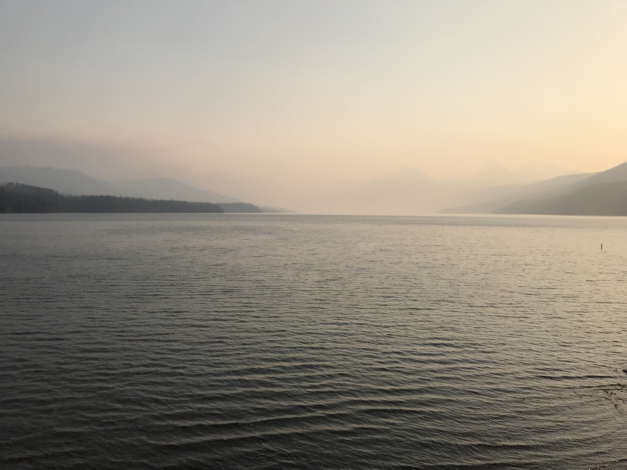
The view north up Lake McDonald that morning
We had breakfast at Eddie�s Caf�, an informal, family-oriented establishment that is the only restaurant at Apgar. But for breakfast, in particular, it was great: hearty, classic offerings, well-prepared, and reasonable prices. I had three huge pancakes and sausages, so I started the day�s adventure well-prepared.
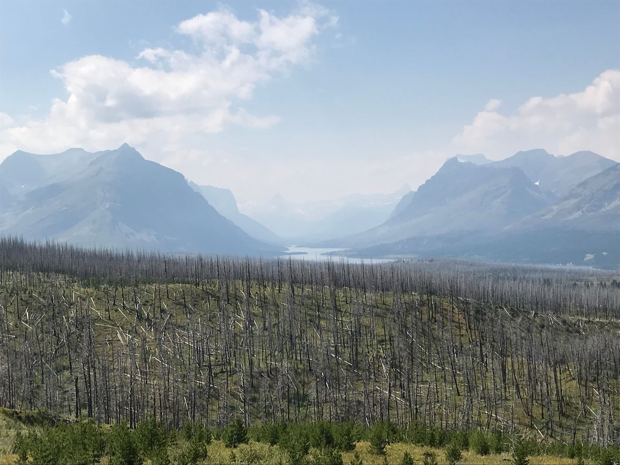
We set off in our rental car down Route 2 at 10:45 a.m. Because Going-to-The-Sun Road is the only east-west communication across the park, its closure meant that we would have to drive along the park�s western and southern boundaries to get over to the east side to see any major sights. (There would have been some trails we could have done by going north, but none of them were on my list and none of the park�s major attractions were up there.) So we made our objective the Two Medicine Area at the southeastern corner of the Park, a 55-mile drive away.
We got there in about an hour. Two Medicine is a valley with a couple of lakes, a number of trails, one or two waterfalls, and a surrounding girdle of mountains. As we were coming down the approach road, it looked stunning, certainly well-worth a visit: but, uh oh, what�s this long line of cars backed up from the entrance kiosk?
Distant View of the Two Medicine Area
When we finally inched up to it, we learned that owing to the limited number of parking places in this rather self-contained area of the park, they were unable to admit any other cars for some unknown period of time. So scratch that.
What would Plan B be? We drove back into East Glacier and stopped off at the Glacier Park Lodge, which we had passed by earlier. It�s another Park Service accommodation that was originally built back in 1915 by the Northern Pacific Railroad, a few years after they first managed to run a pair of tracks through these parts (more on that later). It�s built of dark, massive logs of Douglas Fir with a cathedral-like lobby and is worth stopping to see in its own right.
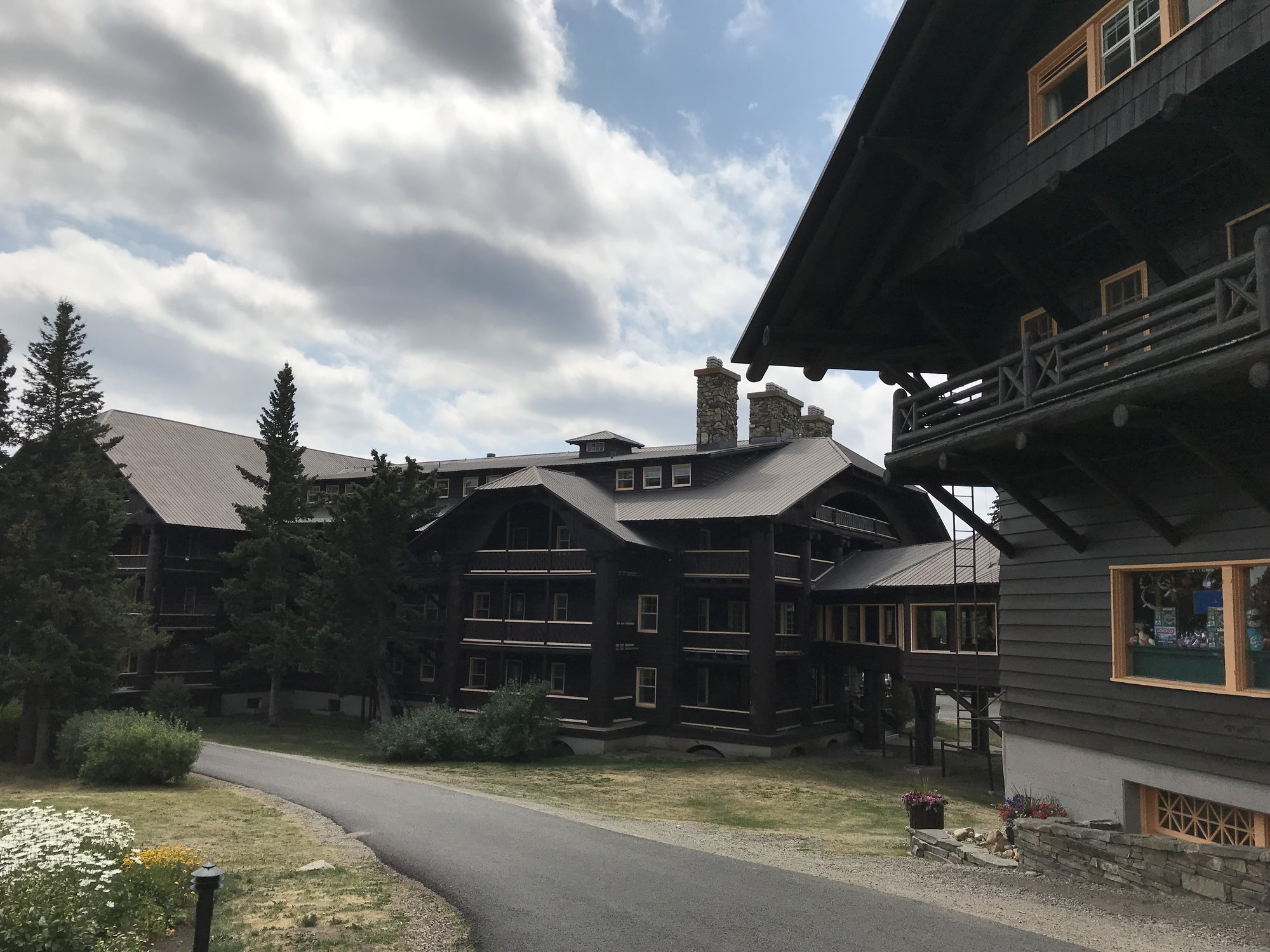
The Glacier Lake Lodge (1913)
There was also a tourist information office where we could make some inquiries. One of the first things we noticed there was a page (shown below) listing all of the trails and areas around the park that were closed either to due to fire activity or bear activity. The number of the latter was a reminder that as the summer wears on and food gets exhausted at the higher elevations, the bears push down closer to the areas that are more heavily trafficked by tourists. So that�s another aspect of the natural world that you should factor into scheduling a visit to Glacier.
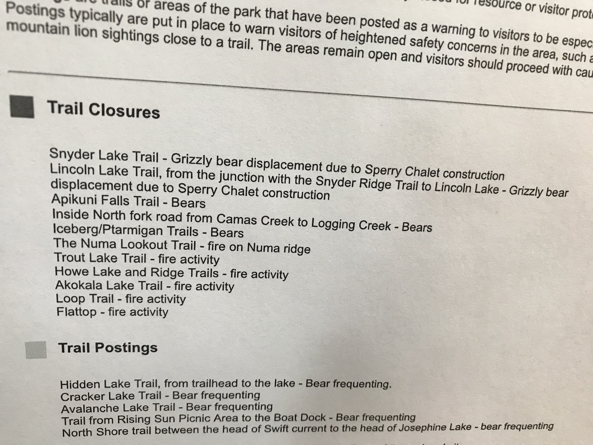
Notice of Trail Closings and Postings (warnings) -- and the reasons why
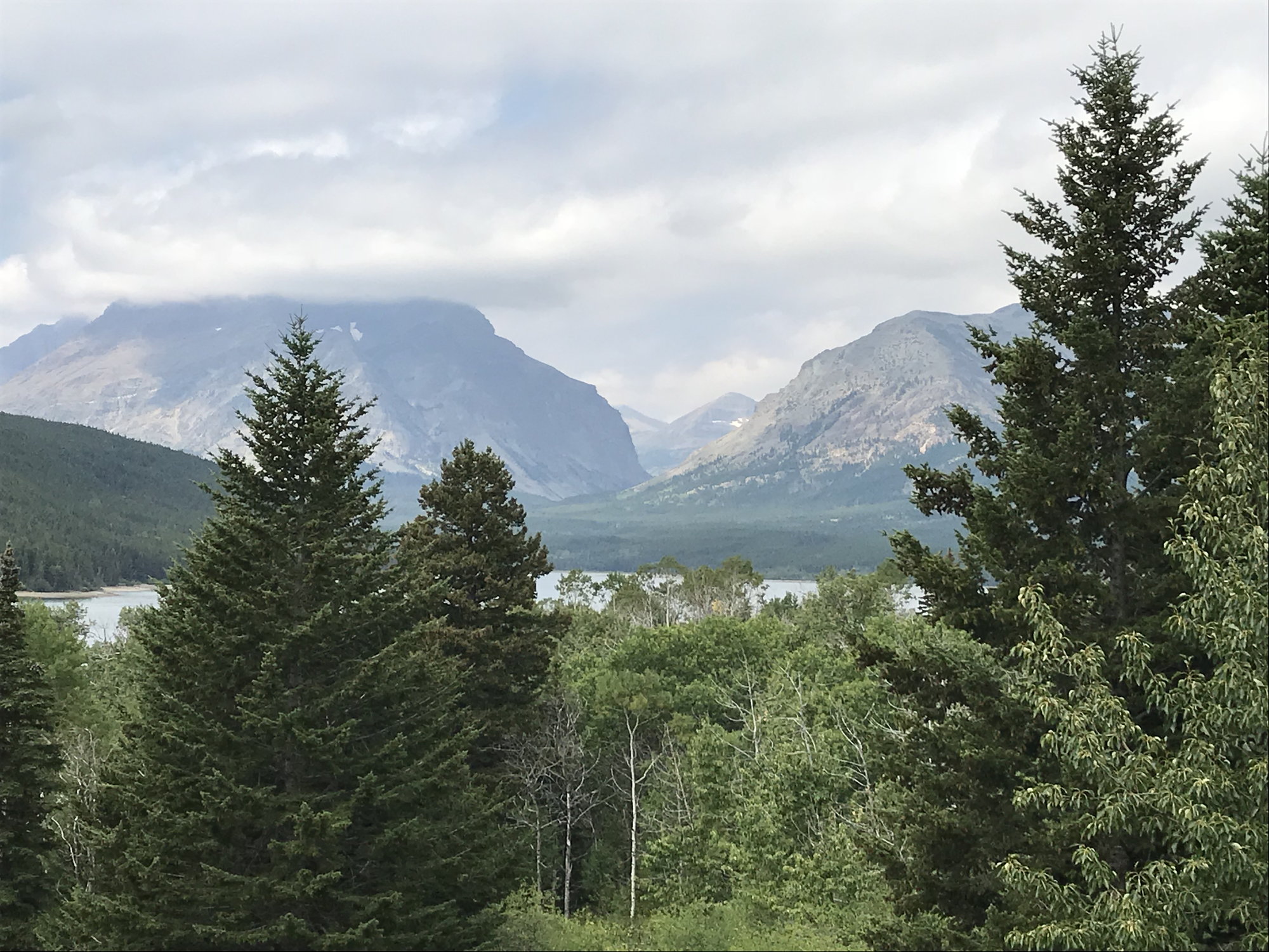
From the woman at the information desk, we learned that Highway 89, the most direct route north up the east side of the park towards St. Mary, was under construction, and thus it would be faster to take the longer road through Browning. This lay across the plains to the east, and we passed a grazing herd of buffalo along the way. We drove through Browning, the capital of the Blackfeet Indian Reservation, and then sped along largely empty highways across the treeless hills that eventually fed us back into Highway 89 north of the construction zone. Then the St. Mary Valley came into view � a long, winding lake sandwiched between tall blue mountains � off to the west.
View west from Highway 89 towards the St. Mary Valley
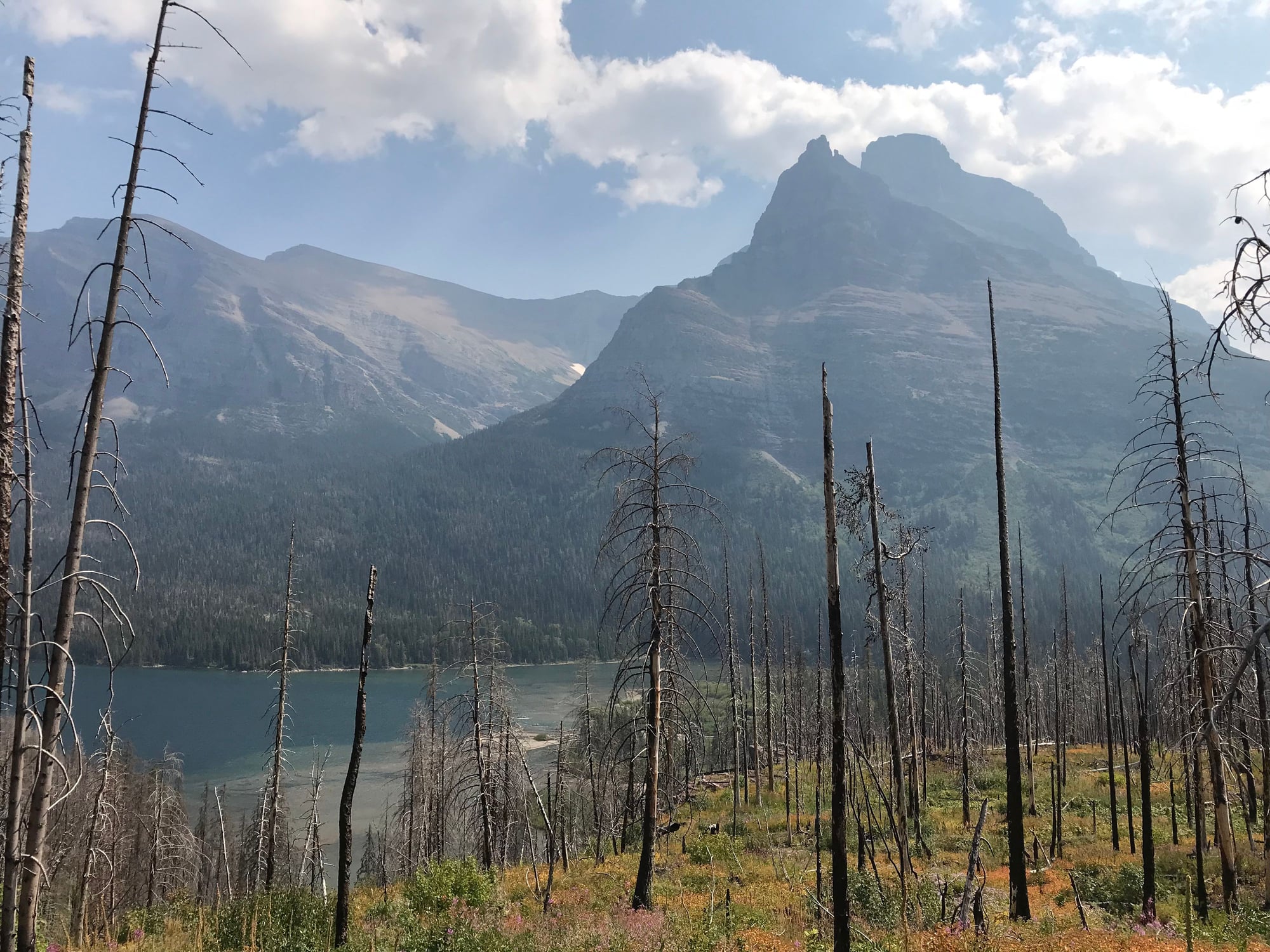
Spread across the hills in the foreground of that grand vista, however, were the bare gray sticks of trees that died during a fire in 2013. And that wouldn�t be the last marks of wildfires that we would see that afternoon, for an hour or so later we were making our way through the now-regenerating landscape along the northwest side of St. Mary Lake where the Reynolds Creek Fire had raged in July 2015. Add to that the Sprague Fire east of Lake MacDonald the previous summer that destroyed the century-old Sperry Chalet, and you can see that Glacier is experiencing a major fire on average about every other year. This reflects the surprising fact that Glacier � �the crown of the continent� � has already suffered the 2 degrees centigrade temperature rise that has always been such a red flag in the climate change literature. With drier, hotter conditions � like those the week before our arrival � there is more heat lightning and, when that lightning strikes dry trees, a greater chance of fire and sometimes significant conflagrations.
We reached the NPS Information Center at the St. Mary (eastern) entrance to the Going-to-the-Sun Road at 2:30. The parking lot was full, when we first arrived, but after a couple of passes, I was able to snag a space when someone left. We caught one of the NPS shuttles heading up the road a few minutes later, planning on taking the St. Mary Falls/Virginia Falls trail at the western end of St. Mary Lake, which the shuttle bus driver assured us we would love as we were disembarking.
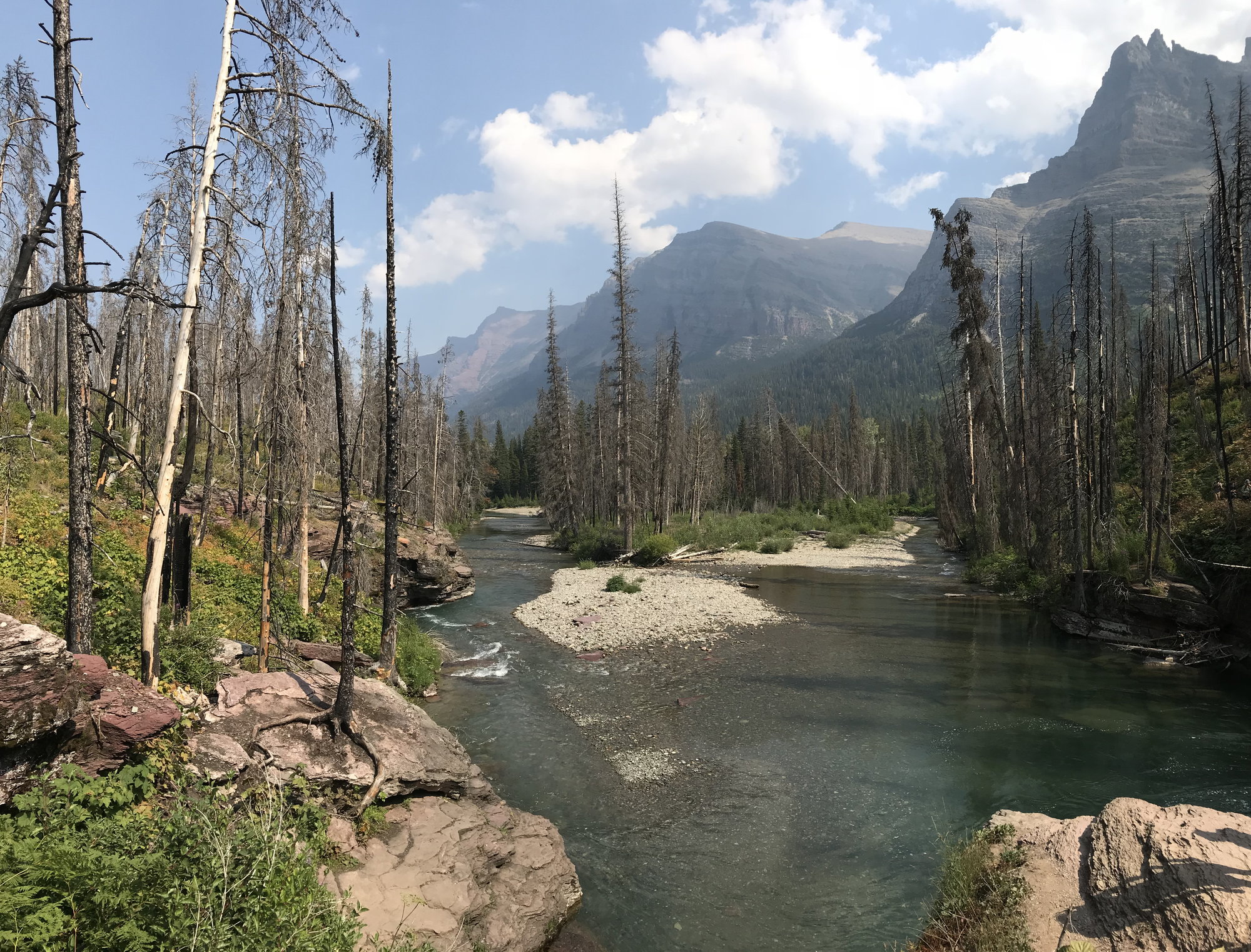
She was right. This trail is only 3.4 miles long, but it packs a lot of natural interest, scenic beauty, and photographic opportunities into its manageable length. First, we passed through the burn area of the Reynolds Creek fire, which after three years was already rejuvenating itself with a thick carpet of grasses, dense wild flowers (particularly purple asters), and pine seedlings. Before us to the south loomed the majestic peaks of Red Eagle, Mahtotopa, and Little Chief Mountains, while Going to the Sun Mountain looked over our shoulders from the north. The trail took us across broad, flat slabs of red argillite (also known as mudstone), which you will see throughout the park.
The first part of the Virginia Falls Trail -- that's Mahtotopa Mountain on the left, and Little Chief Mountain on the right
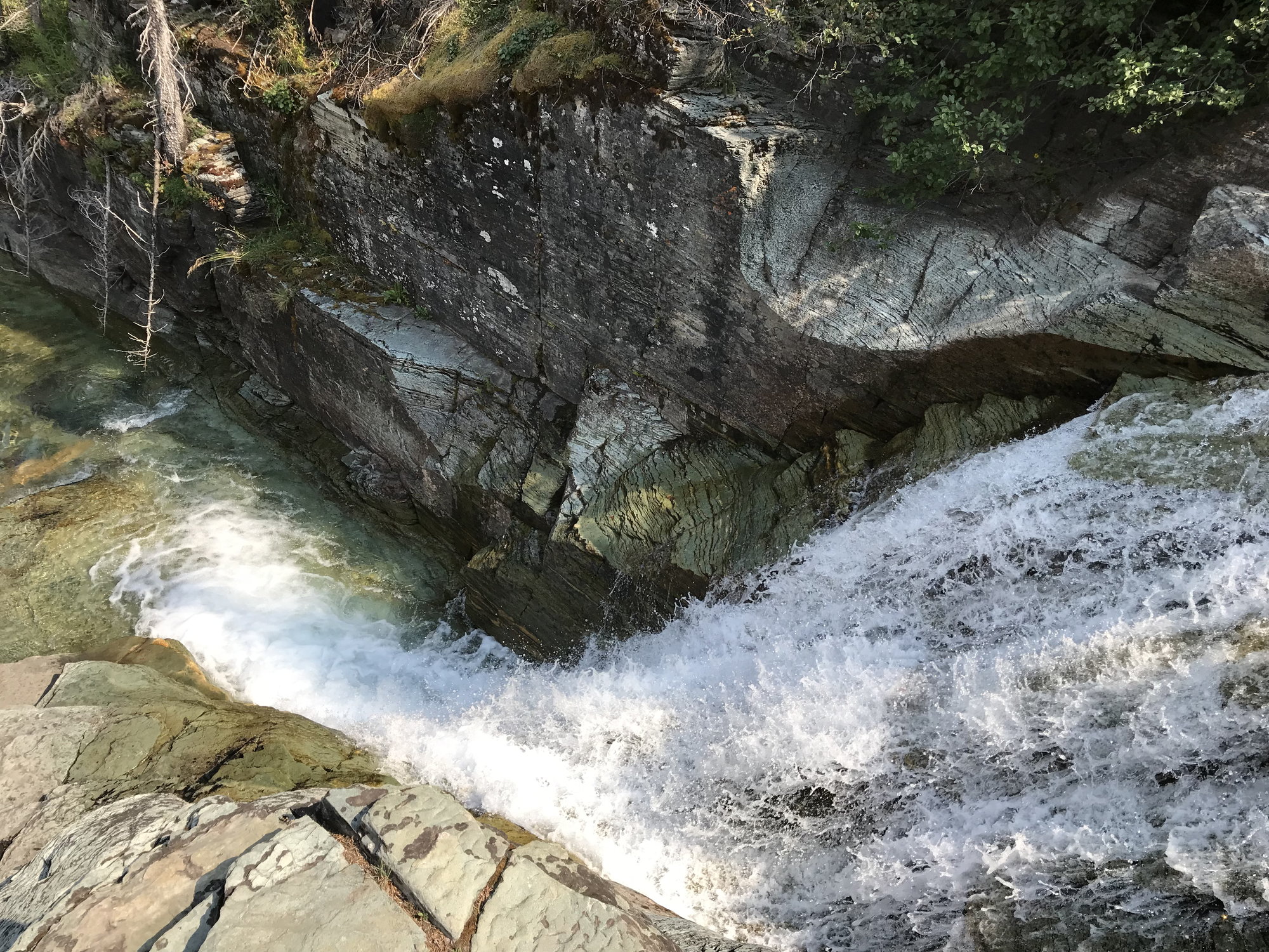
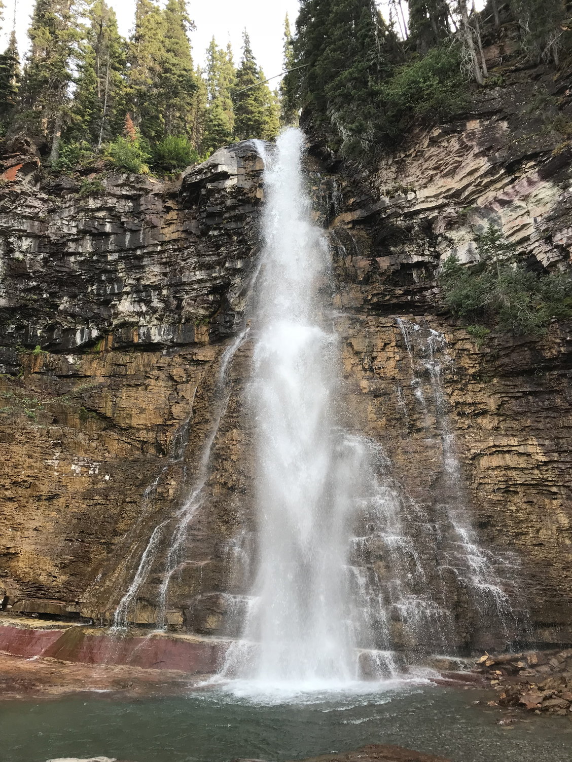
After about a mile of walking, we approached the St. Mary River, which still has a short distance to run before losing itself into the lake. Next, you come to a footbridge just below St. Mary Falls, a triple cascade that is only 35 feet high but that makes up for that with the compressed volume and roar of its water as it powers through a narrow cleft. The temperature was already comfortable � high 70's, low 80's � but the spray from the falls generated a refreshingly cool breeze as we crossed the bridge and then started to climb steeply on the other side as the trail continued towards Virginia Falls.
Looking down the St. Mary River towards the lake, with Mahtotopa Mountain on the right and Red Eagle Mountain in the distance
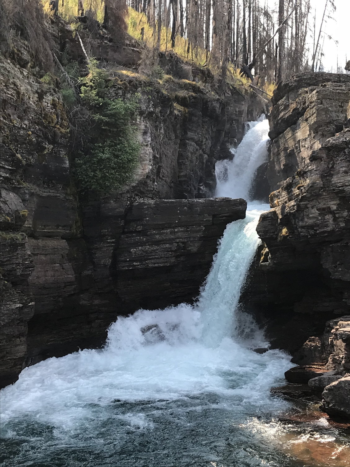
St. Mary Falls
Because Virginia Falls was still supposedly three-quarters of a mile away, I was quite surprised when after just a few minutes of climbing we came across another, higher waterfall as Virginia Creek descended in several tiers to its confluence with the St. Mary River. We all loved this waterfall, and delighted in exploring it and snapping pictures from various vantage points. We could easily have been satisfied with this as the culmination of our hike, but a passing hiker helpfully explained that delightful as this was, it was actually just some no-name waterfall that the Glacier authorities couldn�t even be troubled to christen, and that Virginia Falls � which was �not to be missed� � still lay further up the trail. So we continued on, and after passing through a mature forest that had escaped the Reynolds Creek fire, we could again hear roaring water ahead.
"No Name" Falls
Virginia Falls plummets in a sheer, unbroken drop over the edge of a cliff for some 50-60 feet, then races downhill over terraces of mudstone through a series of cascades, short falls, and pools that tempt you to further exploration. I had learned in Oregon�s waterfall country a couple of years earlier that no still photo can do justice to running water like a video does, so I made several in an effort to preserve the memory of this beautiful place that made our spirits soar like the birds coasting above us on the thermals. (Another thing that made me smile was the way each successive group of hikers arriving at the foot of Virginia Falls stepped up and offered to photograph their predecessors, after which the next group on the scene returned the favor for them.)
Virginia Falls
The view of Going-to-the-Sun Mountain as seen from the Virginia Falls Trail
We made it back to the shuttle stop by 4:45, and given the line of people ahead of us, weren�t particularly surprised that we had to wait for a second bus to come along 15-20 minutes later. Everyone seemed tired and quiet on the ride back to the NPS Visitor Center, but the views of St. Mary Lake off to the right were exceptional.
The Visitor�s Center was closed by the time we got back there, so I had to miss seeing a topographical map my daughter had been impressed by that showed the shrinking of the glaciers over the years. On the drive back south down US 89 I missed the turn for Browning, and by the time I realized my mistake, we decided just to continue on through the construction zone. This was only about three miles, and it was slow going, but once we got past it, there were wonderful views into Two Medicine Valley to the south � although the many sharp curves and bends and unprotected drops along this stretch of the highway mean that the designated driver won�t get to fully enjoy them.
We tried to get dinner at Serrano�s � a legendary Mexican place in East Glacier � but it was so mobbed when we got there (which is its normal state) that we opted to have dinner in the main dining room at the Glacier Park Lodge instead. Our waiter there was a Turk from Istanbul (and not the only one among the wait staff there). The final 60 mile drive back to Apgar up Highway 2 was something of an ordeal. I was pretty exhausted, darkness soon descended, and the road has some tight curves and steep climbs and descents, so you have to take it carefully. By the day�s end, we had driven fully 200 miles that day. But if it had been taxing, it had also been magnificent.
Morning at the Village Inn
I was told by the Inn�s manager that Going-to-The-Sun Road remained closed where we had seen the roadblock established the night before, which was hardly a surprise. Looking north up the lake, the whole northern half of it was now obscured by smoke, although the air remained clear thus far around Apgar. We learned that the evacuees from the Lake McDonald Lodge were now being housed in a refugee tent compound somewhere nearby that the awesomely efficient Park Service had conjured up on remarkably short notice.
The view north up Lake McDonald that morning
We had breakfast at Eddie�s Caf�, an informal, family-oriented establishment that is the only restaurant at Apgar. But for breakfast, in particular, it was great: hearty, classic offerings, well-prepared, and reasonable prices. I had three huge pancakes and sausages, so I started the day�s adventure well-prepared.
We set off in our rental car down Route 2 at 10:45 a.m. Because Going-to-The-Sun Road is the only east-west communication across the park, its closure meant that we would have to drive along the park�s western and southern boundaries to get over to the east side to see any major sights. (There would have been some trails we could have done by going north, but none of them were on my list and none of the park�s major attractions were up there.) So we made our objective the Two Medicine Area at the southeastern corner of the Park, a 55-mile drive away.
We got there in about an hour. Two Medicine is a valley with a couple of lakes, a number of trails, one or two waterfalls, and a surrounding girdle of mountains. As we were coming down the approach road, it looked stunning, certainly well-worth a visit: but, uh oh, what�s this long line of cars backed up from the entrance kiosk?
Distant View of the Two Medicine Area
When we finally inched up to it, we learned that owing to the limited number of parking places in this rather self-contained area of the park, they were unable to admit any other cars for some unknown period of time. So scratch that.
What would Plan B be? We drove back into East Glacier and stopped off at the Glacier Park Lodge, which we had passed by earlier. It�s another Park Service accommodation that was originally built back in 1915 by the Northern Pacific Railroad, a few years after they first managed to run a pair of tracks through these parts (more on that later). It�s built of dark, massive logs of Douglas Fir with a cathedral-like lobby and is worth stopping to see in its own right.
The Glacier Lake Lodge (1913)
There was also a tourist information office where we could make some inquiries. One of the first things we noticed there was a page (shown below) listing all of the trails and areas around the park that were closed either to due to fire activity or bear activity. The number of the latter was a reminder that as the summer wears on and food gets exhausted at the higher elevations, the bears push down closer to the areas that are more heavily trafficked by tourists. So that�s another aspect of the natural world that you should factor into scheduling a visit to Glacier.
Notice of Trail Closings and Postings (warnings) -- and the reasons why
From the woman at the information desk, we learned that Highway 89, the most direct route north up the east side of the park towards St. Mary, was under construction, and thus it would be faster to take the longer road through Browning. This lay across the plains to the east, and we passed a grazing herd of buffalo along the way. We drove through Browning, the capital of the Blackfeet Indian Reservation, and then sped along largely empty highways across the treeless hills that eventually fed us back into Highway 89 north of the construction zone. Then the St. Mary Valley came into view � a long, winding lake sandwiched between tall blue mountains � off to the west.
View west from Highway 89 towards the St. Mary Valley
Spread across the hills in the foreground of that grand vista, however, were the bare gray sticks of trees that died during a fire in 2013. And that wouldn�t be the last marks of wildfires that we would see that afternoon, for an hour or so later we were making our way through the now-regenerating landscape along the northwest side of St. Mary Lake where the Reynolds Creek Fire had raged in July 2015. Add to that the Sprague Fire east of Lake MacDonald the previous summer that destroyed the century-old Sperry Chalet, and you can see that Glacier is experiencing a major fire on average about every other year. This reflects the surprising fact that Glacier � �the crown of the continent� � has already suffered the 2 degrees centigrade temperature rise that has always been such a red flag in the climate change literature. With drier, hotter conditions � like those the week before our arrival � there is more heat lightning and, when that lightning strikes dry trees, a greater chance of fire and sometimes significant conflagrations.
We reached the NPS Information Center at the St. Mary (eastern) entrance to the Going-to-the-Sun Road at 2:30. The parking lot was full, when we first arrived, but after a couple of passes, I was able to snag a space when someone left. We caught one of the NPS shuttles heading up the road a few minutes later, planning on taking the St. Mary Falls/Virginia Falls trail at the western end of St. Mary Lake, which the shuttle bus driver assured us we would love as we were disembarking.
She was right. This trail is only 3.4 miles long, but it packs a lot of natural interest, scenic beauty, and photographic opportunities into its manageable length. First, we passed through the burn area of the Reynolds Creek fire, which after three years was already rejuvenating itself with a thick carpet of grasses, dense wild flowers (particularly purple asters), and pine seedlings. Before us to the south loomed the majestic peaks of Red Eagle, Mahtotopa, and Little Chief Mountains, while Going to the Sun Mountain looked over our shoulders from the north. The trail took us across broad, flat slabs of red argillite (also known as mudstone), which you will see throughout the park.
The first part of the Virginia Falls Trail -- that's Mahtotopa Mountain on the left, and Little Chief Mountain on the right
After about a mile of walking, we approached the St. Mary River, which still has a short distance to run before losing itself into the lake. Next, you come to a footbridge just below St. Mary Falls, a triple cascade that is only 35 feet high but that makes up for that with the compressed volume and roar of its water as it powers through a narrow cleft. The temperature was already comfortable � high 70's, low 80's � but the spray from the falls generated a refreshingly cool breeze as we crossed the bridge and then started to climb steeply on the other side as the trail continued towards Virginia Falls.
Looking down the St. Mary River towards the lake, with Mahtotopa Mountain on the right and Red Eagle Mountain in the distance
St. Mary Falls
Because Virginia Falls was still supposedly three-quarters of a mile away, I was quite surprised when after just a few minutes of climbing we came across another, higher waterfall as Virginia Creek descended in several tiers to its confluence with the St. Mary River. We all loved this waterfall, and delighted in exploring it and snapping pictures from various vantage points. We could easily have been satisfied with this as the culmination of our hike, but a passing hiker helpfully explained that delightful as this was, it was actually just some no-name waterfall that the Glacier authorities couldn�t even be troubled to christen, and that Virginia Falls � which was �not to be missed� � still lay further up the trail. So we continued on, and after passing through a mature forest that had escaped the Reynolds Creek fire, we could again hear roaring water ahead.
"No Name" Falls
Virginia Falls plummets in a sheer, unbroken drop over the edge of a cliff for some 50-60 feet, then races downhill over terraces of mudstone through a series of cascades, short falls, and pools that tempt you to further exploration. I had learned in Oregon�s waterfall country a couple of years earlier that no still photo can do justice to running water like a video does, so I made several in an effort to preserve the memory of this beautiful place that made our spirits soar like the birds coasting above us on the thermals. (Another thing that made me smile was the way each successive group of hikers arriving at the foot of Virginia Falls stepped up and offered to photograph their predecessors, after which the next group on the scene returned the favor for them.)
Virginia Falls
The view of Going-to-the-Sun Mountain as seen from the Virginia Falls Trail
We made it back to the shuttle stop by 4:45, and given the line of people ahead of us, weren�t particularly surprised that we had to wait for a second bus to come along 15-20 minutes later. Everyone seemed tired and quiet on the ride back to the NPS Visitor Center, but the views of St. Mary Lake off to the right were exceptional.
The Visitor�s Center was closed by the time we got back there, so I had to miss seeing a topographical map my daughter had been impressed by that showed the shrinking of the glaciers over the years. On the drive back south down US 89 I missed the turn for Browning, and by the time I realized my mistake, we decided just to continue on through the construction zone. This was only about three miles, and it was slow going, but once we got past it, there were wonderful views into Two Medicine Valley to the south � although the many sharp curves and bends and unprotected drops along this stretch of the highway mean that the designated driver won�t get to fully enjoy them.
We tried to get dinner at Serrano�s � a legendary Mexican place in East Glacier � but it was so mobbed when we got there (which is its normal state) that we opted to have dinner in the main dining room at the Glacier Park Lodge instead. Our waiter there was a Turk from Istanbul (and not the only one among the wait staff there). The final 60 mile drive back to Apgar up Highway 2 was something of an ordeal. I was pretty exhausted, darkness soon descended, and the road has some tight curves and steep climbs and descents, so you have to take it carefully. By the day�s end, we had driven fully 200 miles that day. But if it had been taxing, it had also been magnificent.
Aug 23rd, 2020 | 05:05 PM
#6
Original Poster
Joined: Oct 2003
Posts: 314
Likes: 4
August 14th, Tuesday: Logan Pass and Marvelous Megafauna
This was our last full day at Apgar, which meant doing another 200-mile round trip to get to the east side of the park. We had breakfast again at Eddie�s Caf� (loved the chicken-fried steak, as did my son) and managed to get on Highway 2 by 10:00. In pursuit of some variety, we stopped along the way (milepost 182.6) to hike down to a cliff face above the Flathead River called the Goat Lick, which our Moon Guide indicated attracts mountain goats, but we didn�t see any. (Much later, I saw that in the guide�s separate section on wildlife, the author reported that goats are most likely to be seen at the Goat Lick in the late spring.) As the day developed, however, our unsuccessful pursuit of mountain goats at the Goat Lick would prove to have been completely superfluous.
We also stopped at Silver Stairs Falls (milepost 188.2), which the Moon Guide said �tumbl[es] thousands of feet� (?? Angel Falls, move over?) and is supposed to be pretty dramatic in June and July when the snow runoff is at its peak. But by mid-August, after many 90-degree and a few 100-degree days, the rocky cliff looming above us was merely shaking off drops of water like a dog after a bath.
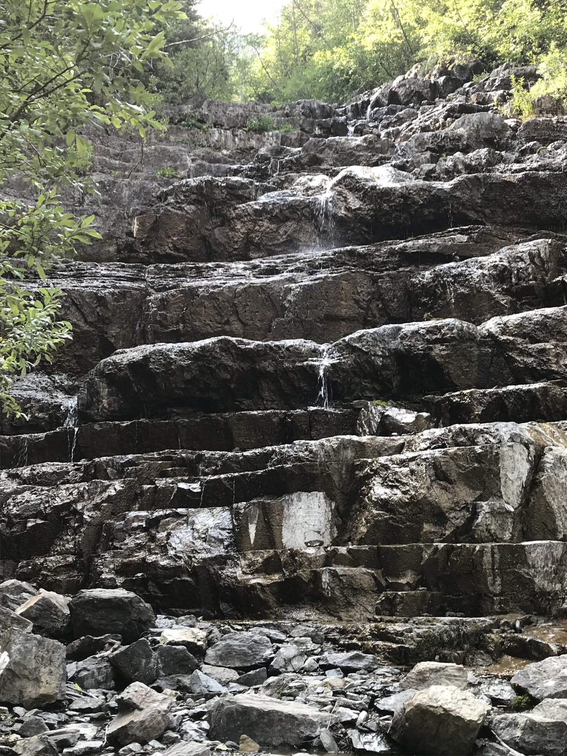
Silver Stairs Falls, at low water
With these stops, we reached the Two Medicine entrance area at almost the same time we had the day before, and with the same result: no entry. However, I have encountered some suggestions in on-line videos that given the limited parking capacity in Two Medicine, this is capable of happening in Glacier�s peak tourist season even without a fire blocking Going-to-the-Sun Road. Moral: if you want to see Two Medicine, get there early (which is actually pretty good advice for Glacier in general).
We made a pit stop by the Glacier Lake Lodge, then followed our trail of the day before back through Browning. This time, however, we stopped to see the Museum of the Plains Indian, a federal government economic development effort from the 1940's that, while it lacked modern-day museum display razzle-dazzle, we nevertheless found informative and interesting. Its coverage extended beyond the Blackfeet to other plains tribes as well, and was heavy on religion, costume, tools, and hunting techniques and equipment. Photographs were not allowed, however, so I have none to offer.
After the museum, we stopped by the tribal arts and crafts store. The Blackfeet are known for beadwork, so I picked up an elaborate piece depicting a bear silhouetted against the sky that today hangs from one of the shelves in my man cave.
We then continued along our route from the day before back to Highway 89 and on up towards the St. Mary entrance and the eastern end of Going-to-the-Sun Road. The day before, the vistas of the St. Mary Valley had prompted us to pull over repeatedly for photos, but today those views were significantly compromised by the thickening smoke drifting over the Continental Divide from Howe Ridge.
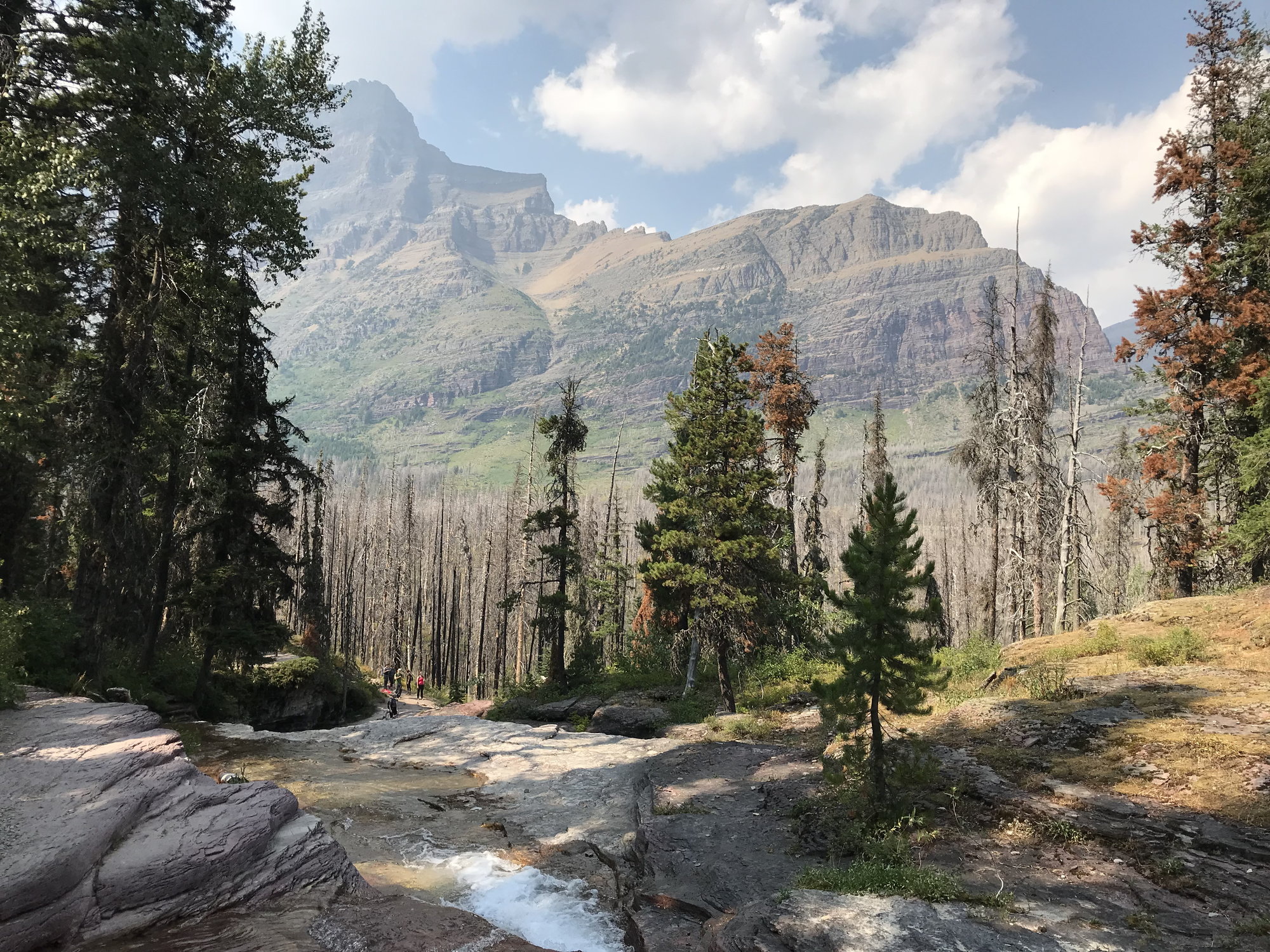
I had assumed we would stop at the NPS Visitor Center at St. Mary and catch the shuttle again, but my family members wanted to go for it and drive, so that�s what we did. As soon as we approached the first parking area, it was clear that the smoke was keeping people away. When we reached the parking area at Logan Pass up at the Continental Divide, we had no problem at all finding space � but it was also evident why this could normally be a very challenging proposition. As you might expect of a parking area located at the top of a mountain pass (with an elevation of 6,646 feet, some 2,200 feet higher than St. Mary, and 3,400 feet above Lake McDonald), there just isn�t that much flat space up there. The Moon Guide said that most days you need to be there before 8:30 to be confident of getting a space. So at least we got that one benefit from the fire.
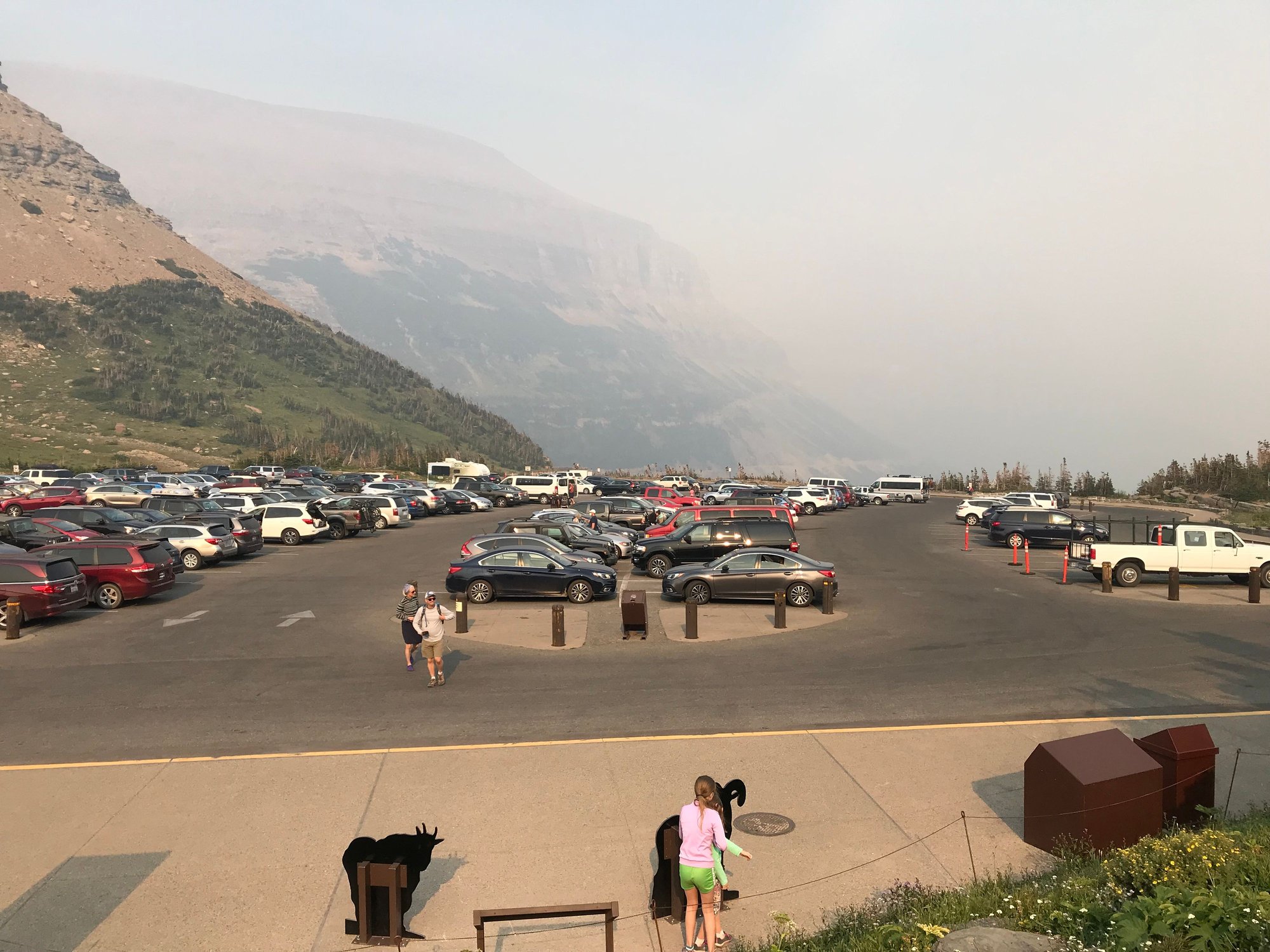
The parking lot at Logan Pass, late afternoon
We walked through the NPS Visitor Center in the pass and enjoyed its diverse collection of stuffed wild animals. Next, we decided to stretch our legs on the highly popular Hidden Lake Trail, which runs 1.5 miles across the alpine tundra to the Hidden Lake Overlook. This is pretty surely the most heavily-trafficked trail in the park, but it wasn�t bad by this point in the afternoon. It starts off as a boardwalk and initially runs through an area called the Hanging Gardens that is dense with mosses and wildflowers watered by streaming rivulets of snow melt coming down from Mount Clements, which looms above you to the right of the trail. There were subalpine daisies, indian paintbrush, shrubby purple penstemon, and stemless goldenweed.
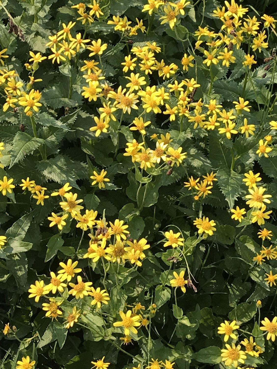
Stemless Goldenweed

Shrubby Purple Penstemon
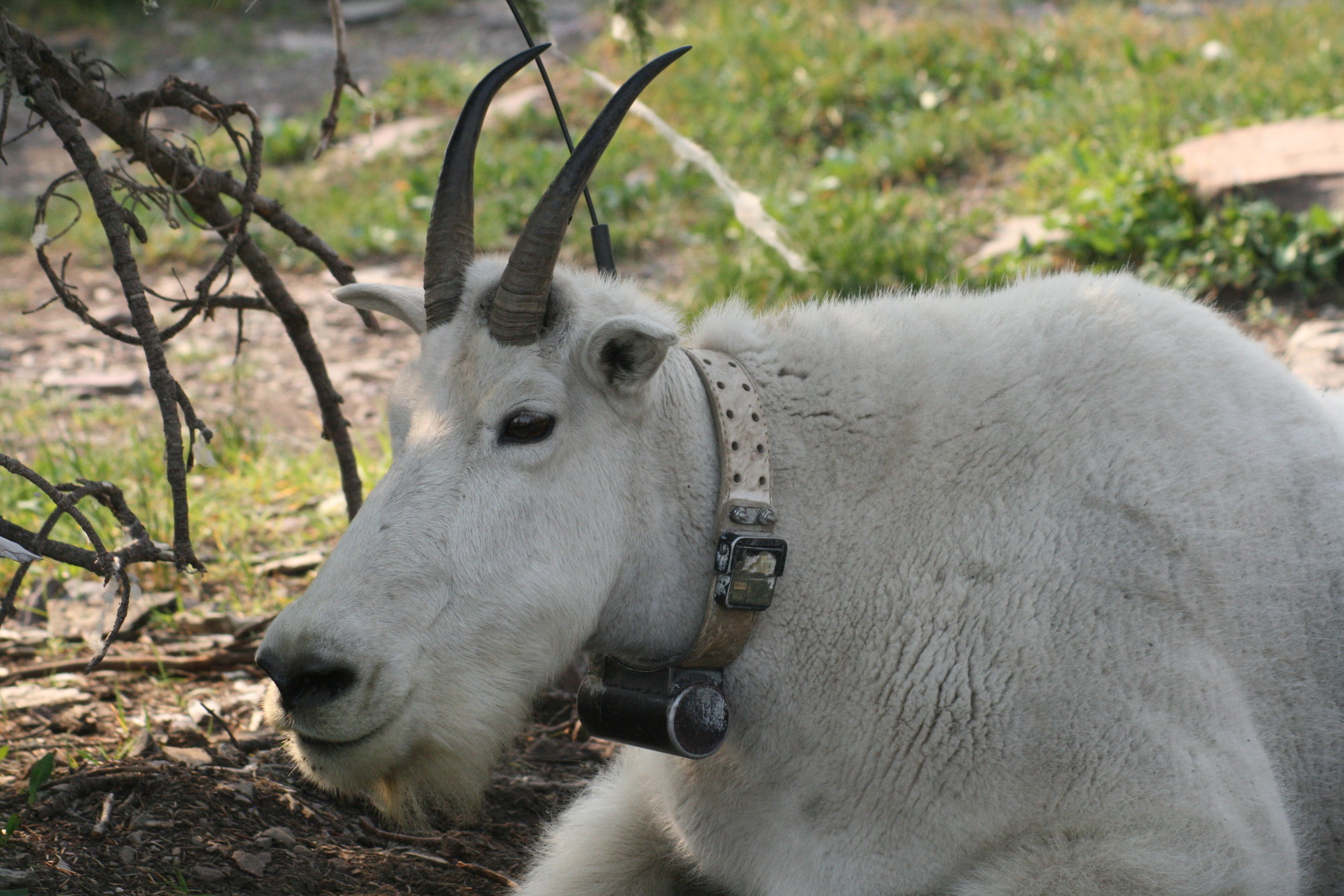
Eventually, at the crest of the trail, you enter into a belt of fir trees just above the overlook. Just as we passed a marker for the Continental Divide at mile 1.2, we looked to the right and saw a mother mountain goat and her calf resting comfortably on the ground only about 75 feet away! We paused to take photos, but they were utterly unfazed by our proximity; the mother had a tracking collar around her neck, so presumably she is somewhat accustomed to the human presence. We remembered how back in 2016 we had been thrilled so see four mountain goats moving across a steep slope in Denali, probably at least a full mile away and looking like the tiny white aphids I occasionally see on garden plants. And now, there they were � making us all feel a little silly about our hike to the Goat Lick a few hours before.

Mother mountain goat and calf
More was to come. We reached the overlook and took in the view of Hidden Lake below us � so named, I presume, because you cannot see if from Logan Pass � but today it was further veiled by a soft layer of gray smoke. It was another 1.5 miles down to the lake, making for a 3-mile round trip, and from both a photographic and a breathing standpoint, there was clearly no reason to proceed any farther. When my daughter and I climbed a bluff behind the overlook to take some pictures of the surrounding peaks, which were still raising their summits above the smoke, we encountered a male mountain goat moving through the trees who likewise seemed completely indifferent to us (he, too, was wearing a tracking collar). He ultimately decided to settle down and make himself comfortable next to a fir tree only about 20 feet away from us: �Don�t mind me,� his manner seemed to say. More pictures.
Mountain goat # 2
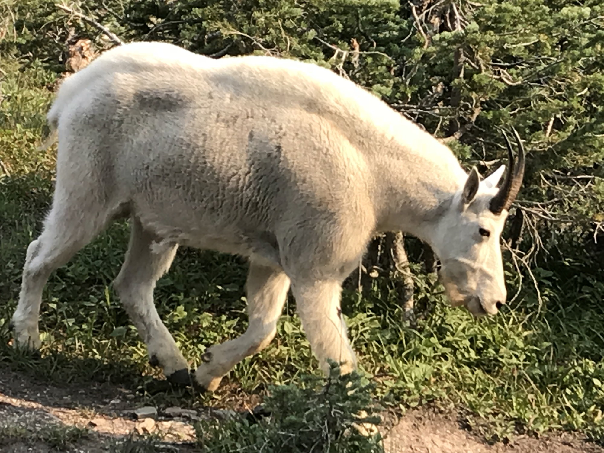
Then we headed back up the trail towards to Continental Divide � where another, younger male mountain goat, unadorned by a tracking collar this time, came ambling down the trail in our direction. We stopped, and so he detoured off the trail (�I know the drill�) and passed by us through the fir trees along the edge of the trail as he continued on his way. A short distance below us, he started to cross the trail and then paused, looking down it towards the Hidden Lake Overlook. This caused an approaching solo hiker who came into sight a moment later to suddenly startle and pull himself up short. The goat contemplated him for a moment, then almost shrugged � �Seen one hiker, you�ve seen �em all� � and ambled on his way. These successive encounters made it very easy to decide which stuffed animal we would get for my grand-niece when we got back to the Visitor�s Center.
Mountain goat # 3
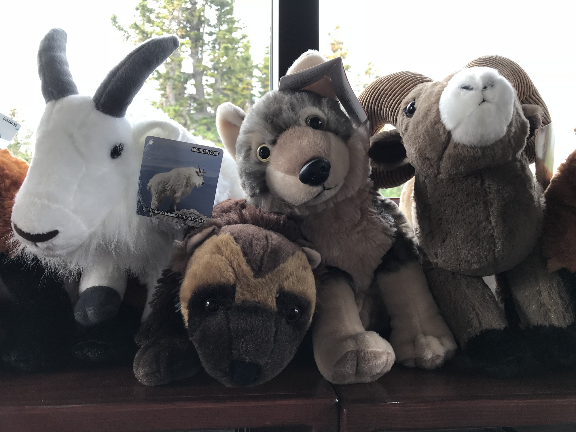
Stuffed animal assortment, Logan Pass Visitor Center
The lowering rays of the late afternoon sun nicely set off the wildflowers as we passed back across the Hanging Gardens at about 4:30 p.m., and we saw several bighorn sheep on the lower slopes of Mount Clement above us. There was also a remarkable marker back outside of the visitor�s center about wolverines, discussing the extensive ranges they cover and their ability to make remarkable time even while scaling Glacier�s daunting peaks (data presumably collected by those tracking collars).
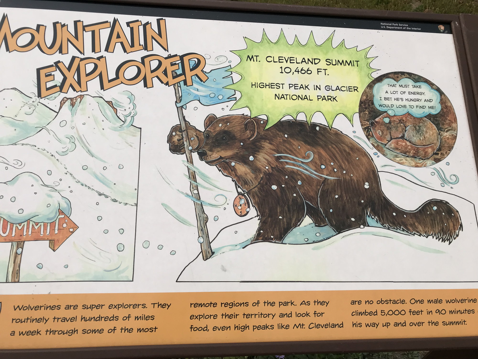
Wolverine marker
And then it was time to commence our 100-mile drive back to Apgar. By this time, St. Mary Lake was largely obscured by smoke as we drove back down the road. We had learned that we could make a quasi-reservation at Serrano�s in East Glacier � just call them and tell them roughly when you expect to get there, and they�ll make sure you get seated when you arrive � and this worked like a charm, notwithstanding the throng waiting outside. It was one of the best Mexican meals I�ve ever had, and the food came in heaping quantities.
Happily, my son (who had also started out driving that morning) agreed to shoulder the driving duties again for the final 60-mile leg back to Apgar. We got in around 9 p.m. While it was still a very good day, the existence of the fire had clearly been more of a problem (except in terms of finding parking at Logan Pass) than it had been the day before.
We also stopped at Silver Stairs Falls (milepost 188.2), which the Moon Guide said �tumbl[es] thousands of feet� (?? Angel Falls, move over?) and is supposed to be pretty dramatic in June and July when the snow runoff is at its peak. But by mid-August, after many 90-degree and a few 100-degree days, the rocky cliff looming above us was merely shaking off drops of water like a dog after a bath.
Silver Stairs Falls, at low water
With these stops, we reached the Two Medicine entrance area at almost the same time we had the day before, and with the same result: no entry. However, I have encountered some suggestions in on-line videos that given the limited parking capacity in Two Medicine, this is capable of happening in Glacier�s peak tourist season even without a fire blocking Going-to-the-Sun Road. Moral: if you want to see Two Medicine, get there early (which is actually pretty good advice for Glacier in general).
We made a pit stop by the Glacier Lake Lodge, then followed our trail of the day before back through Browning. This time, however, we stopped to see the Museum of the Plains Indian, a federal government economic development effort from the 1940's that, while it lacked modern-day museum display razzle-dazzle, we nevertheless found informative and interesting. Its coverage extended beyond the Blackfeet to other plains tribes as well, and was heavy on religion, costume, tools, and hunting techniques and equipment. Photographs were not allowed, however, so I have none to offer.
After the museum, we stopped by the tribal arts and crafts store. The Blackfeet are known for beadwork, so I picked up an elaborate piece depicting a bear silhouetted against the sky that today hangs from one of the shelves in my man cave.
We then continued along our route from the day before back to Highway 89 and on up towards the St. Mary entrance and the eastern end of Going-to-the-Sun Road. The day before, the vistas of the St. Mary Valley had prompted us to pull over repeatedly for photos, but today those views were significantly compromised by the thickening smoke drifting over the Continental Divide from Howe Ridge.
I had assumed we would stop at the NPS Visitor Center at St. Mary and catch the shuttle again, but my family members wanted to go for it and drive, so that�s what we did. As soon as we approached the first parking area, it was clear that the smoke was keeping people away. When we reached the parking area at Logan Pass up at the Continental Divide, we had no problem at all finding space � but it was also evident why this could normally be a very challenging proposition. As you might expect of a parking area located at the top of a mountain pass (with an elevation of 6,646 feet, some 2,200 feet higher than St. Mary, and 3,400 feet above Lake McDonald), there just isn�t that much flat space up there. The Moon Guide said that most days you need to be there before 8:30 to be confident of getting a space. So at least we got that one benefit from the fire.
The parking lot at Logan Pass, late afternoon
We walked through the NPS Visitor Center in the pass and enjoyed its diverse collection of stuffed wild animals. Next, we decided to stretch our legs on the highly popular Hidden Lake Trail, which runs 1.5 miles across the alpine tundra to the Hidden Lake Overlook. This is pretty surely the most heavily-trafficked trail in the park, but it wasn�t bad by this point in the afternoon. It starts off as a boardwalk and initially runs through an area called the Hanging Gardens that is dense with mosses and wildflowers watered by streaming rivulets of snow melt coming down from Mount Clements, which looms above you to the right of the trail. There were subalpine daisies, indian paintbrush, shrubby purple penstemon, and stemless goldenweed.
Stemless Goldenweed
Shrubby Purple Penstemon
Eventually, at the crest of the trail, you enter into a belt of fir trees just above the overlook. Just as we passed a marker for the Continental Divide at mile 1.2, we looked to the right and saw a mother mountain goat and her calf resting comfortably on the ground only about 75 feet away! We paused to take photos, but they were utterly unfazed by our proximity; the mother had a tracking collar around her neck, so presumably she is somewhat accustomed to the human presence. We remembered how back in 2016 we had been thrilled so see four mountain goats moving across a steep slope in Denali, probably at least a full mile away and looking like the tiny white aphids I occasionally see on garden plants. And now, there they were � making us all feel a little silly about our hike to the Goat Lick a few hours before.
Mother mountain goat and calf
More was to come. We reached the overlook and took in the view of Hidden Lake below us � so named, I presume, because you cannot see if from Logan Pass � but today it was further veiled by a soft layer of gray smoke. It was another 1.5 miles down to the lake, making for a 3-mile round trip, and from both a photographic and a breathing standpoint, there was clearly no reason to proceed any farther. When my daughter and I climbed a bluff behind the overlook to take some pictures of the surrounding peaks, which were still raising their summits above the smoke, we encountered a male mountain goat moving through the trees who likewise seemed completely indifferent to us (he, too, was wearing a tracking collar). He ultimately decided to settle down and make himself comfortable next to a fir tree only about 20 feet away from us: �Don�t mind me,� his manner seemed to say. More pictures.
Mountain goat # 2
Then we headed back up the trail towards to Continental Divide � where another, younger male mountain goat, unadorned by a tracking collar this time, came ambling down the trail in our direction. We stopped, and so he detoured off the trail (�I know the drill�) and passed by us through the fir trees along the edge of the trail as he continued on his way. A short distance below us, he started to cross the trail and then paused, looking down it towards the Hidden Lake Overlook. This caused an approaching solo hiker who came into sight a moment later to suddenly startle and pull himself up short. The goat contemplated him for a moment, then almost shrugged � �Seen one hiker, you�ve seen �em all� � and ambled on his way. These successive encounters made it very easy to decide which stuffed animal we would get for my grand-niece when we got back to the Visitor�s Center.
Mountain goat # 3
Stuffed animal assortment, Logan Pass Visitor Center
The lowering rays of the late afternoon sun nicely set off the wildflowers as we passed back across the Hanging Gardens at about 4:30 p.m., and we saw several bighorn sheep on the lower slopes of Mount Clement above us. There was also a remarkable marker back outside of the visitor�s center about wolverines, discussing the extensive ranges they cover and their ability to make remarkable time even while scaling Glacier�s daunting peaks (data presumably collected by those tracking collars).
Wolverine marker
And then it was time to commence our 100-mile drive back to Apgar. By this time, St. Mary Lake was largely obscured by smoke as we drove back down the road. We had learned that we could make a quasi-reservation at Serrano�s in East Glacier � just call them and tell them roughly when you expect to get there, and they�ll make sure you get seated when you arrive � and this worked like a charm, notwithstanding the throng waiting outside. It was one of the best Mexican meals I�ve ever had, and the food came in heaping quantities.
Happily, my son (who had also started out driving that morning) agreed to shoulder the driving duties again for the final 60-mile leg back to Apgar. We got in around 9 p.m. While it was still a very good day, the existence of the fire had clearly been more of a problem (except in terms of finding parking at Logan Pass) than it had been the day before.
Aug 26th, 2020 | 04:35 PM
#7
Original Poster
Joined: Oct 2003
Posts: 314
Likes: 4
An NPS Video and Flickr Photo Album about the Howe Ridge Fire
Since I started this project, I�ve found some other materials that were of interest to me about the Howe Ridge fire and its behavior. The first is a NPS photo album (with 35 photos and 3 videos) that was posted on Flickr concerning the Howe Ridge fire that covers its whole history, which extended for several months � apparently, it wasn�t completely extinguished until the snows came in November. There�s a particularly striking photo (number 3 in the sequence) that shows what it looked like earlier on Sunday, when it was a single relatively small circle of smoking trees near the top of the ridge. Indeed, the album demonstrates very dramatically how the fire developed over the course of that Sunday afternoon and evening. There are also some striking shots of what Howe Ridge looked like in November after the fire was finally extinguished.
About a year later, the NPS also produced a 27-minute instructional video about the first 36 hours of the Howe Ridge fire, which seems to have been designed to explore why it blew up the way it did that Sunday, and whether there was anything that could have been done to prevent that.
This video makes the point about the severity of the wildfire problem all across California and the Pacific Northwest at that time. The fact that so many firefighting crews were already tied down elsewhere seems to have contributed to the difficulty of getting the fire under control in its early stages.
I also thought it was striking to learn from the video by EnjoyYourParks that I posted earlier that the Howe Ridge fire began exactly on the same date (August 11th) as the Sprague fire a year earlier in 2017. Howe Ridge itself had previously burned back in 2003.
Trending Topics
Aug 27th, 2020 | 04:23 PM
#8
Original Poster
Joined: Oct 2003
Posts: 314
Likes: 4
A Farewell to Apgar
Before we depart the Village Inn and the Apgar area, I thought I would post a photo of one of our rooms, along with a couple of other shots to give a sense of Apgar and its offerings.
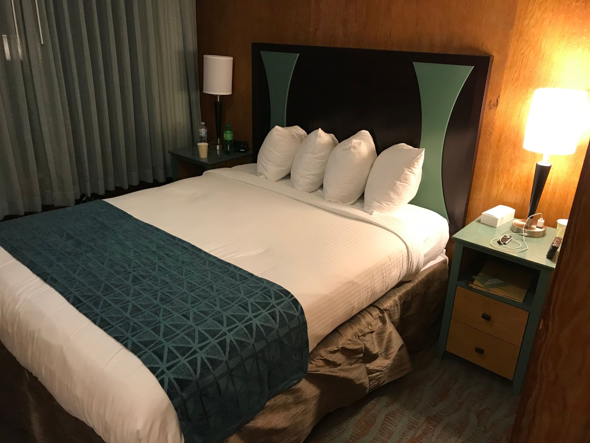
A room at the Village Inn at Apgar - definitely 1950's retro!

Boats and boat rates at Apgar -- and a reflection of the author!

Morning at Apgar
A room at the Village Inn at Apgar - definitely 1950's retro!
Boats and boat rates at Apgar -- and a reflection of the author!
Morning at Apgar
Aug 27th, 2020 | 05:07 PM
#9
Original Poster
Joined: Oct 2003
Posts: 314
Likes: 4
August 15th, Wednesday: Marias Pass, the Blackfeet, and the Many Glacier Area
This was our final morning at Apgar. I was out and taking photos early (for me), and then we had a last breakfast at Eddie�s Caf� before heading south on Route 2 for the third and final time (in that direction). To break up the routine this morning, we stopped in Marias Pass to take a closer look at the monuments and markers we had observed there over the previous two days. It was definitely worth the short stop.
The Theodore Roosevelt Memorial Obelisk in Marias Pass
Mountain passes seem to come in two principal types: the ones where there�s a clear notch or saddle in the surrounding mountains, a stupendous view, and a dual succession of hairpin switchbacks on both the way up and down. And then there are the ones that cause you to say �There�s a pass here? Really??� Marias Pass falls squarely into the second category, although this doesn�t mean it wasn�t important.
Marias Pass lies at roughly the mid-point of Highway 2's passage along the southeastern boundary of Glacier NP. Here, the highway crosses the Continental Divide. With an elevation of 5,216 feet, our Moon Guide noted that it is the lowest pass through the which the Continental Divide runs north of New Mexico. This means that it is both (a) not glamorous and (b) highly useful, especially if you happen to be a railroad route surveyor or a highway engineer.
The Lewis & Clark Expedition spent some time searching for an easily manageable pass across the northern Rockies, but it never found one. On the eastbound return trip in the summer of 1806, Meriwether Lewis took three men and explored up the Marias River, trying to identify the northern limit of the Louisiana Territory. (William Clark was exploring further south along the Yellowstone River at the time.) He named that river after his cousin Maria � it was originally �Maria�s River�, but at some point the possessive apostrophe became lost to history. The river in turn gave its name to the pass, which is curious, as its nearest point is about 65 miles to the east. The closest Lewis and his companions came to the pass in July 1806 was some 35 miles away, when they camped at a spot 12 miles northeast of Browning.
Of course, the Blackfeet had always known the pass was here. But for the white men coming into this parts, it remained a subject of rumor and speculation, like a northern Rockies analogue to the Lost Dutchman�s Mine. Remarkably enough, the pass almost managed to remain undiscovered through the entire 19th century, despite a major effort to locate it in 1853-1855 that was organized by Isaac Stevens, the Governor of Washington Territory. Finally, in 1889, a mere 84 years after Lewis and Clark first tried to find it, James Jerome Hill, the President of the Great Northern Railroad, frustrated by the decades of tantalizing rumors, dispatched John F. Stevens, the railroad�s chief surveying engineer (no relation to Governor Isaac), to find it.
If you�re like me, you will probably assume that Stevens commanded a substantial and well-appointed expedition that set out for the upcountry Rockies at some seasonally appropriate time like, say, the late spring. By that time, the Indian Wars were almost over , and you would also think that the United States Army could have been persuaded to provide escorts and logistical support for an effort so potentially important to the country�s economic development. But if you think that, you that would be wrong. Stevens instead seems to have set out sometime in the fall. And far from commanding a substantial expedition, he went forth into the wilderness accompanied only by a single Indian guide from the tribe of the Bitterroot Salish (also known as the Flatheads) who was named Coonsah.
Stevens, like most engineers, was a careful and precise man � from 1905-07, he was the Chief Engineer of the Panama Canal project during its early, infrastructure-building phase � so it seems we can safely assume that neither the questionable timing nor the minimalist approach to planning and organization that apparently characterized this effort were on him. It seems more likely that James Jerome Hill was the kind of boss for whom the only acceptable response to the command �Jump!� was to ask �How high?�
Anyway, Stevens and Coonsah duly set forth into the wilderness. As they approached the pass, they were using snowshoes to make their way through snow that reached depths of as much as four feet and confronting temperatures (with wind chill, one hopes) of -40 degrees Farenheit. Coonsah, suffering severely from frostbite, ultimately could not continue and had to be left behind at one of their camps, but Stevens persevered. He found the pass on December 10, 1889 in the face of the deep snow and sub-zero temperatures. Equally important, he lived to tell of his discovery.
Within two years, the Great Northern built a railroad through the pass that ran up to West Glacier and eventually beyond to Washington State. The federal highway through the pass didn�t follow for another 40 years, until 1930.
Stevens was promoted to be the railroad�s chief engineer in 1895 and its general manager after that. During his time with the Great Northern, he was responsible for building a thousand miles of track across the northern tier of the United States, from the Iron Range of Minnesota to Washington State, where Stevens Pass in the Cascades is named after him. In 1917 President Wilson dispatched him to Russia following the February Revolution to assist the new provisional government in reorganizing and rationalizing its railroad system. Once there, he focused on addressing the problems of the Trans-Siberian. After the Bolsheviks� seizure of power in November, he shifted his activity to Allied-occupied Manchuria in northeastern China, where he served as the head of an advisory board for the Chinese Eastern and Siberian Railroads until 1923. He died at the age of 90 in 1943.
The statue of John F. Stevens in Marias Pass
Wikipedia�s entry on �Marias Pass� states that �The pass proved ideal for a railroad, because its approach was broad and open, within a valley ranging from one to six miles wide, and at a gentle grade that would not require extensive excavation or rockwork.� That�s certainly a fair description of what you see today. The 3,100-mile Continental Divide Trail also runs through the pass, so this is your chance to hike a short stretch of it (or you can do that on the Highline or the Hidden Lake Trails at Logan�s Pass).
When you reach the pass, you�ll see a parking area with a 60-foot obelisk commemorating Theodore Roosevelt, for whom Highway 2 (which runs all the way from Minnesota to Washington State) is named. There�s also a statue of John Stevens in his winter trekking gear that the Great Northern (today�s Burlington Northern and Santa Fe, or BNSF) put up to honor him in 1925, not long after he returned from his five years in Siberia and Manchuria. There is a marker there that tells the story of Stevens�s journey to find the pass (albeit without mentioning Coonsah: after reading it, I had initially assumed Stevens came solo all the way, which seemed even crazier).
Other markers at the parking area will brief you on the remarkable geologic features looming just to the north. This is a line of mountains (including Summit and Little Dog Mountains) that parallels Highway 2 for a number of miles as you continue towards East Glacier. You will see a prominent vein of white limestone that runs horizontally through these mountains about halfway up their southern face. This is the Lewis Overthrust Fault. Between 72 million and 55 million years ago, as part of the processes that produced today�s Rocky Mountains, the workings of the earth�s tectonic plates shoved a mile-thick layer of 1.4 billion year-old red argillite and limestone over the top of an 80-110 million-year-old layer of Cretaceous (i.e., dinosaur) period sandstone and shales. Everything above that white vein of rock � and most of what you�ll be walking on throughout Glacier Park � is thus the far older pre-Cambrian, while the rock below it is the much younger Cretaceous. The red argillite mudstone that I had seen in Avalanche Creek and on the Virginia Falls Trail was therefore once part of the sediments accumulating on the floor of the Belt Sea that covered much of the northwestern United States in pre-Cambrian times. Two days later, while hiking the trail up to the Grinnell Glacier and the Garden Wall, I walked over portions of the pre-Cambrian seabed that still preserved the rippled pattern of that impossibly ancient ocean floor.
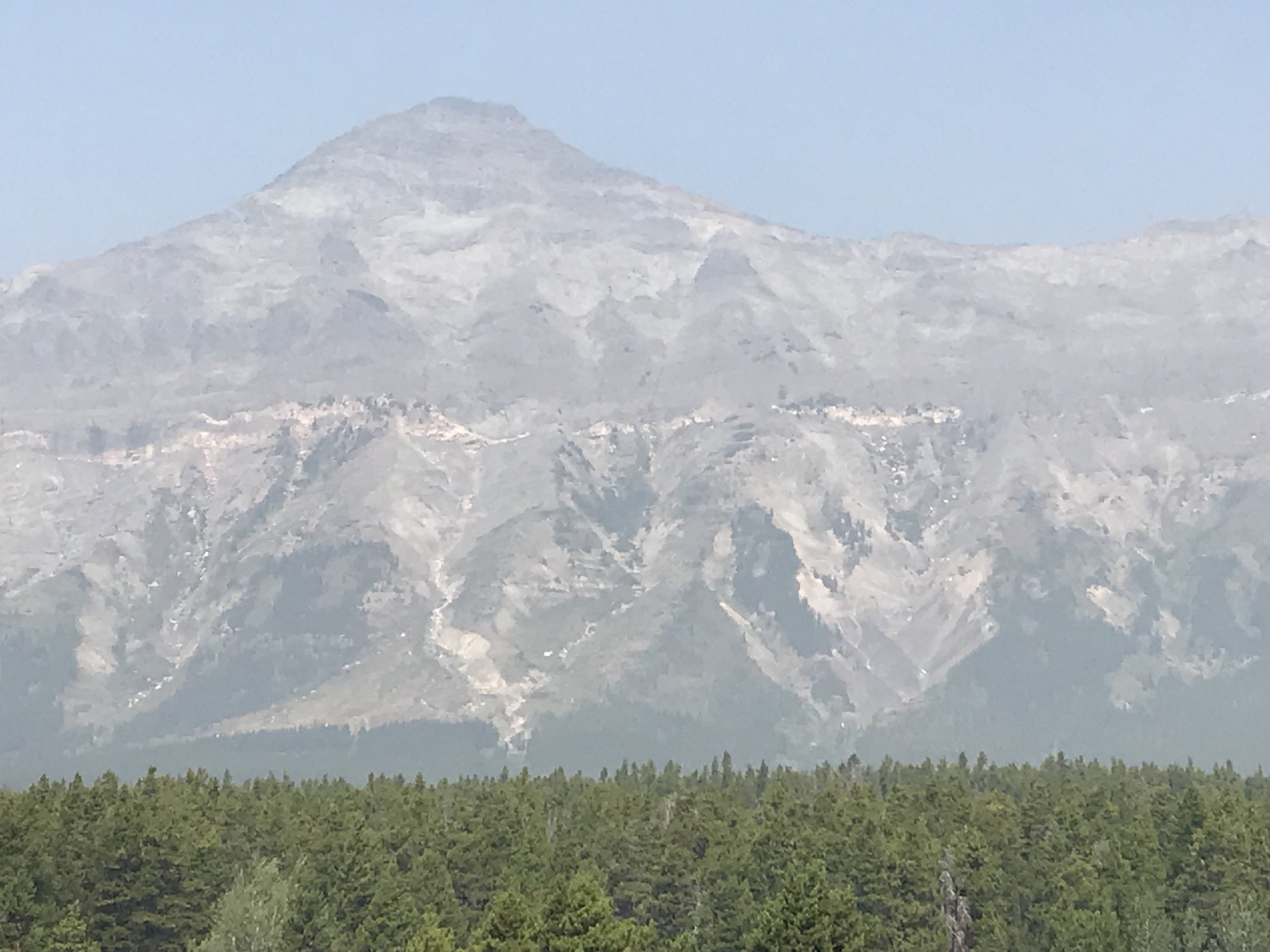
Summit Mountain, with the white line marking the Lewis Overthrust Fault visible in its southern face
If, after reading the above, you are actually hungry for more, check out this U.S. Geologic Survey paper on the rocks of Glacier more generally, of which this section on the Lewis Overthrust Fault is only a part:
USGS: Geological Survey Professional Paper 294-K (The Lewis Overthrust).
From Marias Pass, we continued on to less lofty pursuits. My son had been fascinated by the Blackfeet tribal casino in Browning, so we stopped there, where the management staked each of us to a small starting outlay. This was a low-risk proposition for them, as my wife, daughter, and I swiftly returned our stakes to the casino�s coffers. But my son � who is shrewd about such things � emerged $20 richer. This casino was far less luxe and imposing than the ones we had seen in New Mexico a few years ago, but you can�t grudge anything that helps to bring an economic injection from outsiders to these reservation lands.
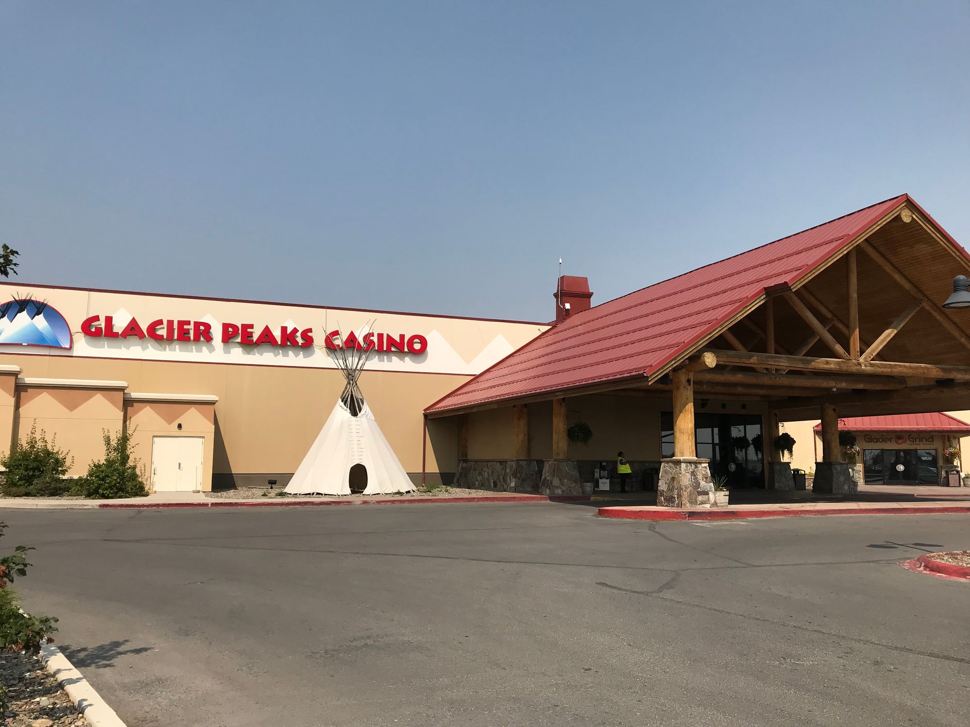
The casino on the Blackfeet Indian Reservation
If you�re curious about the Blackfeet, internet research (including a look at the tribe's website and their Wikipedia entry) discloses that with 17,500 members, they are one of the ten largest native American tribes. They occupy a reservation of 1.5 million acres, granted to them by a treaty in 1855, that abuts the entire eastern side of Glacier NP and runs all the way up to the Canadian border. That sounds pretty good by the standards of what happened to other Indian tribes, but the Wikipedia article on the Blackfeet indicates that the lands of the Blackfoot Confederacy once extended as far north as Edmonton, Alberta. (They do still have several reservations north of the Canadian border as well.) The Dayton Duncan/Ken Burns companion volume to his documentary on the Lewis & Clark Expedition describes the Blackfeet as �the preeminent power of the northern Plains and Rockies, mortal enemies of the Shoshones, Flatheads, and the Nez Perce.�
https://en.wikipedia.org/wiki/Blackfoot_Confederacy
An encounter between a party of young Blackfeet and Lewis and his three men some thirty miles east of Browning on Two Medicine River in July 1806 seemed to begin cordially enough, with the two groups sharing an evening meal and bedding down in a single camp. At dawn the next morning, however, the Blackfeet tried to steal the Lewis� party�s guns and horses � not surprisingly, because seizing such booty was a means of gaining honor and respect as a young warrior. For Lewis and his men, in contrast, losing their guns and horses in such a remote location would almost certainly have ensured their deaths. They successfully resisted, and two of the Indians were killed � the only violent encounter that occurred between the Expedition�s members and AmerIndians during the expedition�s two-year history.
Even today, the Blackfeet are not reluctant to assert themselves. In late June, concerned about tourists bringing Covid-19 across their lands, they unceremoniously shut off access to Glacier National Park from the east across their reservation.
From Browning, it was another 75 minutes/50 mile drive north to get to the Many Glacier area, where we were spending the next three nights at the Many Glacier hotel, the grandest of Glacier�s hostelries. The last 15 miles of the drive in along Lake Sherburne was on a road that was in strikingly poor condition � a function, presumably, of the severity of the winters in these parts � and the valley was so full of smoke from the Howe Ridge fire that there was again no point in stopping for photos. We got in at about 2:45.
Our three days at Many Glacier were really what made this trip one of our best, despite the problems the Howe Ridge fire caused us. The hotel is a real throwback to a different era in American tourism and travel, both in its Swiss-inspired appearance and in the hokey Swiss costumes in which the staff members are obliged to dress � complete with lederhosen. (One of the area�s earliest travel promotional slogans was �America�s Switzerland.�) But the hotel � which underwent a substantial renovation in 2017, just after it passed the century mark � has enormous character and stupendous views across Swiftcurrent Lake to Grinnell Peak and the other mountains surrounding the valley. I wound up being very grateful that we�d cancelled our planned trip in 2017, as it would not have been possible to have stayed at Many Glacier then.
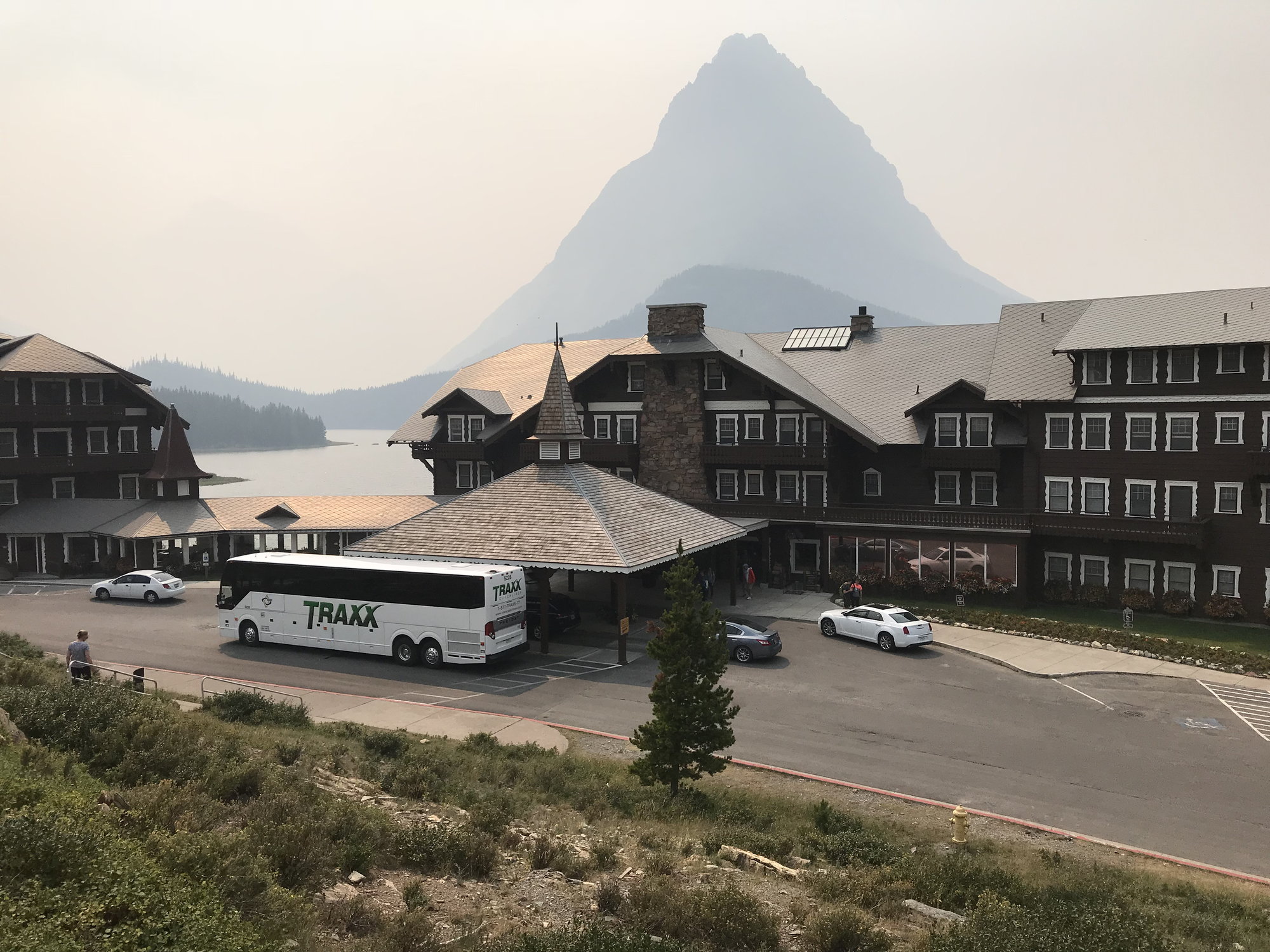
The Many Glacier Hotel, with Grinnell Point and Grinnell Peak behind it
Once we settled into our rooms � #s 227 and 231, on the front side of the building, but overlooking the lobby and the famous double ogival staircase from above � we headed out to explore our surroundings. We stopped to inquire about trail conditions at the information counter in the lobby, and confirmed (as we had seen earlier at the Glacier Park Lodge) that all of the trails on the north side of the entrance road at Many Glacier were closed due to bear activity. (Those would be grizzlies, on the east side of the park.) This put an end to my thoughts of doing either the Iceberg Lake or the Ptarmigan Tunnel hikes. After that, we wandered down to the dam where Swiftcurrent Lake spills over a ragged lip of rock in a dramatic and thunderously noisy waterfall before making its way to Lake Sherburne.
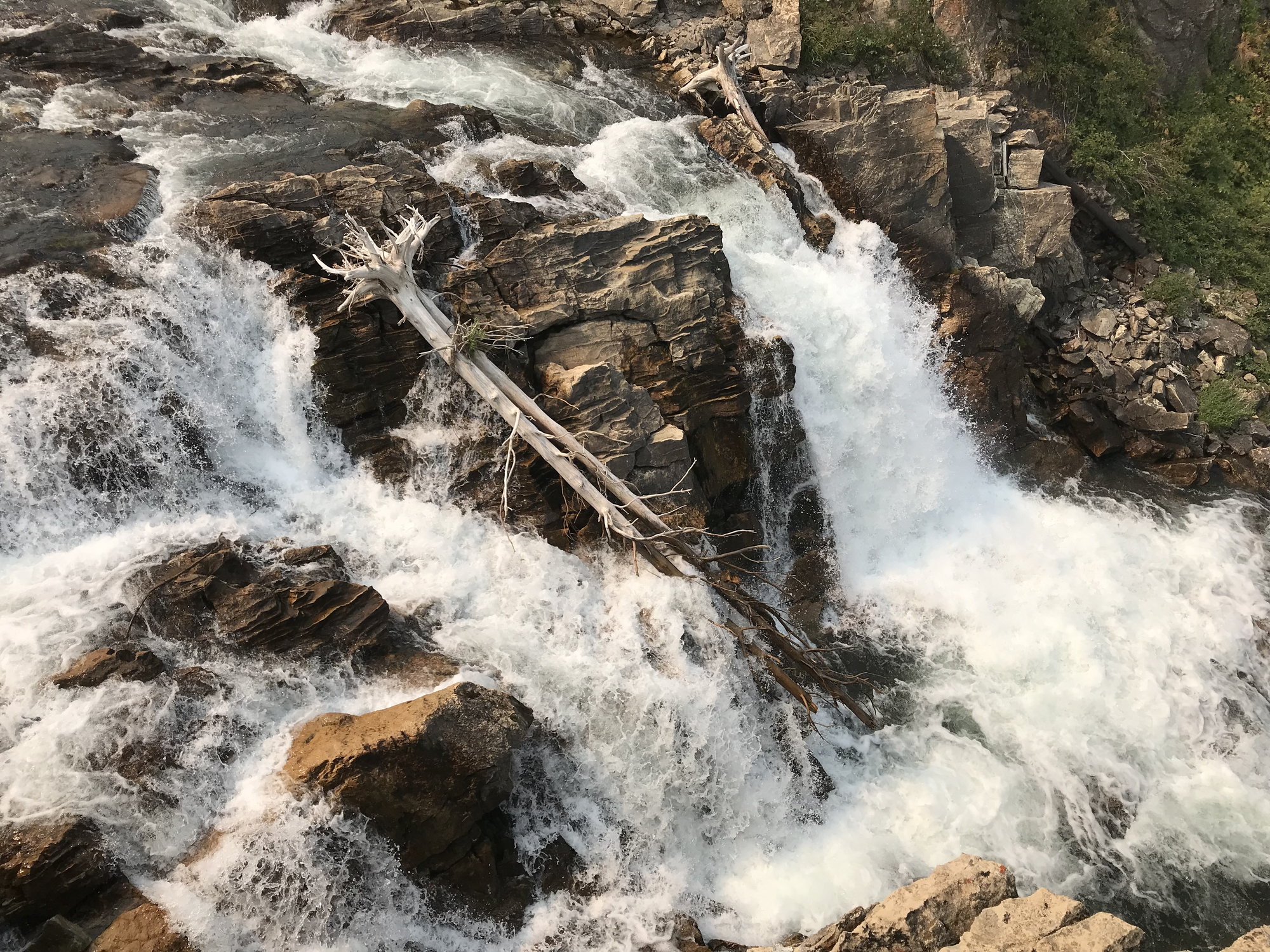
The falls below Swiftcurrent Lake
Our next stop was the boat ticket office by the lake, where we obtained tickets so my son and I could go canoeing later that afternoon, and so that the four of us could take a guided hike to Grinnell Lake the following day. We also put my name on a waiting list for a Ranger-led hike to Upper Glacier Lake and the Garden Wall for Friday. As our experience indicates, it would appear to make good sense not to leave the acquiring of these tickets until you arrive in the Many Glacier area, but to do so in advance. The concessionaire is the Glacier Park Boat Company.
My son and I picked up a canoe at about 4:15 p.m. and set off on an hour-long circuit around Swiftcurrent Lake. It�s quite shallow for the most part, with the water depths ranging from about 3' to 6', with a single substantially deeper area just in front of the dam. If we�d had more time, we learned afterwards that the creek that leads into the southwestern end of the lake can apparently be followed all the way up to Lake Josephine. But it was definitely good to get some exercise after so much time in the car that day, and we enjoyed having a flotilla of ducks escort us as we made our way along the lake�s farther shore.
We went for an early dinner in the hotel�s main dining room, the Ptarmigan Room. Sunlight streamed in the large, high westward-facing windows looking out over the lake, and it was a beautiful setting. As seems to be the case in pretty much all of these park service restaurants, however, I would grade the food about a B+/A-, and the bill usually seems to wind up in the $150-$170 range. We thought it was definitely an experience worth having for one night during our stay, but for one night only.
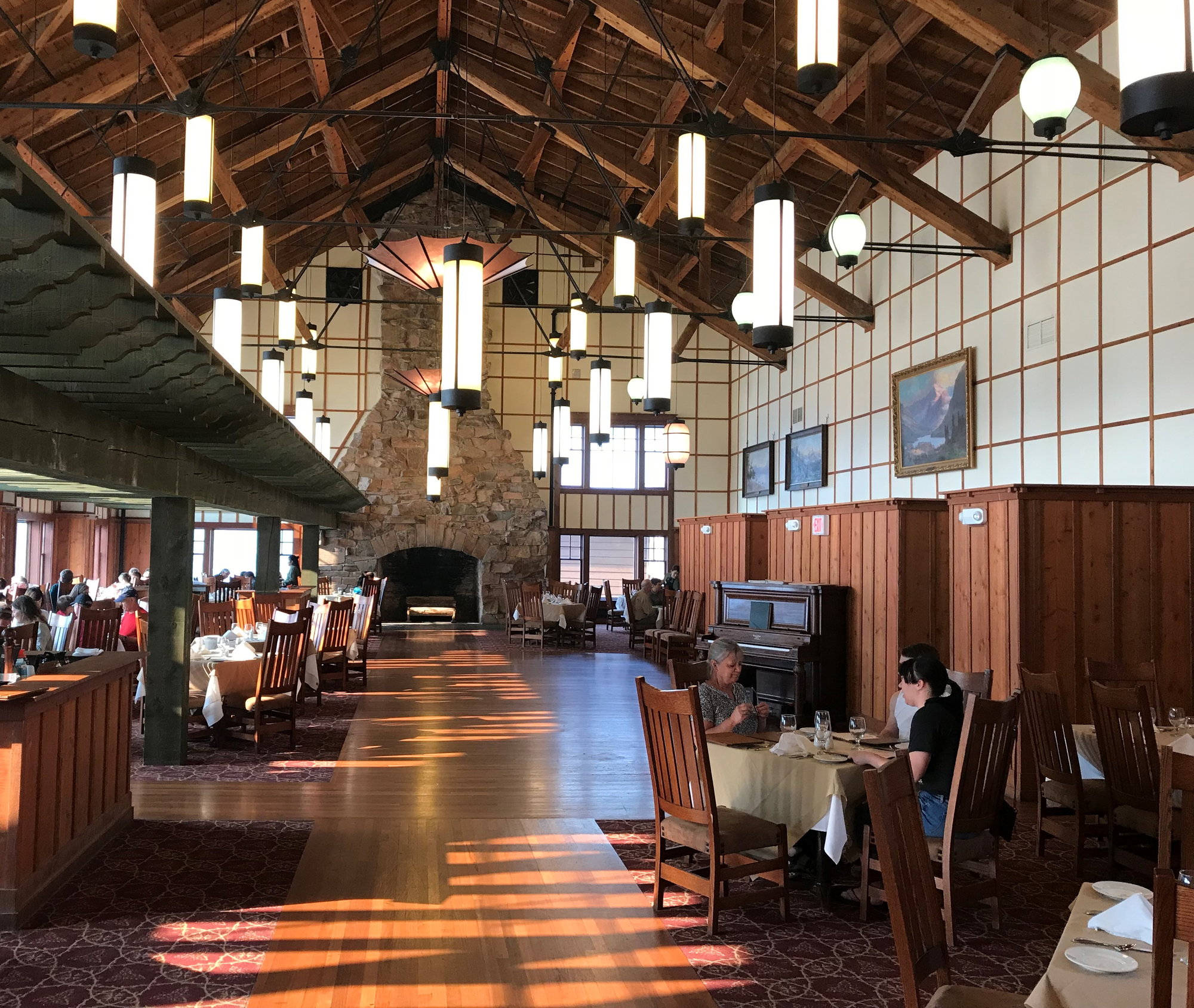
Dinner in the Ptarmigan Room at the Many Glacier Hotel (a Ptarmigan is a local bird similar to, but larger than, a quail)
As we were leaving the Ptarmigan Room, we marveled at some before-and-after pictures in the corridor outside showing the shrinking of the nearby glaciers. Then my wife and the kids relaxed in the lobby while I wandered around the hotel�s lakefront galleries and the lakeshore itself taking photos of the approaching sunset.
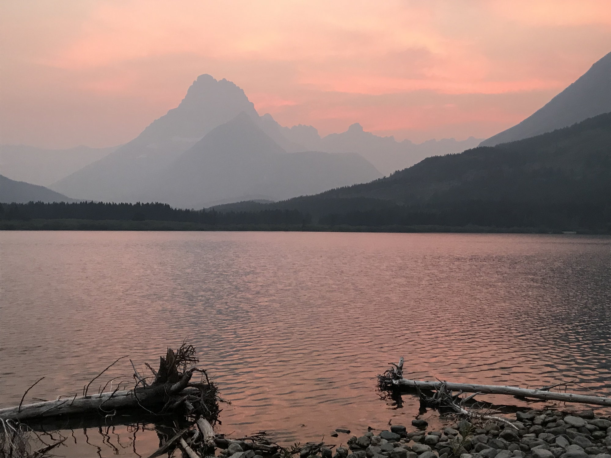
Sunset at Many Glacier, with Swiftcurrent Lake in the foreground
After night descended, my wife and I gathered up the laundry and drove over to the Swiftcurrent Inn, where there was a laundry room. While our clothes were getting cleaned and dried, we settled down in the Inn�s lobby, where my wife read and I worked on my travel journal. There was a log of wildlife sightings by guests posted there that was interesting to examine. We finished around 11:00 and returned to Many Glacier, which was enveloped in a profound quiet and stillness.

List of wildlife spottings posted in the lobby of the Swiftcurrent Inn. As you can see, Fishercap Lake is the place to see moose.
[To Be Continued]
The Theodore Roosevelt Memorial Obelisk in Marias Pass
Mountain passes seem to come in two principal types: the ones where there�s a clear notch or saddle in the surrounding mountains, a stupendous view, and a dual succession of hairpin switchbacks on both the way up and down. And then there are the ones that cause you to say �There�s a pass here? Really??� Marias Pass falls squarely into the second category, although this doesn�t mean it wasn�t important.
Marias Pass lies at roughly the mid-point of Highway 2's passage along the southeastern boundary of Glacier NP. Here, the highway crosses the Continental Divide. With an elevation of 5,216 feet, our Moon Guide noted that it is the lowest pass through the which the Continental Divide runs north of New Mexico. This means that it is both (a) not glamorous and (b) highly useful, especially if you happen to be a railroad route surveyor or a highway engineer.
The Lewis & Clark Expedition spent some time searching for an easily manageable pass across the northern Rockies, but it never found one. On the eastbound return trip in the summer of 1806, Meriwether Lewis took three men and explored up the Marias River, trying to identify the northern limit of the Louisiana Territory. (William Clark was exploring further south along the Yellowstone River at the time.) He named that river after his cousin Maria � it was originally �Maria�s River�, but at some point the possessive apostrophe became lost to history. The river in turn gave its name to the pass, which is curious, as its nearest point is about 65 miles to the east. The closest Lewis and his companions came to the pass in July 1806 was some 35 miles away, when they camped at a spot 12 miles northeast of Browning.
Of course, the Blackfeet had always known the pass was here. But for the white men coming into this parts, it remained a subject of rumor and speculation, like a northern Rockies analogue to the Lost Dutchman�s Mine. Remarkably enough, the pass almost managed to remain undiscovered through the entire 19th century, despite a major effort to locate it in 1853-1855 that was organized by Isaac Stevens, the Governor of Washington Territory. Finally, in 1889, a mere 84 years after Lewis and Clark first tried to find it, James Jerome Hill, the President of the Great Northern Railroad, frustrated by the decades of tantalizing rumors, dispatched John F. Stevens, the railroad�s chief surveying engineer (no relation to Governor Isaac), to find it.
If you�re like me, you will probably assume that Stevens commanded a substantial and well-appointed expedition that set out for the upcountry Rockies at some seasonally appropriate time like, say, the late spring. By that time, the Indian Wars were almost over , and you would also think that the United States Army could have been persuaded to provide escorts and logistical support for an effort so potentially important to the country�s economic development. But if you think that, you that would be wrong. Stevens instead seems to have set out sometime in the fall. And far from commanding a substantial expedition, he went forth into the wilderness accompanied only by a single Indian guide from the tribe of the Bitterroot Salish (also known as the Flatheads) who was named Coonsah.
Stevens, like most engineers, was a careful and precise man � from 1905-07, he was the Chief Engineer of the Panama Canal project during its early, infrastructure-building phase � so it seems we can safely assume that neither the questionable timing nor the minimalist approach to planning and organization that apparently characterized this effort were on him. It seems more likely that James Jerome Hill was the kind of boss for whom the only acceptable response to the command �Jump!� was to ask �How high?�
Anyway, Stevens and Coonsah duly set forth into the wilderness. As they approached the pass, they were using snowshoes to make their way through snow that reached depths of as much as four feet and confronting temperatures (with wind chill, one hopes) of -40 degrees Farenheit. Coonsah, suffering severely from frostbite, ultimately could not continue and had to be left behind at one of their camps, but Stevens persevered. He found the pass on December 10, 1889 in the face of the deep snow and sub-zero temperatures. Equally important, he lived to tell of his discovery.
Within two years, the Great Northern built a railroad through the pass that ran up to West Glacier and eventually beyond to Washington State. The federal highway through the pass didn�t follow for another 40 years, until 1930.
Stevens was promoted to be the railroad�s chief engineer in 1895 and its general manager after that. During his time with the Great Northern, he was responsible for building a thousand miles of track across the northern tier of the United States, from the Iron Range of Minnesota to Washington State, where Stevens Pass in the Cascades is named after him. In 1917 President Wilson dispatched him to Russia following the February Revolution to assist the new provisional government in reorganizing and rationalizing its railroad system. Once there, he focused on addressing the problems of the Trans-Siberian. After the Bolsheviks� seizure of power in November, he shifted his activity to Allied-occupied Manchuria in northeastern China, where he served as the head of an advisory board for the Chinese Eastern and Siberian Railroads until 1923. He died at the age of 90 in 1943.
The statue of John F. Stevens in Marias Pass
Wikipedia�s entry on �Marias Pass� states that �The pass proved ideal for a railroad, because its approach was broad and open, within a valley ranging from one to six miles wide, and at a gentle grade that would not require extensive excavation or rockwork.� That�s certainly a fair description of what you see today. The 3,100-mile Continental Divide Trail also runs through the pass, so this is your chance to hike a short stretch of it (or you can do that on the Highline or the Hidden Lake Trails at Logan�s Pass).
When you reach the pass, you�ll see a parking area with a 60-foot obelisk commemorating Theodore Roosevelt, for whom Highway 2 (which runs all the way from Minnesota to Washington State) is named. There�s also a statue of John Stevens in his winter trekking gear that the Great Northern (today�s Burlington Northern and Santa Fe, or BNSF) put up to honor him in 1925, not long after he returned from his five years in Siberia and Manchuria. There is a marker there that tells the story of Stevens�s journey to find the pass (albeit without mentioning Coonsah: after reading it, I had initially assumed Stevens came solo all the way, which seemed even crazier).
Other markers at the parking area will brief you on the remarkable geologic features looming just to the north. This is a line of mountains (including Summit and Little Dog Mountains) that parallels Highway 2 for a number of miles as you continue towards East Glacier. You will see a prominent vein of white limestone that runs horizontally through these mountains about halfway up their southern face. This is the Lewis Overthrust Fault. Between 72 million and 55 million years ago, as part of the processes that produced today�s Rocky Mountains, the workings of the earth�s tectonic plates shoved a mile-thick layer of 1.4 billion year-old red argillite and limestone over the top of an 80-110 million-year-old layer of Cretaceous (i.e., dinosaur) period sandstone and shales. Everything above that white vein of rock � and most of what you�ll be walking on throughout Glacier Park � is thus the far older pre-Cambrian, while the rock below it is the much younger Cretaceous. The red argillite mudstone that I had seen in Avalanche Creek and on the Virginia Falls Trail was therefore once part of the sediments accumulating on the floor of the Belt Sea that covered much of the northwestern United States in pre-Cambrian times. Two days later, while hiking the trail up to the Grinnell Glacier and the Garden Wall, I walked over portions of the pre-Cambrian seabed that still preserved the rippled pattern of that impossibly ancient ocean floor.
Summit Mountain, with the white line marking the Lewis Overthrust Fault visible in its southern face
If, after reading the above, you are actually hungry for more, check out this U.S. Geologic Survey paper on the rocks of Glacier more generally, of which this section on the Lewis Overthrust Fault is only a part:
USGS: Geological Survey Professional Paper 294-K (The Lewis Overthrust).
From Marias Pass, we continued on to less lofty pursuits. My son had been fascinated by the Blackfeet tribal casino in Browning, so we stopped there, where the management staked each of us to a small starting outlay. This was a low-risk proposition for them, as my wife, daughter, and I swiftly returned our stakes to the casino�s coffers. But my son � who is shrewd about such things � emerged $20 richer. This casino was far less luxe and imposing than the ones we had seen in New Mexico a few years ago, but you can�t grudge anything that helps to bring an economic injection from outsiders to these reservation lands.
The casino on the Blackfeet Indian Reservation
If you�re curious about the Blackfeet, internet research (including a look at the tribe's website and their Wikipedia entry) discloses that with 17,500 members, they are one of the ten largest native American tribes. They occupy a reservation of 1.5 million acres, granted to them by a treaty in 1855, that abuts the entire eastern side of Glacier NP and runs all the way up to the Canadian border. That sounds pretty good by the standards of what happened to other Indian tribes, but the Wikipedia article on the Blackfeet indicates that the lands of the Blackfoot Confederacy once extended as far north as Edmonton, Alberta. (They do still have several reservations north of the Canadian border as well.) The Dayton Duncan/Ken Burns companion volume to his documentary on the Lewis & Clark Expedition describes the Blackfeet as �the preeminent power of the northern Plains and Rockies, mortal enemies of the Shoshones, Flatheads, and the Nez Perce.�
https://en.wikipedia.org/wiki/Blackfoot_Confederacy
An encounter between a party of young Blackfeet and Lewis and his three men some thirty miles east of Browning on Two Medicine River in July 1806 seemed to begin cordially enough, with the two groups sharing an evening meal and bedding down in a single camp. At dawn the next morning, however, the Blackfeet tried to steal the Lewis� party�s guns and horses � not surprisingly, because seizing such booty was a means of gaining honor and respect as a young warrior. For Lewis and his men, in contrast, losing their guns and horses in such a remote location would almost certainly have ensured their deaths. They successfully resisted, and two of the Indians were killed � the only violent encounter that occurred between the Expedition�s members and AmerIndians during the expedition�s two-year history.
Even today, the Blackfeet are not reluctant to assert themselves. In late June, concerned about tourists bringing Covid-19 across their lands, they unceremoniously shut off access to Glacier National Park from the east across their reservation.
From Browning, it was another 75 minutes/50 mile drive north to get to the Many Glacier area, where we were spending the next three nights at the Many Glacier hotel, the grandest of Glacier�s hostelries. The last 15 miles of the drive in along Lake Sherburne was on a road that was in strikingly poor condition � a function, presumably, of the severity of the winters in these parts � and the valley was so full of smoke from the Howe Ridge fire that there was again no point in stopping for photos. We got in at about 2:45.
Our three days at Many Glacier were really what made this trip one of our best, despite the problems the Howe Ridge fire caused us. The hotel is a real throwback to a different era in American tourism and travel, both in its Swiss-inspired appearance and in the hokey Swiss costumes in which the staff members are obliged to dress � complete with lederhosen. (One of the area�s earliest travel promotional slogans was �America�s Switzerland.�) But the hotel � which underwent a substantial renovation in 2017, just after it passed the century mark � has enormous character and stupendous views across Swiftcurrent Lake to Grinnell Peak and the other mountains surrounding the valley. I wound up being very grateful that we�d cancelled our planned trip in 2017, as it would not have been possible to have stayed at Many Glacier then.
The Many Glacier Hotel, with Grinnell Point and Grinnell Peak behind it
Once we settled into our rooms � #s 227 and 231, on the front side of the building, but overlooking the lobby and the famous double ogival staircase from above � we headed out to explore our surroundings. We stopped to inquire about trail conditions at the information counter in the lobby, and confirmed (as we had seen earlier at the Glacier Park Lodge) that all of the trails on the north side of the entrance road at Many Glacier were closed due to bear activity. (Those would be grizzlies, on the east side of the park.) This put an end to my thoughts of doing either the Iceberg Lake or the Ptarmigan Tunnel hikes. After that, we wandered down to the dam where Swiftcurrent Lake spills over a ragged lip of rock in a dramatic and thunderously noisy waterfall before making its way to Lake Sherburne.
The falls below Swiftcurrent Lake
Our next stop was the boat ticket office by the lake, where we obtained tickets so my son and I could go canoeing later that afternoon, and so that the four of us could take a guided hike to Grinnell Lake the following day. We also put my name on a waiting list for a Ranger-led hike to Upper Glacier Lake and the Garden Wall for Friday. As our experience indicates, it would appear to make good sense not to leave the acquiring of these tickets until you arrive in the Many Glacier area, but to do so in advance. The concessionaire is the Glacier Park Boat Company.
My son and I picked up a canoe at about 4:15 p.m. and set off on an hour-long circuit around Swiftcurrent Lake. It�s quite shallow for the most part, with the water depths ranging from about 3' to 6', with a single substantially deeper area just in front of the dam. If we�d had more time, we learned afterwards that the creek that leads into the southwestern end of the lake can apparently be followed all the way up to Lake Josephine. But it was definitely good to get some exercise after so much time in the car that day, and we enjoyed having a flotilla of ducks escort us as we made our way along the lake�s farther shore.
We went for an early dinner in the hotel�s main dining room, the Ptarmigan Room. Sunlight streamed in the large, high westward-facing windows looking out over the lake, and it was a beautiful setting. As seems to be the case in pretty much all of these park service restaurants, however, I would grade the food about a B+/A-, and the bill usually seems to wind up in the $150-$170 range. We thought it was definitely an experience worth having for one night during our stay, but for one night only.
Dinner in the Ptarmigan Room at the Many Glacier Hotel (a Ptarmigan is a local bird similar to, but larger than, a quail)
As we were leaving the Ptarmigan Room, we marveled at some before-and-after pictures in the corridor outside showing the shrinking of the nearby glaciers. Then my wife and the kids relaxed in the lobby while I wandered around the hotel�s lakefront galleries and the lakeshore itself taking photos of the approaching sunset.
Sunset at Many Glacier, with Swiftcurrent Lake in the foreground
After night descended, my wife and I gathered up the laundry and drove over to the Swiftcurrent Inn, where there was a laundry room. While our clothes were getting cleaned and dried, we settled down in the Inn�s lobby, where my wife read and I worked on my travel journal. There was a log of wildlife sightings by guests posted there that was interesting to examine. We finished around 11:00 and returned to Many Glacier, which was enveloped in a profound quiet and stillness.
List of wildlife spottings posted in the lobby of the Swiftcurrent Inn. As you can see, Fishercap Lake is the place to see moose.
[To Be Continued]
Sep 1st, 2020 | 07:02 PM
#10
Original Poster
Joined: Oct 2003
Posts: 314
Likes: 4
August 16th, Thursday: One Grand Hotel, Two Hikes, and Three Lakes
Our first full day (of two) at Many Glacier! I got up a bit before 8:00, and spent about 45 minutes wandering around the hotel and its deck overlooking Swiftcurrent Lake taking photographs. The famous ogival double staircase, which was in the lobby almost directly beneath our rooms, soon became a favorite subject of mine, as did the many Japanese lanterns hanging in the four story lobby.

The double ogival staircase (from below)

The double staircase (from above)
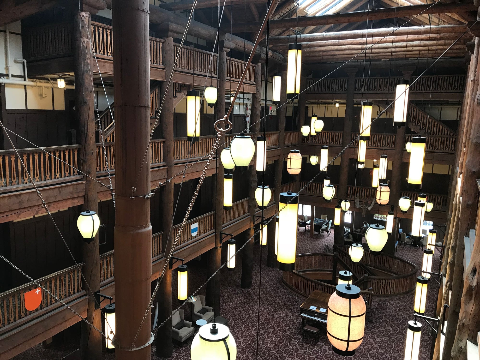
Many Glacier's lobby, with its Japanese lanterns
At 9:15, we headed over to the Swiftcurrent Motor Inn for a breakfast that we knew would cost us less than eating at Many Glacier�s Ptarmigan Room. We arrived there as the crowd was starting to dissipate, and when we were seated, I was delighted to discover that the table tops there consisted of topographical maps showing the surrounding landscape and its hiking trails. I took photos of some of the ones we had already done and of those I planned to do over the next couple of days, or perhaps on a future visit. Breakfast there, like at Eddie�s Caf� at Apgar, consisted of classic, hearty traditional specialties. We loved it (as well as our friendly, personable waitress, who also served us the following morning) and we ate there for the next two days as well.
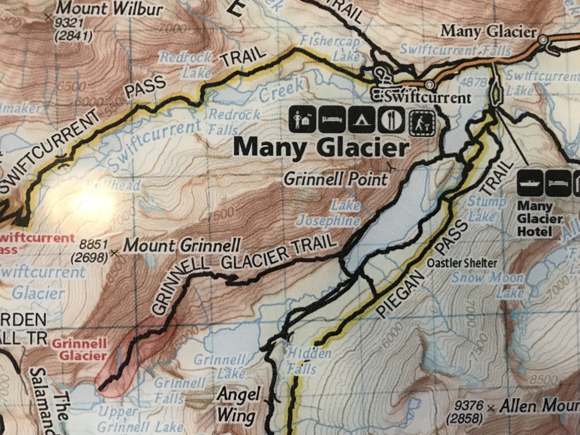
Tabletop hiking map at the Swiftcurrent Inn
After we returned to Many Glacier from breakfast at around 10:30, my wife and the kids stopped by the corral, which was at one corner of the parking lot, to inquire about going on a horseback trail ride the next day. Next, my wife and daughter decided that they wanted to rent a canoe and explore around Swiftcurrent Lake. My son also had some ideas of his own, so I set off on the 2.5 mile trail that circles Swiftcurrent Lake, figuring it might also give me an opportunity for getting some photographs of my wife and daughter in canoe-paddling action.
This was an easy and flat trail, running close along the lakeshore and offering great views of the towering, steep-sided pyramid of Grinnell Point looming above me. It is one of the most memorable and iconic geographic features I�ve seen anywhere (Matterhorn, move over!). As I was approaching the stream that enters the western end of the lake, the girls came along, making good time paddling their canoe despite their relative inexperience, and I was able to get some good photographs and a video of the two of them.
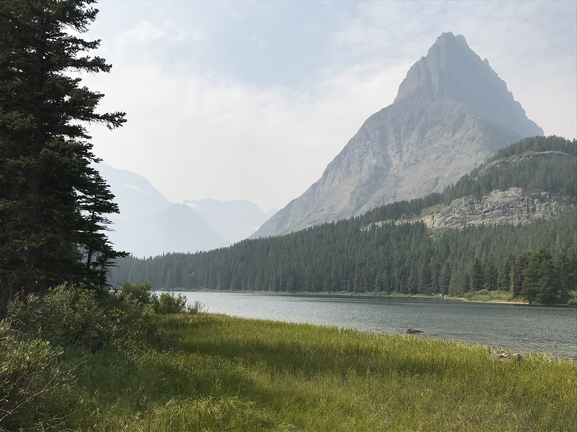
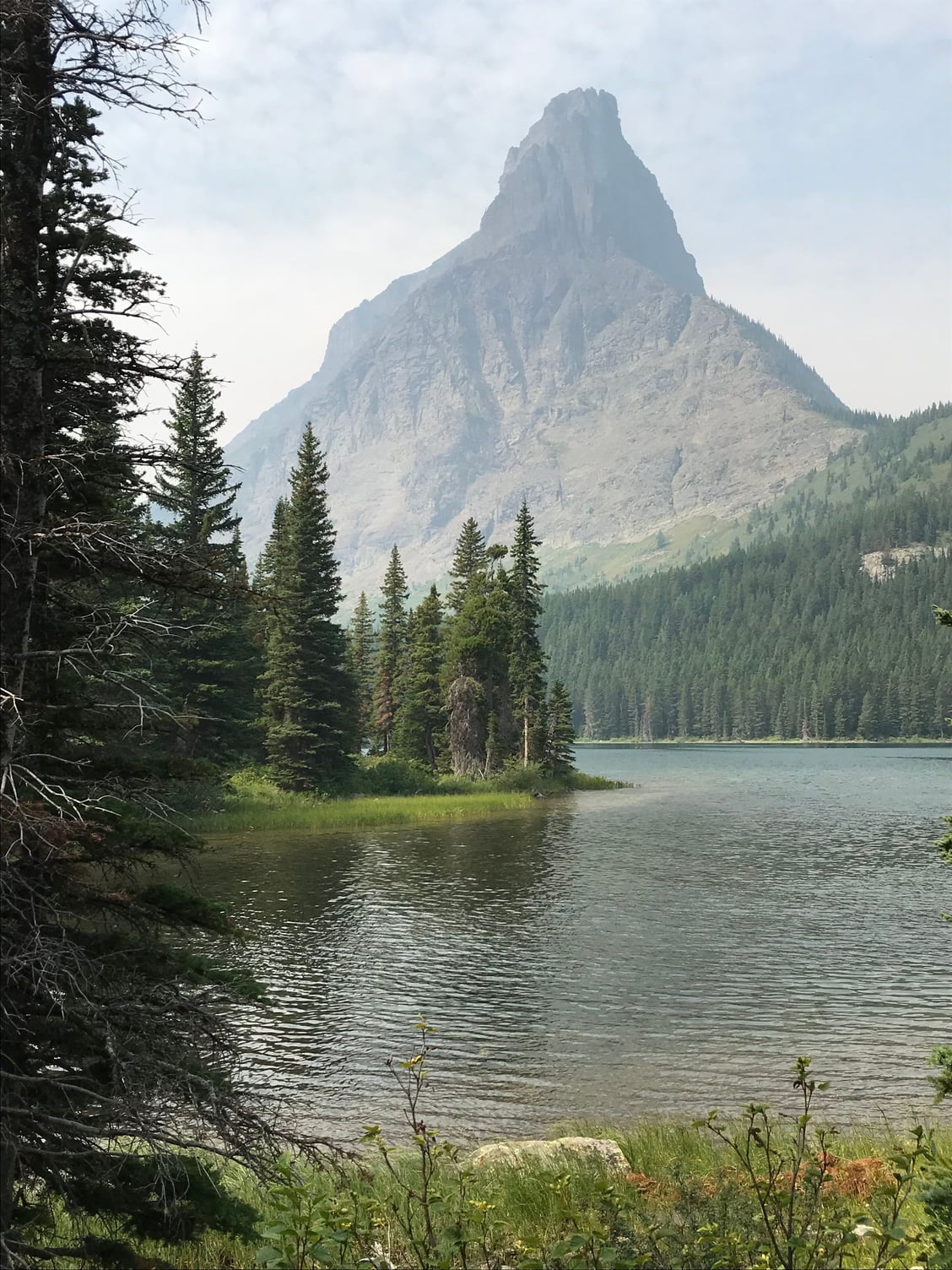
Grinnell Point from the Swiftcurrent Lake trail
I also passed by the boat dock at the lake�s western end, where you can take the trail across a narrow but steep isthmus to reach the boat dock at the eastern end of Lake Josephine, and then continued along the northern side of the lake. It was on this stretch that I encountered two ptarmigans foraging in the thick trailside undergrowth; they paid me little heed and came almost right up to my feet as I stood there photographing them. I remembered that the previous time I had seen this species was on a family hike at Swan Lake in Grand Teton National Park back in 2007, when my daughter was 12 and my son was 9. It was fun to see an animal at the far end of the fauna size spectrum from the mountain goats we�d seen the day before � or the grizzly bears we would be encountering soon enough! I finished my hike at about 1 :00 p.m.
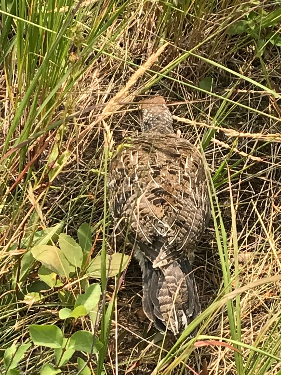
Mini Fauna: A Ptarmigan
Our afternoon activity commenced at about 2:30 p.m., when the four of us boarded the motor launch at the Many Glacier dock and then set off with perhaps 25-30 others on a naturalist-led boat trip/hike to Grinnell Lake, which is 3.4 miles distant from the Many Glacier Hotel. Our boat pilot and guide for the trip was an engaging young staff member whose name I unfortunately neglected to record. He first steered us to the dock at the west end of the lake that I�d passed on my hike earlier that day. We moored there, then disembarked and hiked up over the steep isthmus that separates Swiftcurrent Lake from Lake Josephine, which also has boat docks at both its east and west ends. We caught another boat there, which transported us to the far end of Lake Josephine, which is longer than Swiftcurrent Lake. From its western boat dock, it is just another mile through the woods to Grinnell Lake. Easy-peasy, as my midwestern wife would say � an excellent family outing, even with relatively young children.

View down Swiftcurrent Lake from the boat dock at its western end
There are somewhat more demanding alternatives; you can start at Many Glacier, hike halfway around Swiftcurrent Lake, as I had done that morning, and then take a trail along either the north or south shores of Lake Josephine, which brings your round trip mileage to 6.8. However, the hike along the north shore of Lake Josephine was not an option then, because it was closed as a result of bear activity. As our second motor launch cruised easily up the lake, not far from its northern shore, the �bear activity� duly made its presence known, as we spotted first a mother grizzly (a sow) and then her two cubs browsing for berries amidst the dense bushes lining the steep lower slopes of Grinnell Point. This was very exciting to everyone on the boat, but you definitely would not have wanted to stumble across that threesome while hiking the north Lake Josephine trail.
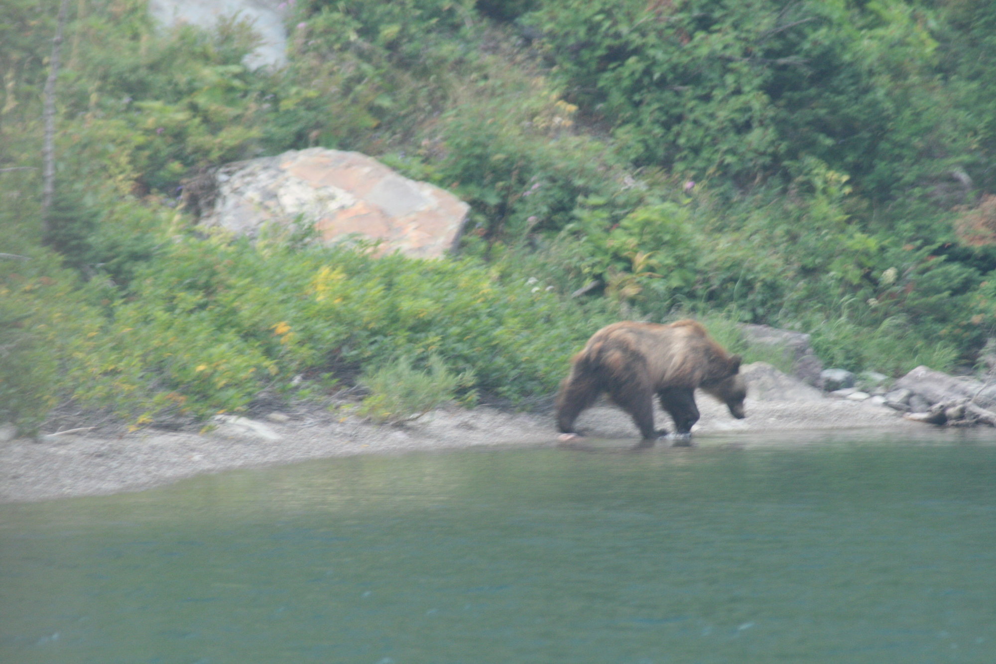
Mother Grizzly Bear on the north shore of Lake Josephine
We disembarked for the second time during this excursion at the western end of Lake Josephine and set off on a trail leading through wet and misty woods for Lake Grinnell, with our guide periodically stopping to show us this or that. There was a thicket of willow flats around the western end of Lake Josephine, and the creek that served as Grinnell Lake�s outlet and linked it to Lake Josephine was joined by numerous other small brooks that we had to keep picking our way across. The ground was wet and dense with vegetation, and the threes covered in lichens. We ultimately began following another creek that eventually led us out onto a sandy beach lined with imposing fir trees along the south shore of Grinnell Lake.
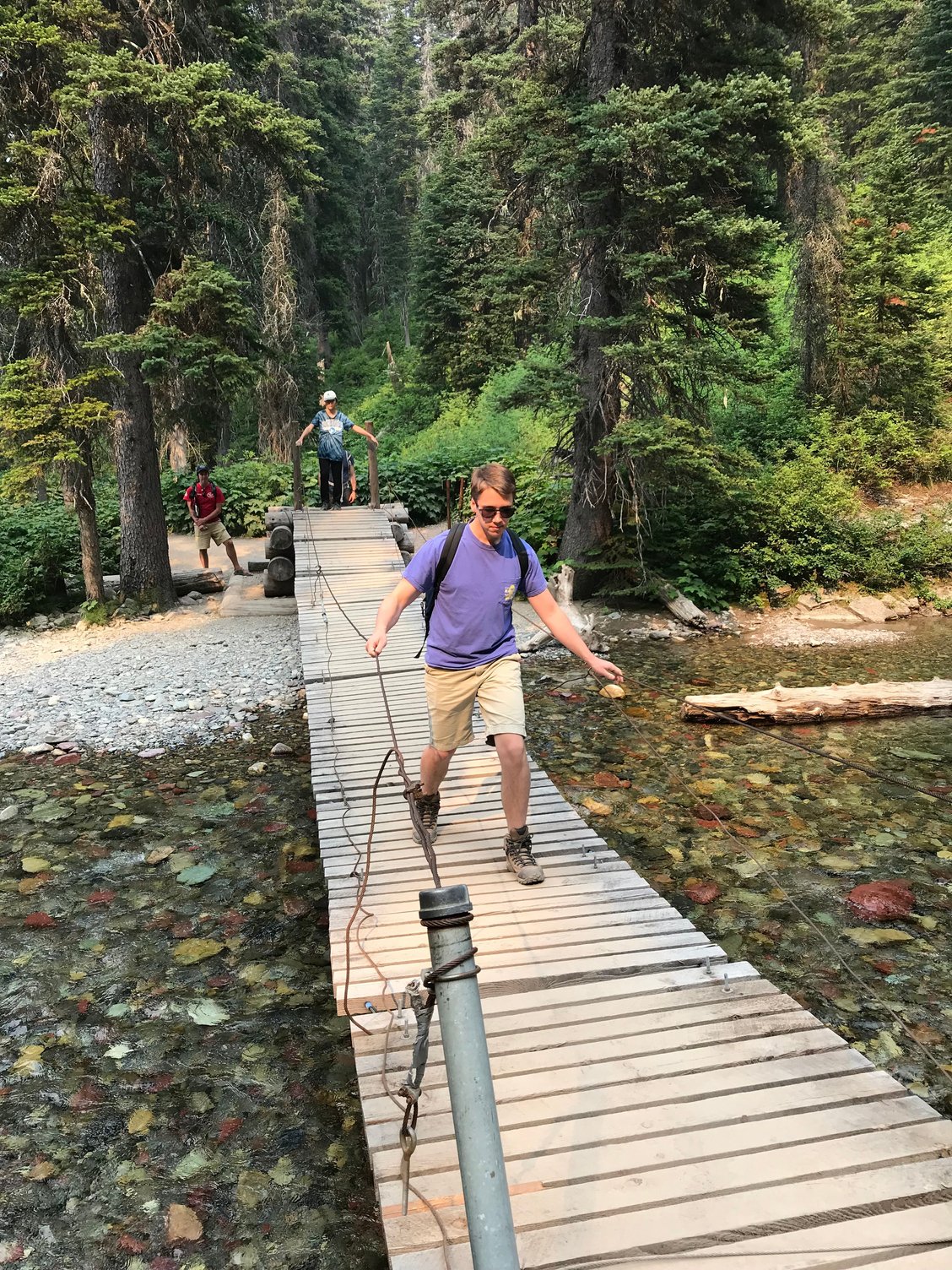
My son on the hike to Lake Grinnell
Again, the view was grand. The steep sides of Grinnell Peak loomed above us to the north; farther west, we could see the imposing, glacially carved arete known as the Garden Wall, with the thin ribbon of Grinnell Falls spilling over a lip of rock and then tumbling down in a series of plunges and cascades for hundreds of feet. The sheer, vertical flank of Angel Wing Mountain also overlooked us from the south side of the lake.

Grinnell Lake (unfortunately, my best shots of the overall view are panoramas, which the software can't post here)
After giving us some time to enjoy the view, we headed back, crossing the stream that fed into Grinnell Lake on a small suspension bridge, where just off to the right we could catch a glimpse of Hidden Falls tumbling out of the lower end of its rocky cleft. That was all you could see from there � hence the name � but if you were willing (loving waterfalls, I certainly was) you could ascend a steep trail and eventually reach a point where it was possible to descend an admittedly precipitous slope to get a much better vantage point on the falls. My daughter, also a shutterbug, dawdled with me there, while my wife and son made more of a beeline back for the boat dock.
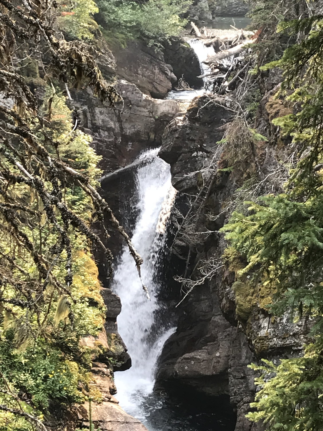
Hidden Falls
This turned out not to matter much, because a substantial line had already accumulated, made up not just of members of our party but of hikers coming down Grinnell Peak from Upper Grinnell Lake and perhaps from other points as well. We could have proceeded back by foot along the south shore of Lake Josephine, but we weren�t up for it, and nobody else seemed very eager to do that, either. While we waited, I was rewarded with a photo of my wife and daughter that I really liked.

My daughter and wife at Lake Josephine's western boat landing

Looking east down Lake Josephine
We eventually got back to the boat dock at Many Glacier just before 7 p.m.; the old but imposing hotel looked lovely in the golden late afternoon light as we crossed Swiftcurrent Lake. We rested for a while before heading off for another dinner in the Ptarmigan Room, then enjoyed taking in the sunset from the hotel�s deck and browsing through the gift shop downstairs before calling it a night.
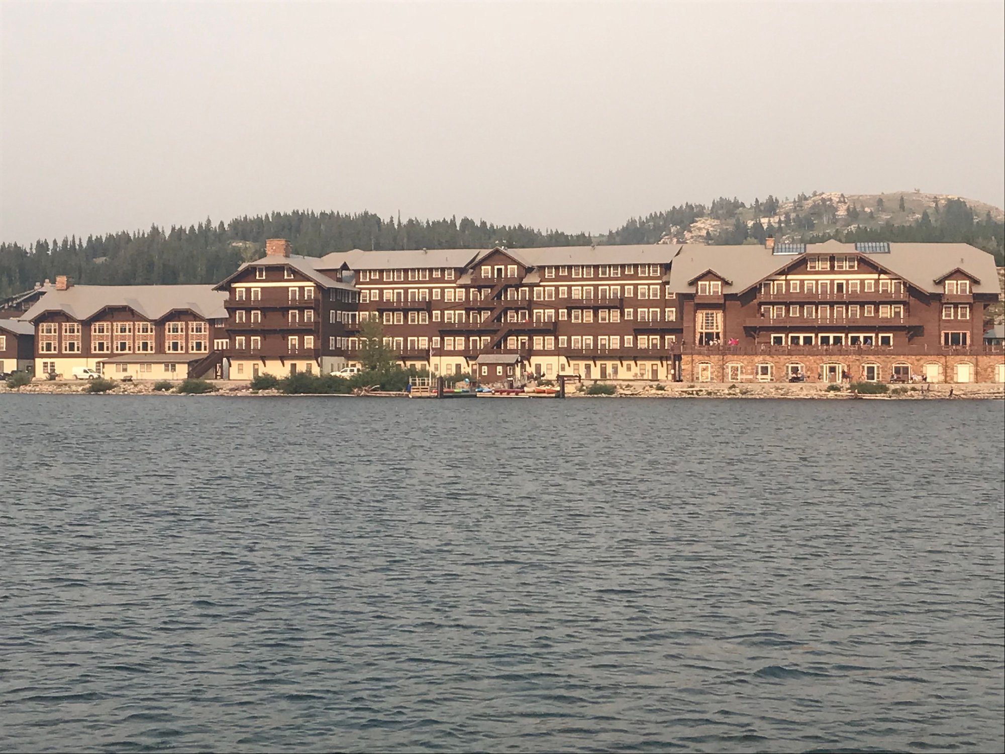
The Many Glacier Hotel
[To Be Continued]
The double ogival staircase (from below)
The double staircase (from above)
Many Glacier's lobby, with its Japanese lanterns
At 9:15, we headed over to the Swiftcurrent Motor Inn for a breakfast that we knew would cost us less than eating at Many Glacier�s Ptarmigan Room. We arrived there as the crowd was starting to dissipate, and when we were seated, I was delighted to discover that the table tops there consisted of topographical maps showing the surrounding landscape and its hiking trails. I took photos of some of the ones we had already done and of those I planned to do over the next couple of days, or perhaps on a future visit. Breakfast there, like at Eddie�s Caf� at Apgar, consisted of classic, hearty traditional specialties. We loved it (as well as our friendly, personable waitress, who also served us the following morning) and we ate there for the next two days as well.
Tabletop hiking map at the Swiftcurrent Inn
After we returned to Many Glacier from breakfast at around 10:30, my wife and the kids stopped by the corral, which was at one corner of the parking lot, to inquire about going on a horseback trail ride the next day. Next, my wife and daughter decided that they wanted to rent a canoe and explore around Swiftcurrent Lake. My son also had some ideas of his own, so I set off on the 2.5 mile trail that circles Swiftcurrent Lake, figuring it might also give me an opportunity for getting some photographs of my wife and daughter in canoe-paddling action.
This was an easy and flat trail, running close along the lakeshore and offering great views of the towering, steep-sided pyramid of Grinnell Point looming above me. It is one of the most memorable and iconic geographic features I�ve seen anywhere (Matterhorn, move over!). As I was approaching the stream that enters the western end of the lake, the girls came along, making good time paddling their canoe despite their relative inexperience, and I was able to get some good photographs and a video of the two of them.
Grinnell Point from the Swiftcurrent Lake trail
I also passed by the boat dock at the lake�s western end, where you can take the trail across a narrow but steep isthmus to reach the boat dock at the eastern end of Lake Josephine, and then continued along the northern side of the lake. It was on this stretch that I encountered two ptarmigans foraging in the thick trailside undergrowth; they paid me little heed and came almost right up to my feet as I stood there photographing them. I remembered that the previous time I had seen this species was on a family hike at Swan Lake in Grand Teton National Park back in 2007, when my daughter was 12 and my son was 9. It was fun to see an animal at the far end of the fauna size spectrum from the mountain goats we�d seen the day before � or the grizzly bears we would be encountering soon enough! I finished my hike at about 1 :00 p.m.
Mini Fauna: A Ptarmigan
Our afternoon activity commenced at about 2:30 p.m., when the four of us boarded the motor launch at the Many Glacier dock and then set off with perhaps 25-30 others on a naturalist-led boat trip/hike to Grinnell Lake, which is 3.4 miles distant from the Many Glacier Hotel. Our boat pilot and guide for the trip was an engaging young staff member whose name I unfortunately neglected to record. He first steered us to the dock at the west end of the lake that I�d passed on my hike earlier that day. We moored there, then disembarked and hiked up over the steep isthmus that separates Swiftcurrent Lake from Lake Josephine, which also has boat docks at both its east and west ends. We caught another boat there, which transported us to the far end of Lake Josephine, which is longer than Swiftcurrent Lake. From its western boat dock, it is just another mile through the woods to Grinnell Lake. Easy-peasy, as my midwestern wife would say � an excellent family outing, even with relatively young children.
View down Swiftcurrent Lake from the boat dock at its western end
There are somewhat more demanding alternatives; you can start at Many Glacier, hike halfway around Swiftcurrent Lake, as I had done that morning, and then take a trail along either the north or south shores of Lake Josephine, which brings your round trip mileage to 6.8. However, the hike along the north shore of Lake Josephine was not an option then, because it was closed as a result of bear activity. As our second motor launch cruised easily up the lake, not far from its northern shore, the �bear activity� duly made its presence known, as we spotted first a mother grizzly (a sow) and then her two cubs browsing for berries amidst the dense bushes lining the steep lower slopes of Grinnell Point. This was very exciting to everyone on the boat, but you definitely would not have wanted to stumble across that threesome while hiking the north Lake Josephine trail.
Mother Grizzly Bear on the north shore of Lake Josephine
We disembarked for the second time during this excursion at the western end of Lake Josephine and set off on a trail leading through wet and misty woods for Lake Grinnell, with our guide periodically stopping to show us this or that. There was a thicket of willow flats around the western end of Lake Josephine, and the creek that served as Grinnell Lake�s outlet and linked it to Lake Josephine was joined by numerous other small brooks that we had to keep picking our way across. The ground was wet and dense with vegetation, and the threes covered in lichens. We ultimately began following another creek that eventually led us out onto a sandy beach lined with imposing fir trees along the south shore of Grinnell Lake.
My son on the hike to Lake Grinnell
Again, the view was grand. The steep sides of Grinnell Peak loomed above us to the north; farther west, we could see the imposing, glacially carved arete known as the Garden Wall, with the thin ribbon of Grinnell Falls spilling over a lip of rock and then tumbling down in a series of plunges and cascades for hundreds of feet. The sheer, vertical flank of Angel Wing Mountain also overlooked us from the south side of the lake.
Grinnell Lake (unfortunately, my best shots of the overall view are panoramas, which the software can't post here)
After giving us some time to enjoy the view, we headed back, crossing the stream that fed into Grinnell Lake on a small suspension bridge, where just off to the right we could catch a glimpse of Hidden Falls tumbling out of the lower end of its rocky cleft. That was all you could see from there � hence the name � but if you were willing (loving waterfalls, I certainly was) you could ascend a steep trail and eventually reach a point where it was possible to descend an admittedly precipitous slope to get a much better vantage point on the falls. My daughter, also a shutterbug, dawdled with me there, while my wife and son made more of a beeline back for the boat dock.
Hidden Falls
This turned out not to matter much, because a substantial line had already accumulated, made up not just of members of our party but of hikers coming down Grinnell Peak from Upper Grinnell Lake and perhaps from other points as well. We could have proceeded back by foot along the south shore of Lake Josephine, but we weren�t up for it, and nobody else seemed very eager to do that, either. While we waited, I was rewarded with a photo of my wife and daughter that I really liked.
My daughter and wife at Lake Josephine's western boat landing
Looking east down Lake Josephine
We eventually got back to the boat dock at Many Glacier just before 7 p.m.; the old but imposing hotel looked lovely in the golden late afternoon light as we crossed Swiftcurrent Lake. We rested for a while before heading off for another dinner in the Ptarmigan Room, then enjoyed taking in the sunset from the hotel�s deck and browsing through the gift shop downstairs before calling it a night.
The Many Glacier Hotel
[To Be Continued]
Sep 9th, 2020 | 08:30 PM
#11
Original Poster
Joined: Oct 2003
Posts: 314
Likes: 4
August 17th, Friday: Greatest Hike Ever!!
Today, my wife, daughter, and son had decided they wanted to do a half-day trail ride, while I was hoping my name would come up off the wait list for the all-day Ranger-led hike to Upper Grinnell Lake and the Garden Wall. We had an early breakfast in the Ptarmigan Room, and then joined the crowd waiting outside by the boat dock a little before 8:00. They counted off everyone who already had a ticket, then started down the wait list. I was thrilled to hear my name called. I excitedly kissed my wife goodbye, telling her I would see her and the kids late that afternoon, then climbed aboard the boat and found a seat.
As we set off across Swiftcurrent Lake, the ranger assigned to lead the group took a microphone at the front of the boat and began her presentation. She immediately poured cold water on my excitement by telling us all that owing to the degree of smoke from the Howe Ridge fire at the higher elevations, she recommended that we only hike part of the way up to Upper Grinnell Lake and the Garden Wall before turning back. This was not welcome news, but I could imagine there might be some institutional biases in favor of an unnecessary degree of caution, so I decided to reserve judgment until I saw what the conditions were like at the higher elevations.
Under normal circumstances, the ranger informed us, we would have taken the trail along the north side of Lake Josephine after reaching the dock on the west side of Swiftcurrent Lake, but that wouldn�t be possible because of the bear activity there. As to that, at least, I knew � based on my observations of the day before � that these concerns were well-founded. The 40-50 of us thus trooped up and down across the saddle between the two lakes and boarded the Lake Josephine boat (the �Morning Eagle�). I was near the back of the line, so this gave me a chance to take some photos of the view ahead towards the western end of the lake, including the one below. Above a stand of deep green fir trees, a cluster of blue-gray mountains looked down on us inquisitively, almost like a welcoming party of Titans wondering who these Lilliputians might be. At the rear, I could already see the Salamander Glacier draped across the Garden Wall several miles to the west and nearly 2,000 feet above me. It was serene, still, and beautiful. I couldn�t see any evidence of significant smoke ahead, which was encouraging.
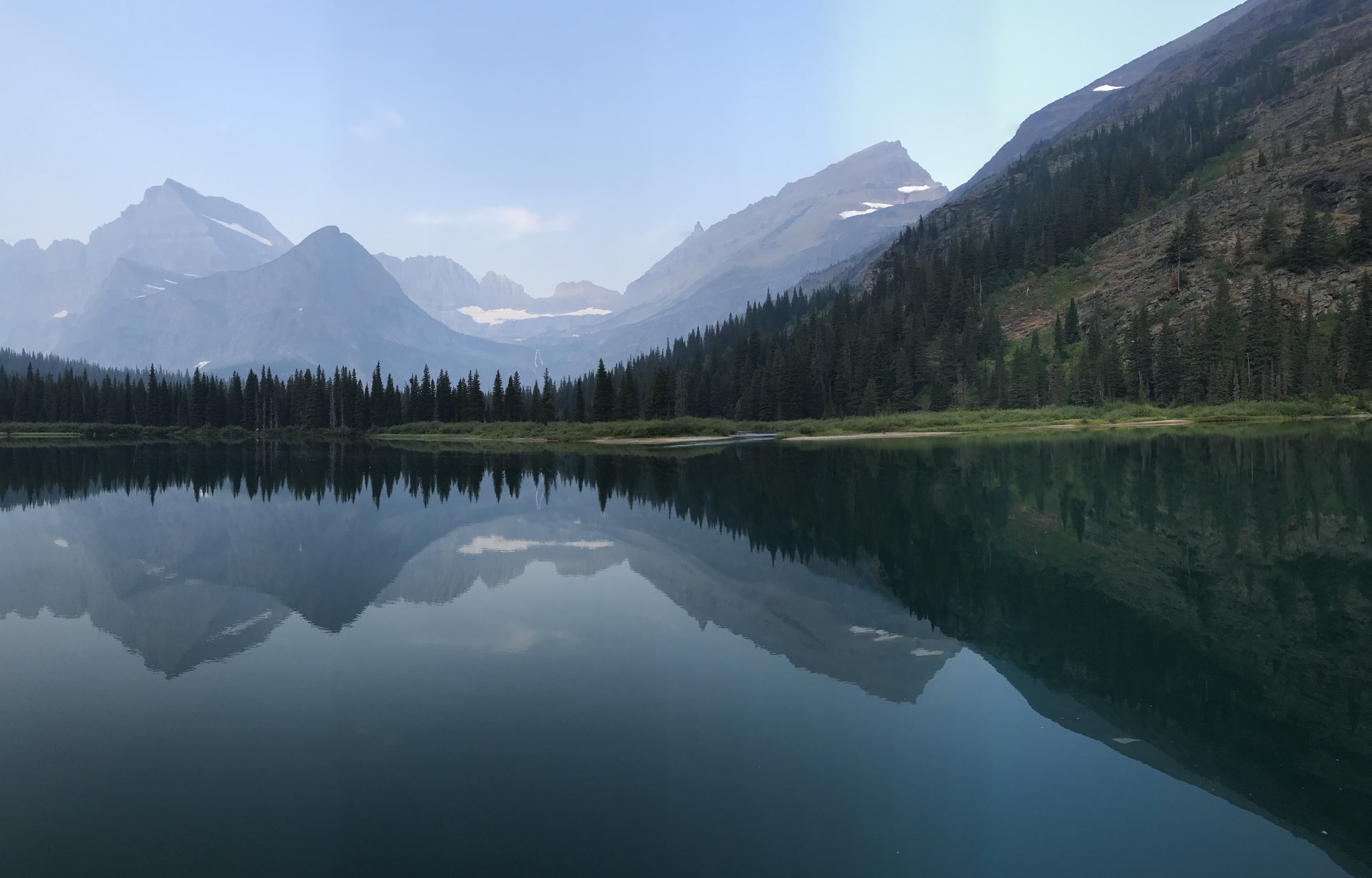
The view west across Lake Josephine towards the Garden Wall, the Continental Divide, and the Salamander Glacier
We motored across to the boat dock on the far side of the lake, which we reached about 9:15. As we disembarked, I was surprised by the number of relatively small children, and based on what I�d heard about the strenuous nature of this hike, I wondered whether their parents fully understood what they were getting them in for.
We set off to the right around the western end of Lake Josephine and made our way over a series of wooden bridges across the marshy, willow-filled area where the creek from (Lower) Grinnell Lake ran into its neighbor. Once we were on the other side, the easy part was over. Starting at an elevation of 5,000 feet, we immediately began climbing a series of steep, rocky switchbacks up the southern side of Mount Grinnell, and I was glad that I had brought both of my trekking poles. The first 500 feet of elevation gain came pretty quickly, but then it tapered off a bit as the trail continued to run up the slope to the west, clinging to the flanks of the mountain while the steep-sided rock pyramid of Grinnell Point (7,500 feet-plus) loomed above us.
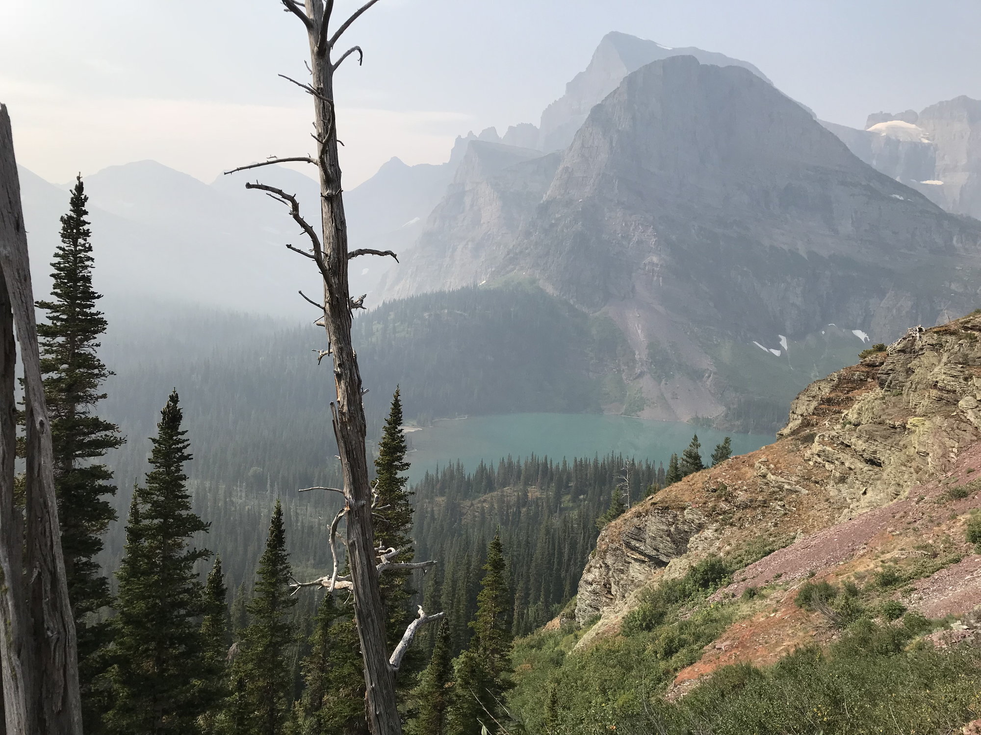
View towards (Lower) Grinnell Lake, Angel Wing Mountain, and Mount Gould
From fairly early on, the views back towards Lake Josephine and later looking south towards Angel Wing Mountain and the even more massive Mount Gould behind it were deeply impressive. Already, however, a shroud of smoke veiled the tops of all these peaks, although it didn�t seem bad where we were, several thousand feet below. I could only marvel at how magnificent this view must be like on a clear day.
The ranger stopped a couple of times for short presentations, and I think we were still short of being able to see (Lower) Lake Grinnell when she announced that she would be turning around at this point. The parents with small children went with her, as did a few others, but at least 25 people determined to press on. By that time, we already had a good view of the serrated knife-edge of the Garden Wall (along which runs the Continental Divide) and of Grinnell Falls spilling over the saddle of rock between Angel Wing Mountain and Mount Grinnell. Those potent attractions lured us on.
And we were soon rewarded for our persistence. Within a few minutes, off to the left and a thousand feet below us (for we had by now reached the 6,000' contour line), was the striking teal-green water of Lake Grinnell, with the sheared-off northern flank of Angel Wing Mountain vaulting towards the sky above it. I could clearly see the beach on its southern shore where my family and I had stood the afternoon before.
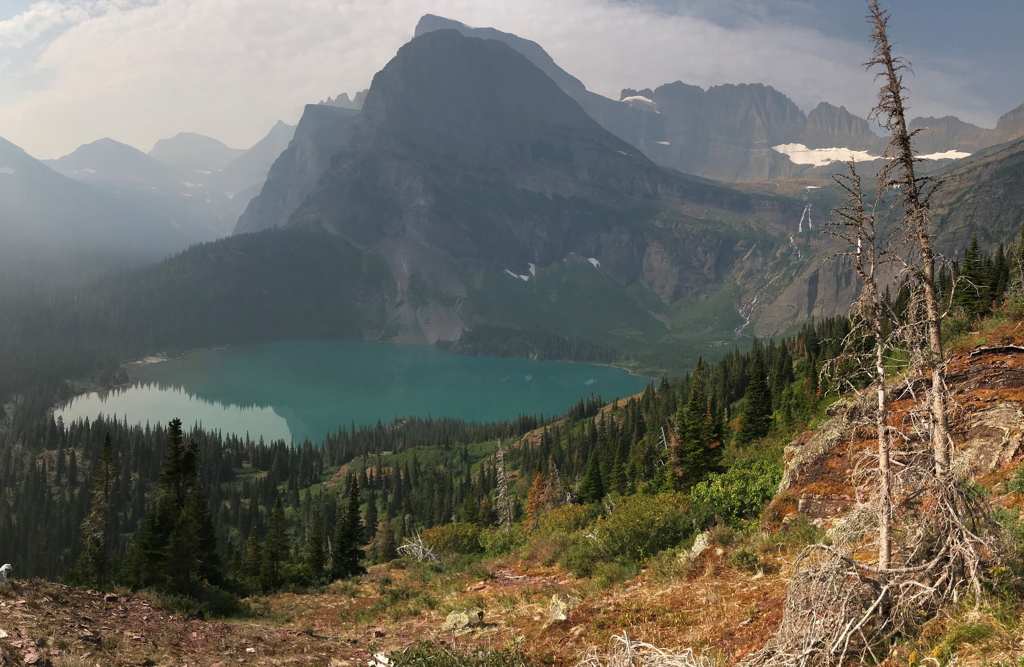
(Lower) Grinnell Lake, Angel Wing Mountain, Grinnell Falls, and the Garden Wall
Our party continued uphill in a long, single-file line. The stone beneath our feet was the distinctive red argillite of the pre-Cambrian Age, but up here it was shattered, crushed, and powdery, far different from the solid slabs across which we had walked on the Virginia Falls Trail three days earlier. Little rivulets began running across the trail from the mountain�s crest above us, and eventually we came to a spot where a small waterfall dropped straight over the edge of a sheer rock face and fell directly onto the trail.
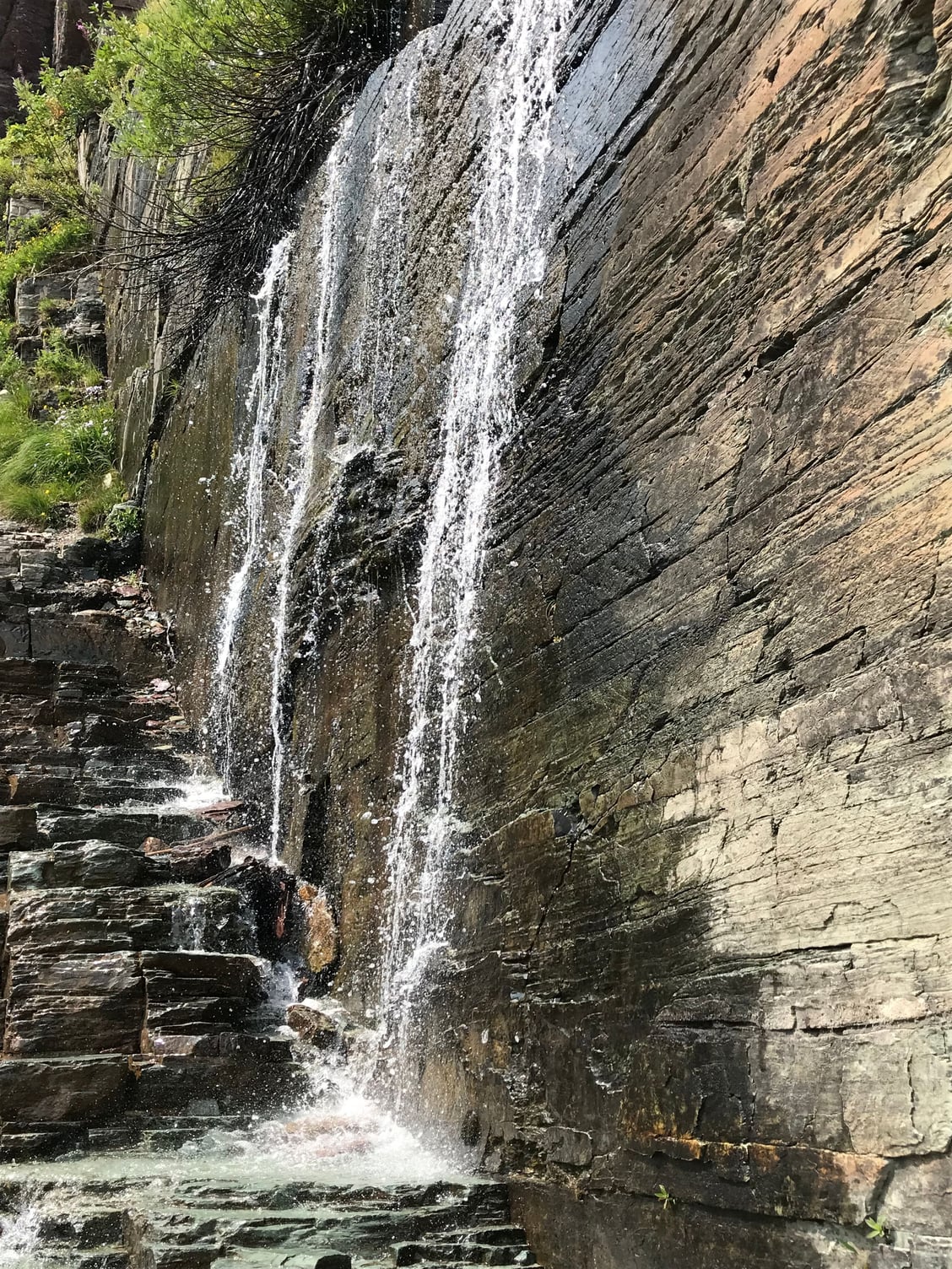
Grinnell Glacier Hike Water Hazard
Not too far past that, we began to encounter a stretches of rippled white rock that preserved the pattern of the pre-Cambrian seabed, estimated here in Glacier to be about 1.4 billion years old, give or take a few. That�s old � but it�s still only a third of the age of the earth.
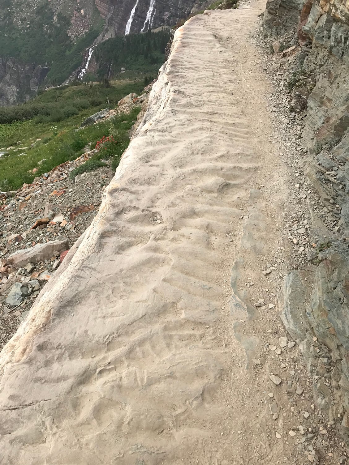
Pre-Cambrian seabed
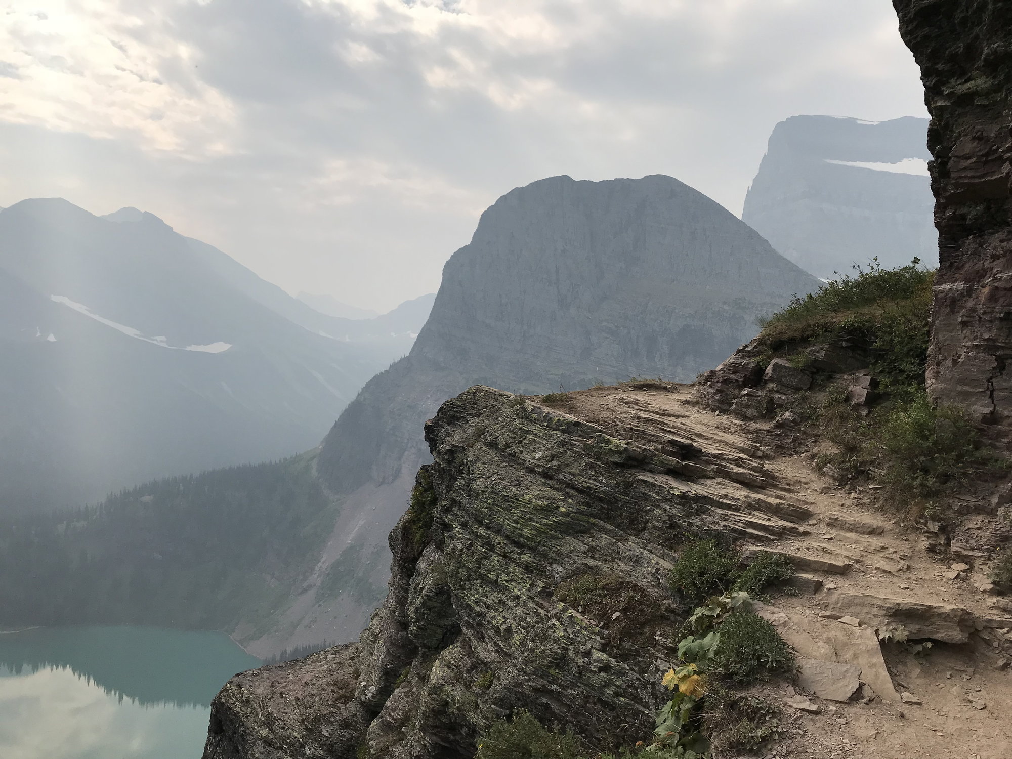
At times, this trail is breathtaking in more ways than one
I stopped to take so many photos that the later ones show only a scattered handful of people making their way along the trail in front of me. Eventually, I passed Grinnell Falls, tumbling down the slope towards Lake Grinnell below, and then there was a final steep climb up a scrubby, rock-strewn hillside to a grove of squat, wind-twisted fir trees in which there were spots to picnic and a few heavily patronized toilet facilities. Not too far beyond that, you came over a small rise (at 6,500 feet in elevation) and Upper Grinnell Lake at last lay at your feet: an expanse of blue-green water on a barren rocky plateau, backing up to what remained of the Grinnell Glacier at its southern end. As a result of the recent heat wave and at least two 100-degree days, there were only a handful of small ice floes drifting about the lake, but it was impossible not to be awed by the massive barrier of the Garden Wall rising up from 1,500 to as much as 2,300 feet above us on its far side, with several thin waterfalls plummeting down its face.
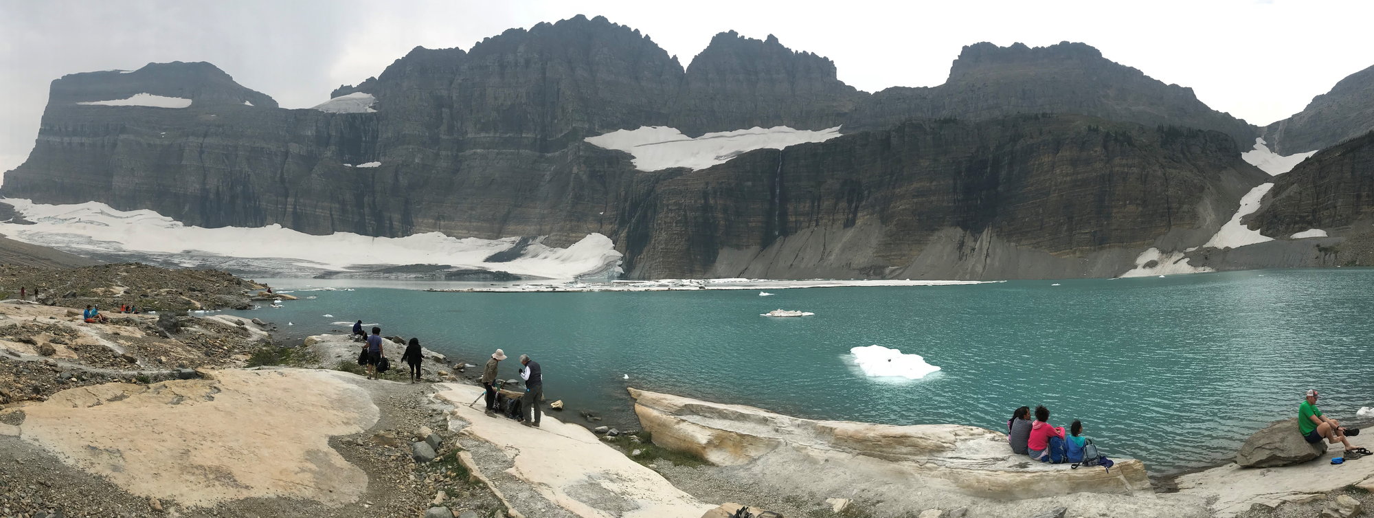
Upper Grinnell Lake, Grinnell Glacier, and the Garden Wall
It was just before noon when I reached the lake. The distance from Lake Josephine was just under three miles � and it had taken me roughly two-and-a-half hours to do it (albeit with a few ranger presentations and frequent stops for photos, or just to take in the amazing landscape). I settled down by a large rock to enjoy the package of trail mix my wife had thoughtfully made up for me. By this time, unfortunately, the sunny skies of the morning had been replaced by overcast, which was disappointing from a photographic standpoint. It was cooler at this elevation in any case, and there was a relatively steady wind. A few young men took the plunge into the lake, but most of the scattered handfuls of hikers just snacked and took in the view.
I struck up a conversation with a man and his wife who were sitting near me; he was wearing an MIT cap, and after a few minutes we realized that we had both been in Cambridge at the same time and had graduated from our respective graduate and professional schools in the same year � 1983! Such a small world.
I remained at the top for about an hour, then started to make my way back down, passing a marmot who was observing the passing hikers from atop a boulder as I did so. Because I had stayed at the top for so long and was still stopping often for photos on the return leg, I soon had the trail largely to myself. I even stopped at one point and took off my heavy socks and hiking boots and enjoyed soaking my feet in a pool of cold water made by one of the freshets running down the mountainside. Once I got back closer to Lake Josephine, however, there were often sharp bends in the trail that limited visibility ahead, as well as dense vegetation that began to close in around the path. The gave me cause for concern about possible encounters with bears, so I made plenty of noise and approached any blind bends in the trail very gingerly.
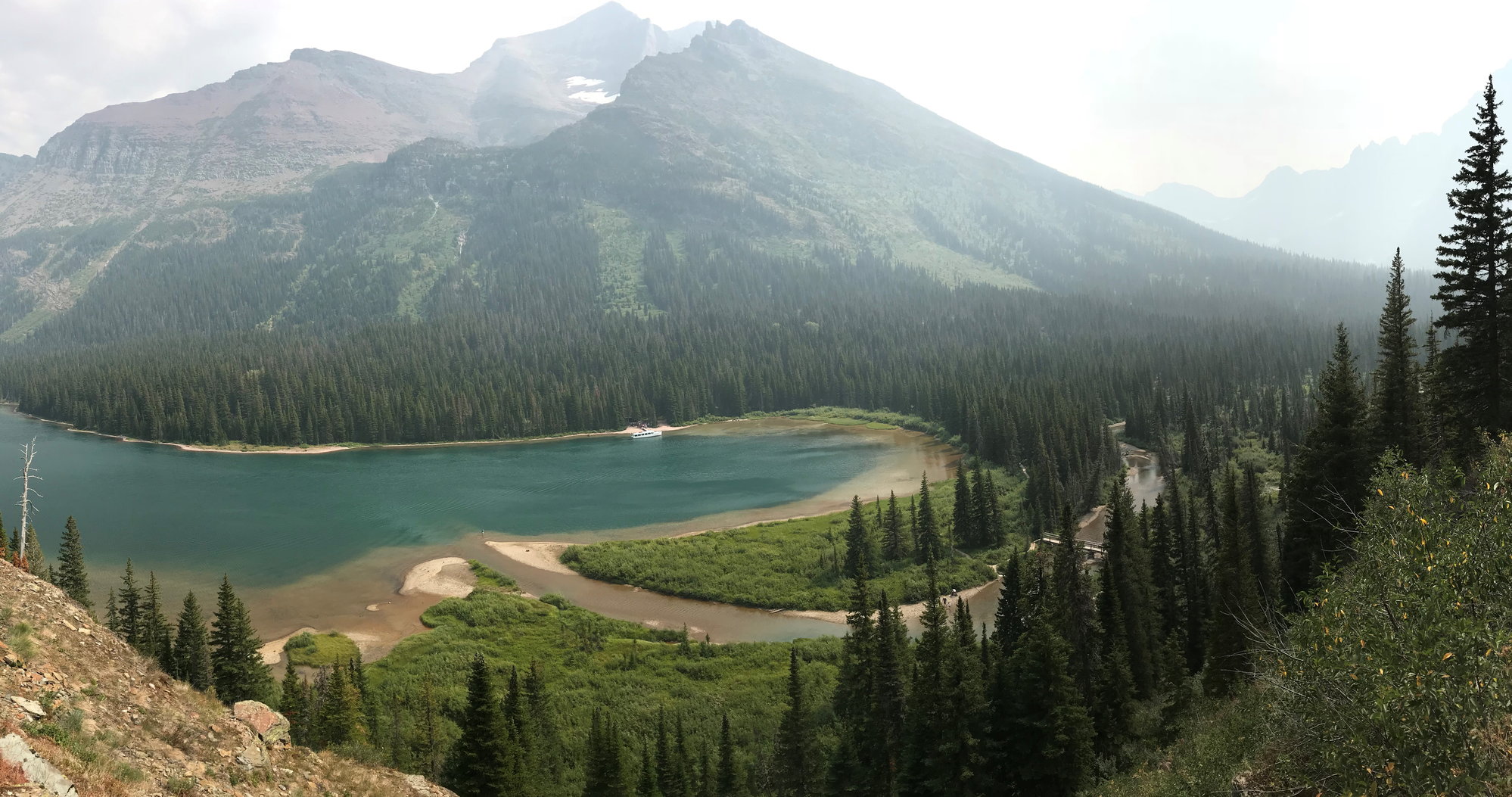
Approaching Lake Josephine on my return trip (and seeing I would be too late for the 3:00 boat)
As 3:00 neared, I was on the slope of Mount Grinnell a few hundred feet above the western end of Lake Josephine, and I could see the �Morning Eagle� approaching the dock below for a pick-up, which I clearly wasn�t going to make. And, indeed, it was just pulling away from the dock, fully loaded, when I emerged from the willow flats and walked up to the shelter and the sandy beach. I figured I probably now had about an hour to wait, but being an early arrival for the next boat at least meant that I had my choice of the limited number of tree stumps to sit on. A young couple were among the handful of others there, and the husband stripped down to his opaque black underwear and plunged into the lake; I�m sure it was cold, but I envied him a little.
Soon, though, our small party at the boat landing had something else to focus on. We noticed what I was pretty sure was the mama grizzly we had seen with her cubs along Lake Josephine�s north shore the day before swimming west along the shoreline opposite us. It appeared that her interest had perhaps been attracted by an angler who had waded into the water where the creek from Lake Grinnell ran into the lake, so we started shouting to him, and he got out of there quickly. Several of us who were there had heard that grizzlies were good swimmers, and indeed she made remarkable time before hauling herself out onto the sandy beach. She nosed about for a bit, perhaps wanting to make sure there was nothing there that presented a threat to her cubs, then disappeared into the bushes. When the next boat arrived a little later, it was piloted by Josh, who had led our nature hike of the afternoon before, and he was astonished and quite envious when we told him what we had seen, for he had never seen a bear swimming.
When the second boat dropped me off at the dock at Many Glacier, it was now pushing 5:00, and I was delighted to see my wife, daughter, and son waiting to greet me there! They said they had thoroughly enjoyed their trail ride that morning, which had taken them down a trail that ran from the parking area at Many Glacier along the western reaches of Lake Sherburne and then towards the valley between Allen and Wynn Mountains. This eventually leads in about 11 miles to Cracker Lake, although they did only the first few miles of this. They enjoyed the scenery and the experience, but it turned out that my wife�s saddle had been improperly adjusted, thereby aggravating her arthritis. She was already hobbling after the ride, and remained in some real discomfort for several days afterwards.
Although I felt fine all the way through my hike, and the areas through which I had passed had seemed clear of smoke, I ultimately suffered some consequences from it as well. When I woke up the next morning, I began coughing, and I continued to do so for several days. So while I never regretted my decision to press on for Upper Grinnell Lake and the Garden Wall in the slightest, I had to concede in retrospect that the ranger clearly had a legitimate basis for her concerns.

View of Swiftcurrent Lake, with sunset approaching; that's Grinnell Peak in the center
We relaxed for a while, took some pictures of the sinking sun from the hotel�s back deck, and then had an enjoyable dinner at the Swiftcurrent Motor Inn for far less than our bills the two previous nights at Many Glacier�s Ptarmigan Room. We were back in time to get some more sunset pictures, and then attended a ranger presentation on local wildlife on the hotel�s lower level, where I saw many familiar faces from my adventure earlier that day. While waiting for the presentation to begin, I checked my fitness app, and it recorded that I had taken over 23,000 steps, walked 9.1 miles, and climbed 126 floors that day! Afterwards, we browsed through the souvenir shop a while (I picked up a couple of coasters) and then we all turned in after what had been a very tiring, but also extremely rewarding, day.
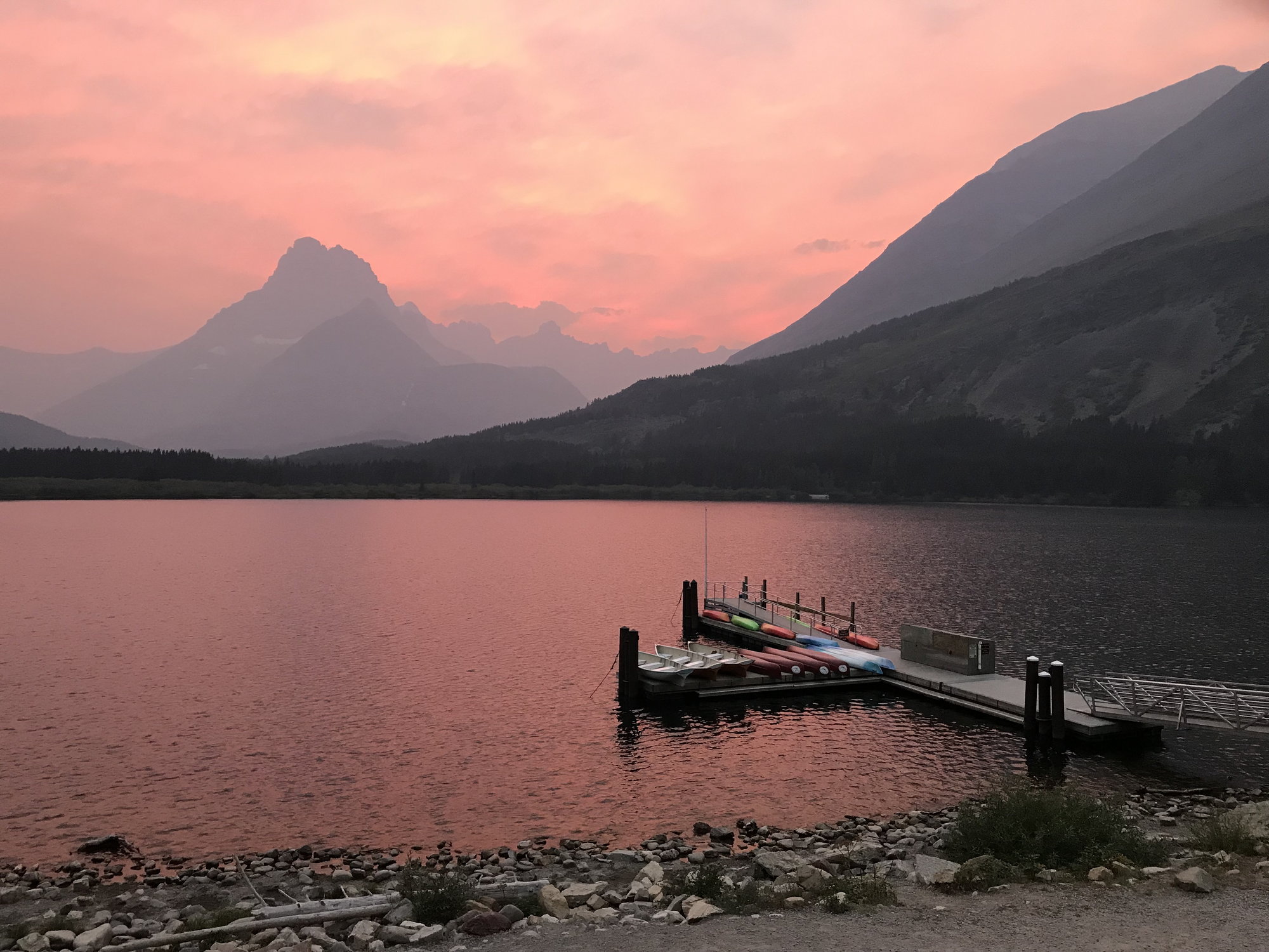
Sunset over Swiftcurrent Lake
Next: The End of our Glacier Adventure!
As we set off across Swiftcurrent Lake, the ranger assigned to lead the group took a microphone at the front of the boat and began her presentation. She immediately poured cold water on my excitement by telling us all that owing to the degree of smoke from the Howe Ridge fire at the higher elevations, she recommended that we only hike part of the way up to Upper Grinnell Lake and the Garden Wall before turning back. This was not welcome news, but I could imagine there might be some institutional biases in favor of an unnecessary degree of caution, so I decided to reserve judgment until I saw what the conditions were like at the higher elevations.
Under normal circumstances, the ranger informed us, we would have taken the trail along the north side of Lake Josephine after reaching the dock on the west side of Swiftcurrent Lake, but that wouldn�t be possible because of the bear activity there. As to that, at least, I knew � based on my observations of the day before � that these concerns were well-founded. The 40-50 of us thus trooped up and down across the saddle between the two lakes and boarded the Lake Josephine boat (the �Morning Eagle�). I was near the back of the line, so this gave me a chance to take some photos of the view ahead towards the western end of the lake, including the one below. Above a stand of deep green fir trees, a cluster of blue-gray mountains looked down on us inquisitively, almost like a welcoming party of Titans wondering who these Lilliputians might be. At the rear, I could already see the Salamander Glacier draped across the Garden Wall several miles to the west and nearly 2,000 feet above me. It was serene, still, and beautiful. I couldn�t see any evidence of significant smoke ahead, which was encouraging.
The view west across Lake Josephine towards the Garden Wall, the Continental Divide, and the Salamander Glacier
We motored across to the boat dock on the far side of the lake, which we reached about 9:15. As we disembarked, I was surprised by the number of relatively small children, and based on what I�d heard about the strenuous nature of this hike, I wondered whether their parents fully understood what they were getting them in for.
We set off to the right around the western end of Lake Josephine and made our way over a series of wooden bridges across the marshy, willow-filled area where the creek from (Lower) Grinnell Lake ran into its neighbor. Once we were on the other side, the easy part was over. Starting at an elevation of 5,000 feet, we immediately began climbing a series of steep, rocky switchbacks up the southern side of Mount Grinnell, and I was glad that I had brought both of my trekking poles. The first 500 feet of elevation gain came pretty quickly, but then it tapered off a bit as the trail continued to run up the slope to the west, clinging to the flanks of the mountain while the steep-sided rock pyramid of Grinnell Point (7,500 feet-plus) loomed above us.
View towards (Lower) Grinnell Lake, Angel Wing Mountain, and Mount Gould
From fairly early on, the views back towards Lake Josephine and later looking south towards Angel Wing Mountain and the even more massive Mount Gould behind it were deeply impressive. Already, however, a shroud of smoke veiled the tops of all these peaks, although it didn�t seem bad where we were, several thousand feet below. I could only marvel at how magnificent this view must be like on a clear day.
The ranger stopped a couple of times for short presentations, and I think we were still short of being able to see (Lower) Lake Grinnell when she announced that she would be turning around at this point. The parents with small children went with her, as did a few others, but at least 25 people determined to press on. By that time, we already had a good view of the serrated knife-edge of the Garden Wall (along which runs the Continental Divide) and of Grinnell Falls spilling over the saddle of rock between Angel Wing Mountain and Mount Grinnell. Those potent attractions lured us on.
And we were soon rewarded for our persistence. Within a few minutes, off to the left and a thousand feet below us (for we had by now reached the 6,000' contour line), was the striking teal-green water of Lake Grinnell, with the sheared-off northern flank of Angel Wing Mountain vaulting towards the sky above it. I could clearly see the beach on its southern shore where my family and I had stood the afternoon before.
(Lower) Grinnell Lake, Angel Wing Mountain, Grinnell Falls, and the Garden Wall
Our party continued uphill in a long, single-file line. The stone beneath our feet was the distinctive red argillite of the pre-Cambrian Age, but up here it was shattered, crushed, and powdery, far different from the solid slabs across which we had walked on the Virginia Falls Trail three days earlier. Little rivulets began running across the trail from the mountain�s crest above us, and eventually we came to a spot where a small waterfall dropped straight over the edge of a sheer rock face and fell directly onto the trail.
Grinnell Glacier Hike Water Hazard
Not too far past that, we began to encounter a stretches of rippled white rock that preserved the pattern of the pre-Cambrian seabed, estimated here in Glacier to be about 1.4 billion years old, give or take a few. That�s old � but it�s still only a third of the age of the earth.
Pre-Cambrian seabed
At times, this trail is breathtaking in more ways than one
I stopped to take so many photos that the later ones show only a scattered handful of people making their way along the trail in front of me. Eventually, I passed Grinnell Falls, tumbling down the slope towards Lake Grinnell below, and then there was a final steep climb up a scrubby, rock-strewn hillside to a grove of squat, wind-twisted fir trees in which there were spots to picnic and a few heavily patronized toilet facilities. Not too far beyond that, you came over a small rise (at 6,500 feet in elevation) and Upper Grinnell Lake at last lay at your feet: an expanse of blue-green water on a barren rocky plateau, backing up to what remained of the Grinnell Glacier at its southern end. As a result of the recent heat wave and at least two 100-degree days, there were only a handful of small ice floes drifting about the lake, but it was impossible not to be awed by the massive barrier of the Garden Wall rising up from 1,500 to as much as 2,300 feet above us on its far side, with several thin waterfalls plummeting down its face.
Upper Grinnell Lake, Grinnell Glacier, and the Garden Wall
It was just before noon when I reached the lake. The distance from Lake Josephine was just under three miles � and it had taken me roughly two-and-a-half hours to do it (albeit with a few ranger presentations and frequent stops for photos, or just to take in the amazing landscape). I settled down by a large rock to enjoy the package of trail mix my wife had thoughtfully made up for me. By this time, unfortunately, the sunny skies of the morning had been replaced by overcast, which was disappointing from a photographic standpoint. It was cooler at this elevation in any case, and there was a relatively steady wind. A few young men took the plunge into the lake, but most of the scattered handfuls of hikers just snacked and took in the view.
I struck up a conversation with a man and his wife who were sitting near me; he was wearing an MIT cap, and after a few minutes we realized that we had both been in Cambridge at the same time and had graduated from our respective graduate and professional schools in the same year � 1983! Such a small world.
I remained at the top for about an hour, then started to make my way back down, passing a marmot who was observing the passing hikers from atop a boulder as I did so. Because I had stayed at the top for so long and was still stopping often for photos on the return leg, I soon had the trail largely to myself. I even stopped at one point and took off my heavy socks and hiking boots and enjoyed soaking my feet in a pool of cold water made by one of the freshets running down the mountainside. Once I got back closer to Lake Josephine, however, there were often sharp bends in the trail that limited visibility ahead, as well as dense vegetation that began to close in around the path. The gave me cause for concern about possible encounters with bears, so I made plenty of noise and approached any blind bends in the trail very gingerly.
Approaching Lake Josephine on my return trip (and seeing I would be too late for the 3:00 boat)
As 3:00 neared, I was on the slope of Mount Grinnell a few hundred feet above the western end of Lake Josephine, and I could see the �Morning Eagle� approaching the dock below for a pick-up, which I clearly wasn�t going to make. And, indeed, it was just pulling away from the dock, fully loaded, when I emerged from the willow flats and walked up to the shelter and the sandy beach. I figured I probably now had about an hour to wait, but being an early arrival for the next boat at least meant that I had my choice of the limited number of tree stumps to sit on. A young couple were among the handful of others there, and the husband stripped down to his opaque black underwear and plunged into the lake; I�m sure it was cold, but I envied him a little.
Soon, though, our small party at the boat landing had something else to focus on. We noticed what I was pretty sure was the mama grizzly we had seen with her cubs along Lake Josephine�s north shore the day before swimming west along the shoreline opposite us. It appeared that her interest had perhaps been attracted by an angler who had waded into the water where the creek from Lake Grinnell ran into the lake, so we started shouting to him, and he got out of there quickly. Several of us who were there had heard that grizzlies were good swimmers, and indeed she made remarkable time before hauling herself out onto the sandy beach. She nosed about for a bit, perhaps wanting to make sure there was nothing there that presented a threat to her cubs, then disappeared into the bushes. When the next boat arrived a little later, it was piloted by Josh, who had led our nature hike of the afternoon before, and he was astonished and quite envious when we told him what we had seen, for he had never seen a bear swimming.
When the second boat dropped me off at the dock at Many Glacier, it was now pushing 5:00, and I was delighted to see my wife, daughter, and son waiting to greet me there! They said they had thoroughly enjoyed their trail ride that morning, which had taken them down a trail that ran from the parking area at Many Glacier along the western reaches of Lake Sherburne and then towards the valley between Allen and Wynn Mountains. This eventually leads in about 11 miles to Cracker Lake, although they did only the first few miles of this. They enjoyed the scenery and the experience, but it turned out that my wife�s saddle had been improperly adjusted, thereby aggravating her arthritis. She was already hobbling after the ride, and remained in some real discomfort for several days afterwards.
Although I felt fine all the way through my hike, and the areas through which I had passed had seemed clear of smoke, I ultimately suffered some consequences from it as well. When I woke up the next morning, I began coughing, and I continued to do so for several days. So while I never regretted my decision to press on for Upper Grinnell Lake and the Garden Wall in the slightest, I had to concede in retrospect that the ranger clearly had a legitimate basis for her concerns.
View of Swiftcurrent Lake, with sunset approaching; that's Grinnell Peak in the center
We relaxed for a while, took some pictures of the sinking sun from the hotel�s back deck, and then had an enjoyable dinner at the Swiftcurrent Motor Inn for far less than our bills the two previous nights at Many Glacier�s Ptarmigan Room. We were back in time to get some more sunset pictures, and then attended a ranger presentation on local wildlife on the hotel�s lower level, where I saw many familiar faces from my adventure earlier that day. While waiting for the presentation to begin, I checked my fitness app, and it recorded that I had taken over 23,000 steps, walked 9.1 miles, and climbed 126 floors that day! Afterwards, we browsed through the souvenir shop a while (I picked up a couple of coasters) and then we all turned in after what had been a very tiring, but also extremely rewarding, day.
Sunset over Swiftcurrent Lake
Next: The End of our Glacier Adventure!
Sep 10th, 2020 | 07:23 AM
#12
Original Poster
Joined: Oct 2003
Posts: 314
Likes: 4
A couple of additional photos from (Lower) Lake Grinnell
Since posting the previous post, I've learned that I apparently can get Fodor's software to upload a panorama shot if I trim off part of it. So I'm going to try that with regard to the view from the beach on (Lower) Lake Grinnell, as well as posting another non-panorama photo.
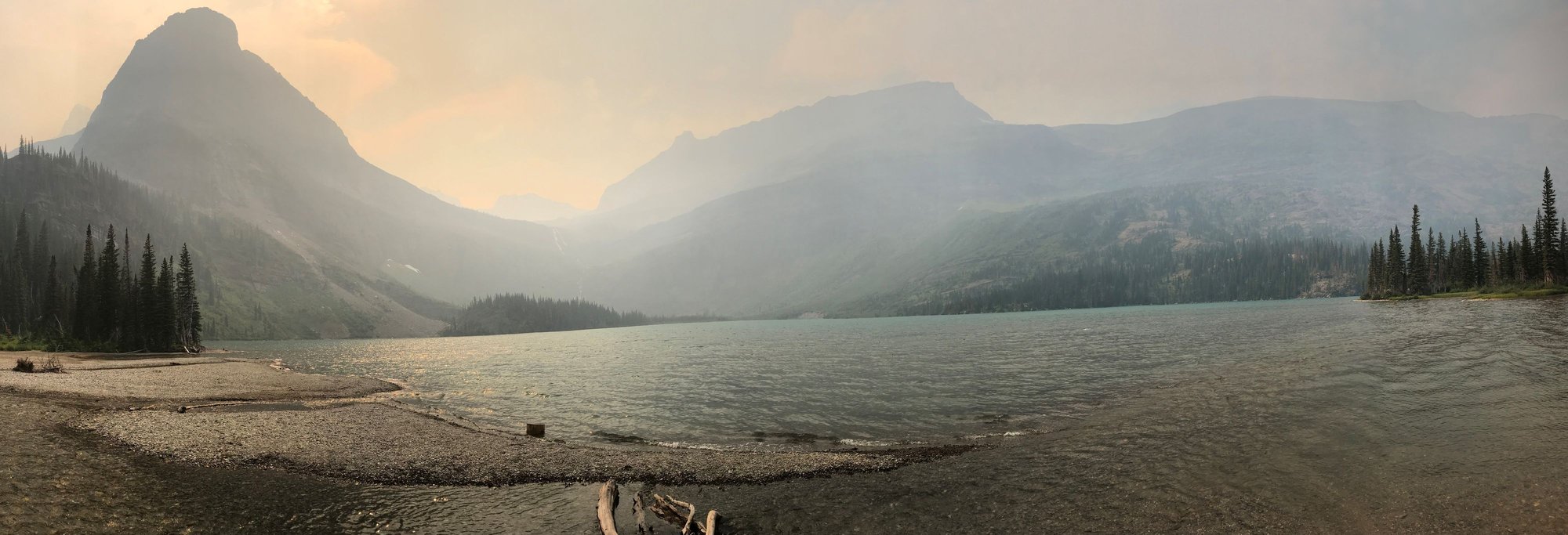
The view from the beach on (Lower) Grinnell Lake
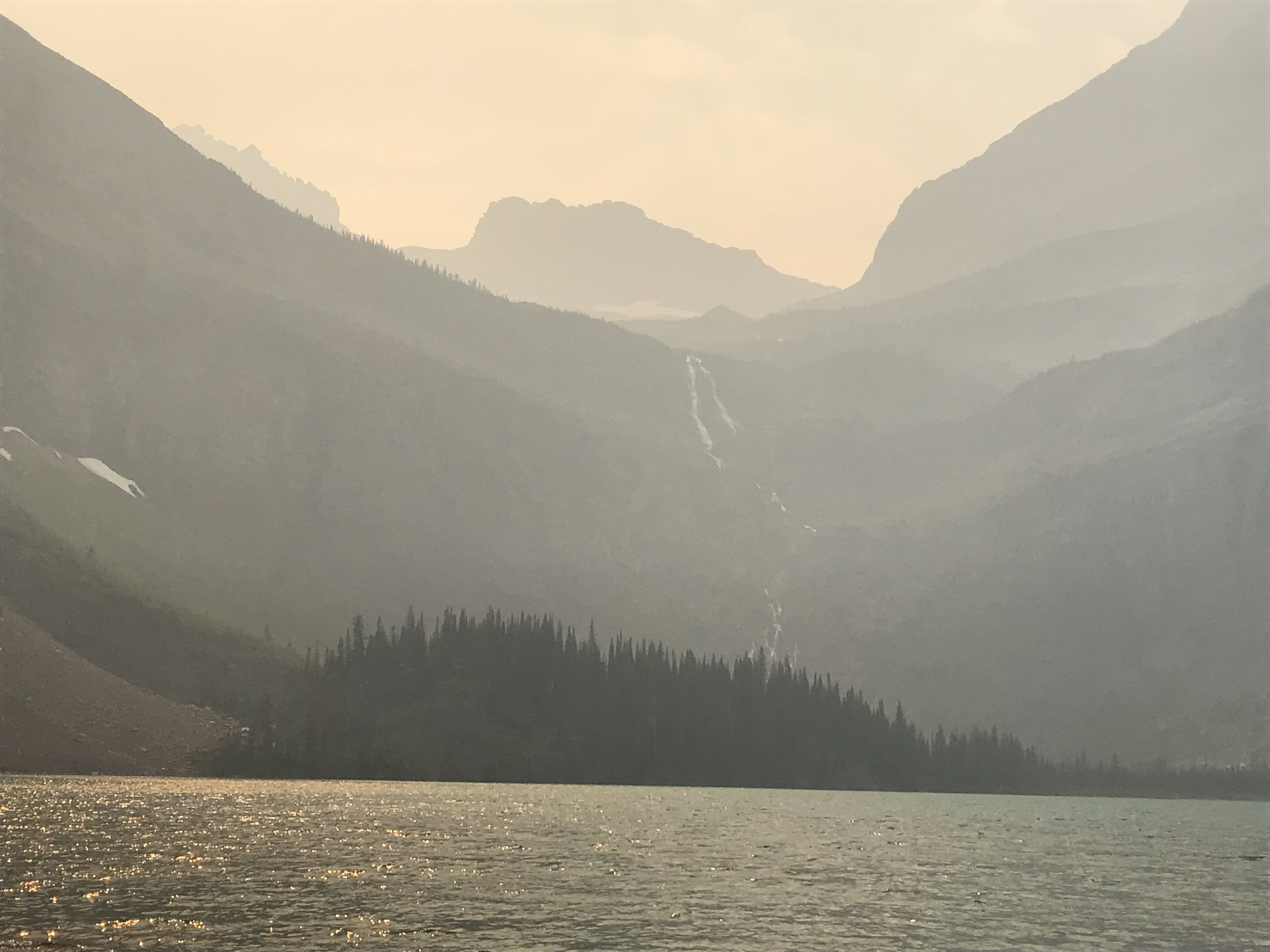
View across (Lower) Grinnell Lake, looking towards Grinnell Falls and the Garden Wall
The view from the beach on (Lower) Grinnell Lake
View across (Lower) Grinnell Lake, looking towards Grinnell Falls and the Garden Wall
Sep 11th, 2020 | 04:46 PM
#15
Original Poster
Joined: Oct 2003
Posts: 314
Likes: 4
Thanks, wtm003 & Wekiva! Glacier is well worth a visit, and I'm hoping to get back there in another year or two.
Before I wrap this up, I will also post links to some other references that I found helpful. There are a lot of useful videos on YouTube.
Before I wrap this up, I will also post links to some other references that I found helpful. There are a lot of useful videos on YouTube.
Sep 11th, 2020 | 04:55 PM
#16
Original Poster
Joined: Oct 2003
Posts: 314
Likes: 4
It occurred to me after I finished up my account of the Grinnell Glacier hike that while I had included several photos showing the views from the trail, I had included only a couple of close-up shots of the trail itself. So here are two more, one taken on the way up and one taken on the way back, that may give a better sense of what the trial itself is like.
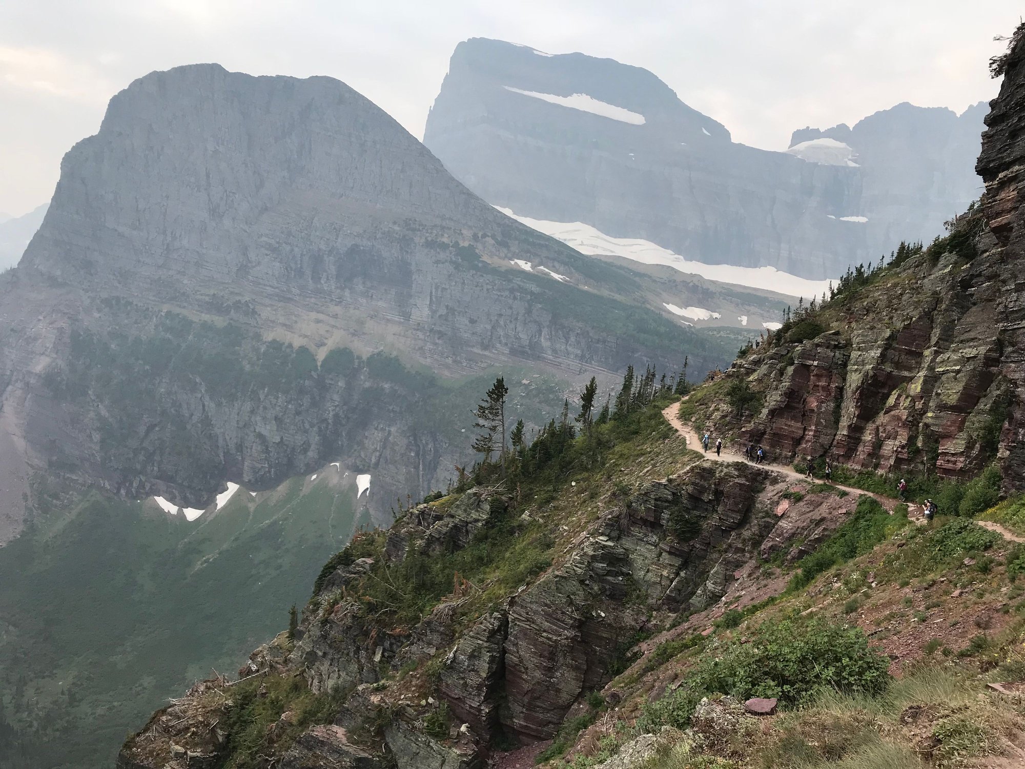
The Grinnell Glacier Trail: going up . . .
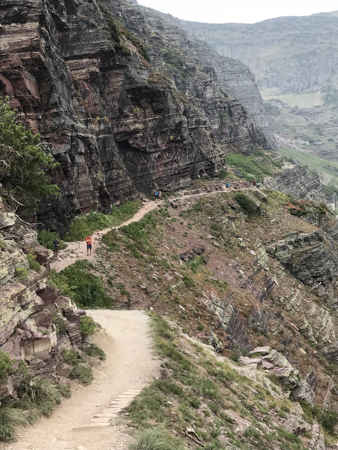
. . . and coming back down.
The Grinnell Glacier Trail: going up . . .
. . . and coming back down.
Sep 12th, 2020 | 08:46 PM
#17
Original Poster
Joined: Oct 2003
Posts: 314
Likes: 4
August 18th, Saturday: Logan Pass, Two Medicine, and Columbia Falls
This was our final morning at Many Glacier. By late afternoon, we needed to be back at the Cedar Creek Lodge in Columbia Falls, which was a drive of about 120 miles. Between the trail closures owing to bear activity and the smoke from the Howe Ridge fire gradually filling the valleys, I�m not sure we would have found much else to do that day even if we had been staying on. The deep cough I woke up with this morning was a reminder of the health risks of staying outside too long under these circumstances.
We had another wonderful and filling breakfast at the Swiftcurrent Motor Inn. Of course, I pored over the typographical trail map on our table again while waiting for our food to arrive, with an eye towards fixing in my mind what I might want to do on a future visit. After seeing the Garden Wall from its eastern side the day before, I now wanted to someday hike its western side along the Highline Trail, which runs north from Logan Pass and then downhill to the hairpin turn known as �the Loop� on Going-to-the-Sun Road.
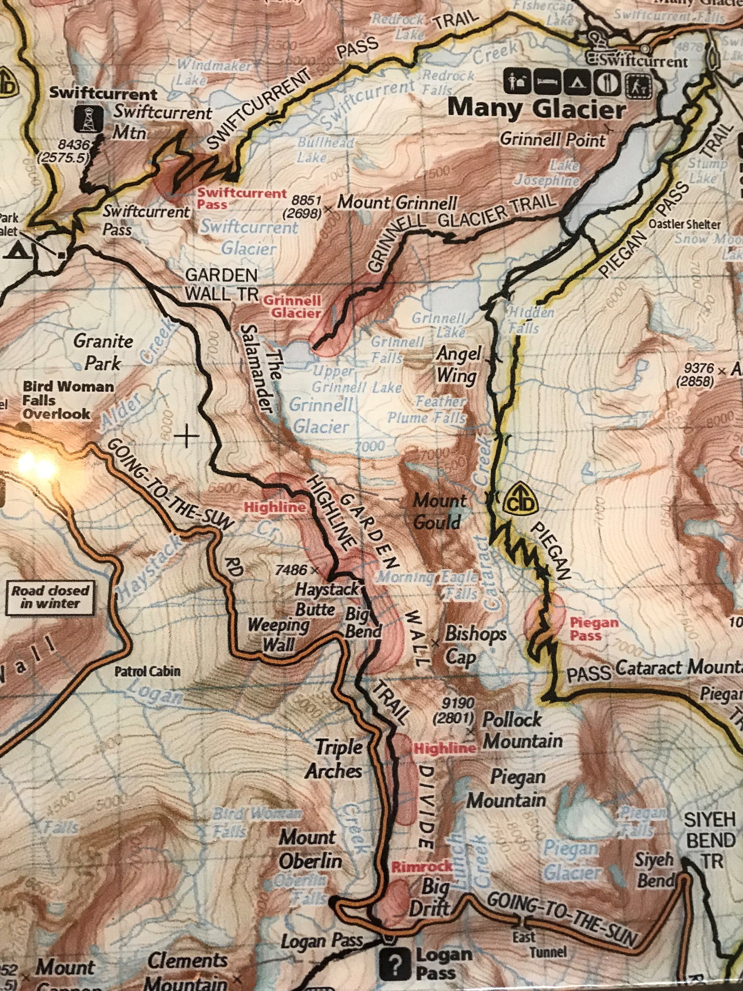
Tabletop Trail Map from the restaurant at the Swiftcurrent Motor Inn, showing the Highline Trail-- one of my aspirations for my next visit to Glacier!
We returned to our rooms, packed up, took a few more pictures, and then were ready to depart a little after 11:30. As we were loading up our car out front, I encountered the MIT alum and his wife whom I�d enjoyed chatting with up at Upper Grinnell Lake the day before, and we wished each other good travels.
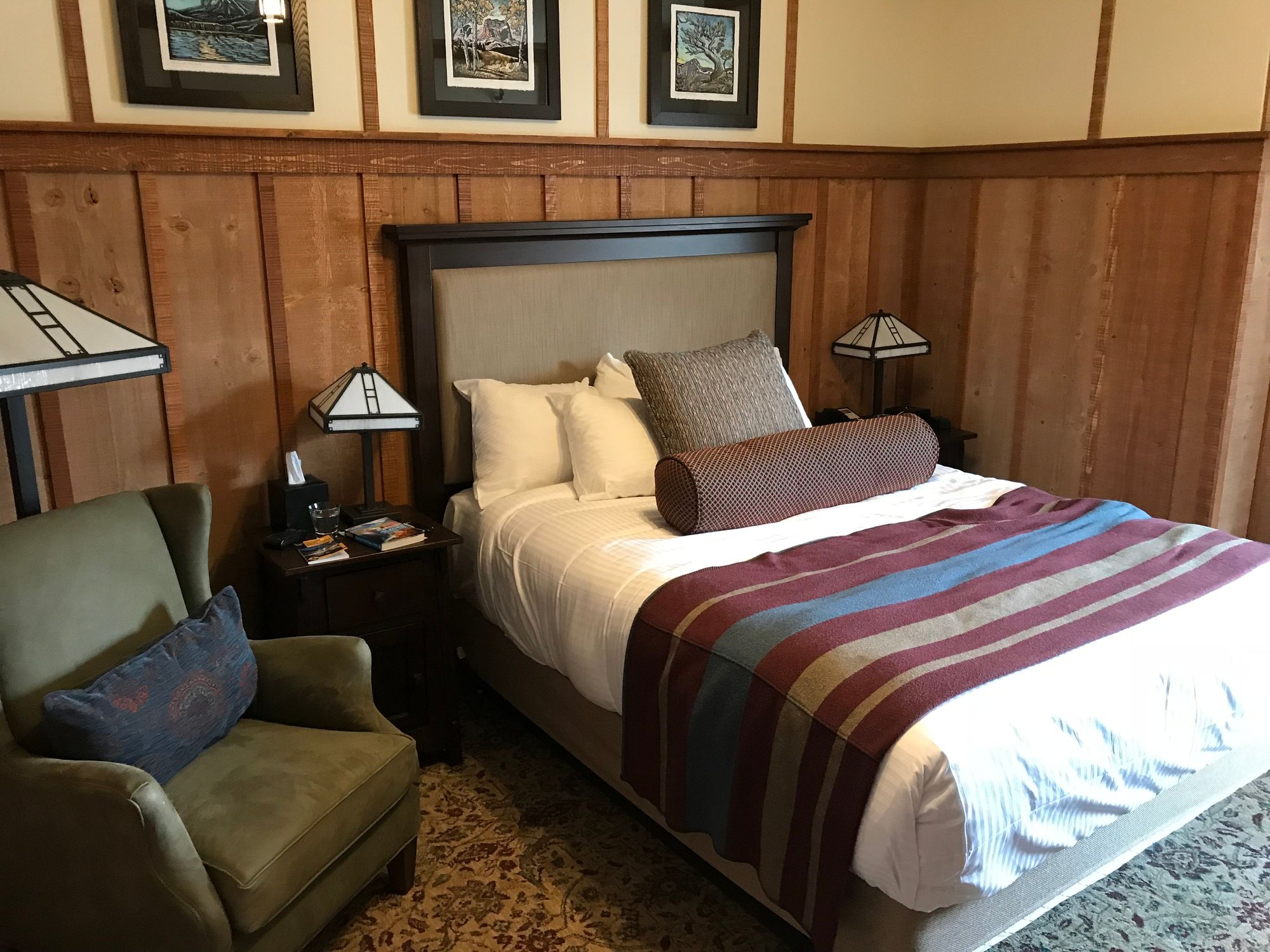
One of our rooms at Many Glacier
And then it was back down the valley past Lake Sherburne and south along the park�s eastern edge to St. Mary, where we turned west up Going-to-the-Sun Road for Logan Pass. We didn�t have much else to do, since it would have taken us a maximum of three hours to drive straight through to Columbia Falls. So we thought we might get some photos along the road, pick up a few souvenirs at the shop at the Visitor�s Center, and give me time to do a short hike on the southern end of the Highline Trail that would serve as an appetizer for a future visit.

Waterfall along Going-to-the-Sun Road
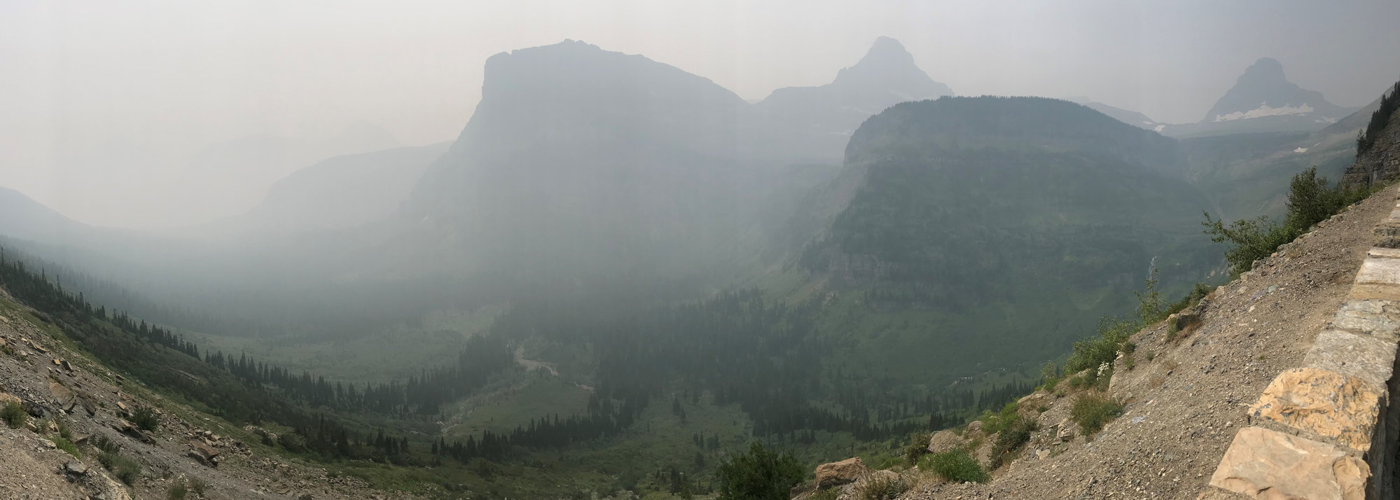
View from Going-to-the-Sun Road, 8 days into the Howe Ridge fire
It turned out that the St. Mary Valley was now so full of smoke that photos were pointless, except for memorializing just how bad things had gotten. (I think we�d learned that morning that they were still waiting to get a Class 1 firefighting team in there to work on the Howe Ridge fire; all the units were still tied up in California.) When we reached Logan Pass at 12:45, the parking lot was barely 40% full. Normally, it would have been packed by that time of day, so it was clear that tourists were giving up on Glacier for the time being.
There were some elevation profiles for the nearby trails posted in the Visitor�s Center. From the one for the Highline Trail, I learned that it definitely made sense to start it from Logan Pass rather than �the Loop.� It ran on a relatively level course north from Logan Pass to the Grinnell Glacier overlook on the Garden Wall before descending some 2,350 feet to �the Loop,� so it you did it the other way around, you had to face that formidable ascent at the very start of your hike.
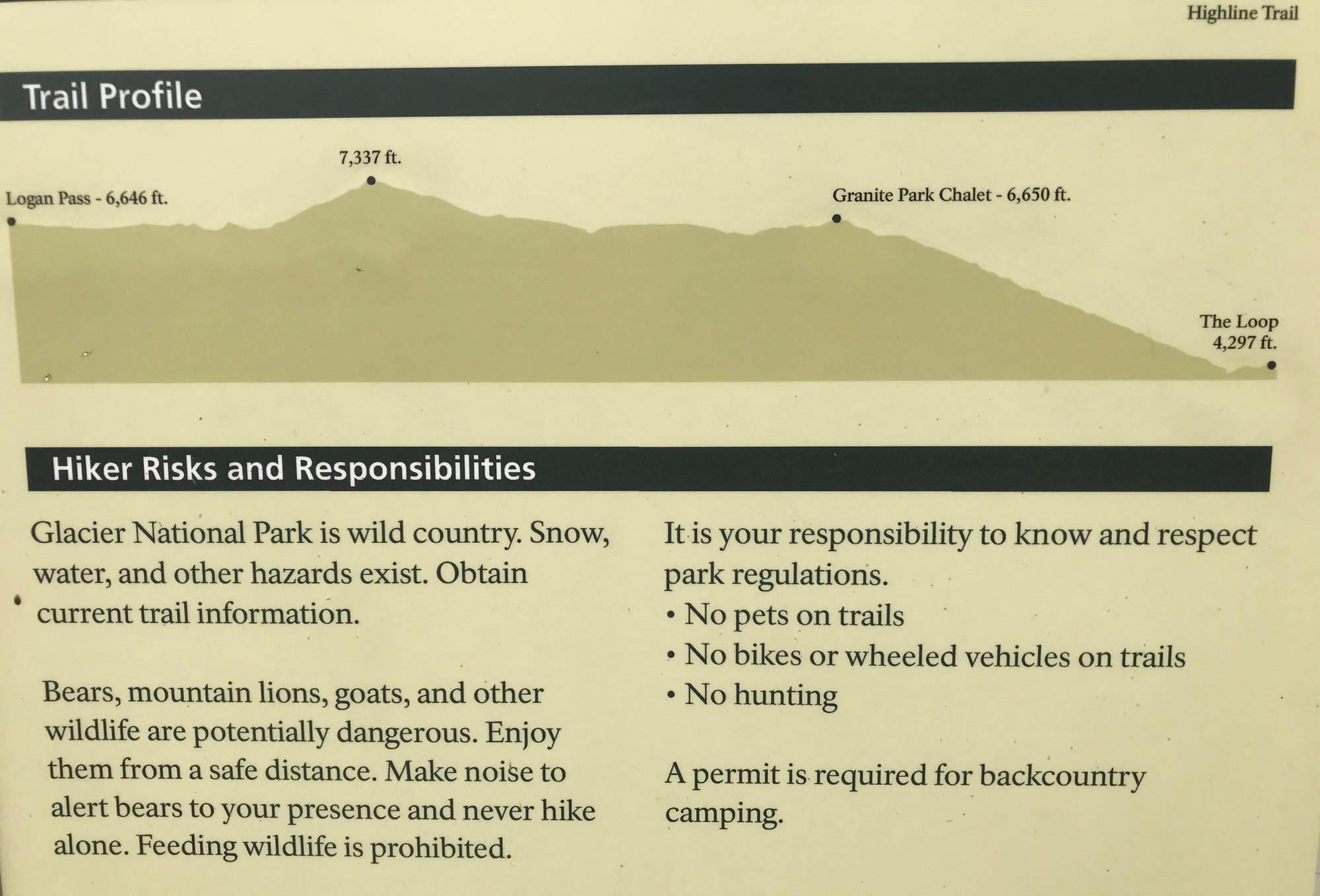
Elevation Profile for the Highline Trail
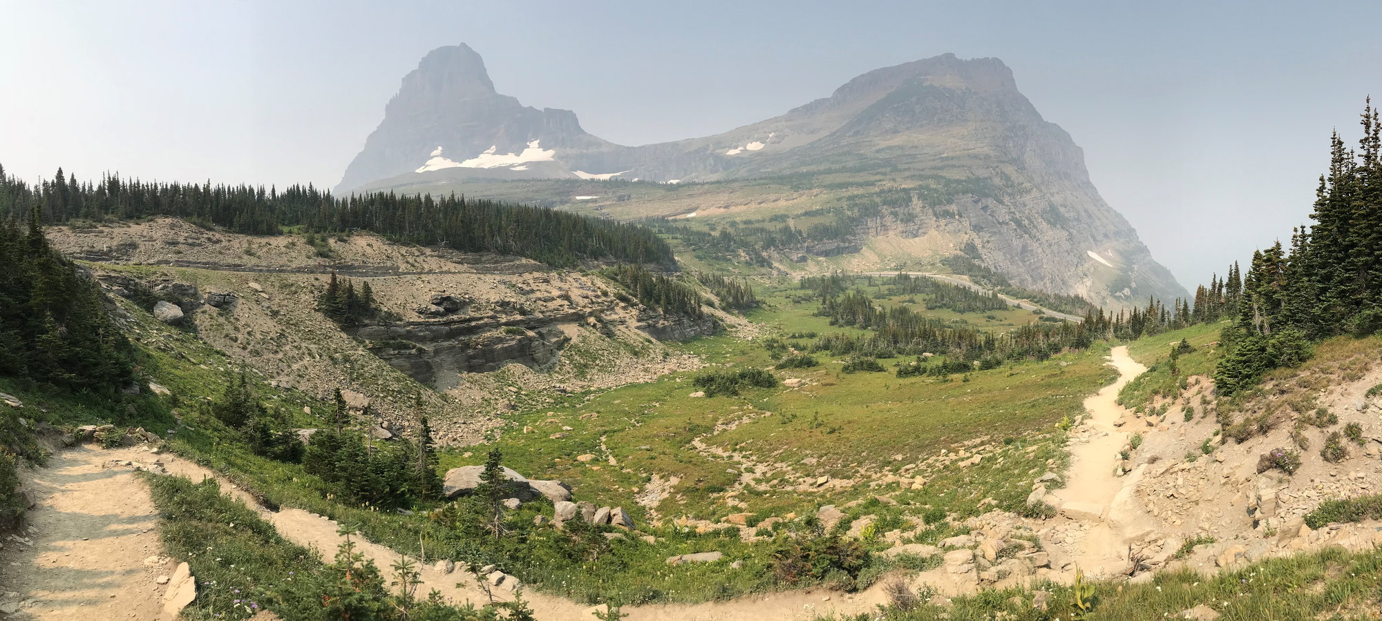
The start of the Highline Trail near Logan Pass
I did walk out about a half mile or so along the Highline Trail to get a feel for it, and this stretch was not for the faint of heart. The trail was mostly about 3'-5' feet wide, which may sound more comfortable than it is when there�s a sheer cliff to your right and a precipitous, unprotected drop to the Going-to-the-Sun Road to your left � and the trail itself is covered with shaly fragments of rock and there are other hikers occasionally coming in the opposite direction. For these reasons, there is a rubber-covered chain strung through pitons hammered into the cliff face on the worst of these stretches to give you a little more security if you need it.
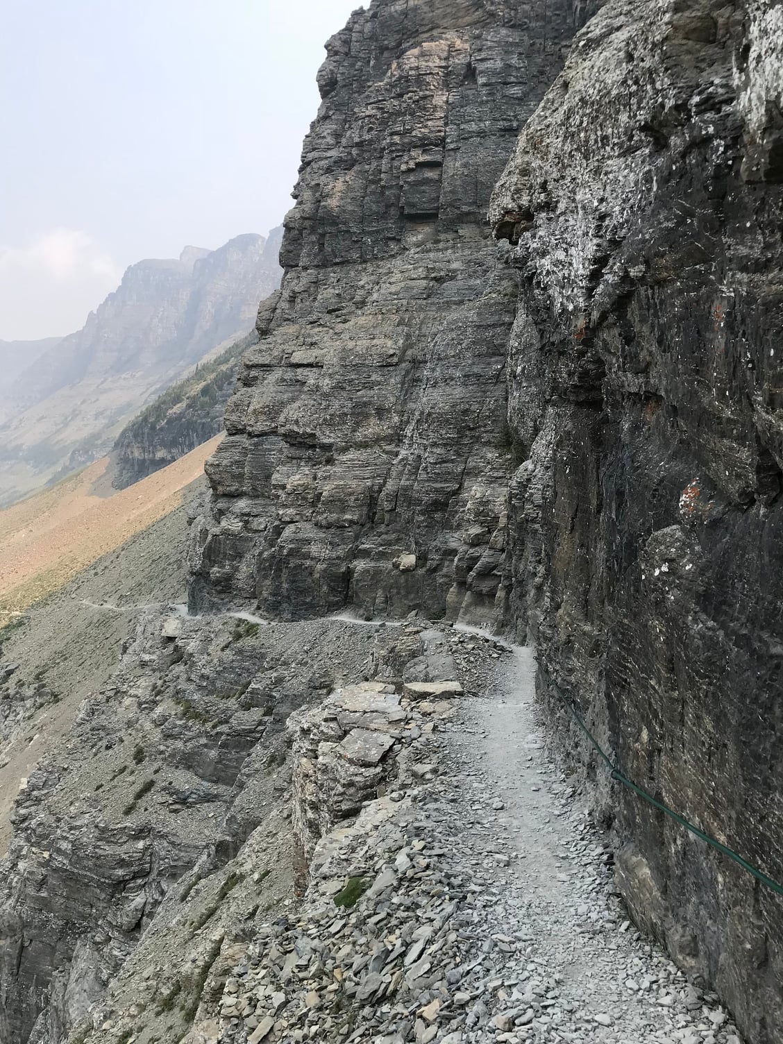
With stretches like this, the Highline Trail won't be for everyone
My pulse was definitely beating a little faster than normal in this stretch. But the landscape was grand � at least for as far as you could see it, which I guessed was about two miles before the mountains became mere shadows in the smoke. I was definitely excited about returning to tackle this trail (it�s an 11.6 mile hike from Logan Pass to �the Loop�) on a future visit, but for today, I had seen enough and I returned to the Visitor�s Center.

View from the Highline Trail, with Going-to-the-Sun Road on the left and Mount Oberlin in the center
I was paying for some souvenirs a few minutes later when the cashier mentioned that there was a herd of bighorn sheep grazing a short distance down the slope, so I found the others and we went out back to the terrace � where we could see a group of 15-20 sheep grazing only a hundred yards away. This was far more impressive than the couple of individual specimens we had seen higher up on the shoulder of Mount Clements several days earlier. So we could check off another one of Glacier�s prime examples of megafauna, and we all felt this made our final trip up to Logan Pass worth the time.
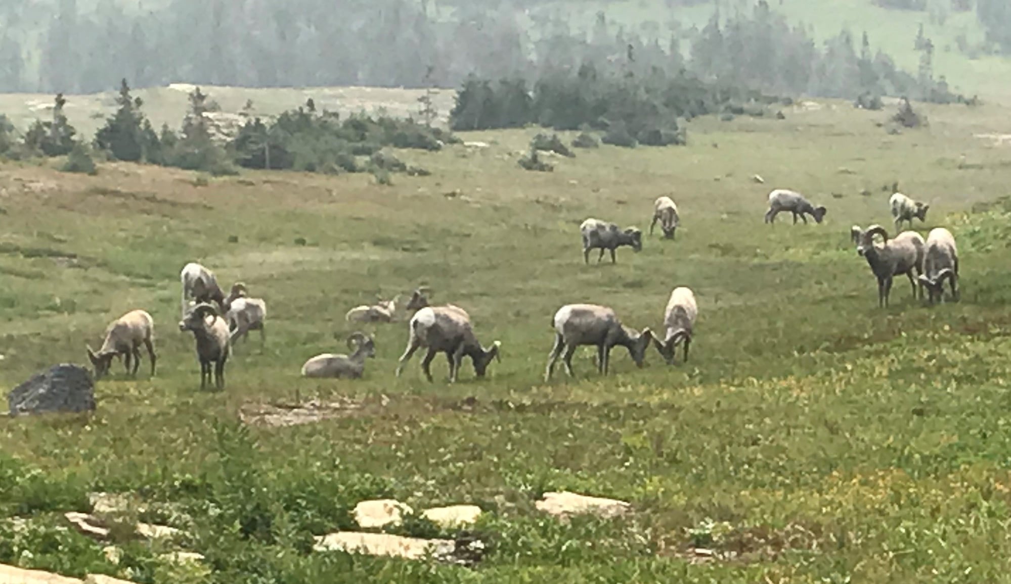
Bighorn Sheep grazing near the Logan Pass Visitors Center
After we finished at Logan Pass, we drove back down Going-to-the-Sun Road to St. Mary, passing largely deserted overlooks that left us with a somewhat lonely feeling. When we approached East Glacier, we turned off one final time for the Two Medicine Area, and today, getting in proved to be no problem at all. This was not particularly surprising, because the lovely valley we had glimpsed in the distance was now largely filled up with smoke. My daughter and I did do a short (two miles round trip) hike to see Running Eagle Falls, which has a curious structure. At the height of the late spring/early summer snow run-off season, the water both flows over the top of the rock face and emerges from a cave in the middle of it. By this point in the season, only the second channel was flowing, but it was still a curious sight.
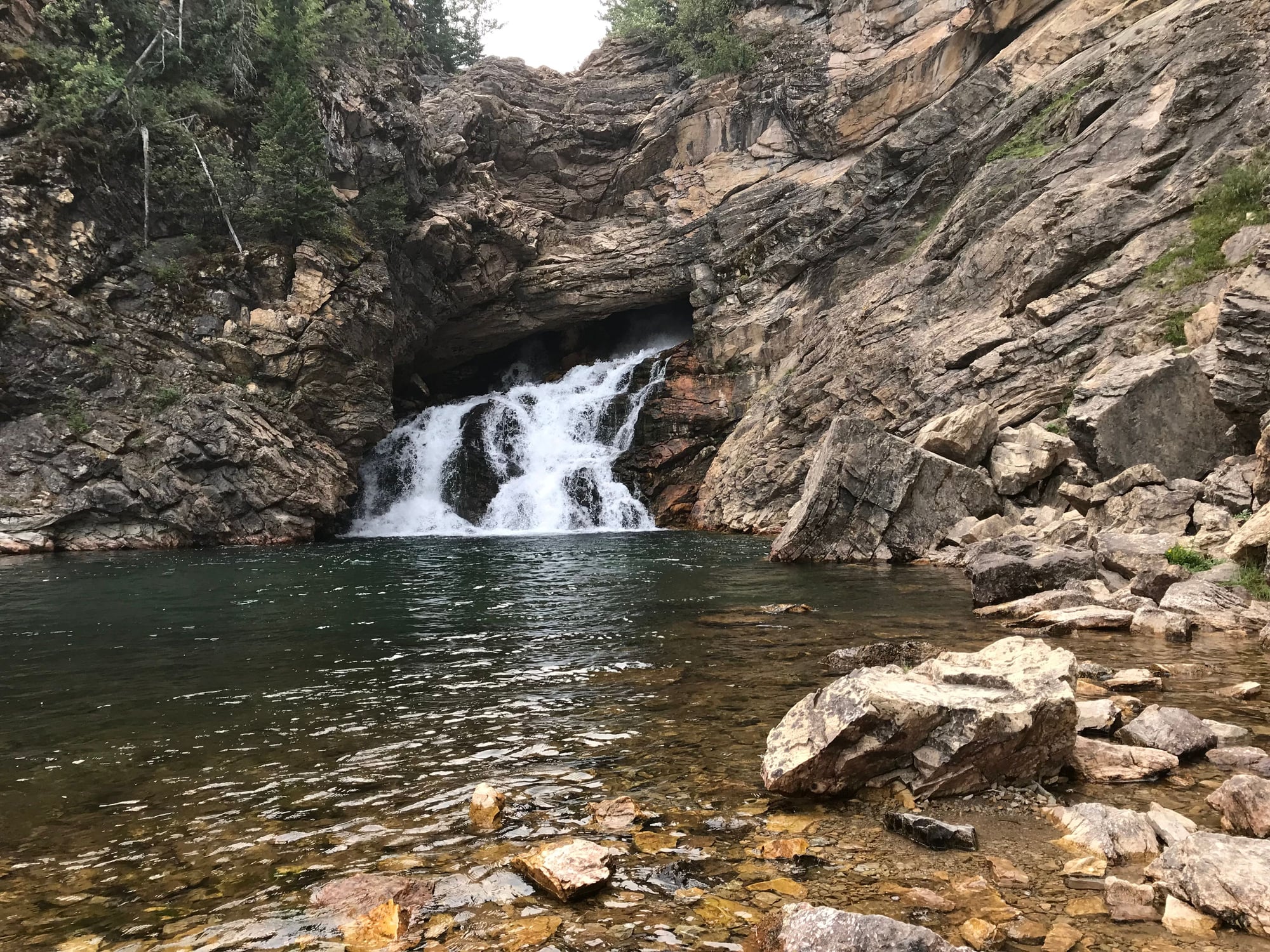
Running Eagle Falls, in the Two Medicine Area
After visiting the falls, we continued on to Two Medicine Lake and walked down to the lakeshore. But even I couldn�t get excited about taking any photos under the conditions that existed by then. So at about 3:30, we set off to do the 55-mile-drive along Highway 2 between East and West Glacier for our sixth time this trip.
We passed through West Glacier and drove a few miles further to Apgar to take in the view up Lake McDonald from there. We found that the smoke obscured everything north of the first headland along the shore. What a contrast to the magnificent, sunny landscape we had first seen just a week earlier!
We drove on over to Columbia Falls and checked in at the Cedar Creek Lodge, which has another positive attribute I hadn�t noticed during our overnight stay there a week earlier. This is t it backs up to a large and pleasant city park called Pinewood � potentially handy if you have smaller children who need to burn off some energy! We went out to dinner at a local pizza place that was recommended to us by the front desk staff, whose name I unfortunately neglected to record. It was informal and hole-in-the-wall cramped, but the food was excellent, inexpensive, and came in substantial quantities. We all very much enjoyed our respective pizzas.
Afterwards, my son got in a soak in the hot tub back at the Cedar Creek Lodge. Then we all turned in early, because our flight out to following morning was at 6:55 a.m. And so our long-anticipated Glacier Park vacation came to an end.
Because of the Howe Ridge fire, it had certainly been something of a mixed bag, with the hours of extra driving over the first several days eating into our sight-seeing time, and the troubles we�d experienced getting into the Two Medicine Area. We never did get to see the central stretch of Going-to-the-Sun Road on either side of the loop � probably about a 15-mile segment � and the scenery in there is supposed to be as fine as any in the park.
But our other hikes and wildlife sightings were a substantial compensation for all that, as was our visit to the Blackfoot Reservation. And we wound up gaining a far more comprehensive education in the here-and-now impacts of climate change than I had expected when planning our trip. After all, wildfires are a traditional -- and increasingly common -- part of the ecosystem in the west.
So, by all means go to Glacier! You just have to be aware that it�s something of a lottery with the wildfire risk. In addition, as the summer wears on, it appears that you are likely to run into greater problems with bears pushing down from higher, more remote elevations, and with trails being closed as a result. Also, I would think that if you were there four to six weeks sooner than we were, you would likely find the glaciers more substantial and more snow remaining on the peaks.
Thus, based upon our experience, I might suggest visiting Glacier in the first half of July or even in late June, or possibly in early September if you don�t have childrens� school schedules that make that impossible. But by all means check that advice with rangers at the park, because you also have to keep in mind the date when Going-to-the-Sun Road becomes completely passable. I found the rangers to be very helpful when I was going through my planning process.
We had another wonderful and filling breakfast at the Swiftcurrent Motor Inn. Of course, I pored over the typographical trail map on our table again while waiting for our food to arrive, with an eye towards fixing in my mind what I might want to do on a future visit. After seeing the Garden Wall from its eastern side the day before, I now wanted to someday hike its western side along the Highline Trail, which runs north from Logan Pass and then downhill to the hairpin turn known as �the Loop� on Going-to-the-Sun Road.
Tabletop Trail Map from the restaurant at the Swiftcurrent Motor Inn, showing the Highline Trail-- one of my aspirations for my next visit to Glacier!
We returned to our rooms, packed up, took a few more pictures, and then were ready to depart a little after 11:30. As we were loading up our car out front, I encountered the MIT alum and his wife whom I�d enjoyed chatting with up at Upper Grinnell Lake the day before, and we wished each other good travels.
One of our rooms at Many Glacier
And then it was back down the valley past Lake Sherburne and south along the park�s eastern edge to St. Mary, where we turned west up Going-to-the-Sun Road for Logan Pass. We didn�t have much else to do, since it would have taken us a maximum of three hours to drive straight through to Columbia Falls. So we thought we might get some photos along the road, pick up a few souvenirs at the shop at the Visitor�s Center, and give me time to do a short hike on the southern end of the Highline Trail that would serve as an appetizer for a future visit.
Waterfall along Going-to-the-Sun Road
View from Going-to-the-Sun Road, 8 days into the Howe Ridge fire
It turned out that the St. Mary Valley was now so full of smoke that photos were pointless, except for memorializing just how bad things had gotten. (I think we�d learned that morning that they were still waiting to get a Class 1 firefighting team in there to work on the Howe Ridge fire; all the units were still tied up in California.) When we reached Logan Pass at 12:45, the parking lot was barely 40% full. Normally, it would have been packed by that time of day, so it was clear that tourists were giving up on Glacier for the time being.
There were some elevation profiles for the nearby trails posted in the Visitor�s Center. From the one for the Highline Trail, I learned that it definitely made sense to start it from Logan Pass rather than �the Loop.� It ran on a relatively level course north from Logan Pass to the Grinnell Glacier overlook on the Garden Wall before descending some 2,350 feet to �the Loop,� so it you did it the other way around, you had to face that formidable ascent at the very start of your hike.
Elevation Profile for the Highline Trail
The start of the Highline Trail near Logan Pass
I did walk out about a half mile or so along the Highline Trail to get a feel for it, and this stretch was not for the faint of heart. The trail was mostly about 3'-5' feet wide, which may sound more comfortable than it is when there�s a sheer cliff to your right and a precipitous, unprotected drop to the Going-to-the-Sun Road to your left � and the trail itself is covered with shaly fragments of rock and there are other hikers occasionally coming in the opposite direction. For these reasons, there is a rubber-covered chain strung through pitons hammered into the cliff face on the worst of these stretches to give you a little more security if you need it.
With stretches like this, the Highline Trail won't be for everyone
My pulse was definitely beating a little faster than normal in this stretch. But the landscape was grand � at least for as far as you could see it, which I guessed was about two miles before the mountains became mere shadows in the smoke. I was definitely excited about returning to tackle this trail (it�s an 11.6 mile hike from Logan Pass to �the Loop�) on a future visit, but for today, I had seen enough and I returned to the Visitor�s Center.
View from the Highline Trail, with Going-to-the-Sun Road on the left and Mount Oberlin in the center
I was paying for some souvenirs a few minutes later when the cashier mentioned that there was a herd of bighorn sheep grazing a short distance down the slope, so I found the others and we went out back to the terrace � where we could see a group of 15-20 sheep grazing only a hundred yards away. This was far more impressive than the couple of individual specimens we had seen higher up on the shoulder of Mount Clements several days earlier. So we could check off another one of Glacier�s prime examples of megafauna, and we all felt this made our final trip up to Logan Pass worth the time.
Bighorn Sheep grazing near the Logan Pass Visitors Center
After we finished at Logan Pass, we drove back down Going-to-the-Sun Road to St. Mary, passing largely deserted overlooks that left us with a somewhat lonely feeling. When we approached East Glacier, we turned off one final time for the Two Medicine Area, and today, getting in proved to be no problem at all. This was not particularly surprising, because the lovely valley we had glimpsed in the distance was now largely filled up with smoke. My daughter and I did do a short (two miles round trip) hike to see Running Eagle Falls, which has a curious structure. At the height of the late spring/early summer snow run-off season, the water both flows over the top of the rock face and emerges from a cave in the middle of it. By this point in the season, only the second channel was flowing, but it was still a curious sight.
Running Eagle Falls, in the Two Medicine Area
After visiting the falls, we continued on to Two Medicine Lake and walked down to the lakeshore. But even I couldn�t get excited about taking any photos under the conditions that existed by then. So at about 3:30, we set off to do the 55-mile-drive along Highway 2 between East and West Glacier for our sixth time this trip.
We passed through West Glacier and drove a few miles further to Apgar to take in the view up Lake McDonald from there. We found that the smoke obscured everything north of the first headland along the shore. What a contrast to the magnificent, sunny landscape we had first seen just a week earlier!
We drove on over to Columbia Falls and checked in at the Cedar Creek Lodge, which has another positive attribute I hadn�t noticed during our overnight stay there a week earlier. This is t it backs up to a large and pleasant city park called Pinewood � potentially handy if you have smaller children who need to burn off some energy! We went out to dinner at a local pizza place that was recommended to us by the front desk staff, whose name I unfortunately neglected to record. It was informal and hole-in-the-wall cramped, but the food was excellent, inexpensive, and came in substantial quantities. We all very much enjoyed our respective pizzas.
Afterwards, my son got in a soak in the hot tub back at the Cedar Creek Lodge. Then we all turned in early, because our flight out to following morning was at 6:55 a.m. And so our long-anticipated Glacier Park vacation came to an end.
Because of the Howe Ridge fire, it had certainly been something of a mixed bag, with the hours of extra driving over the first several days eating into our sight-seeing time, and the troubles we�d experienced getting into the Two Medicine Area. We never did get to see the central stretch of Going-to-the-Sun Road on either side of the loop � probably about a 15-mile segment � and the scenery in there is supposed to be as fine as any in the park.
But our other hikes and wildlife sightings were a substantial compensation for all that, as was our visit to the Blackfoot Reservation. And we wound up gaining a far more comprehensive education in the here-and-now impacts of climate change than I had expected when planning our trip. After all, wildfires are a traditional -- and increasingly common -- part of the ecosystem in the west.
So, by all means go to Glacier! You just have to be aware that it�s something of a lottery with the wildfire risk. In addition, as the summer wears on, it appears that you are likely to run into greater problems with bears pushing down from higher, more remote elevations, and with trails being closed as a result. Also, I would think that if you were there four to six weeks sooner than we were, you would likely find the glaciers more substantial and more snow remaining on the peaks.
Thus, based upon our experience, I might suggest visiting Glacier in the first half of July or even in late June, or possibly in early September if you don�t have childrens� school schedules that make that impossible. But by all means check that advice with rangers at the park, because you also have to keep in mind the date when Going-to-the-Sun Road becomes completely passable. I found the rangers to be very helpful when I was going through my planning process.
Sep 14th, 2020 | 11:57 AM
#18
Joined: Jan 2003
Posts: 363
Likes: 0
Was reading and enjoying your trip report when the other day got a Google reminder on my phone of four years ago. Pictures below from 9/12/2016 Grinnell Glacier hike. We were the first two up top, on the way back down trail picture looks like close to the spot you posted.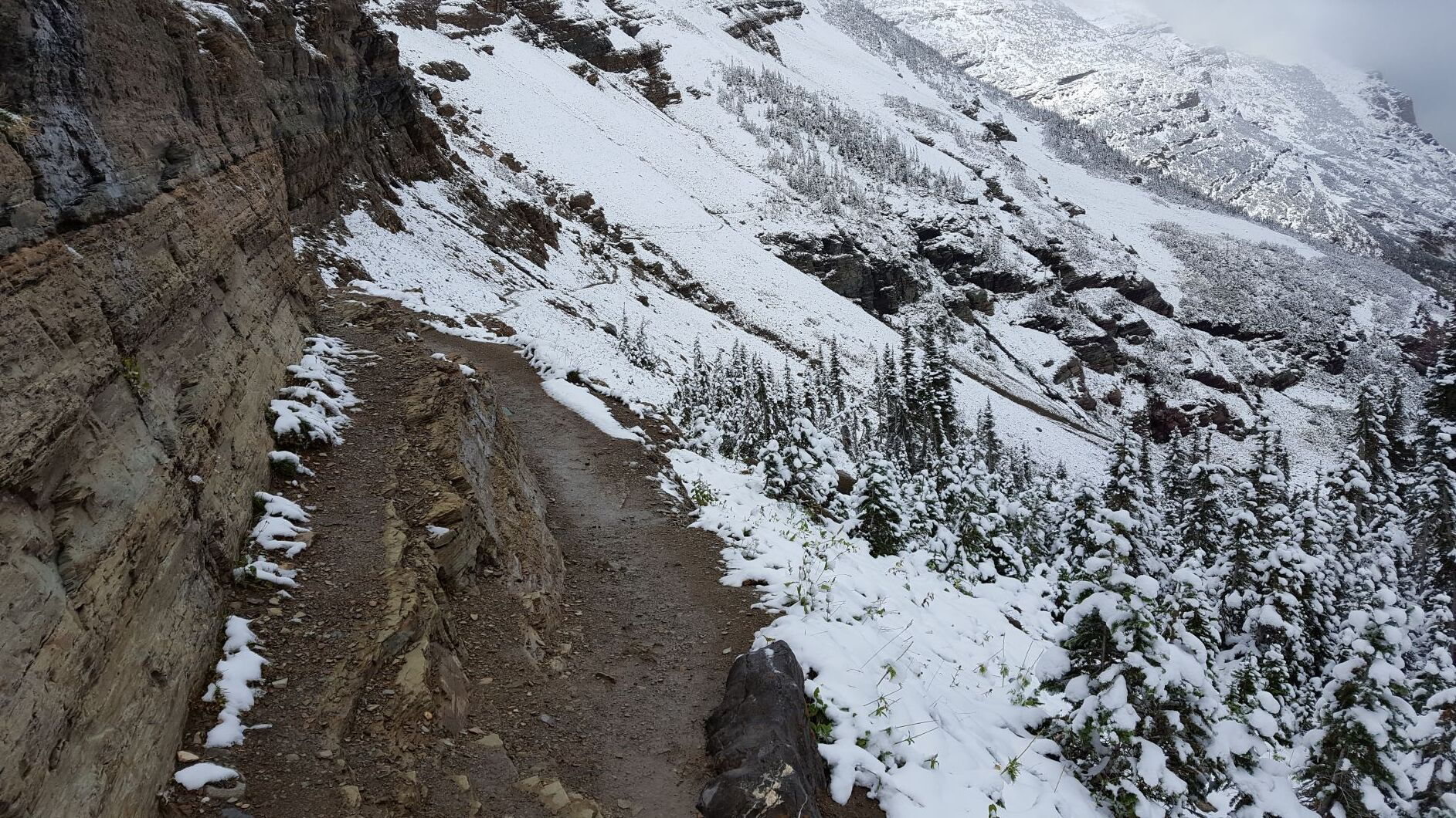
On the way back down
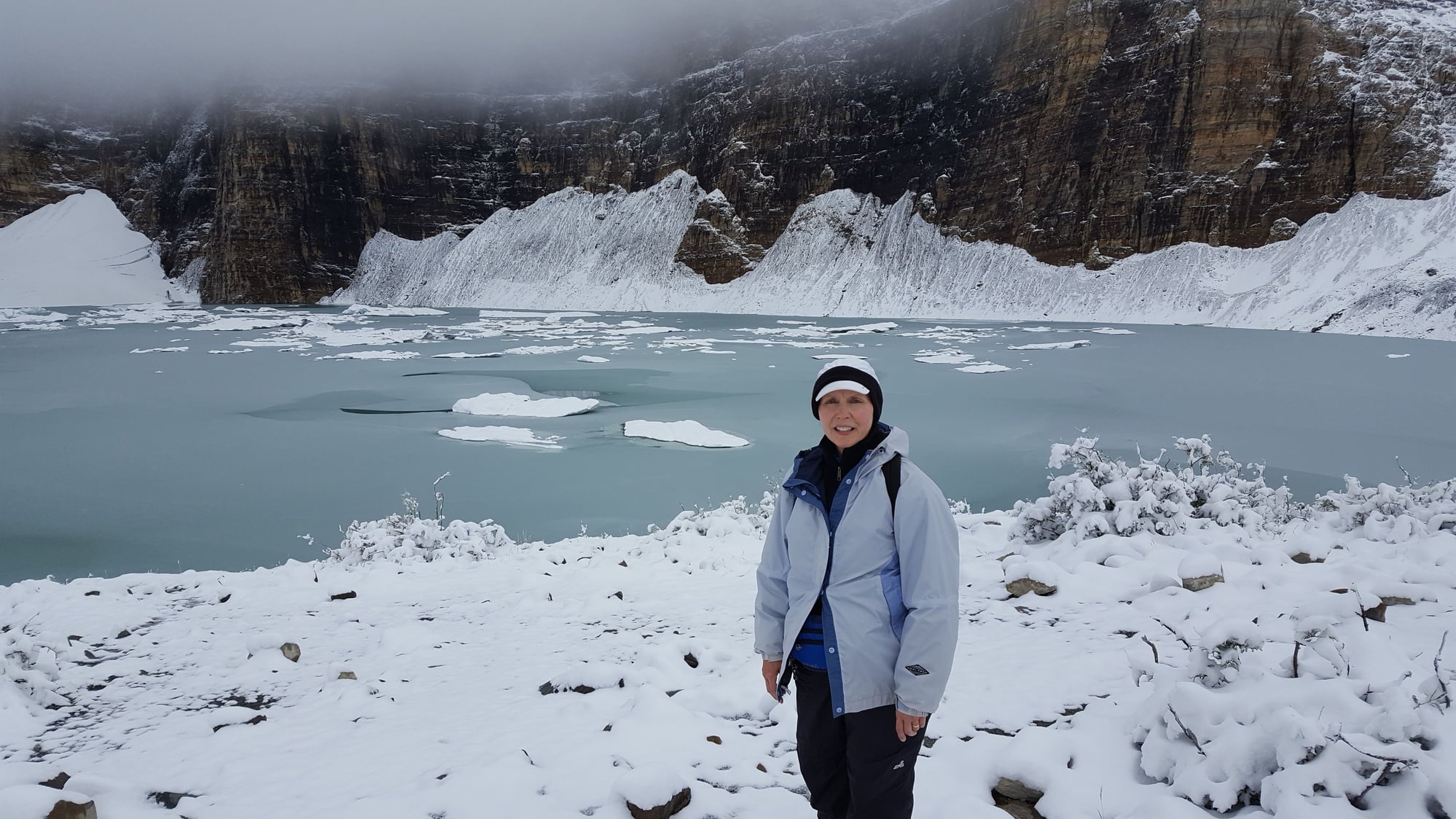
Upper Grinnell Lake
On the way back down
Upper Grinnell Lake
Sep 15th, 2020 | 04:15 PM
#20
Joined: Jan 2003
Posts: 6,204
Likes: 8
A few weeks ago I was going through photos and put Glacier national park, which is one of my favorite places, on my list of places to visit (again).
I was there twice in 2012 with my daughter (adult) and 2013 with a friend who lives in Toronto (we live in South Florida).
The first year we couldn't do all of the Grinnell Glacier hike due to snow (start of August). The second trip we were able to complete it. Not one of my favorite hikes and I would never do it again. That water fall that comes down onto the trail is a menace. There were some people about 20 minutes ahead of us. We could see them across the valley. Suddenly we could hear three blasts of a whistle and a ranger that was with us took off. Somebody slipped off the trail at the spot of that waterfall and fell about 10-12 feet down the rocks. I've posted a couple of photos. There was a nurse right in front of them so she helped patch him up and you can see the ranger who ran ahead.
Several hours later when we were on our way back we could see a helicopter just leaving after picking up the fellow who fell.
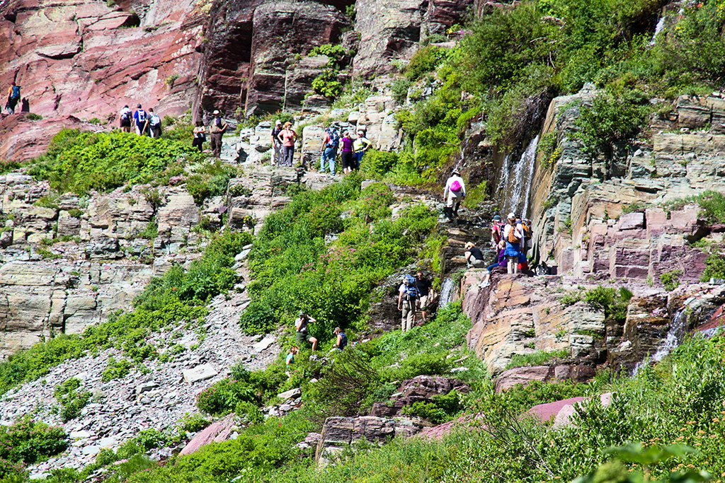
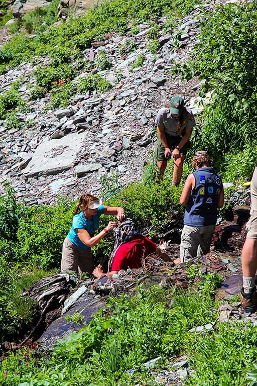
By far my favorite hike is in Many Glacier the area that I named wildlife central. The Iceberg lake hike has amazing scenery and a great end. I took that hike on both trips to Glacier. On the first one, with my daughter, we heard some twigs breaking just to our left on the return from Iceberg Lake. A grizzly was walking beside us. We took some photos and I then yelled at the bear. Instead of running away it walked onto our trail and led us a few feet until it decided to lie down in a little stream that crossed the trail That's what 85 degree weather will do. Eventually (and more than 50 photos later) the bear got up and ran away.
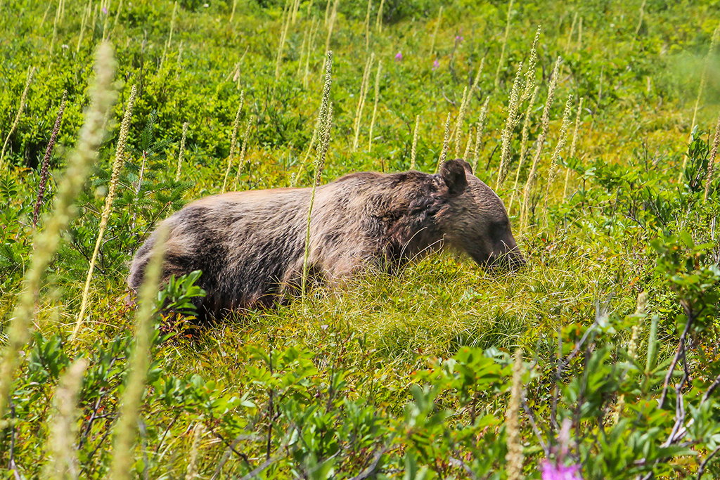
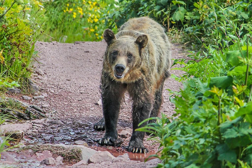
I was there twice in 2012 with my daughter (adult) and 2013 with a friend who lives in Toronto (we live in South Florida).
The first year we couldn't do all of the Grinnell Glacier hike due to snow (start of August). The second trip we were able to complete it. Not one of my favorite hikes and I would never do it again. That water fall that comes down onto the trail is a menace. There were some people about 20 minutes ahead of us. We could see them across the valley. Suddenly we could hear three blasts of a whistle and a ranger that was with us took off. Somebody slipped off the trail at the spot of that waterfall and fell about 10-12 feet down the rocks. I've posted a couple of photos. There was a nurse right in front of them so she helped patch him up and you can see the ranger who ran ahead.
Several hours later when we were on our way back we could see a helicopter just leaving after picking up the fellow who fell.
By far my favorite hike is in Many Glacier the area that I named wildlife central. The Iceberg lake hike has amazing scenery and a great end. I took that hike on both trips to Glacier. On the first one, with my daughter, we heard some twigs breaking just to our left on the return from Iceberg Lake. A grizzly was walking beside us. We took some photos and I then yelled at the bear. Instead of running away it walked onto our trail and led us a few feet until it decided to lie down in a little stream that crossed the trail That's what 85 degree weather will do. Eventually (and more than 50 photos later) the bear got up and ran away.
Last edited by Myer; Sep 15th, 2020 at 04:17 PM.

