6 Best Sights in Big Island, Hawaii

Kalopa State Recreation Area

Fodor's choice

Northwest of the old plantation town of Paauilo, at a cool elevation of 2,000 feet, lies this sweet 100-acre state park with a lush forested area with picnic tables and restrooms. There's an easy .7-mile loop trail with additional paths in the adjacent forest reserve. Small signs identify some of the plants, including the Gothic-looking native ohia and the rare loulu palm. It's chilly and damp here, making it a good escape from the heat at sea level. Three campground areas with full-service kitchens, as well as four cabins, can be reserved online.
Kealakekua Bay State Historical Park

Fodor's choice
Kealakekua Bay State Historical Park
(c) Cecoffman | Dreamstime.com

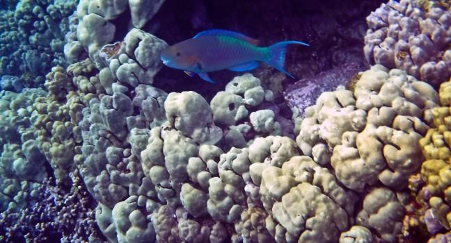
One of the most beautiful spots in the state, this underwater marine reserve has dramatic cliffs that surround super deep, crystal clear, turquoise water chock-full of stunning coral pinnacles and tropical fish. The protected dolphins that frequent the sanctuary should not be disturbed, as they use the bay to sleep and escape predators. There's very little sand at west-facing Napoopoo Beach, but this is a nice place to enter the water and swim (when the water is calm) as it's well protected from currents. At times, you may feel tiny jellyfish stings. There are no lifeguards, but there are bathrooms, a pavilion, shower, and (limited) parking. The Captain James Cook Monument, marking where the explorer died, is at the northern edge of the bay. Stay at least 300 feet from the shoreline along the cliffs, which have become unstable during recent earthquakes. A limited number of tour operators offer snorkeling and kayaking tours here, a good and very popular option.

Laupahoehoe Point Beach Park

Here the surf pounds the jagged black rocks at the base of a stunning point, lending a savage beauty to the place. But be advised: this is not a safe place for swimming, so bring only cameras and picnics, not swimsuits. Still vivid in the minds of longtime area residents is the 1946 tragedy in which 21 schoolchildren and three teachers were swept out to sea by a tsunami.

Recommended Fodor's Video

Lava Tree State Monument

Tree molds that rise like blackened smokestacks formed here in 1790, when a lava flow swept through the ohia forest. Some reach as high as 12 feet. A meandering trail provides close-up looks at some of Hawaii's tropical plants and trees, and there are restrooms and a couple of picnic pavilions and tables.  Mosquitoes live here in abundance, so be prepared.

MacKenzie State Recreation Area

This park was one of the few coastal parks in the Puna region spared in the 2018 Kilauea eruption, and overlooking rocky shoreline cliffs in a breezy ironwood grove are a pavilion, picnic tables, and restrooms—but no drinking water. The park is significant for the restored section of the old King's Highway trail system, which circled the coast in the era before Hawaii's contact with the Western world. In those days, regional chiefs used the trails to connect coastal villages, collect taxes, and maintain control over people. Views take in the rugged coast, rocky beach, and coastal dry forest. There's good shore fishing here, so you might see some locals with a line or two in the water.

Manuka State Wayside

This lowland forest reserve spreads across several relatively recent lava flows, and a semirugged trail follows a 2-mile loop past a pit crater, winding around interesting trees such as hau and kukui (candlenut). You can wander through the well-maintained arboretum, snap photos of the eerie forest, and let the kids scramble around trees so large they can't get their arms around them. The pathways can get muddy and rough, so bring appropriate shoes if you plan to hike. Large populations of the Hawaiian hoary bat inhabit the area, which, in totality, encompasses 25,000 acres of forest reserve. Restrooms and picnic areas are available.