32 Best Sights in Rocky Mountain National Park, Colorado

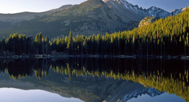
Bear Lake to Emerald Lake

Fodor's choice

This scenic, calorie-burning hike begins with a moderately level, half-mile journey to Nymph Lake. From here, the trail gets steeper, with a 425-foot elevation gain, as it winds around for 0.6 miles to Dream Lake. The last stretch is the most arduous part of the hike, an almost all-uphill 0.7-mile trek to lovely Emerald Lake, where you can perch on a boulder and enjoy the view. All told, the hike is 3.6 miles, with an elevation gain of 605 feet. Allow two hours or more. Moderate.

Glacier Gorge Trail

Fodor's choice

The 2.8-mile hike to Mills Lake can be crowded, but the reward is one of the park's prettiest lakes, set against the breathtaking backdrop of Longs Peak, Pagoda Mountain, and the Keyboard of the Winds. There's a modest elevation gain of 750 feet. On the way, about 1 mile in, you pass Alberta Falls, a popular destination in and of itself. The hike travels along Glacier Creek, under the shade of a subalpine forest. Give yourself at least four hours for hiking and lingering. Easy.

Alpine Visitor Center

At 11,796 feet above sea level, this is the highest visitor center in the National Park Service. Open only when Trail Ridge Road is navigable, the center also houses the park's only gift shop and snack bar.

Rocky Mountain National Park, Colorado, 80517, USA
970-586–1206

Recommended Fodor's Video

Bear Lake

Bear Lake
Mike Blanchard/Shutterstock

Thanks to its picturesque location, easy accessibility, and the good hiking trails nearby, this small alpine lake below Flattop Mountain and Hallett Peak is one of the most popular destinations in the park. Free park shuttle buses can take you there May through October.

Bear Lake Road

This 23-mile round-trip drive offers superlative views of Longs Peak (14,259-foot summit) and the glaciers surrounding Bear Lake, winding past shimmering waterfalls shrouded with rainbows. You can either drive the road yourself (open year-round) or hop on one of the park's free shuttle buses.

Bear Lake Trail

The virtually flat nature trail around Bear Lake is an easy, 0.6-mile loop that's wheelchair and stroller accessible. Sharing the route with you will likely be plenty of other hikers as well as songbirds and chipmunks. Easy.

Rocky Mountain National Park, Colorado, 80517, USA

Beaver Meadows Visitor Center

Housing the park headquarters, this visitor center was designed by students of the Frank Lloyd Wright School of Architecture at Taliesin West using the park's popular rustic style. The center has a terrific 20-minute orientation film and a large relief map of the park.

Rocky Mountain National Park, Colorado, 80517, USA
970-586–1206

Bluebird Lake Trail

The 6-mile climb from the Wild Basin trailhead to Bluebird Lake (2,478-foot elevation gain) is especially scenic. You pass Copeland Falls, Calypso Cascades, and Ouzel Falls, plus an area that was burned in a lightning-instigated fire in 1978—today it's a mix of bright pink fireweed and charred tree trunks. Difficult.

Rocky Mountain National Park, Colorado, 80517, USA

Chapin Pass

This is a tough hike, but it comes with great views of the park's eastern lower valleys. It's about 3½ miles one way, including a 2,874-foot gain in elevation to the summit of Ypsilon Mountain (elevation 13,514 feet); you pass the summits of Mt. Chapin and Mt. Chiquita on the way. From the trailhead, the path heads downhill to Chapin Creek. For a short distance after leaving the trailhead, keep a sharp eye out to the right for a less obvious trail that heads uphill to the tree line and disappears. From here head up along the steep ridge to the summit of Mt. Chapin. Chiquita and Ypsilon are to the left, and the distance between each peak is about 1 mile and involves a descent of about 400 feet to the saddle and an ascent of 1,000 feet along the ridge to Chiquita. From Ypsilon's summit you'll look down 2,000 feet at Spectacle Lakes. You may wish to bring a topo map and compass. Difficult.

Rocky Mountain National Park, Colorado, 80517, USA

Chasm Lake Trail

Nestled in the shadow of Longs Peak and Mt. Meeker, Chasm Lake offers one of Colorado's most impressive backdrops, which also means you can expect to encounter plenty of other hikers on the way. The 4.2-mile Chasm Lake Trail, reached via the Longs Peak Trail, has a 2,360-foot elevation gain. Just before the lake, you'll need to climb a small rock ledge, which can be a bit of a challenge for the less sure-footed; follow the cairns for the most straightforward route. Once atop the ledge, you'll catch your first memorable view of the lake. Difficult.

Rocky Mountain National Park, Colorado, 80517, USA

Colorado River Trail

This walk to the ghost town of Lulu City on the west side of the park is excellent for looking for the bighorn sheep, elk, and moose that reside in the area. Part of the former stagecoach route that went from Granby to Walden, the 3.7-mile trail parallels the infant Colorado River to the meadow where Lulu City once stood. The elevation gain is 350 feet. Moderate.

Rocky Mountain National Park, Colorado, 80517, USA

Continental Divide National Scenic Trail

This 3,100-mile corridor, which extends from Montana's Canadian border to the southern edge of New Mexico, enters Rocky Mountain National Park in two places, at trailheads only about 4 miles apart and located on either side of the Kawuneeche Visitor Center on Trail Ridge Road, at the park's southwestern end. Within the park, it covers about 30 miles of spectacular montane and subalpine terrain and follows the existing Green Mountain, Tonahutu Creek, North Inlet, and East Shore Trails. Moderate.

Rocky Mountain National Park, Colorado, 80517, USA

Copeland Falls

The 0.3-mile hike to these Wild Basin Area falls is a good option for families, as the terrain is relatively flat (there's only a 15-foot elevation gain). Easy.

Rocky Mountain National Park, Colorado, 80517, USA

Cub Lake Trail

This 4.6-mile, three-hour (round-trip) hike takes you through meadows and stands of aspen trees and up 540 feet in elevation to a lake with water lilies. Moderate.

Rocky Mountain National Park, Colorado, 80517, USA

Deer Mountain Trail

This 6-mile round-trip trek to the top of 10,083-foot Deer Mountain is a great way for hikers who don't mind a bit of a climb to enjoy the views from the summit of a more manageable peak. You'll gain more than 1,000 feet in elevation as you follow the switchbacking trail through ponderosa pine, aspen, and fir trees. The reward at the top is a panoramic view of the park's eastern mountains. Difficult.

Rocky Mountain National Park, Colorado, 80517, USA

East Inlet Trail

An easy hike of 0.3 miles from East Inlet trailhead, just outside the park in Grand Lake, will get you to Adams Falls in about 15 minutes. The area around the falls is often packed with visitors, so if you have time, continue east to enjoy more solitude, see wildlife, and catch views of Mt. Craig from near the East Meadow campground. Note, however, that the trail beyond the falls has an elevation gain of between 1,500 and 1,900 feet, making it a more challenging hike. Easy.

Grand Lake, Colorado, 80447, USA

Endovalley

With 32 tables and 30 fire grates, this is the largest picnic area in the park. Here, you'll find aspen groves, nice views of Fall River Pass—and lovely Fan Lake a short hike away.

Eugenia Mine

A moderate, 1.4-mile hike through aspen and evergreen groves takes you to this abandoned mine, where there are some scattered tailings and the remains of a single cabin.

Longs Peak Ranger Station, Rocky Mountain National Park, Colorado, 80517, USA
Sights Details
Rate Includes: Free

Fall River Visitor Center

The Discovery Room, which houses everything from old ranger outfits to elk antlers, coyote pelts, and bighorn sheep skulls for hands-on exploration, is a favorite with kids at this visitor center.

U.S. 34, at the Fall River Entrance Station, Rocky Mountain National Park, Colorado, 80517, USA
970-586–1206

Farview Curve Overlook

At an elevation of 10,120 feet, this lookout affords a panoramic view of the Colorado River near its origin and the Grand Ditch, a water diversion project dating from 1890 that's still in use today. You can also see the once-volcanic peaks of Never Summer Range along the park's western boundary.

Trail Ridge Rd., Rocky Mountain National Park, Colorado, 80517, USA

Fern Lake Trail

Heading to Odessa Lake from the north involves a steep hike, but on most days you'll encounter fewer other hikers than if you had begun the trip at Bear Lake. Along the way, you'll come to the Arch Rocks; the Pool, an eroded formation in the Big Thompson River; two waterfalls; and Fern Lake (3.8 miles from your starting point). Less than a mile farther, Odessa Lake itself lies at the foot of Tourmaline Gorge, below the craggy summits of Gabletop Mountain, Little Matterhorn, Knobtop Mountain, and Notchtop Mountain. For a full day of spectacular scenery, continue past Odessa to Bear Lake (9 miles total), where you can pick up the shuttle back to the Fern Lake Trailhead. Moderate.

Rocky Mountain National Park, Colorado, 80517, USA

Forest Canyon Overlook

Park at a dedicated lot to disembark on a wildflower-rich, 0.2-mile trail. Easy to access for all skill levels, this glacial valley overlook offers views of ice-blue pools (the Gorge Lakes) framed by ragged peaks.

Trail Ridge Rd., Rocky Mountain National Park, Colorado, 80517, USA

Hollowell Park

In a meadow near Mill Creek, this lovely spot for a picnic has 10 tables and is open year-round. It's also close to the Hollowell Park and Mill Creek Basin Trailheads.

Off Bear Lake Rd., about 2½ miles from Moraine Park Visitor Center, Rocky Mountain National Park, Colorado, 80517, USA

Holzwarth Historic Site

A scenic half-mile interpretive trail leads you over the Colorado River to the original dude ranch that the Holzwarth family, some of the park's original homesteaders, ran between the 1920s and 1950s. Allow about an hour to view the buildings—including a dozen small guest cabins—and chat with a ranger. Though the site is open year-round, the inside of the buildings can be seen only from June through early September.

Kawuneeche Visitor Center

The only visitor center on the park's far west side, Kawuneeche has exhibits on the plant and animal life of the area, as well as a large three-dimensional map of the park and an orientation film.

U.S. 34, 1 mile north of Grand Lake and ½ mile south of Grand Lake Entrance Station, Rocky Mountain National Park, Colorado, 80517, USA
970-586–1206

Longs Peak Trail

Climbing this 14,259-foot mountain (one of 53 "Fourteeners" in Colorado) is an ambitious goal for almost anyone—but only those who are very fit and acclimated to the altitude should attempt it. The 16-mile round-trip climb requires a predawn start (3 am is ideal), so that you're off the summit before the typical summer afternoon thunderstorm hits. Also, the last 2 miles or so of the trail are very exposed—you have to traverse narrow ledges with vertigo-inducing drop-offs. That said, summiting Longs can be one of the most rewarding experiences you'll ever have. The Keyhole route is the most popular means of ascent, and the number of people going up it on a summer day can be astounding, given the rigors of the climb. Though just as scenic, the Loft route, between Longs and Mt. Meeker from Chasm Lake, is less crowded but not as clearly marked and therefore more difficult to navigate. Difficult.

Rocky Mountain National Park, Colorado, 80517, USA

Lulu City

The remains of a few cabins are all that's left of this onetime silver-mining town, established around 1880. Reach it by hiking the 3.6-mile Colorado River Trail. Look for wagon ruts from the old Stewart Toll Road and mine tailings in nearby Shipler Park (this is also a good place to spot moose).

Mills Lake

From this popular spot, you can admire the Keyboard of the Winds, a jagged ridge connecting Pagoda and Longs Peaks that looks like the top of a spiny reptile's back. The 5.6-mile hike gains 750 feet in elevation as it takes you past Alberta Falls and Glacier Falls en route to the shimmering lake at the mouth of Glacier Gorge. Moderate.

Rocky Mountain National Park, Colorado, 80517, USA

Old Fall River Road

More than 100 years old and never more than 14 feet wide, this road stretches from the park's east side to the Fall River Pass (11,796 feet above sea level) on the west. The drive provides a few white-knuckle moments, as the road is steep, serpentine, and lacking in guardrails. Start at West Horseshoe Park, which has the park's largest concentrations of sheep and elk, and head up the gravel road, passing Chasm Falls.

Shadow Mountain Lookout

The lookout was built in 1932 and was used to station watchmen and -women until 1968. It was restored in the mid-1990s and is now listed in the National Register of Historic Places. To access the lookout, start at the East Shore Trailhead (just outside the park, in the Arapahoe National Recreation Area), between Grand and Shadow Mountain lakes, and hike approximately 5 miles along the East Shore and Shadow Mountain trails. There's a small fee for parking in the recreation area.