

Armchair Travel: Portugal Photographs
 Jan 31st, 2021, 12:20 PM
#21
Castles and Walled Towns (5): Fortresses of the Alentejo and Algarve
For the last installment in this series on castles and town walls, let’s visit some of the fortresses of Portugal’s southern regions: the Alentejo and the Algarve. What’s interesting about these fortifications is the way they reflect developments in military technology over the course of some 600 years, from the 1100's through the early 1700's.
Chronologically, we’ll start with the walled town and castle at Silves, a few miles upriver from the Atlantic in the west-central Algarve. This town takes you back deeply into Portugal’s Moorish-Crusader history. Silves was the capital of the Moorish Algarve, and in the days before the Arade River silted up, it was an important and bustling port populated largely by Yemenite Arabs. In 1189, after a terrible three-month siege that left the inhabitants dying of starvation, it fell to the Portuguese, who were assisted by English crusaders on their way to the Holy Land for the Third Crusade. The Moors managed to retake it only two years later, but it fell to the Portuguese for good in 1249, as the Moors withdrew into their final Iberian redoubt along Spain’s southern Mediterranean coast and in the mountains of the Sierra Nevada overlooking Granada.
The town, cathedral, and its castle suffered severe damage from the great earthquake of 1755, whose epicenter was beneath the floor of the Atlantic Ocean southwest of Cape St. Vincent, but all were later rebuilt. Its fortifications, the cathedral, and some of the town’s buildings were constructed of a distinctive, deep reddish-brown local sandstone that Sarah Bradford, a 19th century English traveler, vividly (and accurately) described as “the colour of congealed blood.” Today, you can still see some of the Moorish walls and the typically tall main gate of the Moorish town, as well as a Moorish cistern and the remains of the Moorish palace that stood inside the castle. The castle’s wall-walk affords a good view of the surrounding countryside. And a marker on site indicates that Silves and its castle rate a reference in "Fifty Shades of Grey," although I can't confirm the particulars of that!
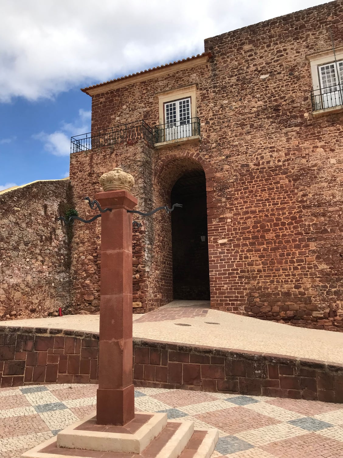
Entrance arch and gatehouse (and reconstructed pillory) in the Moorish town walls of Silves

One of the towers of Silves's castle, adjoining the main gate
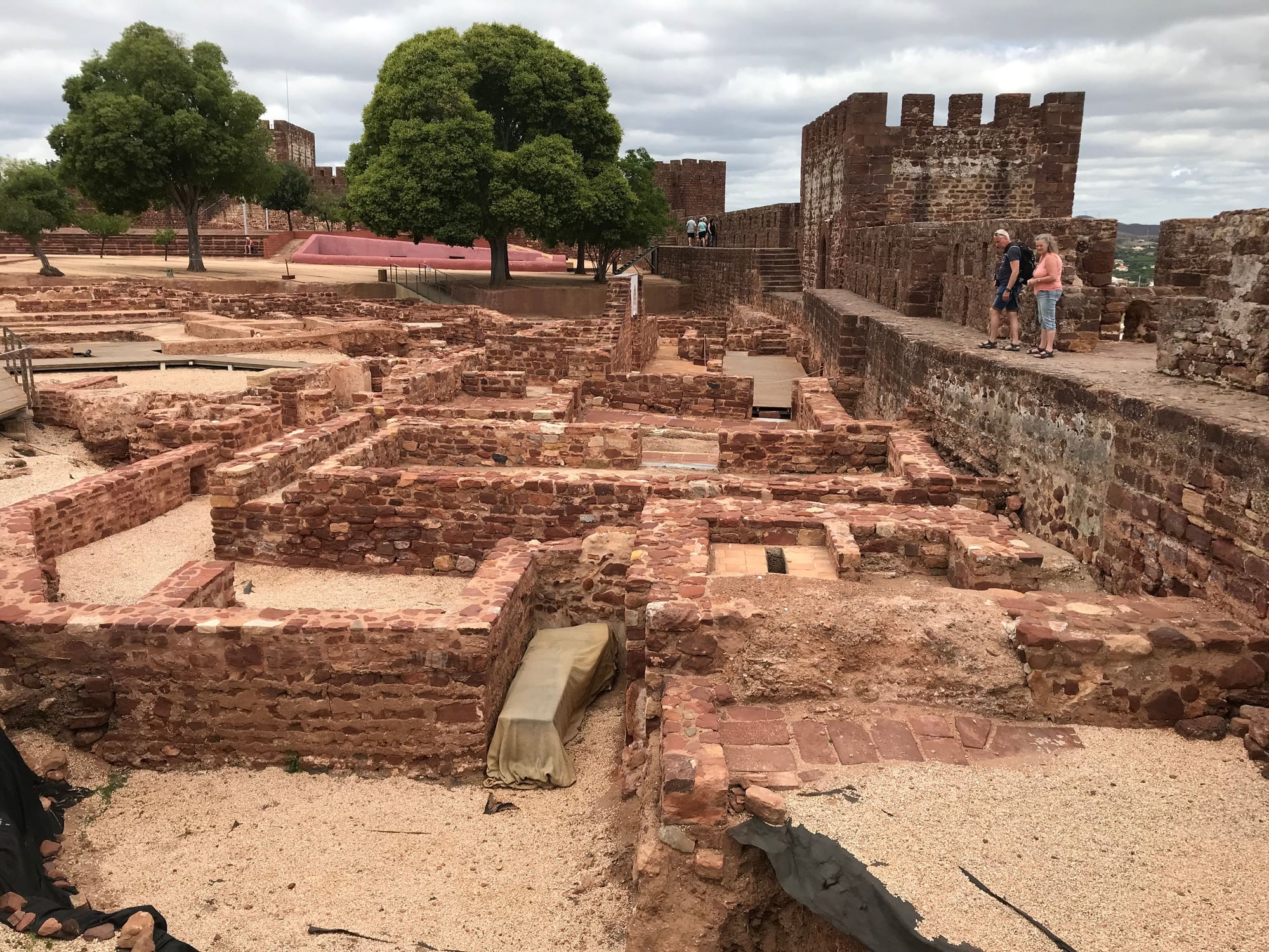
Archaeological remains of the Moorish palace at Silves
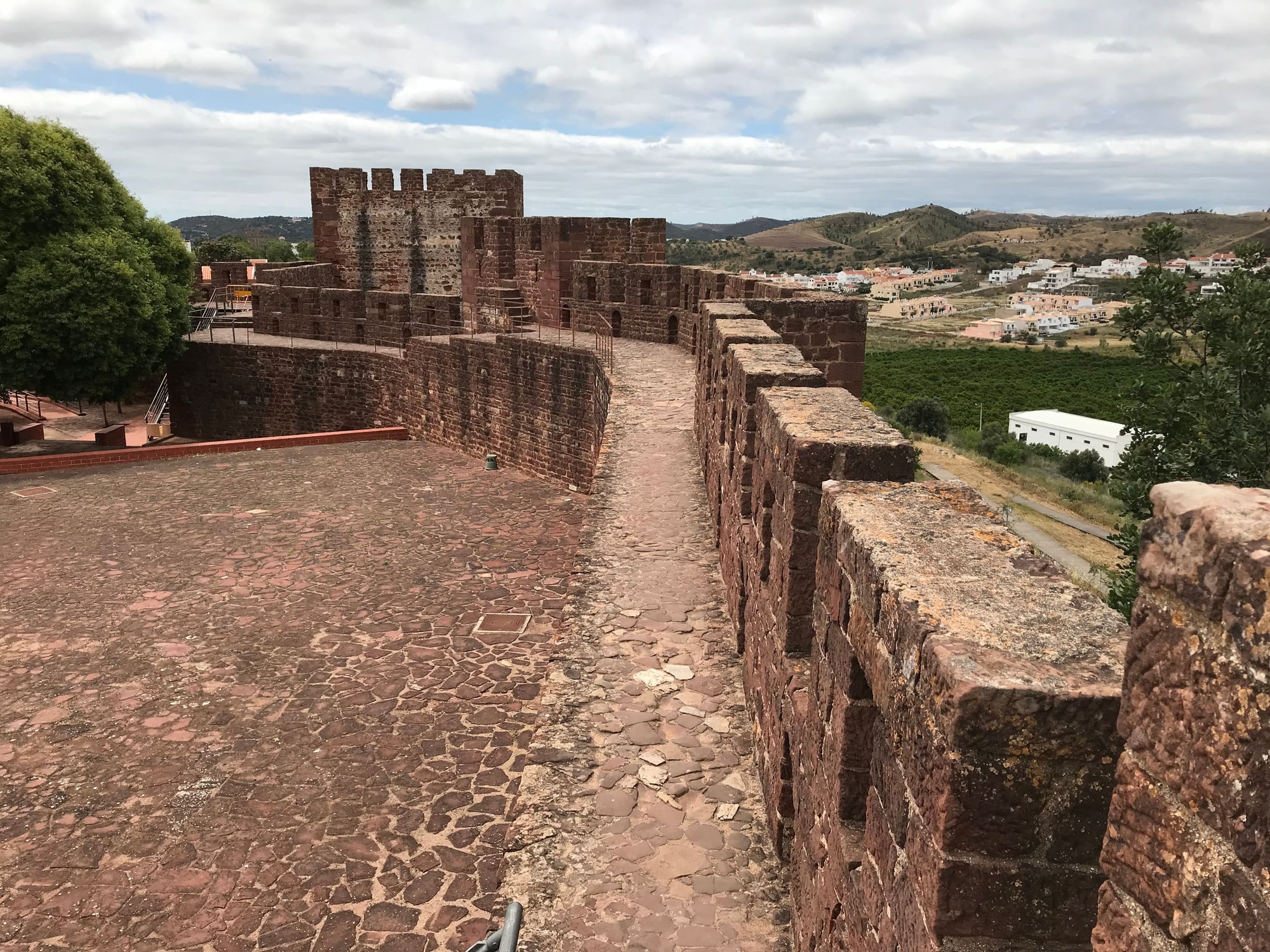
Tower, wall-walk, and surrounding countryside
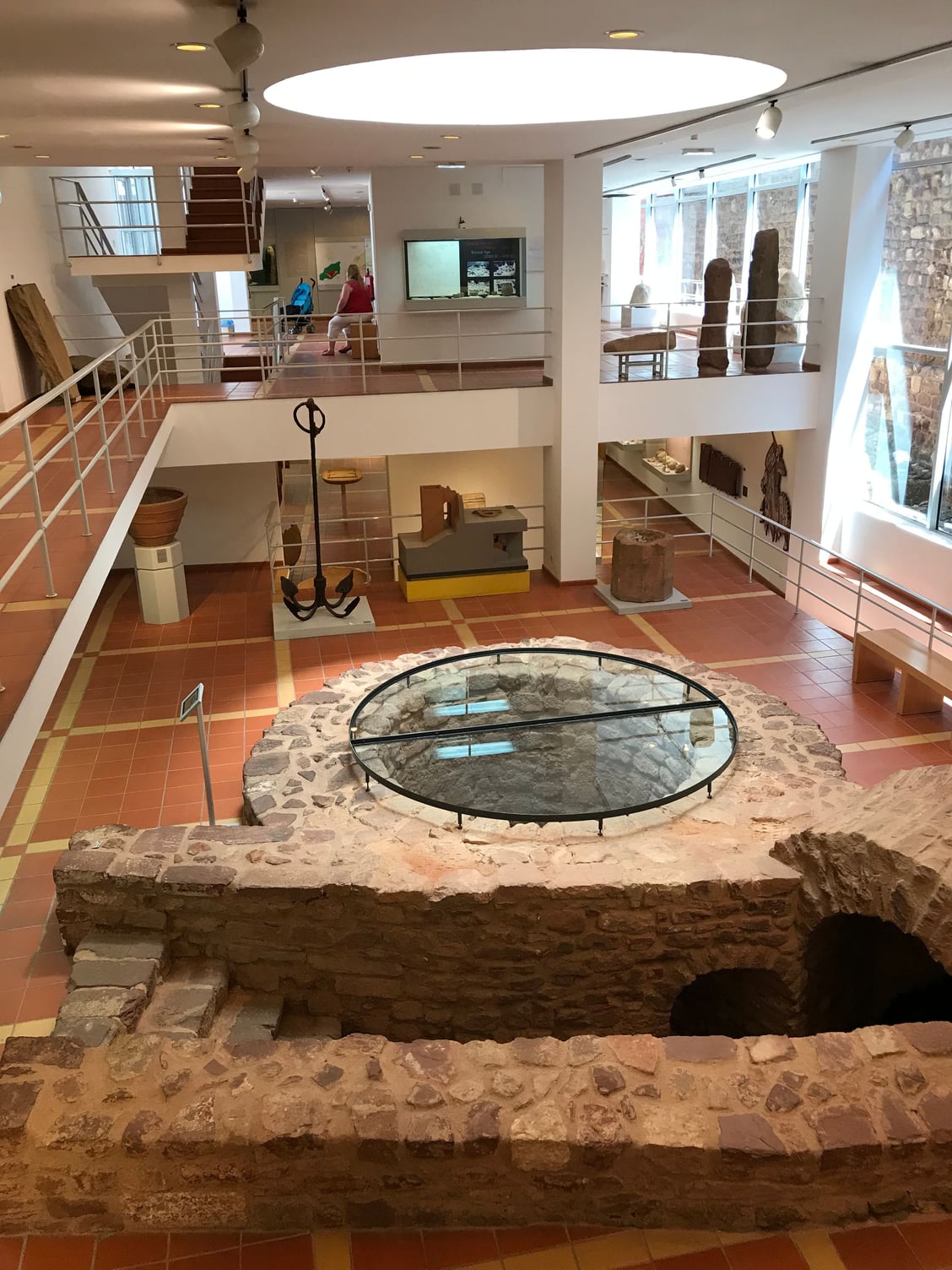
This recently discovered Moorish cistern is the centerpiece of Silves's new archaeological museum

The cathedral and castle of Silves, as seen from across the Arade River
Once artillery (initially using large stone cannonballs) demonstrated what it could accomplish against the vertical walls and towers of classic medieval fortifications during the siege of Constantinople in 1453, and as explosive cannonballs developed and increased in destructive force over the course of the following century, fortifications began to be built with thicker, sloping, and often lower walls, as you can see in the Americas in places like St. Augustine, Havana, and San Juan, as well as in the harbor fort of Pau de Bandeira in Lagos (which probably dates to the first half of the 17th century). Lagos also still retains its town walls, which are said to have been over-topped by the tsunami produced by the 1755 earthquake.
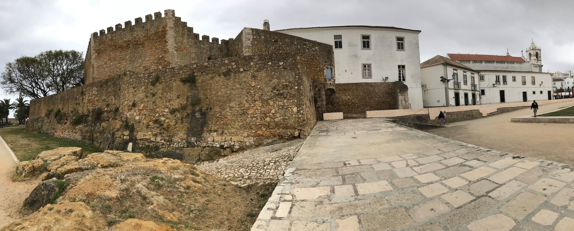
The castle, walls, and Church of Santa Maria at Lagos
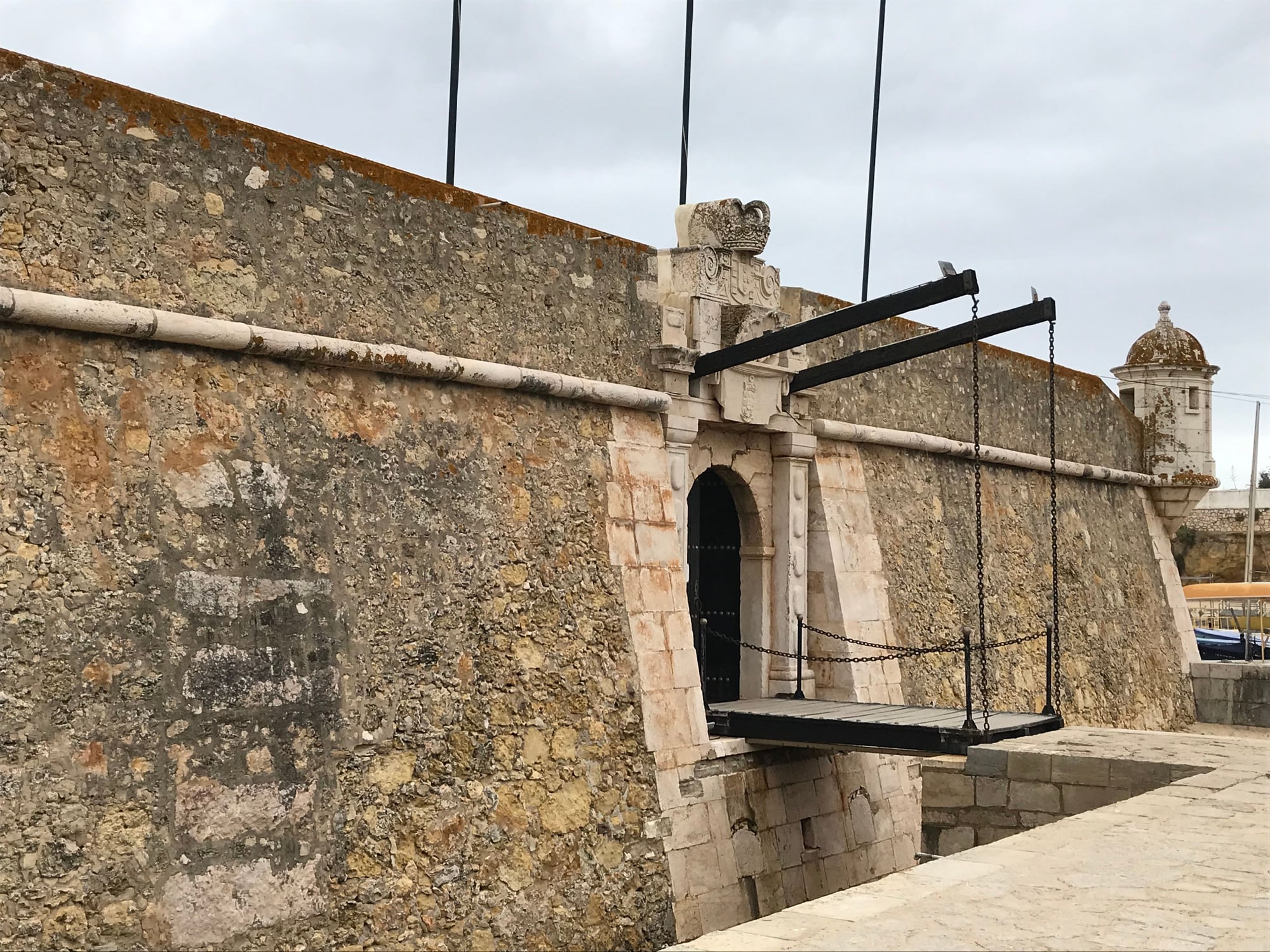
The 17th century harbor fort of Pau da Bandeira at Lagos
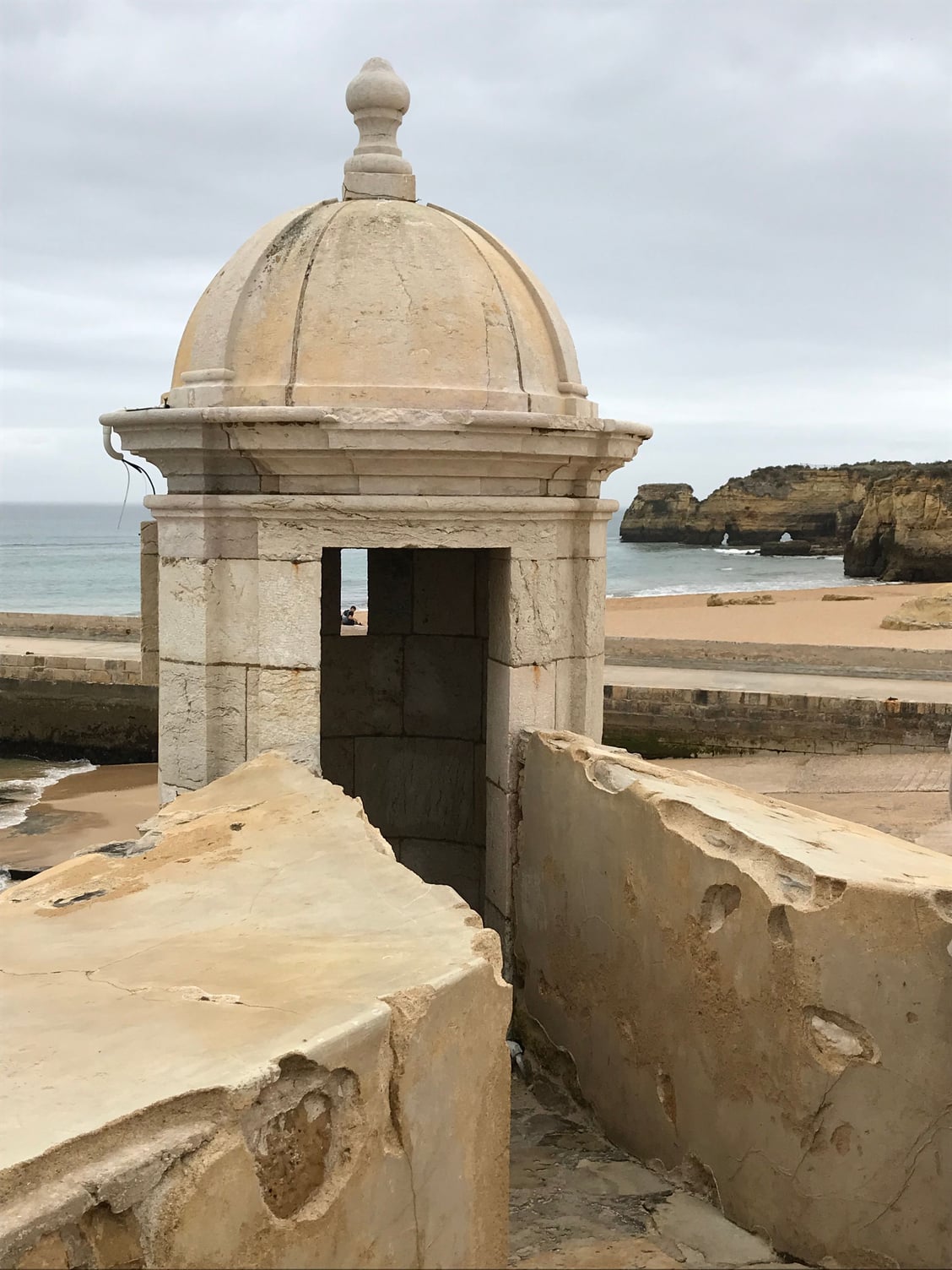
Watchtower of the Fort of Pau da Bandeira at Lagos
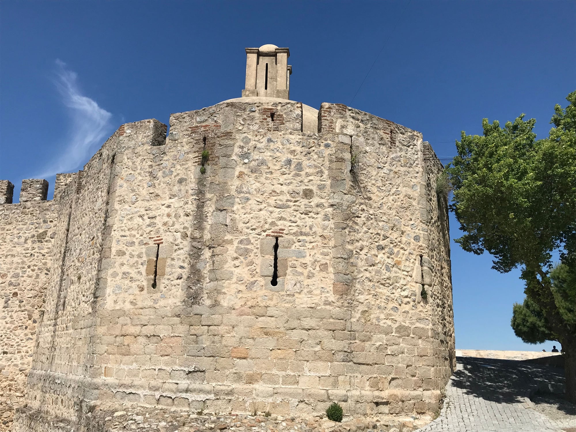
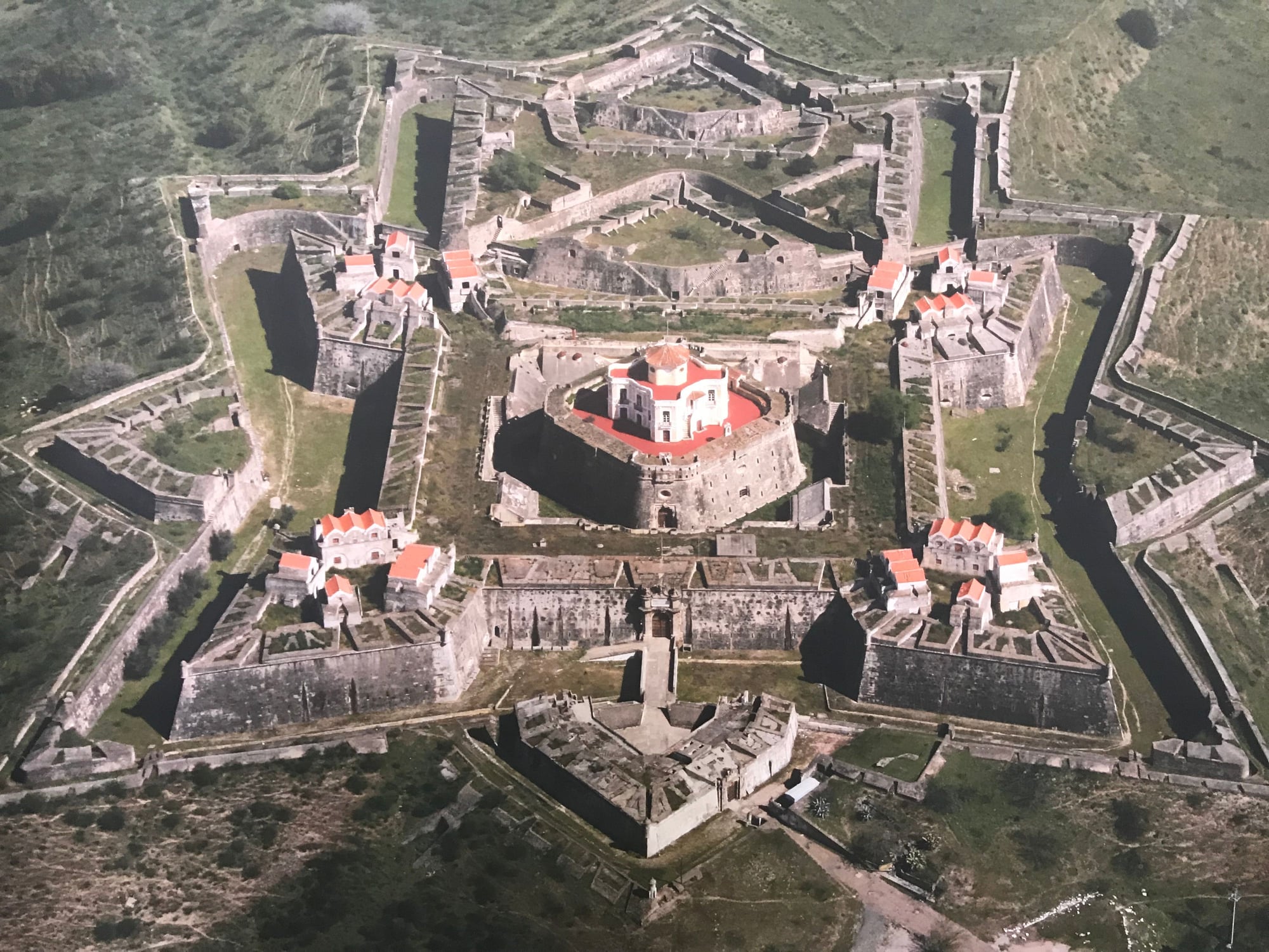
In the mid-17th century, fortifications began to be built of earth backed up by reinforcing stone walls that could absorb and muffle the impact of cannon fire. Initially Italian and Dutch military engineers, and later the Frenchman Sebastien Le Prestre (better known as the Marquis de Vauban) (https://en.wikipedia.org/wiki/S%C3%A...stre_de_Vauban), pioneered the development of low-built fortifications with protruding, V-shaped bastions and triangular outworks called ravelins placed in front of a fortress’s gates, creating a defensive profile that earned them the nickname “star forts”. The massive and elaborate 17th century fortifications of Elvas, located in the Alentejo just five miles west of the Spanish border (on a clear day, you can see the Spanish city of Badajoz on the other side of the frontier), are a classic example of these, which brought them recognition in 2012 as a UNESCO World Heritage Site. The citation (https://whc.unesco.org/en/list/1367/) describes its defenses as “the largest bulwarked dry-ditch system in the world.”
These fortifications were constructed after the Portuguese threw off Spanish rule in 1640, resulting in a war that lasted a full quarter-century; if nothing else, the massive scale of Elvas’s fortifications underlines how determined the Portuguese were to preserve their newly-restored independence. They also erected other Vauban-style fortifications at Castro Marim, in the extreme east of the Algarve right along the Spanish border (
).
Elvas successfully withstood Spanish attacks in 1644, 1659 (an epic struggle called the “Battle of the Lines of Elvas” [[url]https://en.wikipedia.org/wiki/Battle_of_the_Lines_of_Elvas] that was a decisive turning point in the War of the Portuguese Restoration), 1711, and 1801. Elvas later served as a base for the Duke of Wellington and his combined British-Portuguese army as they operated against the French at Badajoz in 1811-12 during the Napoleonic Wars.
In addition to its 17th and early 18th century defenses, Elvas still bears some remains of its original Moorish defenses (including its main gate); a small castle atop its highest point built in 1488; and a remarkable aqueduct built mostly in the 16th century that channels water to the town.
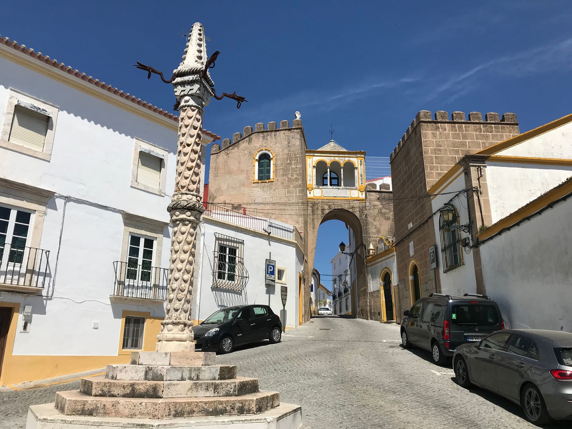
Gate and towers of the original Moorish city wall (with pillory in front), Elvas
Octagonal Torre da Menagem (Keep) dating to 1488, built atop the highest point in Elvas

Religious hermitage built atop one of the main entrance gates in the city walls of Elvas
The Forte da Santa Luzia (1641-87), an outlying fortification on the east side of Elvas (photographed from a Portuguese government travel poster)
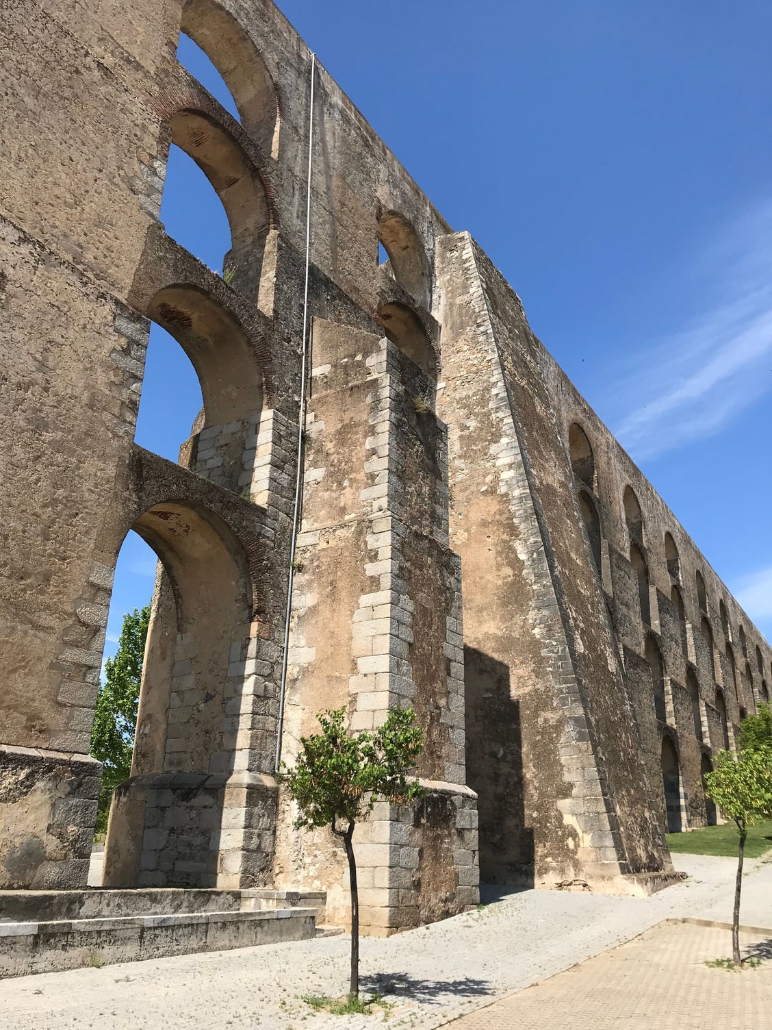
The Aqueduto da Armoreira (1498-1622) at Elvas
Sagres, a foot-shaped, sheer-walled cape that is not quite the extreme southwestern tip of the European continent (that distinction belongs to Cape St. Vincent, five miles further west), is famous as the site of the school of shipbuilding, navigation, seamanship, diplomacy and commerce that Prince Henry the Navigator, one of the sons of Joao I (1385-1433) and Philippa of Lancaster, established there in 1443. It was Portugal’s version of Cape Canaveral during the fifteenth century, serving as the nerve center for the successive waves of exploration that progressively took the Portuguese further and further south along the west coast of Africa until they finally passed the Cape of Good Hope in 1488 and ultimately reached the Malabar coast of India in 1498. Sagres was always well-defended on two sides by its precipitous cliffs, but a line of fortifications was added across its land approaches in the early 1700's during the War of the Spanish Succession. So far as I know, it was never tested by an attacker.
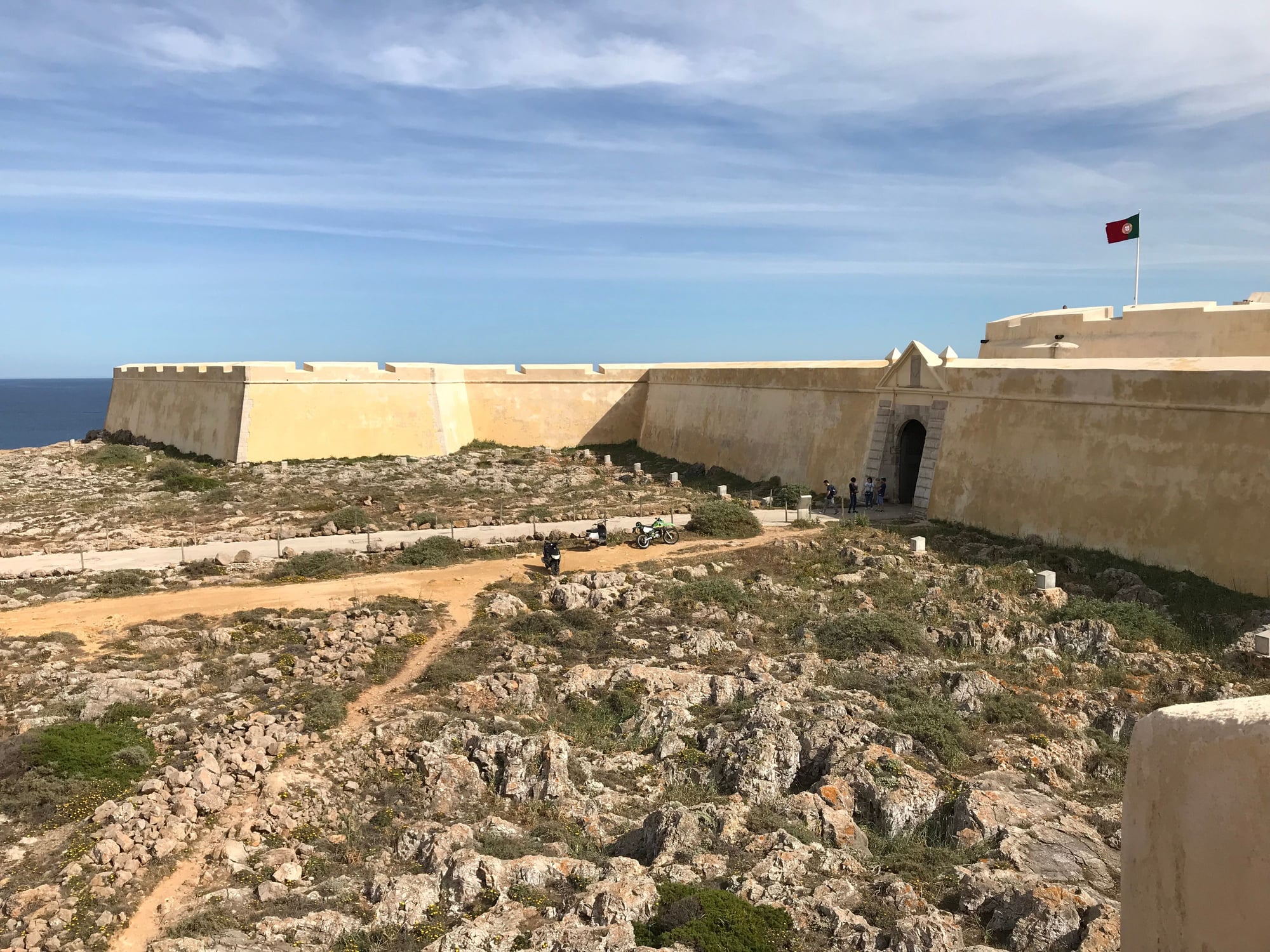
The fortress walls at Cape Sagres (1704)
Church at Sagres (1570)
The limestone desert at Cape Sagres
That's it for my "Castles and Town Walls" series. (Of course, anyone else is free to post their photos on this theme as well.) I'll figure out some other aspect of Portuguese travel to cover in my next series.
Chronologically, we’ll start with the walled town and castle at Silves, a few miles upriver from the Atlantic in the west-central Algarve. This town takes you back deeply into Portugal’s Moorish-Crusader history. Silves was the capital of the Moorish Algarve, and in the days before the Arade River silted up, it was an important and bustling port populated largely by Yemenite Arabs. In 1189, after a terrible three-month siege that left the inhabitants dying of starvation, it fell to the Portuguese, who were assisted by English crusaders on their way to the Holy Land for the Third Crusade. The Moors managed to retake it only two years later, but it fell to the Portuguese for good in 1249, as the Moors withdrew into their final Iberian redoubt along Spain’s southern Mediterranean coast and in the mountains of the Sierra Nevada overlooking Granada.
The town, cathedral, and its castle suffered severe damage from the great earthquake of 1755, whose epicenter was beneath the floor of the Atlantic Ocean southwest of Cape St. Vincent, but all were later rebuilt. Its fortifications, the cathedral, and some of the town’s buildings were constructed of a distinctive, deep reddish-brown local sandstone that Sarah Bradford, a 19th century English traveler, vividly (and accurately) described as “the colour of congealed blood.” Today, you can still see some of the Moorish walls and the typically tall main gate of the Moorish town, as well as a Moorish cistern and the remains of the Moorish palace that stood inside the castle. The castle’s wall-walk affords a good view of the surrounding countryside. And a marker on site indicates that Silves and its castle rate a reference in "Fifty Shades of Grey," although I can't confirm the particulars of that!
Entrance arch and gatehouse (and reconstructed pillory) in the Moorish town walls of Silves
One of the towers of Silves's castle, adjoining the main gate
Archaeological remains of the Moorish palace at Silves
Tower, wall-walk, and surrounding countryside
This recently discovered Moorish cistern is the centerpiece of Silves's new archaeological museum
The cathedral and castle of Silves, as seen from across the Arade River
Once artillery (initially using large stone cannonballs) demonstrated what it could accomplish against the vertical walls and towers of classic medieval fortifications during the siege of Constantinople in 1453, and as explosive cannonballs developed and increased in destructive force over the course of the following century, fortifications began to be built with thicker, sloping, and often lower walls, as you can see in the Americas in places like St. Augustine, Havana, and San Juan, as well as in the harbor fort of Pau de Bandeira in Lagos (which probably dates to the first half of the 17th century). Lagos also still retains its town walls, which are said to have been over-topped by the tsunami produced by the 1755 earthquake.
The castle, walls, and Church of Santa Maria at Lagos
The 17th century harbor fort of Pau da Bandeira at Lagos
Watchtower of the Fort of Pau da Bandeira at Lagos
In the mid-17th century, fortifications began to be built of earth backed up by reinforcing stone walls that could absorb and muffle the impact of cannon fire. Initially Italian and Dutch military engineers, and later the Frenchman Sebastien Le Prestre (better known as the Marquis de Vauban) (https://en.wikipedia.org/wiki/S%C3%A...stre_de_Vauban), pioneered the development of low-built fortifications with protruding, V-shaped bastions and triangular outworks called ravelins placed in front of a fortress’s gates, creating a defensive profile that earned them the nickname “star forts”. The massive and elaborate 17th century fortifications of Elvas, located in the Alentejo just five miles west of the Spanish border (on a clear day, you can see the Spanish city of Badajoz on the other side of the frontier), are a classic example of these, which brought them recognition in 2012 as a UNESCO World Heritage Site. The citation (https://whc.unesco.org/en/list/1367/) describes its defenses as “the largest bulwarked dry-ditch system in the world.”
These fortifications were constructed after the Portuguese threw off Spanish rule in 1640, resulting in a war that lasted a full quarter-century; if nothing else, the massive scale of Elvas’s fortifications underlines how determined the Portuguese were to preserve their newly-restored independence. They also erected other Vauban-style fortifications at Castro Marim, in the extreme east of the Algarve right along the Spanish border (
Elvas successfully withstood Spanish attacks in 1644, 1659 (an epic struggle called the “Battle of the Lines of Elvas” [[url]https://en.wikipedia.org/wiki/Battle_of_the_Lines_of_Elvas] that was a decisive turning point in the War of the Portuguese Restoration), 1711, and 1801. Elvas later served as a base for the Duke of Wellington and his combined British-Portuguese army as they operated against the French at Badajoz in 1811-12 during the Napoleonic Wars.
In addition to its 17th and early 18th century defenses, Elvas still bears some remains of its original Moorish defenses (including its main gate); a small castle atop its highest point built in 1488; and a remarkable aqueduct built mostly in the 16th century that channels water to the town.
Gate and towers of the original Moorish city wall (with pillory in front), Elvas
Octagonal Torre da Menagem (Keep) dating to 1488, built atop the highest point in Elvas
Religious hermitage built atop one of the main entrance gates in the city walls of Elvas
The Forte da Santa Luzia (1641-87), an outlying fortification on the east side of Elvas (photographed from a Portuguese government travel poster)
The Aqueduto da Armoreira (1498-1622) at Elvas
Sagres, a foot-shaped, sheer-walled cape that is not quite the extreme southwestern tip of the European continent (that distinction belongs to Cape St. Vincent, five miles further west), is famous as the site of the school of shipbuilding, navigation, seamanship, diplomacy and commerce that Prince Henry the Navigator, one of the sons of Joao I (1385-1433) and Philippa of Lancaster, established there in 1443. It was Portugal’s version of Cape Canaveral during the fifteenth century, serving as the nerve center for the successive waves of exploration that progressively took the Portuguese further and further south along the west coast of Africa until they finally passed the Cape of Good Hope in 1488 and ultimately reached the Malabar coast of India in 1498. Sagres was always well-defended on two sides by its precipitous cliffs, but a line of fortifications was added across its land approaches in the early 1700's during the War of the Spanish Succession. So far as I know, it was never tested by an attacker.
The fortress walls at Cape Sagres (1704)
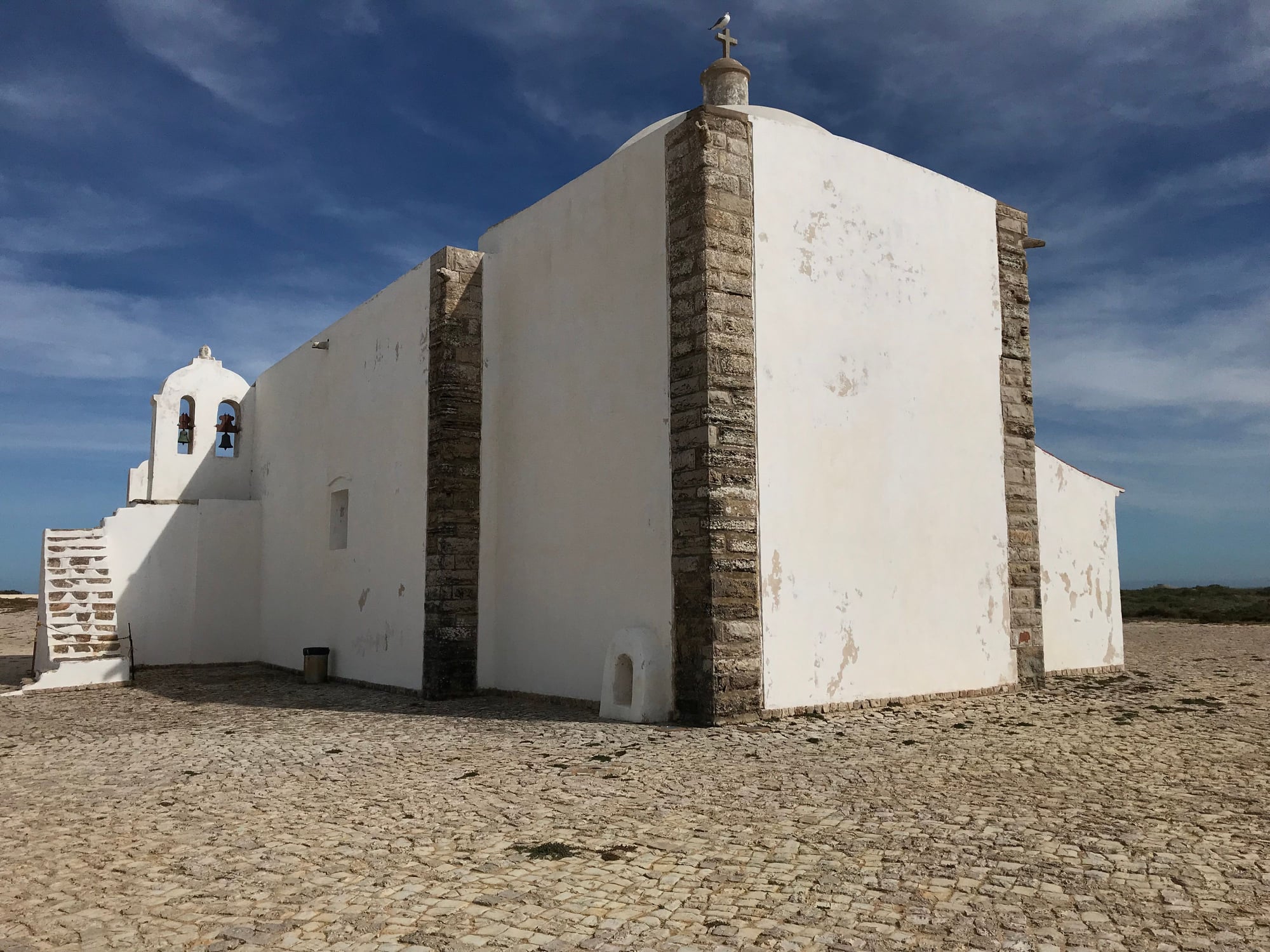
Church at Sagres (1570)
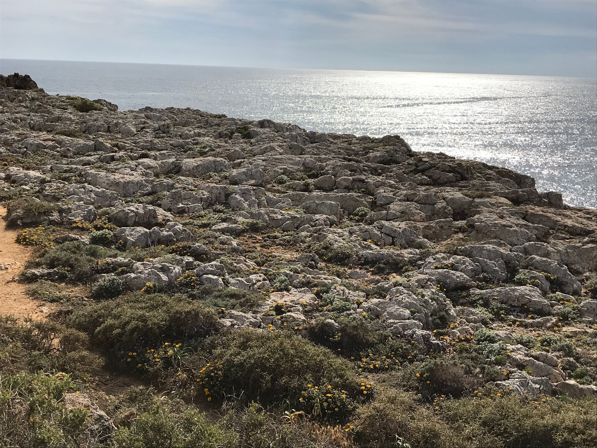
The limestone desert at Cape Sagres
That's it for my "Castles and Town Walls" series. (Of course, anyone else is free to post their photos on this theme as well.) I'll figure out some other aspect of Portuguese travel to cover in my next series.
Last edited by ibobi; Feb 1st, 2021 at 11:06 AM.
 Jan 31st, 2021, 12:28 PM
#22
Thanks for these photos, bdokeefe! Looks like it was a great father/daughter adventure.
Since you brought this to my attention, I have checked on Google Earth and determined that the aqueduct was barely a half-mile off to the right from the road coming down from the north that I took from Batalha to the Convento da Cristo. I'm sure there was probably a sign that pointed the way to it, but I was focused on other things. Portugal is actually characterized by a lot of aqueducts, many of them quite impressive (see the one from Elvas in my next post). Had I focused on that aspect of the country sooner, I could have made Portugal's aqueducts the subject of another photo essay!
I hope you get to take that trip in November. I'm certainly looking forward to getting in another trip to Portugal sometime, when I want to visit the north; tour more of Lisbon's museums; and visit Madeira and the Azores.
Last edited by jeffergray; Jan 31st, 2021 at 12:31 PM.
Jun 12th, 2021, 06:23 PM
#23
Bing's image for yesterday was a striking view of the Portuguese star fortress of Nossa Senhora da Graca, part of the defenses of Elvas, in the country's southeast just a few miles from the Spanish border:
https://bing.gifposter.com/wallpaper...orteNossa.html
https://bing.gifposter.com/wallpaper...orteNossa.html

Thread
Original Poster
Forum
Replies
Last Post
stevelyon
Europe
8
Nov 21st, 2011 12:16 AM


