63 Best Sights in Jasper National Park, Alberta

Athabasca Glacier

Fodor's choice
Athabasca Glacier
Lissandra Melo / Shutterstock

The glacier is a 7-km (4½-mile) tongue of ice flowing from the immense Columbia Icefield almost to the Icefields Parkway. A century ago, the ice flowed over the current location of the highway; signposts depict the gradual retreat of the ice since that time. Several other glaciers are visible from here; they all originate from the Columbia Icefield, a giant alpine lake of ice covering 325 square km (125 square miles). Its edge is visible from the highway. You can hike up to the toe of the glacier, but venturing farther without a trained guide is extremely dangerous because of hidden crevasses.

Athabasca Glacier Ice Walks (800/565–7547, www.icewalks.com) conducts three-, five-, and six-hour guided walks costing from C$115. Reserve a space at the Columbia Icefield Glacier Discovery Centre or through Jasper Adventure Centre (780/852–5595 or 800/565–7547, www.jasperadventurecentre.com) in Jasper. You can also visit the Glacier Skywalk, a glass-floored lookout with incredible views. Tickets for this are also available at the Discovery Centre, as well as on line.

Cavell Meadows Loop

Fodor's choice

This moderately steep 8-km (5-mile) trail will take four to six hours. Into early summer the upper section is still covered in snow and not recommended, but from mid-July to mid-August you can enjoy the carpet of wildflowers. There's also an excellent view of the Angel Glacier. Moderate.

Maligne Lake Road

Fodor's choice

Scenic Maligne Lake Road was built along the glacier valley that runs between the Maligne and Elizabeth mountain ranges. Along the 44-km (27-mile) drive to Maligne Lake, you'll see spectacular mountain scenery, other blue lakes, and the fast-flowing Maligne River. Highlights along the way also include Maligne Canyon and Medicine Lake. This drive takes you through one of the best places to spot wildlife, especially at dusk and dawn. Look for elk, moose, bighorn sheep, white-tail deer, and grizzly and black bears.

Recommended Fodor's Video

Mount Edith Cavell

Fodor's choice

The Jasper area's highest mountain stands 3,363 meters (11,033 feet) tall. Showing its permanently snow-clad north face to the town, the peak was named for a World War I British nurse who stayed in Belgium to treat wounded Allied soldiers after Brussels fell to the Germans and was subsequently executed for helping prisoners of war escape. The mountain is arguably the most spectacular site in the park reachable by car. From Highway 93A, a narrow, winding 14½-km (9-mile) road (often closed mid-October to late June) leads to a parking lot at the mountain's base. Trailers aren't permitted on this road, but they can be left at a separate parking lot near the junction with 93A. Several scenic lookouts along the route offer access to trails leading up the Tonquin Valley, one of the premier backpacking areas.

Buy Tickets Now

Path of the Glacier Trail

Fodor's choice

This must-do 1.6-km (1-mile) trail only takes about an hour. The kid-friendly path, paved at the start, runs across a rocky landscape once covered in glacial ice. Eventually you come to a viewpoint overlooking Cavell Pond, which is fed by Cavell Glacier. Small icebergs often float in the water. The view across the valley takes in Angel Glacier, resting her wings between Mount Edith Cavell and Sorrow Peak. Easy.

Adams Creek Fire Lookout

The steep 36.7-km (22.8-mile) round-trip hike to Adams Creek Fire Lookout from the Big Berland River staging area makes a nice overnight expedition in Willmore Wilderness Park. The trail has 1,369 meters (4,491 feet) of elevation gain. Difficult. 

Big Berland River Staging Area, Alberta, Canada

Angel Glacier

Stretching along the north face of Mount Edith Cavell, this glacier was named because it looks like an angel with wings. The best views of the glacier can be seen on the Cavell Meadows Hike.

Angel Glacier, Jasper National Park, Alberta, Canada

Astoria Valley Viewpoint

This pull-off along Cavell Road offers views of the Astoria Valley and the glaciers at its head.

Cavell Rd., Jasper National Park, Alberta, Canada

Athabasca Day Use Site

This large area has a shelter and is ideal for family reunions because it can be reserved ahead for a fee of C$50. It has beautiful views of the river and mountains.

Athabasca Falls

At 23 meters (75 feet), these falls are not the highest in the Canadian Rockies, but they are the most powerful. The Athabasca River carries more water than any other in the Rocky Mountains, and all of it is funneled over this cascade and into a narrow gorge, creating a powerful surge. The falls are especially dramatic in late spring and early summer when the river is at its highest. Trails and overlooks provide good viewpoints. Do not climb past the guard rails: the rocks and vegetation are very slippery, and people have died trying to get a photo of themselves standing closer to the falls.
Athabasca Falls, Jasper National Park, Alberta, Canada

Beauty Creek to Stanley Falls

This short and relatively easy hike features a narrow canyon with eight waterfalls---the largest of which is Stanley Falls. The trailhead is not well marked. Look for a highway pullout 2 km south of Beauty Creek Hostel where two large culverts divert water under the highway. The return hike is about 3.9 km (2.4 miles) and has an elevation gain of about 139 meters (456 feet). The views are fantastic, but there are no safety barriers. Be careful to stay back from the canyon edge and keep a tight hold on children, so they do not fall in. Easy.

Beauty Creek, Jasper National Park, Alberta, Canada

Beaver Boardwalk

This unique wooden boardwalk winds through wetlands and a beaver pond and is said to be the longest freshwater boardwalk in the world. Along its 3-km (1.9-mile) length you'll find interpretive signage, benches, and two observation towers. The boardwalk is part of a longer trail system that winds through natural areas in the town.

Berg Lake Trail

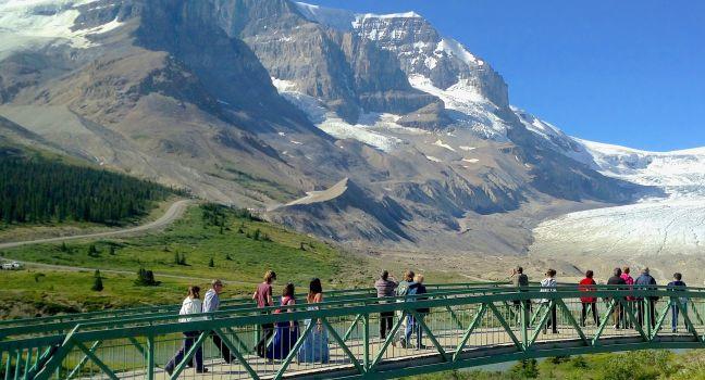
With picturesque views of flowing waterfalls, mountains, and glaciers, the Berg Lake Trail has become a legendary backpacking destination. This moderately difficult 21-km (13-mile) one-way hike is one of the most popular overnight trails in the Canadian Rockies. Turquoise-blue Berg Lake gets its name from the fact that it's dotted with mini icebergs---even in the middle of summer. The lake sits at the base of the north face of Mount Robson and glaciers on the mountain regularly calve off into the water.

This well-maintained trail takes hikers to some of the best scenery in the Canadian Rockies. The first 4.5 km (2.8 miles) are relatively easy hiking along the Robson River and then through dense forest before arriving at glacier-fed Kinney Lake. After crossing a steel bridge at the end of Kinney Lake, it's just 2.8 km (1.7 miles) to the Kinney Lake campground.

Beyond the Kinney Lake campground, the trail splits and gives the option of hiking through Kinney Lake Flats or continuing through the forest. At that point, the trail merges together again and begins climbing steeply to the Valley of a Thousand Falls where it provides views of four spectacular waterfalls. The trail then crosses the Robson River on a suspension bridge and arrives at Whitehorn campground at the 11-km (6.8-mile) mark.

Once the trail gets above the valley, you will start getting glimpses of the Emperor Face of Mount Robson. The Emperor Campground lies about 3 km (1.9 miles) from the shores of Berg Lake. Marmot Campground and Berg Lake Campground sit right on the shores of the lake. Several popular day hikes depart from the Berg Lake Campground and there are two more campgrounds just past the lake, Rearguard and Robson Pass.

The Berg Lake Trail is one of the most popular backpacking trails in the Canadian Rockies and campsites should be booked well in advance, especially during the peak summer months. All hikers must check in at the Mount Robson Visitor Centre before setting out on the trail. In 2021, the portion of the trail past Kinney Lake was closed due to flood damage.

If you can't get a backcountry camping reservation on the Berg Lake Trail, you could opt to fly into Berg Lake and hike down the trail as a day hike. It would be very difficult to hike the trail in both directions in a single day. Difficult. 

Berg Lake Trailhead, Mount Robson Provincial Park, British Columbia, Canada
519-826--6850
Sights Details
Campsite reservation fee C$6 (plus tax) per campsite/tent pad, per night, to a maximum of C$18 (plus tax)
Rate Includes: Closed mid-Oct.--mid-May

Columbia Icefield Glacier Discovery Centre

Opposite the Athabasca Glacier, this facility houses interpretive exhibits, a gift shop, and cafeteria- and buffet-style dining facilities. It's also the place to book glacier treks or skywalk visits. The summer midday rush between 11 and 3 can be intense. The 32 rooms at the Glacier View Inn, on the center's second floor, are available from early May to mid-October.

Eaton Falls

This half-day hike gives you a taste of the Willmore Wilderness. It's a 6-km (3.7-mile) round-trip hike from the Sulphur Gates parking lot to beautiful Eaton Falls. With 120 meters (394 feet) of elevation gain, the hike is relatively easy and one of the few day-trip options in the Willmore Wilderness. There's a viewpoint part way along the trail that is worth stopping for. Moderate.   

Sulphur Gates Provincial Recreation Area, Alberta, Canada

Friends of Jasper National Park

This group's excellent summer offerings include a junior naturalist program, birding tours, hiking tours, and historical walks. At the information center shop, you can borrow a Friends hiking kit with binoculars, maps, and first-aid and other materials.

Grande Cache Tourism and Interpretive Centre

The knowledgeable and friendly staff at this site, 13 km (8 miles) northeast of Sulphur Gates, can assist with travel information for the region. Explore the free on-site museum to see casts of dinosaur tracks found in the area as well as fossils, archaeological artifacts, profiles of early settlers, and tools used by early pioneers. You'll also find displays about the plants, animals, and birds found in the Willmore Wilderness Park. The gift shop and art gallery sell the works of locals artists and writers. Outside are some historical buildings that are fun to explore. 

Jasper Adventure Centre

Guided tours, birding trips, ice walks, and snowshoeing tours are all available here. Most tours last three hours. The center also books canoeing, rafting, and other types of excursions.

Jasper Information Centre

The 1914 cobblestone-and-timber structure that houses the Jasper Townsite visitor center is a superb example of rustic Canadian architecture. Parks Canada staffers here have information about trails, backcountry hiking, wildlife viewing, and interpretive programs. You can pick up maps, brochures, and other helpful materials as well. Parks Canada also operates an information desk at the Columbia Icefield Glacier Discovery Centre, 103 km (64 miles) south of Jasper Townsite.

Jasper Lake

Jasper Lake is actually part of the Athabasca River—it's a point where the river broadens—and you can wade far out into its shallow waters and the beach is sandy. The scenery is beautiful, with lovely reflections on the water, and the Jasper Lake Sand Dunes, the Canadian Rockies' only sand dunes, are dunes nearby.

Jasper Lake, Jasper National Park, Alberta, Canada

Jasper Lake Sand Dunes

The only sand dunes in the Canadian Rockies were formed during the last ice age and are constantly being reshaped by wind. They sit along the edge of Jasper Lake, which is not really a lake as it's part of the Athabasca River. The river widens and you can wade out very far on its sandy bottom; it's particularly popular on hot summer days. There's also a large roadside pullout and toilets. 

Jasper Lake Sand Dunes, Jasper National Park, Alberta, Canada

Jasper Planetarium

Located at the Fairmont Jasper Park Lodge, this planetarium has the largest telescope in the Canadian Rockies. In its dome, an astronomy expert conducts an interactive tour of the dark night sky—a fitting experience given that Jasper is the world's second largest Dark Sky Preserve.

Jasper SkyTram

The tram whisks you 973 vertical meters (3,191 vertical feet) up the steep flank of Whistlers Mountain to an impressive overlook of the town and the surrounding mountains. The seven-minute ride deposits you above the tree line (be sure to bring warm clothes) at the upper station. From here, a 30- to 45-minute hike leads to the summit, which is 2,464 meters (8,085 feet) above sea level. Several unmarked trails lead through alpine meadows beyond.

Buy Tickets Now

Lac Beauvert

Located beside The Fair­mont Jasper Park Lodge, this glacier-fed lake is surrounded by majestic mountains. A scenic 4-km (2.5-mile) hiking trail surrounds the lake, and bicycles, canoes, kayaks, pedal boats, and stand-up paddleboards can be rented at The Boathouse (open during the summer season) on the lake's shore.

Lac Beauvert, Jasper National Park, Alberta, Canada

Lake Annette

This lake is a favorite sandy beach and swimming area with locals. There is a dock, a playground, a grassy area for throwing a ball or frisbee, and a day-use area with picnic tables, fire rings, and grills. A paved interpretive trail loops around the lakeshore. Dogs are not allowed on the beach, but they are allowed in other areas.

Lake Annette Day Use Area, Jasper National Park, Alberta, Canada
Sights Details
Rate Includes: Free

Lake Annette Loop

This kid-friendly 2.4-km (1½-mile) loop trail with interpretive signage is paved and mostly level. It takes most people less than two hours to complete. Toilets are at two locations, and there is a shelter halfway around. Easy.

Lake Annette Rd., Jasper National Park, Alberta, Canada

Lake Annette picnic area

Beside Lake Annette, this picnic area has shelters and tables. It's a favorite with families who come to the lake to swim.

Lake Edith

This beautiful turquoise lake is surrounded by mountains. It has a quiet beach and a dock. The glacier-fed water is cold, but on a hot summer day, it's a popular spot to paddle and wade. You can get there by car or bike, or hiking. Dogs are not allowed on the beach area of the lake. 

Lake Edith, Jasper National Park, Alberta, Canada

Maligne Canyon

The Maligne River cut 50 meters (165 feet) deep through limestone bedrock to create Maligne Canyon. An interpretive trail winds along the river, switching from side to side over six bridges as the canyon progressively deepens. The 4-km (2½-mile) trail along the canyon can be crowded, especially near the trailhead. Just off the path, you'll find the Maligne Canyon Wilderness Kitchen and a nice gift shop. On a wintertime ice walk, the views from the bottom of the frozen canyon are spectacular.

Maligne Lake Rd., Jasper National Park, Alberta, Canada

Maligne Canyon

This 4.4-km (2.7-mile), one-way trail east of Jasper Townsite leads to views of the area's famous limestone gorge. Starting at the fifth of six bridges spanning the canyon, the winding trail gains about 100 meters (330 feet) in elevation. There's a waterfall at the head of the canyon. Easy.

Maligne Lake Rd., Jasper, Alberta, Canada