68 Best Sights in Banff National Park, Alberta

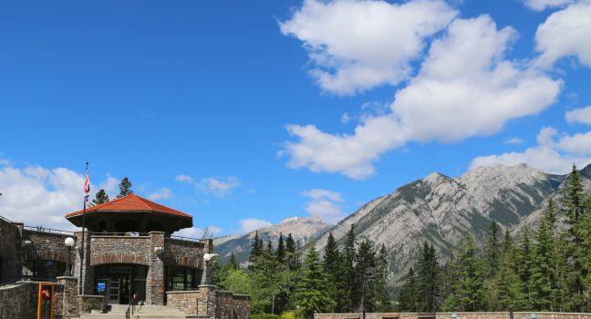
Cave and Basin National Historic Site
Fodor's choice
Cave and Basin National Historic Site
Leonard Zhukovsky / Shuttestock

This site commemorates the birthplace of Canada's national parks system, which began with the protection of the Banff hot springs in 1885. You'll find restored historic buildings, a plaza, and splendid interpretive displays about Banff and the country's other national parks. An interpretive trail explains the area's geology, plant life, wildlife, and history. While walking past the cave's pools, keep an eye out for the park's most endangered species: the Banff Springs snail, which makes its home in the warm mineral waters, cannot be found anywhere else in the world. Children under age 17 enter the site for free, and combo tickets that include admission to Banff Upper Hot Springs are available.
Buy Tickets Now

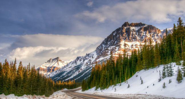
Icefields Parkway

Fodor's choice
Icefields Parkway
BGSmith / Shutterstock

Powerfully rugged mountain scenery, glaciers, waterfalls and icefalls, and wildlife: the Icefields Parkway reveals all of these and more as it snakes its way along the 230 km (143 miles) connecting Banff National Park with Jasper National Park. It is an absolute highlight of the Canadian Rockies.

You could drive this winding road in three to four hours, but your trip will more likely take a full day when you add in stops. The road rises to near the tree line at several points, and the weather can be chilly and unsettled at these high elevations, even in midsummer, so it's a good idea to bring warm clothing along. Only one gas station, open seasonally, operates on the parkway, so check your car's gas gauge before setting out.

Elk, moose, deer, and bighorn sheep are fairly common, and occasionally bears and mountain goats come into view. In summer, alpine wildflowers carpet Bow Pass and Sunwapta Pass. The most dramatic scenery is in the northern end of Banff National Park and the southern end of Jasper National Park, where ice fields and glaciers become common on the high mountains flanking the parkway. (Ice fields are massive reservoirs of ice; glaciers are the slow-moving rivers of ice that flow from the ice fields.) Scenic overlooks and signposted hiking trails abound along the route.

Johnston Canyon Trail

Fodor's choice

Rushing water has carved a path through this must-see limestone canyon. The first 1.1 km (0.7 mile) is a paved walkway that leads to the 10-meter (33-foot) Lower Falls. From here, a slightly more rugged 2.7-km (1¾-mile) trail leads to the nearly 30-meter (100-foot) Upper Falls and a 5-km (3-mile) trail runs to the Ink Pots—six green pools filled with springwater. It takes four to five hours round-trip to complete. Moderate.

Recommended Fodor's Video

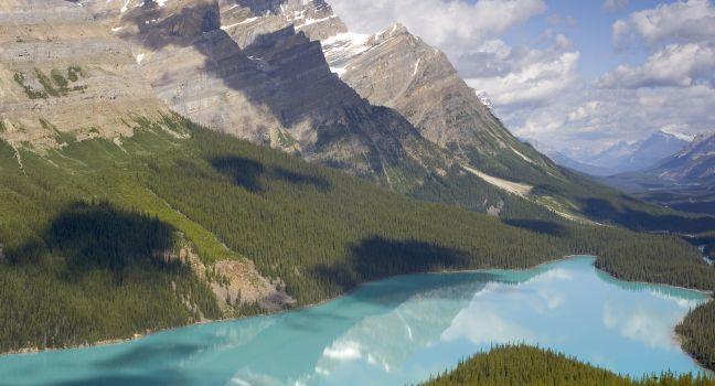
Peyto Lake Lookout

Fodor's choice
Peyto Lake Lookout
oneword / Shutterstock

Named after Bill Peyto, a mountain guide, and early park warden of Banff National Park, Peyto Lake is one of the most beautiful lakes in the Canadian Rockies. The viewpoint for this brilliant turquoise glacier-fed lake is a short 20-minute stroll from the parking area just off the Icefields Parkway. At the lookout, you'll get a view of Peyto Lake, Peyto Glacier, and the Mistaya Valley. Interpretive signage along the trail explains its history and provides information about flora and fauna in the area. The lookout is accessed at Bow Pass, the highest point on the Icefields Parkway; it's wheelchair accessible from the upper parking lot that tour buses use.

Abraham Lake

Alberta's largest reservoir is beautiful in every season, but it has become Instagram famous in winter when bubbles freeze in the ice---pockets of methane gas freeze in layers that coat the lake. Methane gas bubbles are formed when bacteria breaks down organic matter at the bottom of the lake. It’s a phenomenon that's found in other Rocky Mountain lakes, but it’s more visible in Abraham Lake because high winds tend to keep the ice clear of snow; January and February are peak months to view the bubbles. The manmade lake was created in 1972 with the construction of the Bighorn Dam. The lake has a surface area of 53.7 square km (20.7 square miles). Although the lake is manmade, it still has the turquoise blue color of other Rocky Mountain Lakes. Watch for bighorn sheep, black bears, and other wildlife nearby.

Abraham Lake, Bighorn Backcountry, Alberta, Canada

Allstones Lake

This moderately strenuous 13-km (8.1-mile) round-trip hike leads to a lovely alpine lake with beautiful views along the way. If you climb to the top of the peak near the lake you'll have a stunning view of Abraham Lake and the surrounding mountains. Moderate. 

Abraham Lake, Bighorn Backcountry, Alberta, Canada

Banff Central Park

Located along the Bow River inside the town of Banff, this scenic park has picnic tables, a gazebo, restrooms, and a natural playground for children. A paved footpath winds alongside the river.

Banff Gondola

Views during the steep eight-minute ride to and from the 7,500-foot summit of Sulphur Mountain are spectacular in the enclosed four-person gondolas. From the upper terminal, you can hike the short distance to the mountain's true summit on the South East Ridge Trail, perhaps catching sight of grazing bighorn sheep. You can also visit the gift shop, enjoy a quick bite at the cafe, or indulge in a gourmet lunch or dinner at the Sky Bistro. Be sure to walk the easy 1-km (0.6-mile) boardwalk to the Sulphur Mountain Weather Observatory on Sanson's Peak for excellent views and to break away from the crowds. The gondola is south of the center of Banff; you can catch a Roam public transit bus to get here. Riding the gondola is a very popular activity—go early or late to avoid crowds.

Buy Tickets Now

Banff Park Museum National Historic Site

A remarkable 1903 building made chiefly of Douglas-fir log houses one of western Canada’s oldest natural history museums. From bees to bears, the collection, whose origins date to Chicago's fabled World's Columbian Exposition of 1893, encompasses more than 5,000 historical botanical and zoological specimens, many of them quite striking. In addition to providing the opportunity to get up close and personal with some of Banff's largest mammals—a grizzly bear, bison, mountain goats, and bighorn sheep among them—this unique museum offers a window into past generations' priorities regarding the natural world.

Banff Upper Hot Springs

Discovered in 1884, Banff's hot, natural mineral springs were the impetus for the development of Canada's first national park. Early Banff visitors came primarily to experience the "healing waters"—something you can still do today at the popular Banff Upper Hot Springs pools. The waters at the facility, which is child-friendly during the day (think family swimming pool rather than couples' hot-tub vibe), are especially inviting on a dull, cold day or when it's snowing, and the views of the mountains are spectacular. You can rent lockers, bathing suits (circa 1920s or modern), and towels. Although the recommended limit for a soak is 20 minutes, you'll likely want to stay an hour or two. It's a short uphill walk from the parking lot to the springs.

Buy Tickets Now

Banff Visitor Centre

Parks Canada and Banff Lake Louise Tourism (BLLT) run this center jointly. On one side of the building, Parks Canada staffers dispense excellent advice about camping, hiking, interpretive programs, and sightseeing. On the other side, BLLT counselors (www.banfflakelouise.com) provide information about restaurants, tour operators, and accommodations. In spring, stop by to find out which hiking trails are open—many remain closed into May due to avalanche risk.

Barrier Lake

Picnic tables, indoor toilets, a boat launch, a visitor center, free Wi-Fi access, and lovely views are the draws at this day-use area in Kananaskis Country.

Barrier Lake

Picnic tables, indoor toilets, a boat launch, a visitor center, free Wi-Fi access, and lovely views are the draws at this day-use area in Kananaskis Country.

Boom Lake Trail

This 5-km (3.2-mile) hike climbs through a forest of pine, fir, and spruce amid mountains and glaciers. The waters of the lake itself are crystal clear. Allow half a day for this hike round-trip. Moderate.

Banff National Park, Alberta, Canada

Bow Glacier Falls Trail

A trail from the bottom of the parking lot at Bow Lake leads to this stunning cascade, which can't be seen from the road. At the base of the falls, you'll not only feel the spray and hear the roar, you'll also witness the birth of the Bow River—part of western Canada's largest watershed. The hike is about 4 km (2½ miles) one-way and takes from 1½ to 3 hours to complete, depending on how many photos you stop to take.
Icefields Pkwy. (Hwy. 93), Banff National Park, Alberta, Canada

Bow Glacier Falls, Bow Lake, Crowfoot Glacier, and Simpson's Num-Ti-Jah Lodge

You may wish to stop at Bow Lake for the regional Canadian cuisine at Simpson's Num-Ti-Jah Lodge at Bow Lake, but you don't have to dine or stay here to enjoy the trails and views of the lake and Crowfoot Glacier. A trail leads from the bottom of the parking lot to the base of Bow Glacier Falls, where you can feel the spray, hear the roar of the falls, and witness the birth of a river. The Bow River is part of western Canada's largest watershed. The hike is about 4 km (2½ miles) one-way and takes from 1½ to 3 hours to complete depending on how many photos you take.

Bow Lake

Fed by meltwater from the Bow Glacier, one of the largest lakes in Banff National Park is surrounded by mountains and has views of Crowfoot Glacier. This spot is a beautiful place to snap some photos or enjoy a picnic at one of the lakeside tables. There are also public dry toilets here.
Icefields Pkwy. (Hwy. 93), Banff National Park, Alberta, Canada

Bow Lake Day Use Area

This gorgeous lake is surrounded by incredible scenery, including Wapta Icefield, Bow Peak, Bow Glacier, Mt. Thompson, Crowfoot Mountain, and Crowfoot Glacier. Its picnic area is just off the highway with ample parking, restrooms, and tables along the shore.
Icefields Pkwy. (Hwy. 93), Banff National Park, Alberta, Canada

Bow Summit Lookout

At 2,070 meters (6,791 feet), Bow Pass is the highest drivable pass in the Canadian Rockies national parks and the highest point of the Icefields Parkway. Bow Summit Lookout is on the same trail as the better-known Peyto Lake Lookout. Stop and take in the view of Peyto Lake and then head up the upper self-guided nature trail and follow an old fire road to the lookout. The hike is 2.9 km (1.8 miles) one-way. Watch for pikas, marmots, and ptarmigan on the trail and at the lookout. From the lookout, you can see Bow Lake to the south Peyto to the Waterfowl Lakes to the north.

Peyto Lake Upper Viewpoint, Banff National Park, Alberta, Canada

Bow Valley Parkway

Formerly known as Highway 1A, this scenic drive between Banff and Lake Louise leads to Hillsdale Meadows, Johnston Canyon, Castle Mountain, and Baker Creek. There are plenty of viewpoints and picnic sites along the way. In 2020 and 2021, Parks Canada closed portions of the road to most motor vehicles to improve the route for cyclists. Visitors should consult the Parks Canada website for the latest information on road closures. 

Brazeau Collieries Historic Mine Site

Guided tours of Brazeau Collieries Historic Mine Site offer a glimpse into an industrial coal mine operation and the lives of miners who worked and lived in this area. Two-hour guided tours are given of the mine, a Provincial and National Historic Resource, three times daily during the summer.

Nordegg, Bighorn Backcountry, Alberta, Canada
403-845--4444-administrator Clearwater County
Sights Details
Rate Includes: C$10 adults, C$30 family pass, Closed Wed. and early Sept.--mid-May

Buffalo Nations Luxton Museum

Founded in 1953, this museum is one of Alberta's oldest. Its goal is to educate visitors on First Nations' cultures. The museum displays Indigenous artifacts, hunting equipment, ornamental regalia, and arts and crafts. There's also a decorated teepee to explore.  

Canmore

About 25 km (15 miles) southeast of Banff, Canmore became a modest boomtown with the 1988 Olympic Games. Many of its residents feel that the commute to Calgary for work is a fair trade-off for living in the mountains. For tourists, Canmore makes a good base for exploring Kananaskis Country and Banff National Park.

Cascade of Time Garden

This four-acre park was built in the 1930s and showcases gardens terraced into a hillside, water features, pavilions, gazebos, and more. The park is behind the administration building, a short walk from downtown Banff. It blooms from late June to early September and is a great place for a picnic or a short escape from the busy downtown area.  

101 Mountain Ave., Banff, Alberta, T1L1K2, Canada
Sights Details
Rate Includes: Free

Cascade Ponds

This spot has picnic tables, a kitchen shelter, and flush toilets, and it's one of the only picnic areas with fire pits. There's also access to trails, swimming in the summer, and plenty of room for kids to run around. 

Castle Lookout Trail

Outstanding views of the mountains above the Bow River Valley are the highlight of this 3.7-km (2.3-mile) one-way trail that is somewhat steep. Moderate.

Banff National Park, Alberta, Canada

Castle Mountain

Castle Mountain, one of the most striking peaks between Banff and Jasper, got its name from Scottish geologist James Hector who thought the 11-kilometer (6.8-mile) long mountain resembled an ancient fortress with steep walls. When U.S. General Dwight D. Eisenhower, Supreme Commander of the Allied Forces in Europe, visited Canada in 1949, Prime Minister Mackenzie King ordered the Geographical Board of Canada to officially change Castle Mountain to “Mount Eisenhower.” Eisenhower had been given a castle in Scotland and Canada would not be outdone. However, the Alberta government was not consulted or informed of the name change until afterward, causing such a controversy that in 1979, the name was changed back to Castle Mountain; a pinnacle on the southeastern side of the mountain was named Eisenhower Tower.

Castle Mountain, Banff National Park, Alberta, Canada

Columbia Icefield Skywalk

This fully accessible, cliff-edge walkway leads to a glass-floor observation platform 280 meters (918 feet) above the Sunwapta Valley. From this vantage point, you'll get a bird's-eye view of the surrounding ice-capped mountain peaks and deep glacier-carved valleys of the Canadian Rockies. A five-minute shuttle from the Columbia Icefield Glacier Discovery Centre delivers you to the walkway.

It's faster and less costly to book your Skywalk tickets in advance online.