Fodor's Expert Review Rangitoto Island
When Rangitoto Island emerged from the sea in a series of fiery eruptions 600 years ago, it had an audience: footprints in the solidified ash on its close neighbor Motutapu Island prove that Māori people watched Rangitoto's birth. It is the largest and youngest of about 50 volcanic cones and craters in the Auckland volcanic field, and scientists are confident it will not blow again. During the 1920s and '30s hundreds of prisoners built roads and trails on the island, some of which are still used as walkways. Small beach houses were erected by families in the early 20th century. Many were pulled down in the 1970s before their historical significance was recognized. Thirty-two remain, and a few are still used by leaseholders, who are allowed to use them during their lifetimes. (Afterward, they'll be relinquished to the DOC). The island's most popular activity is the one-hour summit walk, beginning at Rangitoto Wharf and climbing through lava fields and forest to the peak. At the top,... READ MORE
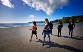
When Rangitoto Island emerged from the sea in a series of fiery eruptions 600 years ago, it had an audience: footprints in the solidified ash on its close neighbor Motutapu Island prove that Māori people watched Rangitoto's birth. It is the largest and youngest of about 50 volcanic cones and craters in the Auckland volcanic field, and scientists are confident it will not blow again. During the 1920s and '30s hundreds of prisoners built roads and trails on the island, some of which are still used as walkways. Small beach houses were erected by families in the early 20th century. Many were pulled down in the 1970s before their historical significance was recognized. Thirty-two remain, and a few are still used by leaseholders, who are allowed to use them during their lifetimes. (Afterward, they'll be relinquished to the DOC). The island's most popular activity is the one-hour summit walk, beginning at Rangitoto Wharf and climbing through lava fields and forest to the peak. At the top, walkers are rewarded with panoramic views of Auckland and the Hauraki Gulf. Short detours lead to lava caves and to the remnants of a botanical park planned in 1915. Wear sturdy shoes and carry water because parts of the walk are on exposed lava flows, which are hot in the sun. You can swim at Islington Bay and at the Rangitoto Wharf in a specially made pool.
READ LESS